|
June 29, 2003: Western Trip, Day 9 |
|
June 27, 2003: Western Trip, Day 7 |
|
Return to the Index for Our Western Trip |
|
June 28 Sego Canyon Petroglyphs Palisade, CO Hoosier Pass, CO To Walsenburg, CO |
Today we will begin heading for home, but since we only need to be in far southeast Colorado by nightfall to make tomorrow's drive reasonable, we will have time to stop and see a few things on the way.
The Sego Canyon Petroglyphs
Getting to the Sego Canyon Petroglyphs
|
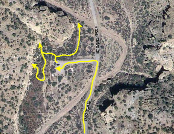
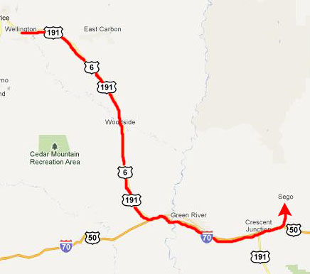
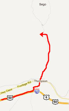
Once off the Interstate, we took Main Street through the little town of Thompson, and then north out of town on Sego Canyon Road. it was about five miles to the parking area for the petroglyphs.
|
As we came north on Sego Canyon Road from Thompson, we found the parking area for the petroglyphs on our left. There was just an information kiosk and some diagrams of the trails, along with one or two other cars. So we borrowed one of the little trail maps (from which much of the information below was taken), and headed off to walk on the pathways around the 50-foot cliffs where the petroglyphs and other rock art were found.
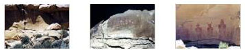
The trail map showed us what to look for, and we did find representative petroglyphs from the three main cultures that have left their mark in this area (not counting the modern graffiti, an example of which you'll see on one of our photographs). I think the best introduction would be to show those three examples, and then follow that with some of the additional pictures that we took.
|
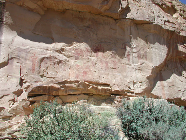
This rock art, the Barrier Canyon Style usually consists of larger than life-size anthropomorphic (manlike) forms. The identifying characteristic of these figures is hollowed eyes or missing eyes, the frequent absence of arms and legs, and the presence of vertical body markings. This panel is characterized by at least 19 painted anthropomorphs with bug-eyes, antennae, earrings, snakes in hand, and legless torsos. The "ghostlike" images may represent shamanistic art associated with ritual activities of the Archaic people.
|
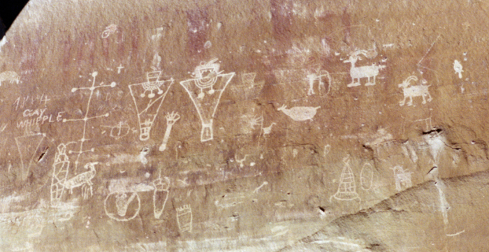
At the top of the panel are the oldest figures. These are the line of large, red-painted figures with the rectangular bodies and small heads, which are similar to the Anasazi Basketmaker style. Superimposed on the older, painted figures is a line of carved (pecked) human figures. Typically, these have trapezoids for the head and body. The most recent Fremont period is also represented by superimposed carvings. They are the deeply grooved outlines of two life-sized human figures with collars and waistbands, and the associated mountain sheep and abstract elements. This last group is representative of the Classic Fremont style.
|
The Ute people practiced a hunting and gathering lifeway. They used the bow and arrow, made baskets and brownware pottery, and lived in brush wickiups and tipis. The No-tah (Ute people) lived freely throughout western Colorado and eastern Utah until about 1880, when they were forced onto reservations.
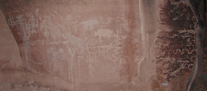
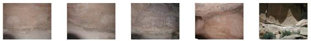
Below are thumbnails for some of the other pictures we took of petroglyphs here in Sego Canyon; just click on them to view the full-size pictures:
|
|
There was a ghost town a couple of miles further up the road, but we decided to forego it, and make some other stops as we began winding our way towards home. As we were going back through Thompson, which seemed kind of like a ghost town itself, we stopped briefly to take a picture of the Thompson Fire Department, which happened to be next door to the abandoned Thompson Motel. Then we were back on the Interstate heading East.
You can return to the page index or continue on to the next section.
We Visit Palisade, Colorado
|
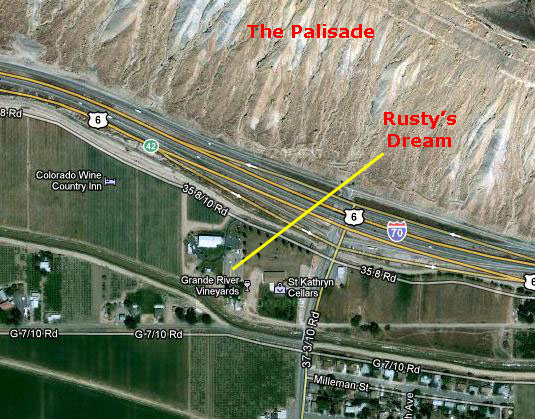
Outside, near the parking area, we found two interesting sculptures, both made of metal parts like screws and nails and gears and such. One, untitled, was of a rooster. The other is actually fairly well-known, apparently, and was titled "Rusty's Dream". Of course, if you look at the picture the title will have obvious significance. You can see another, perhaps better, view of this sculpture here, and when you got real close to the dog, you could see it was made of nuts and bolts.
Just for fun, I Googled the title of the piece and found a number of references to it. Apparently, it has been moved from its position at the Vineyard downtown to adorn the front of a bank. We never would have run across it there, for we just got back on the Interstate and continued east.
You can return to the page index or continue on to the next section.
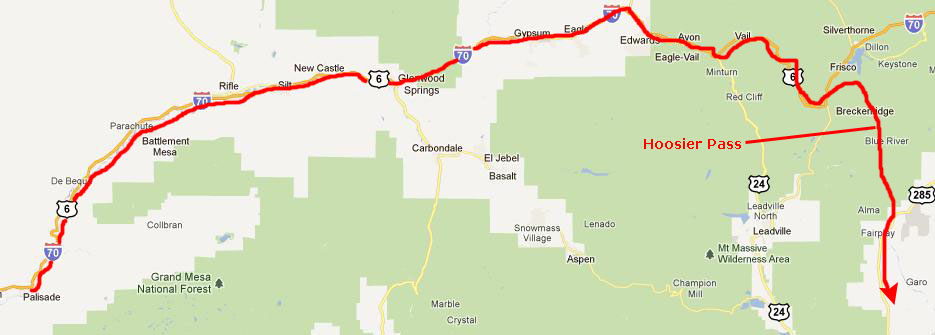
Going Through Hoosier Pass, CO
|
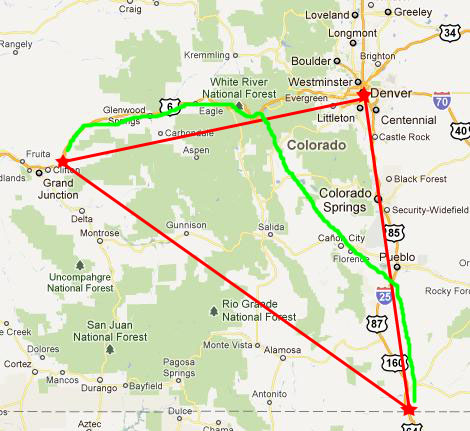
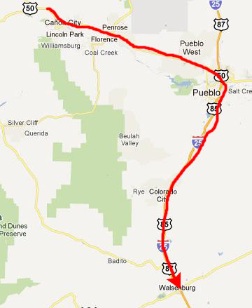
A better compromise is to head generally east on I-70 to the Vail-Breckenridge area, and then go southeast from there on a more direct highway through the Rockies. This would bring us to I-25 near Pueblo, Colorado. We will make use of the speed of I-70 and I-25, and shave off the trip through Denver with a shorter, slower cutoff. All in all, it saves about three hours over the shortest route, with an hour of that saving coming from avoiding Denver. You can see all this on the map at left.
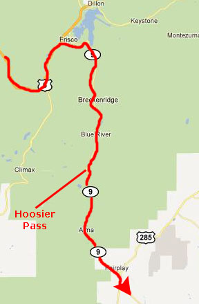
So we begin by taking I-70 to a point just past Vail and then going south on Colorado Highway 9 through Breckenridge and over Hoosier Pass:
|
Highway 9 is very scenic through Breckenridge; we will have to return here sometime to do some hiking.
|
Hoosier Pass, elevation 11,532 ft, is one of the high mountain passes through the Rocky Mountains in Colorado. The pass is located on the Continental Divide at the northern end of the Mosquito Range, in a gap between Mount Lincoln (west) and Hoosier Ridge (east). It sits on the boundary between Park (south) and Summit (north) counties. It is traversed by State Highway 9 between the towns of Breckenridge (north) and Fairplay (south). The highway over the pass provides an alternative route from Denver to the ski areas near Breckenridge and Keystone. It is generally open all year round, is traversable by all vehicles in good weather, but is occasionally closed during winter storms. The road over the pass has a smooth approach on the south side but has several switchbacks on the north side with a grade of 8%.
This pass is the highest point on the TransAmerica Trail, a transcontinental bicycle route that stretches from Yorktown, Virginia to Astoria, Oregon.
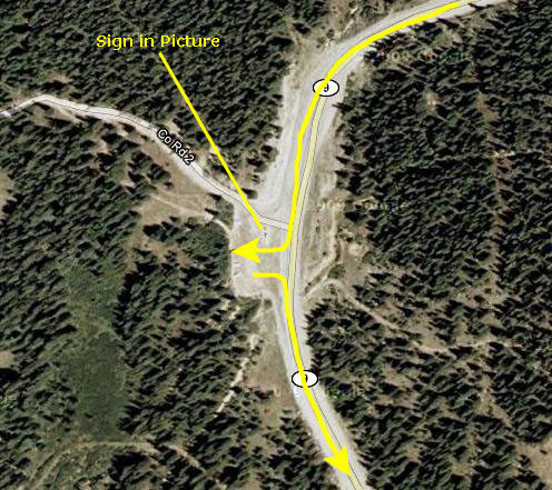
We stopped at the top of the pass to admire the view and take some pictures.
You can return to the page index or continue on to the next section.
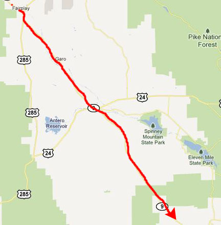
Driving to Walsenburg, CO
|
|
|
|
|
June 29, 2003: Western Trip, Day 9 |
|
June 27, 2003: Western Trip, Day 7 |
|
Return to the Index for Our Western Trip |