|
June 28, 2003: Western Trip, Day 8 |
|
June 26, 2003: Western Trip, Day 6 |
|
Return to the Index for Our Western Trip |
|
June 27 Morning in Arches NP Nine Mile Canyon Petroglyphs Staying in Wellington, UT |
It's Friday, and today we will be returning to Arches National Park to look at a couple of additional arches. Then we'll be heading further north in Utah to visit a place called Nine-Mile Canyon, which is supposed to have one of the largest collections of petroglyphs in Utah. We intend to camp in Green River, Utah.
A Morning in Arches National Park
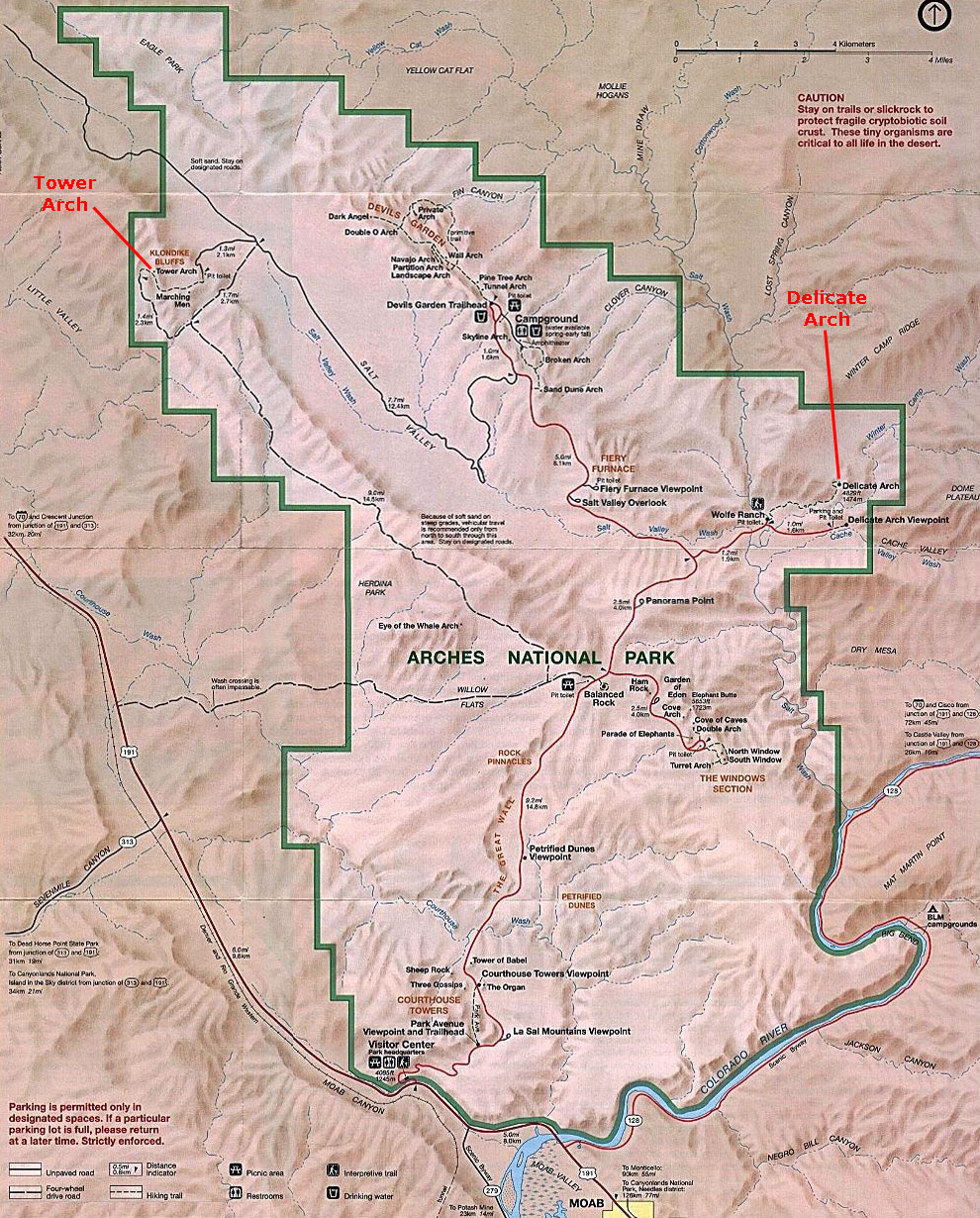 |
Delicate Arch
|
The trek out to Delicate Arch is a hike and not a stroll, but it is an easy hike if you are prepared for it. The 1.5-mile trail is heavily traveled and well defined. From the trailhead you can see the remains of the John Wesley Wolfe Ranch, which was built in 1888 and abandoned in 1910. Just past the Homestead we crossed Salt Wash on a suspension bridge.
Once over the bridge we took a short, signed spur trail to our left which led to an excellent Ute petroglyph panel that depicts horses and a bighorn sheep hunt.
The first part of the hike was on a wide and well-defined trail that led to the base of a steep sandstone hill; this type of sandstone, which we also encountered in Canyonlands NP, is known as "slickrock." Once we began hiking on the slickrock we had to follow cairns (stacks of rocks) as the route slowly climbed over the sandstone hill; I think that lots of people have added cairns to those that the people who originally marked the trail set up, for there were scads of them (including a group of medic‑rescue personnel in training), making the route easy to follow. The fact that there were a hundred other people visible ahead and behind like a trail of ants also kept us from any danger of getting lost.
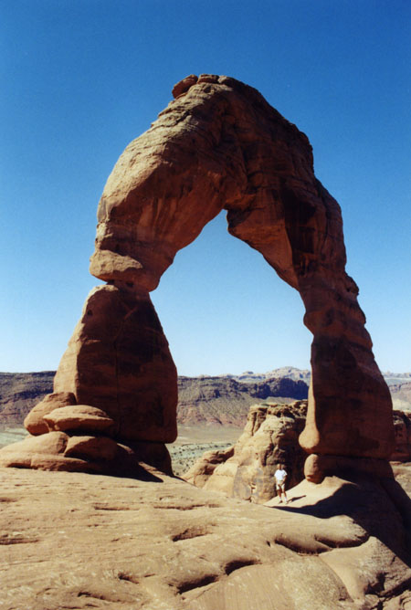
As we neared Delicate Arch, we passed another formation- known as Frame Arch- on our right. The arch gets its name because it is often used as a picture frame for photographing Delicate Arch. Finally, just before we reached Delicate Arch itself, the trail followed an impressive 200 yard ledge which was blasted from the sandstone. Just past the ledge we reached Delicate Arch.
The arch itself is iconic; almost everyone has seen a picture of it at one time or another, even if they didn't recognize it or even know what it was. It is on the Utah license plate, and it has been pictured on at least two postage stamps. At the end of the hike, it is tempting to go underneath it an sit down for a while, but there was a little sign asking visitors to the arch not to spend a great deal of time underneath it because so many folks want to get that "pristine" picture of the arch, and having hordes of tourists milling about underneath it certainly detracts from the image. When I wanted to observe the arch for a span of time, I found a place up on a rock ledge opposite the arch (where Fred photographed me with someone else who had the same idea). Actually, from up there on the rock ledge I had some good views of the landscape around Delicate Arch.
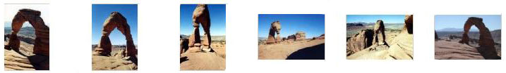
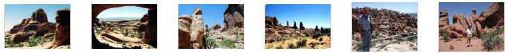
We took a number of good pictures here at the arch, and if you will click on the thumbnails below you can have a look at some of them:
|
We spent about an hour wandering around Delicate Arch before hiking back down the trail to head off to Tower Arch.
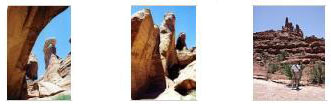
Tower Arch
|
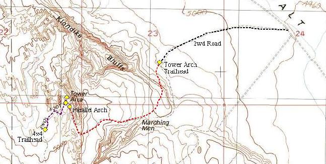
We'd read that this desert hike would require 2 to 3 hours round trip, but when we also read that the route was only 1.5 miles each way, we knew we'd have plenty of time to spend at the destination and still make it back in a couple of hours. The elevation gain on this hike is minor, and it should be easy going.
The entire route was easy to follow; we simply had to watch for the cairns used to mark the route. From the Tower Arch Trailhead we first headed west, immediately climbing a short but steep ridge that had us scrambling for a bit. From the top of the ridge we had an outstanding view of the area. The trail then crossed a long rocky area that required hiking from cairn to cairn and then descended slightly to the bottom of a minor drainage. We crossed the drainage and climbed a short but steep sand hill before turning north into a passage that snakes through the rocks. We passed a formation known as the Marching Men on our right. This formation, which consists of some needle-like rocks that are close together with some individual needles out in front and more widely spaced, looks like a close group of marching figures with some individual figures out ahead. You can see the formation in two views- the close group of needles and the individual needles "leading the way." A ways past this formation, we got our first good views of Tower Arch. The trail continued east and climbed directly beneath the massive arch.
|
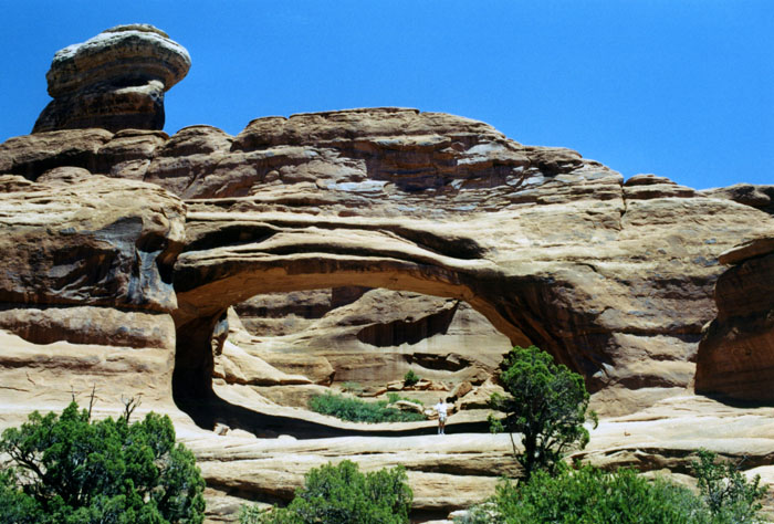
There is a bit of controversy about the name of the arch, though. Those who look closely will find two inscriptions, one each on the north and south abutments of the arch. The inscription on the south abutment reads "DISCOV'D BY M. AND MRS. ALEX RINGHOEFFER AND SONS 1922-23." This inscription has led to much controversy because the name "Ringhoffer" is misspelled and the date 1922-23 is cryptic. The Ringhoffer family operated a silver mine in Salt Valley and spent Sundays exploring the surrounding country. The family was probably aware of the arch. It is unknown who actually carved the inscription.
The second inscription reads "Minaret Bridge, H.S. Bell 1927." No one is sure who H.S. Bell was, but in 1933 and 1934 the Arches National Monument Scientific Expedition conducted an in-depth reconnaissance of the new monument. The expedition was led by Frank Beckwith, a local newspaper editor and amateur scientist, who was responsible for naming many of the arches- including Tower Arch. It appears that he was unaware of or disregarded the possibility that the Ringhoffer's ought to have naming rights, or that the name given by Bell ought to be followed. So should it be Ringhoffer Arch or Minaret Bridge or Tower Arch? All we know is that official maps and documents since the 1930s have referred to the formation as Tower Arch.
|
|
I've also put three thumbnails below for some pictures we took here at the arch, and if you will click on those little images you can see the full-size pictures:
|
We took some other really great pictures in and around Tower Arch and of the countryside on the hike back. Click on the thumbnail images below to have a look at some of them:
|
We spent the better part of an hour wandering around this incredible feature before beginning our hike back to the car. We saw only three other groups on the trek, so it was almost as if we had the arch to ourselves. Once back at the car, we had to drive back out the dirt road and then out of Arches National Park heading to our next stop- the Petroglyphs in Nine Mile Canyon.
You can return to the page index or continue on to the next section.
The Petroglyphs in Nine-Mile Canyon
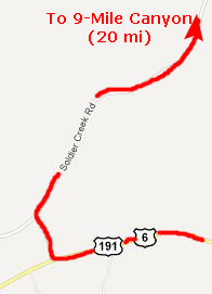
Getting to Nine-Mile Canyon
|
|
About ten miles up this road there was a turnoff onto Nine Mile Canyon Road and the unmanned entry kiosk for Nine Mile Canyon.
The History of Nine-Mile Canyon
By 750 A.D., village life had developed in the heart of the Fremont region, with a number of farming villages consisting of semi-subterranean timber and mud pithouses and above-ground granaries. Fremont farming techniques appear to have been as sophisticated as those of other contemporary farming societies, involving water diversion techniques such as irrigation. Due to generally favorable climatic conditions and a culminating indigenous knowledge of the area, the era between roughly 700 A.D. and 1250 A.D. was the height of Fremont culture.
Between 1250 and 1500 A.D., the Fremont culture vanished. The exact reasons for this disappearance are not known. More aggressive Ute, Paiute and Shoshoni peoples, are believed to have migrated into the region around this time, and may have displaced the Fremont or absorbed the Fremont into their own culture. Whatever the case for the Fremont demise, it is clear that these resourceful and impressive ancients had great knowledge of the land that they inhabited.
John Wesley Powell led a government expedition through Utah in 1869. He had a topographer with him by the name of F. M. Bishop. Bishop did a nine-mile triangulation drawing, and he named Nine Mile Creek. The canyon was subsequently called Nine Mile Canyon even thought the canyon is actually 40-miles long. Maps presented to Congress by the Powell expedition clearly have Nine Mile Creek and Bishop Ridge labeled.
In the early development of the Uintah Basin of Utah, no road was more important than the Price-Myton road which runs through Nine Mile and Gate Canyons. The road was carved through the rugged canyon by the all-black 9th Cavalry. Nine Mile Road construction coincided with the building of Fort Duchesne on the Uintah frontier in 1886. The road was needed to supply the 300 soldiers garrisoned at Fort Duchesne. Following Indian trails, the road linked the fort with the nearest railhead in Price. For the next quarter-century, the road was the most heavily traveled in eastern Utah. It was the main route for stagecoach, mail, freight and telegraph into the Uintah Basin. This heavy usage resulted in some of the travelers leaving their mark in the canyon. One small settlement grew slowly from the 1880s until it became the town of Harper in 1906, and reached a population of 110 in 1910. By the late 1920s, however, Harper was a ghost town, with only a few foundations still visible. One Harper building has been restored and maintained.
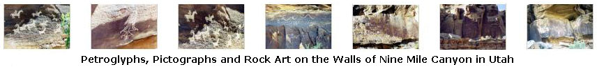
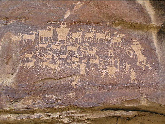
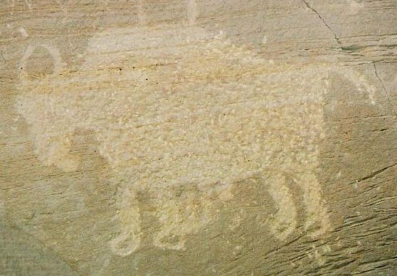
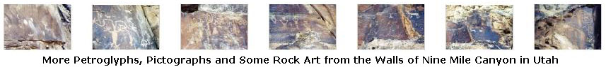
The Creation of the Nine-Mile Canyon Petroglyphs
We took lots of pictures of the petroglyphs, and if you will click on the thumbnail images below, you can see seven of the best of them:
|
Researchers have also identified hundreds of ancient pit-houses, rock shelters, and granaries, although only a limited amount of actual excavation has been carried out to date. Many of these structures are located high above the canyon floor on cliff ledges, pinnacles, and mesas.
The creation of the images and the buildings is attributed to the Fremont, whose presence in Nine Mile has been dated at AD 950�1250. Indeed, Nine Mile Canyon was one of the locations most heavily occupied by the Fremont. In contrast to the purely hunter-gatherer cultures that surrounded them, the Fremont practiced agriculture, growing corn and squash along the canyon bottom. Unlike some Fremont areas, little pottery is found in Nine Mile, suggesting that beans, which must be boiled for hours to become edible, were not an important part of the local diet. The Fremont left irrigation ditches and earthen lodges on the valley floor that could be seen as late as the 1930s, but are no longer visible after generations of modern cultivation.
|
|
Our Drive Through Nine-Mile Canyon
|
Nine-Mile Canyon was really neat, and we saw lots of interesting petroglyphs. But it was getting late, so we headed back the twenty-five miles to Wellington.
You can return to the page index or continue on to the next section.
Staying in Wellington, Utah
|
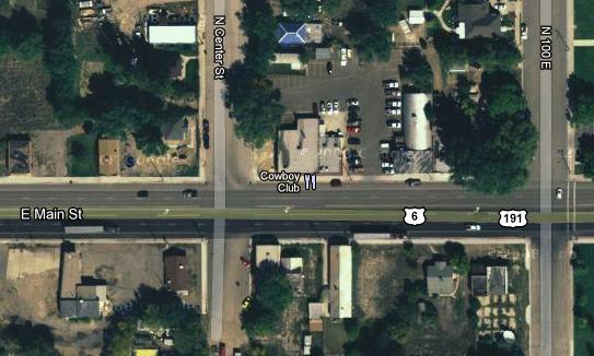
The lady who checked us in recommended The Cowboy Club for dinner, so that's where we went. It was just a few blocks west on the main street through town. We had a good dinner there, and a good rest at the motel.
You can return to today's index
or use the links below to continue to the album page for different day.
|
June 28, 2003: Western Trip, Day 8 |
|
June 26, 2003: Western Trip, Day 6 |
|
Return to the Index for Our Western Trip |