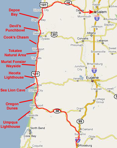
Today is going to be a full day. We spent some of last night looking at the map and plotting out some places that we wanted to visit, although we also left room to stop whenever we found something of interest.
We knew ahead of time that we wanted to stop at Umpqua Lighthouse State Park; there were supposed to be great views of the Oregon Dunes and the Pacific from there. The Oregon Dunes Recreation Area was another planned stop; there was a small museum and some nature trails there.
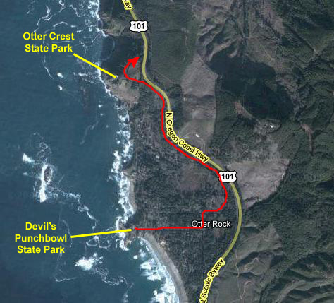
Sea Lion Cave was also on our list; we knew it would be touristy, but any excuse to get inside a cave was enough for us. Also on the schedule was the Heceta Lighthouse. Completing the list we made ahead of time was the Devil's Punchbowl north of Newport Bay (spectacular rock formations) and the picturesque fishing town of Depoe Bay.
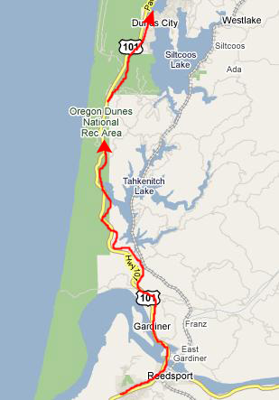
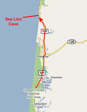
I have marked all of these stops on the map at right, but I have also, after the fact, added the other stops that we made, most of which were just roadside parking areas that were particularly scenic. Cook's Chasm was probably the most interesting of the unplanned stops we made. We intend to spend the entire day on the Oregon Coast, and eat dinner in Depoe Bay or north of that, and then use the evening darkness to head inland for our last night's stay in Salem, Oregon. We have already made a reservation at the Super 8 there, so we are under no time pressure.
At the Umpqua Lighthouse State Park
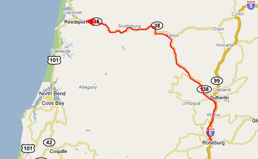
We slept in just a bit late in Roseburg, and ate our breakfast right there at the Super 8. Then we checked out and headed up Interstate 5 to pick up Highway 38 again, angling west off the interstate on Highway 138 and on to Reedsport, Oregon.
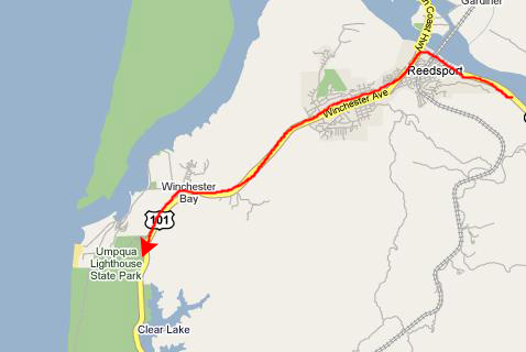
At Reedsport, we intersected with Highway 101. In California, US 101 is known as the Pacific Coast Highway, or just PCH, and it runs the length of the state from the Mexican border to the Oregon state line. It is a fabled, fabulous route, and many of California's most iconic locations can be found along its route- San Clemente, Huntington Beach, Venice, Santa Barbara and San Francisco. It is the highway that crosses the Golden Gate Bridge.
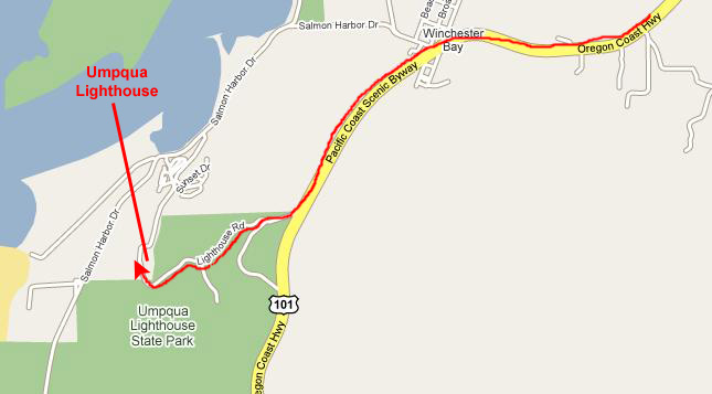
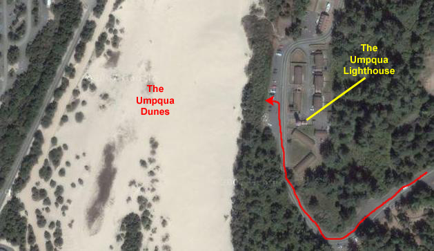
In Oregon, US 101 is known as the Oregon Coast Highway (no acronym), and it also runs the length of the state along the coast, turning inland at Portland to cross the Columbia River into Washington. We will be spending the rest of the day along the Oregon Coast Highway, starting with the Umpqua Lighthouse State Park south of Reedsport.
When we reached the entry for the State Park (after overshooting it one time) we drove through the park towards the beach, coming out in the parking area for the lighthouse.
We parked the car and got out to walk around, and I began by making a movie of the area around the Umpqua Lighthouse; use the player at right to watch it.
Of course, the first thing we noticed was the
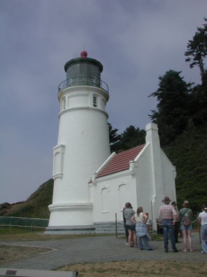
Umpqua Lighthouse
itself. Originally the first lighthouse in the Oregon Territory, it was built in 1857 near the mouth of the river. It was undermined and destroyed by a flood in February, 1861. It was rebuilt on this new site, about a mile from the old one, in 1891-1894. As was the purpose of all lighthouse, it was a guide for mariners. Originally designed to use oil, it was electrified in 1934. The conical tower is 65 feet high, and is situated 165 feet above sea level. The lens is 6 feet in diameter, 10 feet high and weighs 2 tons. There are 616 prisms, hand cut in Paris, France, in 1890. The lamp is 210,000 candlepower resulting in visibility 19 miles out to sea. The Umpqua Lighthouse signal is 2 white flashes followed by 1 red, and it also has a radio beacon that is dot-dot-dash and dash. The original cost of the lighthouse was $50,000.
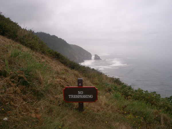
This point of land is apparently right on the migration path of the Grey Whale, and
the sign in front of the lighthouse
gave us a lot of information about the whale's habits. I'll let you zoom in on the wording if you are interested. From the parking area, there were unobstructed views out across the
Umpqua sand dunes
to the Pacific Ocean. I am sure that the dunes are a popular place for weekend vacationers; even with the poor weather today there were a number of trailers parked down at the edge of the dunes. These vehicles don't drive across the dunes but access them via a local street that runs right along the ocean from Reedsport.
Looking off to the southwest,
we could see that someone had brought a couple of dune buggy/ATVs, so I assume that kind of thing is allowed.
Although it had nothing to do with the lighthouse, particularly, there seemed to be some sort of Corvette car club rally or something going on here today. A
long line of Corvettes
was coming down the street from the north; some were parking but some were, apparently, getting rally forms signed and then they tooled off the way we had entered the park. Reedsport is a small town, so it was pretty clear that these cars had not come from there, so the rally must be a big deal.
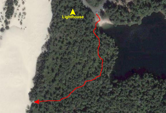
As we were heading back out of the State Park, we came around the curve just south of the lighthouse and saw a parking area and a sign for a forest trail, so we thought we would stop and have a look.
The trail began to head around the west side of the small lake, and quickly disappeared into thick coastal forest. We could still see the lake but it was very dark and shady on the trail. We came to a point where the trail diverged and the sign said that one branch would take us to the dunes, so we followed that. After about a quarter mile, we came out on the sand dunes themselves.
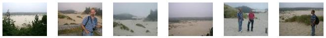
It might have been interesting to walk across the dunes and through the bands of vegetation to the ocean, but we knew we'd be much closer to the Pacific later in the day, so we eschewed that adventure for now. About all we did was to take pictures of each other here at the dunes. Here is
Fred's picture of me
and here is
my picture of Fred.
Then it was back to the car to now begin a day-long trip up the Oregon Coast.
We headed north on the Oregon Coast Highway from Umpqua Lighthouse, passing through the coastal town of Reedsport. Although we were kind of high up at the lighthouse, the town is almost at sea level, with lots of marshes and wetlands about. As we started climbing again (not much, just a hundred feet or so), I stopped to take a movie of our route out of Reedsport. You can watch that movie with the player below:
Just a few miles up the coast, we saw signs for the continuation of the Oregon Dunes National Recreation Area, and pretty soon found a small Forest Service Visitor Center for
the dunes.
Stretching approximately 40 miles down the Oregon coast from Florence to Coos Bay Oregon is the largest expanse of coastal sand dunes in North America. Comprised primarily of sediment from the Coast Mountain Range that was carried out to sea and brought back to shore by waves and coastal winds, the dunes reach over two miles inland and tower up to 500 feet high. We will be right in the thick of the Recreation area for the next twenty miles, and won't leave it until we reach Sea Lion Cave.
Intermingled in this amazing geography are forests, lakes, saltwater marshes and other diverse ecosystems. In 1972, 32,186 acres of this landscape were set aside to create the Oregon Dunes National Recreation Area. The recreation area is within the Siuslaw National Forest, and the Forest Service manages the dunes as well. The wind-sculpted sand dunes have thick �tree islands�, open dunes, marsh-like deflation plains and beaches.
In the exhibit area, Fred was interested in the
Seashore Lupine
that is common among the dunes. Leaves are a distinct star shape. Flowers vary in color from blue to purple to pink with white. The plant should not be eaten because several lupine species are known to be poisonous.
The Oregon Dunes NRA was formed by the ancient forces of wind, water and time; these dunes are like no others in the world. They are the largest expanse of coastal sand dunes in North America. From the nature center where we stopped, we found two or three trails we could follow; we chose
a trail
a trail that started off through some Douglas-fir and Sitka spruce, and then wandered up, over and through open sand dunes.
We stopped at a point where we could hear (if not see) the Pacific Ocean off in the distance, and at this point I made a movie of the Oregon Dunes; you can watch that movie with the player at left.
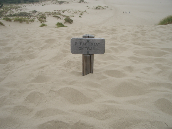
It was here that the sign at right admonished us to stay on the trail. I would have, if I could have determined where the trail was. After a while I could pick out a worn path and see some people off in the distance, but I would think that one stiff wind and all sign of the trail would disappear.
The dunes can reach over three miles inland, although once you get more than a mile or so from the ocean the dunes are covered in forest and vegetation, and you don't realize they are beneath what you see.
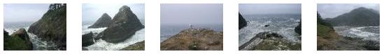
We took other pictures of the Oregon Dunes, both from the Visitor Center and from the trail. I have put thumbnails for some of these pictures below, and you can view the full-size images by clicking on the thumbnails:
Sea Lion Cave is located about 11 miles north of Florence, Oregon, and getting there from Oregon Dunes was a simple drive up the highway. We found a spot in the parking area and then walked over to the Visitor Center. Sea Lion Cave is one of those quasi-private affairs that govern many odd attractions across the country. It is neither a State nor a National site of any kind. While I presume that these days the owners of the land above the cave are limited in what they can do, they can pretty much set the rules. The result is that things are pretty commercial and while there are rules against flash photography of the sea lions (not to scare them away) making pictures in the cave difficult, it was still an interesting place to visit.
We went inside the visitor center to buy our tickets for the elevator that would take us down into the cave. I had thought that the elevator would have been inside the visitor center, but it was not. It was about a hundred feet north of the visitor center at the end of a paved walkway. So, we began to walk down to the elevator along the paved walkway. You can watch a movie of this using the player below:
When we got there, there was a bit of a wait, so we stopped to look at the shoreline and the fog. The
black birds nesting on the cliff below
are cormorants. This is the familiar fishing bird of Japan which is placed on a leash with a ring around its throat and is disciplined to bring its catch to its trainer. Over thirty different species of these birds are found in the world, this one being the Brandt's Cormorant. Cormorants are found on the Oregon coast the year 'round and congregate at their various nesting grounds during Spring and Summer. Three to five eggs are laid in May and they are hatched in June. Cormorants are not scavengers; their diet is composed totally of live fish which they catch in the ocean.
While Fred was taking his picture of the cormorants, I was making a movie of the shoreline below us, and you can watch that movie with the player at right. The V-shaped inlet you can see below is actually the west entrance for Sea Lion Cave, and the wave action coming into that inlet will be the cause of the waves you'll see in the movies I take of the sea lions inside the cave.
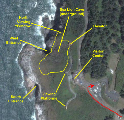
When the elevator arrived, we hopped in and in a minute or so we had descended 11 floors (at least that's what the numbers indicated). If you will look at the aerial view of the Sea Lion Cave facility at right, I'll be able to orient you to the major features of the cave below as well as the viewing platforms on the surface (which we'll get to when we come up out of the cave).
The cave was discovered in 1880 by Captain William Cox when he piloted his boat through the cave's western entrance to find one of the largest sea caves in the world. Daylight penetrates the cave from the north, south and west entrances (although only the main, west entrance is used by the sea lions). The floor of the cave covers 2 acres and the ceiling is 125 feet above the surface of the water. When you exit the elevator, you are 35 feet above sea level and 300 feet below the highway. Captain Cox had discovered the only known hauling area (cave) and rookery (outside rock ledges) for wild sea lions on the American mainland.
Rivers of molten rock from erupting volcanoes formed this headland about twenty-five million years ago. Two fractures in the basaltic rock developed, one running north to south, the other east to west. Where these fractures intersect, loosened rock was scoured out by ocean action, creating the cave. A tunnel developed along the north-south fracture, and now contains the exhibit area and the path to the north lookout window.
When we came out of the elevator underground, we were in a museum-like area (there were some exhibits and stuff like that). To our right, we could see a large tunnel that we could see led to a viewing window to the outside; this was the north viewing window. To our left, and down a few steps, there was a
fenced viewing platform;
this is where there were people peering into the interior of the cave. I can only assume that the chain link mesh was to keep people from throwing objects (or dropping them) into the cave itself.
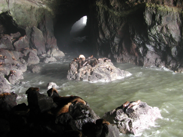
This cave is home to a great many Steller Sea Lions. This member of the eared seal family is found from central
California to the Bering Sea. This is the only mainland rookery, the rest of their homes being on rocks off shore. Sea lions make the area their home year 'round, generally landing in the cave during Fall and Winter stormy seasons and on the rock ledges outside during the Spring and Summer. They feed on fish that they catch themselves- principally bottom species such as skate, squid and varieties of rockfish.
In the Spring, bulls gather harems of 10 to 20 cows and keep these families until breeding is finished in early July. The weaker males are fought away and are called bachelor bulls. Sea lions possibly breed every other year, as many of the young are observed nursing well into their second year. Single pups are born in Spring and weigh 40 to 50 pounds. Bulls average 1200 to 1500 pounds at maturity and cows average 500 to 700 pounds. The average life span of the sea lion is about 20 years.
On the south wall of the cave, halfway up, you can see a yellowish rock layer. this is volcanic ash and sedimentary deposits, and separates two different lava flows. Although hard to see in our pictures, there were colored deposits on the walls in green, pink, buff and red- created by lichens, algae and mineral deposits.
I took two movies from the viewing platform, sticking the lens of my camera through the wire mesh (as we did for all our pictures). These movies just record the action inside the cave (the sea lions didn't move much), and you can watch those movies with the players below:
We took quite a few pictures of the inside of the cave. It was so large that flash photography (even had it been permitted) would not have helped much. So many of our pictures did not turn out well. I have put thumbnails for five of our best shots below. To view the full-size pictures, just click on those thumbnails:
(Click on Thumbnails to View)
From the viewing area into the cave, we went back up into the museum/display area. One of the exhibits that caught our eye was a
sea lion skeleton,
but there were many other displays and much other information about the creatures. We walked through the museum and up
the stairway to the north viewing window.
The viewing window at the end of the tunnel was usually crowded, so we waited until we could squeeze in by ourselves. This enabled us to get a good picture of
the view north
along the coastline. We were also able to get pictures of each other at the window; and here are those pictures of
Fred
and
myself.
I also wanted to take a movie of the view out the tunnel entrance, but the first one I tried had a lot of noisy people behind me messing up the sound. The second one turned out rather well (complete with bird cries), and you can watch that movie with the player at left.
We spent about an hour down in Sea Lion Cave, and then took the elevator back to the surface. Just outside the elevator, Fred took a picture of
me on the walkway back to the visitor center.
As you can see, it has gotten a bit foggier, and the fog is even more apparent in this picture that I took from up the walkway looking
north past the elevator building.
And taken from about the same spot, here is a picture of the
rocky coastline
below the building housing the elevator.
We walked back up the pathway to the Visitor Center, and then down the other side of the hill to the
lower viewing area.
From here, we could get some pretty amazing views up and down the coast and right around Sea Lion Cave. For example, when we looked south, we could see a pretty amazing
rocky headland
in the distance. As you can see, it looks very much as if someone sliced off the end of the promontory with a gigantic knife, and pushed the separated piece aside, just as if you'd sliced the end off a piece of fruit or something. I can only imagine that, at some point, the rock just fractured and the oceanside piece tilted away from the main portion- like a slow-motion rock glacier. The forces at work must be incredible.
Directly below us, we could see more
sea lions on the rock ledge
(resting? feeding? reproducing?). They looked as if they were in their element on this foggy day, and every once in a while one would slip into the water or another would climb out. The scene was made more interesting by the sounds that the sea lions and the various wheeling birds all made, and you can only appreciate this if you watch the movie that I made of this scene with the player at left.
We enjoyed the viewing area, but knew we should get going up the coast, so we went back to the visitor center. There, we took a couple of more pictures right at the center. There was a sculpture of some sea lions (which for some reason reminded me of the photo of the marines raising the flag at Mt. Surabachi), and so we used it as a backdrop for pictures of each of us-
Fred
and
myself.
Then it was back to the car and up the coast again.
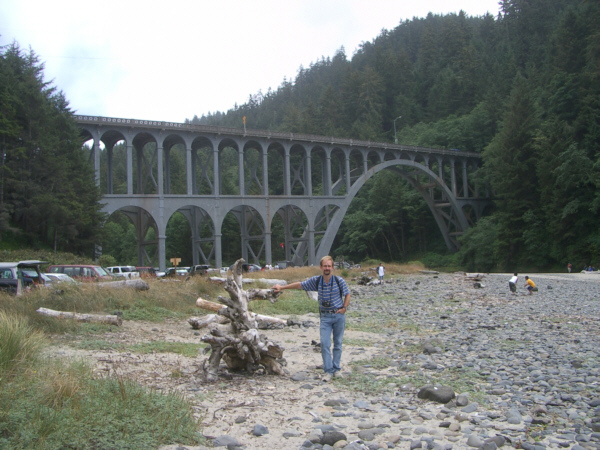
The Heceta Lighthouse in the Devil's Elbow State Park
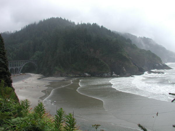
From Sea Lion Cave, we continued north along the Oregon Coast Highway for just a few miles. The road wound through a heavily wooded area and then, all of a sudden, as if we were coming out of a tunnel, we were on a bridge over a small creek with the lighthouse and Devil's Elbow State Park in front of us.
I thought this particular bridge was really great; it reminded me of the bridge into downtown Pittsburgh coming from the airport, where you can't see the city at all until you emerge from the tunnel onto a bridge across the Monongahela River with the city spread out in front of you. There is no warning, and that's the way it was here (except that the thick forest took the place of a tunnel and Devil's Elbow State Park took the place of Pittsburgh).
Anyway, it was pretty spectacular, as you will see in the photos we took here.
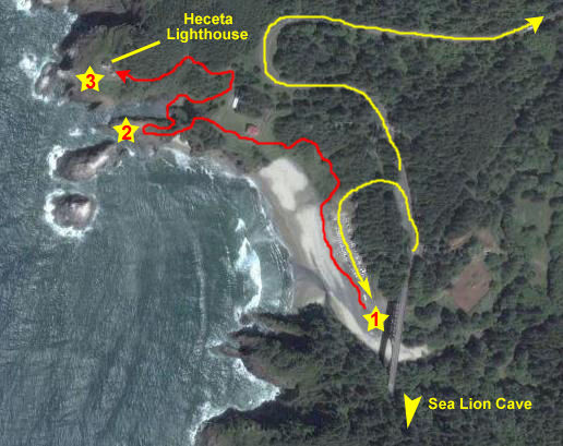
I want to use the aerial view at right to orient you to the pictures we took here. We came up from the south (Sea Lion Cave) on Highway 101 which, as I said, emerged from the forest onto the bridge at the bottom of the view. On the other side of the bridge was the entrance to the state park and the road down to the large parking area. This is a popular place, even on a sub-par day like today. We parked at the end of the parking area.
We took pictures in a number of different places. Although I think you'd be able to tell where each one was taken, I'm going to organize them into four groups (even if they weren't all taken at the same time). One large group of pictures was taken right near the parking area (yellow star #1 on the aerial view), as we wandered over the pebbly creek bed under the bridge and around towards the ocean. From here, we had great views of the bridge and of the beach area nearby.
We walked up the trail marked in red to the Haceta Lighthouse, and another series of pictures was taken along that trail, both going up and coming down. About halfway up the trail, there was a side trail that led out onto the rock outcropping right by the ocean (yellow star #2) and here we took lots of pictures of the rocky coastline and particularly the odd, conical-shaped rocks just offshore- in an area called the "Heceta Churn."
Finally, we continued on up the trail to the lighthouse itself (yellow star #3), and here we took a good many more pictures- of the lighthouse itself and the views from it. Anyway, if all this organization is overkill, you can ignore it and just look at the pictures.
The Creek Area and Bridge (1)
When we came off the bridge and turned into the state park, we found the parking lot to be quite full, so we drove down to the end of it and found a
parking place under the bridge
(along with a bunch of other cars in this overflow parking area). I was really quite taken with the highway bridge itself, and the way it
emerged suddenly from the forest
to cross the stream. It was a beautiful piece of engineering, and exactly suited to its location.
From the place we parked, we could look
along the streambed towards the beach
which was actually quite some distance away. We wandered over in that direction, walking on the small rounded stones that formed the bed of the stream. I could only assume that during the spring when the water flow is greater, that the entire area where we were walking is under water. As we got close to the beach area, we started to find lots of driftwood, and the picture at left was taken from the beach looking back at the bridge- and Fred is leaning against a large piece of this driftwood.
As we neared the water, the rocks gave way to sand (in a pretty clear dividing line, I thought), and the views out to sea were pretty good- what with the odd conical rocks forming a backdrop. Again we shared a couple of pictures from basically the same place- one of
me
and one of
Fred.
We walked along the beach in front of the parking area and over towards the trailhead for the path up to the lighthouse. On the way, we passed by one of the many
picnic areas
that are undoubtedly one reason why this state park is so popular.
The Trail Up to the "Heceta Churn"
From the beach area, we started off towards the trail up to the lighthouse. The trail began right at the end of the parking area, ascended a bit, and then turned oceanward. I walked a bit behind Fred (see the movie below) on the trail and when it turned towards the ocean, it ascended along the hillside, and we got good views back to
the bridge area
and also
down the coast.
Once we got a little higher, we could look down and see the entire
Devil's Elbow Beach,
which is actually much larger than it appeared from down at ground level. All very beautiful. Looking ahead along the trail, we could see the
offshore rocks
that form part of the "Heceta Churn," which we'll explore shortly.
I stopped at the top of this part of the trail to make a movie of Devil's Elbow Beach (see below) and the waves and the coastline, and then we turned onto the side trail that led down to the ocean. Just before we got there, we got another really great view of
the beach and coastline.
Behind Fred on the Trail
Devil's Elbow Beach
Exploring the "Heceta Churn" (2)
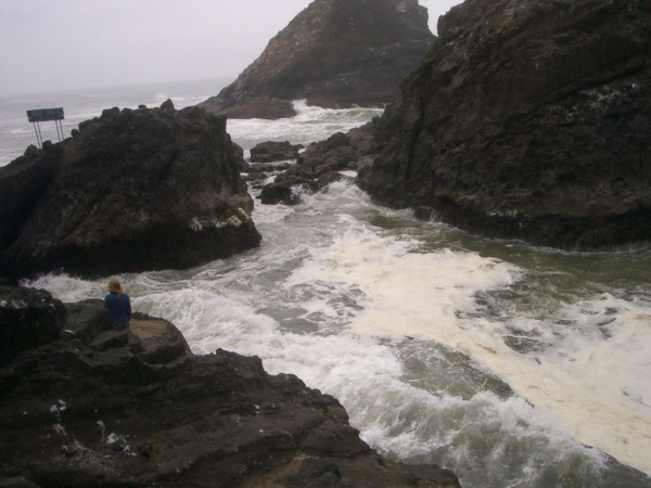
Heceta Head
is one of the most photographed sites on the Oregon Coast,
known for its natural beauty as well as its historic significance. this coastal headland is constantly being reshaped by the sea. The
deep chasm
began thousands of years ago as a small fracture in the volcanic bedrock. Pounding by the sea and the force of air compressed ahead of the wave continuously widens the opening. The rocks along the chasm are uneven but surprisingly slippery. Large waves and high winds often spray water over the sides of the chasm and onto the surrounding headlands.
We took pictures of each other here at Heceta Head, and I have put thumbnails for three of these pictures below; you can view the full-size pictures by clicking on those thumbnails:
(Click on Thumbnails to View)
I also took a couple of movies of the wave action here at the "Heceta Churn;" it's really pretty interesting. You might want to watch those movies with the players below:
I also took what I think is a really good movie encompassing the whole scene here at Devil's Elbow State Park, panning from the highway bridge to the coastline to the ocean to the rocks in front of us, and you can watch that movie with the player at right.
I'd like to include here a selection of other pictures we took of the rocks offshore, some birds and the coastline; all of them are interesting but don't require any specific explanation. Look at as many of these pictures as you would like by clicking on the thumbnails below:
(Click on Thumbnails to View)
From the "Heceta Churn" to the Lighthouse
We left the rocky ocean shore and headed back up to the main trail, continuing to follow it around the crevasse that forms the "Heceta Churn." On the upward path, we could look ahead and see
the top of the lighthouse through the trees,
and just before we came out on top of the bluff, we could look back and down at
the "Heceta Churn."
The Heceta Lighthouse (3)
For more than a century
Heceta Head Lighthouse
has helped seagoers navigate the Pacific Ocean�s treacherous currents. The cape owes its name to Don Bruno de Heceta, who in 1775 embarked on a secret voyage for the Queen of Spain to sail up the West Coast. Due to the onslaught of scurvy, Heceta and his crew turned back just before the Columbia River, but not before he noted the shallow waters and rocky headland that now bear his name.
A century later, mariners frequenting the dark waters between Coos Bay and Newport asked for a lighthouse to guide their journeys up and down the coast. Heceta Head proved an ideal location, and an order was placed in 1892 with the Chance Brothers in England for a powerful First Order Fresnel Lens to be shipped to Heceta Head, where construction of two Queen Anne-style Lightkeepers� houses and Lighthouse tower had already begun.
On March 30, 1894, the lighthouse cast its first beam. The first eight years were trying times for the three Lightkeepers and their families who lived in the little community of Heceta Head. Many Lightkeepers were unable to handle the sparse and isolated conditions and moved on. Head Keeper Olaf Hansen worked for over fifteen years to make the Lightstation a sustainable community. Olaf started the vegetable gardens, a schoolhouse and the Heceta Head Post Office.
Much changed in the 1930s, when Oregon finished construction of U.S. Highway 101 and the Lightstation received electricty. Motorist frequently traveled up and down the Oregon Coast, which ended the Lightkeepers� years of isolation. Electricity allowed for a partially automated lighthouse, ending the duty of one Lightkeeper. The 1930s ended with the retirement of the U.S. Lighthouse Service. Its successor, the U.S. Coast Guard, retired the Head Keeper�s dwelling and sold the house for $10.
During World War II, the Coast Guard Beach Patrol manned
Heceta Head
with 75 men. They guarded the beaches between Florence and Yachats with attack dogs and lived in wooden bunkers where the Head Keeper�s house once stood. After WWII, the Coast Guard continued to man
the Lightstation
as an aid to navigation. Two men and their families remained at Heceta. In 1963, Head Lightkeeper Oswald Allick witnessed the end of the era of Lightkeepers when the Lighthouse was automated (here is a picture of
Fred at the Lighthouse)
and turned over to computers. The Keeper�s House was then turned over to the U.S. Forest Service.
From 1970 to 1995, the U.S. Forest Service leased the Keepers House to Lane Community College for use as a satellite campus. When the house was placed on the National Registry of Historic Places in 1973, the U.S. Forest Service looked for alternative uses that would allow it to be more accessible to the public and to share the rich history. It was decided that a Bed & Breakfast would make this feasible. Since 1995, two generations of the Korgan family have worked on a careful restoration of the interior and now invite the public to enjoy this National Treasure.
I took two movies here at the Lighthouse. The first is of the Lighthouse and surrounding area and the other is of the view from the lighthouse of the waves crashing on the rocks of the "Heceta Churn" way down below. You can watch those movies using the players below:
Our next stop after Heceta Lighthouse was an unscheduled one. We had only gone a few miles up Highway 101 when the highway came down to the level of the beach inside Carl Washburne State Park, and there was only a thin strip of scrub separating the road from the ocean. Then we came across a turnoff to a parking area/beach access, and so we decided to stop.
You can see the small circle drive into the parking area in the aerial view at left. We decided since we were so close to the beach, that we would get out and walk along it for a ways. So we climbed down the small hill in front of the parking area, and found ourselves on
a broad, flat beach,
quite unlike either the Oregon Dunes we'd seen earlier, or the rocky shoreline a few miles south of here. The parking area was right next to a small stream that we found out was named
China Creek;
the creek flowed right in front of the parking area up on the dune and then right out to the ocean. It was really small; only a culvert under the highway. I thought that the area right in front of the parking lot, what with the creek and some really large, bleached tree trunks lying about, was a good spot for a movie, so I filmed one, and you can watch it with the player below:
We thought we would walk up the beach for a ways, but before we started out I got a picture looking north (the direction we would walk) of
Fred on the beach.
Then we started off walking up the beach, and you can follow along with us by watching the movie at left.
About a half mile up the beach, we came upon
another pile of driftwood,
and, sure enough, there was another stream coming out across the beach to the ocean. This was a respectable stream, and looking over at the highway we could see that there was a
bridge across it.
I made a movie of this area, and you can watch that movie with the player at right. It looked as if we wanted to walk any further up the beach we'd have to take our shoes and socks off and wade across the shallow but wide stream, so we decided we'd come far enough.
We turned and walked towards
the highway bridge,
intending to climb up to the roadway and walk back, but we found a path that led up the embankment onto
the top of the scrub‑covered dune.
The path continued south through the scrubby vegetation back to the parking area, and along the way we found a
notch in the oceanside embankment,
through which we could see other folks walking on the beach.
The walk was kind of neat, particularly with the little streams flowing across the beach, and we were back at the car in less than 45 minutes, and off up Highway 101.
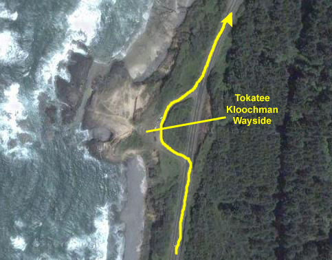
Well, before you ask, I have no idea of the derivation of the name "Tokatee Kloochman" as applied to this Natural Area wayside about ten miles north of the Muriel Ponsier Wayside we were just at. Maybe Jewish Indian; I don't know.
Anyway, we just ran across this wayside as we were driving north along the coast, and we stopped to see what we could see. What we could see were great views of the
Oregon coastline,
like this one looking north. There was a stiff breeze blowing here, and that might account for the fact that the clouds seemed to be breaking up and giving us some weak sunlight for a change.
I made a movie of the coastline that I think will give you an excellent idea of what it is like along here as I pan from north to south; you can watch that movie with the player at right.
I also tried to put together a movie that would express how open and expansive and free we felt driving along the coastline. It'd different from the mountains and waterfalls, that are usually secluded, closed-in place. Here, the sky and the ocean gave a feeling of limitless possibilities and, as the Aussies are reputed to say (although it's probably just an advertising slogan) "No Rules." Anyway, I hope you'll watch that movie with the player below:
And, in case you missed it in the movie, you'll get an appreciation for how safe this area made us feel by checking out the picture I've included
here.
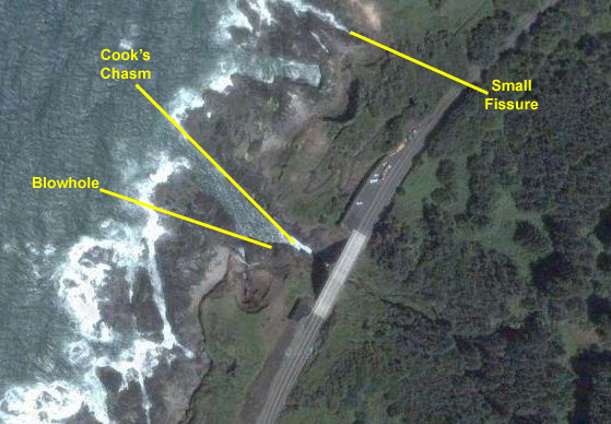
The drive to the next viewpoint was just a few more miles up the highway- Cook's Chasm. The parking area for the Chasm was on the north side of the bridge; we found a spot and I walked
out on the bridge
to take a look at the chasm from above. The shot you just saw was looking north from the middle of the bridge. From that spot, I could
look down on Cook's Chasm.
Cook's Chasm is a fissure in the rock that makes a spectacular sight when the incoming tide rushes into it (or when any large wave comes in). The action comes from the compression of the water already in the fissure by the force of the new water coming in, and sometimes the spray can reach twenty or thirty feet in the air.
Coming off the bridge, we went back to the parking lot and found the stairway down to the rock ledges beside the chasm. Here, at the top of the stairway, I made a movie of the chasm and the surrounding area that will put the sight into some perspective for you. I actually the movie after being down beside the chasm, but including it here will help set the stage. You can watch that movie with the player at right. Then, we went down the stairs to see the chasm up close.
We started down the stairs to the chasm itself, and when we were about halfway down there was a landing where I stopped to take a picture of
the ocean entrance to the chasm
and you can see the waves pounding into the fissure (which seemed to be about thirty feet wide. When we got down to the bottom of the stairs, we found ourselves on the north side of the chasm,
below the highway bridge,
with excellent views of what was going on in the fissure.
The constant pounding of the waves and weather have worn away at cracks and crevices in the volcanic basalt, making tidepools, caves and vent holes. On the south side of the fissure, the water has eaten away under the rock so that it forms a shelf, and there are also a couple of small caves there as well. There is a small opening in the roof of one of the small caves. When the tide is just right an incoming wave rushes into the fissure, goes under the shelf, and rushes into those underwater, undershelf caves. This usually occurs around high tide.
When this happens, and when the water covers the cave opening, there will usually be enough water entering the cave and sufficient pressure built up inside to send a whale-like spout through the vent hole up to 45 feet in the air. I did not catch this occurring in a picture, but you'll see some water forced through the vent in the movies below.
After taking my movies, I walked out to the ocean end of the rock shelf, and I could see that when the waves came in, they actually split and went up
two fissures,
although the right-hand one was pretty small. We also walked a hundred feet or so up the coast on the rocky shore, and we found another,
much smaller fissure;
a very long time from now it, too, may be quite a sight to see. Our last picture taken here is of the
rocky Oregon coastline looking north.
Now for the movies. In the section below, you'll movie players for the seven best movies that we took here, and a short description of each one. Just use the player to view any movie:
Wave action in Cook's Chasm taken from the highway bridge above the fissure.
Cook's Chasm taken from beside the fissure; you can see the wave action, the shelf of rock on the south side, and you'll see water being forced through the blowhole.
Cook's Chasm & the different size waves coming in; only some force water through the blowhole. Note the cave openings under the shelf opposite where I am standing.
Wave action in Cook's Chasm.
The beach area at the inland end of the chasm; waves are breaking and spraying onto the black sand.
A smaller fissure up the coast; it is built differently, with the inland end actually a rock shelf. Waves come into the small fissure, are compressed and then are forced through a very small opening up onto that shelf.
A rocky point where water separates and follows different channels up different small fissures.
The drive to our next planned stop was about 30 miles. We just drove along the coast admiring the scenery, passing through some picturesque seacoast towns.
We passed through the town of Newport, Oregon, about 5 in the afternoon, and a few miles north of town found ourselves approaching the town of Otter Rock, Oregon.
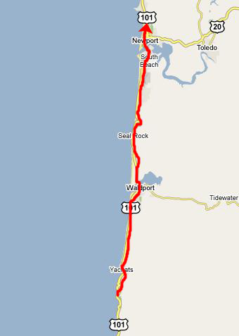
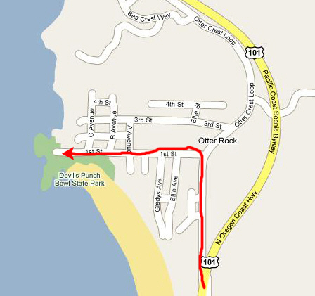
The Devil's Punchbowl State Park
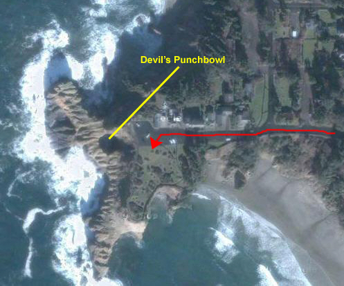
Just south of Otter Rock, we found a sign for the state park, so we got off the Oregon Coast Highway and took the business street into the small town. We turned left on First Street and headed west to the state park. I've included an aerial view above just out of interest. You'll be able to match up the pictures we took to the aerial view, even though the weather when the aerial view was taken was vastly better than when we were there.
When we parked the car we were at the top of a high bluff overlooking the Oregon Coast 180 degrees from south to north. It was quite the vantage point. One view looked
south towards Newport,
past a black sand beach and quite a few surfers sitting on their boards waiting for a wave. This picture, in retrospect, seems to be the iconic picture of the northern Oregon coast on a blustery day. I made a film to take in the view to the south, the black sand beach, and the surfers waiting expectantly, and you can watch that movie with the player at right.
Fred also took a picture of
the surfers
and also a picture of some
very pretty flowers
that he found growing here at the top of the bluff.
As we walked around the end of the pathway and north along the bluff, I made a movie of our surroundings, and you can watch that movie with the player at left. At the railing along the pathway, Fred took a picture, looking north, of
me and the Oregon coastline
and I took a picture of one of the
rock promontories
here. The Devil's Punch Bowl formation has come into view as you can see in the movie I made (which you can watch with the player below):
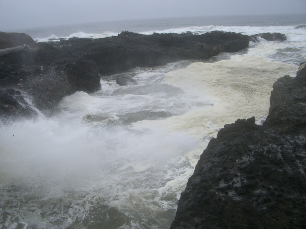
It took a very long time for the
Devil's Punch Bowl
to look as it does today. For thousands of years, the Pacific Ocean has carved the rocks of the land, sculpting this landscape into unusual formations. Before the punch bowl was formed, waves pounding the coast beat against the walls of two sea caves, gradually wearing away the softer rock between them and enlarging the cave. Waves beating against the roof of the sea cave gradually eroded the rock of the cave ceiling. Eventually, the cave roof collapsed, giving us
the bowl
we see today.
So far as I could see, there were only two entrances into the punch bowl, and Fred used his zoom to take a closeup picture of
one of these openings;
the other one came in from the north side of the bowl.
In the punch bowl, the surf churns, foams, and swirls as it mixes in a sometimes violent brew. Today, it seemed, the waves were not so large so as to put on a good show. Before we left here, we did take some more good pictures of the coastline nearby; click on the thumbnails below to have a look:
(Click on Thumbnails to View)
I took some good movies here at the Devil's Punchbowl, and you can have a look at them with the players below"
My first movie of the Devil's Punchbowl
Waves coming into the Devil's Punchbowl
The coastline near the Devil's Punchbowl
Cape Foulweather
From the Punch Bowl, we followed First Avenue back towards the highway, but turned off on the Otter Crest Loop, just interested to see what we could see. We started climbing fairly steadily on the winding street, and, eventually, we came out in an open area for some sort of park. The park building was closed, but there were signs outside to tell us that we were at Cape Foulweather.
Cape Foulweather was discovered by Captain James Cook, the English explorer, on March 7, 1778. the weather was particularly stormy on the day of his discovery; winds of 100 MPH at the cape are not unusual. Captain cook named the location Cape Foulweather, the first geographic location named on his voyage to the north Pacific coast. Once accounts of this voyage were published, world interest was aroused and the fur trade followed.
We were able to follow the walkways over to the top of the point overlooking the ocean, and here we got some really great views. Fred got two really good pictures- one looking
south towards the Punch Bowl
and the other looking north along
the Oregon coastline.
Very pretty, even if the weather was as foul as the name of the place indicated. Fred also got a picture of
me at the overlook.
For my part, I just made a movie from here, showing the southern view and the view out to Gull Island just offshore. You can watch that movie with the player at left.
Then we found our way back to US 101 and continued north towards Depoe Bay.
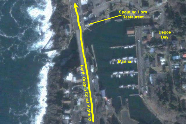
We continued up the scenic coast highway another five or six miles and then came into the very pretty town of Depoe Bay, Oregon. Depoe Bay was founded by a Siletz Indian- "Charley" Depot (whose name was later changed to "DePoe"). The land that now is Depoe Bay was allotted to him by the U.S. government in 1894, although he and his family had lived on the land for some indeterminate time before that. Incidentally, his last name was derived from his employment at a U.S. army depot. The family later changed the spelling to Depoe, which was the spelling used when the post office was established in 1928.
Around 1908 Harvey L. Collins and a group of businessmen from the Portland area heard of a charming isolated �sea cove� on the Oregon Coast accessible only by trail. Curious, the group trekked from the Willamette Valley to the coast to determine if it the cove might be a good investment. Charlie and Minerva DePoe�s heirs wanted $10,000 for their land, so the men formed the Sunset Investment Company and purchased the two hundred acres of land. These men became the founders of Depoe Bay.
It was not until May 29, 1927 when The Roosevelt Highway and Depoe Bay Bridge were completed that the land became accessible and the Sunset Investment Company began promoting its development. The public was invited to come and witness a natural phenomenon, The Spouting Horn, which was predicted to rival the famous Old Faithful geyser in Yellowstone Park, and one of two natural harbors on the Oregon Coast. They explained that the phenomenon was caused by ocean tides running back under the rock cliff then forcing its way forcefully through a two-foot hole in the ceiling of an underground cavern.
In 1934, Clyde Crawford constructed the original Spouting Horn Restaurant as a single-story building. Prior to the construction of the Spouting Horn the Bridge Lunch Restaurant was located near the Depoe Bay Bridge on the Highway. It was moved back to accommodate the Spouting Horn. Purl Taunton bought the Spouting Horn from Crawford in 1944 and used the old Bridge Lunch Restaurant as a cottage until it burned down. A second story was added to the Spouting Horn in 1936 with the restaurant downstairs and rooms upstairs. Also in 1963 a lumber barge sank and its cargo of redwood washed ashore. Much of the redwood was used as siding inside the restaurant. Since that time the front and back of the building have been added onto several times, but it still is said to have one of the best views in Depoe Bay. Members of the Taunton family own and run the restaurant to this day.
Totally unaware of all this history at the time, we crossed
the Highway 101 bridge
over the inlet into the small bay and marina (declared by a sign on the bridge to be the world's smallest active bay), and then slowly drove through the town, still heading north. We wanted to get out and walk around and also find a place to get dinner, as we would be heading inland towards Salem in another few miles.
We first drove through town and a bit north, not seeing anything of particular interest, and then decided to drive back down into the center of the small town, park, and walk around and see what we could find. We did that, and soon came upon a couple of seafood restaurants near the bridge.
We examined some menus and walked around some more before deciding on the Spouting Horn Restaurant. It looked as reasonable as any of the places we checked, and it had the virtue of having a dining room that overlooked the bay and marina. Having made that decision, we thought we would spend a little more time walking around and working up an appetite. We went around the south side of the restaurant near the bridge and found a little observation area that consisted of a balcony that ran along the side of the restaurant and wooden stairs that led down to the docks below. Standing on that balcony, we could see
the entire bay and marina-
it was indeed as small as advertised. Standing here, I also made a 360-degree movie where you can see the bay, the inlet and bridge and the Spouting Horn Restaurant. You can watch that movie with the player at right.
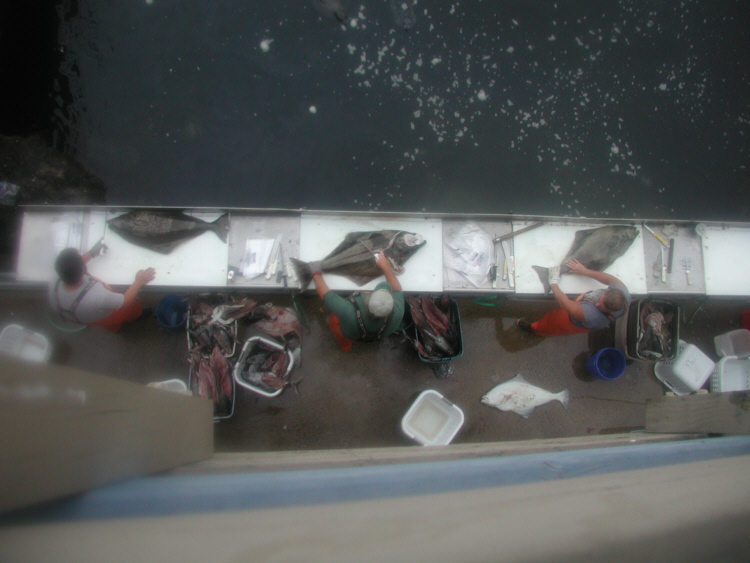
We went a couple of levels down the stairs and found ourselves on another kind of balcony, this one overlooking an area where three or four men were cleaning and fileting fish-
most of them quite large. We assumed that boats would bring their catch in at the end of the day and that these men would be paid to clean and sort them. We found this operation very intriguing to watch, marveling at the speed and expertise of the workers who would take one whole fish out of the catch bucket, clean and fillet it, and then pack the fillets in ice, either to be served or sold locally or sent inland to other restaurants as, presumably, "the catch of the day."
If you would like to see what we saw, I took two movies in sequence (my movies are limited to 30 seconds each) of one worker cleaning and fileting one fish and then a picture of the result. First, watch the two movies with the players below:
One particularly interesting aspect of the operation was that the workers just threw any smaller pieces of waste from their cleaning process into the water in front of them, and I was thinking that it wouldn't take long for the bay to become quite foul with rotting fish. Then Fred and I noticed that nature had provided a clean-up crew in the form of both birds and, oddly enough, sea otters. It was hard to catch the otters in pictures, but I have selected two of our better attempts to include here. In this first picture you can pick out the
sea otters waiting for handouts-
they are swimming around in front of the cleaning station. I also used my zoom to try to capture a single seal on film, and I think I achieved
an interesting result.
The birds were equally hard to capture in still pictures, although Fred did get one good shot of some of the
birds going after the morsels.
What seemed to work better was to film the action. You can follow the birds and sea otters, and you can hear the cries of the birds and the spashing in the water. I took two acceptable movies of the action, and I hope you will watch them with the two players below:
It was all very interesting and fun to watch.
When it got darker, we went on into the restaurant and were seated pretty quickly. We got an excellent table right by the windows where we look out to the south and see the bay, marina and bridge, and where we could continue to watch the action at the fish cleaning station. I made a movie of the restaurant and the views outside, and you can watch that movie with the player at left.
While we were waiting for our meal, I had Fred take a picture of
me at our table
and I returned the favor by taking a picture of
Fred in the Spouting Horn Restaurant.
We had a very good meal, each of us having a seafood platter of one kind or another, and it was a very nice meal for our last night in Oregon.
This was the last stop of the day. It had been a great day on the coast. Although the weather could have been nicer, at least it did not rain, and so we were more than satisfied.
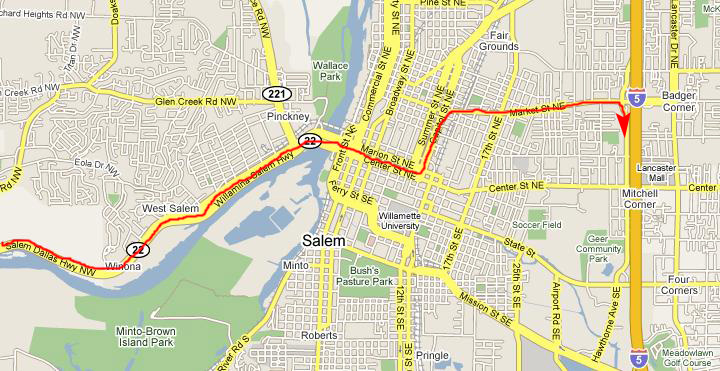
When we finished dinner, we got back in the car and headed further up Highway 101. It was getting pretty dark by this time, and there wasn't much to see. We passed through Lincoln City, and then headed inland on Oregon 18, joining Oregon 22 at willamina. Then we took that highway to Salem (oddly enough, passing quite close to Dallas, Oregon).
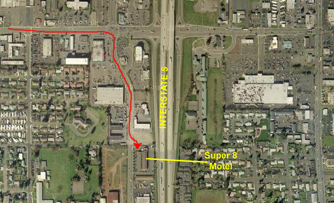
We couldn't see much of anything by the time we got to Salem, but we just followed route 22 into the middle of town and then, following the directions to the hotel we'd gotten the night before, went up to Market Street and over to Interstate 5.
We found the Super 8 easily enough; it was just south of Market Street on the frontage road for the interstate. We had a pretty good room as I recall, although there seemed to be some college or high school thing going on as there were an awful lot of kids around.
But we had a good night's sleep after a long and interesting day.
You can return to the Page Index
or go to the next or previous day of our Oregon trip using the links below.