|
July 3, 2006: The Bighorn Wilderness, WY and Pictograph Cave SP and Lost Creek SP, MT |
|
July 1, 2006: Driving from Van Alstyne, TX to Cheyenne, WY |
|
Return to Glacier National Park Trip Index |
Wyoming Visitor Center
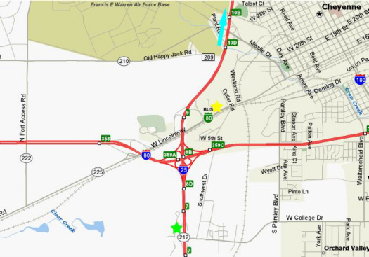 |
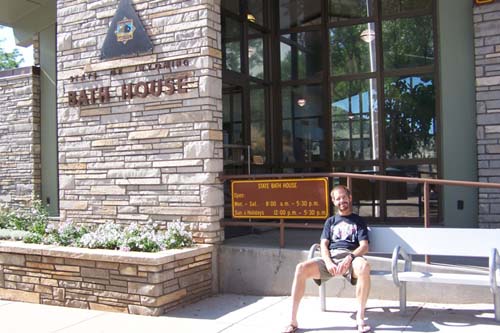
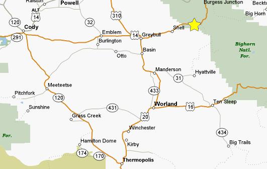
Right near the motel (yellow star on the map) was a Wyoming visitor center (green star on the map), so we drove over to pick up some brochures and get some information. We told the nice lady manning the station where we'd intended to go today, and she was the one who clued us in to Ayres Natural Bridge State Park and how to get there. This one we'd seen on the Internet, but we hadn't gotten good directions for, so her advice was invaluable. She confirmed that our first planned stop in Thermopolis would be worthwhile. We also asked about Shell Falls, but she hadn't been there, so we got some maps and other material about it.
Before heading off north along I-25 towards Ayres Natural Bridge, we stopped just outside the visitor center to look at the statues honoring Lewis and Clark (shown here with Fred), and Sacajawea (shown here with me).
Ayres Natural Bridge State Park
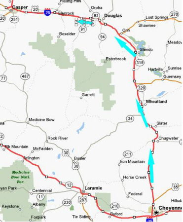 |
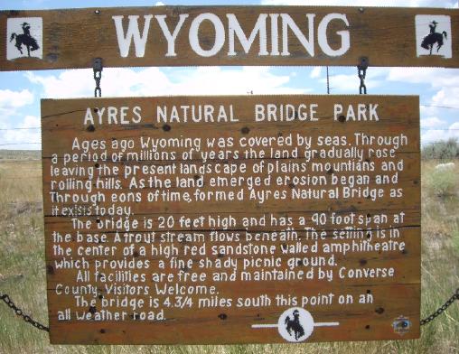
As the interstate turned west towards Casper, we were told to look for the exit for the state park, which turned out to be a bit before the town of Glenrock, WY. Just off the interstate, there was a sign that confirmed we were in the right place:
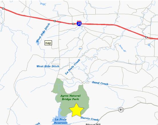 |
Once on the other side, it is just fifty feet or so to the natural bridge itself, which forms a perfect backdrop for pictures of Fred and myself.
Just a short ways from the natural bridge, back by the footbridge, there was a sign telling a little bit about how the natural bridge was formed. We've seen natural bridges before formed by wind erosion (such as Delicate Arch in Arches National Park), but of course the Ayres Natural Bridge was formed by water action.
Of course, the first thing I wanted to do was find a way to climb up on top of the natural bridge, but we thought that might not be allowed, until we saw a small sign showing the way to the trail to the top. It was quite short (the whole natural bridge is maybe 100 feet long by twenty feet wide), and soon we were out on top. There, we discovered a red rock pillar that stood out in stark contrast against the blue sky. There was also a good view up the valley. Here, even in July, there was still a lot of green, particularly near any small water source as well as on the mountainsides.
There is a reservoir just downstream and apparently there has been or is some sort of power generation or reservoir maintenance that goes on; that is the only purpose I can think of for the concrete building that sits beside La Prele Creek in the canyon through which the creek runs. The last thing we did before climbing back down a different way to get back to the RAV4 was to take a couple of pictures that would show the entire recreation area near the natural bridge. Here is a shot of me and the footbridge at the base of the natural bridge. The creek runs under the footbridge, of course, and then left to circle around the parking area and run along the base of the redcliffs that form the boundary of the recreation area.
There were some picnic tables here, so we had lunch and then drove back up to the interstate an on towards Thermopolis.
Wind River Canyon
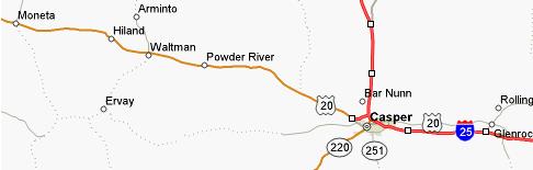 |
At Casper, we filled up with gas and, as a precaution, ensured that the spare tire had the right amount of air, and then headed off west on US20 towards Thermopolis.
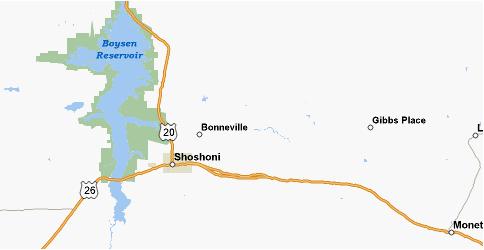 |
As you go north from Shoshoni, you are soon driving alongside Boysen Reservoir. One oddity which will be with us almost the entire trip is that in this area of the country, most of the rivers and streams flow either north or east, rather than south and east which is more common where we live. The reason is that most of this area makes up the headwaters of the Missouri River, the main body of which is actually a bit north of where we are, and, of course, it flows eastward into the Mississippi. Once you cross the Continental Divide, of course, then most rivers flow towards the Columbia River, or a river in Oregon or Northern California. Much further south from here, it's the Colorado River.
At the end of Boysen Reservoir is the Boysen Dam, and just past that is the first in a series of three tunnels that take you over and around the dam itself. When you exit the last tunnel, you are at the beginning of the Wind River Canyon.
 |
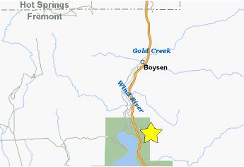 |
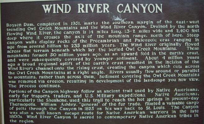
There's an explanation of the Wind River Canyon in the photo of the sign at left, and, at this point, we are at the approximate location of the yellow star on the map above. It was pretty amazing how the terrain changed so abruptly once you passed the dam, from relatively flat high desert to the steep walls, beautiful colors and flowing water, and I hope the movie of the Wind River Canyon does it justice; watch it using the player below:
|
|
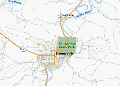
We headed off north along the highway through the Wind River Canyon which was among the most scenic of the roads traveled in the entire trip. At every turn, the scenery seemed to outdo itself, and one of the more interesting things were the rock formations on the canyon walls alongside the road. The canyon was extremely beautiful, and adding to the natural beauty was the way in which the railroad, river and highway paralleled each other along the way. At some points, even the highway ahead got lost in the spectacular mountain scenery of the Wind River Canyon. The drive through the canyon was about 15 miles, with the canyon itself flattening out slowly as we proceeded north. Here is a typical canyonview just a few miles before we came out of the canyon at Thermopolis, Wyoming.
Hot Springs State Park
 |
We spent quite a while here, and moved about the park and the surrounding pastureland taking pictures. To give you a good idea of where we went, and where we were when the various pictures were taken, I've included a map of the state park below. I've put some directional arrows alongside the streets and highways so you can follow our route, and I've also put some markers on the map that I'll refer to when I describe the pictures. I hope that these additions will give you a good idea of what the park was like.
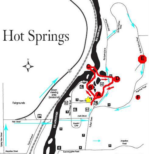 |
Next, we took a walking tour around the hot springs. The path (marked by the red line on the map) leads first up beside the bathhouse to the beginning of a boardwalk system that takes you out across the natural stone terrace that has been formed over the centuries by the deposit of minerals that are dissolved in the water when it comes up out of the springs (which, contrary to what I thought at first, are actually an eighth of a mile away). We've seen the same type of formations in Yellowstone. Anyway, we stopped at Point A, and I thought this would be a good place to take an explanatory movie of the boardwalk area, and you can watch it using the player below:
|
|
We continued along the boardwalk to Point B. There, you can look down off the terraces to the parking area alongside the Bighorn River. Fred took some pictures of the parking area here, and at first I didn't understand why. But he was getting a picture of some locals looking for a tourist handout. Apparently, the passenger wasn't being cooperative, so some of them went to see if they would have better luck with the driver. Very cute.
We continued on around the terrace walkway to the Swinging Bridge. This suspension foot bridge that takes you out from the terrace area and across the Bighorn River was removed in July 1991 and replaced in 1992. The full story is here. From the vantage point at the opposite side of the bridge (Point C), you can get a good look at Mineral Terrace and the Bighorn River.
We walked back across the bridge and across the top part of Mineral Terrace to the eponymous Hot Springs- source of all the water for the Mineral Terrace and the bathhouses. Watch the movie I made of them with the player below:
|
|
|
The last thing we did in the park was to take the loop road (see the map above) that leads up to the high meadow and the bison herd. Although we only saw five or six animals, the Hot Springs State Park Bison Herd is the central herd for Wyoming State Parks. Herd size is dependent upon the carrying capacity of the available range areas and the site-specific requirements necessary to manage a healthy and safe bison herd.
The park maintains a free-roaming herd of 24-27 adult and yearling bison on a year-round basis. This number increases by 10-15 animals during the months of April, May and June as new calves become a welcome addition.
In addition to the "natural" feed that the bison receive from the pasture areas, the park's bison are provided with a daily "cake" supplement that provides necessary minerals and helps to ensure good health. This feeding occurs daily between eight and nine in the morning, so we did not get to see the bison up close. One thing the bison do have up here are beautiful views, like this one of the park, Bighorn River and Thermopolis.
We left the park late in the afternoon, and headed further north on Route 20. Here is some of the countryside along the way.
Shell Falls
 |
|
|
After looking at Shell Falls in the late afternoon light (we were blessed throughout the trip that it never really started to get dark until past 8pm in the evening), we consulted our information from the Internet and headed further east along US14 to one of the campgrounds in the Bighorn National Forest.
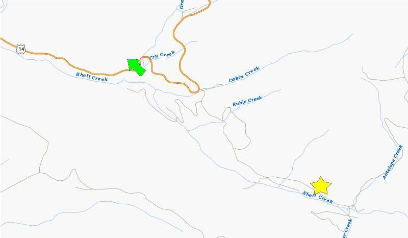 |
We finally found the turnoff for the campgroud area (a dirt road you can see heading southeast from the tight bend in the highway). There were actually three or four campgrounds, one of which was right by the highway, but we wanted something more private, so we picked the one called "Shell Creek Campground," hoping it would be near the creek/river itself. As it turned out, it was, and our campsite was in a small campground (about six spaces) right alongside Shell Creek. I've marked the location of the campground with a yellow star.
After setting up camp, Fred worked his usual culinary magic and we had a hot meal, with sound of Shell Creek a pleasing, restful and constant backdrop. We unloaded our camera memory cards, looked at the day's pictures and called it a night.
You can use the links below to continue to another photo album page.
|
July 3, 2006: The Bighorn Wilderness, WY and Pictograph Cave SP and Lost Creek SP, MT |
|
July 1, 2006: Driving from Van Alstyne, TX to Cheyenne, WY |
|
Return to Glacier National Park Trip Index |