|
December 7, 2008: La Palma, Canary Islands, Spain |
|
December 5, 2008: Agadir, Morocco |
|
Return to the Europe/Cruise Trip Index |
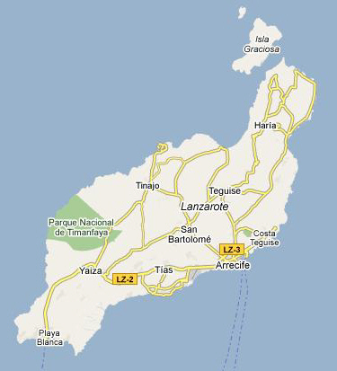
Docking in Lanzarote
 |
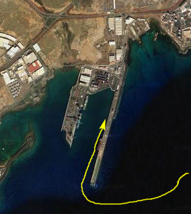
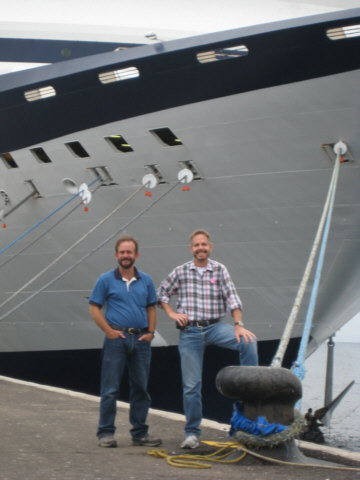
Where Agadir had been quite sunny, it was once again fairly overcast when we arrived in Arrecife on Lanzarote. I had hoped to be up in time to see the docking procedure, but when I awoke and went out on the balcony, I could see that we were already at the dock. We both threw on some clothes and went up on deck before breakfast, and we just took a couple of pictures. Fred took one of me on the ship in Arrecife harbor and I took one of Fred.
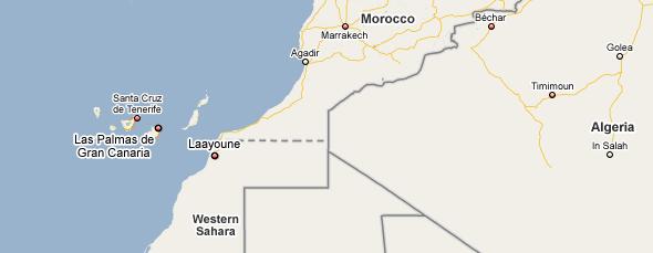
An Orientation to The Canary Islands, Lanzarote and Arrecife
The Canary Islands
 |
The name "Canary Islands" is likely derived from the Latin term Insula Canaria, meaning "Island of the Dogs", a name applied originally only to Gran Canaria. It is speculated that the so called dogs were actually a species of Monk Seals ("sea dog" in Latin) now extinct. The dense population of seals may have been the characteristic that most struck the few ancient Romans who established contact with these islands by sea. The connection to dogs is retained in their depiction on the islands' coat-of-arms.
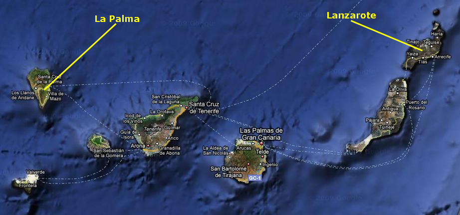
When we zero in on the islands themselves, we find that there are seven of them (not counting some small offshore islands). Our first stop will be Lanzarote, the northeasternmost of the islands, and our second will be La Palma, the northwesternmost.
 |
King Juba, Augustus's Roman protegee, is credited with discovering the islands for the Western world, and he dispatched a naval force to explore them. When Europeans arrived, they encountered several indigenous Neolithic populations. Linguistic and genetic analyses seem to indicate that at least some of these inhabitants shared a common origin with the Berbers of northern Africa. During the Middle Ages, the islands were visited by the Arabs for commercial purposes, and from the 14th century onward, numerous visits were made by sailors from Mallorca, Portugal, and Genoa. In 1402, the Castilian conquest of the islands began with the expeditions from the court of Henry III of Castile. In 1448, the lordship of Lanzarote was sold to Portugal's Prince Henry the Navigator, an action that was not accepted by the natives nor by the Castilians. A crisis swelled to a revolt which lasted until 1459 with the final expulsion of the Portuguese. Finally, in 1479, Portugal recognized Castilian control of the Canary Islands in the Treaty of Alcaçovas.
The Castilians continued to dominate the islands, and in 1495 the Canaries were incorporated into the Kingdom of Castile. The Castilians imposed a new economic model, based on single-crop cultivation: first sugar cane; then wine, an important item of trade with England. The cities of Santa Cruz de Tenerife and Las Palmas de Gran Canaria became a stopping point for the Spanish conquerors, traders, and missionaries on their way to the New World. This trade route brought great prosperity to some of the social sectors of the islands. The islands became quite wealthy and soon were attracting merchants and adventurers from all over Europe. Magnificent palaces and churches were built on the island of La Palma during this busy, prosperous period.
The Canaries' wealth invited attacks by pirates and privateers. The most severe attack took place in 1599, during the Dutch War of Independence. A Dutch fleet of 74 ships and 12,000 men, commanded by Johan van der Does, attacked and laid seige to the capital, Las Palmas. Eventually, they gave up the siege of Las Palmas and withdrew. Another noteworthy attack occurred in 1797, when Santa Cruz de Tenerife was attacked by a British fleet under the future Lord Nelson on 25 July. The British were repulsed, losing almost 400 men. It was during this battle that Nelson lost his right arm.
The sugar-based economy of the islands faced stiff competition from Spain's American colonies. Crises in the sugar market in the 19th century caused severe recessions on the islands. A new cash crop, cochineal (cochinilla), came into cultivation during this time, saving the islands' economy. These economic difficulties spurred mass emigration, primarily to the Americas, during the 19th and first half of the 20th century, and there are large groups of Canary Islanders in Venezuela, Puerto Rico and Cuba. At the beginning of the 20th century, the British introduced a new cash-crop, the banana. In 1936, Francisco Franco was appointed General Commandant of the Canaries. He joined the military revolt of July 17 which began the Spanish Civil War. Franco quickly took control of the archipelago, although there was never a proper war in the islands. During the Second World War, Winston Churchill prepared plans for the British seizure of the Canary Islands as a naval base, in the name of Gibraltar being invaded from the Spanish mainland. After the death of Franco, and the establishment of a democratic constitutional monarchy in Spain, autonomy was granted to the Canaries via a law passed in 1982.
Lanzarote
 |
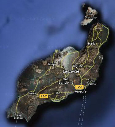 |
Today, we'll be driving across the island through San Bartolome towards the park.
Arrecife
Driving to the Lava Fields
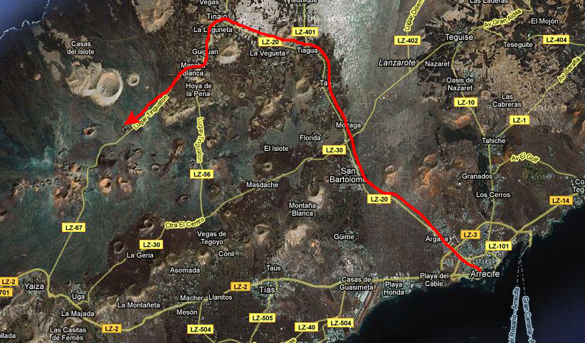 |
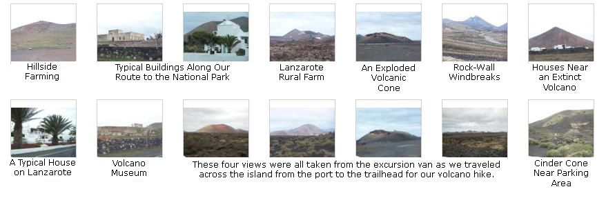
It took us about 45 minutes to get out of Arrecife and along the highway through a number of small towns and past a number of country houses and farms. On the van ride from Arrecife, Fred and I took a number of pictures of the scenery along the roads and of the landscape all around us. We were pretty amazed at how desolate and barren the landscape was, particularly on this island.
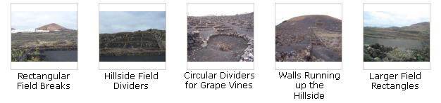
One reason that this island is barren is that it is one of the newer ones, and vegetation hasn't had time to get established (and break down the volcanic rock). Another reason is the constant winds that blow across this island in particular, winds that can cut down new seedlings quickly. In fact, in some of the pictures we took, we could see the low rock walls that farmers must build to shelter plants until they can become established. We will also see more of this later.
We eventually turned off towards the north just before entering Parque Nacional de Timanfaya (similar to Volcanoes National Park in Hawaii), followed an unpaved road around a cinder code, and then turned south for just a few feet before the vans parked. Below are some thumbnail images for the best of the pictures we took along the way out here, and if you will click on each image you can see what we saw:
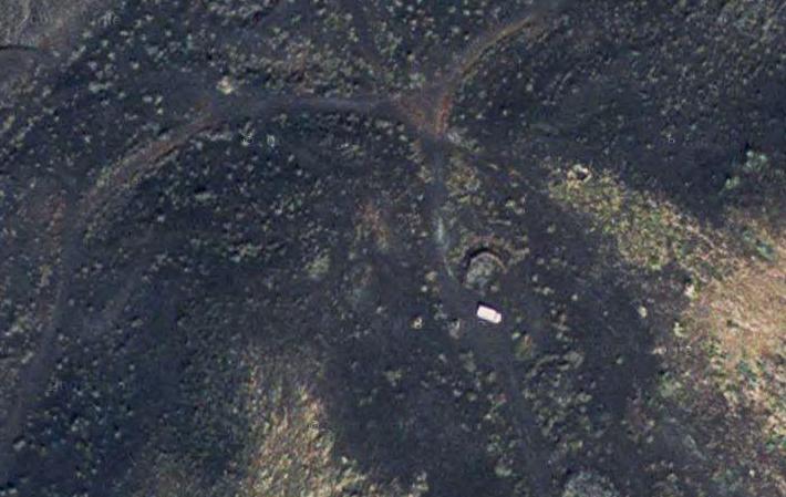 |
The white van that you can see in the aerial view was actually one from Canary Trekking, today's tour guide; they just happened to be conducting a tour at the exact moment when the satellite image was taken. That is a pretty amazing coincidence.
You'll see more pictures taken from where the van parked in just a minute and you'll be able to pick out some other features of the landscape and verify that we were standing just where the van is in the aerial view. One of them is the tree with the arc-shaped rock wall that is just a few feet north of the van. I took a picture of it when we returned after the hike, and you should take a look at that picture here. Amazing!
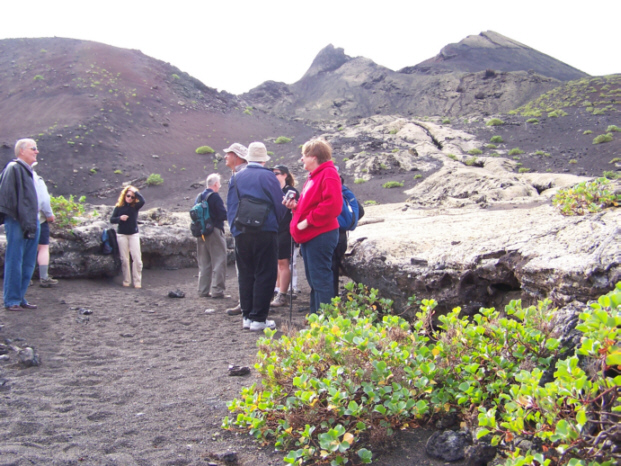
When we got out of the vans and all officially met the two tour guides, we got a preliminary lecture on the geology of Lanzarote. As it turns out, the entire Canary Island chain was built in the same way as the Hawaiian Islands- a "hotspot" on the ocean floor spewed out magma that eventually built up and broke the surface of the ocean as a new island. Volcanic activity on the island made it larger and longer as the hotspot slowly moved in response to tectonic forces. At some times, activity slowed, although the hotspot continued to move. In this way, one island stopped being built and, some time later, another was begun. The Canary Island volcanoes have been dormant in recorded history, but there is no assurance that at the other end of the chain the activity might pick up again.
After our lecture, we were ready to hike off to some distant hills.
Our Hike Through the Lanzarote Lava Fields
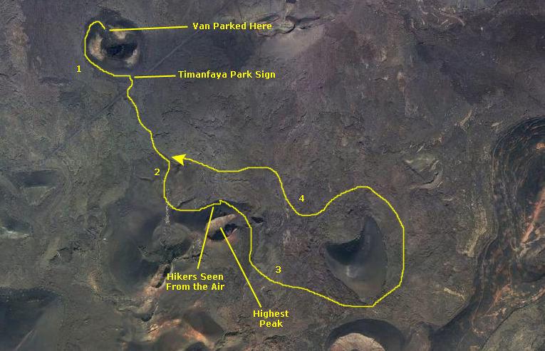 |
So we'll take a look at the pictures of our hike in these four groupings (and I've indicated on the aerial view of our hike route approximately the portion of the route that the groupings cover).
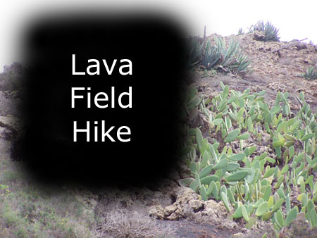
Lava Field Hike to the Park Entrance
|
I have put this group of pictures into a slideshow.
To view the slideshow, just click on the image at left and I will open the slideshow in a new window. In the slideshow, you can use the little arrows in the lower corners of each image to move from one to the next, and the index numbers in the upper left of each image will tell you where you are in the series. When you are finished looking at the pictures, just close the popup window.
This first section of the hike ended at the highway we had come in on. Here was the entrance sign for Timanfaya National Park. I had one of the tour group take a picture of Fred and I at the entrance sign.
Hiking to Lanzarote's Highest Peak
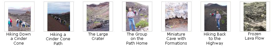
The scenery as we walked through the ascending lava field was certainly interesting. It is hard to call it "beautiful," since most of it was unrelenting shades of black, gray and white (which made the ochre color of some of the mountains stand out all the more), but I would certainly call it different from anything we'd seen on the trip thus far. Below are some thumbnail images for some of the pictures we took as we ascended through the lava fields towards Lanzarote's highest peak. If you will click on them, you can see the full-size images:
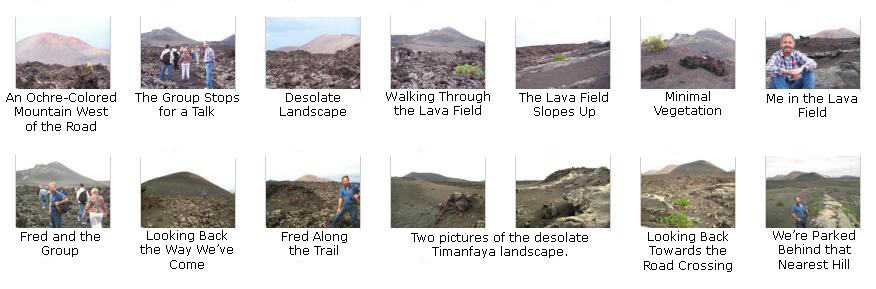
As the trail continued, it got steeper, but as we got higher, the views got better, and we could see all the way to the ocean and offshore islands.
 |
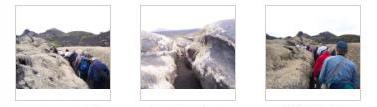
Then we headed off, single-file, through the lava crevasse. It was only about four feet in depth; presumably, it would have been a lava tube had the ceiling either formed or, if it did, had not collapsed afterward. So it turned out to be more like the slot canyons in California, but only chest high. Below are thumbnail images for three good pictures we took while going through the crevasse; click on them to see the pictures:
|
|
Before we got to the top end of the crevasse, the guide told us that we'd be climbing up out of it because it came to an end about a hundred feet further on. He took one small group at a time up through the rest of the crevasse to see the end of the actual lava tube, now clogged with rock and debris. When you come over the rise at the top of the crevasse, you are looking down into the tube- or at least what remains of it. It was OK to scramble down into the small cave and go all the way to the end of the little cavern, which I did, and took a picture of Fred and our little group examining the cave. I found it immensely interesting, and was the last one to come back out and down the crevasse, where Fred caught a picture of me in the crevasse.
Once we were out of the crevasse and back on top of the ground, new vistas opened up, such as Fred's view looking back the way we'd come and my view looking east towards the ocean. From here, we headed off up the trail to the east across the barren landscape. At the crest of the hill we came across a humorous cairn (a pile of stones), and of course our guide had a humorous story to go with it. After the group headed off on the next leg of our trek, Fred got a picture of me at the cairn. Our group continued up the final slope to the viewing area for the highest peak on Lanzarote.
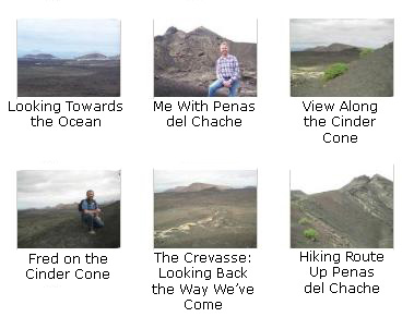
At Penas del Chache- Lanzarote's Highest Peak
 |
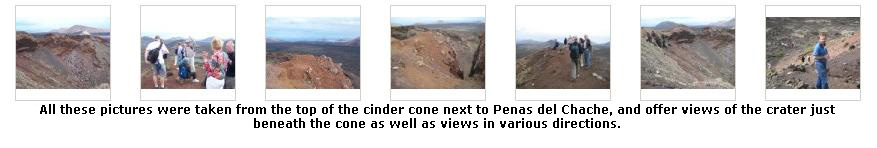
To get better views, our guide took us us up a steep trail to the top of a tall cinder code adjacent to the level area. From the top of this cinder pile we got some excellent views in all directions, and if you will click on the thumbnail images below, you can have a look at these views:
|
|
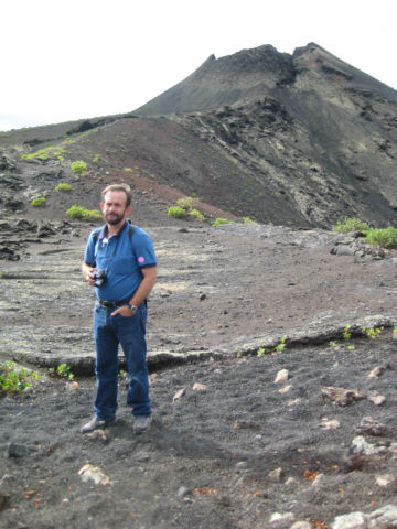
As I said, we came up a steep trail towards the top of this cinder cone. As we walked up the trail, we could see a large crater through a notch in the crater wall. Indeed, when we got to the top, we could see a huge crater spread out in front of us. Our guide stopped here to explain to us the geology of this crater (at least what is supposed to be known about it). We took a number of pictures at the top, including one of me, looking east and one of Fred and Penas del Chache. When we were done, we turned and headed down the trail and back to the level viewing area where some of the group had waited.
We took a number of other good pictures from the top of the cone and the edge of the crater, and if you will click on the thumbnail images below you can have a look at them:
 |
From the Highest Peak to the Apogee of Our Hike
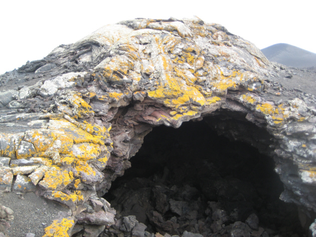 |
The group came around the cinder cone and we could see a lava cave in front of us as we continued down the trail towards it. Fred was back a little further from me taking some pictures of the distant views towards the east along the side of the cinder cone, and you can see the best of those pictures here. Then we arrived at the lava cave.
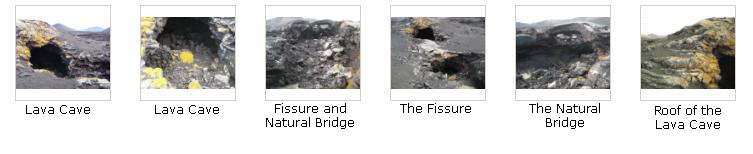
The lava cave was really neat. It was actually a long fissure in the ground, much of which had collapsed up towards the peak, but the lower end disappeared into a cave that seemed to go back quite a ways. The guide told us that it really did not go very far before it was blocked by rock, but it was pretty interesting nevertheless.
At one point, a short distance from the cave itself, the rock over the fissure had not collapsed for a stretch of maybe eight feet, and a natural bridge had formed over the fissure. I wanted to walk out on it, but thought better of it and just took a picture instead. (At this time I was behind the group by about a hundred yards- mostly so I could walk at my own pace rather than amble along as the group was doing.) That's what enabled me to actually see the group leaving the lava cave and heading for home before I actually got to it.
When I arrived at the cave and fissure, I took a number of pretty good pictures, including a few of the natural bridge that had formed. If you will click on the thumbnail images below, you can have a look at them:
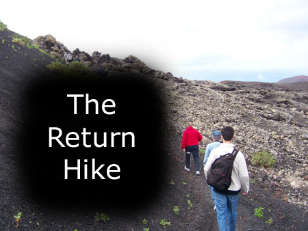
The Hike Back to the Parking Area
It was tough to weed out many of the pictures; a great many of them were very interesting for one reason or another. Below are a number of sections of thumbnail images for the pictures we took on the way back. Please click on as many of the labeled images as you wish to get a good set of impressions as to what we saw on the way back:
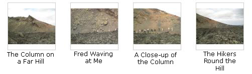
Here is an interesting series of long-distance shots and closeups that I took when I had gotten pretty far behind the main column, and they had walked to the far side of a lava ravine ahead of me. Fred is at the tail end of the column waving to me:
|
To view the slideshow, just click on the image at left and I will open the slideshow in a new window. In the slideshow, you can use the little arrows in the lower corners of each image to move from one to the next, and the index numbers in the upper left of each image will tell you where you are in the series. When you are finished looking at the pictures, just close the popup window.
|
|
When we got back to the vans, we piled in for the ride back to Arrecife.
Returning to the Ship
We passed more interesting houses on the route back, which took us back through the town of San Bartolome.
|
|
 |
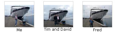
Here at the dock, we took some pictures of ourselves with the ship as a backdrop; click on the thumbnail images below to see these pictures:
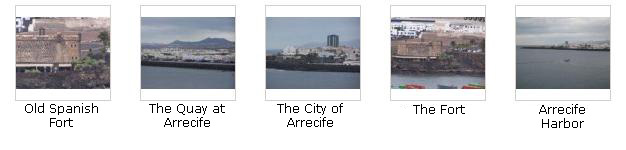
We also took some pictures of the harbor area here at Arrecife, and if you will click on the thumbnail images in the next section below, you can see them:
We boarded the ship and, as usual, headed for the snack bar for a very late lunch, and then did some walking around the ship. Later on, we headed to the gym, and while we were there, the ship left port for our next and final stop before the transatlantic crossing- the Canary Island of La Palma and its port, Santa Cruz de la Palma.
You can use the links below to go to another photo album page.
|
December 7, 2008: La Palma, Canary Islands, Spain |
|
December 5, 2008: Agadir, Morocco |
|
Return to the Europe/Cruise Trip Index |