|
June 19, 2009: New Mexico Trip Day 3 |
|
Return to the Index for Our New Mexico Trip |
The Cumbres & Toltec Scenic Railway: History and Overview
 |
The 64-mile line on which we will ride today is a remnant of the San Juan Extension of the narrow gauge part of the Denver & Rio Grand Railway (later to be known as the Denver & Rio Grande Western Railroad, or the "Rio Grande"). Narrow gauge (3 feet between the rails) was chosen instead of the more common standard gauge (4 feet 8 inches), so that the railroad could make tighter turns in the mountains and thereby reduce construction costs. Wishing to tap the booming mining districts in southwestern Colorado, the railroad headed west from Antonito in 1880. Crews surveyed, graded roadbed, and laid track through spectacular Toltec Gorge, over 10,015 foot Cumbres Pass, and down the 4 percent grade into Chama, where they arrived on December 31, 1880.
The coming of the railroad was a critical factor in the opening up of northern New Mexico and southwestern Colorado. The railroad was instrumental in developing the natural resources of the region, hauling mineral ore, timber, cattle, and sheep. The Rio Grande also carried passengers to and from the region. It even carried a first class parlor car on its daily passenger trains until ending passenger service in 1951.
The railroad had its ups and downs over the years. In 1893 the Silver Purchase Act was repealed and the federal government stopped purchasing silver. This brought a calamitous decline in the railroad's revenues. Subsequent economic booms and busts affected the railroad as well. Good times in the 1920s resulted in the purchase of "modern" engines (still in use today) and the rehabilitation of many freight cars. Except for a brief respite during World War II, the Rio Grande narrow gauge never recovered from the Great Depression, and most of the narrow gauge lines in the Rocky Mountains were scrapped during the 1950s.
The discovery of oil and gas In the Four Comers area of Colorado, New Mexico, Arizona, and Utah in the early 1950s led to a revival of the San Juan Extension, and it was used to transport equipment into the region. Very likely this single factor prevented the scrapping of the line we are riding today. However, even that traffic died out in the mid-1960s and the Rio Grande was ready to abandon this line by 1967.
In July 1970, through the intervention of dedicated people, the states of New Mexico and Colorado purchased the most scenic portion of the San Juan Extension- Chama to Antonito. Today the states administer the railroad through a bi-state commission, which contracts for services with two non-profit corporations: the CNTS Management Corporation (CNTSMC) and the Friends of the C&TSR. The CNTSMC is responsible for operating regular tourist trains and maintaining the rolling stock and facilities it uses. The Friends is responsible for preserving, restoring and interpreting the historic cars and structures.
The Cumbres & Toltec Scenic Railway:
At the Chama, NM, Train Station
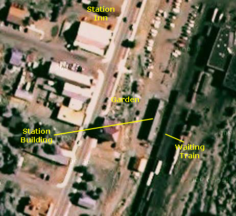
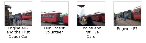
Our train was scheduled to depart at 10AM, so we were up about eight so we could be at the station by nine-thirty. We arranged with the Station Inn proprietress to leave our car parked beside the building, and she let me leave my laptop in her office for safekeeping. Fred got a picture of me coming out of our room. We walked the short block to the station, and were there well in advance of the departure time.
 |
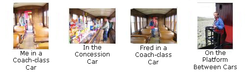
As I said, it was raining this morning, so waiting outside was a hassle as we tried to both hold our umbrellas and take pictures at the same time while watching engine 487 being readied for today's trip. The train was eight cars long, not counting the engine and coal car. Behind the coal car there were three coach cars, then a concession car, then another coach car, then an open car, then our tourist-class car and finally a parlor car. You can see these cars in that last picture of the train. Our car was the next to last and the only tourist car. Tourist cars have padded individual chairs instead of bus-style bench seats, arranged two on the left side of the car and one on the right. Fred and I had the pair of seats four rows back in our car. The seats were quite comfortable and there was plenty of room to move around. (In the parlor car, there is only one row of seats arranged along the windows. They got good views from the rear of the train. They were also served snacks throughout the trip, while we used coupons to get a couple of snacks each from the concession car.)
|
|
|
The Cumbres & Toltec Scenic Railway:
Trip First Half: Chama, NM to Osier, CO
To organize all the pictures we took while on the Cumbres & Toltec Scenic Railway, I am going to first break the trip into three major sections. In the first section, we'll travel on the first half of the actual train ride which, in our case, was from Chama, New Mexico, to Osier, Colorado. In the second section, we'll stop at Osier for lunch. And in the third section, we'll complete our train ride by going from Osier to Antonito, Colorado. This section will be the first half of the train ride.
Even then, more organization is necessary, since we saw so much and took so many pictures. So I will be further subdividing each of the two sections dealing with the train ride. To do so, I am going to use the route map for the railroad. I'll be cropping out one section at a time so that you can see the major features along the way. Associated with each small section of the route map will be the pictures and movies we took within that section as well as the narrative for them. We'll begin with the first section just out of Chama station.
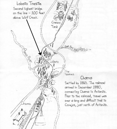
Riding the Cumbres & Toltec Scenic Railway: Chama and the Lobato Trestle
|
As we were going over the trestle, I was also able to make a movie, and you can watch that movie using the player below:
|
|
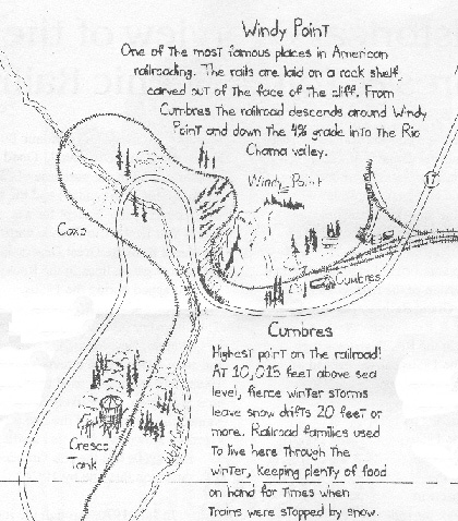
Riding the Cumbres & Toltec Scenic Railway: Windy Point and Cumbres Pass
|
|
Fred took a good movie of the train chugging along, and you can watch that movie using the player below:
|
|
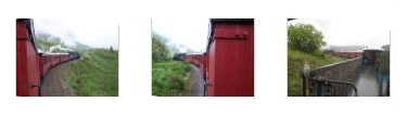
The next point of interest is Windy Point. As the train came up from Cresco Tank, we made a turn around a hillside and when we came around the backside of the hill we could look across the valley and see the track around Windy Point. As you can see from the route diagram at right, we have to snake back into the valley for a ways to allow enough time for the track to ascend quite a bit.
|
The Lobby of the Statehouse |
Our train then snaked up the valley, ascending as it went, until it got to the back of the valley and made a turn to come back southeast and go around Windy Point. As we approached the curve around the point, we could look down on the Highway 17 crossing we'd been over about twenty minutes earlier. Then it was around the point and on towards Cumbres.
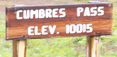 |
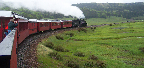
Cumbres Pass is the highest point on the line at just over ten thousand feet, so it is pretty much all downhill from here. As we started out from the station (where we had taken on water), we could see some snow trackside, evidence of our altitude.
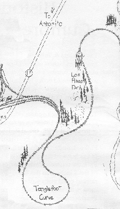
Riding the Cumbres & Toltec Scenic Railway: Tanglefoot Curve & Los Pinos Tank
|
The next item of interest, after we rounded Tanglefoot Curve (where rain showers prevented any good pictures), was Los Pinos Tank. As the train approached the tank it slowed to a stop to take on water, a process that took about ten minutes. Then the the train continued past the tank, eventually leaving it behind as we moved out into a broad verdant valley. This was the valley of the Rio de Los Pinos, which is the wavy set of lines at the extreme right on the map inset at left. (You'll see the label for the river on the next map inset, below.)
 |
|
|
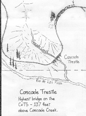
Riding the Cumbres & Toltec Scenic Railway: Cascade Trestle
|
|
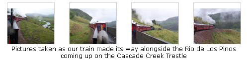
We eventually had ascended until we were high above Rio de Los Pinos and then we rounded the end of a range of mountains and came immediately to the Cascade Trestle.
Looking down from the trestle, where we were 150 feet above the water, we could look down and see Cascade Creek below us. It was a neat crossing. We continued around the mountain and could soon see Osier out ahead of us.
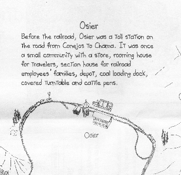
Riding the Cumbres & Toltec Scenic Railway: Osier (and Lunch)
|
 Historic Marker |
The lunch was actually quite good, and there were desserts and drinks as well. It was all very well done for such an out-of-the-way location, I thought. While we were sitting down, another crowd of people entered the dining room to get served. They were passengers on the train that had come from Antonito. That's why there are two tracks here; the two trains meet at this point each day. Thus, some tourists can board a train at either end, ride to Osier, have lunch, and then take the other train back to their starting point. Other tourists, like us, can continue on the same train to the other end of the line, returning to their starting point via motorcoach. The system seems to work well.
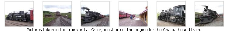
When we were done with lunch, we came out into the yard to look at the two trains and just wander around. We took a number of pictures of the engine of the other train as our engine was a ways down the track. Below are some thumbnail images that you can click on to see the pictures that we took here in Osier:
|
Just before we boarded our train for the continuation of our trip, the clouds started to clear and pictures, including this one of Rio de Los Pinos below Cascade Creek across the valley, became better. The last picture we took here at Osier was this one, of Fred and the parlor car of our Antonito-bound train.
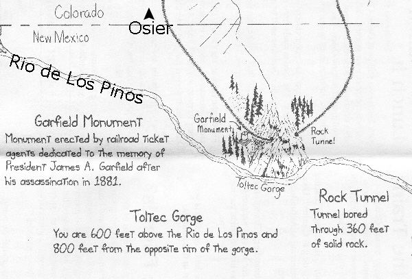
Riding the Cumbres & Toltec Scenic Railway: Garfield Monument and Rock Tunnel
|
|
|
Toltec Gorge was really quite beautiful, even with the low clouds, and, looking across the gorge, you can see the rocky cliffs that descend down to the Rio de Los Pinos. Just as the gorge was getting very scenic, we came to the Garfield Monument, which was erected by railroad personnel after his assassination in 1881. I've made a small copy of the inscription on the monument, and you can read it on the inset image below:
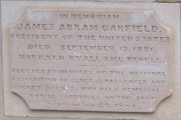 Garfield Monument Inscription |
|
|
The pictures inside the tunnel didn't turn out, even with flash, but it was less than a minute and we were coming out of the tunnel. I took an interesting movie as we were coming back out into daylight, and you can watch that movie with the player below:
|
|
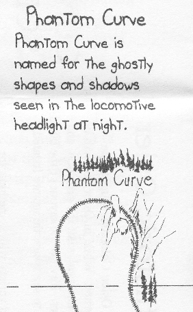
Then we wound along the mountainside up towards Phantom Curve (see below). Along the way, we got some good pictures of each other- one I took of Fred and one he took of me.
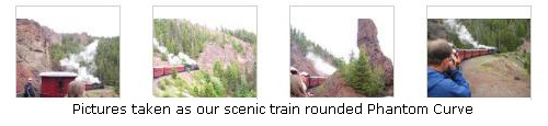
Riding the Cumbres & Toltec Scenic Railway: Phantom Curve
|
|
|
|
|
|
I also took a movie as we rounded the curve, and you can watch that movie using the player at left.
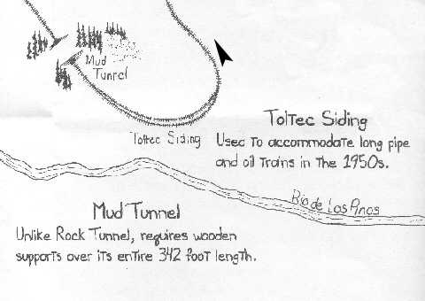
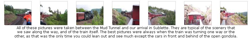
Riding the Cumbres & Toltec Scenic Railway: Mud Tunnel and the Toltec Siding
|
|
|
|
|
Fred took a picture looking back at the tunnel and also a picture of the valley of the Rio de Los Pinos.
Coming out of the Mud Tunnel, we were treated to more great views of the valley through which the Rio de Los Pinos flows, and you can see a couple of those views here and here. All the while, since we've left Osier, our volunteer guide shown here with me) has been a wealth of information, and I'm glad the weather is clearing so we can stay out here and listen.
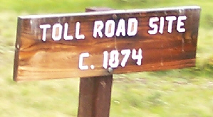
Shortly after emerging from the tunnel, we went through an area where the track splits and there is a siding running for the better part of a half mile- the Toltec Siding. This siding was added in mid-century to accommodate long trains.
All the way to Sublette we had good weather and great views and took lots of pictures. If you will click on the thumbnail images below, you can see some of the best of the pictures we took along this part of the route:
|
Fred also took a good movie just as we were rounding the final corners before Sublette, and you can watch that movie using the player below:
|
|
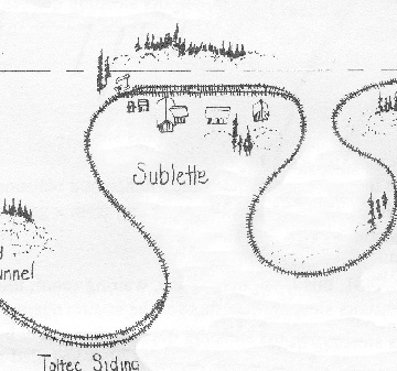
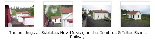
Riding the Cumbres & Toltec Scenic Railway: Sublette
|
If you will click on the thumbnail images below you can see some of our pictures of the buildings here at Sublette- now currently in use and maintained:
|
Shortly after we left Sublette, we rounded a curve (as you can see on the inset map) and so we had a view back towards the buildings at Sublette.
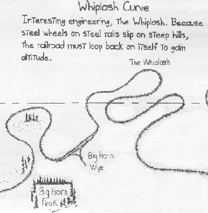
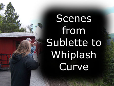
Riding the Cumbres & Toltec Scenic Railway: From Sublette to Whiplash Curve
|
|
To view the slideshow, just click on the image at left and I will open the slideshow in a new window. In the slideshow, you can use the little arrows in the lower corners of each image to move from one to the next, and the index numbers in the upper left of each image will tell you where you are in the series. When you are finished looking at the pictures, just close the popup window.
After descending for a while from the mountains, we passed the Big Horn Wye, which is an area where double track has been laid and then two arcs have been built off one of the tracks. These arcs allow a train or, more likely, just an engine, to be switched from one end of a train to another. This might be needed if the track ahead in either direction is blocked. While the train could conceivably be backed up, it is much easier and much safer to switch the engine. If you look at the route diagram inset above right, you'll see the wye marked.
Next, we entered the area called "the Whiplash." Trains can only deal with a certain percentage grade let's say 2%. This means that if a train has to rise two feet, then it will require 100 lateral feet to do it. So, let's say that Point A and Point B are 10,000 feet apart, on a straight line. So long as Point B is no more than 200 feet higher than Point A, the track can be laid in a straight line. But if Point B is 400 feet higher than Point A, then 20,000 feet of track will have to be laid between them for the train to make the ascent. That is the situation here, and that's the reason for the switchbacks that the track makes.
|
|
The land has leveled out here; we have lost our forest and are now in a drier, warmer area characterized by low scrub, so there is not so much to see. We took this opportunity to walk the length of the train to get some different angles. We began in the open car, with a couple of pictures looking out ahead, and you can see those views here and here. I also took a movie from the open car as we passed through this different landscape and through the turns of the Whiplash, and you can watch that movie using the player at left.
In the open car, I had one of our fellow tourists (actually, the lady traveling with her dad who occupied the two seats in front of ours in the tourist car) take our picture. And then, I got at the front end of the open car and called to everyone to look towards me (by now the weather is so nice that lots of people are riding outside) so I could get their picture. That's our volunteer docent standing in the middle of the picture with his hat off.
|
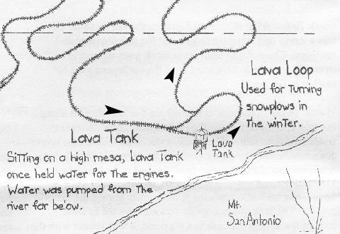
Riding the Cumbres & Toltec Scenic Railway: The Lava Tank and Lava Loop
|
|
|
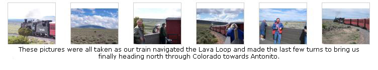
As we came out of the loop, we passed what I can only assume is the Lava Station, although if you look at the picture, you'll see why I was puzzled. And shortly after that, we crossed into Colorado once again. This was the ninth time today that we'd crossed the state line between New Mexico and Colorado; each one was marked and I should have taken pictures of all of them- it would have made quite a montage. The next two state line crossings were accomplished within minutes, and then we were heading north towards Antonito.
If you will click on the thumbnail images below, you can see some of the other pictures we took as we navigated the Lava Loop and entered Colorado for the last time:
|
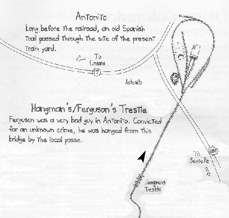
Riding the Cumbres & Toltec Scenic Railway: Hangman's Trestle and the Ride to Antonito
|
Now we were on the last leg of our trip, and we are taking a few final pictures. Fred got one of me with the scrubland background and I prevailed on our docent to take a picture of Fred and I in the open car. I also took a final movie as the train wound its way through the level scrub towards Antonito, and you can watch that movie using the player below:
|
|
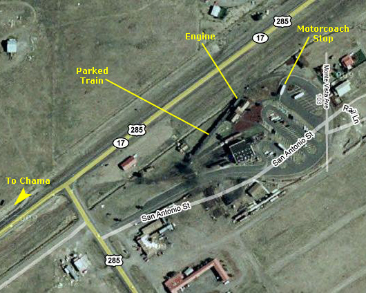
Riding the Cumbres & Toltec Scenic Railway: Antonito Station
|
|
|
Fred was moderately successful in getting his eye washed out; he told me later that he actually thought he had gotten the cinder out but that there was some residual discomfort that made him think for a while he hadn't. In any event, we took our seats on the motorcoach, and when all the passengers riding back to Chama were aboard, we headed out of the C&TSRR yard and onto Highway 17 for the ride back to the Chama Station.
Riding the Cumbres & Toltec Scenic Railway: Motorcoach Ride from Antonito to Chama
|
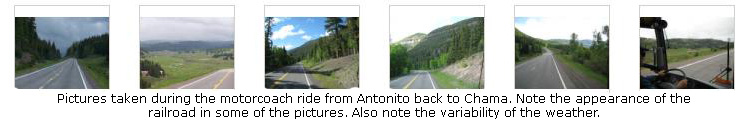
The ride in the motorcoach back to Chama was very pleasant. We were in the front two seats, so we had an unobstructed view of the road ahead and the scenery on both sides. I am going to include some pictures that we took out the front window of the coach here. You'll note that the weather was variable, and indeed, when we got close to Chama again, we were getting rained on, although in the town itself it wasn't raining. In some of these pictures, you will be able to pick out landmarks that you saw from the train- a railroad bridge and a water tank to name two. See what you can pick out by clicking on the thumbnails below:
|
When the motorcoach pulled into the Chama Station parking lot, our trip on the C&TSRR was officially over. It was a really neat experience, and I would recommend to anyone that they do the complete trip from one end to the other with the motorcoach ride back. That way, you can see all the really wonderful scenery along the entire line.
The Town of Chama, New Mexico
|
|
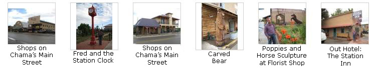
Then, before we piled back into the car to head south towards Albuquerque, where we would be spending the night, we spent some time walking around Chama's main street. We might have done so this morning, but since it was raining, there was little point. The weather has cleared this afternoon, though, and now we have an opportunity to see some of this touristy town. If you will click on the thumbnail images below, you can see some of the pictures we took:
|
We got back in the RAV4 that we'd left at the Station Inn this morning, and headed off back down Highway 17 towards Taos and Albuquerque.
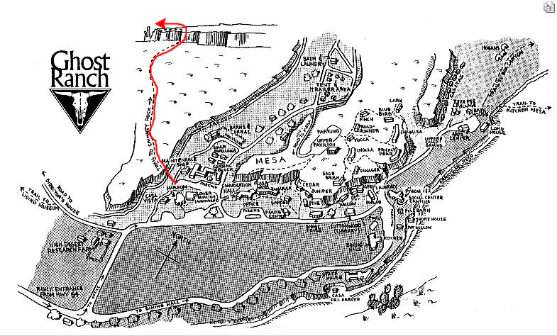
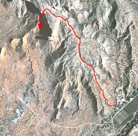
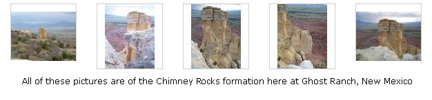
At Ghost Ranch: The Chimney Rocks Hike
|
The only other things we had thought about were potentially some hikes in the ski areas northeast of Taos on the way home, but when we thought about it, we thought that doing the Chimney Rocks hike at Ghost Ranch and then simply driving to Albuquerque to spend the night before a drive home would be just as good. We'd get home a day or so earlier than we might have, but since the hikes in the ski areas didn't look outstanding on the Internet, that's what we decided to do.
So we just retraced our route up here yesterday afternoon, found Ghost Ranch with no problem, and by seven-thirty or so were parked at the trailhead for the Chimney Rocks hike.
|
We parked and started off.
|
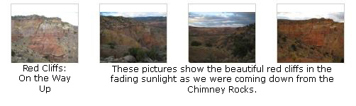
Again, if you look carefully at the image, you can see the shadow cast by the separate chimney of rock at the end of the mesa. I had thought that the trail might have taken us to the base of the chimney, in the space between the mesa and the chimney, but where we actually went offered even better views of the chimney and across the valley.
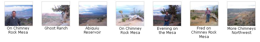
So we started out and pretty soon were up on top of the first series of hills. Across the valley we could see rain showers, and we didn't know enough about how weather moves around this local area to know whether they would come across the valley to us, so for the first part of the hike we were a little worried about that. As it turned out, we worried needlessly.
When we got to the top of the first hills, we stopped to take some pictures of the view across the valley (and the rainbow that had formed); you can see the best of these pictures here and here. We also got some good views looking ahead at the Chimney Rocks themselves, and you can see two of the best of these views here and here. Fred also stopped to take a movie, panning from the mesa out across the valley, and you can watch that movie using the player below:
|
|
|
On the way up, I stopped and made a movie of the cliffs and the trail back down to the ranch, and you can watch that movie using the player below:
|
|
|
Then we (actually, Fred did not come all the way out to the edge, as per usual) went to the edge of the caprock mesa just opposite from the chimney and took a number of good pictures of the Chimney Rocks and the valley behind. Click on the thumbnail images above left to have a look at these pictures.
|
|
|
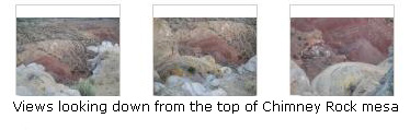
Coming back from the edge, I met up with Fred more in the middle of the mesa top, and we walked around taking pictures of anything that looked interesting. Some of these turned out really well, and if you will click on the thumbnail images below, you can have a look at them:
|
|
|
We'd beaten the rain, which I don't think ever made it across the valley to Ghost Ranch, so going down was more leisurely than going up. About a quarter mile from the beginning of the trail, I got a picture of Fred and Ghost Ranch, and when we were almost back, I took a picture of our RAV4 parked near Chimney Rock trailhead.
Well, our hiking for today was done, and we headed down to Albuquerque for another stay at the same hotel we stayed at when we arrived on Wednesday. We drove down Highway 84 through Espanola and then on to Santa Fe. We took a new bypass around Santa Fe and hooked up with I-25 south to Albuquerque. Before we went to the hotel, we had dinner at the Route 66 Diner, which was quite near the Frontier Restaurant that we'd tried Wednesday. Then we went to the same Super 8 Motel for the night.
June 21: Driving Home to Dallas
This was a short but busy trip, and we enjoyed it immensely.
You can use the links below to go to another album page.
|
June 19, 2009: New Mexico Trip Day 3 |
|
Return to the Index for Our New Mexico Trip |