|
October 29 - November 2, 2009: A Few Days in Fort Lauderdale |
|
October 1-8, 2009: Our Fall Trip to the Upper Midwest |
|
Return to Index for 2009 |
Last Christmas, Ron and Jay gave Fred and I a unique gift. The gift was a trip to San Antonio with them to visit Ron and Prudence at Ruckman Haus. The idea was that they would chauffeur us down there and back so we wouldn't have to do much. We let Ron and Jay pick a time best for them, and they both wanted to go in the Fall when it got a bit cooler, and that was fine with us. In August, Ron called to say that instead of driving, the gift would be the airline tickets down and back; Southwest had offered a deal too good to pass up. Good for everyone; no 5-hour drive down and back. Ron and Jay settled on Tuesday, October 20 to go down and a return on Thursday. We checked with Ron and Prudence and they had space for us, so that became the final plan.
Since the trip was only two days long, I'm going to put everything from the entire trip on this page, and give you the usual index up at the top. There's a section for the four major things that the four of us did while we were in San Antonio, plus a section for our travel pictures and one for incidental pictures around Ruckman Haus. You can simply scroll down through the whole two-day trip, or use the index to jump directly to what interests you.
Getting to Ruckman Haus
We were on Southwest, on a plane like this one. We took off right on time, to the east, and banked around the west side of downtown Dallas and headed south. Fred took one more good picture as we were flying over the Trinity River south of Dallas.
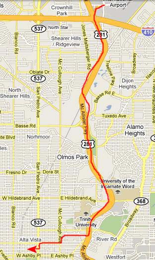 |
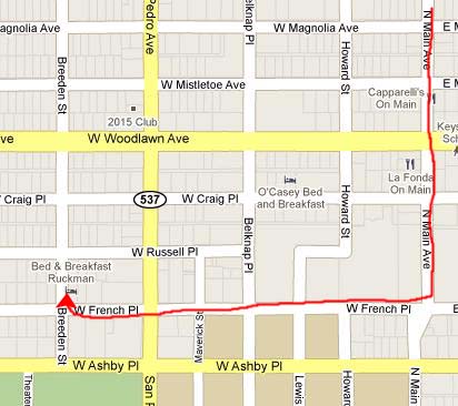
We usually come right down Main Street and hang a left on French, cross San Pedro and go one more block to Ruckman Haus.
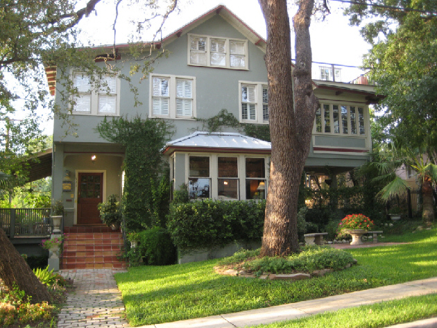 |
After breakfast, Ron joined us in the dining room where we had a chance to sit down and visit for a while; Ron and Jay have not been down to San Antonio in a few years. We got settled in our rooms and then Ron and Prudence took some time to show Ron and Jay all the changes that they've made since their last visit. (I suppose that on any album page where both Ron Mathis and Ron Ruckman are mentioned, I should use both names all the time, but I hope that if I don't, you'll be able to figure out which Ron is being referred to at any particular time.)
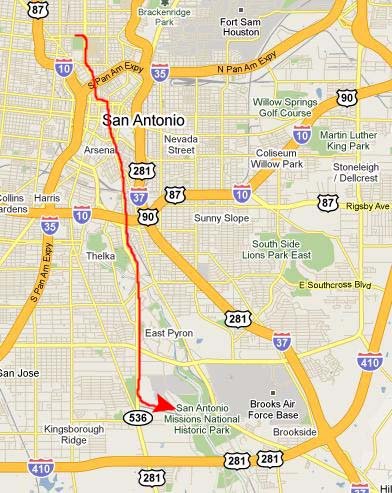
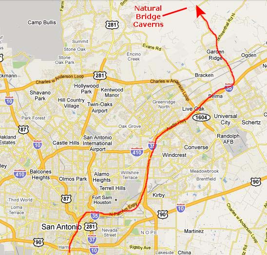
We sat down for a while to plan some of the things that we would do while we were here. These included walking along the new part of the Riverwalk, visiting the missions, going to Natural Bridge Caverns and, at the urging of Jay, doing some of the touristy things down by the Alamo. (We'd already been to the Alamo with Ron and Jay, so we wouldn't be doing that again.)
We decided that today, we'd do the missions and Natural Bridge Caverns, and be back in time for dinner with Ron and Prudence.
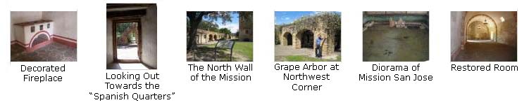
The Missions of San Antonio
 |
|
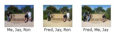
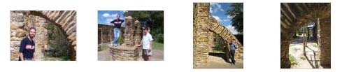
I also got what I thought was a good picture of Ron and Jay together, and you can look at it here.
Over 400 years ago Spanish expeditions began to explore land that is now the American Southwest. Beginning in the 16th century, missionaries, accompanied by a few soldiers, moved north out of the Valley of Mexico, founding missions and presidios. By 1718 this activity extended to the San Antonio River, helping form the nucleus of the future city of San Antonio itself. For the Spaniards, the acculturation of the native peoples was a major means for securing their claim to vast lands in North America. With very few soldiers and settlers, Spain's claim to these areas in the face of encroachment by France and England, depended upon the success of the missions. Church and State were very closely linked, and the Spanish monarch granted various religious orders of the Catholic Church permission to found mission communities. Through instruction by these religious, communities of native converts were to emerge as part of an essentially medieval peasant society loyal to the crown on the frontier.
Along with the missions, a system of frontier military outposts, or presidios, was built as a means of protecting Spain's expanding territory. Generally these presidios were manned by a small force of soldiers. Wherever missions were built, a presidio was sure to be established nearby. This was the case in 1718 when a presidio was founded and named San Antonio de B�xar. A failed mission from within the jurisdiction of the presidio of San Juan Bautista del R�o Grande in the province of Coahuila, Mexico relocated to the San Antonio River and was named Mission San Antonio de Valero. (It later became known as the Alamo.)
Noting the substantial population of native people nearby, Fray Antonio Margil de Jes�s established a second mission, San Jos�, south along the river in 1720. By 1731, three missions originally established in East Texas were relocated along the San Antonio River, joining the two founded earlier and the presidio of San Antonio de B�xar. These missions are Concepci�n, San Juan, and Espada. The missions flourished between 1745 and the 1780s. Increasing hostility from the mission Indians' traditional enemy, the Apache, and later the Comanche, coupled with inadequate military support, caused the communities to retreat behind walls. Disease reduced the native population, accelerating the missions' decline.
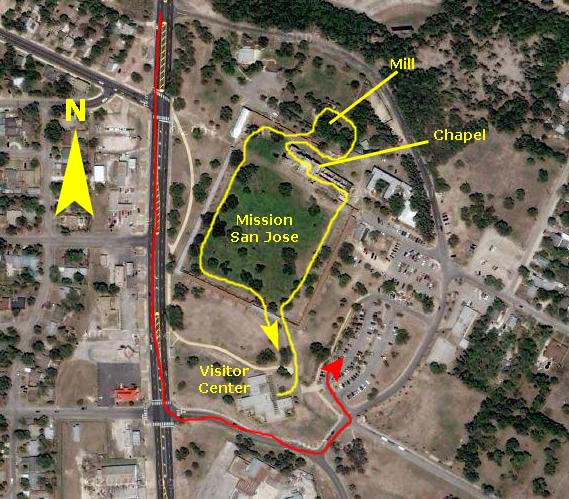 |
Visitor Center and Entrance
The Southeast Corner Bastion
|
Right after we came out of the bastion, while we were still in the southeast corner of the mission, I made a movie that pans 360 degrees around the interior of the mission, and you can get an idea of how big it is. |
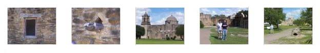
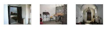
Along the Southeast Wall and Buildings
Along this part of the walk, we took some other interesting pictures of the church, the convento ahead of us and various architectural details, and if you will click on the thumbnail images below, you can have a look at these pictures:
|
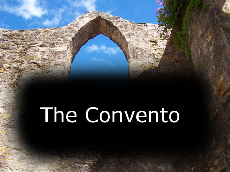
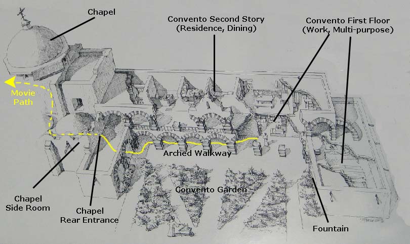
The Convento
|
The ruins standing today reflect a major reconstruction begun by Benedictine monks in 1861- work that was never completed.
We thought that the convento must have been a pleasant place to live and work. There was a garden in the space between the back of the chapel and the easternmost of the rooms of the convento, and it had a fountain built into the eastern wall. There was a long, arched walkway that provided access to the downstairs rooms and shelter from the elements; it was possible to get from the convento into the chapel without going out in the open. Behind (north of) the two-story portion of the convento there was a back area that could, presumably, have been used as an extended garden. (Some administrative buildings for the park are there now.)
|
To view the slideshow, just click on the image at right and I will open the slideshow in a new window. In the slideshow, you can use the little arrows in the lower corners of each image to move from one to the next, and the index numbers in the upper left of each image will tell you where you are in the series. When you are finished looking at the pictures, just close the popup window.
|
|
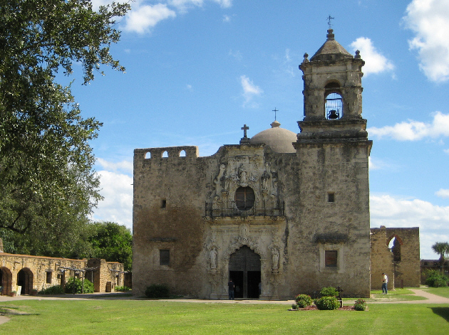
The Chapel at Mission San Jose
|
Having fallen into disrepair and partial ruin over the years, the San Antonio Conservation Society and the Federal Government among others, undertook to restore portions of the mission community in the 1920s and 1930s. The church, which had lost its dome, bell tower, and a wall, was rededicated in 1937.
The Church at Mission San Jose celebrated the 250th anniversary of its dedication in 2005. This is the only mission church in San Antonio, Texas, that never lost its roof or walls to age or neglect. As a result, remnants of colorful frescos still remain.
If you will click on the thumbnail images below, you can see some other views of the Church at Mission San Jose:
|
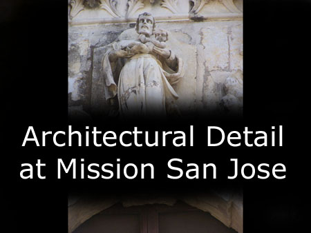
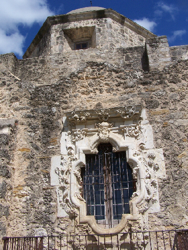
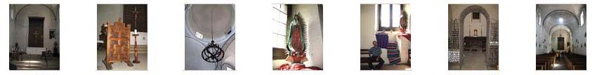
The Chapel at Mission San Jose: Architectural Detail
|
To view the slideshow, just click on the image at left and I will open the slideshow in a new window. In the slideshow, you can use the little arrows in the lower corners of each image to move from one to the next, and the index numbers in the upper left of each image will tell you where you are in the series. When you are finished looking at the pictures, just close the popup window.
The Chapel at Mission San Jose: The Rose Window
|
The window, sculpted ca. 1775, has been the object of both legend and admiration. It is considered one of the finest examples of baroque architecture in North America. The meaning behind the name is currently unknown, but legend has it named for Rosa, the betrothed of Juan Huizar who many believe created the window.
The Chapel at Mission San Jose: Interior Detail
|
|
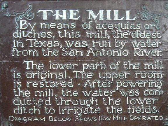
The Mill
|
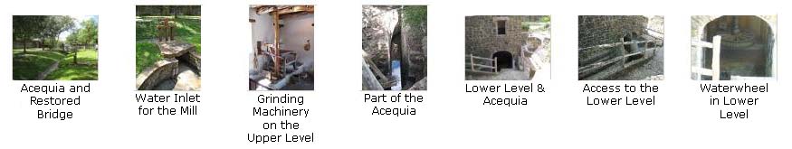
The mill area is north of the church, and was actually outside the walled area of the mission. To get to it, we walked north from the main entrance to the church, through an archway in the mission wall and then across a restored wooden bridge to the area around the mill.
Water from the acequia flowed through a wooden chute and turned the horizontal wheel of the mill in the lower vault. A drive shaft turned the grindstone in the room above. You can see a diagram of how the mill worked here.
The actual mill machinery was restored by the Pioneer Flour Company of San Antonio as part of the general restoration by The National Society of the Colonial Dames of America in the State of Texas, and it commemorated the centennial of Texas Independence from 1836-1936.
If you will click on the thumbnail images below, you can see some of the pictures we took here at the mill. We tried to capture the area around the mill, the interior, and the machinery in the lower level.
|
|
The Mill Mission San Jose |
Northwest Corner Exhibits and Rooms
|
The West Wall and Spanish Quarters
In the early years, mission Indians lived in small detached houses called jacales. In 1755, eighty-four of these jacales lined "streets" in what is today the plaza. But after 1768, as conflicts with Apaches and Comanches increased, the mission was enclosed. Indians began living in rooms along the walls, similar to those we saw today.
|
The South Wall and Back to the Entrance
We arrived back at the main entrance, stopped in the visitor center again for a few minutes, and then piled into the SUV to go get some lunch and then head off north to Natural Bridge Caverns.
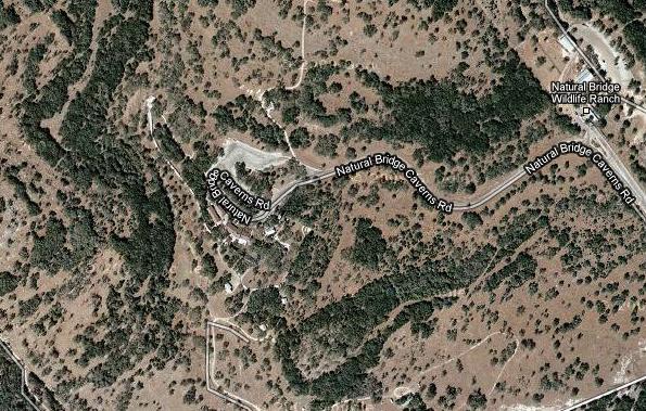
Natural Bridge Caverns
|
A Bit of History
The explorers made their way carefully climbing and crawling through two miles of vast cavern passage. After making this amazing discovery, they returned to the surface to tell the landowners. The discoverers knew immediately what an astonishing find they had made and the land owners decided to develop the first 1/2 mile, the most spectacular part of the caverns, for the enjoyment of guests from around the world. That first 1/2 mile is now the Discovery Tour. Natural Bridge Caverns� Discovery Tour was developed with two main goals in mind: preservation of the cavern environment and comfort of its guests. The result is one of the world�s premier show caverns.
|
A Bit of Geology
Perhaps around 20 million years ago, a number of faults formed in Texas due to settling of the costal regions. These movements created an extensive series of faults known as the Balcones Fault Zone. The eroded face of the Balcones Escarpment marks both the fault zone and the beginning of the Texas Hill Country. In addition to creating the faults, the tectonic stresses also created joints, or cracks in the rock. Underground water moving along the joints eventually carved the passages at Natural Bridge Caverns.
The cavern formed by an underground �river� moving slowly through cracks and pores within the limestone. Rain Water seeping through cracks started dissolving the limestone. In time, the original narrow cracks or joints enlarged to form huge underground conduits or passages.
Perhaps due to changes in climate, vegetation, or other natural forces, the water drained to lower levels within the earth. As the water left the upper passages, it moved deeper and started forming a second level. The water eventually moved to another level even deeper within the earth. As the water left the lower level, stresses within the rock led to many of the layers collapsing to form break-out domes. This final stage of collapse led to the creation of the passages we now see.
Before the Tour
|
When our guide had joined us on the visitor center patio, we headed off towards the cavern entrance. It is down underneath the natural bridge, so we followed the sloping and winding walkway down to a point underneath the natural bridge. Here, we stopped briefly so our guide could tell us a little bit about the history of the cave and what we could expect. She drew our attention to the informative sign with all the rules as she cautioned us to be sure not to touch any formations still growing (some were not).
|
Entering Natural Bridge Caverns |
I made a movie while walking down the entrance passage and actually entering the cave for the tour, and you can watch that movie using the player at right. I also made a movie once we got into the darkness of the cave, but while we were still in the entrance passageway. Eventually, it opened out into the first large room. You can watch this short movie using the player below:
|
|
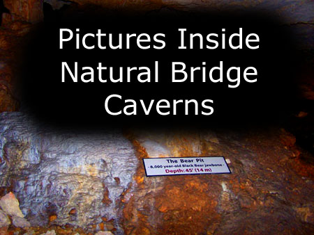
Inside Natural Bridge Caverns
|
To view the slideshow, just click on the image at left and I will open the slideshow in a new window. In the slideshow, you can use the little arrows in the lower corners of each image to move from one to the next, and the index numbers in the upper left of each image will tell you where you are in the series. When you are finished looking at the pictures, just close the popup window.
We had a really good time at the caverns; just before they closed we headed back to San Antonio and dinner with Ron and Prudence.
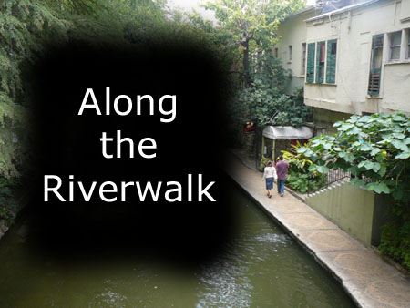
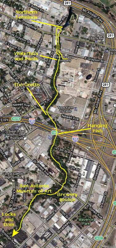
We Explore the New Part of the Riverwalk
As I've marked on the aerial view below, we entered the Riverwalk at the Pearl Brewery where there is a beautiful series of waterfalls and pools. (I should note that the aerial view was taken before any of the new work on this part of the Riverwalk was undertaken, so you can't see the widened river, the new walkways on either side or any of the other features that you'll see in our pictures.)
|
Riverwalk Waterfalls at the Pearl Brewery
|
|
From the west side of the river, I made a movie of this area, and you can watch it using the player below:
|
|
The Current Northern Terminus of the Riverwalk
|
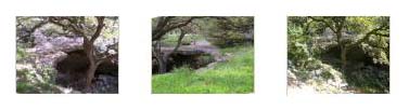
From the Brewery to the Grotto
|
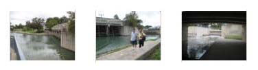
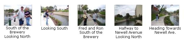
Heading South from the Pearl Brewery |
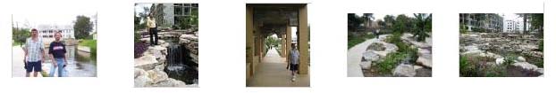
As we walked along down towards the next bridge over the Riverwalk at Newell Avenue, all of admired all the work that has gone into the construction of this unique attraction- including the plantings all along the walkways on either side of the river. (On an upcoming trip back down here in December, we will be walking along this same area with Guy from Green Bay, and with both him and Fred along, there will be lots of pictures of some of the flora along the Riverwalk. For now, you might just know that The Riverwalk has been designated an ASHS Horticultural Landmark.) If you will click on the thumbnail images below, you can see some views of the Riverwalk between the Pearl Brewery and the Newell Avenue bridge:
|
|
|
There is another bridge over the Riverwalk just south of Newell Avenue, and on the other side we saw this huge pipe up on the hill above us. At first, I thought it was some kind of industrial sculpture, but when Fred stopped to read the sign, we found that it was actually a ventilation shaft for a flood-control tunnel that runs underneath downtown San Antonio. Rather than tell you what the sign said, you can just read it for yourself. You can also look at a nearby diagram of the tunnel system here.
From the Fish to the Locks (no pun intended)
|
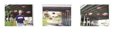
Heading south, we could see, up ahead, the I‑35 bridge over the Riverwalk, and we could also see that there appeared to be some things hanging down underneath the bridge. Pretty soon, we got close enough to see that they were fish! Not real ones, of course, but colorful sculptures. They were whimsical and quite beautiful, and we spent a few minutes wandering around on both sides of the river admiring them. If you click on the thumbnail images at left, you can see some of the other pictures we took of them.
We continued walking south from the I-35 bridge on the east side of the Riverwalk. A little south of the bridge, we could look back and see some of the beautiful plantings and rockwork that have been painstakingly built in this new section of the Riverwalk. Downtown, there was not room for this kind of feature, and that makes this part of the Riverwalk quite different. The cruise boats do make it up to this area now. Fred stopped here in this really neat area to read the sign about riprarian ecology.

|
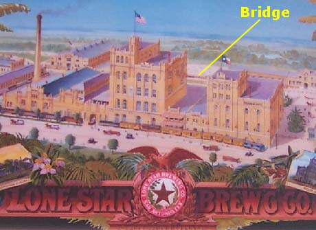
Prohibition ended beer production here in 1918, after which many businesses occupied the buildings until the early 1970s when they were largely abandoned. A massive renovation transformed the brewery into the San Antonio Museum of Art that opened in 1981. An enclosed walkway (seen in this picture of the museum) replaced the original bridge, which was dismantled and stored. This year, the bridge was incorporated at this site as part of the San Antonio River Improvements Project.
We did find that at the museum, the walkway on the west side ends temporarily. If we'd been walking down that side, we would have had to cross over the Brewery Bridge. As we walked along south on the Riverwalk opposite the museum, we got some very nice views of this new building. We've never been inside it, but you can look at our views of it here and here.
If you will click on the thumbnail images below, you can see some of the other scenery we saw as we walked south from the San Antonio Museum of Art to the locks. Note especially nice work that has been done to landscape this part of the Riverwalk. (You may also note an unfinished residence in the background; it did not appear as if work was currently ongoing there.)
|
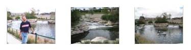
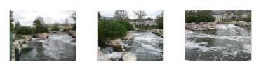
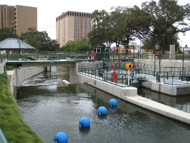
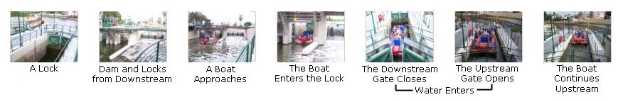
The Locks and Dam
|
|
The locks and dam were an unexpected surprise; I had no idea that any had been built, or were needed. But they have been, and they are.
|
These locks work in the familiar fashion. The bottom of the lock is at the level of the river bottom of the lower part of the Riverwalk. A gate which seals at the bottom is high enough so that it rises a few feet above the level of the upper part of the Riverwalk. At the other end of the lock, there is a shorter gate, which extends from that few feet above the level of the river down to a concrete bottom that is also at the same level as the natural bottom of the upper part of the river.
With these mechanisms in place, the lock can operate without pumps; the only power needed is to open and close the gates. The bottom gate is opened slowly. Any water currently in the lock will flow downstream until the level of water in the lock equalizes to the downstream level. The boat goes in and the gate closes behind it. Now, pipes that lead from the upper river into the lock are opened. Water again seeks its own level, and the water in the lock rises until it is exactly as high as the water level in the upper river portion. The boat, of course, rises with it. When the levels have equalized, the upper gate opens and the boat continues upriver. The process is simply repeated in reverse when a boat wants to go downstream. (I actually hadn't really thought about this when we were here. I assumed that pumps filled and emptied the lock. It was not until I attended a lecture on our November cruise through the Panama Canal that I realized that pumps were unnecessary- gravity does all the work.).
We took lots of pictures and movies here. As far as the pictures are concerned, if you will click on the thumbnail images below you can have a look at the best of them:
|
Now for the movies. I took two movies of a boat going through the lock. You can watch them with the players below:
|
The boat enters the lock, the lower gate closes and the lock begins to fill. |
The lock finishes filling, the upper gate opens, and the boat leaves the lock. |
|
The Lobby of the Statehouse |
At this point, we stopped to take stock of the day. Ron and Jay wanted to do some things in downtown San Antonio- namely, the Ripley's museums. We had walked about halfway to downtown, and we all could have continued, but then the SUV would have been back at the Pearl Brewery, and we would have had a long walk back. Or, we could have walked back from here and all driven downtown together. The problem with that was that we would miss a big portion of the Riverwalk we hadn't yet seen. I solved the problem by volunteering to postpone my seeing this other part of the Riverwalk (after all, Fred and I are down here frequently). I headed back to the Pearl Brewery, got the SUV, drove it downtown and parked it, and met the guys when they came up from the Riverwalk near the Ripley's museum. I didn't mind at all.
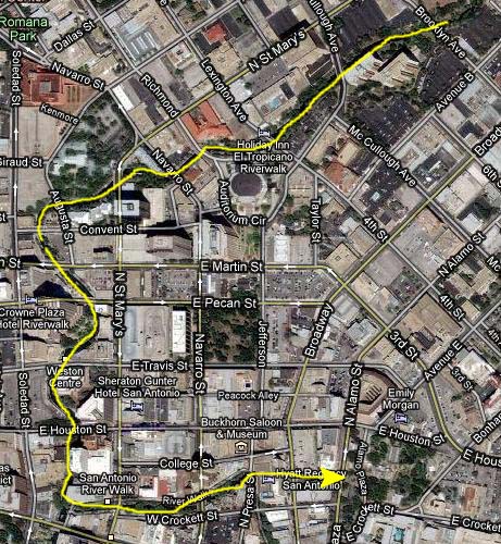
From the Locks and Dam to Downtown
|
I have marked the route that they took on the aerial view at left, although I suppose it isn't really important what the exact route was.
|
To view the slideshow, just click on the image at right and I will open the slideshow in a new window. In the slideshow, you can use the little arrows in the lower corners of each image to move from one to the next, and the index numbers in the upper left of each image will tell you where you are in the series. When you are finished looking at the pictures, just close the popup window.
The group stopped somewhere along the Riverwalk where I have not been and found a display area with a lot of information about various aspects of the San Antonio River. Fred took pictures of the six displays, and I wanted to include them here, but the problem I ran into was that sizing them to fit on the page made them almost impossible to read. So what I've done is included full-size images of the six signs here in the album. To read one of them, just click on its title below. A new window will pop up with a scrolling window inside. You can use the scroll bars to go up and down the sign, reading the narrative and looking at the drawings or photographs. It will be as if you are standing in front of them.
Missions in the San Antonio River Valley
As planned, I met up with the guys downtown and we decided to try "Ripley's Believe It Or Not!"
Ripley's "Believe It Or Not!"

|
He ventured into unconventional areas in India and the Orient; his favorite destination was China. During these travels, he picked up many strange and unbelievable souvenirs that later became an extensive collection of amazing oddities and stories. Ripley was commonly known as being extremely eccentric in clothes (flamboyant colors, pith helmets and bat wing ties) and pets (a boa constrictor, chipmunks and squirrels). He was a heavy social drinker and quite a ladies' man. He sailed a junk and changed his birthday from December 26th to Christmas Day. Ripley died of a heart attack while taping the 13th episode of his television series- on death and death rituals.
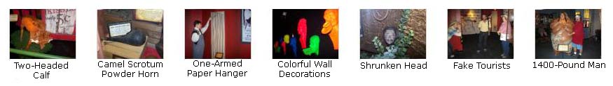
We spent a couple of hours in the multi-story Ripley museum, trying to have a look at most everything. Sometimes, when we took a picture, we got the description along with it; other times, I can remember what the item was. Below is a list of the items I can't possibly remember what each picture we took shows; most times, we weren't able to photograph the written explanations. So I'll just put some thumbnail images below for the more interesting of the pictures we took, adding labels where I can. Click on as many of the thumbnail images as you wish to look at the full-size pictures.
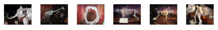
First, here are some of the pictures we took of the various skeletons (who can say if they are actually real or not):
|
Some of the oddities in the museum were superlatives. First of all, you have Ron sitting in the world's largest tire (made for the huge trucks that carry 25 tons of ore at a time from open pit mines). There was a 24-foot tall model of the Eiffel Tower, made entirely of toothpicks. It used over 110,000 toothpicks but weighed only five pounds. You can have a look at the base of it here. There was also a 13-foot-long multi-headed dragon ship (like those used by ancient Chinese emperors), but this one was made from over 1000 pounds of solid jade! You definitely want to take a look at it here.
|
Finally, you can click on as many of the thumbnails below as you wish to see some of the candid shots we took of various items and exhibits in the museum. It was certainly full of oddities and amazing facts, things and people. Whether it's all true, or whether the items were all real, I have no idea.
|

|
Ron and I took some movies here in the museum, and you can watch them with the players below:
|
The skeleton of the "Sacred Buffalo" was on a turntable, so I filmed it going around. |
This is the first of two movies Ron made of an "interactive floor display." It was apparently a projection, but one's actions in getting into it were to change the projection. In this case, walking through the leaves projected on the floor caused the leaves to scatter in response to your steps. Very interesting. |
|
I'm not sure if there were two of these displays, or one just changed from one theme to another, but in this movie Ron made, there are fish projected on the floor, and they "swim" away from your feet when you walk across the display. We saw something similar in Las Vegas earlier this year at the Aquarium in Mandalay Bay, except in that case, the projection was onto a wall. |
Ron had bought us all combination tickets so we could also see the other Ripley attraction, so when we were finished at "Believe It Or Not!" we went next door to the wax museum.
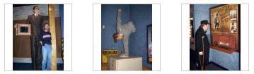
Ripley's Louis Toussaud's Waxworks Museum

|
From the website, we learn that "Our Louis Tussaud's Wax Works features over 250 life-like wax figures in themed settings of Hollywood and History. "Freedom's Journey" features a 66-foot handpainted wall mural depicting significant events over the last 100 years. It's truly awesome! Other themed sections include Children's Land of Make Believe, Heroes of the Lone Star, Heroes of Mexico, The Passion Of Christ, Horror and much more!"
Describing our walk through the "museum" isn't very necessary, except to say that we walked through one section after another, including those mentioned above. So all I'll do is categorize the pictures that the three of us took into sections, and show them in basically the order we encountered them.
In the Lobby
|
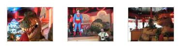
The entrance lobby for the waxworks was actually pretty schlocky. It featured wax models of Superman and Tiger Woods. (As I write this, I am not sure if the Tiger Woods model is still there; I rather doubt it.) There was also an animatronic dinosaur. Click on the thumbnails at right to see some of the pictures we took here in the lobby.
I made a couple of movies here in the lobby, and you can watch them with the players below:
|
Fred thought I was taking a still picture of him, so he looks expectant for a while and then finally asks whether I have snapped the pictures as yet. Then he notices that the dinosaur is moving. |
I made a movie of Ron making a movie (which didn't turn out well) of Jay interacting with the dinosaur. Humorous but lame (the dinosaur, not Jay). |
Legends of Hollywood
|
To view the slideshow, just click on the image at left and I will open the slideshow in a new window. In the slideshow, you can use the little arrows in the lower corners of each image to move from one to the next, and the index numbers in the upper left of each image will tell you where you are in the series. When you are finished looking at the pictures, just close the popup window.
I assume you'll be able to recognize everybody, but, if you can't, perhaps you ought to renew your subscription to People.
Television Personalities
|
To view the slideshow, just click on the image at left and I will open the slideshow in a new window. In the slideshow, you can use the little arrows in the lower corners of each image to move from one to the next, and the index numbers in the upper left of each image will tell you where you are in the series. When you are finished looking at the pictures, just close the popup window.
"Freedom's Journey"
|
To view the slideshow, just click on the image at left and I will open the slideshow in a new window. In the slideshow, you can use the little arrows in the lower corners of each image to move from one to the next, and the index numbers in the upper left of each image will tell you where you are in the series. When you are finished looking at the pictures, just close the popup window.
Fairy Tales
|
|
We also took a fair number of pictures, and they are in the slideshow below. To view the slideshow, just click on the image at left and I will open the slideshow in a new window. In the slideshow, you can use the little arrows in the lower corners of each image to move from one to the next, and the index numbers in the upper left of each image will tell you where you are in the series. When you are finished looking at the pictures, just close the popup window.
|
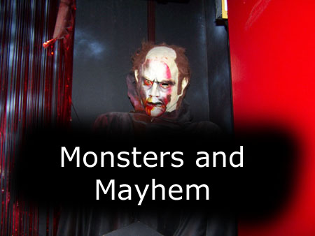
Monsters, Horror and General Mayhem
|
The first time we encountered the doors, I'll admit I was surprised. If you opened the wrong door, the lights went out for a while and this is what you got. |
We also took a fair number of pictures here, and they are in the slideshow below. To view the slideshow, just click on the image at left and I will open the slideshow in a new window. In the slideshow, you can use the little arrows in the lower corners of each image to move from one to the next, and the index numbers in the upper left of each image will tell you where you are in the series. When you are finished looking at the pictures, just close the popup window.
|
The next morning we were up early to catch our flight back to Dallas. It was an enjoyable trip, although short.
You can use the links below to continue to the album page for different day.
|
October 29 - November 2, 2009: A Few Days in Fort Lauderdale |
|
October 1-8, 2009: Our Fall Trip to the Upper Midwest |
|
Return to Index for 2009 |