|
November 24, 2010: Greyfield Farms (Elon, NC) |
|
November 22, 2010: Amicalola State Park (GA) |
|
Return to the Index for Our Thanksgiving Trip |
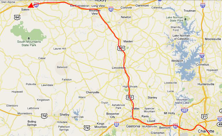
We are going to spend the day with Ted today, and travel with him to South Mountains State Park, which is located up towards the mountains. We plan on getting up to Judy's tonight so we will be ready to be at her house for Thanksgiving Eve.
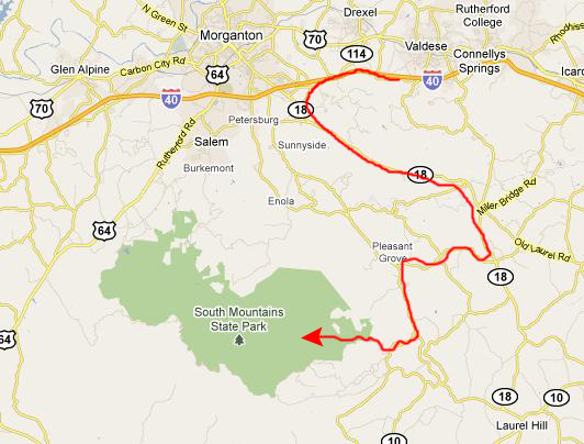
Getting to South Mountains State Park
|
|
Not today, though. It was overcast and misting/drizzling when we got to the parking area, and there was a bit of precipitation off and on throughout our hike. This didn't make it unpleasant, and it was nice that it wasn't raining while we were at the falls themselves. Actually, most of the precipitation occurred during the first two-thirds of our hike up to the falls and the last third of the hike on the way back in the afternoon.
The Hike Up to High Shoals Falls
|
As I often do at the beginning of our hikes, I made a movie to record where were going and what the trail was like. It was raining lightly, so I didn't take many movies until we got to the falls themselves, but this one will show you what the initial quarter of the trail was like. Not very interesting, but a pleasant walk. |
|
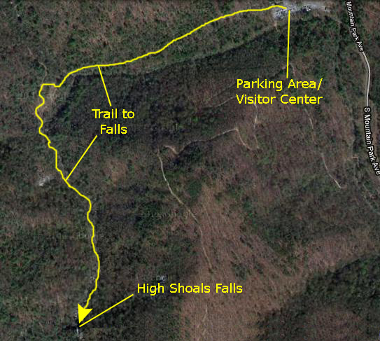
The waterfall is on Jacob's Fork Creek; near the Visitor Center, the creek is placid and mostly level. But way up the trail, where the falls are, the creek, after flowing over a large rock outcropping to form the falls, continues over a series of cascades for a half mile downstream, where it loses about 300 ft. in elevation. Along this route were many small waterfalls, and lots of places where the creek tumbled over boulders on its way down.
As you can see on the aerial view, the trail follows the creek from the parking area to a point where a smaller creek comes into it. Then the trail continues through the woods for a ways until it gets into the bed of the creek itself. From there on up to the falls, the trail goes over rocks, across bridges, up and down stairs and past numerous small cascades.
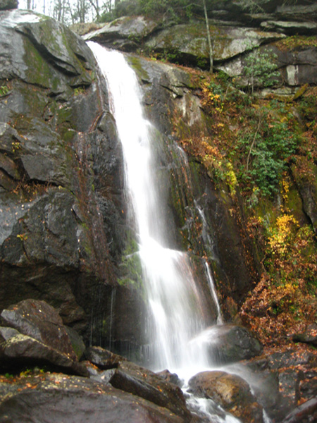
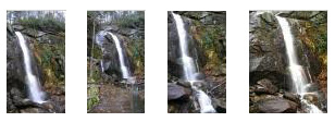
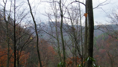
Eventually, as we were climbing over some of the boulders making our way up the trail, we could see High Shoals Falls up ahead at the end of the canyon.
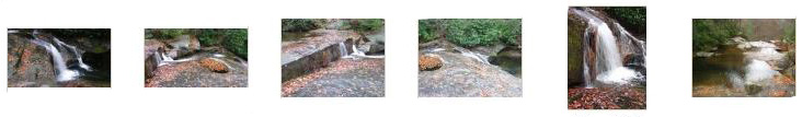
Although we took more pictures of the part of Jacob Creek below the falls on the way back, we did get some good ones on the way up- even though we were dodging raindrops to do it. If you'll click on the thumbnails below, you can see some of the pictures that Fred, Ted and I took on the way up:
|
|
|
As we were climbing over some of the boulders in the watercourse of the creek, following the trail across it and up further, we could see High Shoals Falls ahead. |
At the Base of High Shoals Falls
|
|
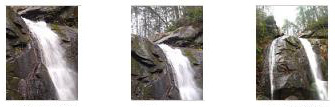
Another common composition was to zoom in on the very top of the cascade, to catch the water coming over the edge. Click on the thumbnails below for the best of these pictures:
|
The third most common view of the falls was to zero in on the main cascade; in these pictures, the focus was on the falling water, and the rocks below at the base of the falls. You can click on the thumbnails below to see the best of these pictures:
|
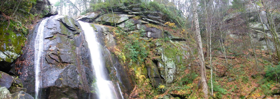
While he was below the falls, Fred used the capability of his camera to stitch pictures together to create a panoramic view of High Shoals Falls, and you can see the result below:
|
|
As with many water features that we see, it is hard to appreciate it simply by looking at pictures; the sound is a big part of the attraction of such sites. So watch this movie of High Shoals Falls. |
Above High Shoals Falls
|
We went off to the left of the falls themselves and found the stairs up to the top of the falls. We began climbing, and Fred stopped near the top to take a couple of pictures looking back down; you can see those pictures here and here. The trail came over the crest of a ridge, and then descended down to the top of the falls.
|
This movie, which I took while walking up the stairs to the top of the falls, will show you just what part of our hike was like. |
When we descended down to the top of the falls, we found that the trail wound around the left side of Jacob Creek which, at the top of the falls, was a fairly wide, fairly level stream.
|
At the Top of High Shoals Falls |
|
After I hung out by the railing for a while, I continued along the trail upstream until I came to and crossed the wooden footbridge to the other side. I wanted to work my way down through the woods to the top of the falls on the far side, where I thought I might get the best view. So I didn't know that both Fred and Ted had also walked up to and crossed the bridge. Ted stopped in the middle of it to photograph Jacob Creek looking towards the falls. Fred, too, came to the other side and, looking back, took this picture of the footbridge. I continued along the trail for just a ways, and then made my way through the dripping foliage to get down to and then along the shore of the creek. I came out in a small clear area, and from here I could get a pretty good view of Jacob Creek going over the cliff.
|
At the Top of High Shoals Falls |
|
|
I walked out onto the rock and from a point near (but not too close to) the precipice, I made a movie looking upstream at the cascades (and Ted taking his own pictures). |
One of the small waterfalls here was very picturesque and very restful to watch and listen to. So I made a movie featuring this cascade, and if you are in the mood for a few seconds of relaxation, you should watch it. |
Our Return Hike
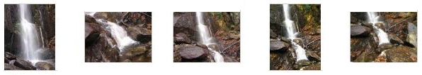
On the return trip, we recrossed the wood bridges, of course, but this time it wasn't raining and so our pictures were better. And all the way down we paralleled (and in many cases went over) the boulder avalanche streambed. Because the weather was better (at least for now) we took rather more good pictures. Click on the thumbnail images below and you can have a look at some of them:
|
As we got back nearer to the parking area, the rain began again- but still lightly. I'll end our hike with one more movie.
|
About a quarter mile from the parking area is the place where the trail crosses Jacob Creek for the first time, and I made a movie of the creek flowing down from the falls, under a footbridge, and on down towards the Visitor Center. |
We had a really great time on the hike, and we thank Ted for showing it to us. We piled in his car and headed back to Charlotte, this time taking a different route through a number of small, picturesque North Carolina towns.
We Head to Judy's
|
We followed the familiar route up I-85 to the familiar exit for her house, and went directly there. We did indeed have some supper and hang out for a while.
|
You can use the links below to continue to the album page for different day.
|
November 24, 2010: Greyfield Farms (Elon, NC) |
|
November 22, 2010: Amicalola State Park (GA) |
|
Return to the Index for Our Thanksgiving Trip |