|
September 26, 2011: The Rhode Island and Connecticut State Capitols |
|
September 24, 2011: Getting to Providence, RI |
|
Return to the Index for our New England Trip |
Last night and this morning, Steve and Fred did some investigation on the Internet as to some of the things we might want to do today. Mario had wanted to see some of the old mansions in Newport, RI, so Steve and Fred picked a couple of them and worked out the route to get there. I added Cape Cod to the list, if there was time at the end of our stay in Newport. I had never been out to the end of the Cape where Provincetown is located, and thought it would be interesting for everyone.
Getting to Newport, Rhode Island
|
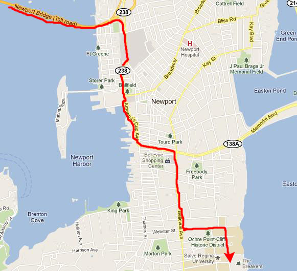
We came off the island to the east by crossing the Newport Bridge, and this brought us to Newport, Rhode Island.
|
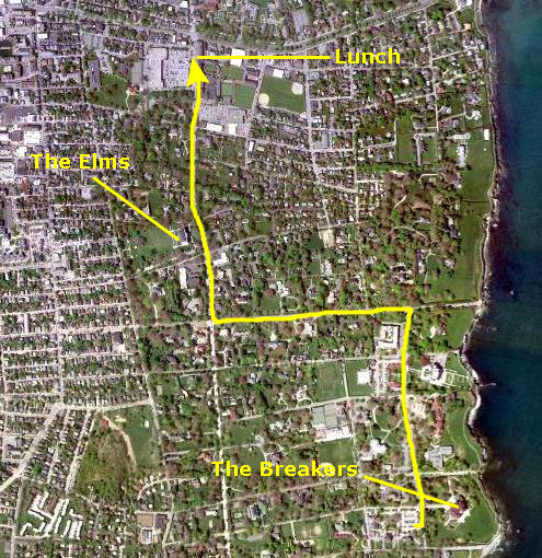
The avenue wound through town, and we saw lots of tour busses filled with people out to see the sights in Newport itself, but we continued south and then east on RI Highway 138A to Bellevue Avenue. This took us south, through an area of shops and restaurants (where we will have lunch later) and then past a number of historic mansions (one of which, The Elms, we will visit later today as well).
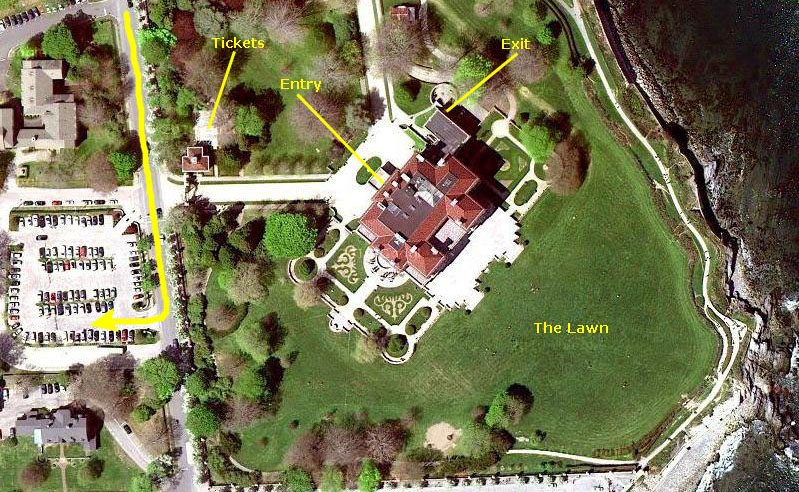
We went east on Webster and then south through Salve Regina University to the parking area for The Breakers, the first of two mansions that we'll visit today here in Newport.
A Tour Through "The Breakers"
|
On the actual tour of the interior of the house, photography was not actually allowed. Perhaps it is because when people stop to take flash pictures it can really slow everything down, or perhaps it is because fragile items can be damaged over time by continual flash photography, or perhaps it is because the Preservation Society simply wants to control the images of what it owns. Regardless, I thought on this tour, as I have thought on others, that I paid enough for my ticket to come away with some images of the interior. Obviously, I couldn't just flaunt the rules and stop wherever I wanted to take a flash picture, nor could I be real obvious even without using a flash. So I took as many pictures as I could, without flash and without taking care to compose the pictures well. I was the only one of the three of us taking pictures inside, and not but about half of my pictures turned out well enough to include here.
So blame me if you wish for flaunting the rules, but flaunt them I did. I am also going to include a few pictures taken from the Internet of some of the primary rooms, as mine were not nearly so good as those taken by professional photographers under optimal conditions.
Background
|
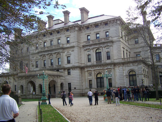
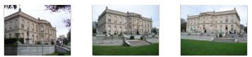
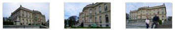
The Breakers was built as the Newport summer home of Cornelius Vanderbilt II. It is built in a style often described as "Go�t Rothschild." Designed by renowned architect Richard Morris Hunt and with interior decoration by Jules Allard and Sons and Ogden Codman, Jr., the 70-room mansion has approximately 65,000 sq. ft. of living space. The home was constructed between 1893 and 1895 at a cost of more than $12 million (approximately $310 million in today's dollars adjusted for inflation).
The Ochre Point Avenue entrance is marked by sculpted iron gates; these 30-foot-high walkway gates are part of a 12-foot-high limestone and iron fence that borders the property on all but the ocean side. Particularly striking are the huge main gate posts with their wrought iron lanterns.
The main house (a five-story, 250 x 120 ft. mansion aligned symmetrically around a central Great Hall) is part of a 13-acre estate on the seagirt cliffs, and it faces east- overlooking the Atlantic Ocean. It is now the most-visited attraction in Rhode Island with approximately 300,000 visitors annually and is open year-round for tours. In April 2009 the museum stopped offering personalized tours by tour guides patrons now receive standard audio headsets.
History
|
The Breakers is the architectural and social archetype of the "Gilded Age", a period when members of the Vanderbilt family were among the major industrialists of America. Indeed, if the Gilded Age were to be summed up by a single house, that house would have to be The Breakers. During 1895, the year of its completion, The Breakers was the largest, most opulent house in the Newport area.
Vanderbilt died from a cerebral hemorrhage caused from a second stroke in 1899 at the age of 55, leaving the Breakers to his wife, Alice Gwynne Vanderbilt. She outlived her husband by 35 years and died at the age of 89 in 1934. In her will, The Breakers was given to her youngest daughter, Countess Gladys Sz�chenyi (1886�1965), essentially because Gladys lacked American property. Also, none of Alice's other children were interested in the property while Gladys had always loved the estate. Four years later, The Breakers survived the great New England Hurricane of 1938 with minimal damage and minor flooding of the grounds.
In 1948, Gladys leased the high-maintenance property to the non-profit Preservation Society of Newport County for $1 a year. The Society bought the Breakers in 1972 for $365,000 from Countess Sylvia Szapary, Gladys' daughter of Gladys. (Given inflation, this was something of a discount; it would be as if the $12 million house had been sold later the same year it was built for a little less than $8,000.) However, the agreement with the Society allows the family to continue to live on the third floor, which is not open to the public. Countess Sylvia lived there part time until her death on March 1, 1998. Gladys and Paul Szapary, Sylvia's children, spend summers there to this day, hidden from the hundreds of thousands of tourists who explore below.P Although the mansion is owned by the Society, the original furnishings displayed throughout the house are still owned by the family.
The Architect
Hunt directed an international team of craftsmen and artisans to create a 70 room Italian Renaissance- style palazzo inspired by the 16th century palaces of Genoa and Turin. Allard and Sons of Paris assisted Hunt with furnishings and fixtures, Austro-American sculptor Karl Bitter designed relief sculpture, and Boston architect Ogden Codman decorated the family quarters.
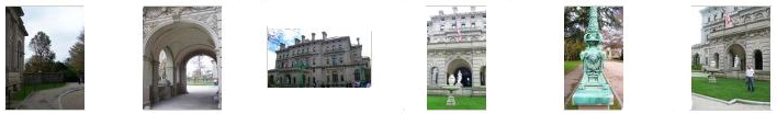
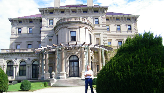
Before the Tour / Main Entry
|
|
|
While we were wandering around the front of The Breakers, I made a movie panning around the area.
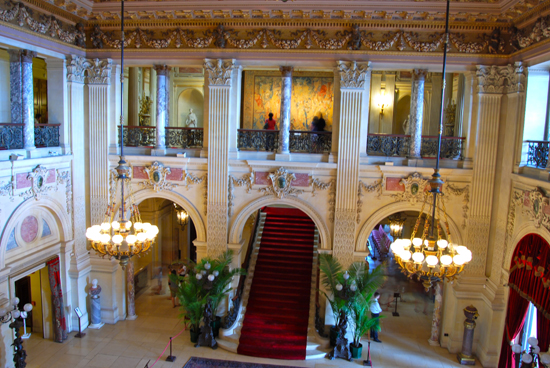
Our Tour: The Main House
|
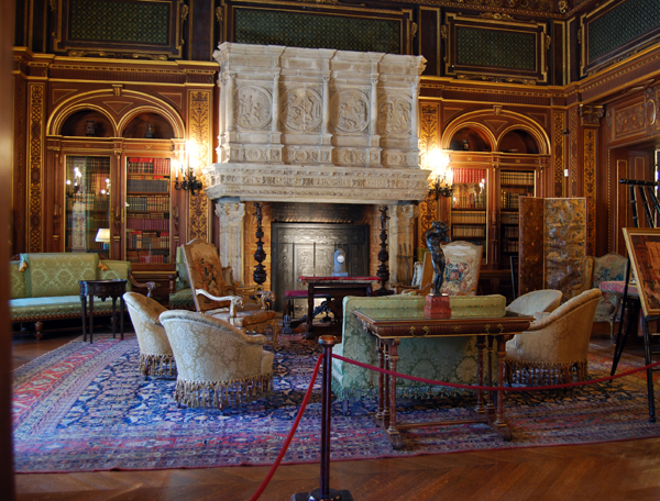
The room was two storeys high and, like other homes I've toured (such as Vizcaya in Miami), it had a balcony all the way around on the second level, so that all the rooms on that floor could open out onto that balcony and have unobstructed views down to the main floor. You can see that balcony very clearly here. The room was a beautiful, impressive one- as you would expect in a house that cost the current equivalent of $300 million. The coffered ceiling and chandeliers were particularly striking.
At the northeast side of the room you can see the main staircase; the staircase itself is not accessible on the tour, but later on we will be crossing back across the top of it on the balcony you can see above it, coming from the left in the picture. Then, I'll be showing you a picture taken at the top of that stairway. At the opposite end of the Great Hall is one of the huge fireplaces that are found throughout the house.
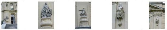
The Great Hall is fifty feet square, and over each of the six doors which lead from it are limestone figure groups celebrating humanity's progress in art, science, and industry. Galileo represented science, Dante represented literature, Apollo represented the arts, Mercury represented speed and commerce, Richard Morris Hunt represented architecture and Karl Bitter represented sculpture.
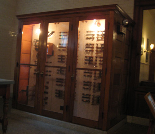
Other rooms on the first floor included the Gentlemen�s Reception Room, the Ladies� Reception Room (see my two pictures taken in this room here and here), the Library (shown above), the Music Room, the Billiard Room and the Dining Room. I have a picture of the Dining Room ceiling here.
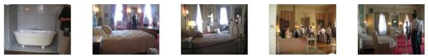
On the second floor, we found most of the bedrooms and baths, as well as the upper loggia (open, covered porch). The bedrooms included Mr. Vanderbilt�s Bedroom, Mrs. Vanderbilt�s Bedroom, Miss Gertrude Vanderbilt�s Bedroom, Countess Szechenyi�s Bedroom and some guest bedrooms. These rooms, particularly the first four, were very ornate, and still furnished with the actual furniture used by the Vanderbilts (and which is still owned by their family). I took some pictures in these various bedrooms and baths, but unfortunately had no way to record which was which. Take a look at them anyway by clicking on the thumbnails below:
|
From the loggia on the second floor, we were able to get a nice view out across the lawn to the Atlantic Ocean; this is the kind of view that great wealth brings you. We continued through the bedrooms and finally came out at the second floor landing over the Grand Staircase. Over the Grand Staircase is a stained glass skylight designed by artist John La Farge. Originally installed in the Vanderbilt's 1 West 57th Street townhouse dining room, the skylight was brought here in 1894 during an expansion of the townhouse.
The tour did not include either the third floor or the attic floor. The third floor contains eight bedrooms and a sitting room decorated in Louis XVI style walnut paneling by Ogden Codman. The North Wing of the third floor quarters were reserved for domestic servants. With ceilings near 18 feet high, Richard Morris Hunt created two separate third floors to allow a mass congregation of servant bed chambers. This was all in part of the configuration of the house, built in Italian Renaissance style, that included a pitched roof. Flat roofed French classical houses in the area allowed a concealed wing for staffing at the time. The Breakers does not feature this luxury.
A total of 30 bedrooms are located in the two third floor staff quarters. Three additional bedrooms for the Butler, Chef, and Visiting Valet are located on the Mezzanine "Entrasol" Floor located between the first and second floor just to the rear of the main kitchen.
The Attic floor contained more staff quarters, general storage areas, and the innovative cisterns. One smaller cistern supplied hydraulic pressure for the 1895 Otis lift, still functioning in the house (though it was wired for electricity in 1933). Two larger cisterns supplied fresh and salt water to the many bathrooms in the house. Our tour continued down a secondary stairway to the kitchen, which was the last stop on the official tour.
|
The Gardens and Lawn
|
Clipped hedges of Japanese yew and Pfitzer juniper line the tree shaded foot paths that meander about the grounds. Bowditch�s original pattern for the south parterre garden was determined from old photographs and laid out in pink and white alyssum and blue ageratum. The wide borders paralleling the wrought iron fence are planted with rhododendron, laurel, dogwoods, and many other flowering shrubs.
As I said, the gardens and most of the unusual trees were on the southwest side of the house, and we spent some time there taking pictures of that end of the mansion. You can have a look at some of these by clicking on the thumbnail images below:
|
From the gardens, we walked around the southwest corner of the house to come to the ocean‑side patio, which is just below the second-floor loggia that we saw on our tour. From here, the views look east to the Atlantic Ocean.
|
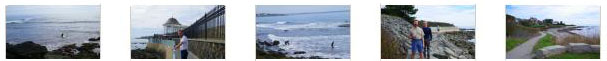
I went down to the end of the lawn thinking that I could get right to the shore, but the wrought iron fence that surrounds the estate did not have a gate of any kind to let you through (undoubtedly these days to keep people from wandering all over the property at odd hours of the day or night). I could, however, get close enough to look over the fence and get a picture looking west along the shore.
There was a walkway that was coming from the east along the top of the cliff, and it continued west along the shore, through that gate that you can see in the previous picture. There were people strolling along this walkway, so I thought that when we were done at The Breakers we might see how to get to that path and walk along the shore for a while.
|
|
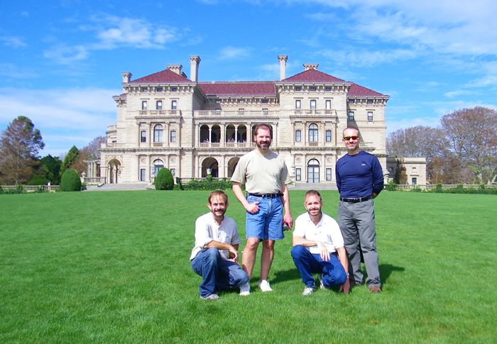
When we were done on the lawn, we walked along a pathway inside the estate that led back around towards the entrance. Along the way, I got another nice view of The Breakers, framed by some overhanging trees, and as we came around the southwest corner of the mansion again, a picture of Fred at The Breakers.
Our tour of The Breakers was completed, so we walked back out the main gate to see if we could find our way down to the shore.
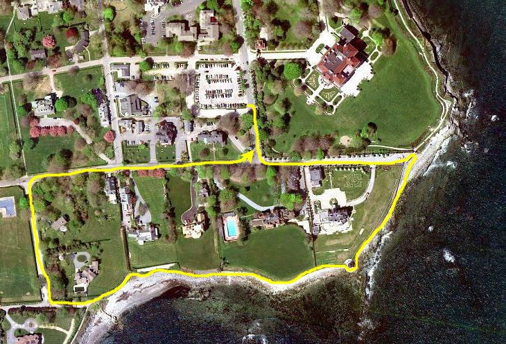
A Walk Along Sheep Point Cove
|
When we got down to the water, which is actually Sheep Point Cove at this point, we were treated to expansive views across Sheep Point Cove to more houses over in East Newport. We descended a ramp that carried the walkway down closer to the shore, and then came back along the seawall to sit down and admire the view. Steve took a picture of Fred and I on the seawall, and Fred took his own picture of me at Sheep Point Cove.
|
|
From our vantage point down here by the water, I made a movie looking all around along the water, beginning with a view to the east and ending with the view ahead of us to the west.
We were going to walk along the path from this point to the west. Ahead of us, you could look along the rocky oceanfront. Ahead of us, not far along the walkway, there was a small, round gazebo that was apparently part of the property just north of us at this point- another large estate. You can see it on the aerial view above, and in this picture I took of Fred on the walkway. As we walked along the shore, Fred took some interesting photos, and you can have a look at them if you click on the thumbnail images below. (The last picture was taken just before we left the shore and started through the neighborhood streets to get back to the car.)
|
As we left the shore and headed up north along Marine Avenue to get back to Ruggles Avenue, Steve took a picture looking back to the ocean.
|
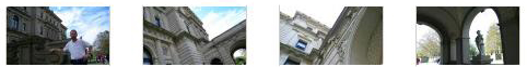
At the end of the row of buildings along Bellevue Avenue was a 1903 building called the Audrain Building. One of the striking aspects of the building was its facade. The facade is glazed terra cotta in the style of the Italian Renaissance artist Luca della Robbia decorates the facade. Copies of his swaddling infants from the Foundling Hospital in Florence, Italy, appear on the building, which served as medical offices. You can see all of this in Fred's photo.
There were other interesting houses on both sides of Bellevue Avenue, this being one of the very fashionable streets in town. At the Isaac Bell House, Fred stopped to take a picture of an explanatory marker that talked about some of the ornate houses along the avenue. You can read over his shoulder here.
As we walked along Bellevue, we saw some of these houses, and you can see them too if you click here and here.
After we'd walked four blocks, we found The Elms.
A Tour of "The Elms"
|
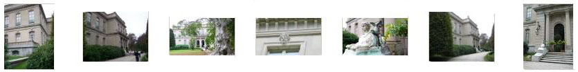
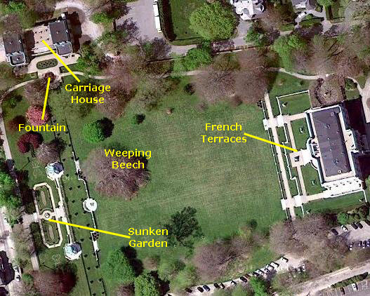
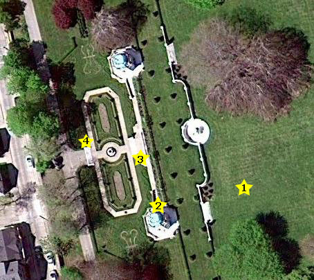
I've pulled in an aerial view of The Elms and marked our tour route on it. We came down Bellevue and turned into the grounds, entering the house from the Bellevue entrance. Before we went in the house, we got some good pictures of the front of it, showing the architecural style. As I said earlier when talking about The Breakers, photos inside the house were not officially allowed, but again I felt that, unless there were some copyrighted work inside that someone tried to take a professional picture of, or unless there were some artifact that might be harmed by continual flash photography, that taking pictures ought to be allowed- provided that by doing so patrons weren't holding up other visitors or causing some sort of commotion. So I did take snapshots- without flash, of course. Many of these did not turn out, the lighting inside being relatively low, but some did, and I'll include them here. Of course, picture-taking outside on the grounds was quite allowable, and we did a lot of that.
I'll begin with some of the best photos that we took from outside the front of the house. You can have a look at these by clicking on the thumbnail images below:
|
History
|
A huge party was held with the house opened in 1901, and for the next 20 years, Berwind's wife, Sarah, would spend the summers there, the season being from the 4th of July to the end of August; Berwind would come out only on weekends, for his coal-mining interests kept him in New York during the week. Though the Berwinds had no children, their nephews and nieces would come out to visit on a regular basis. In 1922 Mrs. Berwind died, and Edward asked his youngest sister Julia A. Berwind to move in and become the hostess of The Elms.
When Berwind died in 1936, he willed the house to Julia, who, not being interested in technology, continued to run the house in the same way for the next twenty five years: washers and dryers were never installed at the Elms. Julia was well-known in Newport, and she would invite children from a nearby working-class immigrant neighborhood to the estate for milk and cookies. She did have a love for cars and would drive around Newport every day in one of her luxury cars. This was somewhat shocking to the rest of Newport society where it was considered "unladylike" for women to drive themselves. It was rumored that her social secretary would perform the "white glove test" to make sure there was no dust on the steering wheel before Julia got into the driver's seat.
The Mansion
I know that my pictures of the interior aren't that great, but you can have a look at them nevertheless by clicking on the thumbnail images below:
|
|
|
One of the two movies I took inside the house was this short look at Mr. Berwind's bathroom. The others that we saw were similar.
As with all of the large mansions built in this era that Fred and I have toured, care was taken to provide working areas and quarters for the many servants that such huge houses required. In the Berwind home, there was a special service stairway that led from the basement (actually the ground floor, as the north end of the basement opened out to the service drive at the north side of the house) to every floor, enabling servants to do their work without often being seen.
|
|
The other movie I made during the house tour was made here, in the china pantry. It was off the beaten path of the tour, and there were no docents anywhere around.
I continued down to the basement/ground floor to the area where the the electrical equipment was. This was also where laundry was done and dishes were washed, and the floor contained servants' quarters as well. But the main focus of this area was, of course, the kitchen. From the kitchen a door led out of the house to the circular service drive, and from there we could continue our walk around the estate by visiting the gardens.
The Grounds
|
The French Terraces
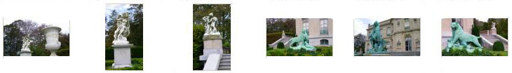
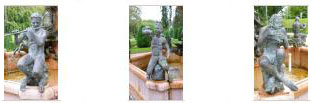
Wandering around on the terraces, Fred and Steve got a number of good pictures of the sculpture and statuary on the terraces. Have a look at some of their pictures by clicking on the thumbnail images below:
|
Berwind intended that The Elms be a showplace; he was anxious to make sure that people knew of his arrival in the American aristocracy, and so little expense was spared to adorn the outside of the building.
|
|
|
Walking around on the terraces and looking at the amazing house, it was hard not to snap away, taking picture after picture, and all three of us came away with six or eight different views of The Elms as seen from the terraces.
|
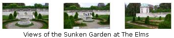
The Sunken Garden
|
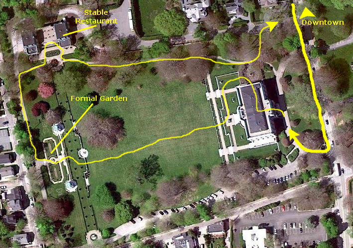
I walked across the strip while Steve took some pictures and came around to the side of the nearest gazebo so that I could look out over the sunken garden; at this point I am standing at #2 on the aerial view. Fred had already gone down into the sunken garden, and while I was still near the gazebo, he snapped a picture of be beside the limestone gazebo. (Of course, you can see that it was more of a little glassed-in room rather than an open-air gazebo.) There was a second, matching gazebo at the other end of the retaining wall above the sunken garden. You can see both of them in the aerial view.
|
|
Then I descended the stairs from the gazebo to join the others down in the garden. The first thing I noticed was that built into the six-foot retaining wall was a set of three fountains (#3 on the aerial view above), one of which you can see here. These were very pretty, and a bit of a surprise. Behind me, in the center of the sunken garden there was another fountain, although this one was not on. Beyond that, up another set of steps to a walkway outside the sunken garden there was a beautiful trellis niche and statue.
Fred took some other nice pictures here in the sunken garden; click on the thumbnails below to have a look at them:
|
|
|
We all met up again over at the steps up on the other side of the garden (#4), and we sat down to rest for a bit and just admire the beauty of the garden. Fred snapped a good picture of the rest of us sitting on one side of the stairs, and you can have a look at that picture here.
I got one of my best pictures of Fred on the entire trip, and you can have a look at it here.
The Carriage House
|
On the edge of The Elms estate, a large carriage house and stables were built, over which lived the stable keepers and gardeners. When the Berwind family began using automobiles, the carriage house and stables were converted into a large garage. The head coachman, in order to keep his job, became the family driver, but he could never learn to back up, so a large turntable had to be installed in the garage. That structure was later replaced by the largest private garage in America, and included two gasoline tanks.
When the house was sold to the Preservation Society, the original purposes were no longer necessary, so now the building houses a cafe, offices and storage.
|
|
Meanwhile, I had climbed the stairs to the carriage house, and found the cafe and offices. From the balcony overlooking the little garden and the fountain, I called to the other three guys to gather so I could take their picture, and you can see the result
here.
When I came down from the cafe patio, I found an interesting statue off to my left. I wasn't sure if it was just me, but there seemed to be
something missing.
While I was engrossed with the statue, Fred had turned to take a picture with his zoom lens, looking back towards the sunken garden and the gazebos. I thought it was a pretty picture, so I have included it
here.
Finished at the carriage house, we continued to follow the walkway that led back around to the north end of The Elms and the exit from the property. Along the way, we passed a huge, particularly interesting tree, and Fred wanted me to snap a picture of him standing at its base. You can see the result here.
Preserving The Elms
We certainly enjoyed touring The Elms, both the house and grounds. The Preservation Society has done an excellent job.
Driving to Provincetown, MA
|
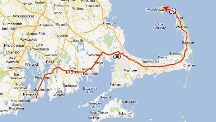
We left Newport and continued east on the highway we'd taken coming in. It was good that we had a GPS, because there were lots of turns and shifting onto one different road after another until we got to the expressway at Fall River. We took that east, picked up US Highway 6 and then just followed that all the way out to the Cape.
I had hoped that even though it was later in the day, that the skies would be clear and we could get some good views, but by the time we got to Wellfleet, MA, just twenty miles from Provincetown, a fairly thick fog had gathered and we couldn't see more than a mile in any direction. One of these days I may want to return here when the weather is nice.
|
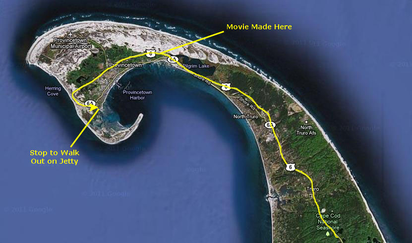
As we turned west again on the highway, we were actually passing north of Provincetown, and eventually we reached water again. Then the road curved around south, and it would eventually keep curving around back to the east to go right through Provincetown, but we stopped at an overlook by the water to see what we could see. You can see these features on the aerial view below.
|
Touring Provincetown
The Jetty
|
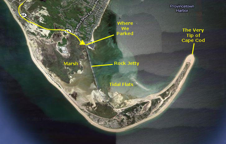
I have zoomed in a bit so you can see more of the detail of this area. You can see the road coming around from the north and beginning to head back to the east, and I've pointed out where we parked.
You can just see the rock jetty (or breakwater) that we eventually walked out on, and you can see that on one side we have a marsh (the water rises and falls with the tide, but because of the jetty it doesn't really flow. On the ocean/bay side of the jetty, the tide goes in and out more forcefully, and we have tidal flats. The type of lifeforms in the two areas are quite different, as it turns out.
You can see in this view that we were not actually at the very tip of Cape Cod; I actually thought that we were. The only way to get to the very tip is to go all the way out the jetty to the sandy hook of land at the end, and then walk east along the beach until you, well, run out of beach. Had I known about the terrain, I might have done some investigation as to just how long the rock jetty was (just about a mile, as it turns out) and then how far it would be to land's end (another mile or so), and known that there wouldn't be time to do the walk and get back before it got dark.
|
But in truth, the Pilgrims did not land first at Plymouth, they actually stepped off the Mayflower here, just west of Provincetown. How long they stayed is still an open question, but it was not long, for they realized that sand dunes and tidal marshes wouldn't make an hospitable place to settle down. Vacation, yes, but settle? No. So they continued on across the open water between Provincetown and the coast south of Boston, and that's where they put down roots. (I guess that many, many years later, when Plymouth- and Boston- were getting crowded, that someone remembered that isolated place they'd first landed, and thought it might be a good place to use to get away from it all.) Interesting.
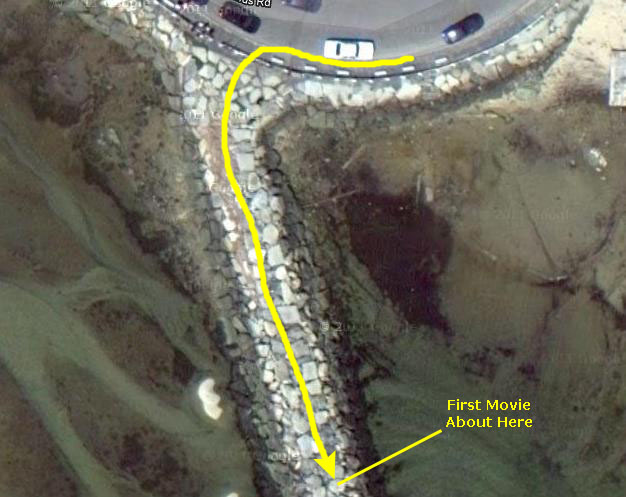
But now it was time to explore the jetty, stretching out so invitingly from where we'd parked. Over at the shore, we all stopped for a bit to look around, and Steve got a good picture of one of the local denizens taking advantage of the tidal outflow to see what might have been uncovered. Mario didn't particularly want to go out on the rocks, and Steve just went a short way before he bid Fred and I adieu and took our picture as we headed out for a walk on the jetty that stretched away into the fog.
|
A short ways out the jetty, I stopped to make my first movie of Fred walking along past me, and you can have a look at that movie with the player at left. Fred took a couple of good pictures at this point, and you can click on the thumbnails below to have a look at them:
|
|
When I realized that the only thing I could hear were sea birds and my own breathing, I stopped to enjoy the relative silence. It was a little eerie, and so I made a movie of what it looked like all around me, and you can watch that movie with the player at right.
I hadn't seen anyone since leaving Fred; all I could see was the shallow water on both sides and the jetty extending ahead and behind- and all I could hear were the sea birds. Click on the thumbnails below to see what it looked like ahead of me and behind me:
|
I was watching my watch, and I still had some time, so I ran off and on for another ten minutes before stopping again.
|
Keeping track of the time, I headed back, sometimes walking rapidly, sometimes breaking into a jog and jumping from rock to rock. The rocks were mostly flat and fairly level, so there wasn't any problem at all going quickly. After another fifteen minutes or so, I came within sight of the shore again, and, with a couple of minutes to spare from my 30 minutes, reached the other three guys waiting by the car. It was a really neat walk, but I would like to return sometime, now that I know the lay of the land, and go all the way out to the end of the cape. But I'll wait for a sunny, clear day to do it.
Walking Through Provincetown
|
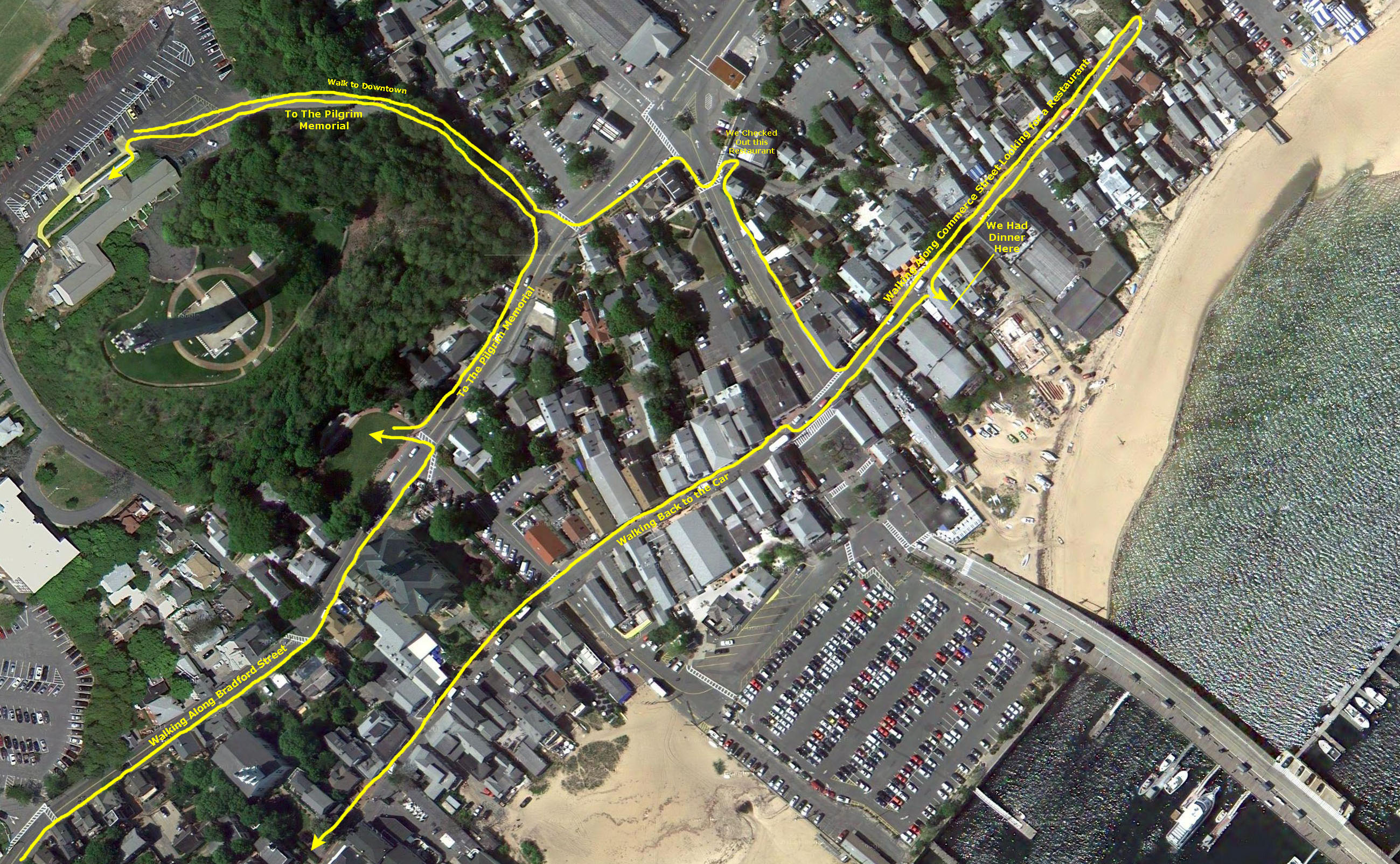
The window at left contains the aerial view. The view was way too large to simply place on the page, so the window is scrollable- you can follow us around town by using the horizontal and vertical scroll bars. You should begin by scrolling all the way to the bottom and all the way to the left (until you see the yellow route line and the legend "Walking Along Bradford Street").
To begin with, we actually parked on Bradford Street a few blocks southwest of where the aerial view begins, but you can see us coming into the view along the route marked "Walking Along Bradford Street." When we got out of the car, Fred went across the street to take our picture.
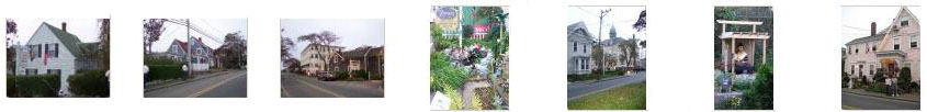
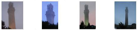
Then, we followed the marked yellow route northeast along Bradford Street, heading towards the Pilgrim Monument, the tall tower that we could see in the distance. Bradford Street was lined with guest houses- much like bed and breakfasts. Although the afternoon was overcast and a bit grim, the bright colors and many whimsical decorations made it seem nicer. Romeo's Guest House had an extremely kitschy display out front, and one house had what seemed to be some sort of Hindu shrine out back. If you would like to see some of the buildings and displays, just click on the thumbnail images below:
|
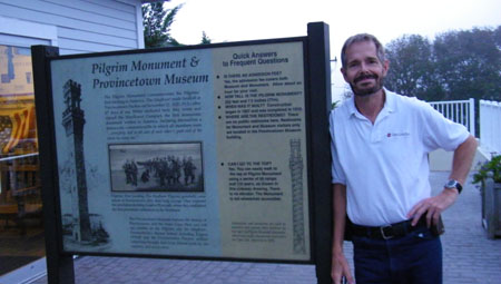
The middle picture, above, of the display at Romeo's deserves a closer look, and you can see Fred's closeup here. We continued walking along Bradford Street until we were quite close to the tower of the Pilgrim Monument. On Bradford Street, there is a part of the Memorial- and we walked over to take a look at it. From down below, we could look up at the tower, but we wanted to get closer. It seemed as if there had to be a road up to the tower, and a little bit further along Bradford Street we found it and walked up. (As it turned out, the actual entrance road is back along Bradford; we actually walked up the exit road.) The Memorial had already closed for the day, but there was an explanatory sign telling about the Memorial and the tower; you can read that sign here.
|
|
From the Memorial, we walked back down the exit road and then up Bradford for a short ways. We crossed the street to investigate a restaurant called Napi's, but it looked to be a bit too expensive. So we continued east to Commerce Street, and then walked north and back south looking at all the restaurants. We stopped a few locals to ask for a recommendation, but no one was really enthusiastic about anything. Coming back south, we settled on a restaurant right near the main intersection called The Lobster Pot. It turned out to have a fairly extensive menu, with salads for Steve and Mario, fish for Fred and a burger for me.
When we were done, we continued southwest along Commerce Street, eventually finding a side street that took us back to Bradford and the car.
Provincetown seems to be an interesting place, and I can only imagine how busy it must be in the summer or when the weather is nicer than it was this evening.
Returning to Providence
|
|
We left about eleven, and Steve followed the GPS directions and got us back to the Best Western.
Tomorrow begins our first of five days of state capitols, so Steve will be in his element.
You can use the links below to go to another day of our New England trip or return to the Index page.
|
September 26, 2011: The Rhode Island and Connecticut State Capitols |
|
September 24, 2011: Getting to Providence, RI |
|
Return to the Index for our New England Trip |