|
May 21, 2012: Kerkira (Corfu), Greece |
|
May 19, 2012: A Sea Day |
|
Return to the Index for Our Mediterranean Cruise |
|
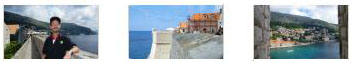
We Arrive in Dubrovnik
|
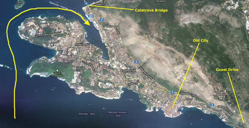
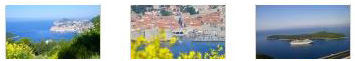
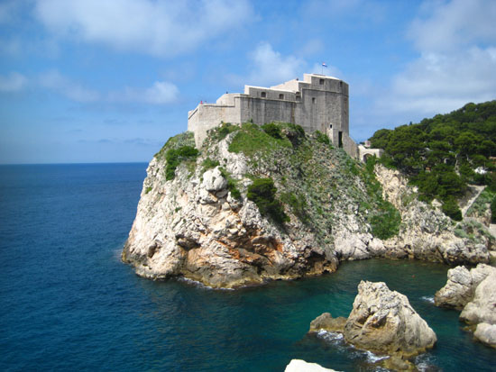
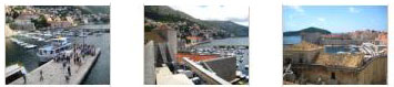
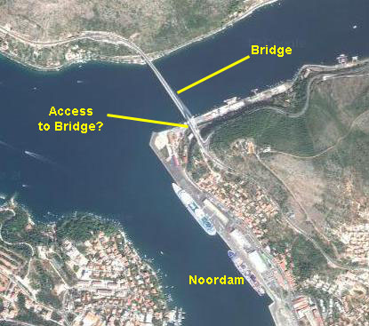
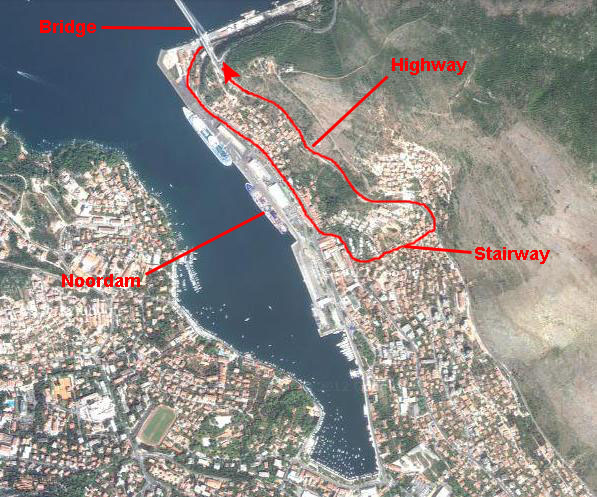
Before we start talking about our arrival, it might be a good idea to familiarize you with the area around Dubrovnik; this will enable you to piece together the three major destinations we reached today- the scenic overlooks on the Dalmation Coast south of Dubrovnik, the Old City of Dubrovnik, and the highway bridge just north of the city that was designed by Calatrava.
In the aerial view below, I've marked our route into the harbor and the three destinations mentioned above:
|
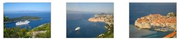
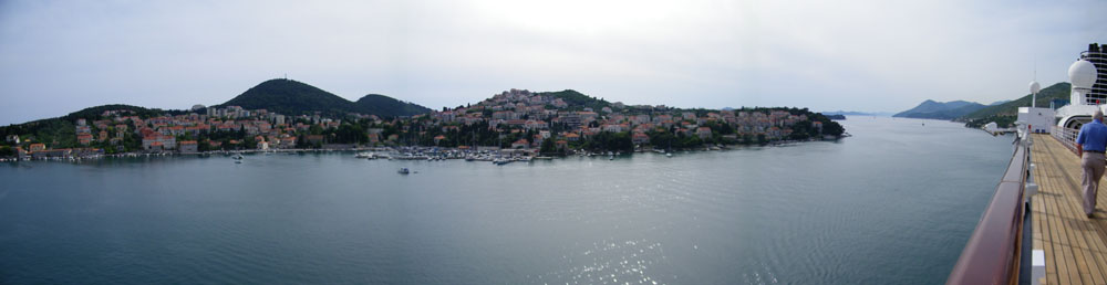
As we passed around the northern side of that peninsula, I tried my hand at stitching together three or four pictures to show you the panorama of the scene, and my effort is below:
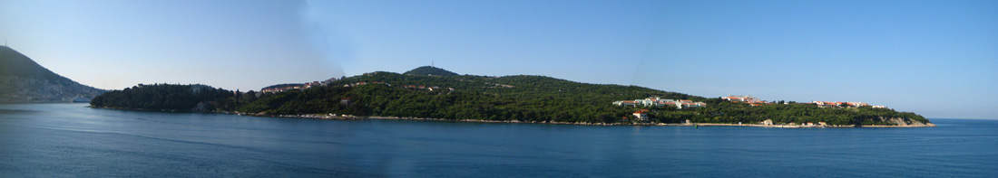
|
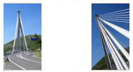
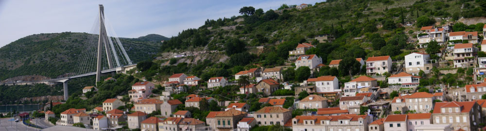
On the port side of the ship, the side facing the dock, we could see the ship behind us, the buses waiting for the shore excursions, and Dubrovnik's Calatrava‑designed bridge. It is a highway bridge that spans a long, thin fjord-like inlet that goes almost due east from the Adriatic to within a mile or so of the border between Croatia and Bosnia-Herzegovina.
By eight in the morning we were docked, and we returned to the stateroom to gather our things and prepare for our first shore excursion of this, our second cruise.
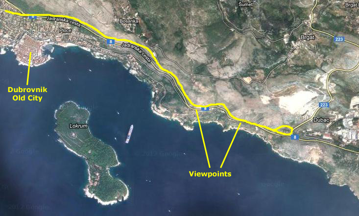
A Scenic Drive South of Dubrovnik
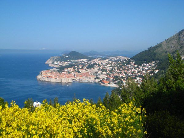
Today's shore excursion would actually encompass two destinations. First, the bus, which departed at nine o'clock, would drive us south of Dubrovnik along the coast road to a point where we would look back and down at the beautiful coastline and the city of Dubrovnik.
|
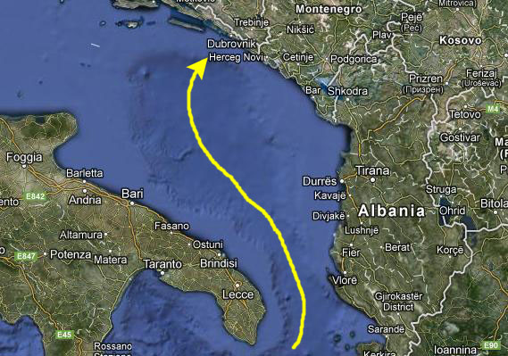
I might mention a bit of geography here. Croatia, which became independent in 1991, is a Balkan country that begins at the northeastern end of the Adriatic Sea. Its northern neighbor along the coast is Slovenia, and here it extends eastward with Hungary across its northern border. It extends eastward south of Hungary and north of Bosnia and Herzegovina to an eastern border with Serbia. Its capital, Zagreb, is found in this part of the country.
Back along the coast, it extends southward, with Bosnia and Herzegovina as its eastern neighbor, and it continues southward along the coast, getting narrower and narower (at one point almost pinched to become just some islands and a strip of beach by Bosnia and Herzegovina). By the time you get to Dubrovnik (about 200 miles south), the country is less than five miles wide, and only about twenty miles further on it ends at the intersection of the borders of Croatia, Bosnia and Herzegovina, and Montenegro. (If you are curious, if you continue south along the coast of the Adriatic, you will pass through Montenegro and then through Albania to finally reach Greece.)
|
|
(I overheard some of the other passengers commenting that it was good to see a Costa ship actually upright in the water- an allusion to the recent capsizing of the Costa Concordia off Giglio, Italy. When we left Civitavecchia two days ago, we were already about fifty miles south of where the accident happened, so we of course had no chance to see it.)
From its turnaround point, our bus headed back up the coast, this time heading down into Dubrovnik to arrive at the south gate of the Old City for our next stop.
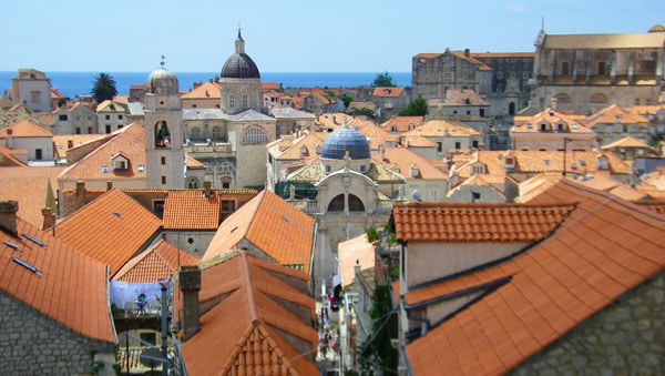
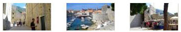
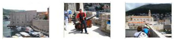
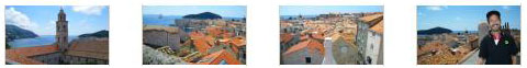
We Tour the Old City of Dubrovnik
Our bus took a different route on the way back, dropping down into the city to stop at a small plaza/park just outside the west gate of Dubrovnik's old city walls. There, we all descended from the bus and then got headsets and receivers from our tour guide. (As at our other stops, these would enable us to hear her even if we were some distance away from her.) She kept us in the plaza for a short time while she gave us some background on the old city itself. While she was doing that, we were looking around- at the northwest corner tower and at the bridge across the moat leading into the old city.
Dubrovnik's Old City: An Introduction
Dubrovnik, the "Pearl of the Adriatic" on the Dalmatian coast, was an important Mediterranean sea power from the 13th century onwards. Although severely damaged by an earthquake in 1667, Dubrovnik managed to preserve its beautiful Gothic, Renaissance and Baroque churches, monasteries, palaces and fountains.
|
Dubrovnik is a remarkably well-preserved example of a late-medieval walled city, with a regular street layout. Among the outstanding medieval, Renaissance and Baroque monuments within the magnificent fortifications and the monumental gates to the city are the Town Hall (now the Rector's Palace), dating from the 11th century; the Franciscan Monastery (completed in the 14th century, but now largely Baroque in appearance) with its imposing church; the extensive Dominican Monastery; the cathedral (rebuilt after the 1667 earthquake); the customs house (Sponza), the eclectic appearance of which reveals the fact that it is the work of several hands over many years; and a number of other Baroque churches, such as that of St Blaise (patron saint of the city).
The original defenses and the intra-mural city was later extended to include an industrial suburb (a planned development dating from the 15th century) and the Lovrijenac Fortress, located on the cliffs above; the fortress dates from the 11th century. Also included were the Lazarets, built in the early 17th century to house potential plague-carriers from abroad, the late 15th-century Kase moles, built to protect the port against south-easterly gales, and the Revelin Fortress, dating from 1449, which was built to command the town moat on its northern side. Dubrovnik's walled old city is now a UNESCO World Heritage Site.
Following Us On Our Walk Through the Old City
In touring the old city, we first followed our guide across the bridge, through the city walls and down into the city itself. There, we followed her sometimes and went off on our own other times, looking at the buildings and monuments and whatever else seemed interesting.
 |
Entrance and Placa Stradun
Our tour group (following our guide holding up a standard with a big number "2" on it) headed off across the moat bridge to the entrance, and we followed along.
|
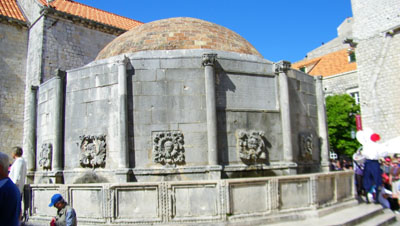
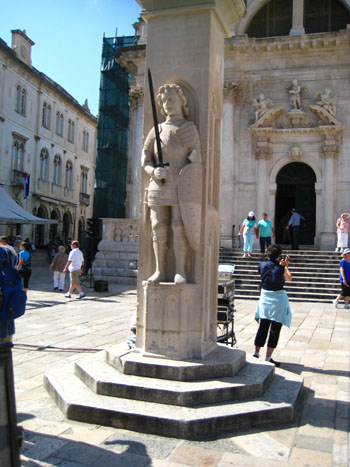
This brought us into an area called "Placa Stradun." It is actually the beginning of Placa Street which leads east through the old city. Here in the small plaza is Onofrio's Fountain (shown at left). Neopolitan engineer Onofrio designed this fountain and the 8-kilometer aqueduct that supplies its water in 1444. The fountain, with its interesting gargoyle spouts, is a popular meeting place for tourists and locals. Across the small plaza was the Franciscan church and monastery; it still functions as a church, but is also used for concerts and other performances; indeed, there was to be a concert inside tonight. Behind it was a museum, but we chose not to go in but rather to continue exploring.
The fountain was a center of activity; there was a vendor selling souvenirs on neck straps and, a little while after we got there and just after our guide finished her explanation, a solo musical performer.
I made two movies here at Placa Stradun, and you can watch them with the players below:
|
A Look Around Placa Stradun |
A Street Performer in Placa Stradun |
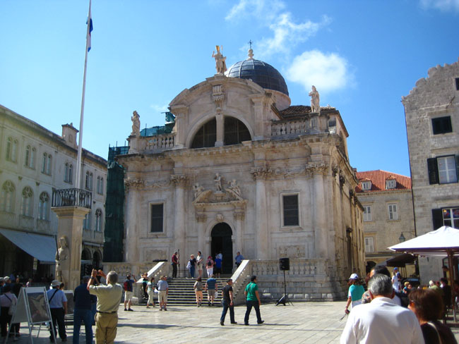
A Walk to the Church of St. Blaise
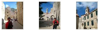
Stradun is actually the name of the main east‑west street in the old city; it goes from Onofrio's Fountain to the plaza in front of the church of St. Blaise. It was very crowded, with numerous tour groups and lots of individual tourists and locals, and at times it was tough to keep up with our own tour group, even though there was another one pushing us along. Radiating off on either side of the street were much more narrow side streets. On our right as we walked eastward towards St. Blaise Church, the city is level, and many of the narrow alleyways contained restaurants and cafes, along with other shops. On our left, heading away from the street to the north, the narrow alleyways climbed steeply towards the north walls of the old city.
|
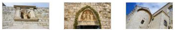
Saint Blaise is the patron saint of the city of Dubrovnik; relics of the saint are used in the yearly celebrations devoted to him. Chroniclers of Dubrovnik attribute his veneration there to a vision in 971 that warned of an impending attack by the Venetians. An effigy representing how inhabitants said he appeared in the vision remained on Dubrovnik's state seal and coinage until the Napoleonic era. There is also a statue of St. Blaise on top of the church itself.
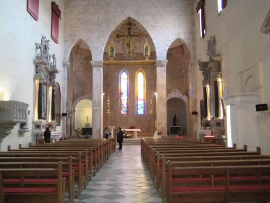
We took the time to go into the church itself, passing underneath ornate carvings above the archway door. Inside, we found a small but ornate chapel. It was very pretty, and there were some folks just sitting in the pews admiring the altar statuary and decoration. There were also some nice stained‑glass windows, although it was hard to get good pictures of them.
Coming out of the church, we also spent a fair amount of time in the plaza in front of the Church of St. Blaise.
|
Across the plaza from the front of the church is the Sponza Palace. It was built about a hundred years after the duke�s court in a mixed late gothic-renaissance style. It served as the taxation and mint building. Today the palace is used for historical archives that keep important documents from the republic of Dubrovnik. On the east side of the church is the Bell Tower and Loggia, with its interesting fountain out front. Finally, just south of the small Church of St. Blaise is the much larger Dubrovnik Cathedral. We did not take the time to go into it, but at one point we heard the bells announcing Mass.
Below are clickable thumbnails for some additional pictures taken here in the plaza:
|
Here at St. Blaise Church I made two movies of note; you can watch them with the players below:
|
Inside the Church of St. Blaise |
Dubrovnik Cathedral Bells |
East Gate/Dominican Church and Monastery/Church of San Sebastian
After Greg and I left the Church of St. Blaise, he decided to go off and look for the tour, which, apparently, we had lost track of. We wandered around trying to pick up the signal of our tour guide, but couldn't seem to, so Fred and I headed off on our own to see some of the northeast corner of the old city.
|
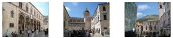
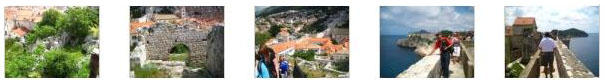
Below are some clickable thumbnails for other photos we took on this part of our walk:
|
Returning to the old city from the outside plaza, we came alongside the Church of San Sabastian and the Dominican Monastery.
|
|
The inside of the relatively plain chapel was really quite nice; not as ornate as the Church of St. Blaise. You can see a couple of additional views of the inside of the chapel here and here. The church was on the south side of a rectangular building that had a a very pleasant garden in its interior. This garden had an old well in the middle of it, and the entire courtyard was surrounded by a colonnaded walkway. Along the sides of this walkway we found the occasional interesting sculpture and, as it turned out, we started picking up transmissions from our tour guide, and we reconnected with the group as they were entering the small museum that occupies the north part of the open rectangular structure. We were happy to have found her again, although we wouldn't stick with her for very long, as it turned out.
We decided not to go into the museum; it was small, crowded, and photographs were not allowed anyway, so we spent some time in the garden courtyard, taking quite a few pictures. There are clickable thumbnails below for some of the best of these:
|
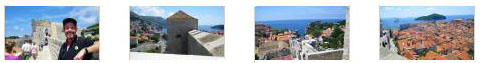
When the tour came back out of the museum, our guide sent us off on our own to explore the old city. She pointed out some of the things we might want to see- particularly the narrow side streets and the top of the city walls. She cautioned us to be back at the spot where the bus let us off earlier, and she named a time about 90 minutes hence. Fred and I wanted to walk the entire circuit of the city walls, and we knew from our guidebook that this would take about an hour (although we thought we could do it in less time). So we headed off through the side streets back to the west gate where the ticket office and entrance for the walk along the top of the walls was located.
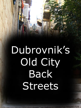
The Back Streets of Dubrovnik's Old City
|
To view the slideshow, just click on the image at left and I will open the slideshow in a new window. In the slideshow, you can use the little arrows in the lower corners of each image to move from one to the next, and the index numbers in the upper left of each image will tell you where you are in the series. When you are finished looking at the pictures, just close the popup window.
Our walk through the side streets brought us back to the entry plaza, where we bought our tickets to go up on the city walls. You can leave the aerial view open, if you wish, to follow us along on our circuit of the walls.
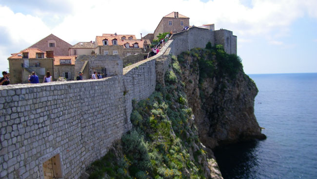
A Circuit of the Walls of Dubrovnik's Old City
The Walls of Dubrovnik are a series of defensive stone walls that have surrounded and protected the citizens of the city-state of Dubrovnik. With numerous additions and modifications throughout their history, they have been considered to be amongst the great fortification systems of the Middle Ages, as they were never breached by a hostile army during this time period. In 1979, the old city of Dubrovnik, which includes a substantial portion of the old walls of Dubrovnik, joined the UNESCO list of World Heritage Sites.
The oldest systems of fortifications around the town were likely wooden palisades. Today's intact city walls, constructed mainly during the 12th�17th centuries, mostly a double line, have long been a source of pride for Dubrovnik. The walls run an uninterrupted course of approximately a mile and a quarter in length, encircling most of the old city, and reach a maximum height of about 80 ft. The bulk of the existing walls and fortifications were constructed during the 14th and 15th centuries, but were continually extended and strengthened up until the 17th century. This complex structure, amongst the largest and most complete in Europe, protected the freedom and safety of a "civilised" and "sophisticated" republic that flourished in peace and prosperity for five centuries. The walls were reinforced by three circular and 14 quadrangular towers, five bastions (bulwarks), two angular fortifications and the large St. John's Fortress. Land Walls were additionally reinforced by one larger bastion and nine smaller semicircular ones, like the casemate Fort Bokar, the oldest preserved fort of that kind in Europe. The moat that ran around the outside section of the city walls which were armed by more than 120 cannons, made superb city defense.
NOTE:
For our circuit of the walls, I will mark that walk in numbered sections on the aerial view, beginning and ending with our access up and down the stairs from Placa Stradun. I'll key the photos and descriptions to those numbered sections, in case you would like to follow along closely.
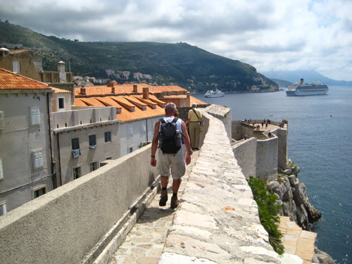
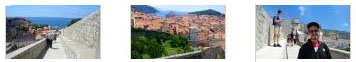
Section 1: From the Stairs Up Onto the Walls to Southwest Point
We bought some tickets for admission up onto the walls, and then crossed the plaza to the steep stairs that led up the side of the old city's northwestern wall.
|
|
We walked just a few feet southwest and could then look down Placa Stradun back towards the Church of St. Blaise and the Cathedral. We could also look down into the entry plaza and the Onofrio Fountain. Looking the other way, out of the old city, you can see modern Dubrovnik and the square where the tour bus let us off earlier.
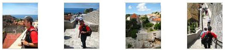
Beginning our walk, we headed southwest and almost immediately made a jog to the right before continuing on. We got another good view looking down the old city's main street and a number of other good views of the old city. There are clickable thumbnails below for some of these:
|
At the point where we jogged right, we could look ahead down towards the southwest corner of the old city walls, and in that picture you can see one of the fortified towers that we found along the wall walk. We'll go up into that one shortly. At the point where we turned left again (you can see all this in the aerial view), there was a raised platform with some steps up. From the top, there were views ahead to the southwest, back to the northeast, and, once again, out over modern Dubrovnik. We could also get a good view of the bus plaza and the bridge we crossed to enter the old city, and you can see that view here.
|
|
I made a movie looking out at the views from this battlement, and you can watch it with the player at left.
|
|
Section 2: Turning Along the Southwest Side of the Old City Walls
We came to a corner of the city walls- the westernmost point of the walls- and turned sharply east and then not as sharply southeast along the Adriatic. This section of the walk will bring us to the point where we turned generally east to go along the top of the walls that defined the southern edge of the old city.
|
From this same point, Fred could look back along the west walls of the city- the way we have come so far. I think that capturing the clouds at the top of the mountains above Dubrovnik makes the picture a very good one.
We continued along the walls, going fairly slowly since there were so many people making the trek (and some of them were going quite slowly). I should point out that signs had indicated that the wall walk was one-way, but there were always those few people trying to buck the trend. As we walked along this side of the city, which seemed to be residential, we could down at the houses and gardens.
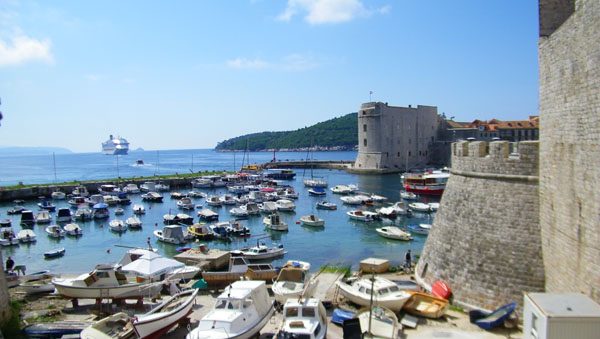
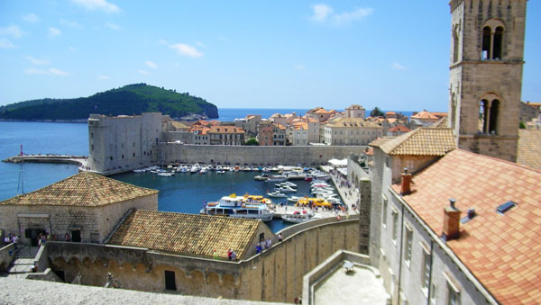
Eventually, we reached another "point" along the wall walk where we turned in a different direction, but this turn was more gradual, to take the walk almost directly eastward along the coast of Croatia. You might note that you can see that same cruise ship docked in the sheltered harbor that we saw earlier from the bus tour. And at the point where this section of the walk ended, there was a turret with commanding views of the Adriatic- complete with an old cannon emplacement.
Click on the thumbnails below to see a selection of views from this part of our walk:
|
|
Section 3: Walking Atop the South Side of the Old City Walls
From the end of our second segment, the path atop the city walls headed pretty much directly east, with the Adriatic south of us. (Although the coast of Croatia actually goes generally southeast, at this point, at Dubrovnik, it is much more east than south. )The walk made a number of small jogs, and actually passed through or around a couple of outdoor cafes which, during the day, are set up in the wide areas of the path. All along this part of the walk we were looking eastward along the Croatian coastline.
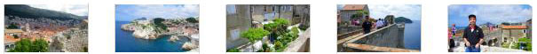
There were no towers or anything for us to climb, but there were a number of overlooks that enabled us to see the path ahead of us to the east as well as behind us to the west. We took quite a few pictures as we walked along, and I have put clickable thumbnails for the best of these below:
|
|
|
|
I also took a couple of movies, one at the beginning of this segment and one towards the end. You can watch them with the players below:
|
Looking Back Up the Dalmation Coast |
Walking Ahead to the East |
Section 4: East Side and Harbor
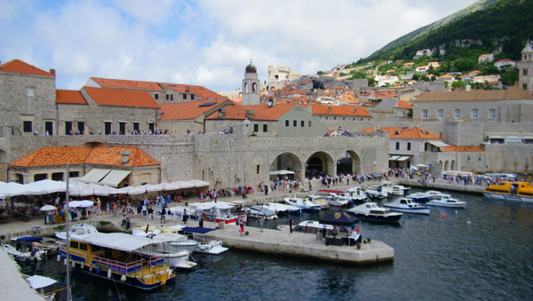
The next section of our walk took us north to a large observation plaza on top of the walls, just west of the harbor's southern breakwater.
There we got good views of the old city, and particularly the harbor frontage of the city hall. We could look north along the harbor to the area outside the city walls where we first saw the harbor a bit earlier and from which point we looked across to where we are now. You can see that spot here. The walk led down some stairs and through a short tunnel and we found ourselves walking towards the Dubrovnik Cathedral and its bell tower. Along here there were good views of the harbor (below, left) and, after we turned north just near the Cathedral, we could see the bell tower of the San Sebastian Church that we visited earlier.
|
|
|
At the church, we headed north again, alongside the harbor. It might have been nice when we were down in the city to have walked through the city hall and out to the harbor side, but there just wasn't time. The walk along the top of the walls led in something of a zig-zag fashion up to the north to the northeast corner of the old city. At a number of places, the walkway wasn't actually on top of the walls, but it might take a jog in towards the city, perhaps going around some building or other. At these spots, the walk was literally hanging off the side of those structures, as you can see here. Since the land was sloping upwards, the walls rose as well, so there were quite a few stairs to get us up to that corner.
|
|
|
Section 5: The North Wall
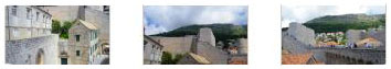
From the northeast corner of the city, high up on the wall, we had excellent views of both the harbor and the city- as well as the modern city stretching up the hillsides. It was also interesting that from up here on the walls, we could see behind the buildings lining the narrow streets of the north part of the old city, and this gave us a different perspective. For example, we could see that there were areas containing ruins that either weren't going to be or hadn't been restored. The last major segment of the walk was to negotiate the relatively straight (if not relatively level) section that would take us to Minceta Tower, a major fortification at the extreme northernmost (and almost westernmost) corner of the old city.
|
|
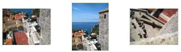
And below are thumbnails for some of the pictures we took while walking along the north wall:
|
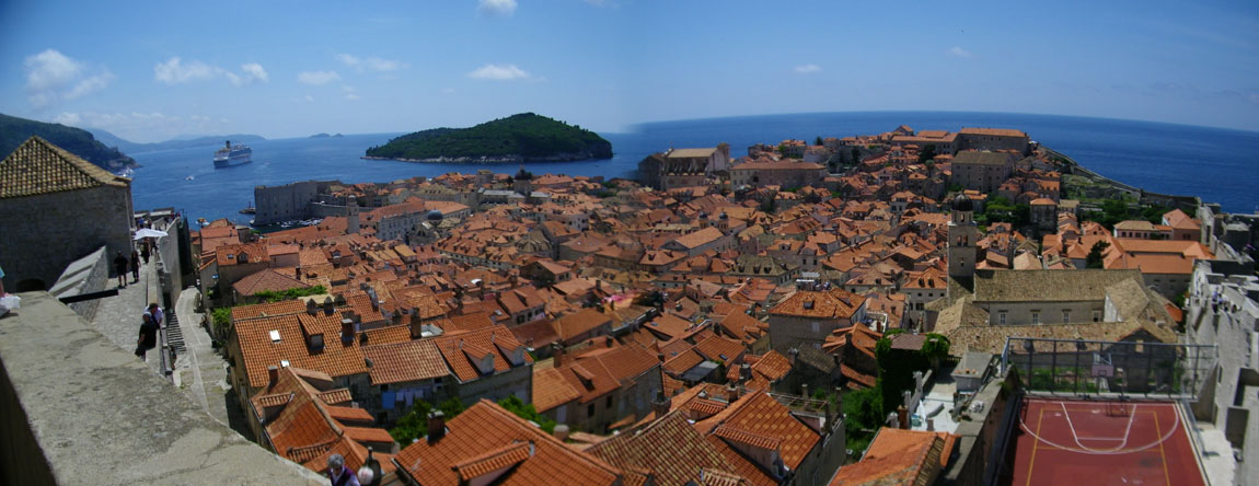
From a point near Minceta Tower, Fred used his camera to take and stitch together two pictures for an excellent panoramic view of Dubrovnik's Old City; that view is below:
|
I took a number of pictures too, coming across the north wall. Clickable thumbnails for some of these are below:
|
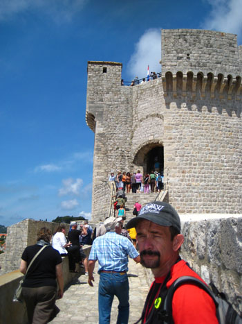
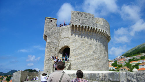
Section 6: Minceta Tower and the Circuit is Completed
The Minceta Tower was built by a local builder named Nicifor Ranjina and Italian engineers sent by Pope Pius II in 1463, at the height of the Turkish threat.
|
In the middle of the 15th century, around the earlier quadrilateral fort, Michelozzo built a new round tower to take into account new techniques of warefare, and joined it to the new system of low scarp walls. The full 20-feet-thick walls of the new tower had a series of protected gun ports. The architect and sculptor Giorgio da Sebenico of Zadar, continued the work on the Minceta tower. He designed and built the high narrow round tower, while the battlements were a later addition. The tower was completed in 1464, and became the symbol of the unconquerable city of Dubrovnik. Since it is the highest point of the wall, it is considered to offer a seemingly "unforgettable" view of the city.
|
Soon, we could see the tower just up ahead of us. There was a stairway up into it and, obviously, some interior stairway to get up to the top. So that's where we headed next.
|
|
|
|
I left the top of the tower to meet Fred at the bottom, so we could head south along the west wall of the city and back to our starting point. We walked south along the wall, and we could get a good look back at Minceta Tower. Another interesting view was down below us in the old city at an old building that had, apparently, lost its roof; you can see that view here.
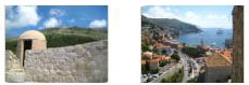
Below are clickable thumbnails for some of the best of the last views we got along the wall on the west side of Old Dubrovnik; have a look at as many as you would like:
|
|
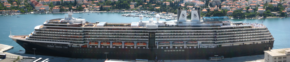
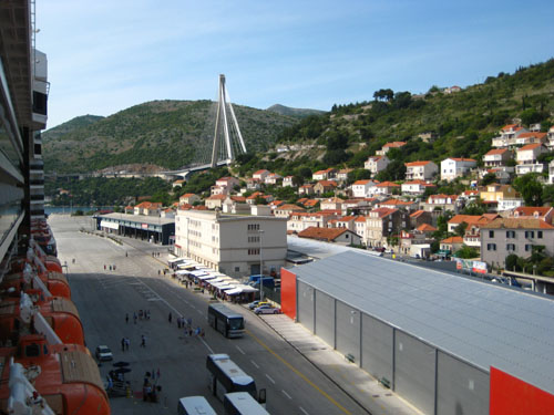
There is not much to say about our return to the ship. We were out of the Old City and back to the plaza in plenty of time to meet our tour bus, which then took us back through town to the dock. We went aboard the Noordam and had some lunch. Greg wanted to stay on board and go to the spa, but Fred and I thought we would see if we could get up to Dubrovnik's Calatrava bridge that we saw when we came into port and which was now quite near the port, just behind and to the northeast of the ship.
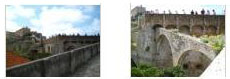
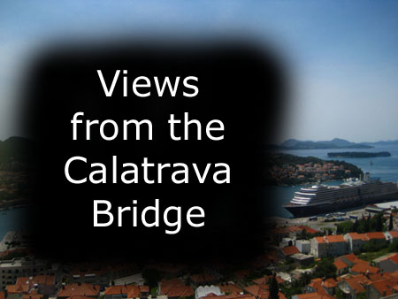
Walking to Dubrovnik's Calatrava Bridge
After lunch and a bit of downtime, we watched another ship leave the harbor, and then left our own ship again to head over to the Calatrava Bridge nearby. Before we headed off, I got a picture of Fred on the dock. As you can see, there was another ship docked right behind ours; it had come in after we arrived this morning.
|
|
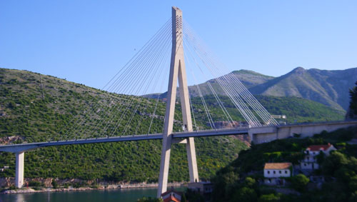
The view of the bridge that we got in the early morning was really spectacular, and we were looking forward to seeing it up close.
Walking Underneath the Bridge
We left the harbor area, and then walked along the harborside street towards the bridge. As you can see, the hillside to our right was very steep, and we were beginning to wonder whether there would be a way up when we got to the bridge.
|
|
I stopped to make a movie of the bridge from this vantage point, and you can watch it with the player at left.
We decided that since we could see the highway that crossed the bridge high up the hillside from the decks of the Noordam, that there had to be a way up to that road from the harbor. We didn't see such a street from the ship, but expected that we could find one if we walked back southeast towards town. So we turned around and headed back. (Just before we left the area underneath the bridge, I saw an interesting catering truck; I found the name of the catering service to be puzzling, and still haven't figured it out. I know what the Latin term means, but to use that as a business name seemed wrong somehow.
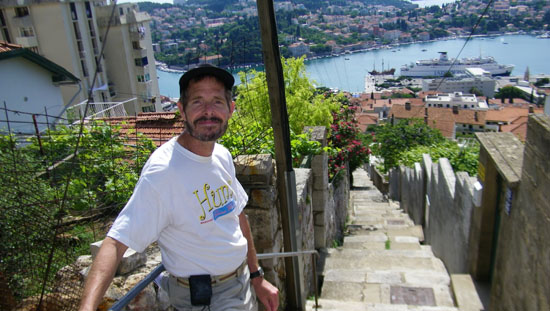
As we walked back past the ship, we found lots of little alleys (actually stairways) that led up the hill, but they all seemed to end after a while at one house or another. So we continued walking towards town until we finally did find a way up.
The Way Up to the Highway
So, from our position underneath the bridge, we walked back along the harborside street, back alongside the Noordam, and on towards the city center of Dubrovnik. Shortly, we found a street that angled up the hill, and we tried that. A few block later we saw, to our left, a long, continuous stairway that led directly up the hill to the highway leading to the bridge.
|
The climb up the stairs was easy at first, but in the afternoon sun it got quite strenuous as we neared the top. Along the way, there were some interesting views of the houses and gardens we passed, and out to the harbor as well. There are clickable thumbnails below for just a few of these views.
|
Eventually, we did reach the top and turned left to walk along the highway towards the bridge.
The Highway to the Calatrava Bridge
When we got to the top of the stairs, we were on a section of the highway lined with houses and little businesses; on the downhill side, the houses were almost all below grade, with stairs down to them, and in some cases steep driveways down to small garages.
|
|
As you can see, the day was very nice, so most of the pictures turned out well.
I also tried my had at another panorama- this time by stitching together four pictures of our ship, the Noordam. You can see the result below:
|
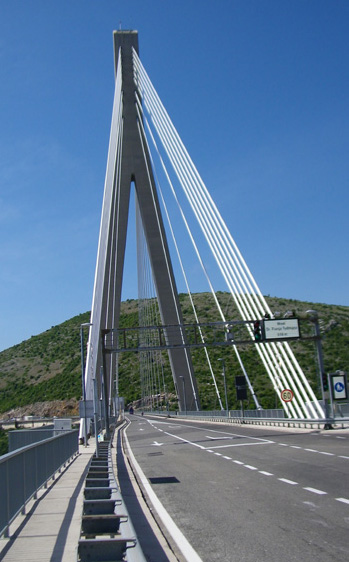
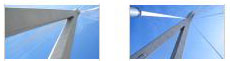
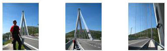
At the Calatrava Bridge
The walk down the highway was about a half-mile, until we came around a curve and saw the Calatrava Bridge ahead of us.
|
|
|
We walked out onto the bridge and got great views out to the Adriatic and up the Croatian coast. On the land side of the bridge, there was a beautiful view of the long, thin inlet that is spanned by the bridge. At first, we thought that this was the mouth of a river, since we couldn't see the end of the body of water when we stood on the bridge. Later, we learned that this finger of water extends more than two miles inland, eventually ending at the base of the mountain range that parallels the coast. The bridge was built so that traffic going north and south along the coast would not have to follow the two-lane road that hugs the shore of this inlet all the way around. The bridge cuts six miles and about half an hour off the trip along the coast.
From the south end of the bridge there were also very nice views back towards our dock and the Noordam.
Returning to the Noordam
After we'd seen about all there was to see of the bridge and the area around it, we turned to retrace out path back to the ship.
|
|
By four o'clock, we were back on the ship, and preparing to watch from the decks as the ship left Dubrovnik.
The Noordam Leaves Dubrovnik
There is not a great deal to say about our sail out of Dubrovnik. When Fred and I returned from the Calatrava bridge, we had time for a quick snack before we were up on deck to watch the ship depart. When I got up to the dock side of the upper deck, the last buses were pulling in to drop off ship passengers; some of these were going to the ship docked behind us. I got good views both towards the bridge and towards town:
|
|
As we sailed slowly out of the harbor, Fred tried his had at a couple of panoramic shots, allowing his camera to stitch some pictures together. Here are a couple of his better efforts:
| |
|
Fred also took a variety of interesting pictures of the harbor as we left Dubrovnik, and there are clickable thumbnails below for some of these pictures:
|
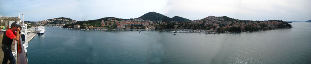
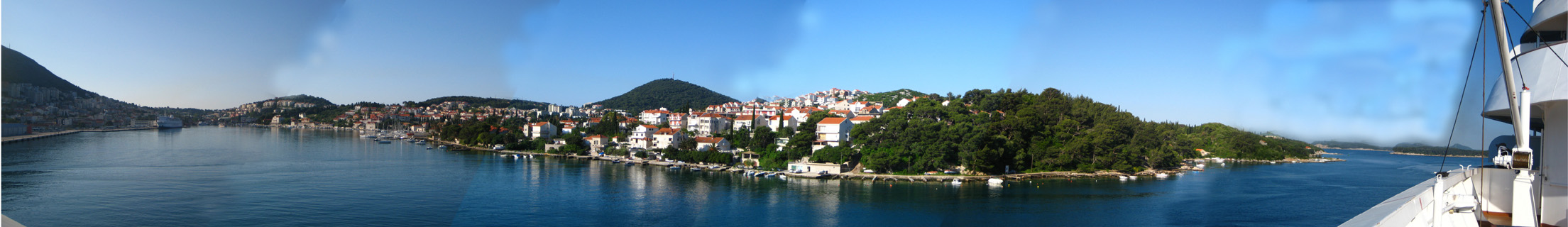
I, too, tried my hand at creating some harbor panoramas, although I had to take multiple pictures and use software to merge them together later. Here are the two best panoramas that I created:
| |
|
Evening Activities
Our evening on board, as we sailed down to Corfu, Greece, was pretty uneventful, occupied mostly by our routine of the gym, the LGBT gathering, dinner, and a short attendance at the show- a comedian by the name of Rikki Jay (who was not particularly amusing, as I recall).
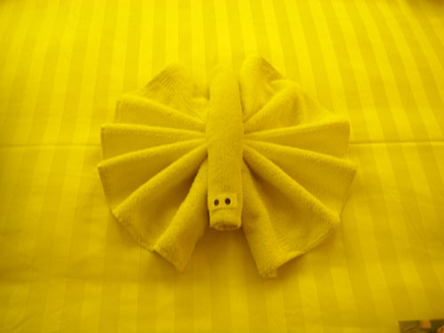
This Evening's Towel Animal
|
I also can't identify what this animal was supposed to be, but maybe you can.
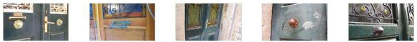
The Doorknobs of Dubrovnik
Continuing Fred's accumulation of pictures for his collection of doorknobs, he found a few interesting ones as we wandered through the old city and later on when we went up to the Calatrava bridge. There are clickable thumbnails below for these pictures:
|
You can use the links below to continue to another photo album page.
|
May 21, 2012: Kerkira (Corfu), Greece |
|
May 19, 2012: A Sea Day |
|
Return to the Index for Our Mediterranean Cruise |