|
May 22, 2012: Olympia, Greece |
|
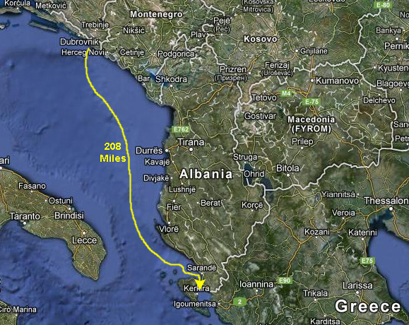
May 20, 2012: Dubrovnik, Croatia |
|
Return to the Index for Our Mediterranean Cruise |
|
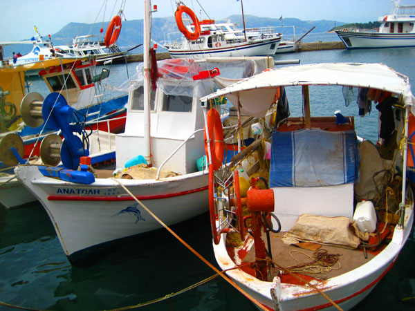
When you look at the ship's log, I thought it was interesting that this was one of the few ports that didn't require a Port Authority pilot to come aboard. I guess simply anchoring isn't all that tricky.
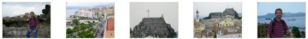
We Arrive in Corfu
|
|
Corfu is the second largest of Greece's Ionian Sea Islands and it forms the edge of the northwestern frontier of that country. The island is administered as a single municipality; the principal city of the island and seat of the municipality (pop. 33,886) is also named Corfu.
The island's history begins in Greek mythology. Its Greek name is related to two powerful water symbols: Poseidon, god of the sea, and Asopos, an important Greek mainland river. According to myth, Poseidon fell in love with the beautiful nymph Korkyra, daughter of Asopus and river nymph Metope, and abducted her. He brought her to this hitherto unnamed island and, in marital bliss, offered her name to the place. Together, they had a child they called Phaiax, after whom the inhabitants of the island were named; this name was transliterated via Latin to Phaeacians.
The island's history is laden with battles and conquests. The legacy of these struggles is visible in the form of castles punctuating strategic locations across the island. Two of these castles enclose its capital, which is the only city in Greece to be surrounded in such a way. As a result, Corfu's capital has been officially declared a Kastropolis ("castle city") by the Greek government. Corfu was long controlled by Venice, which repulsed several Turkish sieges, before falling under British rule following the Napoleonic Wars. Corfu was eventually ceded by the British Empire along with the remaining islands of the United States of the Ionian Islands, and unification with modern Greece was concluded in 1864 under the Treaty of London.
In 2007, the old part of Corfu was designated a UNESCO World Heritage Site. It is now a very popular tourist destination, although, up until the early 20th century, it was mainly visited by the European royals and elites, including Emperor Wilhelm II of Germany and Empress Elisabeth of Austria. Today it is also widely visited by middle class families (primarily from the UK, Scandinavia and Germany), leading to mass tourism. It is still popular with the global elite however, and in the island's northeast the homeowners include members of the Rothschild family and Russian oligarchs.
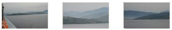
Having reviewed this history last night, we discussed it at breakfast. While we were eating, the ship was anchoring. Our shore excursion was going to meet in the Vista Lounge just after nine, so we had a few minutes to go up on deck and watch the process.
|
|
We got our stuff together and headed down to the Vista Lounge to await the call for our shore excursion.
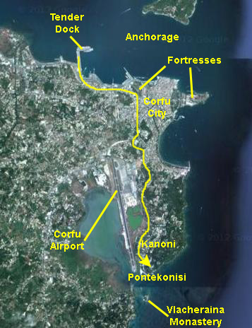
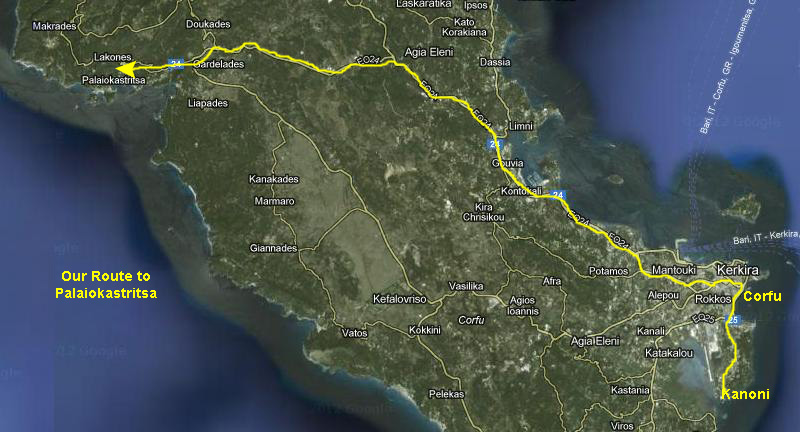
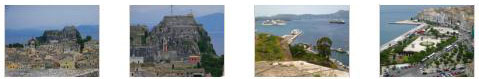
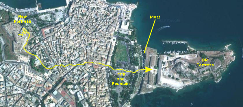
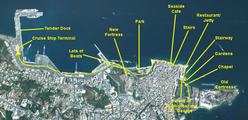
The excursion today is going to take us to three different places on the island of Corfu. First, we will head south through the city of Corfu to a small point just above the international airport- the hilltops of Kanoni. From here, we will get some good views south along the island coastline. Next, the bus will take us back through the city and across the island to the northwest to the seaside town of Palaiokastritsa. We'll visit both the village and the monastery on the hilltops above it. Finally, the tour bus will bring us back to the center of town, leaving us off on the park by the harbor. Our tour guide will take us on a walk through the city, and then leaves us on our own to visit whatever we'd like to see. Fred and I will visit the two fortresses that flank the city on the north and south- the old fortress to the south and the new one to the north. Then we'll make our own way back along the harbor to the tender dock.
There will be separate sections below for each of these stops we'll make.
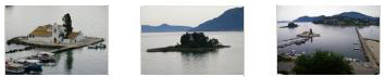
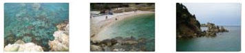
Pontikonisi and the Vlacheraina Monastery at Kanoni
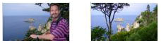
Once we were on our tour bus, our guide laid out the morning's trips that we would make. We would first head south through the city to the hills at Kanoni. There, we would be treated to wonderful ocean views and a view of the Vlacheraina Monastery, which is situated on an island just off the coast.
|
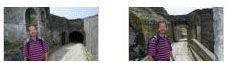
Our route didn't make much sense to me; I hadn't looked at a map or a view like the one at left. We just snapped pictures of whatever seemed interesting as we rode in the bus- but there wasn't much in the gray morning light. Fred did get one nice picture of what later turned out to be the Old Fortress. Later in the day, when we visited it, we went into the Parthenon-like structure that you can see here.
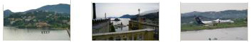
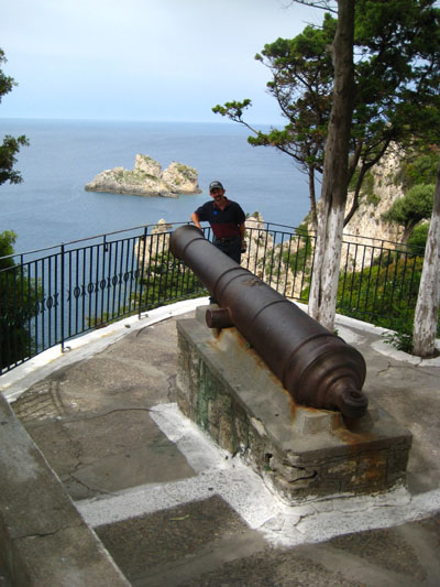
When our bus arrived on the hilltop above the inlet of Pontikonisi, we got off to wander through what appeared to be a restaurant and resort, which I assume had allowed the tour company to use its patios and overlooks as a stop on their tour. I don't know why, but there was an old cannon on display. And we were right next to the airport, and while we were wandering around, a couple of small planes landed.
|
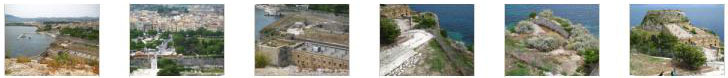
You can match up some of the pictures we took to that aerial view when you use the clickable thumbnails below to have a look at them (including a nice closeup of the monastery):
|
I guess we spent a half-hour or so here at Kanoni before getting back aboard the bus for the trip back through Corfu and across the island to the village and monastery at Palaiokastritsa.
A Visit to Palaiokastritsa and the Monastery
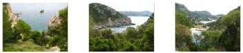
The ride across the island to the village of Palaiokastritsa took about 45 minutes, as we went back through Corfu and then northwest across the island. The distance was about 20 miles, but we had to go pretty slow through the city.
|
The monastery is actually perched on the top of a hill just west of the small bays where the townspeople live. The road is one-way for buses, and they have a system that controlls access so buses don't have to pass each other on the narrow road to the top. We had to stop for a few minutes and wait our turn to head up. As our driver took the bus up the narrow road, we were all thankful that we didn't have to deal with anything larger than a small car passing us on the road. There was precious little room for even that. The trip up took just a few minutes, and soon we were getting off the bus bus in the parking area for the monastery.
|
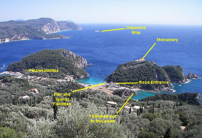
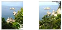
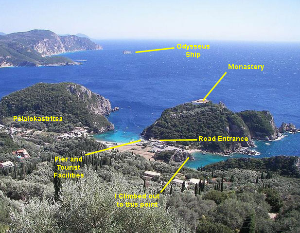
The views shows you clearly the relationship of the monastery to the village, and I have marked some of the points of interest (or places that I did actually get to) on the beautiful view of the bay of Palaiokastritsa. The rock in the sea visible near the horizon at the top center-left of the picture is considered by the locals to be the mythical petrified ship of Odysseus. The side of the rock toward the mainland is curved in such a way as to resemble the extended sail of a trireme. The historic monastery of Palaiokastritsa can be seen at the top of the hill of the peninsula to the right of the picture.
I hope that you'll return to this picture when you see views of the coast taken from the monastery, and when we return to the bay to spend a bit of time (a "shopping and dining opportunity," our tour guide called it) wandering around the main bay of Palaiokastritsa. I think that if you do, it will help put things in perspective, and give you more of a feeling that you were there, too.
We followed our tour guide into the monastery, passing underneath the entrance gate, which had a mosaic of the Virgin Mary above the arch. There was a small, hand-lettered sign to the left of the doorway, and if you would like to read it, just click here.
|
|
|
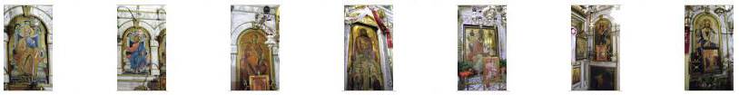
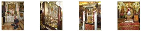
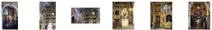
Our tour guide brought us immediately around to the right when we got to the end of the archway. There was an outside garden, but she took us right into the small church which was, at that moment, on our right. The Monastery of Paleokastritsa is dedicated to Panagia (Virgin Mary) of Paleokastritsa, and it dominates the whole region. The Byzantine Monastery dates from 1228, although the current complex, the cells of the monks and the yard date from the 18th century. The small chapel was impressively decorated; there was a frescoed ceiling and a great many mosaics and paintings of religious figures all around the walls. Fred took a number of excellent pictures inside the chapel, and there are clickable thumbnails below for some of them:
|
The name of the Monastery Paleokastritsa is derived from a local phrase "Paleokastritissa". This phrase was applied to the temple of Virgin Mary in the 15th century when a historic document, written on the 7th of August 1497, was recovered that referenced the temple as a "Paleokastro". The word translates into "old castle" indicating the existence of a previous fortress constructed on the grounds pre-dating the present structures. The ruins of the castle no longer exist. In their place stands what is now the present structures that comprise the Monastery of Virgin Mary of Paleokastritsa.
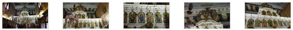
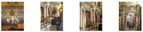
The walls, especially at the front of the church, were covered with all manner of pictures, mosaics, flowers, mementos and relics- and the section you can see here is a good example. Our tour guide and group moved slowly around the inside of the church, stopping occasionally so the guide could explain the background of some of what we were seeing. You can see our tour guide and part of our group here.
|
|
|
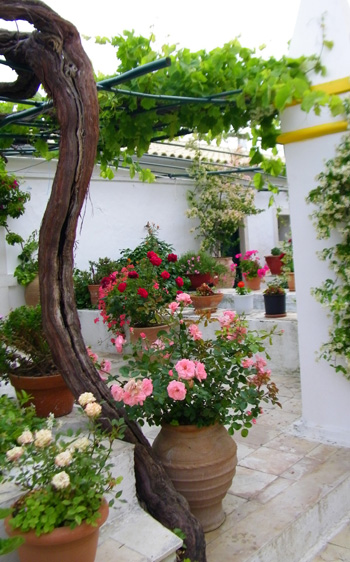
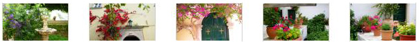
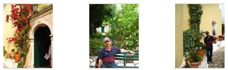
Our tour guide led us through the grounds and kept up a running commentary- a commentary that was very informative. We could only listen with half an ear, though, as we were flitting about trying to take as many pictures as we could of the chapel, the grounds and the impressive views. Just outside the chapel there was a small garden with a pergola. There was lots of bougainvillea and other plants, plus two small fountains, colorful mosaics and some statuary.
|
|
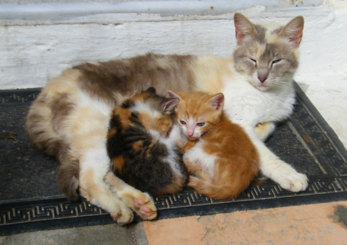
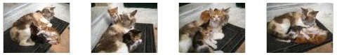
Before we left the garden area and walked underneath the chapel bell tower to get out to the patios where we could take in the views, we stopped to investigate some of the other residents of the monastery.
|
|
There was also a small orange cat that let me get close enough so that Fred could get a good picture.
We left the garden and walked out to the area that was made up of outdoor patios and balconies and which offered views of the Corfu coastline.
|
|
When we were done looking around and photographing the views, we headed back down to the bus parking area. There were a couple of vendors up here selling trinkets, and I thought one of the displays was colorful. We reboarded the bus and presently headed off back down the hill for our stop at the little bay we'd passed earlier.
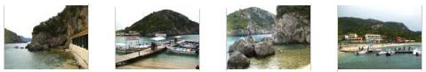
When the bus got to the bottom of the hill, we turned off into a large parking area and disembarked. Our tour guide pointed out the little restaurants and coffee shops, the combination chapel and vendor market and the two little bays; she then went to the little cafe to have herself a coffee and wait for us to wander around for a while.
|
There was a little beach right by the bus park, so we walked over there first. I went and climbed up on some rocks at the south end of the beach to take a few pictures. Fred was taking some pictures of hillside houses, and he also snapped a picture of me walking over to the rocks and also one of me on the rocks taking my pictures. From the top of the rocks, I could see a long way down the rocky coastline; I also took a few pictures looking around at the water and the coast; click on the thumbnails below to have a look:
|
Next, we walked over towards the little cafe and had a look inside the little chapel; after the decorated chapel at the monastery, it seemed very plain.
The little coffee shop was adjacent to the chapel, hugging the east side of the small bay. Nearby, there was a pier where the small tourist boats that take people on short boatrides along the coast and out to some small caves docked. It was pretty busy. I went up onto the restaurant's verandah, which afforded me some good vantage points for looking at the harbor area, and I took a few pictures. Click on the thumbnails below to have a look at them:
|
(On my way through the restaurant, I noted a couple of other items- one was an interesting ship model that one of the waiter's told me the owner had built. The other was, apparently, the restaurant mascot. He didn't say much, but he did screech occasionally.) Eventually, we were all back on the bus and heading off for our return trip to Corfu.
Walking Through Corfu
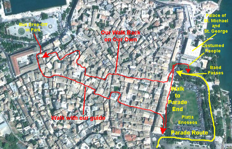
After a short, pleasant return trip (during which our guide talked non-stop), we arrived back in the bayside park on the north side of the downtown area of Corfu. Here, our guide explained, we would begin a walking tour through town. Officially, she would guide anyone who wished through the center city area, returning to the bus in an hour for the return trip to the pier. For those who wished to sightsee on their own, the bus would return to the park periodically through the afternoon to shuttle excursion members back to the dock. She also pointed out the way we could walk the fifteen minutes back to the dock on our own, if we wished.
|
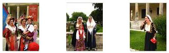
I'll try to put our pictures in perspective using the aerial view at left. I've marked the route we began with our guide, although we left her before getting to Platia Enoseos. There, we found there was a parade going on. We couldn't see it very well, so we walked north towards City Hall, there to encounter a group of locals in national costume who obligingly posed for pictures. We also saw some of the parade units end up here. Then the three of us walked back toward the bus drop-off.
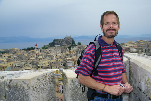
But for now, we'll follow our guide. While everyone was getting off the bus and congregating around the guide, I had a chance to get Fred to stand by the fountain in the middle of the park (not on, sadly) so I could get a picture of the new fortress (by the end of the day we knew that's what it was) in the background. Then we crossed the street into the city and were off.
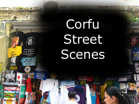
Walking through Corfu was very interesting. We found Corfu similar to Cadiz, in that the streets were all very narrow but because we were here on a weekday, all the shops were open and the narrow streets were much more crowded.
|
|
To view the slideshow, just click on the image at left and I will open the slideshow in a new window. In the slideshow, you can use the little arrows in the lower corners of each image to move from one to the next, and the index numbers in the upper left of each image will tell you where you are in the series. When you are finished looking at the pictures, just close the popup window.
There were a number of small churches and chapels that we passed, but nothing as ornate as a major cathedral. While Greece has a large Catholic population, it is not nearly so Catholic-oriented as, say, Italy or Spain. One of these chapels was very nice inside, and we took some good pictures; there are clickable thumbnails for them below:
|
|
|
I also made a movie just walking down towards the parade; it's not particularly interesting, but you can watch it with the player at left.
We couldn't actually get close to the parade; the crowd was too thick (and some folks were watching from their balconies is nearby buildings. But we did take some pictures here by the park; there are clickable thumbnails for some of them below"
|
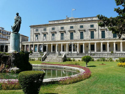
Since we couldn't see the parade, we just turned and walked along the park to the north, getting a good view of the bell tower of Corfu's largest chapel (the same one whose interior pictures you saw earlier), and another statue alongside the park. We were heading to what I thought was City Hall, but which turned out to be the Palace of St. Michael and St. George.
|
Today the palace houses the Museum of Asian art of Corfu. The collection of the museum started in 1927 and consists mostly of donations, the largest being from Gregorios Manos with 10,500 pieces. The palace is designed in the Regency style by the British architect George Whitmore, who was a Colonel and later a Major-General in the Royal Engineers. It primarily consists of white Maltese stone. The two gateways which flank the palace are the gate of St. Michael and the gate of St. George, and there are matching wings on either side. Just now we got a picture of the West Wing, and later in the day we came around the other side of the palace by the East Wing. The state rooms consist of a grand staircase, a rotunda in the centre leading to two large rooms, the Throne Room and the state dining room. The Palace was renovated for the European Union Summit meeting in 1994.
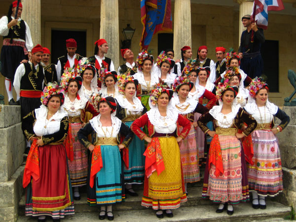
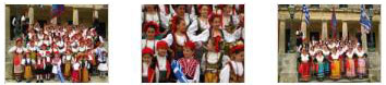
What we found when we got close to the palace was that there was some sort of gathering of Greeks in traditional costumes- undoubtedly tied into the parade.
|
|
As the costumed folks were breaking up, one of the parade units came by- a marching band. Apparently, this was the end point for the parade, as the band broke up amidst the constumed folks. That gave me an opportunity to photograph some individual participants. I also made two movies- one of the costumed folks and one of the band- and you can watch either or both of them with the players below:
|
The Costumed Folks Breaking Up |
The Marching Band |
It was getting on towards the time that our guide said that the bus would depart for the ship, and Greg wanted to get back on board, so the three of us began our return walk through Corfu to the park where the bus was waiting. Fred and I planned to stick around for a while and explore the two fortresses that bracket the old city of Corfu. We took a somewhat different route back through town, and you can see the approximate route marked on the aerial view above.
Along the way back to where we left Greg, we took the occasional picture of whatever seemed interesting. There were no monuments or famous structures along our walk, but just the normal, everyday life of the people of Corfu. I have included these pictures in the slideshow you saw earlier. We left Greg near where we'd first begun our walk through town, and Fred and I continued a bit further west, eventually finding out way to the narrow street leading to the New Fortress.
The New Fortress
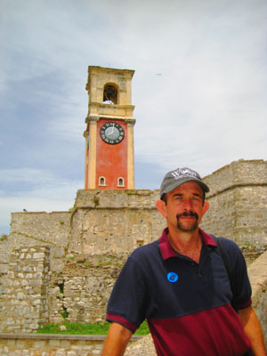
|
The fortress overlooks the town from the western part, between the Old Fortress on the east and the New Port. It was constructed by the engineer F. Vitelli from 1576 to 1645 and it is situated on an almost exclusively artificial hill. It is an excellent example of military architecture in the age of gunpowder, with an angular, linear, voluminous construction, and internal tunnels. This fortress is smaller and much different than the Old one, but was almost equally successful- its last contribution to the security of Corfu being the repulsion of the last attacks of the Ottoman army on 9 and 10 August, 1716. The morning of 11 August was one of the most welcome in Corfu history, when the guards at the fortress saw that the Ottoman camp had been abandoned, the siege had been terminated and they spread the good news to all the Western world. This event is still celebrated to this day.
The view from its top is impressive, offering expansive views all across Corfu and the bay to the north. For some reason, on the level just below the top a bar has been opened, and from its outside seating area patrons can enjoy the beautiful views of the Old Town until late into the evening. If you want to see an excellent example of the views from the top of the fortress, just have a look at Fred's panoramic view below:
|
The park where we were left off earlier is at the left, and the structure in the far background, on the other side of the city, is the Old Fortress, and we will visit it next.
|
|
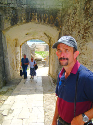
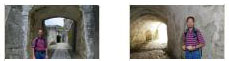
From this overlook, the pathway to the top led through a tunnel passageway that you can see in this picture behind Fred, so that was the next portion of our ascent. We headed through the tunnel which brought us to a set of ramps that led up to the next level- the level where the bar at the fortress is located.
At the bar level, there is a wooden platform and some seating; it didn't look as if the bar was open this time of day, though. There is a raised platform that is separate from the larger fortification; it must have been a lookout of some kind at one time. We took a good picture of it a bit later from inside the fortification, and you can see that picture here. I climbed the stairs up onto that perch, and took this picture of Fred back on the bar level- as well as a picture of the park below us in Corfu.
|
|
|
Movie Title |
Then, from this level, we took a curved inside stairway that brought us up through a turret and out onto the top of the fortification. The top of the new fortress was, as you would suspect, a broad open area with low walls running all around it- affording defenders shelter from unfriendly fire while allowing use of their own cannon for defense. There were wood planks around the inside of some of the walls, and you could get up on these for a better look at the city or the countryside to the northeast. Obviously, there was a commanding view of the harbor, but there were also unobstructed views of Corfu as well.
One thing I did here at the top of the fortification was to take a series of pictures beginning looking south and swinging all the way around to the northwest. Then I stitched them together into a panorama, so that you can stand on the top of the new fortress and look at the scenery basically all the way around. Use the scrollable window below to have a look at Corfu and its harbor as seen from the old fortress:
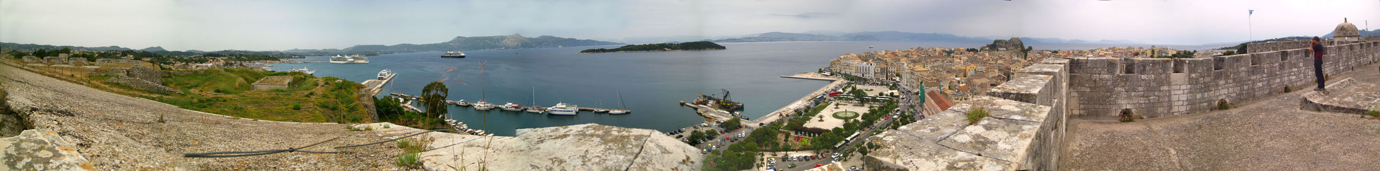
There were really great views from the top of the new fortress- particularly looking across Corfu to the old fortress (which we will visit next).
|
|
After spending some time here at the top of the fortress, we concluded our visit by heading back down to the bar level and from there down the ramps to the exit tunnel.
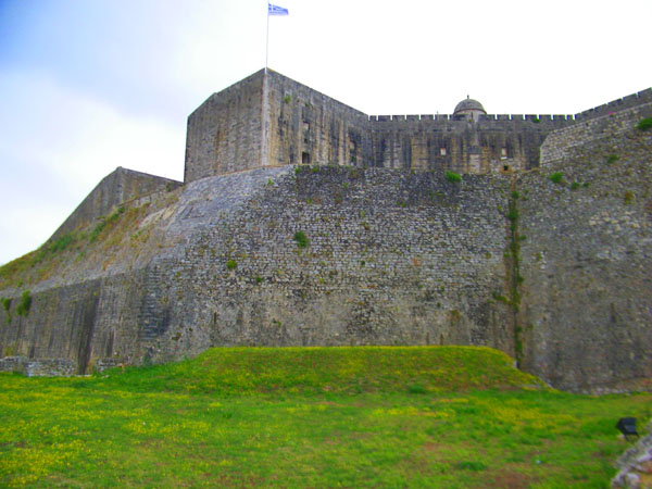
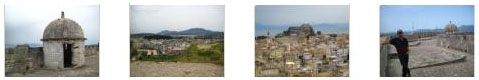
Corfu's Old Fortress
We first saw Corfu's Old Fortress from our bus window as we were coming back from our first stop this morning, and now we will head there from here at the New Fortress. This will require walking back through Corfu.
Getting to Corfu's Old Fortress
Here is the approximate route we took in coming down from the top of the New Fortress and making our way across Corfu Town to the bridge across the moat separating the Old Fortress from the town of Corfu:
|
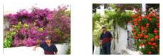
Earlier, we'd seen quite a bit of bougainvillea hanging from balconies, but we ran across a single vine that covered three stories! The only other pictures of note were a couple of interesting buildings (here and here), a typical street scene and an enticing display of chips.
We found that the park (known locally as the Spianada) was indeed quite emptied out so we stopped to admire its central fountain. We also exchanged pictures of each other with some of the plantings here in the park; here are Fred and myself. Then we came to the entrance to the Old Fortress.
Exploring Corfu's Old Fortress
|
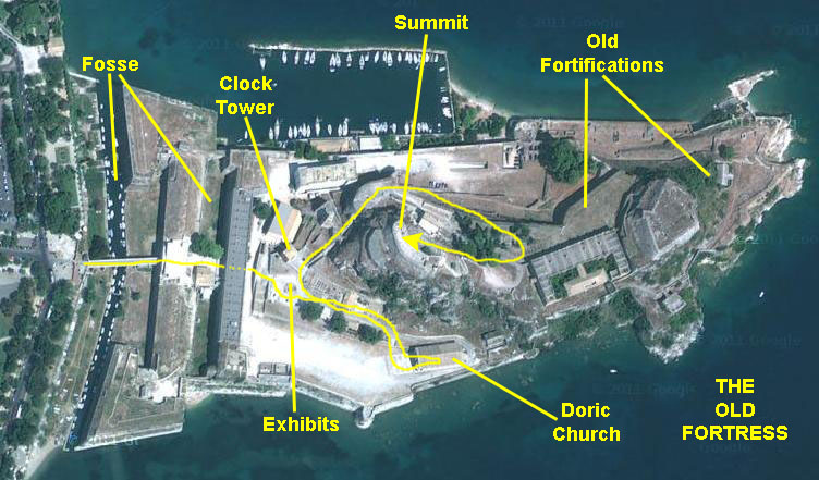
Our path did not take us to the actual old fortifications, but those are marked since you'll see them in numerous pictures we took. And I have shown our approximate path to the summit.
So let's begin our tour of the Old Fortress.
Corfu's Old Fortress: Entry and Exhibition Area
The Old Fortress of Corfu is one of the most impressive fortification works in Europe. For most visitors, who arrive by ferry, it is the first thing they see and has become symbolic of the island and the town. It stands on the eastern side of the town, on a rocky peninsula that juts into the sea. This fortress is called "Old" in contrast to the "New Fortress" (of Saint Mark)- the one we just visited that was also built to protect the town from enemies and pirates.
|
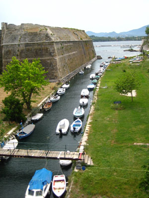
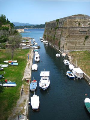
The entrance to the fortress is on the east side of the Spianada, the famous square of Corfu, which is in fact the second largest square in Europe. The entrance is arched and has a Venetian symbol above it, carved in marble. After the entrance, there are two rooms on both sides that now host the Byzantine Collection of Corfu and a gift shop. There was also the first of many old cannon that we saw here in the Old Fortress. A few steps away, there is another fosse, 65 feet wide, that was used as an additional protection measure. This one is no longer filled with water.
After the entrance, on the right, there is the small chapel of Madonna del Carmine, where persons sentenced to death were transfered in chains. The huge building in front was constructed by the British in the 18th century to host the barracks, but now it houses the Public Library of Corfu, which hosts rare manuscripts and editions.
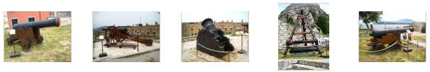
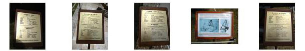
Some broad stone stairs lead to a higher flat area, where there is a beautiful polygonal well that dates from 1732. Here, we also found a number of old artillery pieces on exhibit. These pieces were pretty interesting. I took pictures of all five of them, along with their explanatory plaques. Click on one of the thumbnails on the first row below to see the piece, and then click on the thumbnail below it to read its assocciated plaque:
|
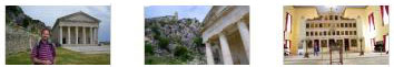
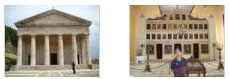
On the eastern side of the fortress, there is a flatland, used today for cultural events in summer. In this flat square, there is the church of Saint George, built by the Venetians as an ancient temple.
|
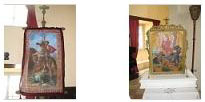
We took a number of good pictures- inside and out- and you can click on the various thumbnails below to have a look at them:
|
This is actually the only church in Greece that has been constructed according to the Doric style, and it was pretty intersting to walk through. We went up the stairs from the flat area around the church back to the level where the exhibitions were. There was also a little restaurant here. For more than four centuries, this fortress had been the symbol of the Venetian occupation in the Ionian islands and today it is one of the most impressive sights on Corfu.
|
|
The path wound around to the to the north side of the promontory where we began to get wonderful views of Corfu and its harbor, looking past some of the buildings that date to the turn of the century, when the fortress was used to defend the city from pirates. There were also the ruins of older structures that date from the seventeenth and eighteenth centuries. This brought us around to the east side of the peak, and now the trail began to climb steeply to the top of the fortress.
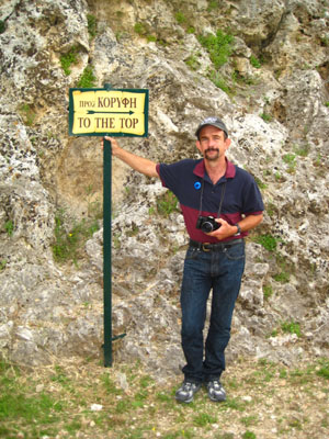
Another ten minutes on the steep, switchback path brought us to the highest point of the fortress.
|
|
Some Medieval accounts tell us that this peak, named Citadella, was inhabited and had some houses, churches, water cisterns and storehouses for gunpowder. In fact, in 1499, 1800 people were living in Citadella. Unfortunately, an explosion in 1718 destroyed a large part of it and the church of Agioi Apostoli.
I don't know how old it was, but someone had taken advantage of the commanding view and the height of Citadella to build a lighthouse here.
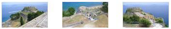
The view from here was simply beautiful, as we could see the whole town and the immense Ionian Sea in front of us, and I got an excellent picture of Fred with the harbor in the background. For the rest of the pictures, we've selected the best of them to share with you. You can click on the thumbnails below to see a selection of the pictures that Fred and I took from here:
|
|
Here is a panoramic view that Fred stitched together in his camera:
|
And here, in the scrollable window below, is a panoramic view that I stitched together from six separate pictures:
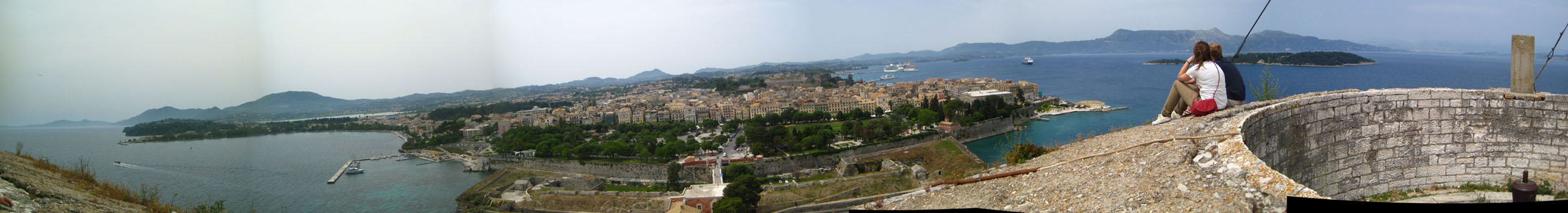
We spent quite a bit of time here at the top of the old fortress, just soaking in the views. Then we hiked back down the path to the exit from the old fortress.
Returning to the Noordam
To get back to the Noordam, we first had to walk from the Old Fortress to the tender dock. We eschewed the bus for the ride back; it was a nice day walking along the harbor. Once we got through the security building and out to the tender dock itself, then we had the actual tender ride back to the ship.
Getting Back to the Tender Dock
|
When we came across the bridge from the Old Fortress, we turned north to walk along the Corfu side of the fosse and towards the gardens of thee Palace of St. Michael and St. George.
The first building we passed turned out to be the small chapel that was part of the palace complex. Along the way there were nice views back to the fortifications of the Old Fortress.
Then we came to the gardens on the east side of the Palace and we began a walk north through the shady, well-manicured park.
|
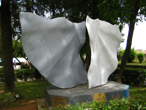
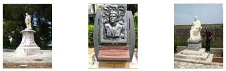
Below are clickable thumbnails for pictures of some of the other monuments and statuary that we found here in the palace garden:
|
We took a short detour over to the palace, as Fred wanted a picture of the unique base of the pair of lamps in front of the palace that we hadn't noticed earlier what with all the people around (this was where the costumed people had been). Walking back to the garden, we passed by the east gate of the palace. Continuing to the north end of the garden, we came to the cliffs above the harbor, where we had to turn west a bit to follow the shore of the harbor around behind the palace. At the cliff was a beautiful wrought‑iron circular staircase that gave access to the beach below. I wanted to go down it, but it was locked. From this vantage point, we got a nice view looking north to what appeared to be a jetty or breakwater; there seemed also to be a cafe there.
When we had walked as far north as we could go, we headed west along the shore of the harbor. Looking back, we could get a last view of the Old Fortress, and ahead of us we could see the street along the water- twenty-five feet above the water on the rocky cliff. At the point ahead of us there was a harborside cafe. We passed an interesting set of stairs that led from the street up between some buildings, I guess to give access to them, as it didn't seem to be the entrance to one particular building or another. Fred got a good picture of me on the stairs, and you can see that picture here. Between the stairs and the point of land where the cafe was, we passed another sidewalk cafe that seemed very busy.
|
|
|
|
Corfu didn't seem to be a city of many interesting doorknobs for Fred to add to his growing collection of such pictures. He found only one of note, and you can have a look at it here.
Back on Board the Noordam
At the cruise ship dock, there was a large building we had to go through; it had the security station and, of course, a bunch of duty-free shops. I took a chance and bought another bottle of Bailey's, and had no problem getting it through security and onto the ship. So much for bringing your own liquor aboard!
|
When we got on board, we went back to the suite for a while and then out onto our balcony. From there, we saw the last of the tenders brought aboard in preparation for our departure. Then we went up on deck where Fred took a number of excellent pictures of Corfu- including a really neat zoom view of the very top of the Old Fortress. You can see some of these pictures if you use the clickable thumbnails below:
|
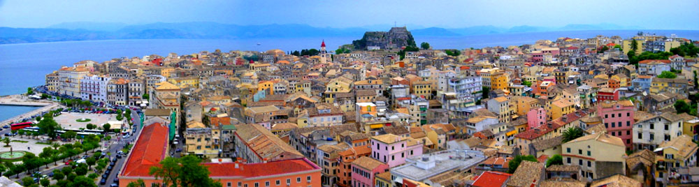
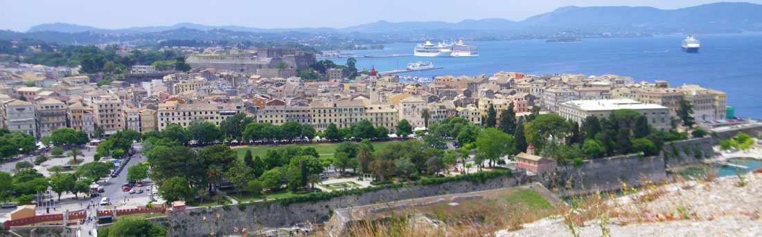
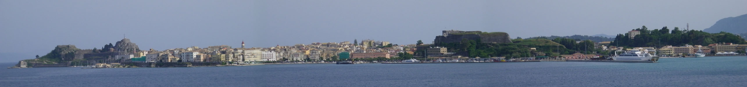
Fred also made a very good panorama of the entire harbor area of Corfu, and you can use the scrollable window below to have a look at it:
Evening Activities
This was a sedate evening on board the Noordam. We had time to visit the gym and have some wine on our balcony before heading up to the Crow's Nest for the LGBT gathering and then dinner in the Vista Dining Room. After that, Fred and I wandered the ship for a while before turning in.
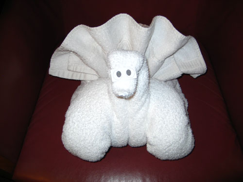
This Evening's Towel Animal
|
You can use the links below to continue to another photo album page.
|
May 22, 2012: Olympia, Greece |
|
May 20, 2012: Dubrovnik, Croatia |
|
Return to the Index for Our Mediterranean Cruise |