|
May 23, 2012: Athens, Greece |
 |
May 21, 2012: Corfu, Greece |
 |
Return to the Index for Our Mediterranean Cruise |
May 23, 2012: Athens, Greece
May 21, 2012: Corfu, Greece
Return to the Index for Our Mediterranean Cruise
|
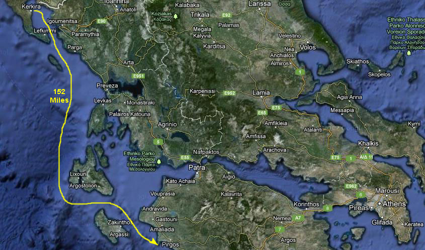
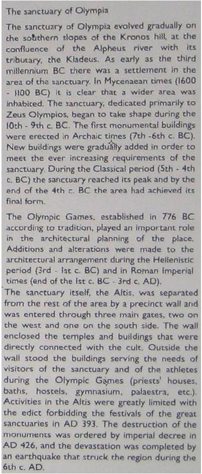
Legend aside, the ruins at Olympia, about thirty miles from our actual port at Katakolon, are among the most prominent in the ancient world and were, in fact, one of the wonders of the world. We are looking forward to seeing them.
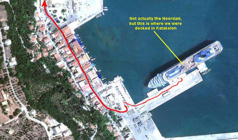
Docking in Katakolon
|
Before I went up to eat, I stepped out on the balcony where I could see another cruise ship in the early morning light, about a mile or so away.
|
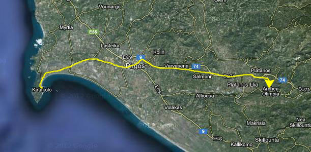
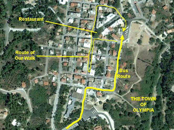
The shore excursions were the first order of the day since, unlike many ports, we'll be leaving this one in mid-afternoon instead of early evening. We should have time, though, when we return from Olympia, to tour the little seaside town itself.
So we disembarked about eight-thirty, walked down the pier to the parking area, and boarded our bus for the trip to Olympia.
The Trip to Olympia
Our shore excursion today will be a half-day trip to the town of Olympia, about twenty miles away from the port. There, our buses will let us off for our tour of the ruins at Olympia. Then, before we return, we'll have a chance to walk around the small town for a while.
|
|
The trip ended as our bus drove slowly up the town of Olympia's main street to the crowded bus parking area near the ruins. There, our tour guide, a very nice Greek woman named Esther, gathered us around her sign (which we were supposed to stick close to, an admonition that lasted all of about a half-hour). While she was giving us the info on when to be back at the bus, I stepped over to read the introductory sign nearby. It's hard to read the sign in the picture, but you can see what it had to say (all signs here at Olympia had three languages- Greek, English and, for some reason, German) if you click here.
Then our tour guide led off, and we walked down the broad entrance avenue, across the bridge over the small stream that runs along the west side of the ruins site, and to the beginning of the ruins themselves. There, we found another informational sign, and you can read it if you click here.
Touring the Ruins of Olympia
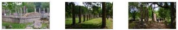
Olympia, a sanctuary of ancient Greece in Elis, is known for having been the site of the Olympic Games in classical times- the most famous games in history.
|
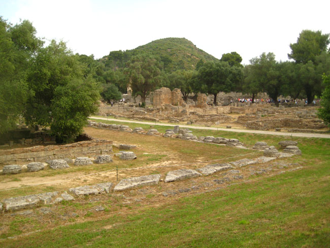
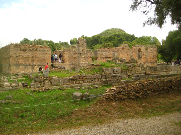
The ancient ruins sit north of the Alfeios River and southwest of Mount Kronos (named after the Greek deity Kronos and seen in the picture at left). The Kladeos, a tributary of the Alfeios, flows under the bridge we crossed as we came into the site.
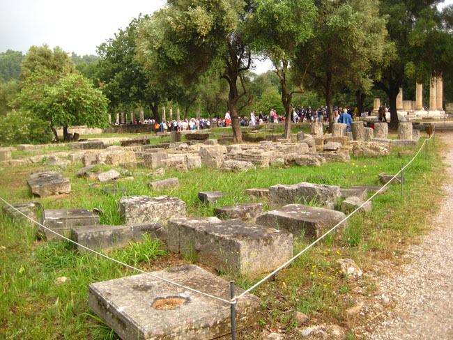
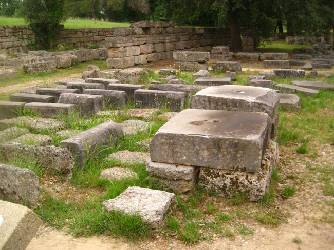
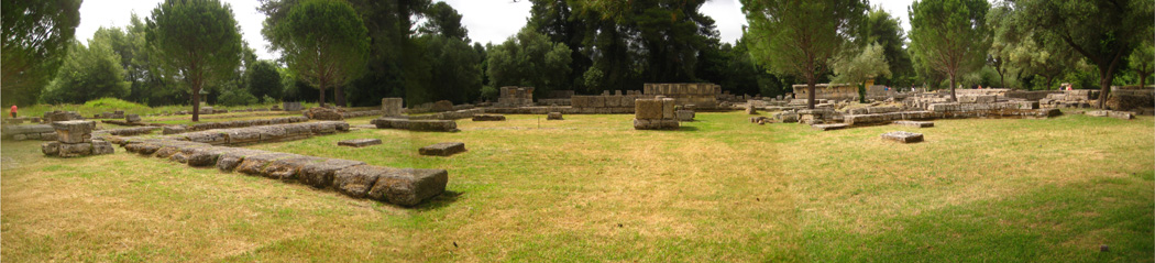
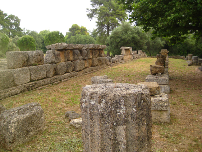
The Altis consists of an unordered arrangement of various buildings. Enclosed within this sacred enclosure are the Temple of Hera and Temple of Zeus, the Pelopion and the area of the altar, where the sacrifices were made. The hippodrome and later a stadium were to the east of the Altis. To the north of the actual sanctuary can be found the Prytaneion and the Philippeion, as well as the array of treasuries representing the various city states. The Metroon lies to the south of these treasuries, with the Echo Stoa to the East. To the south of the sanctuary is the South Stoa and the Bouleuterion, whereas the West side houses the Palaestra, the workshop of Pheidias, the Gymnasion and the Leonidaion.
|
|
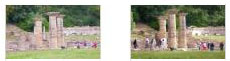
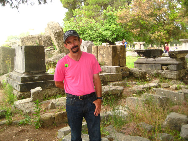
We began by following our tour guide, but keeping up with her, and getting close enough to listen turned out to be a problem, what with all the people at the site, and all the tour groups, so we eventually just went off on our own. Greg got separated from Fred and I, and then later on I got separated from Fred, but we all got back together on the bus.
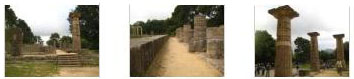
To organize the pictures we took here at Olympia, I'm going to follow the general route that Fred and I took through the ruins here at Olympia, and show you one building/feature at a time. Some of the photos we took of the same building were taken at different times or from different angles, but I think I have them all organized pretty well.
So that you can follow us through Olympia, I thought I might use a site plan, but then it occurred to me that if the aerial views available from Google were good enough, I could use those instead, which would give you a better idea of what the site is like. So that is what I did; I stitched together a large aerial view of the site so the ruins are clearly visible, and I have marked not only the specific ruins that we visited but also our approximate route and some of the spots where we stopped.
|
Now let's begin our tour around the site here at Olympia.
Northeast Propylon
When we entered the actual ruin site, we came in from the north down a broad path from the road that runs around the northern perimeter of the site.
|
|
At this point, we were at the approximate location of the north‑east propylon. A propylon is any monumental gateway based on the original Propylaea that serves as the entrance to the Acropolis in Athens. The word is the union of the prefix "pro" (before or in front of) plus the the Greek "pylon" (gate), meaning literally "that which is before the gates," but the word has come to mean simply "gate building." The most famous Greek propylon is the one on the Acropolis; another well-known and often-photographed example is Berlin's Brandenburg Gate.
 |
(I know it is hard to read the English narrative, so I have enlarged it and put it in the scrollable window at right.)
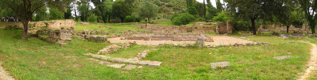
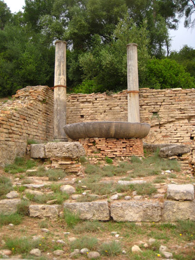
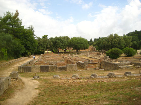
The Kronion Thermae (Baths of Kronos)
|
In the view at left, you are looking northeast towards Mount Kronos.
I stitched together three pictures of the entire Kronion Thermae site into a panorama, and you can have a look at it below:
|
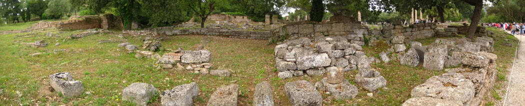
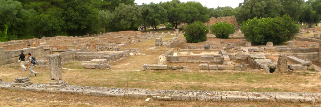
The Prytaneion
A "prytaneion" was seat of the "prytaneis" (executive), and so the seat of government in ancient Greece. The term is used to describe any of a range of ancient structures where officials met (normally relating to the government of a city). The Prytaneion normally stood in centre of the city, in the agora. The building contained the holy fire of Hestia, the goddess of the hearth, and symbol of the life of the city.
|
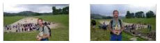
In the second century A.D. a wealthy Athenian named Herodes Atticus dedicated an exedra (fountain) to provide drinking water for visitors to the site. It was fed by an aqueduct which channeled water from a spring on the slopes of the Kronion. While we were listening to our guide, Fred took a picture of me at the Prytaneion, and I took a nice picture of him in front of the Prytaneion with the Temple of Hera in the background. You can see that picture here.
At Olympia, the Prytaneion was where the priests and magistrates lived; the high priests lived in a vanished structure called the Theokoleon. The Prytaneion also housed the Altar of Hestia where the original Olympic flame once burnt. You can learn more about the Prytaneion by reading the descriptive plaque here.
Here at the Prytaneion, I took a series of four pictures panning across the site, and then later stitched them together into a panorama. Here is the result:
|
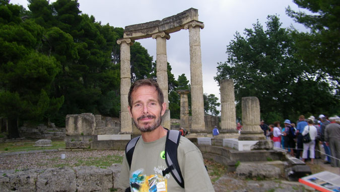
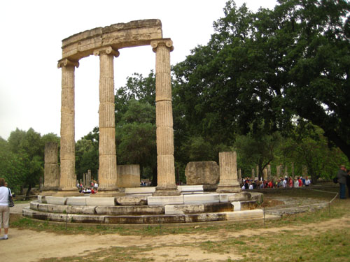
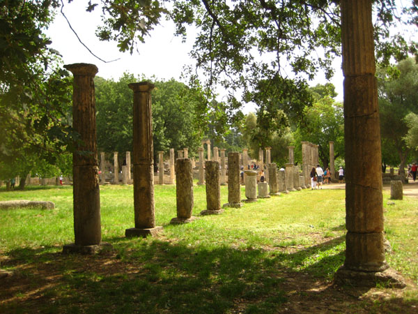
The Philippeion
Just before his death in 336 B.C., Philip II of Macedon began work on a circular monument known as the Philippeion to commemorate his victory over the Greeks at Chaeronea in 338 B.C.
|
Philip died before the structure was completed; it was finished on the order of his son, Alexander the Great, and included statues of all of the Macedonian kings (including no less than five of Alexander himself).
The Philippeion is inside the Altis of Olympia, and it was constructed in the Ionic style, using both ivory and gold (both of which materials have long since been removed). Three of the graceful Ionic columns still stand today. The Philippeion contained statues of Philip's family, Alexander the Great, Olympias, Amyntas III and Eurydice I- these statues the work of the Athenian sculptor Leochares. It was the only structure inside the Altis dedicated to a human.
In addition to the three columns that are standing, three other partial columns remain.
|
|
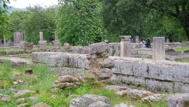
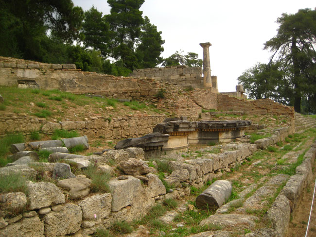
The Temple of Hera
The Heraion (Temple of Hera) is the oldest surviving building on the site (it replaced an earlier version) and one of the most important and influential structures in the history of Greek architecture. It was dedicated to the wife of Zeus and one of the most important female deities in Greek pantheon. If you like, you can have a look at the informational sign here.
|
The platform and lower parts of the walls were built out of local limestone but the rest of the superstructure was of mud brick and the original columns were made out of wood. The latter were replaced (as necessary) with stone versions� a solitary wooden one was still standing as late as A.D. 173. The individual columns vary markedly in style and even in size (diameters vary by about a foot) which shows that they were put up at different times� presumably as individual acts of piety. The Temple of Hera was destroyed by an earthquake in the early 4th century A.D., and never rebuilt.
The cella was of the type known as a hecatompedon, meaning it was 100 Greek feet in length, and had porches at the front and rear, each with a pair of columns in antis. There are two rows of four columns running the length of the cella but the builders apparently did not trust the load-bearing capacity of these, so they alternated the columns with short partition walls creating a series of alcoves along each side.
It has a peripteros of 6 by 16 columns. These were originally wooden and were only gradually replaced with stone ones. As the replacements took place at widely differing periods between the Archaic and Roman periods and were carved under the influence of their respective contemporary styles, they differ considerably in proportions and detail.
|
Reports indicate that there were two cult statues inside the cella or naos, of the temple: a seated Hera and a standing Zeus. An Archaic stone head on display in Olympia museum may belong to the statue of Hera. The building was also used to store numerous other objects, including many further statues of deities and votive offerings. Among the few of these objects to survive is the statue generally identified as the Hermes of Praxiteles, one of the most important preserved examples of Greek sculpture. The temple also held the table on which the olive wreaths for the victors were displayed during the Olympic Games. In modern times, the temple is the location where the torch of the Olympic flame is lit, by focusing the rays of the sun.
|
|
|
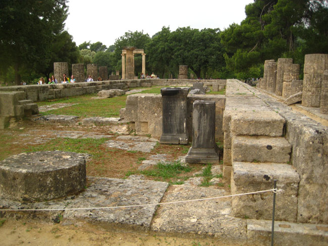
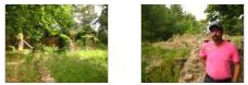
The Pelopion
The Pelopion was an open air shrine, which presumably included a sacred grove, dedicated to Olympia's founding hero- Pelops- and was located right next to the Hera Temple on the south side.
|
Actually, I wasn't sure why so many column sections were lying on the ground here; they did seem to be organized as coming from the same column. There was some restoration work going on in this area.
You can read the informational sign here.
The Nymphaeum
A nymphaeum, in ancient Greece and Rome, was a monument consecrated to the nymphs, especially those of springs. These monuments were originally natural grottoes, which tradition assigned as habitations to the local nymphs. They were sometimes so arranged as to furnish a supply of water. One famous nymphaeum, dedicated to a local water nymph, Coventina, was built along Hadrian's Wall, in the northernmost reach of the Roman Empire. Subsequently, artificial grottoes took the place of natural ones.
|
|
Lucius Vibullius Hipparchus Tiberius Claudius Atticus Herodes, otherwise known as Herodes Atticus (101-177), was a very distinguished, rich Greek aristocrat who served as a Roman Senator and a sophist. He was born in Marathon, Greece, but spent some of his childhood in Italy. He received an education in rhetoric and philosophy from many of the best Greek and Roman teachers, but remained entirely Greek in his cultural outlook.
Roman Emperor Hadrian in 125 appointed him as Prefect of the free cities in the Roman province of Asia. He then later returned to Athens, where he became famous as a teacher. In the year 140, he was elected and served as an Archon of Athens. Later in 140, the Roman Emperor Antoninus Pius, invited him to Rome from Athens to educate his two adopted sons, who were future Roman Emperors Marcus Aurelius and Lucius Verus. He married a wealthy girl, Aspasia Annia Regilla, and became a Roman consul in 143.
|
Throughout his life, Atticus had a stormy relationship with the citizens of Athens (he was the Donald Trump of his time); but before he died he and the citizenry were reconciled and his many good works recognized. Upon his death, the citizens of Athens gave Atticus an honorary burial, the funeral being conducted in the Panathinaiko Stadium that he had built for the city.
The nymphaeum here at Olympia was a semi-circular affair with three circular fountains; these were fed by an aqueduct from the nearby river.
The Metroon
|
The Metroon was built in the fourth century B.C. and dedicated to Cybele (aka, Rhea, Demeter), the great mother-goddess of Anatolia. The peripteral temple of Doric order had six columns in the narrow sides and eleven in the long sides. Sadly, little more than miscellaneous stones and blocks that archeologists theorize were part of that structure remain at the site today. Just on the north side of the Metroon, we came across a small monolith with an inscription in Greek on it. We meant to ask our guide what it was, but she was some distance away.
You can read the informational sign describing the Metroon here.
Near the Metroon, we stopped to look at two odd ruins. Each one was in the shape of a huge capsule that had been cut in half- or perhaps an arched doorway lying on its side. You'll see what I mean if you look at our picture of one of them here. The interior was sunken, and walled with rocks, stones and cut blocks. I believe that these structures were what the signage nearby called "Prehistoric Buildings." You can have a look at that sign here.
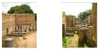
We took a number of other pictures here at the Metroon; you can have a look at them using the clickable thumbnails below:
|
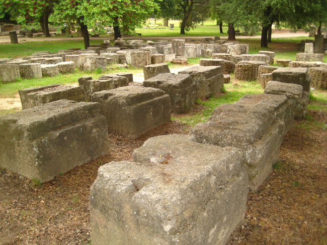
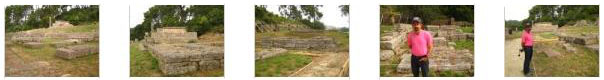
The Treasuries
On the north side of the ruins complex and on the lower slopes of the Kronion were the Treasuries, built by various Greek cities over the centuries to house their dedications to the sanctuary. Although only ten are mentioned by chroniclers of the times, the remains of twelve small buildings have been found.
|
The majority of these buildings dates from the 6th century B.C. and their construction is most likely related to the occupation of Pisa by the Eleans in 570 B.C.; they greatly supported the growth of the sanctuary. This was also a time of rapid economic development of the Greek cities. These during the same period. These buildings housed the valuable votive objects that the cities offered to the sanctuary, hence their name. The votive objects included gold and ivory items, as well as vessels made of precious metals. It is believed that the first Treasury belonged to Sikyon. Next followed the Treasuries of Syracuse, Epidamnus, Byzantium, Sybaris, Cyrene, two unidentified buildings, Selinus, Metapontum, Megara and Gela. Those of Byzantium, Selinus and Metapontum were built during the Classical era.
You can read the informational sign about the Treasuries here.
We took some additional pictures of the row of Treasuries, and you can use the clickable thumbnails below to have a look at them:
|
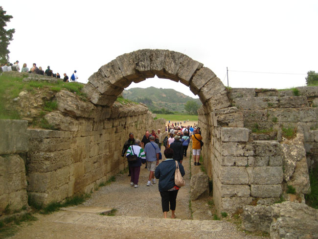
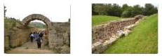
The Crypte (Stadium Entrance)
We continued eastward through the complex; the next major area to visit was the Stadium. There were a couple of ways to get into it. One was to follow a path that led up around the Treasuries and down into the bowl of the stadium. The other was to enter the stadium via the Crypte. You can see people following both these paths here.
At the base of the hill where the Treasuries were found, we encountered a row of what looked like pedestals as we went east towards the Crypte. These were the Bases of Zanes, and in fact they were indeed pedestals on which bronze statues of Zeus were placed. These statues were financed by fines levied on Olympic games competitors for cheating, and the statues were a kind of warning to the athletes as they entered the stadium to compete. You can read the informational sign about the Bases of Zanes here.
|
|
|
As soon as we got into the stadium, I scrambled up on the hill to our left- the other path into the stadium I mentioned before. There, I was able to get a good look at the tourists coming through the Crypte, and tried to imagine what it would have been like seeing the athletes enter the stadium millenia ago. As you use the player at right to watch my movie of the folks coming into the stadium through the Crypte, you'll have to use your own imagination to replace with them with the fit, trim, oiled bodies of the naked men that did the same thing a few thousand years ago.
Below are a some clickable thumbnails for a couple more pictures of The Crypte:
|
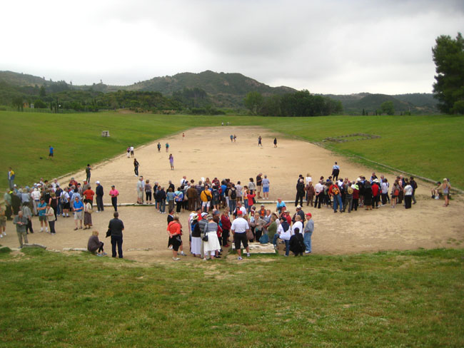
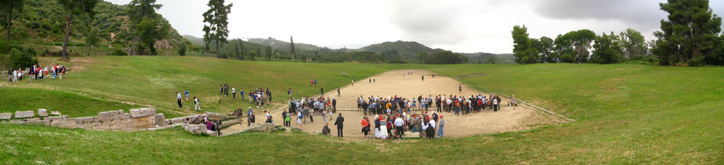
The Stadium
The Stadium at Olympia was, of course, the venues for the athletic competitions; it is located east of the Altis, separated from it by the Echo Stoa, a long portico that offered shade to the visitor. The vaulted corridor called the Crypte led to the Stadion. If you would like to read the informative sign about the Stadion, you can do so here.
|
I was taking pictures from the west slope of the stadion, and you can see a couple of views of me and the stadion in the pictures Fred took; just use the clickable thumbnails below:
|
There is no consensus as to what the length of a stadion actually is� surviving stadia tracks range anywhere from 550-750 feet long. The one at Olympia is over 650 feet. The runners appear to have run in lanes, since mention is made of a series of 5 stakes that each runner passed. In addition to the short sprint, there was a 2-stadia race, in which the runners turned at the far end of the track and raced back to the starting line. A long-distance race, the dolichos, was run over a distance of about three miles. It started and finished at the stadion but route wound through the sanctuary. It seems as if the "marathon" event was a more recent addition.
|
|
The stadium was a holy place for the ancient Greeks and was originally located west of its present location, allowing spectators able to view races from the slopes of Mt. Kronos. It was gradually relocated east until it reached its present location in the early 5th century B.C. All the seats were earthen, although on the southern slope there was a stone platform, the exedra, on which the Hellanodikai, the judges, would sit. Opposite this, on the north slope, was an altar to Demeter Chamyne. The stadium could hold 50,000 spectators. (During the 2004 Summer Olympics, it actually hosted the shot put events.)
While I was on the west slope, I took four pictures spanning across my field of view, and then later stitched them together into a panoramic view of the Olympia Stadion. Have a look at it below:
|
The Stoa of Echo
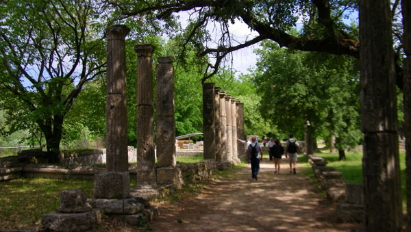
Dating from the 4th century BC, the Stoa of Echo was located at the sanctuary of the Altis, east of the temples of Zeus and Hera. It was probably built under the reign of Philip II and it almost covered the entire east side of the enclosure. The Stoa was 94m. long and had an external colonnade of Doric order. Named Stoa of Echo because of its acoustics, it was also known as "Poikile Stoa" because its walls were decorated with paintings.
|
|
|
Below are clickable thumbnails for two more views of the Echo Stoa:
|
The Building of Ptolemy II and Arsinoe II
Many of the structures at Olympia were either commissioned by, or donated by, prominent figures of the time period- such as Herodes Atticus (the Nymphaeum). The next building ruin we stopped at was actually constructed by someone who was an Olympics competitor. Ptolemy II (309-246 B.C.) was a king of Egypt, son of Ptolemy I. He was actually a victor in the chariot races in the Olympic Games of an unknown Olympiad. He was incorporated in the dynastic cult with Arsinoe II in 273/272 B.C. Arsinoe II was his sister.
|
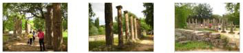
Here are clickable thumbnails for two more views of the Building of Ptolemy II and Arsinoe II:
|
Not only was Ptolemy II an Olympics competitor, but so was Arsinoe II. She was victor in all three events for harnessed horses probably in the 127th Olympics held in the summer of 273 B.C. Arsinoe II died in 268 B.C., and was honored as a priestess in her dynastic cult at Alexandria.
The Hestia Stoa
|
Of course, all that is left now of the Stoa is a jumble of odd stones and the top of one column.
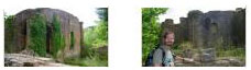
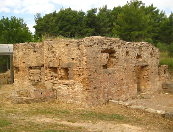
The Villa of Nero/Roman Barracks
|
Perhaps because of the presence of the Emperor, a military barracks was also constructed adjacent to Nero's House.
If you would like to read the informative sign that we found here at Nero's Villa, please click here.
|
|
Below are clickable thumbnails for some of the pictures we took here at Nero's Villa:
|
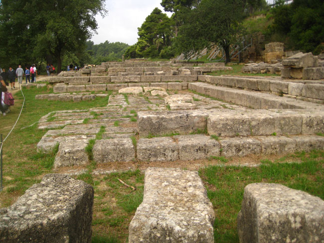
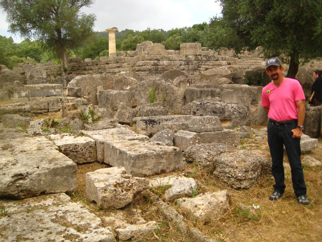
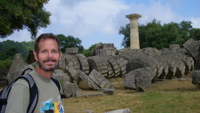
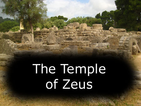
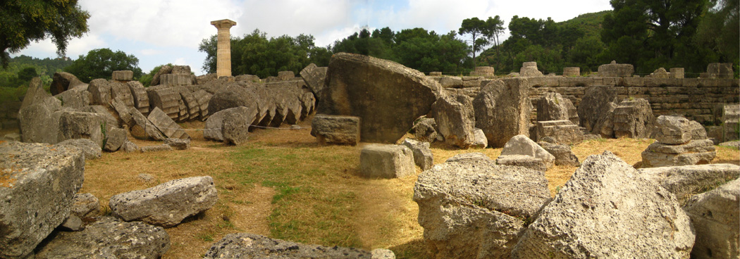
The Temple of Zeus
The Temple of Zeus was not built until long after the Heraion went up; it was built between 472 and 456 B.C.
|
There were two different explanatory signs here at the Temple of Zeus, and I took pictures of both of them. You can read those signs here and here.
|
I might mention that there was a lot of restoration work going on here at the Temple of Zeus. It is, of course, one of the primary ruins here at Olympia.
A statue of Nike, the winged goddess of victory, once crowned the the apex of the east pediment. Later, it was moved to sit atop a triangular base that was erected outside the temple. You can read more about the statue here. Inside the temple was one of the seven wonders of the ancient world, a colossal statue by the Athenian sculptor Pheidias of Zeus seated on his throne, which was installed in 430 B.C. It was chryselephantine, meaning that it was made out of ivory (for the exposed flesh) and gold for the rest. Not a scrap of it survives but there is a detailed description by Pausanias (author of an ancient travel guide to Greece) and some bad reproductions on Elean coins. Pheidias' workshop is just outside the western boundary of the sanctuary where a kylix (wine cup) with his name scratched on the bottom has been found.
|
Both Fred and I took quite a few pictures here at the Temple of Zeus, and rather than have you click on individual thumbnails to see each of them, I have put them into a slideshow.
To view the slideshow, just click on the image at left and I will open the slideshow in a new window. In the slideshow, you can use the little arrows in the lower corners of each image to move from one to the next, and the index numbers in the upper left of each image will tell you where you are in the series. When you are finished looking at the pictures, just close the popup window.
Finally, I thought this site impressive enough that I would try to capture all of it in one panoramic view, so I stitched a couple of individual pictures together and here is the result:
|
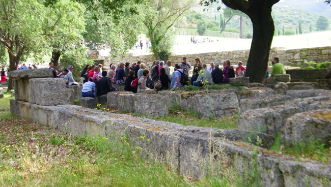
The Bouleuterion
We walked south from the Temple of Zeus to come to the Bouleuterion.
|
The Bouleuterion was an administrative building which housed the council of citizens in Ancient Greece. It almost always had the kind of square, horse-shoe shape, was usually located near the agora, and often had tiered seats around the perimeter for citizens to sit, observe and participate. There are several extant remains of Bouleuterions around Greece and former Greek territories of ancient times. The boule, a basic institution of the ancient city-state in historical times, consisted of the citizens' representatives who assembled in order to confer and decide about public affairs. The word Bouleuterion is composed from Greek "boule" (council) and the suffix "-terion" (place for doing something).
|
The South Stoa
Just south of the Bouleuterion there were the South Baths (see below) and another long portico, the South Stoa, which marked the boundary of the Altis.
|
Below are clickable thumbnails for a couple of additional pictures I took here at the South Stoa:
|
We have reached the southern border of the complex of ruins at Olympia, and before we continue west and then back around to the north and the entrance, I made a movie looking across the complex from this vantage point; you can use the player below to watch it:
|
|
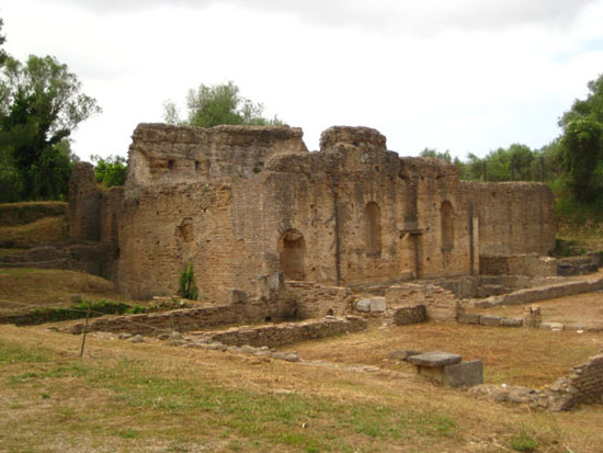
The South Baths/The Southwest Building
On the outer side of the southeast enclosure of the Altis, east of Leonidaion and west of Bouleuterion and South Stoa lie the South Thermae (baths), which date to the 3rd century B.C.
|
There was a bit more information about these baths and some diagrams of them on the informational sign, and you can have a look at this sign here.
You can also see two more views of the South Baths here and here.
The South Baths are part of a larger complex that also includes "the Southwest Building."
|
You can read a bit more and see some diagrams on the informational sign here.
Below are clickable thumbnails for some additional views of the Southwest Building:
|
The Leonidaion
West of the South Baths and south of the Palaistra/Gymnasion was the Leonidaion- the lodging place for athletes taking part in the Olympic Games at Olympia.
|
|
This was a multi-purpose building, with entrances on the north and south sides. It served as a guest house for official visitors; there were suites of rooms on all four sides which faced into a peristyle courtyard. During the Roman period the building was severely damaged in a fire. Under Hadrian's reign the building was fully renovated and remodeled into a luxurious mansion with a garden with islets and channels.
You can read a bit more about the Leonidaion on the informational sign.
I also tried my hand at stitching together a panorama to try to express the vast size of this building; the result, a combination of two pictures, is below:
|
The Palaestra/The Gymnasion
The "track" events took place in the Stadion, of course. But a litle-known fact (save to those Olympic planners who love to scatter venues all over the host city) was that most of the rest of the athletic events� the wrestling, the boxing and the field sports such as the discus and javelin� took place to the west of the sanctuary. The Gymnasion and Palaistra, which were the site of these events, were both built in the third century B.C.
|
The building is entered through the south side through two separate doorways, each with Corinthian columns distyle in antis, thus immediately establishing symmetry within the plan of the structure. The doorways open into bench-lined vestibules leading to anterooms that open directly onto the southern portico.
Between the two anterooms is a long, shallow hall lined with benches and faced with Ionic columns. This room is identified as the apodyterion, or undressing room, a space that would need to be close to the main entrance and have room for athletes and friends to meet. Directly across from the apodyterion, along the north side of the palaestra is the ephebion, or clubroom. This large, colonnaded hall is deeper than the apodyterion but does not run the entire length of the courtyard. The entire north side of the palaestra has deep rooms, a feature mentioned by Vitruvius, which offered shelter from the sun. Also in the north side of the building is a doorway that leads directly into the rest of the adjoining gymnasium space. The room in the northeast corner of the palaestra is identified as a bathroom. The brick-lined, 4 meter square and 1.38 meter deep tank found here is dated to the Roman period, however.
|
An unusual feature of the palaestra is the 24.20 by 5.44 meter strip of concrete pavement on the north side of courtyard, which is formed with alternate bands of ribbed and smooth tiles arranged to create continuous ridges stretching the length of the pavement. This was probably a sort of bowling alley, as suggested by a similar pavement found at Pompeii with heavy stone balls on it.
It is not possible to say for what most of the other rooms lining the porticoes were used. Since Olympia had no resident population, the palaestra and gymnasium would not have included spaces for lectures or intellectual discourse and would have been used primarily by competitors in the sanctuary games. The stone benches found in six of rooms would certainly have been used by athletes and spectators rather than by intellectuals. The unidentified rooms of the palaestra would have included rooms such as the elaiothesion or oil store, the konisterion or dusting-room, rooms for storing athletic apparatus, and a few sphairisteria, which were rooms or open courts for ball play.
|
|
That was it for our tour of Olympia; we had only minutes to get back to the bus (although as it turned out, if we had missed it, we would only have had to walk three blocks into the center of the town of Olympia to get to where it parked again). But we did make it back on the bus just in time.
Postscript
After the closure of the sanctuary by the edict of the emperor Theodosius in 393 AD, the buildings rapidly fell into decay. The colossal statue of Zeus was transported to Constantinople where it was subsequently destroyed in a fire. The site itself was rocked by a pair of tremendous earthquakes in the sixth century which destroyed virtually all of the remaining buildings. Only Pheidias's workshop survived and was converted into a Christian basilica. Later flooding of the Alphaos and Kladeos together with erosion of the Kronion hill eventually covered the site in a deposit of silt some seven metres thick. Excavation of the site began with a German expedition in 1875 and has continued to the present day.
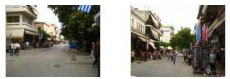
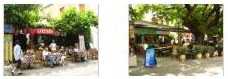
Touring the Town of Olympia
From the parking area near the ruins site, the bus made its way slowly through the congestion of all the tour buses and other vehicles north and then to the east side of the town of Olympia, there to park at what appeared to be a special place for tour buses. Our guide gave us an hour to walk around the town and take advantage of the "shopping opportunity."
|
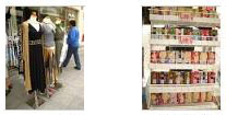
Below are some clickable thumbnails for pictures we took of Olympia's main street, a couple of restaurants and some of the merchandise displays (olive soap and fashions):
|
After an hour, we were all back on the bus and heading off back to the port of Katakolon.
Returning to Katakolon
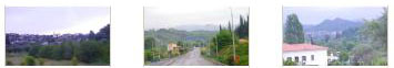
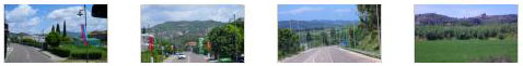
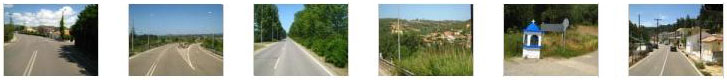
Our bus ride back to Katakolon was, of course, the reverse trip from this morning. The weather was better for picture taking, and so Fred and I snapped a number of photos of the road and the countryside, ending with our arrival back in Katakolon. If you would like to see some of this roadside scenery, just click on the thumbnails below:
|
|
This bus ride brought us back to the ship. We had time to go aboard and relax for a time before coming back off the ship to walk around the town of Katakolon.
A Walk Around Katakolon
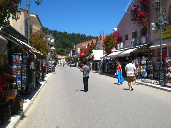
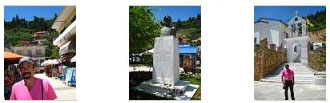
We have an hour or so to explore the seaside port village of Katakolon. The Noordam was docked very close in, although the harbor was crowded with cruise ships. We got off the ship, walked the hundred yards to the port entrance, and then began walking through the town.
|
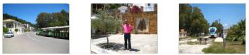
We saw a number of interesting things on our short walk, including the local Greek Orthodox Church, the terminus of the train line to Pirgos and a horse‑drawn carriage. Click on the thumbnails below to see some of the pictures we took:
|
|
|
There are also clickable thumbnails below for some additional pictures that we took while walking around Katakolon:
|
When we were done walking around town, we returned to the pier where I got an interesting picture of the Noordam's bow; we were able to walk right around the front of it to get a good look. We passed back through Greek security, and headed back along the port side of the Noordam to the gangway to reboard the ship.
The Noordam Sails from Katakolon
We have a long way to go to get to Athens by tomorrow morning, so the Noordam sailed from Katakolon about two-thirty in the afternoon.
We were up on deck well before we sailed, and we were snapping away at some of the scenery around the harbor, and some of the other cruise ships that were docked here. The clickable thumbnails below will take you to some of the best of the pictures that we took:
|
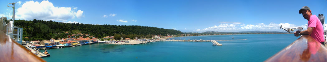
Just before we sailed, Fred and I went over to the starboard side of the upper deck where we could see the town of Katakolon and look in the direction we went when we traveled to Olympia. I asked Fred to stand against the rail and then took a series of five pictures, beginning with a look down the rail at him and ending with a look down the rail in the opposite direction. Then I merged all five pictures for a panoramic view of the harbor at Katakolon. The result is below:
|
Once we'd had our fill of watching the Greek coast slide by, we headed down for a snack and then a pleasant afternoon on board the Noordam. I got into a short bridge game in the card room, and later went to the gym with Fred. We had our usual LGBT meeting and then dinner in the Vista Dining Room.
The show in the Vista Lounge was a Flamenco guitarist. He was quite good, although we didn't bring our cameras for pictures.
You can use the links below to continue to another photo album page.
|
May 23, 2012: Athens, Greece |
|
May 21, 2012: Corfu, Greece |
|
Return to the Index for Our Mediterranean Cruise |