|
May 26, 2012: At Sea |
|
May 24, 2012: Kusadasi, Turkey (Ephesus) |
|
Return to the Index for Our Mediterranean Cruise |
|
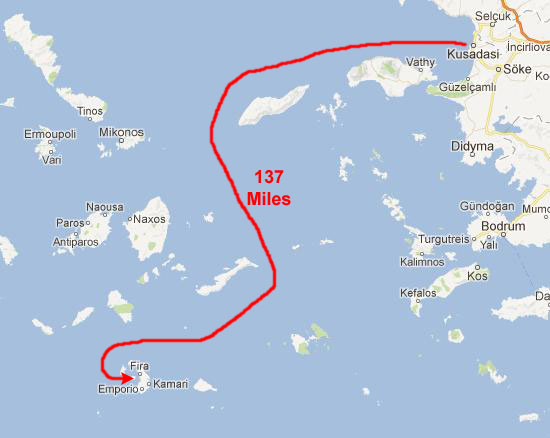
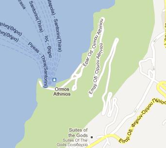
Although we will begin our tour at one dock and return to the ship via another, the Noordam will, apparently, stay in the same place where we anchor in the morning.
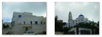
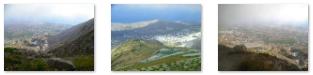
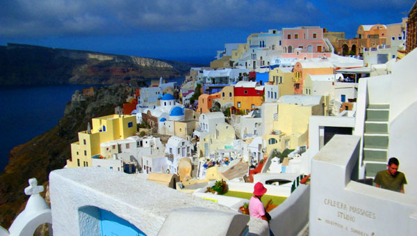
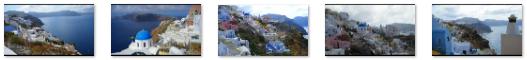
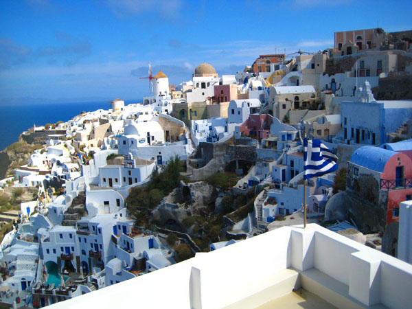
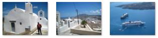
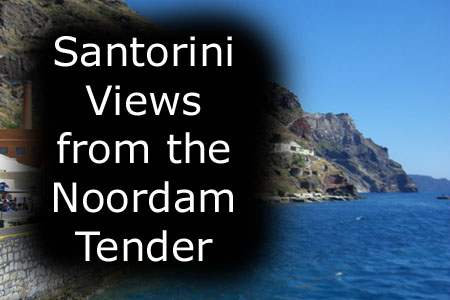
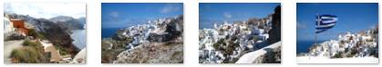
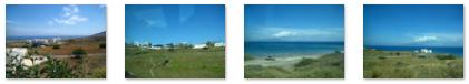
Arriving at Santorini
|
|
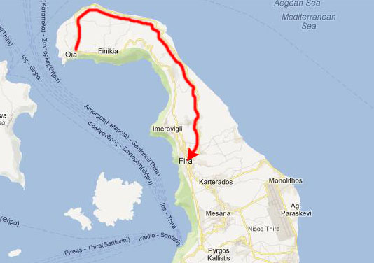
A giant central, rectangular lagoon, which measures about 8 by 4 miles, is surrounded on three sides by cliffs that are a thousand feet high. On the fourth side, the lagoon is separated from the sea by another much smaller island called Therasia; the lagoon is connected to the sea in two places, in the northwest and southwest. all but the largest ships can anchor anywhere in the protected bay.
There is a new marina for smaller ships and large boats in Vlychada on the southwestern coast. The Noordam, like most cruise ships, anchored in the caldera just below the main city of Thira.
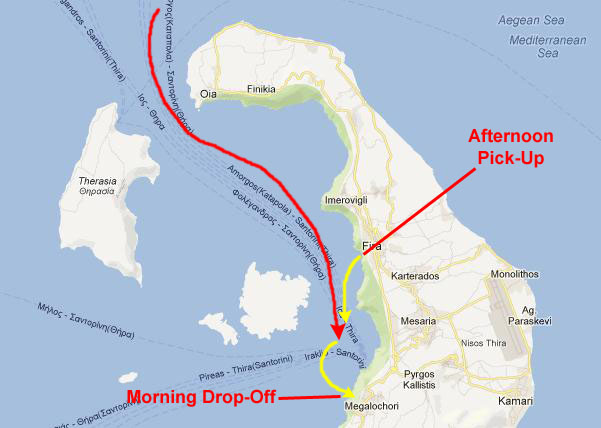
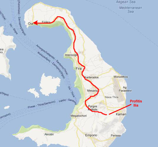
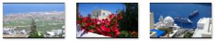
The large map above shows our approximate route from Kusadasi, but if we look at a more detailed map of Santorini, we can describe the actual route that we took to get to our anchorage- coming in through the northwest passage.
|
Once we'd passed south of Oia and gotten some distance from the shore, Fred looked back and got a nice picture of the clifftop town of Oia. On the way to our anchorage, we passed below the main town of Thira; although we took some pictures this morning, the sun was behind the island and they didn't turn out well. So we'll wait until this afternoon, when we are on the tender returning to the ship, to get some good pictures of that town as seen from the lagoon below.
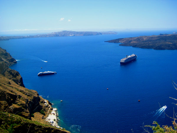
The Noordam anchored just southwest of Thira and Greg, Fred and I met our shore excursion group in the Vista Lounge at seven-thirty. Just before eight, our tour group was called and we went down to the gangway to board our tender. Our tender boarded right at eight, and we pulled away from the ship just a few minutes later. From the tender heading south we could look back to see the Noordam riding at anchor in the Santorini lagoon.
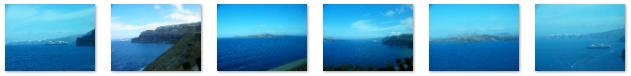
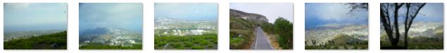
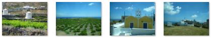
Below are clickable thumbnails for some additional pictures Fred and I took in the early morning light as we steamed slowly into the lagoon from the northwest:
|
This was one of our earliest shore excursion departures, and it was interesting to see the Noordam in shadow below the Santorini cliffs.
|
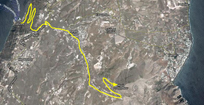
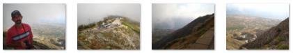
The Drive to Profiti Ilia
|
Once we arrived at the top of the cliffs, the bus headed off to Profiti Ilia.
|
|
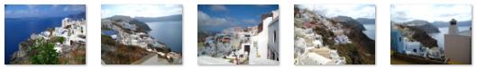
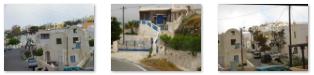
Leaving the town behind, the bus (actually, a caravan of them) headed east and up. There was some interesting scenery as we got higher and higher. Towards the end of the ride, the road narrowed and there were again a few switchback before we reached the end of the highway. It ends at the monastery, in a small parking area where we could get out and walk around. Below are clickable thumbnails for some of the best pictures Fred took as the bus traveled east of Pyrgos Kallistis:
|
At Profitis Ilia
|
Below are thumbnails for some additional views from the top of Profitis Ilia:
|
The monastery was built in 1712; its walls remind one of a fortress. It has figured prominently in the history of Santorini. Early on, the monastery owned its own ship; that vessel conducted private business for the benefit of the monastery. At the same time, the monastery was an active intellectual and patriotic influence. From 1806 to 1845 it ran a school where the Greek language and literature were taught. The monastery's decline began in 1860; its buildings suffered serious damage in the 1956 earthquakes. The monastery today has an important collection of icons and bibles, artifacts of the Greek Orthodox religion, ecclesiastical objects, books and ethnographic material. It has also become something of a cultural center, hosting displays on shoemaking, printing, candle making and wine making.
|
|
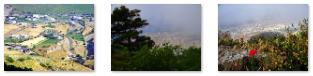
We did get some more good views through the intermittent clouds and you might want to use the clickable thumbnails below to have a look at some of them:
|
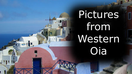
The Drive to Oia
|
 |
This brought us into the town of Pyrgos Kallistis, and there are clickable thumbnails below for some pictures we got as we passed through:
 |
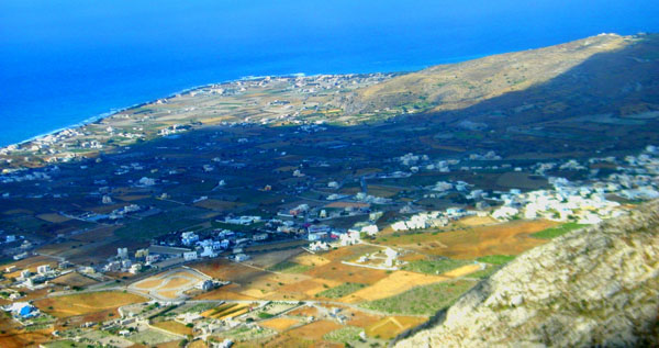
After passing through that town, we turned north. There is only one north-south road at this point, and it is up on the cliffs above the lagoon to our left. To our right, east-west roads lead down to the agricultural area of the island and the airport. Coming north out of Pyrgos Kallistis, we got an excellent view north towards Thira. Heading north along this road, we passed an interesting, and somehow unexpected, restaurant- I thought I was back in Texas.
We continued north, passing some typical Santorini houses, and there was some neat scenery to our left looking down towards the lagoon (and at one point we passed above the Noordam anchored far below us).
|
To view the slideshow, just click on the image at left and I will open the slideshow in a new window. In the slideshow, you can use the little arrows in the lower corners of each image to move from one to the next, and the index numbers in the upper left of each image will tell you where you are in the series. When you are finished looking at the pictures, just close the popup window.
North of Thira (also spelled "Fira"), the road we followed continued on top of the high hills that form the west side of Santorini, so the views to our left were looking down towards the relatively flat land along the eastern side of the island.
|
Driving North to Oia |
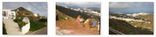
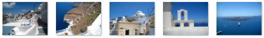
Below are clickable thumbnails for some views of Santorini that I captured:
 |
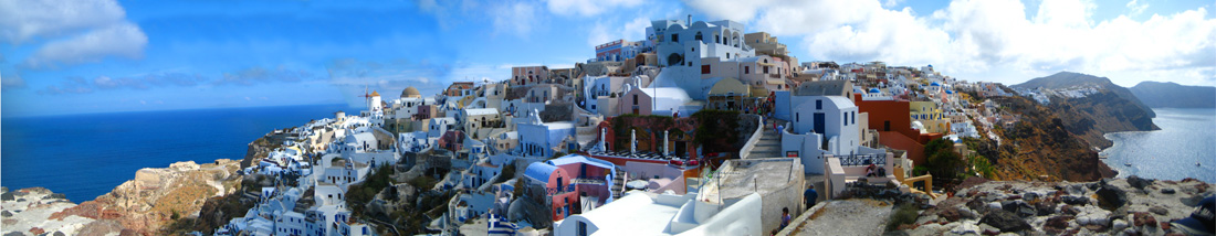
As our ride came to an end, we could see the town of Oia ahead of us. The bus came right up into the middle of town, and we were treated with a beautiful back towards the Noordam in the lagoon. Shortly, the bus came to a stop in a parking area just a block or so from the cliffs and, after giving us some information on when to be back at the bus, our tour guide put us on our own (since trying to herd a big group through the narrow streets would be nigh onto impossible).
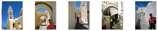
Walking Through Oia
|
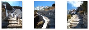
Oia has a main pedestrian street that runs the length of the town across the top of the cliff; many small streets run north and south from it- much like a multitude of short ribs coming off a backbone. Most of these streets aren't really streets at all; they are little more than walkways between houses and buildings or stairways that lead to houses up or down the cliff face. It is quite a maze, but a very beautiful one.
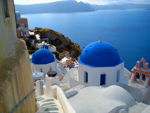
Oia was devastated by the 1956 earthquake that also destroyed many towns throughout the neighboring islands; the town has only now been substantially rebuilt. Oia is often compared to the other major town on the island- Thira- but it is more dramatic and striking in its beauty than Thira, and much quieter than that tourist-oriented town. The narrow streets of Oil are filled with small, yet expensive shops- many are boutiques selling local jewelry. Oia is also famous for the beauty of its sunsets, which means that the narrow streets and passageways can get quite full in the evenings. The most popular spot to watch sunset is by the Kastro walls.
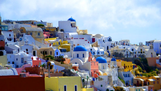
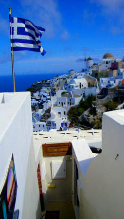
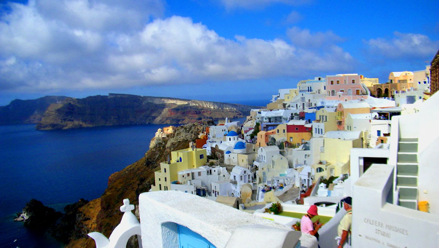
The central square, Nikolaou Nomikou, skirts the caldera. The town hosts a cultural centre and Greek art galleries as well as the usual handicrafts, souvenir and jewelry shops. As seen on a zillion postcards, the characteristic classic view of Oia is the bright white and blue of the church contrasting with the deep blue of the Aegean Sea in the background. Oia, is a beautiful, exquisite small town and an ideal place for those seeking peace and quiet. The houses and churches that cling to the cliffs, and the narrow pathways and stairways that connect them and the beautiful sunsets all combine to make Oia a place worth visiting, and one that is difficult to forget.
|
Walk Segment 1: Bus Park to the Church of Panagia of Platsanio
|
 |
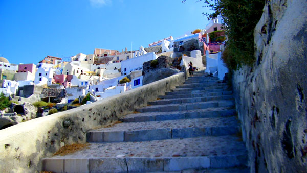
We walked up this stepped street toward the top of the cliffs on which Oia is perched above the caldera lagoon, and came out into a square in front of the Church of Panagia of Platsani.
Religion on the island of Santorini is primarily Greek Orthodox and Roman Catholic. Today, Oia, as an Orthodox village, has the picturesque blue-domed chapels, pristine white bell towers and volcanic stone trimmed church doorways dotted all along the caldera cliffs. Each chapel is of course named after the saint it honors and was built by a local family, many to pray for the safe return of the seafaring members of the family. These are usually closed to the public except on the Saint's Name Day when the owning family sponsors a small celebration complete with wine and local specialties. It's a fine reason for a social event attended by the locals and invited island visitors.
But there are also two main churches in Oia that have a priest conducting weekly services. The Church of Panagia of Platsani is the principal church and located at the center of the village. It was built in the 1800s and maintained in perfect condition. The local craftsmen have created a wonderful interior, including icon paintings and furnishings. The church also has one of the best views to the sea and caldera. The church has a little front courtyard and in the village square in front of that we found an interesting inlaid design that apparently had something to do with an event in 2007. This square is also the point of annual celebrations such as Easter and occasionally a wedding.
|
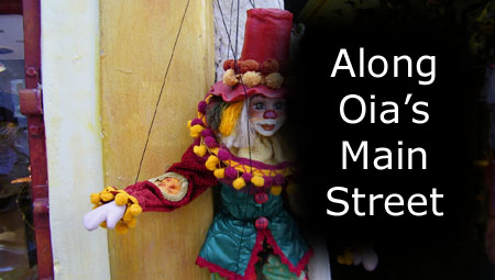
Walk Segment 2: Walking West on Oia's Main Street
|
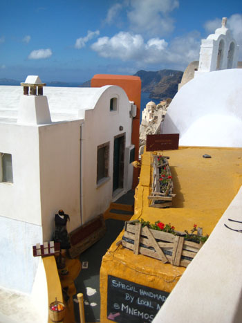
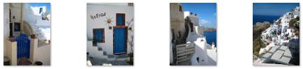
But along the cliff face where we were, there were no streets; the widest throughfare was maybe eight or ten feet wide, and was essentially a cobblestone walkway that wound between shops (like this art gallery), restaurants and houses on either side. On the caldera side, there were numerous little offshoots of the main pathway; these led to individual houses and restaurants that were sometimes fifty feet below us on the cliff face. These pathways were often no wider than a set of narrow stairs. Some of them almost looked as if they had been "poured" down the hillside between the structures.
Individual homes might have little arched gates that opened onto these narrow pathways. Many of these houses and little inns had terraces overlooking the caldera lagoon, and must have been great places to live or stay. The whole area was a rabbit warren, albeit not a very large one. Tourists generally stick to the main pathway, unless they are going down to a shop or a little inn or perhaps a cliffside restaurant; this made the main pathway generally crowded, particularly on a day like today when there were a number of tourist buses in town.
For this second part of our walk, we'll go from the square in front of the Church of Panagia of Platsani west through the clifftop village, ending just above the Kasteli (Castle) of Agios Nikolaos- which is on a point of land at the western end of the village. Along the way, we'll pass numerous little shops, lots of cafes and small restaurants and many, many interesting buildings. All along the way, we'll be passing one traditional white, blue-domed chapel after another.
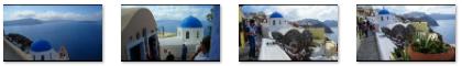
One of the most beautiful of all the views of Oia that we got today was a view that Fred took from a ledge down below the square where we began. It looks west towards the Kasteli:
 |
Every so often along the pathway we followed, we'd come out at a spot where we could look east or west along the cliffs and get more wonderful views of the houses, shops and churches spilling down the hillside towards the caldera. These views were uniformly beautiful, and it was hard to weed any of them out. Below are clickable thumbnails for the best of these spectacular views. (When the lagoon is at the right, you are looking east towards Thira; when at the left, you are looking west towards the Kasteli.)
|
We passed two more churches on our walk. One was quite near our starting point; we could see it by looking down the main street by the square. And, as we walked west, we passed beneath its blue dome.
|
The views of the church and from the church were pretty amazing; in some of them, you can clearly see the ancient volcano cone out in the middle of the caldera lagoon. Below are clickable thumbnails for some of the pictures that Fred took around the Anastasis Church, and I think you'll agree with us about the views:
 |
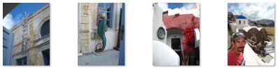
There were just all kinds of interesting and quirky things to look at as we walked along towards the Kasteli; many of these pictures defy explanation. For example, here in the U.S. we have all heard of "fast food," but in Oia we were introduced to a different concept. Take another example: we've all seen signs telling us to "Enter Here" or "Order Here;" but, once again, it seems that in Oia they do things a bit differently. How about one more? Here in the U.S., the pay phone and phone booth seem to have gone the way of the Dodo bird, what with the proliferation of cell phones. We saw cell towers on Santorini as well, but down one side street I happened to see a couple of litte wall phone booths. That wasn't surprising in and of itself, but see if you can figure out why I thought the pair of them were worth this photo. (Hint: Which one would you use?)
|
Shortly after we left the main square, we dropped down to a lower ledge where I could get a picture of Fred and Greg overlooking the first of the two other churches we passed. I noticed in that picture that there was a small, craggy island just out into the lagoon way down below us, and that there seemed to be a house or two on it. So I came down to where Fred and Greg had been standing and used my zoom to get a closer view of what seemed to be a house on that very private island. You can have a look at it here.
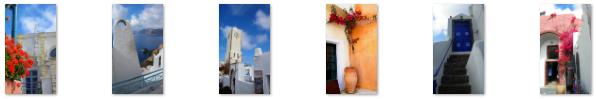
All along our walk, it was Fred who had the real eye for detail, and he took a number of very nice pictures of buildings, decoration, flowers and the like (including his first "doorknob" picture in quite a while).
|
To view the slideshow, just click on the image at left and I will open the slideshow in a new window. In the slideshow, you can use the little arrows in the lower corners of each image to move from one to the next, and the index numbers in the upper left of each image will tell you where you are in the series. When you are finished looking at the pictures, just close the popup window.
As we walked along, I liked to follow some of the little pathways that led up and down the cliff face; most of them led to houses that had gates opening out onto those pathways.
|
I didn't take as many pictures as Fred, but I did get some interesting shots as we walked along. You can use the clickable thumbnails below to have a look at some of these:
|
After an hour or so, we came to the western end of this main pathway.
Walk Segment 3: The Western End of Oia's Main Street
|
Let's use this segment of our walk to take in the vistas from here, and save the Kasteli and the harbor itself for a little while.
One of the first things I noticed as I came down the stairs at the end of the street were the dog and cat on the building at the end of the street. The dog was intently focused on the seemingly unaware cat sitting below. I thought this might be a good close-up or movie, so I tried to get closer to them. No sooner had I got my camera set to take a movie, though, than the cat leaped forward off the low wall heading downhill with the dog in hot pursuit. I'm sorry I missed it!
We spent a bit of time walking around this area before heading out to the Kasteli.
|
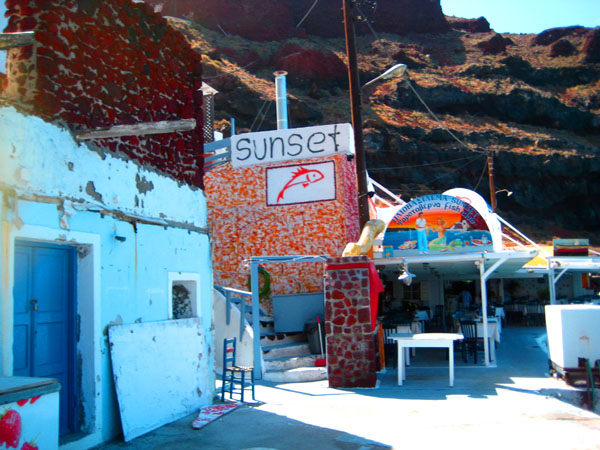
Way down at the base of those cliffs where the resorts were, we could see the small harbor of Oia- the Ormos Ammoudiou. A bit later, I learned that the place is usually called "Sunset Harbor," even by locals. From the end of the street, I could see the beginning of the stairs and pathway leading down to Sunset Harbor. (There is also a road that goes down there, but you have to go down to the north side of the island from the bus parking area to get to it.) I hoped I would have time to get down there. A bit later, while I was actually going down to the harbor, Fred had moved around towards the windmill beyond the resort area, and from there, the stairs and path down were easily seen. I also found a spot right nearby where I could look down the path to the harbor.
But first, we are going to head out to the Kasteli and wander around there.
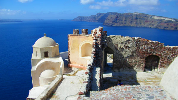
Walk Segment 4: The Castle of Agios Nikolaos (The Kasteli)
|
|
|
Once in the Kasteli, we walked around the old fortification, looking at it and the views from it. Below are clickable thumbnails for some of the pictures we took here in the Kasteli:
  |
Today, the settlement of Oia extends far beyond the original fortified settlement, which now occupies just this point of land at the extreme western end of the town. Nowadays, the site of the Kasteli provides a great place from which to view the settlement of Oia, stretching away to the east along the cliffs. The castle is also a favorite spot for watching the beautiful sunsets.
|
|
Both I from my vantage point out beyond the fortification, and Fred from his own perch on the Kasteli itself, took some interesting photos looking back at Oia, the resorts to our left, and the island of Santorini extending away to the east. Below are clickable thumbnails for some of these pictures:
  |
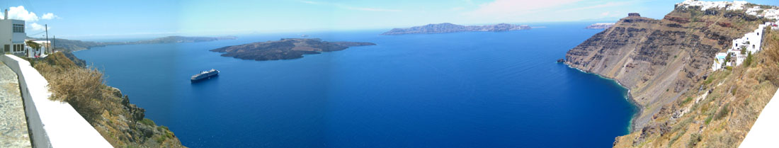
From my position out here at the end of the island, I could also see the caldera lagoon on both sides. On my right (south) I could down into the caldera and get another view of that private island we saw earlier. On my left (north), I could get a good view of Sunset Harbor, which I hope to visit shortly. Also, while I was out here as far as I could get, I took a series of pictures of the scene in front of me- from the Aegean Sea on the left to the caldera lagoon on the right. I later stitched these pictures together into the panoramic view that you can see below:
 |
Walk Segment 5: My Walk Down to Sunset Harbor
|
 |
The descent was easy, of course, and I always had good views of Sunset Harbor ahead of me. And I could see, some distance from the stairs and pathway, what appeared to be an abandoned chapel; I thought about trying to get over to it, but couldn't see an easy way to do that.
The stairs just continued downward, with the occasional switchback, until I reached the last flight of stairs that brought me to the shore.
|
|
|
I took a couple of other pictures of the harbor area, and you can have a look at them here and here. I also got a good picture looking up at the top of the cliffs to my northeast. I also took a series of five photos, beginning with the base of the cliffs below the fortress and panning around across the island of Therasia on the other side of the caldera lagoon, the outlet to the Aegean Sea and the tip of Santorini to the north. These were stitched together to form the panorama below:
 A Panoramic View Looking West from Sunset Harbor |
After spending a few minutes down here at the harbor, I reluctantly turned to head back up the stairs. It was a daunting hike, as you can see in this view looking up at the fortress from Sunset Harbor.
|
|
|
Anyway, when I got back to the top, I made a movie to record the fact that I'd gone down to the harbor and climbed back up, and you can watch that short movie with the player at right.
Walk Segment 6: Fred Walks Around Western Oia
|
|
To view the slideshow, just click on the image at left and I will open the slideshow in a new window. In the slideshow, you can use the little arrows in the lower corners of each image to move from one to the next, and the index numbers in the upper left of each image will tell you where you are in the series. When you are finished looking at the pictures, just close the popup window.
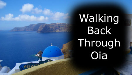
Walk Segment 7: Walking Back to the Bus Park
|
To view the slideshow, just click on the image at left and I will open the slideshow in a new window. In the slideshow, you can use the little arrows in the lower corners of each image to move from one to the next, and the index numbers in the upper left of each image will tell you where you are in the series. When you are finished looking at the pictures, just close the popup window.
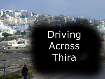
The Drive to Thira
|
All of the pictures Fred snapped from his side of the bus turned out blurry, but many of the ones I took from my side, looking out to the Aegean Sea, turned out well. There are clickable thumbnails for some of them below:
|
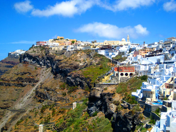
At the end of our thirty-minute ride, we climbed back up to the top of the hills to park for the last time in a parking area just a few blocks from the cliffs in the town of Thira- largest on the island.
Our Walk Through Thira
|
You can bring up the window any time you want to locate us, and you can close it at the end of this section (I'll remind you). To start, when you open the window, scroll to the lower right-hand corner, where you will see the route our bus took to the drop-off area, and the beginning of the first segment of our walk through Thira.
From the Bus Drop-Off to Cliffside
I Wander Down the Cliffs Above the Noordam
|
The area I was walking through seemed to consist of a mixture of small houses, little hotels and a cafe or two. The hillside was so steep, that on the sea-side of my walk, places like the Keti Hotel ahead of me were entered through doorways or arches that immediately became stairs down to the actual building. I walked forward in that last shot towards the domed hotel, and took another photo of the Keti Hotel Entrance.
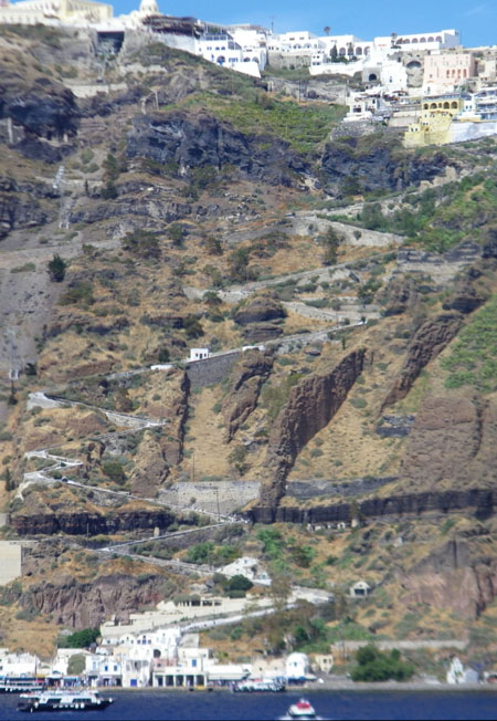
Throughout our walk today, we found this to be quite common. Whenever we were walking along, building on our lagoon side were usually a ways down the hill- reached by stairs through arched entrances. Sometimes, these stairs just led down to another pathway that paralleled the one we might be on, and the process repeated. In the aerial view, you can see some of these terraces.
I might point out that the aerial view is a bit misleading, for anything west of our route was built down the cliffside below us. It is hard to detect changes in altitude on aerial views, unless you have something like the harbor below or the stairs zigzagging up and down as reference points.
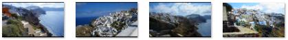
All the while as I was wandering through the multi-leveled narrow alleyways, I was treated to beautiful views along the coastline north and south.
|
|
I took my alotted fifteen minutes to wander around down here before heading back up to rejoin Fred and Greg, and I snapped quite a few pictures. I've selected a few of them to be representative of what this part of Thira was like and to show you the views from here. You can use the clickable thumbnails below to have a look at the pictures I selected:
 |
I rejoined Fred and Greg just about fifteen minutes after I'd left them.
Fred's Pictures Near the Atlantis Hotel
|
|
Walking Through Thira to the Top of the Donkey Path
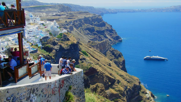
One of the more frequent views we got as we walked along the cliff top was that of the various restaurants and cafes below us that had seating areas with spectacular views. I can't recall any similar situations in any of the trips Fred and I have taken, save for the occasional restaurant that might have a balcony overlooking a river or valley just fifty or a hundred feet below. These were just incredible, and if we'd had time, it might have been nice to grab one of the empty tables and sit with a drink for a while. You'll see some of these pictures in the slideshow below.
|
To view the slideshow, just click on the image at left and I will open the slideshow in a new window. In the slideshow, you can use the little arrows in the lower corners of each image to move from one to the next, and the index numbers in the upper left of each image will tell you where you are in the series. When you are finished looking at the pictures, just close the popup window.
I think you will agree that these views are simply amazing- and about as close to unique in the world as you can get. But even more spectacular were the continual views out across the caldera lagoon and the Noordam at anchor.
|
|
|
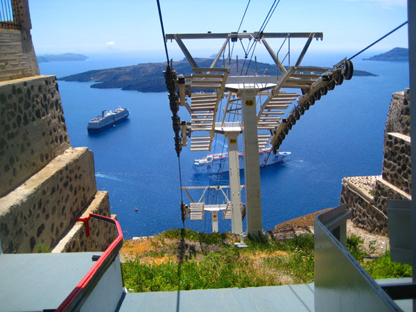
The end of this segment of our walk through Thira brought us out to an area from which there were great views. The overlook was just a few hundred feet north of the top of the pedestrian stairs/donkey path that comes up from the harbor, and also just south of the cable car station. (Fred got a good closeup of some of the donkeys at the top of the stairs. I never did find out what the charge was to ride one of the animals up the long, winding staircase.) We also got our first views of the cable cars in transit.
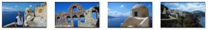
At the observation deck, we did, of course, take pictures of each other with the beautiful town of Thira perched above the lagoon as a backdrop. You can have a look at Fred's picture of me or my picture of Fred or my picture of Fred and Greg.
From the Cable Car Station to the Second Viewpoint
|
|
A short while after I ended that movie, the other set of cars coming up from the harbor passed the set heading down, and I got a pretty good picture of them that you can see here.
To continue north from here, there is a little passageway that goes through the cable car station (and with leads to another kind of balcony where you can look out. While I was doing my movie stuff, Fred and Greg headed up that way. As Fred passed across that balcony, he stopped to get a good picture looking down at the cable cars leaving the station. This was the same set of cars that I was filming at the same time.
|
When Greg and I were done, we went to join Fred, where I got another good picture of the lower observation deck and the Santorini coast, along with another view of the multi‑level cable car station. Greg was about ready to head off to do his shopping, but I got one more picture of Greg and Fred with the Church of St. John in the background. (We'll be visiting that church before we leave Thira.)
We turned to head north after Greg left us, and Fred got a good picture of our route and the next observation area we'd be stopping at. You can see that picture here. Then we headed off.
This part of the walk was much like our trip to the cable car station, except for the fact that we were climbing now, to reach the tallest spot in the town of Thira.
|
|
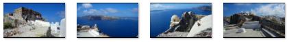
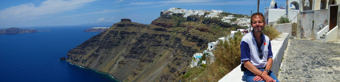
When we got to the next overlook, at pretty much the highest point in Thira (or on the western side of the island, for that matter), the views were really tremendous. We could see all the way across the island. Fred got a really excellent view looking past Thira and across the island to the southeast- all the way to Profiti Ilia on the mountaintop we'd visited early this morning. The early morning fog is gone, of course, and the view was really, really good. I hope you will look at Fred's picture here.
For my part, I like my picture of Fred and the northwest Santorini coastline, as well as the nice view I got from here of the Noordam at anchor. I also took the time to take a series of pictures that I could stitch together into a widescreen panoramic view from this point. The five pictures I took have been merged into the panorama below:
 |
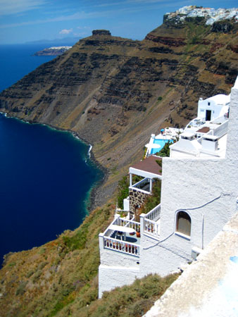
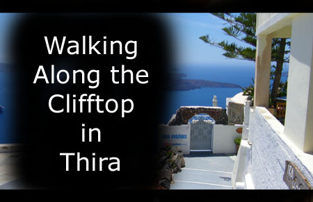
Clifftop Walk in Northwest Thira
 |
This part of the walk was extremely pleasant. Apparently, not too many tourists walk this far north, for we saw only a few other people as we walked along- and many of them appeared to be residents of the area.
|
|
To view the slideshow, just click on the image at right and I will open the slideshow in a new window. In the slideshow, you can use the little arrows in the lower corners of each image to move from one to the next, and the index numbers in the upper left of each image will tell you where you are in the series. When you are finished looking at the pictures, just close the popup window.
We found an access inland to the street that led back into the center of town right beside yet another picturesque chapel, and so there we doubled back- wanting not to simply retrace our steps- aiming for St. John's Church and the cable car station.
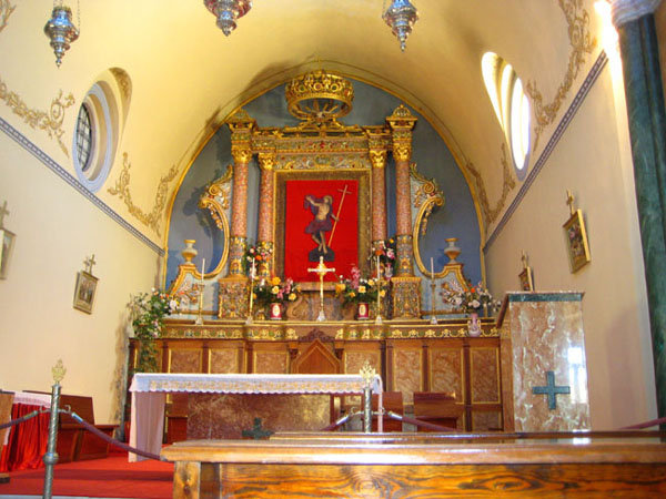
Our Walk to and Tour of the Church of St. John
|
 |
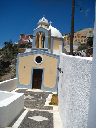
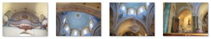
The Catholic Cathedral of Saint John the Baptist is in great contrast to many of its Byzantine neighbors. Its peach-colored exterior, as well as its size, makes it stand out in the skyline of Thira. There is an ornate clock tower that also contains the church bells. The dome of the church is blue and peach on the outside; the interior is lilac blue and other parts are colored orange and cream. The cathedral is not that old; it was restored and opened in 1975 after suffering significant damage during the earthquake of 1956.
|
 |
We spent a few minutes wandering around the hushed chapel, admiring the artwork and enjoying the quiet.
|
|
I also took some pictures inside the chapel, and you can use the clickable thumbnails below to have a look at them:
 |
The chapel of St. John was the last stop on our walking tour of Thira. It has been a very, very nice experience- similar to Oia but different in other ways. Now all that remained was to take the cable car down to the harbor and then catch a tender back to the Noordam.
So when we were done in the church, we went back outside and down the long stairs that would take us to the entrance to the cable car station to the right.
Riding the Cable Car Down to the Harbor
|
|
|
We didn't have long to wait before the cable car showed up.
|
|
While we were waiting and I was making my movie, Fred was also busy taking some still shots of the cable car arriving; he also took a picture once we were inside the car awaiting its departure. There are clickable thumbnails below for these pictures:
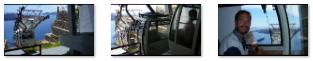 |
There weren't a lot of people going down at this time of day, so only two or three of the set of cars on our side were occupied. As I wanted, we were in the front car, ready for an unobstructed view ahead.
|
|
I knew we would be taking a number of pictures on the way down, but since still pictures taken while you are moving can be easily spoiled, I thought I would just film the entire trip down. I'd already timed the trip approximately by watching the previous two sets of cars, so I knew that filming for a couple of minutes wouldn't present a problem.
So if you would like to take the trip with us, from the Thira cable car station down to the station at the harbor, fasten your seatbelts and use the movie player at right.
As expected, the trip took a little over two minutes, and I hope you enjoyed riding down with us.
|
|
You can also see a still picture of the mechanism here.
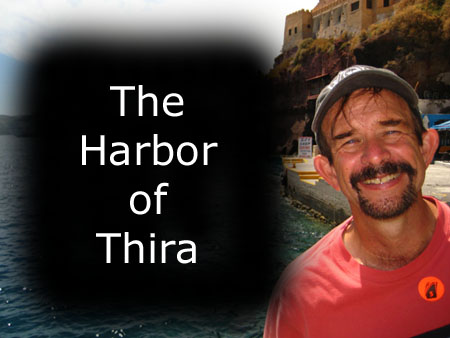
We left the building and walked out onto the quay of the harbor. It was really an interesting place. One of the first things I did was to make a movie of the harbor area and of Thira and the cliffs above. You can watch that movie with the player below, left. A bit later on, I also made a movie of some of the boat activity- ending with our arrival at the Noordam tender. You can watch that one with the player below, right.
|
The Harbor of Thira |
Boat Activity at the Harbor |
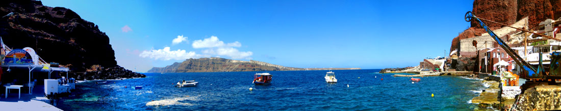
The harbor was really neat, and there was a lot going on, so we walked around for quite a good while before heading over to catch a tender to the Noordam.
|
To view the slideshow, just click on the image at left and I will open the slideshow in a new window. In the slideshow, you can use the little arrows in the lower corners of each image to move from one to the next, and the index numbers in the upper left of each image will tell you where you are in the series. When you are finished looking at the pictures, just close the popup window.
This brought our visit to the island of Santorini to a close, and it was time to head back to the Noordam.
Riding on the Noordam Tender
When the tender pulled up, I could see that it was not one of the Noordam lifeboat/tenders. Apparently, local boats are hired here so that the ship doesn't have to go to the trouble of lowering its own boats. Or maybe it is some local ordinance. Anyway, when I saw that there was outside seating up on top of the boat, that's where I wanted to be, even though the mate was directing everyone inside. Fred thought he should follow instructions, but I detoured up to the top. No one said anything, but I made sure anyway that it was OK. As it turned out, there was another couple that came up just before we left for the Noordam. So when we pulled away from the dock, I was all ready to take some pictures and movies.
I made two movies- one when we left the Thira harbor and another when we approached the Noordam. There was a fair amount of wind noise in the second one, but you can watch both of them using the players below:
|
Leaving Thira Harbor |
Docking with the Noordam |
As we motored out to the Noordam, I was snapping away at the island of Santorini. Not all the pictures turned out real well, but some did, and you will see them in a slideshow shortly. We docked with the Noordam and were back in our room by 3 p.m. We each stopped to get a nice picture of Santorini from our balcony before we went off to get a late lunch.
|
He took some other good pictures, at one point fiddling with his settings to take a sepia-toned picture of Thira (which made me think that this is what the town looked like before color was invented). I took some of my own pictures on deck. To our north, I saw an Ibero Cruise Lines ship that looked identical to one we'd see when we were docked in Athens. I also got a nice picture of Fred and Santorini. But it was when I saw the tender heading for the ship that I had the idea that since he missed out on sitting on the top of the boat earlier, he might enjoy simply riding the tender in to the harbor and back out again. It was a beautiful day, and we hadn't anything pressing to do for a while, so we went quickly down to the gangway to make sure that it was OK for us just ride the tender back and forth. It was, and after the tender unloaded, we hopped on and took seats on the top for the ride in and back. Here is Fred seated atop the tender.
|
To view the slideshow, just click on the image at right and I will open the slideshow in a new window. In the slideshow, you can use the little arrows in the lower corners of each image to move from one to the next, and the index numbers in the upper left of each image will tell you where you are in the series. When you are finished looking at the pictures, just close the popup window.
It was a pleasant way to spend 45 minutes, and I got a nice picture of Fred at Thira harbor. I took my last picture of the day as we came alongside the Noordam.
When we returned to the ship, our visit to Santorini was officially over. We had a normal evening- with the gym and dinner in the dining room, and Fred and I went to see pianist Stephen Kane in the Vista Lounge. (Tonight was the night for the Filipino Crew Show, but we'd seen one of those before, so we skipped it and went back to the cabin to prepare for our last port tomorrow.
You can use the links below to continue to another photo album page.
|
May 26, 2012: At Sea |
|
May 24, 2012: Kusadasi, Turkey (Ephesus) |
|
Return to the Index for Our Mediterranean Cruise |