|
May 28, 2013: Rapid City and Mt. Rushmore |
|
Return to the Index for Our South Dakota Trip |
We started out on our trip to South Dakota on Sunday, May 26th, got to Chamberlain the next day, and spent that day with Guy in and around Chamberlain. This page covers our trip up and that day in Chamberlain.
From Dallas to Grand Island, Nebraska
|
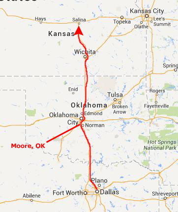
A few miles south of Oklahoma City, the traffic on the Interstate slowed and then came to a complete halt. I assumed it was an accident of some kind, but the odd thing was that there was no southbound traffic, either. As far as I could see, all three lanes of the Interstate were full- and stopped. I even got out of the car at one point, but no one seemed to know much. After about half an hour, I noticed some traffic coming southbound, and, shortly after that, I heard our own lanes begin to move way up ahead. Our traffic jam slowly unwound and we got up to 30 MPH or so. Then we came to Moore, OK.
Just days before out trip, part of Moore had been devastated by tornadoes- on two separate occasions. We'd all seen the pictures on the news. What Fred and I didn't know was that the tornado came right across I-35, and while the highway itself wasn't damaged, the structures on either side were damaged- the small homes to our right were leveled, and the commercial buildings on the other side of the highway were damaged. As we crawled through the half-mile or so of the area, we could see the effects of the tornadoes up close- the first time I'd seen such in person. We didn't know until we got to the devastated area that we'd be seeing it, and by the time Fred got his new camera out, we were already through the area. It was very sobering.
A short ways north of the affected area, the traffic opened up completely, and we were back to highway speeds. So it hadn't been an accident that stopped the traffic, and we assumed that some kind of emergency vehicles had been crossing the highway or something. It was not until that night, in our motel room, that we discovered the real reason for the stoppage. As it turned out, the President had been in Moore on the kind of inspection trip Presidents love to take because it makes the people think they are "in touch" with them. Obviously, there had been a Presidential motorcade or perhaps a flyover, and traffic had been blocked for that visit. You'd think that if a President were really "in touch" and "concerned" about the average citizen that he'd think twice about inconveniencing a few thousand people just for a photo op.
Anyway, at Wichita, Kansas, I-35 heads northeast towards Kansas City. We could have gone that way, up through Omaha and Sioux Falls, but it's longer, and direct road is just as good. So we continued almost due north on spur I-135 to Salina, Kansas.
|
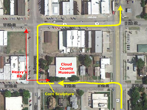 |
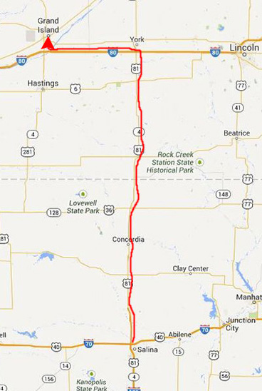
We parked the car by the Cloud County Museum and walked across the street to the restaurant- Heavy's Bar‑be‑Que. It was a pretty good meal, although Red, Hot and Blue in Dallas is better. After eating, we walked around for a few minutes, admiring the old downtown buildings before walking back to the museum, getting back in the car and heading off again up US 81 to Nebraska.
|
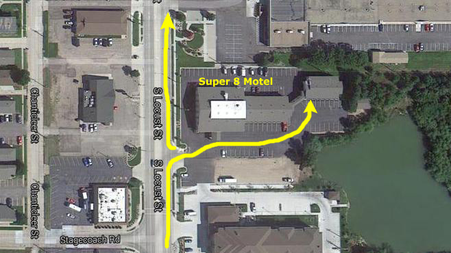
So we made a reservation at a motel in Grand Island and drove the 50 miles over there to stay the night. We were on the south side of downtown, right on the street that we would take north the next day.
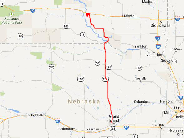
Driving from Grand Island NE to Chamberlain SD
|
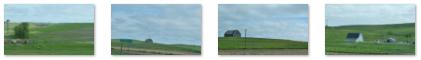
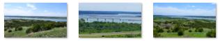
Fred took quite a few pictures of the rolling Nebraska and South Dakota farmland on our way up to I-90, and I've put clickable thumbnails for some of these below:

|
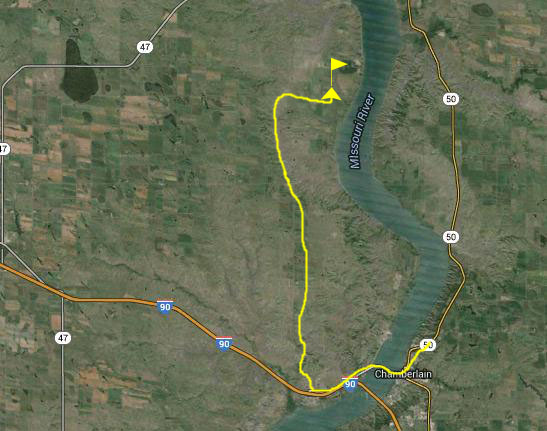
We called Guy when we got close to Chamberlain, driving west on I-90. He told us to go ahead and get off the Interstate on Business I-90, which would take us right into the center of Chamberlain. You can see the Missouri River ahead in that last picture, and the second of two bridges across it here at Chamberlain (the other being the actual Interstate Highway bridge about two miles south). At the stop sign, Main Street, we turned left, went three blocks, and pulled into the parking lot of St. James Catholic Church where we found Guy waiting for us.
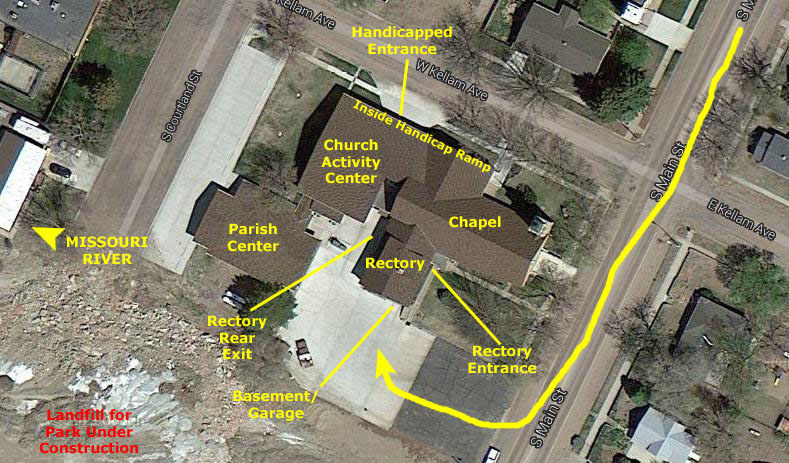
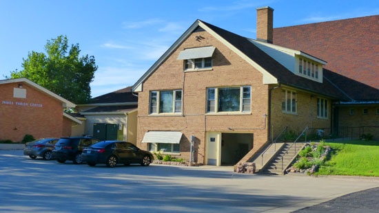
Guy's House: The St. James Catholic Church Rectory
|
There is already a small park across the street; it has an avenue of flags, some whimsical sculptured animals, and some little gazebos and picnic areas. I assume that this park will continue on Guy's side of the street, eventually.
As for the rectory itself, it is really quite nice- especially for just one person.
 View East and South |
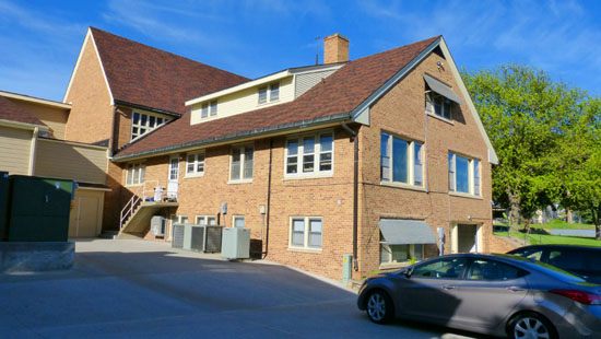 View West and South |
The rectory is actually three stories. On the bottom level is Guy's garage and a basement. You can get to the second floor via the stairway at the north end of the garage, which is the same stairway that you find when you go in the main entrance- which is in front, at the point where the rectory attaches to the church. When you come in that entrance, the church is on your left, there are stairs in front of you down to the basement, garage and church office, and there are stairs up to the level of Guy's first floor.
|
Back at the front entrance, if you go straight ahead you pass Guy's formal office on your left; it is spacious, with a large desk, chairs and bookshelves. Continuing straight ahead brings you to the living room, which is at the southeast corner of the floor, and on your right are the stairs up to the second floor. The living room has windows on the east and south, and on the west there is a large opening leading directly into the dining room, which at the southwest corner of the floor (on its north wall is the doorway to Guy's small office and the kitchen behind it.
It may sound a bit confusing, but you can think of the first floor as a donut, with the stairs to the second floor in place of the "hole." You can walk continually around in a circle on this floor. If you take the stairs up to the second floor, you'll find a door ahead of you that leads to Guy's bedroom suite (large bathroom on the west and bedroom on the east). If you go around the landing to your right you'll come to the door of the guest room, which has its own ensuite bath. The guest room is above the living room and Guy's bedroom is above his large first floor office. Both bathrooms are basically above the kitchen and dining room on the west side of the second floor.
Most of the pictures we took were of Guy's amazing collection of potted plants- violets, geraniums, succulents and some others. These are on multi-level baker's racks in front of each set of windows on the first floor to maximize the amount of light they get. Also on those shelves are a collection of little wooden New England houses that Guy has. Guy and Fred had always talked a great deal about his plants and his attempts to keep them healthy, and now we know what a big job that is. Fred took lots of pictures of the racks of plants, and if you would like to see some of them, you can use the clickable thumbnails below:
 |
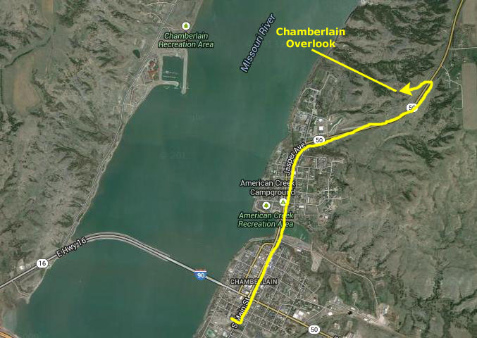
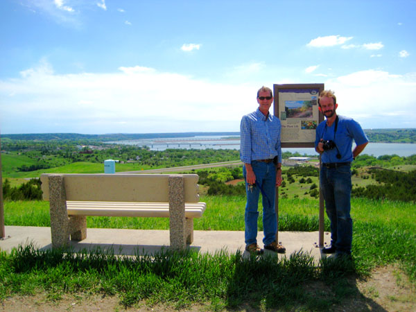
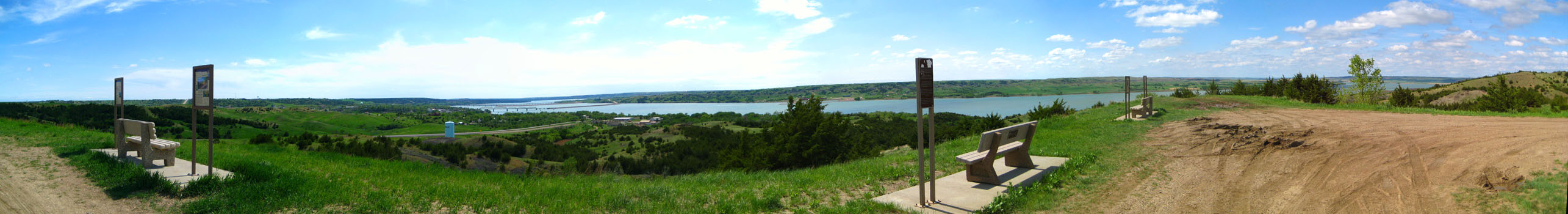
The View Point Above Chamberlain
|
The first would be north of Chamberlain on a high point above the river and the town. From there, Guy said, we should be able to get wonderful views of the river, the town and the surrounding countryside.
The other stop he wanted to make was on the other side of the river and a good ways from the river itself. It was an old settler's cemetery, and Guy said it tied in to the Lewis & Clark expeditions and the Corps of Discovery.
So we piled into guy's car and headed off.
To get to the view point, we just turned north on Main Street and went right through town. That street becomes South Dakota Highway 50. After a mile or so, we passed the entrance to the St. Joseph's Indian School, an institution run by Guy's order. We aren't going to stop there today, but save that so that Prudence and Ron can see it, too.
|
The view was simply spectacular; we could see all the way downriver well past Chamberlain and the I-90 bridge, Chamberlain itself, and a long stretch of the river passing us and heading north.
 |
One of the pictures that Fred took shows a resort hotel and conference center, the name of which escapes me. The reason for including that picture in the album is that we ended up having dinner there after Ron and Prudence arrived and we returned to Chamberlain from Rapid City. You can see that picture here.
|
|
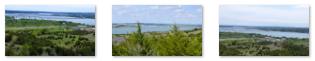
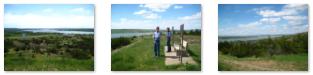
Fred also took some excellent pictures from here at the overlook, and I have put clickable thumbnails for some of them below:
|
As I mentioned earlier, I did do some picture-stitching to create two panoramic views. The first, the product of four different pictures, is below:
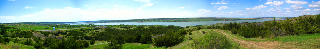 |
The second, the product of rather more individual shots, can be viewed in the scrollable window below:
The overlook was really neat, but Guy had something else to show us, so we headed back towards Chamberlain on highway 50. Down towards the bottom of the hill, I saw a turnoff towards the river, and asked Guy if he would stop there for a moment so I could walk down and see what the river looked like close up.
|
|
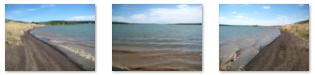
I was a bit surprised to find that the river looked more like a big lake; I couldn't really detect any flow downstream (although I am sure there was), and there were actually waves lapping at my feet- just like you might see at a lake on a windy day. I made a movie down here at the shore, and you can watch it with the player at left.
I also took a few still pictures, and you can use the clickable thumbnails below to have a look at them:
 |
I came back up to the car and we headed off to the cemetery.
An Old Settler Cemetery
|
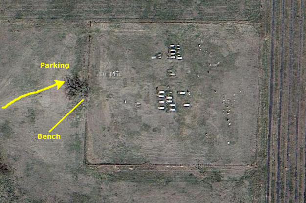
I have done some investigation, and have pinpointed the location of the cemetery, and you can see it on the aerial view at left. It is actually on land belonging to the Lower Brule Tribe, but it wasn't until later in the week that we drove through some of the populated areas on the reservation.
After a number of turns, we came down a hill and I could see we were back close to the river again (and that fact helped me locate the cemetery). We turned north, and just past an intersection came to the church and cemetery.
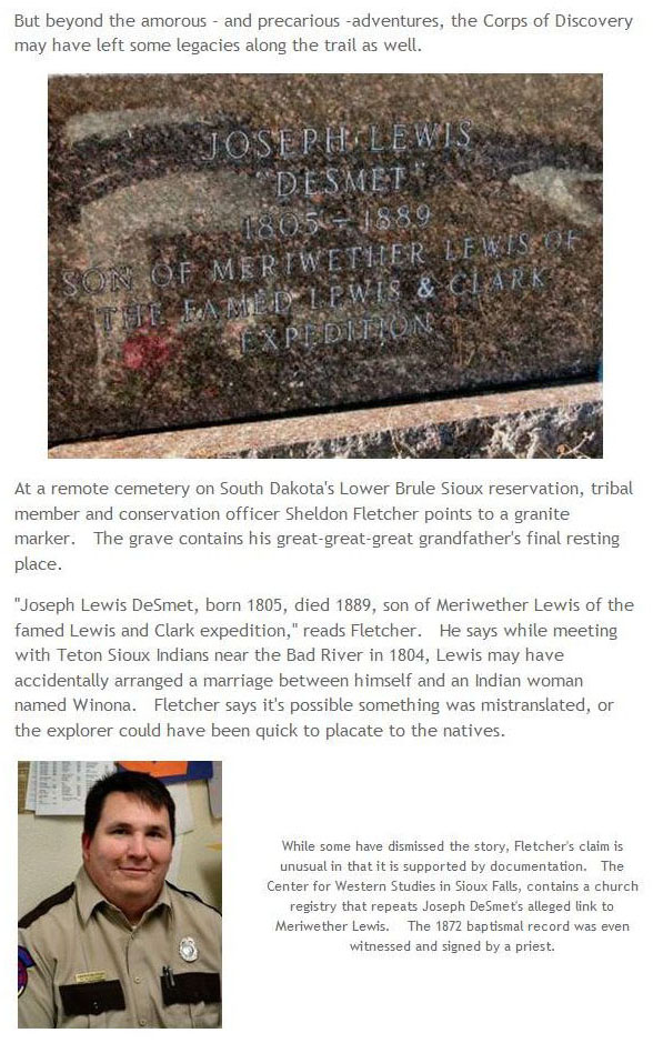
I can't find much information on the church or the cemetery. What I did find out was that the church itself, St. Alban�s Episcopal Church, was established at Fort Hale, South Dakota, sometime around 1875. The church seems to have been the first one in Lyman County. The cemetery, actually, is still in use.
|
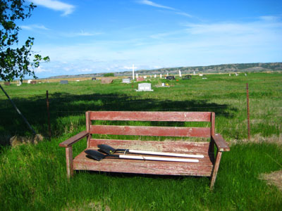 |
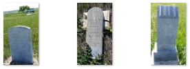
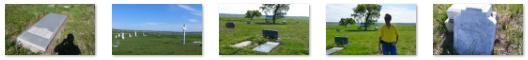
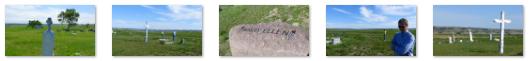
We made a complete circuit through the cemetery looking at all the interesting markers. And some of them have unusual stories behind them. In fact, the reason that Guy brought us out here was to see the grave of Joseph Lewis DeSmet- the son of Meriwether Lewis of Lewis and Clark fame.
 |
www.nathpo.org/Many_Nations/mn_news12.html
But I have put the relevant part of the story for our visit to the cemetery in the scrollable window at left. You can read about Joseph Lewis DeSmet, and see the same picture of his grave marker that we took on our visit. Below are clickable thumbnails for some of the other pictures I took here:
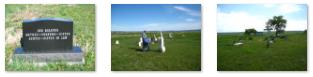 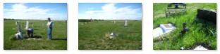 |
With his usual eye for detail, Fred also took a number of pictures around the cemetery, of the setting and of the individual graves. I've put clickable thumbnails below for quite a few of these pictures; you may not want to look at all of them, but all are interesting in their own way:
|
  |
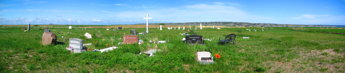
My own penchant is for panoramic views, and I made one here at the cemetery by combining four separate pictures. A copy of that panoramic view is below:
 |
Finished at the cemetery, we headed back to Chamberlain. Guy tried a different route back to the Interstate, and it worked out fine, and thirty minutes later we were heading back across the Missouri River Bridge into Chamberlain. The three of us had a nice, home-cooked dinner (thanks, Guy!) in the rectory, and spent some time catching up before heading off to get some sleep prior to our trip over to Rapid City tomorrow.
You can use the links below to continue to another photo album page.
|
May 28, 2013: Rapid City and Mt. Rushmore |
|
Return to the Index for Our South Dakota Trip |