|
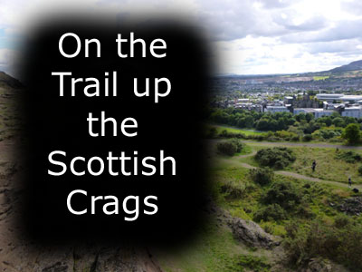
September 15, 2013: Sightseeing in Edinburgh (Day 2) |
|
September 13, 2013: Hadrian's Wall and Vindolanda |
|
Return to the Index for Our British Isles Trip |
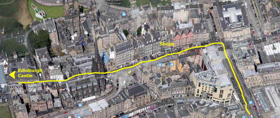
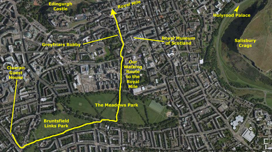
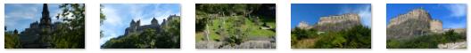
Today will be our first full day here in Edinburgh, and we plan to see as much as we can. We've gotten directions from our hostess on how to walk into the center of town to what's called "The Royal Mile," a street of shops, restaurants, old building and churches that begins near Edinburgh Castle and ends near Holyrood Palace. Once there, we plan to have a look around and perhaps take one of the "Hop-on, Hop-off" bus tours around town; this will enable us to determine what we would like to see on our own. Once we return to the starting point on the Royal Mile, we'll determine what we want to see during the rest of the day.
Our Morning Walk to The Royal Mile
 |
I had gotten up early this morning, and so before breakfast I went out to see the neighborhood around the Cluaran House.
|
Bruntsfield Road |
Nor did the buildings have their own parking; a typical street had all the available curb space taken up by parked cars, and I noticed that Edinburgh does the same thing as many cities- giving the actual residents of the neighborhoods stickers for their cars so that spaces are not continually taken up by folks who don't live there. Still, I suspect that there were more cars than parking spaces.
I returned to Cluaran House as everyone else was getting to the dining room for breakfast which, at Cluaran House, was cooked to order. (I discovered on this trip that this is the typical arrangement for bed and breakfast accommodations, unlike at Ruckman Haus where Ron prepares a set breakfast for all guests each day.)
|
Walking Up Leamington Street |
We crossed Bruntsfield Road and headed into the Bruntsfield Links park, angling off to the northeast along the edge of the park. It was nice walking, and we'd gotten an early start, so we passed a number of folks walking through the park (it was Saturday and so few people we saw were actually going to or from work), and some early birds already out jogging or biking.
It was a pleasant walk through the Links (why it is called that, I do not know, although we did see one golfer practicing his swing, but no course to speak of). Karl did well on the walk (as he did throughout the trip) although I know he has difficulty going as fast as everyone else.
|
Off to our right (south) Fred got a picture of the beautiful old buildings of what must have been a very nice residential neighborhood. For my park, I got a nice picture of Prudence and Nancy in Bruntsfield Links park.
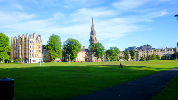
At the bottom of the long, downward-sloping hill, we crossed a street and came into The Meadows park.
|
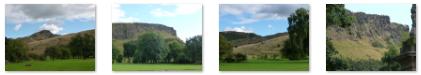
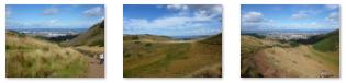
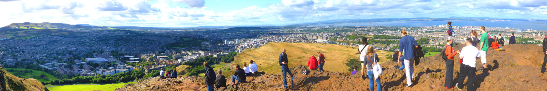
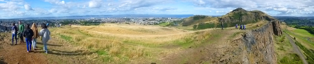
In my picture at right, you can see the geological features known as Arthur's Seat, the mountain at right, and the Scottish Crags, the ridge of lower cliffs at left. I was wondering whether it might be possible to do some walking there during our stay here in Edinburgh when Fred tapped me on the shoulder to show me a picture he had just taken of Arthur's Seat using his zoom. As you can see, there were people on top of Arthur's Seat, and so the question of whether one can get up there was answered. Now the only question was when and how, and that I planned to find out.
We crossed through the middle of the park heading north, left the park, and found ourselves on a broad walkway, called Middle Meadow Walk that sloped up to the north taking us towards the city center.
|
From here to the Royal Mile, we passed a number of interesting buildings and sights. One of the most famous is the Greyfriars Bobby Bar. Actually, it isn't the bar that's famous, but the little dog it's named for- Greyfriars Bobby. Greyfriars Bobby was a Skye Terrier who became known in 19th-century Edinburgh for supposedly spending 14 years guarding the grave of his owner until he died himself on 14 January 1872.
The story continues to be well known as active oral history in Edinburgh, through several books and films, and because a prominent commemorative statue and nearby graves act as a tourist attraction. The bar is part of a row of buildings on the west side of the street, beyond which is Greyfriars Kirk, a park-like area containing two churches that date from the 1500s and a large graveyard- the same graveyard where the terrier supposedly kept vigil.
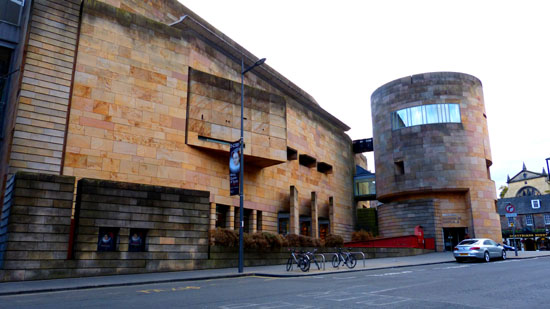
Other points of interest we passed (at least one of which we'll visit later) were the Edinburgh Central Library and the Royal Scotland Museum. (This is a view of the new wing; much of the museum is much older.)
|
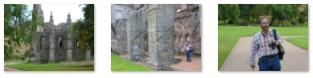
And below are clickable thumbnails for some additional pictures we took along George IV Bridge:
|
|
To view the slideshow, just click on the image at left and I will open the slideshow in a new window. In the slideshow, you can use the little arrows in the lower corners of each image to move from one to the next, and the index numbers in the upper left of each image will tell you where you are in the series. When you are finished looking at the pictures, just close the popup window.
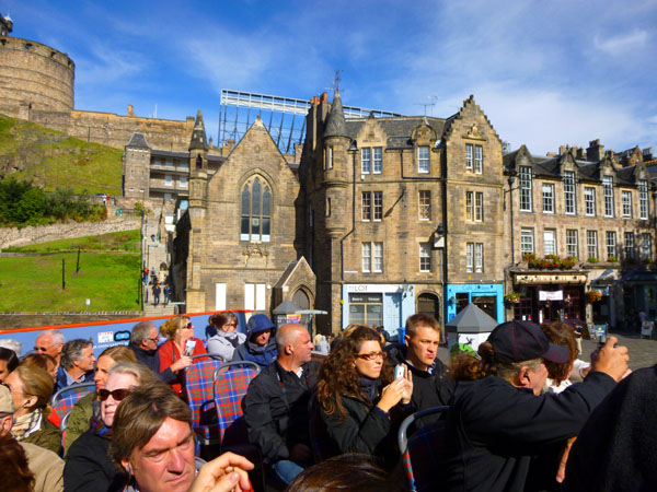
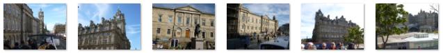
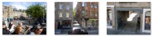
After an hour's walk from Cluaran House, we arrived at the intersection of George IV Bridge and High Street- the western end of the Royal Mile.
|
We came up George IV Bridge from the south, reached the intersection of Bank and High Streets, and paused to have a look around. We eventually walked up towards Edinburgh Castle to look at some of the shops and perhaps buy a thing or two. We walked up towards the castle and took a few pictures there, but thought we would save a tour of it until later.
Eventually, we came back to the area just west of the intersection, for this is where the tour buses stopped.
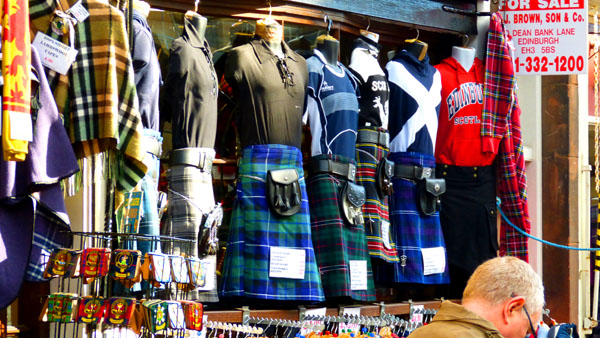
Standing on the southeast corner of the intersection, I faced northwest (towards the castle) and took a picture of the area of shops where we spent some time looking around. You can see that picture here.
|
At the Top of the Royal Mile |
I stopped to make a movie here, not for the least reason that in front of the building on the northeast corner of the intersection there was someone playing bagpipes (for what reason I was not entirely sure, as I don't recall seeing a collection tin about). You can watch that movie with the player at right.
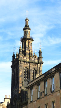
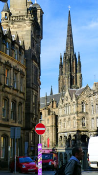
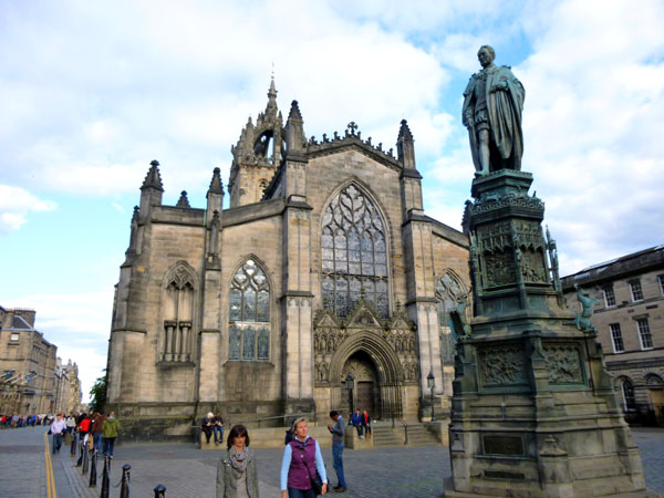
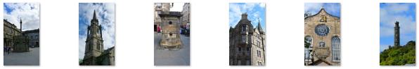
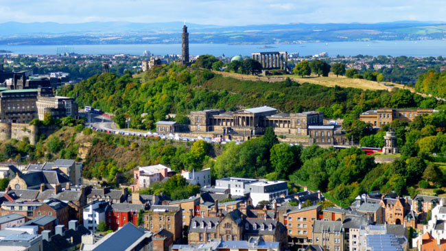
You may have noticed, as I turned in making the movie, that I panned by St. Giles' Cathedral. St Giles', more properly termed the High Kirk of Edinburgh, is the principal place of worship of the Church of Scotland in Edinburgh. Its distinctive crown steeple is a prominent feature of the city skyline, at about a third of the way down the Royal Mile which runs from the Castle to Holyrood Palace. The church has been one of Edinburgh's religious focal points for approximately 900 years. I hope to come back to have a closer look later.
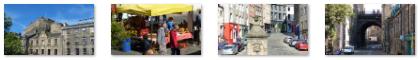
Finishing with my movie, I crossed to the northwest corner of the intersection and rejoined everyone else, who were at one of the wool shops looking for scarves or some other souvenir. As I did so, I was able to look north down Bank Street, which makes a left turn in front of the muncipal building in the photo and then continues down to a park and, eventually, Edinburgh's main train station.
Looking up towards the castle, there was what appeared to be a beautiful church just up the street, and while the others were shopping, I went over to have a look at it and at another church just across the street- St. Columba's Free Church. I learned later that the church and this building were part of the same church, but weren't any longer. I'd found another church that had been converted to a different use. The main part of the church was originally the Tolbooth Church (built in 1842-44) and it housed the General Assembly of the Church of Scotland; its tall gothic spire is the highest point in central Edinburgh (outside of the Castle) and a landmark visible for miles around. But it's no longer a church. The sanctuary is now called The Hub, and is the central box office and information center for the Edinburgh International Festival, an annual festival of performing arts that takes place during the month of August. What used to be the administration building for the Tolbooth Church became a church on its own.
|
Along the street there were two or three passageways through the buildings that led to interior courtyards or plazas where there were other buildings. One calls the passageway/courtyard a "close," and you can look through one of them here. And, although it is really of British origin and not Scottish, I couldn't resist taking a picture of an iconic English phonebooth. Given the fondness of the British for mobile phones (particularly the royalty), I can't imagine that there are many of these around any more.
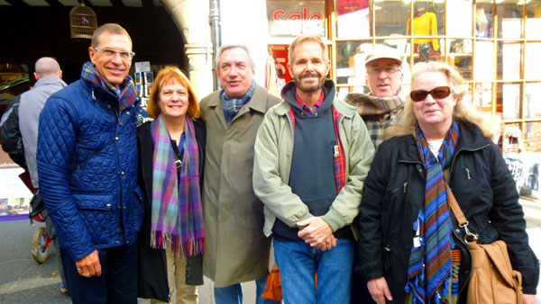
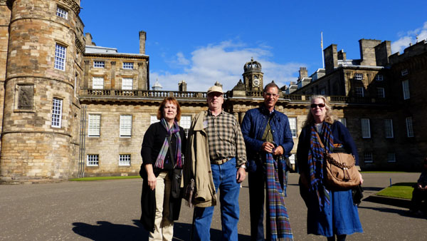
When we were done shopping, we walked up the street towards Edinburgh Castle, just to see what it looked like; we planned to tour it later. Just before entering the plaza in front of the castle (which was still set up for a ceremony held the week before), there was a narrow street heading down the peak to the north and a stairway going down to the south. I'd have a chance to come up that stairway a day or two hence. In the plaza, we checked on opening times and tickets for the Castle, and I got a picture of our group.
|
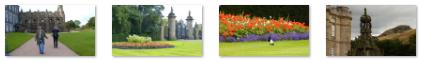
I want to include some additional pictures while were here before our tour bus ride; they are all interesting in one way or another, and you can use the clickable thumbnails below to have a look at them:
|
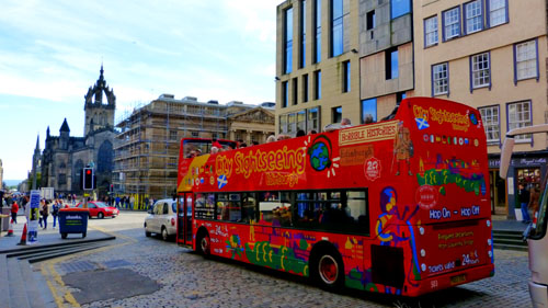
Then we waited a few minutes for the next "Hop-on, Hop-off Sightseeing Bus" to come along.
Our Ride on the "Hop-on, Hop-off" City Sightseeing Bus
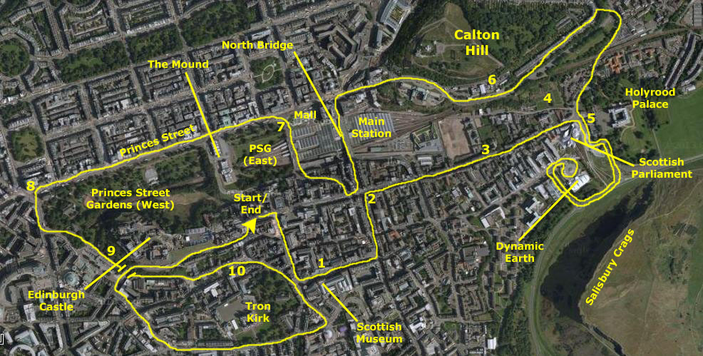 |
You'll note some little numbers along the route; these are reference numbers that will tie the text and pictures below to the aerial view above. They will indicate where we were when most of the pictures were taken.
|
A couple of blocks south, the bus turned left on Chambers Street (1) to take us past the front of the Royal Museum of Scotland. Then we continued on down the street to turn left on South Bridge to head back north to the Royal Mile. As we were heading north, I took this picture of one of a British chain of game and comic book stores- mostly because I thought the name was interesting and I was a fan of the movie.
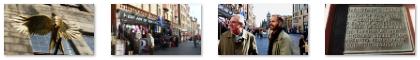
As we continued north on Bridge Street, we came back to the intersection with High Street (the Royal Mile), and on our left was a beautiful old church, and I found myself thinking that it might be nice to walk back by it later to have a look at the inside. That never happened, and it is probably just as well. The Tron Kirk is a former principal parish church here in Edinburgh. It is a well-known landmark on the Royal Mile. It was built in the 17th century and closed as a church in 1952. Having stood empty for over fifty years, it was used briefly as a tourist information centre, but is now standing empty again and closed to the public. This was the fourth "repurposed church" that we found on our trip, but it would not be the last.
At the High Street (2), we turned right, towards Holyrood Palace. As we turned, Fred got a picture looking back up high street while I got a picture looking down High Street towards the palace over a mile away. You can see that view here.
|
  |
High Street, the Royal Mile, ends at Holyrood Palace (5), and here the bus turned right with the Scottish Parliament building on our right as we made the turn. In front of us, we could see the Holyrood Palace, the official residence of the Monarch of the United Kingdom in Scotland. It has served as the principal residence of the Kings and Queens of Scots since the 16th century, and is a setting for state occasions and official entertaining. It is also one of the places that is worth a return visit, and so we have put it on our list of things to see. As we came around to the south, we could see the east side of the Scottish Parliament building. Here there were lines of what we assumed were tourists waiting to get in. The building took five years to complete, and overran its initial cost estimate by a factor of ten. Before we reached the Crags, we also passed the main gate of Holyrood Palace.
|
Our bus came around to the west and then turned north to the Dynamic Earth museum, which is, apparently, a popular hop-on/hop-off point. It was an interesting building with its tent-like roof, and in a great location with the Crags and Arthur's Seat in the background. As we made the turnaround, there was another view of the buildings comprising the Scottish Parliament, and after we came back out to the perimeter road below the Crags to head back past Holyrood, we could see that the museum was actually an old fort that had been converted into the museum complex. Then the bus retraced its route to go back past the Holyrood Palace and north beyond it.
We continued up Abbeyhill Road as it ascended Calton Hill. Along the shady street we passed some interesting old structures, and you can have a look at them here and here.
|
The actual school moved to other, more modern and larger quarters in 1968, and since that time it has been used as an Edinburgh municipal building, housing various city departments. It was proposed as the new devolved Parliament building a number of times, but the new buildings you saw a little while ago down by Holyrood Palace were built instead.
From the road, we could also look up towards the top of Calton Hill and we could see the Nelson Monument up on top of the hill. I made a mental note that if there were time remaining after my hike, I would get back on the bus and come here to the hill to see the monument and whatever else might be up top. When we got to the western end of the hill, we could look ahead and see the main train station and North Bridge Street arcing over it.
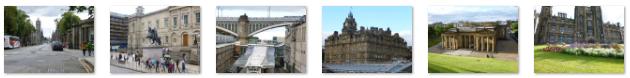
Regent Road turned into Princes Street and the sightseeing bus headed to its next scheduled stop- which is actually the beginning of the route. This stop is adjacent to Princes Mall, located at the northwest corner of the main train station (7). To get there, we had to make a quick circle around the station so we were pointed the right way to continue down Princes Street. Along the way, we passed some interesting buildings and I took a few noteworthy pictures. You can use the clickable thumbnails below to have a look at them:
 |
We eventually pulled up to our stopping place (7) on one of the street bridges that cross over the tracks of the main station, pointed north to continue our trip down Princes Street once folks had gotten on and off the bus. I found this to be another interesting example of how train stations in Europe are the town's transportation nexus. We don't have an analogy here; even though many people fly, airports are usually way the heck outside the city, so one always has to first navigate that distance before one can move around in the center city. Anyway, while we were waiting for the tour to resume, we had a chance to snap a number of pictures looking all around, and you can use the clickable thumbnails below to see some of them:
|
Just to our left was a tall monument, but we couldn't get a great view from here, but when the sightseeing bus continues on down Princes Street we'll be able to see it clearly. Right now, all we could see were the lunchtime walkers near the base of the structure. Eventually, when the bus pulled out onto Princes Street we could get a clear view. Driving west on Princes Street, we were alongside the Princes Street Gardens- a public park in the centre of Edinburgh, in the shadow of Edinburgh Castle. The Gardens were created in two phases in the 1770s and 1820s following the long draining of the Nor Loch and building of the New Town, beginning in the 1760s.
|
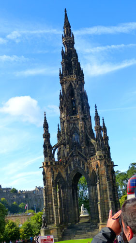
The most prominent feature of the East Gardens is the Scott Monument (shown at left), a Gothic spire built in 1844 to honour Sir Walter Scott. In the middle of the east section, out of our sight, are also statues of the explorer David Livingstone and the essayist John Wilson (Christopher North), along with a small commemorative stone honoring local volunteers who fought in the Spanish Civil War.
After we passed the Mound (now the site of two museums) we could see the statue of the poet Allan Ramsay, the church reformer Thomas Guthrie, and the obstetric pioneer James Young Simpson. Other monuments are the Royal Scots Memorial, the Royal Scots Greys Memorial, the Scottish American War Memorial, the Ross Fountain and Bandstand, and the Norwegian Brigade War Memorial. Here are some additional views from Princes Street of the Castle, the Gardens and the streets north of us:
  |
At the west end of the gardens, at the corner of Princes Street and Lothian Street (8) stands St. John's Episcopal Church. The church was dedicated as St John's Chapel on Maundy Thursday 1818 with construction having begun in 1816. It was designed by the architect William Burn. The actual congregation had begun in 1792 when Daniel Sandford came to Edinburgh to minister on Church of England lines. The sanctuary and chancel were built in 1879-82 by John Dick Peddie and Norman Boyd Kinnear. The vestry and Hall in 1915 to 1916 by John Dick Peddie and Forbes Smith. At Lothian, the bus turned south alongside an early century office building.
The bus turned left on Kings Stables Road, a route that runs along the south side of Princes Gardens, past the Chapel of St. Cuthbert, and on around below the peak on which Edinburgh Castle sits. Fred got some good pictures along here (9), and you can use the clickable thumbnails below to see them:
 |
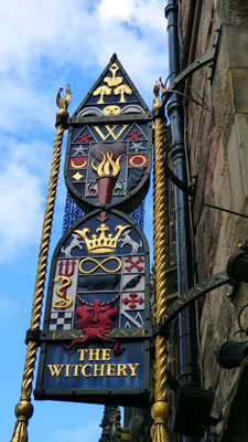
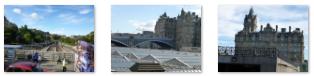
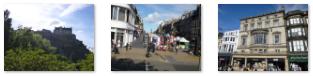
We came through a short tunnel and out into an area of Edinburgh south of and below Edinburgh Castle called The Grassmarket (10).
|
  |
At the bar, we turned south along the same street we'd walked up this morning, and the bus went south to Lauriston Street and then west again. At Lady Lawson Street, the bus turned northwest, passing a post office building, and continued to the intersection with Castle Terrace. Turning right, this took us over Kings Stables Road (the tunnel we'd been through earlier) and up onto Johnston Terrace just below the Castle.
We followed Johnston Terrace up and around to the east, climbing up below Edinburgh Castle and past another set of steps that lead up from Johnston Terrace to the Castle entrance. (I would be climbing these steps tomorrow.) Finally, the bus came around the south side of the Tolbooth Church, that repurposed church that we had seen on our arrival at the Royal Mile this morning. Then the bus brought us back to our starting point.
Along our ride up Johnston Terrace, there were unobstructed views looking up at the buildings that comprise Edinburgh Castle. Fred took some really good pictures of these buildings, and you can use the clickable thumbnails below to have a look at them:
 |
I'd already told everyone else that I was going to stay on the bus, return to Holyrood Palace and then hike up to Arthur's Seat and the Scottish Crags. For their part, they were going to have some lunch, do some shopping and go and see Holyrood Palace. So we split up here.
The Group Has Lunch and Walks the Royal Mile
|
You might remember that when we arrived at the top of the Royal Mile earlier, there was a bagpiper standing in a doorway at the intersection playing his instrument. Well, oddly enough, when they walked by the same building heading east along the Royal Mile, there was a different bagpiper in the same place.
From the restaurant, they took about 45 minutes to walk down (east) along the Royal Mile to end up at Holyrood Palace. Along the way, they passed a number of interesting buildings, churches and statues, and Fred also took a good picture of the Nelson Monument on top of Calton Hill to the north. I can't say much more about the objects of the photographs since I wasn't along, so let me just put clickable thumbnails for a selection of the best of them below:
  |
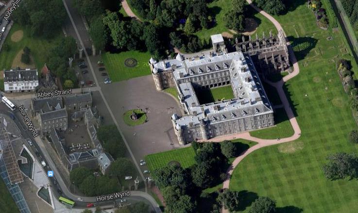
The Group Visits Holyrood Palace
|
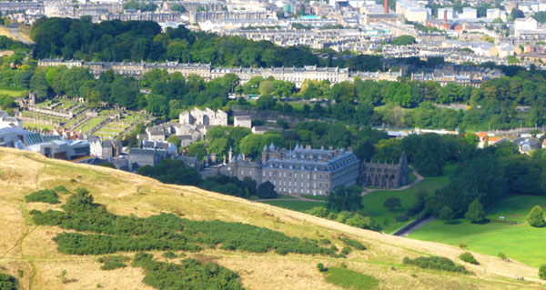
James IV constructed a new palace adjacent to the abbey in the early 16th century, and James V made additions to the palace, including the present north-west tower. Holyrood Palace was re-constructed in its present form between 1671 and 1679 to the Baroque design of the architect Sir William Bruce, forming four wings around a central courtyard, with a west front linking the 16th‑century north‑west tower with a matching south-west tower.
The Queen's Gallery was built adjacent to the palace and opened to the public in 2002 to exhibit works of art from the Royal Collection. It is the building that we were able to see from the sightseeing bus as it is west of the Palace and quite near the street (called Horse Wynd). You might remember that as the bus followed that street, it passed the ornate south gate, and you can see that gate in the aerial view.
Queen Elizabeth spends one week in residence at Holyrood Palace at the beginning of each summer, where she carries out a range of official engagements and ceremonies. The 16th century Historic Apartments of Mary, Queen of Scots and the State Apartments, used for official and state entertaining, are open to the public throughout the year, except when members of the Royal Family are in residence.
|
Just through the gate, Fred found himself in the plaza in front of the Palace. There was a fountain there, and it was a good place to pose for pictures. From the plaza, the group found that they could get in to take a look at the interior courtyard, which they did. Fred got a couple of good pictures there, and there are clickable thumbnails for them below:
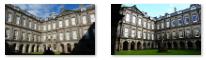 |
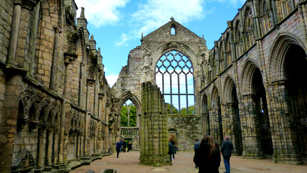
The Palace itself was not open today, and so the group didn't go inside. They did have the opportunity to walk through the ruins of the Abbey, though, and that's where they headed next. Holyrood Abbey is today only a ruin. It was founded in 1128 by King David I. During the 15th century, the abbey guesthouse was developed into a royal residence, and after the Scottish Reformation the Palace of Holyroodhouse was expanded further. The abbey church was used as a parish church until the 17th century, and has been ruined since the 18th century. The remaining walls of the abbey lie adjacent to the palace, and they are now protected as a Scottish national monument.
|
Below are clickable thumbnails for some of the pictures Guy took inside the Abbey:
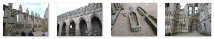 |
The original abbey church of Holyrood was largely reconstructed between 1195 and 1230. The completed building consisted of a six-bay aisled choir, three-bay transepts with a central tower above, and an eight-bay aisled nave with twin towers at its west front. The side aisle adjacent to the new Palace is in pretty good shape, and you can see it here. The Parliament of Scotland met at the abbey 7 times before 1410, and in 1326 Robert the Bruce held parliament here. There is evidence that Holyrood was being used as a royal residence by 1329. The treaty ending the First War of Scottish Independence was signed here, and the Abbey was often visited by Scotland's kings. Increasingly, the Abbey was used for secular purposes until James IV constructed the a royal palace here.
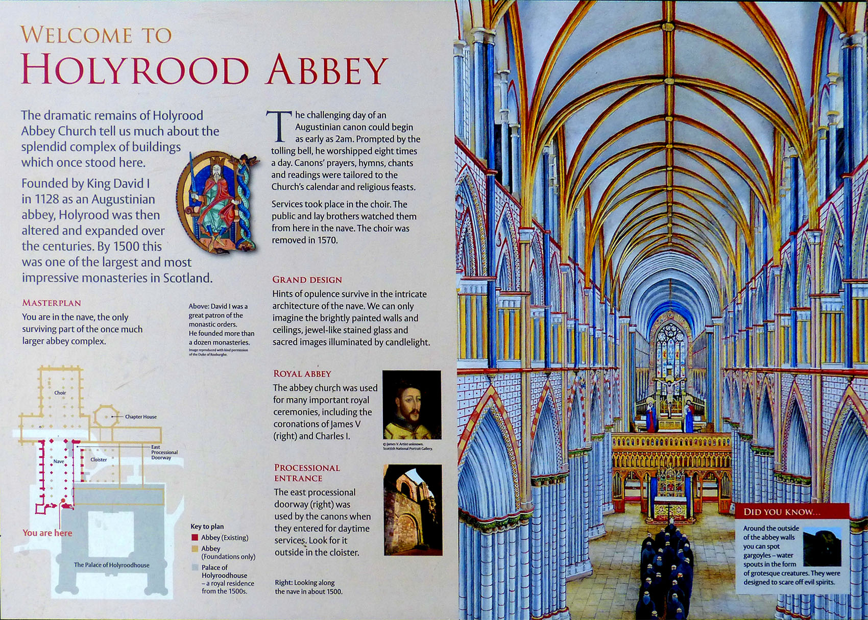
Fred found an interesting and informative sign inside the Abbey that explained a lot about it, and which also had a drawing of what it must have looked like at its height. I have put this sign in the scrollable window below so that you can read and look at it:
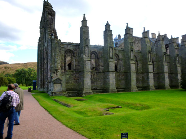
The Abbey enjoyed something of a renaissance under James VII in the first half of the 17th century, but in 1688, following the Glorious Revolution, the Edinburgh mob broke into the abbey, destroyed the Chapel Royal and desecrated the royal tombs. The roof was vaulted in stone in 1758, but the work was badly executed, and during a storm in 1768 the roof collapsed, leaving the abbey as it currently stands, a roofless ruin. Even the ruins are impressive, though, and I have put clickable thumbnails below for some of the best of the pictures Fred took while he was wandering around inside the ruined Abbey:
 |
From inside the ruined Abbey, the group went outside to the north side of the ruin, where they found a small garden and pleasant walkways that offered them a view of the ruined Abbey from the outside.
|
They spent some time wandering around and looking at the ruins and at the plantings nearby. I have put clickable thumbnails below that you can use to see some of the pictures that Fred and Guy took:
  |
Eventually, the group walked around the back (east) side of the ruin and the palace to the south side of the palace grounds.
|
|
The pictures from Holyrood Palace are the last I have from Fred and Guy until later in the day after we'd met up once again, so now we'll go back a few hours to the point where I left them at the top of the Royal Mile.
I Climb to the Top of Arthur's Seat
|
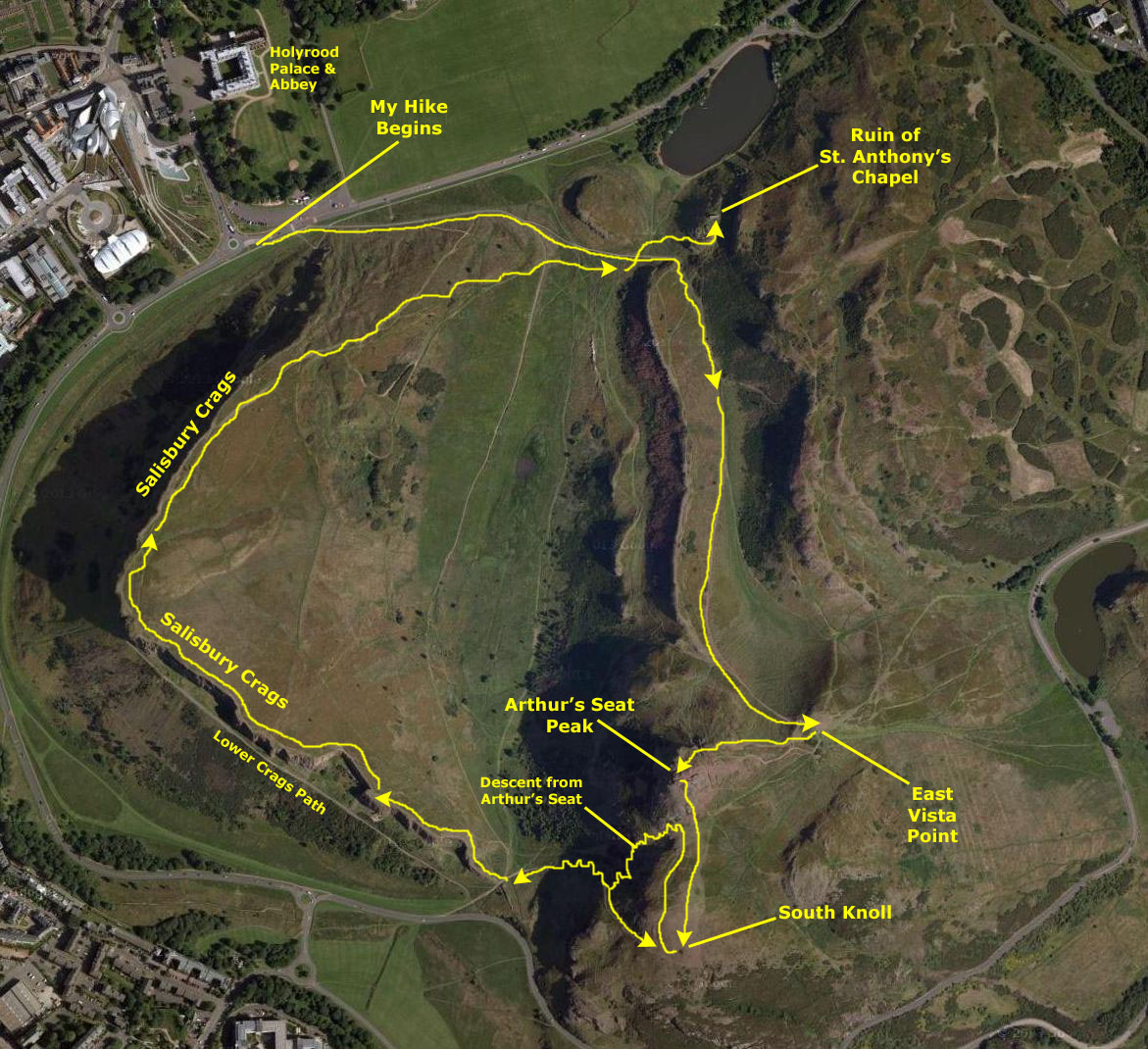
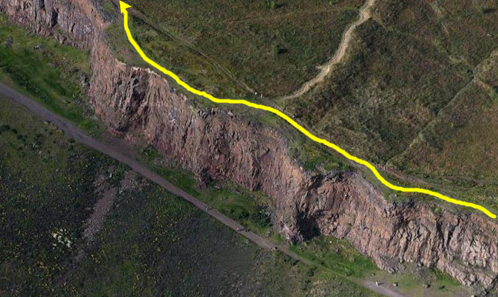
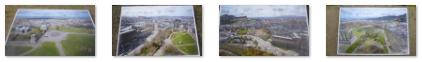
I want you to be able to follow along with me on my hike- not just with the pictures I took but also with the path I followed. I've created an aerial view of the entire area and have marked my route and the major stopping points on it. I've put that view in the scrollable window at left.
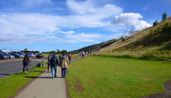
You can see where my hike began, along the perimeter road south of Holyrood Palace, as I headed up and to the east. Return to this spot on the page as often as you like to follow along with me. I'm going to divide the part of the hike that took me to the top of Arthur's Seat into sections, and those sections have been marked on the aerial view, each one ending with an arrowhead.
So head off with me as we climb Arthur's Seat.
From the Starting Point Past St. Anthony's Chapel
So I walked along the sidewalk for a ways until I came to the point where the actual trail angled off from it heading up the hill. At that point, I took a picture
looking back to my starting point.
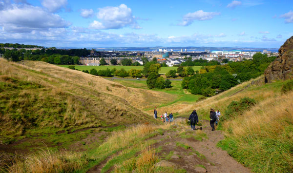
Then I followed the path and the people as it headed slowly upward to the east, and after a short distance I could see the ridge in front of me. I wasn't sure where the path actually went, but soon found out that the area was crisscrossed with them. I passed one path to my left that seemed to lead along level ground to the south, going to the west of and below the mountain peak, so I continued straight ahead. This path headed towards
the ridge in front of me.
It seemed as if the trail up to the top of the peak would be behind that ridge, and it was. When the trail got past the ridge, it turned south behind it and began to rise quickly. Looking back, I could see there was
a little lake behind me.
That lake, I would later learn, was directly below the ruins of St. Anthony's Chapel and would form the backdrop for many of my pictures of it. There was a turnoff trail that led up to those ruins (whose name I did not know at the time), but I thought I would visit them after visiting Arthur's Seat and the Crags.
Climbing to the Vista Point
The views got better and better as I ascended, as you can see from three of the pictures I took on the way up. There are clickable thumbnails below for three of the best, taken in order from left to right:
When I got up to the vista point, I was amazed at the views, as the entire area to the east and north of Edinburgh opened up. Only from this height could I see the loch north of the city, which has been the shipping route into the city from the North Sea for as long as the city has existed. And I could see for many miles east of Edinburgh along that loch, and I could see it opening out to become the North Sea way, way off in the distance. I took a series of six pictures of the vista- from due north to southeast- and put them together into a single panorama. You can have a look at it using the scrollable window below:
The first section of the hike took me from the sidewalk at the base of the mountains at the perimeter road, shown in the inset picture at left, east and into a draw behind a low ridge, where the trail turned south and began ascending steeply.
From the turn to go behind the ridge, all the way to the vista point below the Seat, the trail was a continuous upward slope, and at times it got fairly steep. It was here that I began to rue wearing so much clothing- a shirt, pullover and jacket on top. About a third of the way up to the point, I shed the jacket, and after another third shed the pullover as well. Both I tied around my waist so I wouldn't have to carry them in one hand.
Climbing to the Top of Arthur's Seat
I was, perhaps, twenty yards from the top of the mountain when I was passed by
a large group coming down.
They were guiding a person in a kind of wheelchair affair, holding him back with ropes while guiding him forward down the mountain. At first, I thought this was a rescue of some kind; perhaps someone had broken an ankle or leg or something. But I didn't recall seeing any emergency vehicles down in the parking area, and these didn't look like a fire rescue team. Then I noticed the legend on the vests many of them were wearing: "capability." So what I think now is that this is an organization that helps handicapped people go to places they could never get to on their own; certainly Arthur's Seat was far from "wheelchair accessible." (Note: As it turned out, I was right. The organization is "Capability Scotland," and it provides all kinds of regular services for the handicapped, as well as personalized services on request.)
Looking ahead to the top,
I could see some folks also watching the downward progress of the team, and I could see that my objective was in sight.
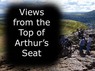
On Top of Arthur's Seat
Some other interesting views included one below and to the south, where I could see that visitors had constructed symbols and letters using little piles of rocks so that they would be visible to those on the peak. You can see some of this "graffiti"
here.
Another very interesting picture taken from the peak shows the stone stairway and path that leads from the perimeter road southwest of the peak up to the top of the viewpoint to the south of here. You can see that picture
here.
The path looked a good deal shorter than the path I'd taken from Holyrood Palace, but it was also a good deal steeper. Of course I could also see
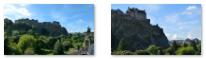
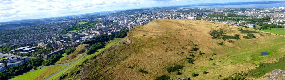
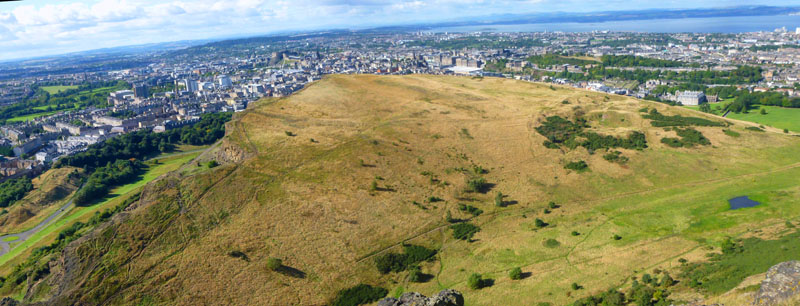
the Scottish Crags overlooking Edinburgh
below me and to the west. Another interesting view was one that I took looking back across Edinburgh in the direction of our bed and breakfast. You can clearly see
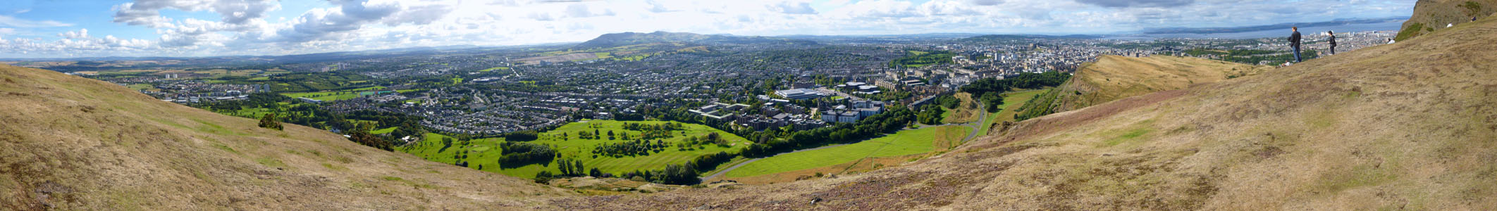
Meadows Park and the Bruntsfield Links-
the parks that we'd crossed early this morning. The views were just spectacular.
The Scottish Crags were a bit difficult to get into a single shot- and still get the panorama of the city below them, so I began by taking two pictures and putting them together. Here are the Scottish Crags as seen from Arthur's Seat:
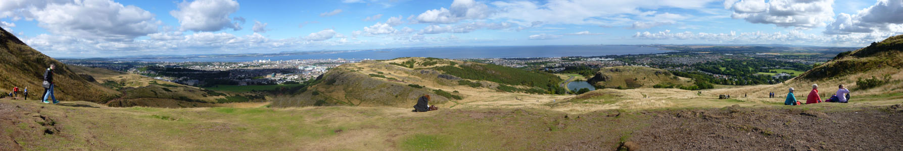
I wanted to take a 360° panorama from up where the marker was, but I had difficulty walking around it for the camera to create it. And the separate pictures I took didn't quite fit togther. I did get a couple of good panoramas, though. The first one consists of seven different pictures, and shows the view from the east, around through the south, ending up at the west. You can use the scrollable window below to have a look at this large picture:
As I climbed, the
views to the north
got better and better, and all of Holyrood Palace came into view; you can see the vista I saw at left. Up this high, I could also see the network of paths and trails that seemed to crisscross the entire park (Arthur's Seat and the Crags, along with a good deal of surrounding land, are actually Edinburgh's largest park). For example, you'll remember that just after I started out, a path led off to the left, and I thought it looked fairly level. I could see now that the path cut a straight diagonal route through the park; you can see that path far below me
here.
Just before I reached the summit of the mountain, I paused to look behind me,
back down to the vista point
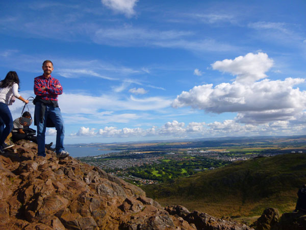
where I'd been standing a short while earlier. I was also treated to quite an amazing view to the east. From the summit there were, of course, fantastic views in every direction. One of the first things I did was to prevail on some other folks to take my picture. That's how I got the one at left. Another young lady took one of
me with the view to the east in the background.

|
360° Panorama from Arthur's Seat |
The Trails on the Scottish Crags |
|
To view the slideshow, just click on the image at left and I will open the slideshow in a new window. In the slideshow, you can use the little arrows in the lower corners of each image to move from one to the next, and the index numbers in the upper left of each image will tell you where you are in the series. When you are finished looking at the pictures, just close the popup window.
Finally, I was able to create a panorama that covers about 320°, excluding only a small section to the southeast that wasn't terrifically interesting. You can use the scrollable window below to scan across this panorama:

Descending to the South Knoll
When I got down to the level area below the peak, I could get a better look at the little rock piles that people had created to send messages to those standing on the peak above. These were made of small rocks, presumably gathered from around the area, but since I didn't see many that weren't already part of some inscription, I suspect that the inscriptions only last for a while before someone cannibalizes the rocks to use in a different way. This
rock heart
was the most recognizable artwork that I saw.
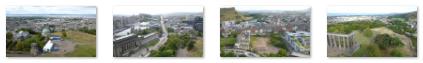
From the knoll below Arthur's Seat I got a number of excellent views of the city of Edinburgh, mostly to the east, south and west, and also some great views looking back up at the peak of Arthur's Seat from which I had descended. You can use the clickable thumbnails below to see a few of these pictures:
I also took a series of pictures beginning by looking east towards the North Sea, then panning around through the south and finally ending looking west out over Edinburgh, and you can look at the resulting panorama using the scrollable window below:
As I came down from Arthur's seat, I could get a different angle on the Scottish Crags, where I would be heading next. The view at left looks out across the Crags to the northwest, spanning the area from Holyrood Palace on the right across the large city parks on the left.

Descending from Arthur's Seat
The trail down was a good deal steeper than the trail up, and no so well worn. I suspect that most hikers park in the large area near Holyrood Palace and take that route up the mountain. Still and all, there were a number of hikers and kids that I passed on the way down. Below are clickable thumbnails for a couple of views of the trail that led about halfway down to another trail that ran across the cliff face below the knoll, and the beginning of the more improved trail down to the perimeter road:
When I got down to the improved trail, I found that there was a trail that continued to my left, back around the cliff face underneath the South Knoll; apparently, this was another trail up to the top, easier than the one I'd come down.
And you can use the clickable thumbnails below to see the pictures the hikers took of me as well as one I took while descending the trail back to the valley:
When I got down to the bottom of the trail, I did indeed find myself at a trail junction. I could have turned right and taken the level path through the valley to my starting point, I could have exited to the perimeter road and south Edinburgh, or I could continue straight ahead and up another trail along the edge of the Scottish Crags.
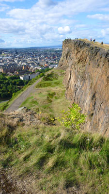
Climbing the Scottish Crags
There are a number of trails up to the highest point; one leads through the grass keeping some forty feet or more from the edge of the cliffs, while the other goes pretty much along the edge. The "edge trail" doesn't really start until you've ascended a good ways, and it isn't particular unnerving; you can go as close to the edge as you want to.
From the point where I am standing in the valley, you can see
the trail leading up
through the grassland. Looking the other way, behind me, you can see
the trail down from Arthur's Seat.
So, I started off up onto the Crags.
To view the slideshow, just click on the image at left and I will open the slideshow in a new window. In the slideshow, you can use the little arrows in the lower corners of each image to move from one to the next, and the index numbers in the upper left of each image will tell you where you are in the series. When you are finished looking at the pictures, just close the popup window.
There was another
trail at the base of the Crags;
although I didn't have time to walk along it, I suspect the the views looking up at the cliffs are as interesting as
the views from the top of them.
I took a number of pictures, and prevailed on some other folks to take one or two of me as well. I have put clickable thumbnails for four of the best of these below:
From just about the highest point along the crags, I turned to face generally east and then let my little camera construct a panoramic picture as I moved it from left to right. The result was very nice, I thought, and you can see it below:
I spent quite a bit of time up on the Crags, at one point just lying down near the edge and enjoying the afternoon sunshine. There were lots of other folks doing the same thing, for the walk up here is not nearly so strenuous as the climb to the Seat.
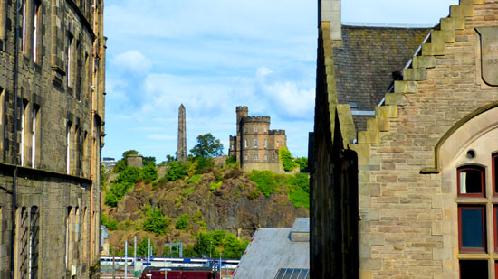
It shows my next destination after I leave the park- Calton Hill, a little over a mile away. You can see some of the points of interest I'll visit, such as the Royal Boys School (the Greek-looking building at the base of the hill), and the Nelson Monument (the tall tower) and the unfinished National Monument (the U-shaped set of columns).
Below are clickable thumbnails for some of the other good pictures I took as I descended from the Crags and came back to the trail I started out on earlier:
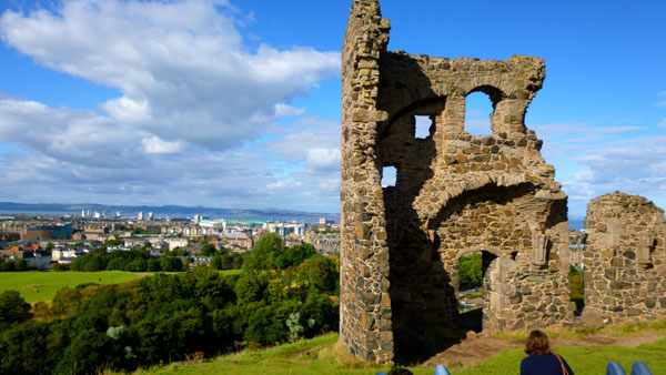
At the Ruins of St. Anthony's Chapel
I did not see right away that there was a path that most folks followed to get to the ruins; it was still a bit ahead of me. I thought I'd have to just go "cross-country" and climb up the rocks myself. This was not difficult and was actually fun, and it got me up onto the outcrop where the ruins were in just a few minutes.
The actual ruins were just off to my left at the end of the better path that intersected with the path to Arthur's Seat.
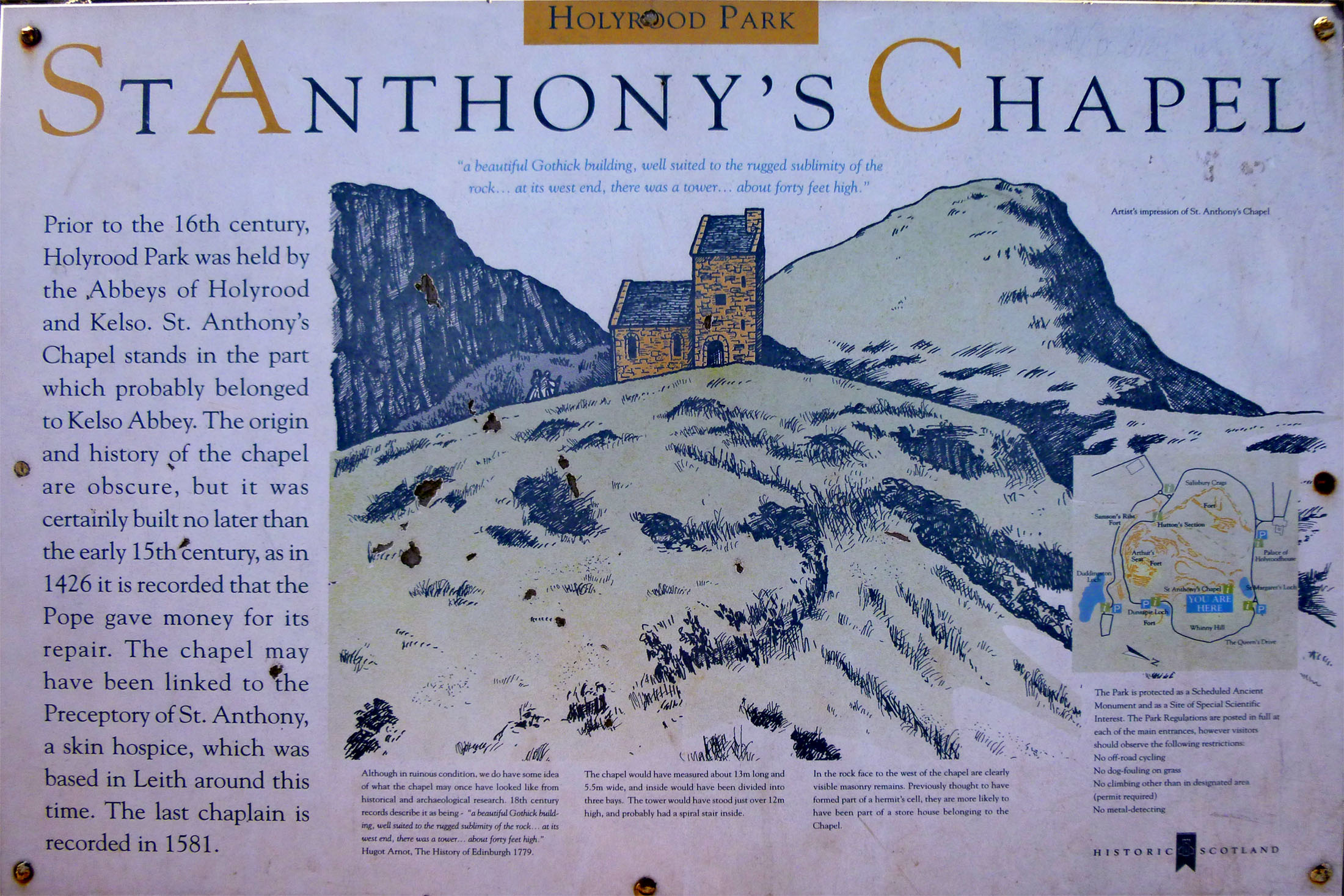
The origin and the history of the chapel are obscure, but it was certainly built no later than the early 15th century, as in 1426 it is recorded that the Pope gave money for its repair. The chapel may have been linked to the Preceptory of St. Anthony, a skin hospice, which was based in Leith around this time. Maybe it was linked to the nearby Abbey of Holyrood.
It was originally rectangular in shape, around 43 by 18 feet, with 3-foot thick walls, and was built with local stone. The tower would have stood just over 39 feet high, and probably had a spiral stair inside. The chapel is now a ruin: only the north wall and a fragment of west wall remain next to part of an ancillary building.
Although in ruinous condition we do have some idea of what the chapel my once have looked like from historical and archaeological research. 18th century records describe it as being: "a beautiful Gothick building, well suited to the rugged sublimity of the rock ... and its west end there was a tower .. about forty feet high." (Hugot Arnot, The History of Edinburgh, 1779)
The views from here were also quite good, and from behind the ruin, I could get a good view of
Calton Hill
where I'll be heading next. I also found that a bit up the pathway there was an informations sign, and I found it interesting enough to photograph and place here for you to read. It's in the scrollable window below:
This would not be the same trail that I took coming up, but I could see from the Seat that there were trails below that would lead me over to the Scottish Crags, and I could basically make a big circle and end up back near where I started. The trail down began just in front of where I was standing to take the picture at left.
(Mouseover Image if Video Controls Not Visible)
I took that trail around to the left for a ways until I found that it was simply ascending the mountain again, and I had no desire to go back up. So I turned and headed back down, but not before prevailing on a couple of other hikers to take my picture in a couple of different spots. Then when I returned to the trail junction, I continued on down the trail which at this point was almost a walkway. You can use the player at right to watch a movie of me descending.
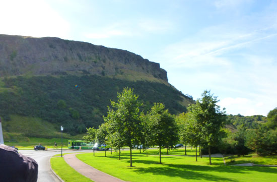
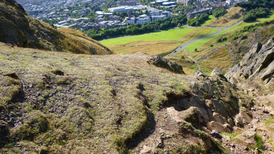
The Scottish Crags are not a continuous wall of cliffs of the same height. From the picture at left, which shows a typical section in the middle of the Crags, one might get that impression. But the Crags have the shape of a parabola, which arcs from the point where I was standing when I got down from the Seat out towards the city and then ends at the point where I originally left the sidewalk and began on the trail up to Arthur's Seat. The apex of the parabola is raised some 150 feet. So, as one walks around the parabola, one begins at essentially ground level, slowly rises to 150 feet, and then descends again. In actuality, the rise is not constant; most of the rise (and the fall on the other side) occurs near the endpoints of the parabola, with most of the trail being at a fairly constant height of that same 150 feet.
Click on the Image Above to View the Slideshow
As I headed up the trail, the views got better and better. I could see behind me back to Arthur's Seat, through the valley towards my starting point near Holyrood Palace and, of course, along the Crags and out across Edinburgh. I took a lot of pictures on my way to the highest point, and I have picked eight of them that, if you look at them in sequence in the slideshow at left, I think will give you a good idea of how the terrain, and the views, changed as I walked the trail to the highest point.
Looking East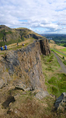
Looking West
Quite quickly, I reached the maximum elevation of the cliff face, then walked along it around the curve, looking out over Edinburgh. The views in all directions were simply spectacular, even though I wasn't all that high. I don't know of any other city I have been in, except Phoenix, that has a mountain or cliffs like these, so close to the center of the city. (Phoenix has both Spirit Mountain and Camelback that offer views of the entire Valley of the Sun, although they are much, much higher than the crags or Arthur's Seat.)
But there were other things I wanted to see this afternoon in Edinburgh, so I reluctantly got up and continued on along the path, eventually descending the northern edge of the Crags back to my starting point. Along the way, I took more good pictures, one of which is at left.

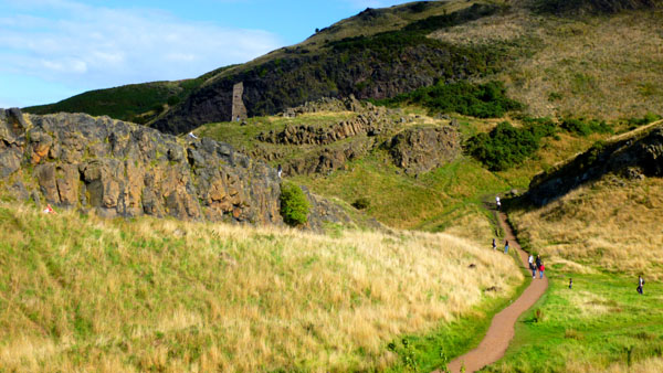
So I turned right on the pathway and headed back up the way I had come earlier. I found that at the point where the path went behind the ridge of the rock and turned right to Arthur's Seat, I could veer off to the left instead to get to the ruins I'd seen before.
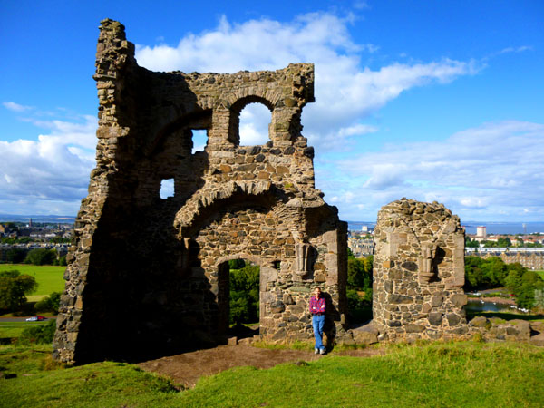
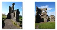
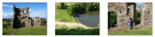
The ruins, while small, were quite beautiful in the afternoon sunlight that was almost perfect for picture-taking, and one of the best pictures I got (taken by one of a group of girls who were actually having a picnic) is at right.
|
  |
Well, I have to say that my hike this afternoon was not only invigorating (after a few days of not much exercise) but rewarded me with really great views- from the top of Arthur's Seat, from the Crags, and even from here at the chapel ruins. Now I am ready to go back down to Holyrood Palace to hop back on the sightseeing bus to get to Calton Hill.
On Calton Hill
Arriving on Calton Hill
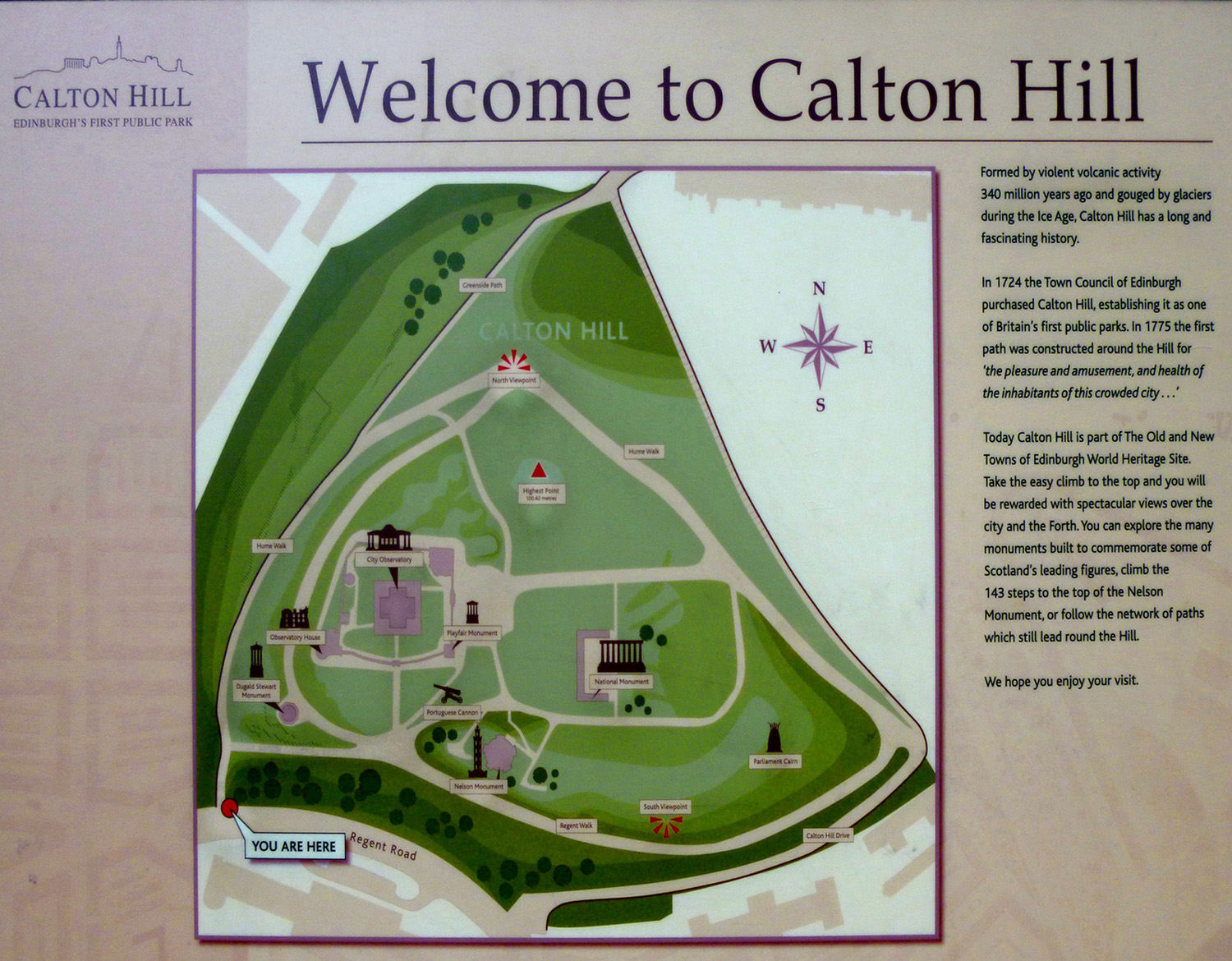
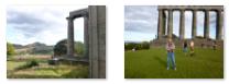
Calton Hill is located right in the middle of Edinburgh, and is included in the city's UNESCO World Heritage Site. Views of, and from, the hill are often used in photographs and paintings of the city.
Calton Hill is the headquarters of the Scottish Government, which is based at St Andrew's House, on the steep southern slope of the hill; with the Scottish Parliament Building, and other notable buildings, for example Holyrood Palace, lying near the foot of the hill. The hill also includes several iconic monuments and buildings, many of which I will stop and see: the National Monument, the Nelson Monument, the Dugald Stewart Monument, the old Royal High School, the Robert Burns Monument, the Political Martyrs' Monument and the City Observatory.
Even from where I was standing, there were nice views out south across Edinburgh, such as this one of
Arthur's Seat and the Scottish Crags.
I learned a lot about Calton Hill simply by reading the two signs that were right at the top of the stairs, and you might like to read them as well. Both of them were entitled "Welcome to Calton Hill," but they were somewhat different. The first one, in the scrollable window below, provided a capsule history of Calton Hill:
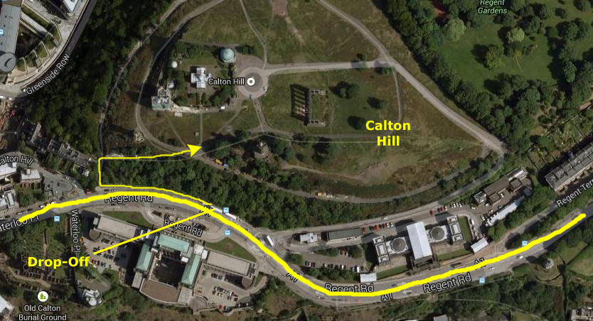
When I hopped off the sightseeing bus, I went to the next street down and one of the entrances to Calton Hill. This street led me to the actual entrance- a long stairway up through the trees that came out on the south side of the hilltop.
The Nelson Monument
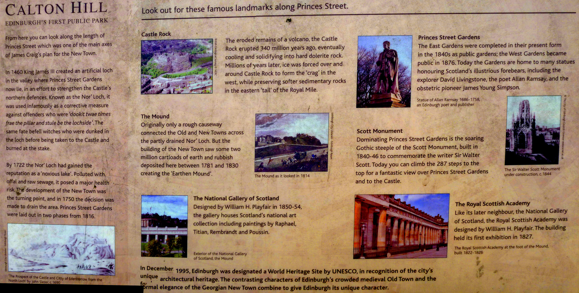
The monument was constructed at the highest point on the hill, replacing an earlier mast used to send signals to shipping in the Forth. The monument was funded by public subscription and a design in the form of an upturned telescope— an object closely associated with Nelson— was approved. Building began in 1807, and was almost complete when money ran out the following year. The building that forms the base of the tower was finally completed in 1816. The tower was intended as a signal mast, attended by sailors who would be accommodated within the ground floor rooms, although these were in use as a tea room by 1820. Public access was available from the start, for a small fee. The rooms were later used to house the monument's caretaker.
The monument is 105 feet high, and the internal circular stairway has 143 steps leading to a public viewing gallery. The plaque above the entrance carries the following inspirational dedication:
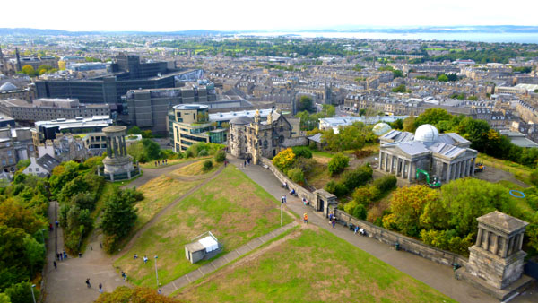
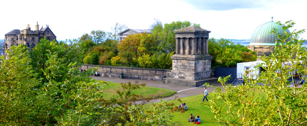
I bought an entry ticket ($5) and climbed the tower, coming out on the viewing platform that runs all the way around the top of the tower, just outside the enclosure where the signal light is. The views were very good from the top; one in particular was looking down on some of the other structures here on Calton Hill. In the picture below, left, you can see, from left to right, the Dugald Stewart Monument, Observatory House, the Observatory and the Playfair Monument.
I did take a number of other pictures from the top of the tower, and I have put clickable thumbnails below for some of them. You'll recognize, certainly, Arthur's Seat and the Crags, but you'll probably be able to pick out things you've seen before:
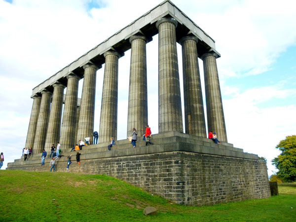
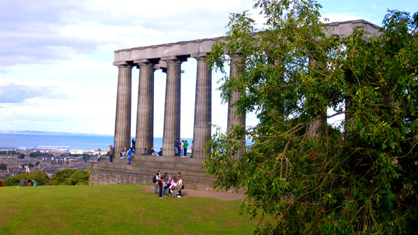
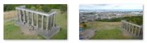
The National Monument
As early as 1816, the Highland Society of Scotland called for the construction of a national monument to commemorate the fallen in the Napoleonic Wars, and Calton Hill was chosen as the site. In January 1822, a proposal was put forward to erect a facsimile of the Parthenon, and this idea found much support, with the result that a Royal Association for the monument was formed that same year. In July, the foundation stone was laid.
Originally, the building was planned to have extensive catacombs in the area supporting the main structure, to provide a burial place for significant figures, intended as a "Scottish Valhalla". But when the money ran out, no individual or organization came forward with the funds for completion. It is hard to believe, but even now, almost 200 years later, the structure has still not been finished.
The
view of the monument from the Nelson tower
was impressive, and when I came down from that tower I went right over to the monument to get up onto it.
This is not easy to do, as the unfinished building lacks stairs; the only way to get up is to either hoist yourself up (ruling out a visit by any but the very fit) or to be helped up by someone already on the monument. Some thoughtful person got a six inch rock from somewhere and has placed it at exactly the point of minimum height above ground level, an almost everyone uses it as a steppingstone. Even so, it is hard, particularly for someone short, to get up on the monument.
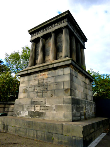
The Playfair Monument
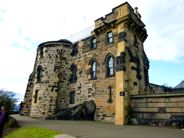
The oldest part is the Gothic Tower in the southwest corner, facing Princes Street and Edinburgh Castle. It is also known as Observatory House, the Old Observatory, or after its designer James Craig House. The central building with the appearance of a Greek temple is the Playfair Building, named after the building's designer William Henry Playfair. This houses the 6-inch refractor in its dome and the 6.4-inch transit telescope in its eastern wing. The largest dome of the site is the City Dome in the northeast corner. During the early 20th century this contained a 22-inch refractor.
You can see these features in the picture I took of the area from the Nelson Monument:
The Portuguese Cannon
Then, either by trade or capture, the cannon came into the possession of the King of Arakan, ruler of a state on the west coast of Burma. It was subsequently captured by the British during their invasion of Burma in 1885.
In 1886 the cannon was presented to Edinburgh and placed on Calton Hill the following year.
Observatory House
Before the light-pollution of an expanding city made it impractical, Edinburgh's Calton Hill was a perfect vantage point from which to gaze at the night sky. Fanned by the intellectual flames of the Enlightenment, the city granted permission to Thomas Short, an Edinburgh-born optician, to found an observatory on top of the volcanic hill in 1776.
The accommodation sleeps 8 and ranges over three floors, consisting of a sitting room, circular dining room and fully equipped kitchen on the ground floor. Stairs lead down to the garden level where there is a twin bedroom, a circular double bedroom, a shower room and a utility area. On the top floor there is a further double bedroom, a twin bedroom, a bathroom and a stylish drawing room in the circular domed observatory. All the rooms command panoramic views across Edinburgh, Fife and the Lothians.
The building was designed by James Craig, who was also the architect of Edinburgh's first New Town, and there is
a plaque dedicated to him
on the side of the building.
The Dugald Stewart Monument
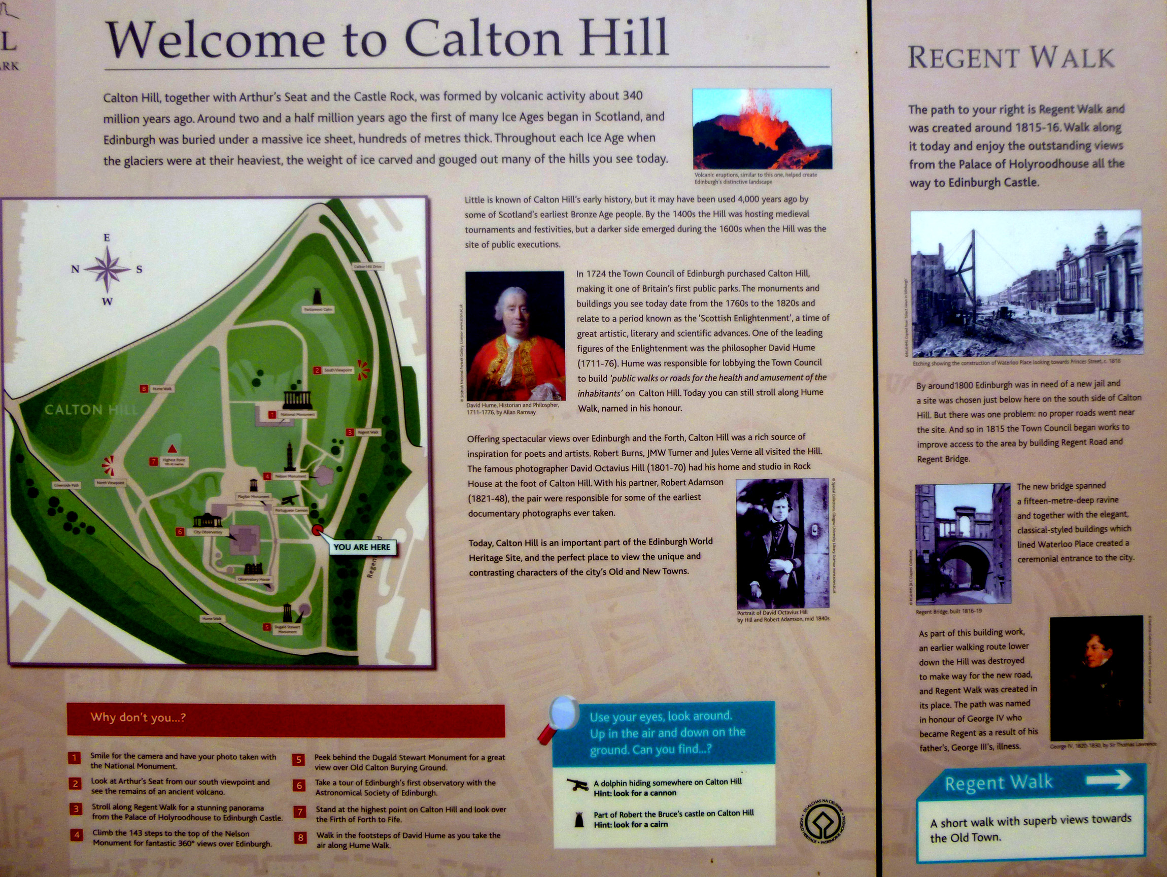
Well, that was my last stop on Calton Hill, and I went back towards the entrance stairway where I'd come in. There was another sign here that I hadn't noticed, detailing some of the sights along Princes Street. You've already seen most of these in the section where we were all riding the sightseeing bus, but you might want to read the sign anyway. You can do so using the scrollable window below:
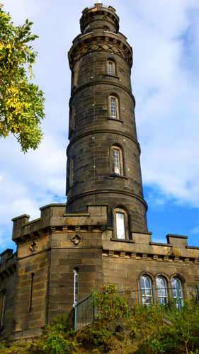
The Nelson Monument is a commemorative tower in honor of Vice Admiral Horatio Nelson; it was built between 1807 and 1815 to commemorate his victory over the French and Spanish fleets at the Battle of Trafalgar in 1805, and his own death at the same battle. In 1853 a time ball was added, as a time signal to shipping in Leith harbour. The monument was restored in 2009, and, each year on Trafalgar Day, flags fly from the monument spelling out Nelson's famous message "England expects that every man will do his duty."
“To the memory of Vice-Admiral Horatio Lord Viscount Nelson, and of the great victory of Trafalgar, too dearly purchased with his blood, the grateful citizens of Edinburgh have erected this monument: not to express their unavailing sorrow for his death; nor yet to celebrate this matchless glories of his life; but, by his noble example, to teach their sons to emulate what they admire, and, like him, when duty requires it, to die for their country."
At each compass point around the viewing platform, there was a labeled photo with the items of interest in that direction marked. In the two rows of clickable thumbnails below, the first row are thumbnails for the four signs, and the second row is my own picture looking in that direction:

The monument dominates the top of Calton Hill, and it was designed during 1823-6 by Charles Robert Cockerell and William Henry Playfair; it is modelled upon the Parthenon in Athens. Construction started in 1826 and was halted in 1829 for lack of funds; this resulted in a number of various nicknames, such as "Edinburgh's Folly".
In addition to the view of the Monument from in front of the Nelson Monument shown at right, I took a few more pictures that I'll include here. There are clickable thumbnails for these pictures below. The first two were taken from the top of the Nelson Monument, and from there the Monument has an "unreal" appearance. The other two were taken on the ground; one looks past the Monument to the Crags and Arthur's Seat, and the other one was taken for me by an obliging visitor to Calton Hill:
The City Observatory is the largest building on Calton Hill. It is enclosed by a boundary wall, at the southeast corner of which is a monument to John Playfair, president of the Edinburgh Astronomical Institution
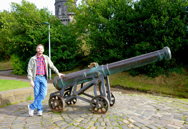
This brass cannon has travelled all over the world. Cast in the early 15th century, with the Royal Arms of Spain on its barrel, the cannon was transported to the Portuguese colonies in southeast Asia sometime before 1785.
Observatory House is an iconic eighteenth century Gothic style building at the top of Calton Hill offering spacious city centre holiday accommodation for eight.
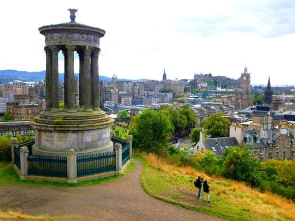
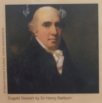
This monument commemorates another key player of the Scottish Enlightenment, Dugald Stewart. Born and educated in Edinburgh, Stewart rose to fame as a writer and philosopher.
William H. Playfair modelled the monument on the ancient Greek Monument of Lysicrates in Athens, which also inspired Thomas Hamilton in his design for the Robert Burns Monument which sits on the other side of Calton Hill.
Walking Back to Cluaran House
|
  |
For my part, I stayed on the sightseeing bus until it stopped at the central station. I got off there and then walked up the hill alongside the east section of the park, and then headed south on Bank Street. I took some candid street scenes along the way, and you can use the clickable thumbnails below to have a look at them:
 |
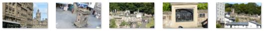
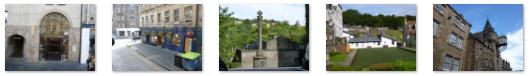
At the top of the hill above the park, I turned south just past the Black Watch memorial, and I intended to follow Bank Street around to the intersection we'd arrived at early this morning, but instead I saw a stairway leading to the Writers' Museum, and I knew that the close in which the Writers' Museum was located had an entrance that came out right by the kilt shop you saw early this morning, so I detoured through it. Set in the pavement of the stairs and the entire close were quotations by Scottish writers; you can see a couple of examples here and here.
|
Born at Midlothian, Scotland, the fifth child of seven, his father was the 4th Duke of Buccleuch. When his older brother died at the age of 10 from measles, Walter became heir apparent to the Dukedoms of Buccleuch and Queensberry, titles he assumed in 1819. Through his grandmother, he also inherited the ancient northern English lordship of Bowland at this time. He was educated at Eton and St John's College, Cambridge, and was a Fellow of the Royal Society.
A great Scottish land magnate, Buccleuch was a Conservative in politics, and was appointed a Knight of the Garter in 1835 and a Privy Counsellor in 1842. He served as Lord Privy Seal from 1842 to 1846 and as Lord President of the Council from January to July 1846 in Peel's government. After Peel's fall, the Duke's political career largely came to an end. In 1878 he became Chancellor of the University of Glasgow, a post he held until his death in 1884.
There are two other pictures I took here that are of interest- one is the city building at Bank and High Streets and the ornate main entry to St. Giles.
I was most of the way down Bank Street to the Meadows Park when I walked by a Subway sandwich shop. I hadn't had lunch, and was fairly hungry, so I stopped in for a 6-inch turkey sub. (I was also in the mood for something simple after four days of elaborate restaurant meals, and intended for this to be my dinner this evening.) I was sitting outside at a table, eating my sandwich when I looked up and saw Fred, Guy, Prudence and Ron walking by on their own way home! They sat down while I finished, and then the five of us retraced our path from this morning to get back to the Cluaran Guest House.
You can use the links below to continue to another photo album page.
|
September 15, 2013: Sightseeing in Edinburgh (Day 2) |
|
September 13, 2013: Hadrian's Wall and Vindolanda |
|
Return to the Index for Our British Isles Trip |