|
November 29, 2019: Rio de Janiero, Brazil |
|
Sea Days Aboard the Viking Jupiter |
|
Return to the Index for 2019 |
Well, we have been at sea for the last four days, enjoying the relaxing shipboard activities that have become routine for those days on the water. I hope you enjoyed discovering sea day activities aboard the ship on the previous page. Today, however, we are making our fourth port- another new city in a new country (at least on Fred's list, although not on Greg's and mine)- Recife, Brazil. We will take one of the included ship tours here, as the add-on tour we had booked was cancelled and it was too late to book any of the other tours we might have wanted to do instead. Today we will be doing a fairly simple walking tour of Recife, and then a bit later on take a bus ride through a different part of town.
Arriving in Recife, Brazil
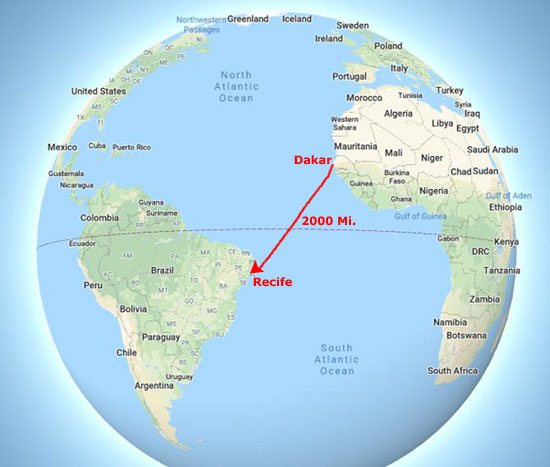
We left Dakar on the evening of November 21, and arrived in Recife in the morning on November 26- four full days and one full night at sea.
|
Dakar is Africa's westernmost point, and Recife is pretty close to as far east you can get in South America, so I guess you could call this a "point to point" voyage. At 2000 miles, and with a cruising speed just north of 20 mph, you can see that it is a 100 mile trip- or right around 4 days. Actually, as with other segments of the trip, the captain goes even a bit slower than that, since you need to time your arrival to be at a particular time in the morning. I am sure we could have gotten here before midnight instead of at about six am, but then we might have had to just sit in the harbor until personnel were available to get us into the dock and tied up.
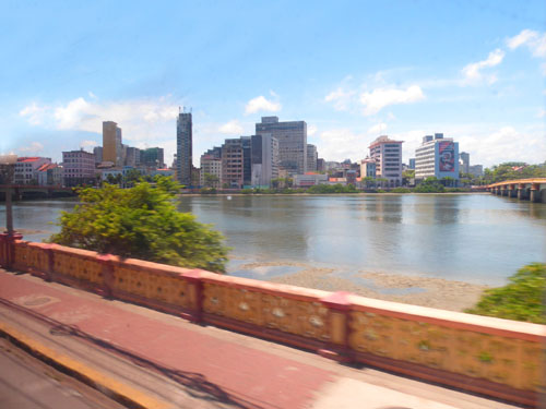
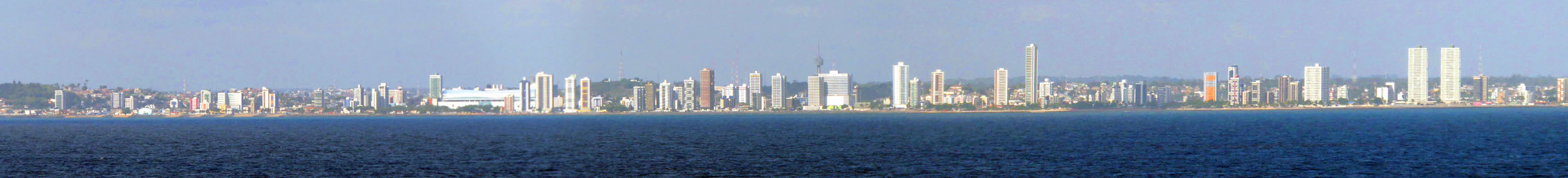
But we did get within sight of land again about four in the morning, and by six I was up on deck with some of the other early risers to get our first look at Recife. And I have to admit that I was just as surprised when I saw Recife as I was years ago when I first saw Panama City after we transited the Canal. In neither case was the city at all what I expectd. Here, in the scrollable window below, is a panoramic view of Recife created from four separate pictures taken from a few miles out to sea:
 |
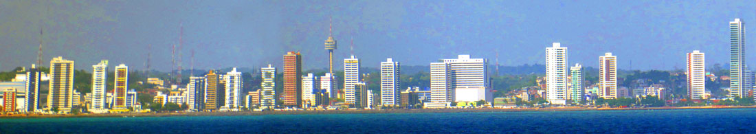
Pretty impressive, but here is another panoramic view I constructed of a smaller section of the skyline taken from a good deal closer:
 |
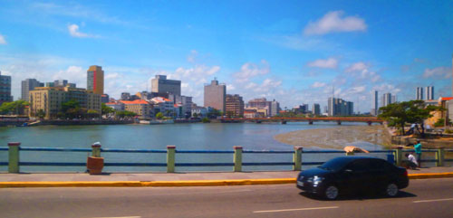
So what did I expect? Being a port on the east coast of Brazil, one that has featured movies involving exploration of the Amazon (even though Recife is quite a ways from the mouth of the river) or adventurers in the jungles of eastern Brazil or something else like that, I was expecting a smallish city- more of a frontier town. But what we found was a major metropolitan area with a skyline to rival most coastal cities around the world.
Fred took a couple more good pictures of Recife from a ways out in the water- one of the hills south of the city and another of the tallest of the buildings in the skyline of Recife.
|
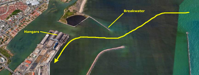
As we went by, Fred took a good picture of the north breakwater. I was on the other side of the ship looking at the port itself. These are two large hangar buildings at the north end of the port island and another picture of the Recife skyline near the port.
I think its interesting that you can pick out identifying structures and land features in the pictures that match up to the same things or locations in the aerial view (even though the aerial view probably reflects a Recife at least a few years older than it was when we visited today.
|
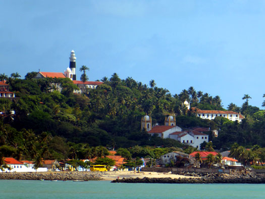
I thought that the hills around the city and at the shore, the style of the buildings, and much of the vegetation resulted in scenes that were very reminiscent of the Southern California landscape- particular as I remember San Diego. One representative scene is at left, and there are a few more below:
|
Fred and I were done with our picture-taking in time to have a bit of breakfast with Greg before heading back to our cabin to get ready to depart the ship for a walking tour of Recife.
Our Walking Tour of Recife, Brazil
Back when we were planning the cruise, we booked and paid for one of the non-included shore excursions here. It was to have been a bus tour up the coast to the town of Olinda, where there was beautiful scenery and a chance to walk around an old Brazilian town. A few days out from Recife, we were notified that this tour had been cancelled (for what reason I can't quite remember). There was another tour that we would have liked to have taken, but by the time we tried to book it, it was full.
|
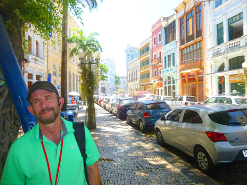
So we decided to do just that. Since we weren't on a specific walking tour group already, we got some advice from one of the crew and just left the ship with one of the first groups and then joined a new group on shore (groups were nominally formed ahead of time, and everyone on these included tours given a number, the but crewman said the tour group sizes were somewhat flexible, and we should just toss his name out when we got on shore. We did that, became the first three members of a group formed on shore, and then headed off.
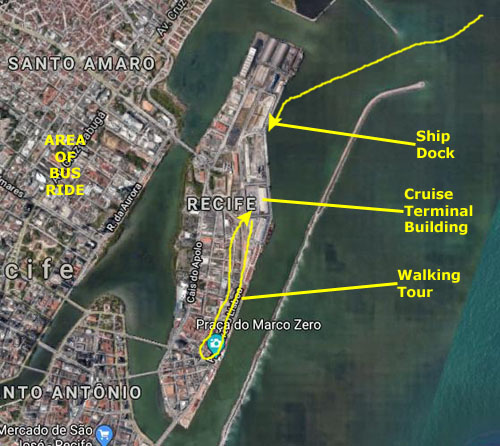
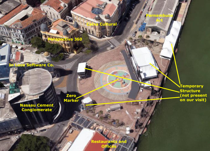
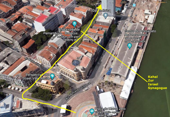
The walking tour took us south along what is in fact a decent sized (about 1.5 miles, north to south, and maybe a half mile wide at its widest) about a mile along the sea-side of the island, and then back north a few streets in to the west. You can see that general route on the aerial view at left.
Later in the day, Fred and I decided to take a ride on the ship's shuttle bus just to see what we could see (that bus circulating from the ship onto the mainland to a park and "shopping opportunity").
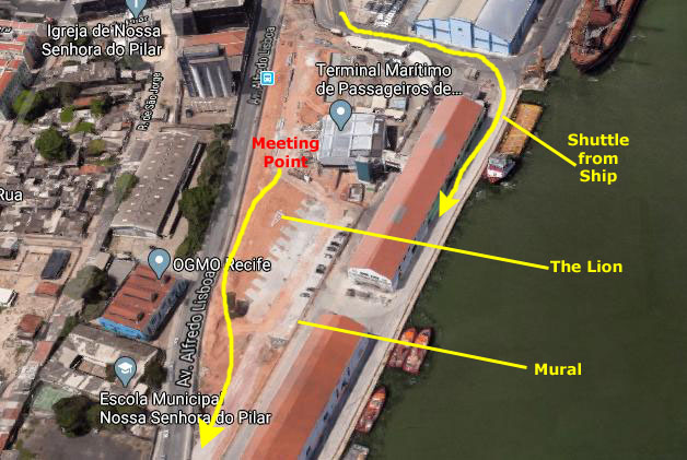
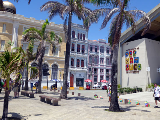
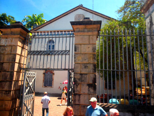
Each of these tours departed from the fairly new cruise terminal building at the south end of the port. Recife's cruise port can accommodate a couple of ships at one time, but you have to take a bus from dockside over to this cruise terminal building.
Ship to Cruise Terminal
|
|
(Mouseover Image Above for Video Controls) |
Coming out of the building, we looked around for the ship's excursion coordinator to find out where we could join one of the walking tour groups. We found him, and he directed us to a guide, whose name turned out to be Gilberto, and we joined his group as its first three members.
|
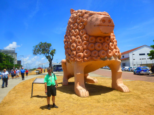
When we actually started off, we passed a notable sculpture here in Recife- "Nuca's Lion". Brazilian sculptor Nuca of Tracunhaem has a simple explanation for his works in clay: �My star sign is Leo.� Maybe the stars do help, but the true explanation is in the hands that mould and sculpt, in a tradition that involves his entire family.
�All my family worked in the sugar factories in Nazar� da Mata, where I was born. In 1940, when I was 8 or 9 years old we arrived in Tracunha�m. Back then I already used to play with bits of clay. My father bought a bit of land, built a shack and we stayed on in the town. Life in a sugar cane plantation was very hard, and with the clay around, I used to make pots, toy horses, and all kinds of little objects that the family sold. When I grew up and married, my wife Maria helped me. When the city of Recife placed an order, I made the lion (and my wife made the mane). Recife got this 7-foot lion, placed in the port to welcome visitors, but we also made many small copies, and they are very popular."
Nuca has retired, but his sons continue to make these and other sculptures. As Nuca once said of the sculpture and his wife, �We invented it all for fun. My thoughts were united with hers and we came up with the curly lion.� It worked.
The Walk to Marco Zero Plaza
|
|
As you can see from the aerial views above, this part of Recife is an island; to the east, there is a long, thin breakwater, and between the island and that breakwater is a narrow channel. There are two ways out onto that breakwater. We saw one spot where some small boats were picking up a few people to ferry them across the channel, but the breakwater is also connected to the mainland a mile or so south of here, but it's a long way around. If you are wondering why anyone would want to go out there, it's because of a couple of spots people like to visit. One is the old Recife Lighthouse. The other, oddly enough, is the Francisco Brennand Sculpture Park, with its focal point his Crystal Column.
|
It would have been nice to get over there and visit the sculpture park, but there wasn't nearly enough time to do so. Fred, however, got an interesting view of some of the sculptures around the base of the Crystal Column.
The Sculpture Park brings together some of the Brazilian artist's fauna pieces, mythological figures and panels with inscriptions. Much of Brennand imagery is along the path that runs along the length of the jetty and they capture the atmosphere and aesthetics of the artist. Because of this, the park was quickly incorporated into the modern postcard views of the city of Recife.
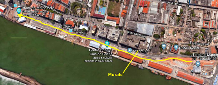
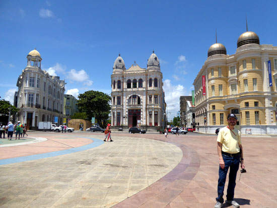
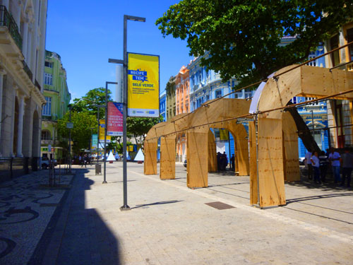
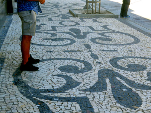
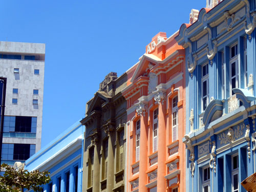
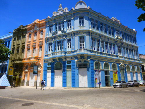
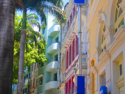
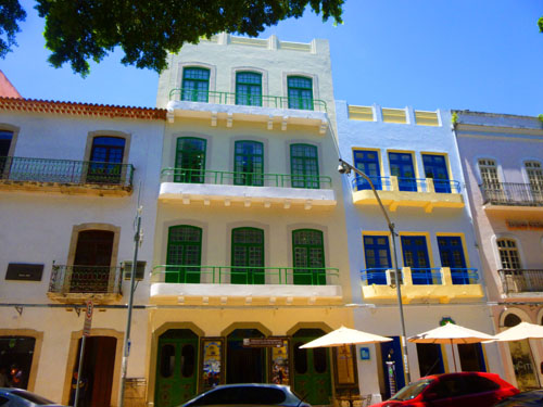
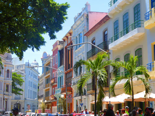
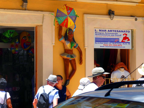
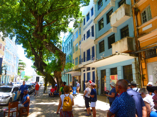
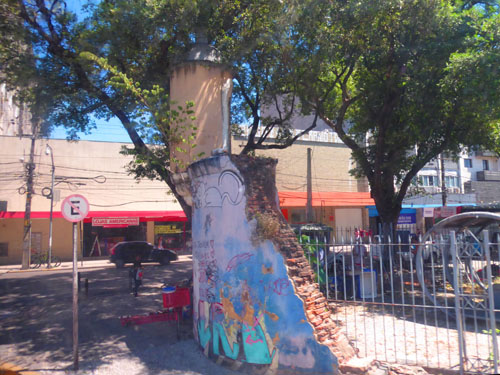
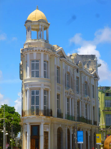
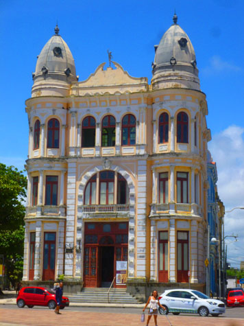
It was pretty warm this morning, so the tour group walked fairly slowly along the street to Marco Zero. This seemed to be a fairly industrial area, and not until we got a few blocks south of the port did we find much worth photographing. There were some interesting street scenes and old Portuguese colonial buildings on the street, and part of our walk was along the channel.
|
Recife began as a collection of fishing shacks, inns and warehouses sometime around 1535 in the earliest days of Portuguese colonization of this area. It was a settlement of colonial fishermen and way station for Portuguese sailors and passing ships. In 1541, General Duarte Coelho brought a sugar mill from Spain to take advantage of the sugar cane that grew throughout the delta. Recife was briefly part of the Dutch West Indies, but mostly part of the Portuguese Empire, but became part of the Empire of Brazil in 1822 and the Republic of Brazil in 1889.
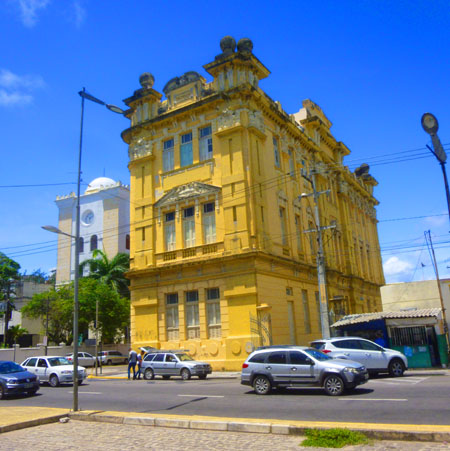
This bright-blue building, built in the early 1900s, is now the Justice Scretariat, and just south of it is a much newer office tower. Here are a few more of the pictures we took along this part of our walk:
|
It took us about a half hour to follow our guide from the cruise terminal to the plaza Marco Zero.
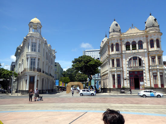
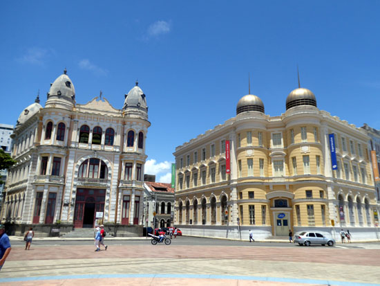
At Marco Zero Square
|
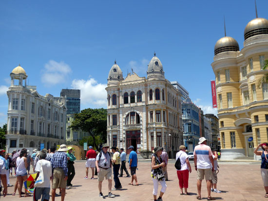
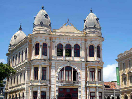
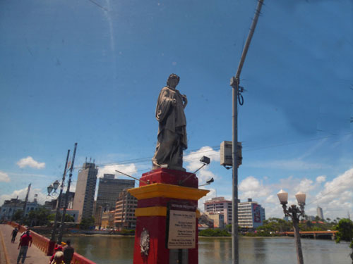
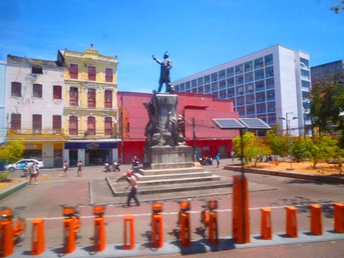
At the center of the square there is a wind rose designed by an artist born in Pernambuco, C�cero Dias. On one side of the square there is a 9-foot-high bronze statue of the Baron of Rio Branco by the French sculptor Felix Charpentier. Jos� Maria da Silva Paranhos Jr., Baron of Rio Branco (1845-1912) was a Brazilian diplomat, geographer, historian, monarchist, politician and professor, considered to be the "father of Brazilian diplomacy". He was a member of the Brazilian Academy of Letters, occupying its 34th chair from 1898 until his death. As a representative of Brazil, through his diplomacy, he managed to peacefully resolve Brazil's border disputes with its South American neighbors.
The square is the center of activity in Old Recife; during Carnival the square becomes the origin point for parade units. And from this square, you can get a boat and go to the Sculpture Park across the channel on the breakwater.
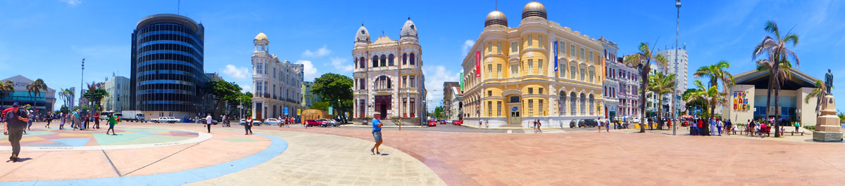
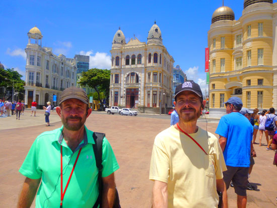
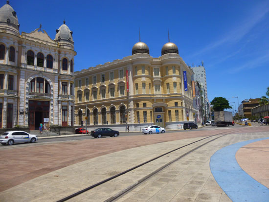
The square is surrounded by some of Old Recife's most iconic structures. One way to have a look at them is to scan across Fred's excellent panoramic picture, taken from the east side of the square near the channel:
|
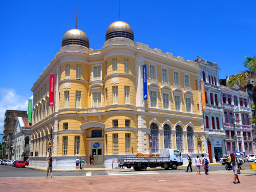
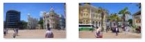
From left to right in the panoramic view, we see first a long, low building housing numerous restaurants and tourist attractions on the fist floor, and the offices of Accenture Consulting on the upper floor. Next, we see the modern, curved building housing the offices of Nassau Cement, and then to the right of that the renovated old structure that now houses the In Loco Software Co. (Recife is a technical hub for this area of Brazil). Next around the square are the beautiful building that is the home of Perspectiva 360 and the Caixa Cultural Center. Finally, between the street and the canal, is Pernambuco Handicrafts Center, where visitors can examine and purchase handicrafts made by over 700 craftsmen here in Pernambuco State.
 In Loco Software |
(Picture at left) In Loco Media is a Brazilian software company that built the most accurate indoor location software on the market. With more than 600 partners, they are using this technology to be the most profitable ad network for mobile apps in Latin America, paying more than both Facebook and Google.
(Picture at right)
|
 Perspectivo 360 |
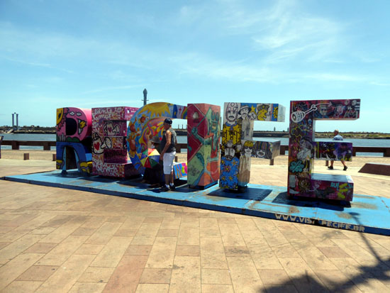
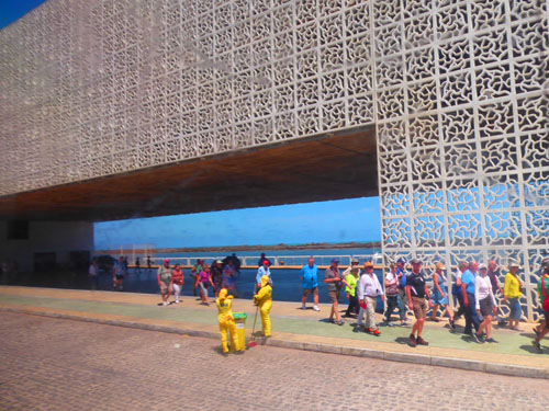
A waterside monument on the broad square marks the very spot where Recife was first founded in 1537 by the Portuguese colonists. Marco Zero Square is a really neat place, very open, right on the estuary of the port of Recife, formed by the Rio Capibaribe. The estuary is protected by a natural levee/breakwater, where the sculpture garden is located. Many cultural events take place in Marco Zero (carnival, elections, soccer, etc.) and it is Old Recife's most popular meeting place. The site, with shady trees and benches, is a favorite of those who like to admire the view of the mansions of Old Recife. The square was remodeled recently and has gained a modern design.
|
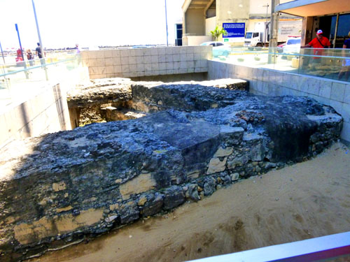
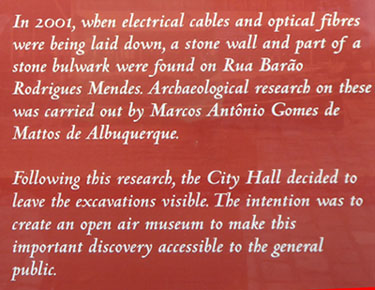
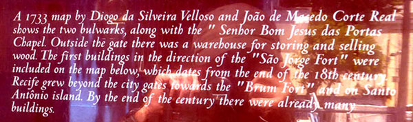
In the exhibition, 11 paintings from Caixa's art collection that depict the Bairro do Recife over the centuries are on display, as well as serigraphy reproductions and sculptures that help to tell more of this story. In addition to the artworks, the show features a vast collection of fragments of objects (such as pipes, earthenware and tiles), dating from the 16th century and found in 2006, when the reforms carried out by Caixa to install the cultural center began.
In this period, structural remains of previous buildings were also found and some of these ruins are part of the architecture of the space, which can be seen from the archaeological window on the ground floor of the building. There is also a safe in English hardware and an elevator in Brazilian hardwood.
Listening to our guide describe the building and its contents, I thought that it would have been nice if the tour had included an excursion into the building, but when I asked the guide about that, he said that even a cursory visit can easily occupy a couple of hours (although in the hot, humid sunshine, that didn't seem to be much of a drawback). But we had other places to see.
|
|
|
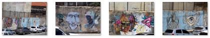
A selection of the best of the other pictures we took before we left the square are in the slideshow at right. To view the pictures, just use the little arrows in the lower corners to go back and forth through the slides. You can see where you are in the slideshow by referring to the index numbers in the upper left.
Enjoy looking around Marco Zero Square!
We met back up with our guide at the appointed time, and he led us across the street to the west.
Old Recife to the Synagogue
|
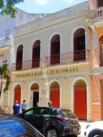
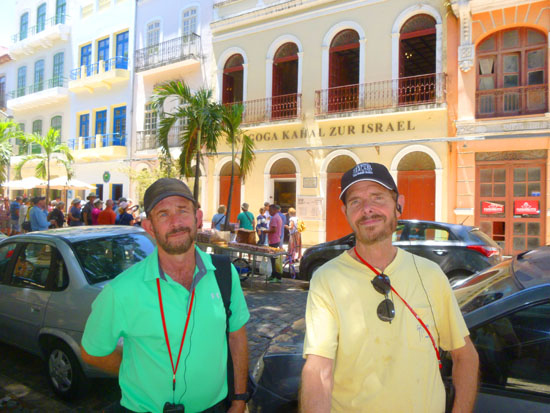
When we get to the street named Rua do Bom Jesus, we will turn right and head north, going past the Kahal Zur Israel synagogue. This part of the walk will bring us to a small city park north of the synagogue.
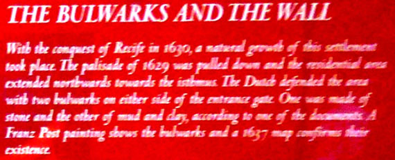
The nucleus of Recife Antigo is the initial Portuguese settlement in the 16th century around the port. Sugar cane production from Pernambuco was delivered to Portugal through Recife's port. While Recife had port functions, Olinda was the capital. In 1630, the Dutch invaded Pernambuco, set Olinda partially on fire and Recife became the seat of the Dutch government. Count John Maurice of Nassau-Siegen became Governor-General of the Dutch colony and built a new town on a neighboring island. This city was named Mauritsstadt and the Palacio do Campo das Princesas, current seat of the State of Pernambuco government, today sits on that site.
The Dutch were forced out in 1654, but they left a Recife with good infrastructure, for they had built canals and improved the port and the defenses of it. A flourishing Jewish community lived in Recife under them and they had to leave it because of the Portuguese Inquisition. They had constructed the first synagogue in the Americas, but it was abandoned when the Jewish community left with the Dutch. They ended up on Manhattan Island, where they founded another synagogue in lower Manhattan. As that city grew, the synagogue was moved north, and now the Portuguese and Spanish Synagogue is located on Central Park West in Mid-town Manhattan.
|
|
|
From 1636 to 1654, the synagogue functioned on the site of the houses no. 197 and 203 Rua do Bom Jesus (formerly Rua dos Judeus, literally "Street of the Jews"). It flourished in the mid-17th century when the Dutch briefly controlled this part of northeastern Brazil. The synagogue then served a community of approximately 1,450 Jews. It had a cantor and a rabbi who were both sent to Recife in 1642.
|
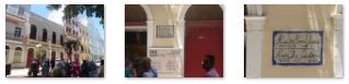
In 2001 the decision was made to create a Jewish museum in the two-story house with two shops located on the first floor that was then standing on the site of the old synagogue. It was odd to see a synagogue that wasn't a free-standing building, but this one is at least now in a row of structures, including this apartment building next-door that was undergoing renovations.
|
The museum, designed to resemble synagogues built in the 17th and 18th centuries by Sephardic Jews from Spain and Portugal, opened in 2001. Today, there are four synagogues in Recife. Many Jews choose to celebrate their weddings and other celebrations in the Kahal Zur Israel because of its symbolism as a connection to their long history in this country. The synagogue is also at the center of a broader cultural renaissance. In November of every year, a Jewish festival offering dance, cinema, and food attracts around 20,000 visitors.
|
|
|
|
|
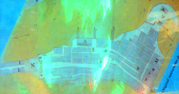
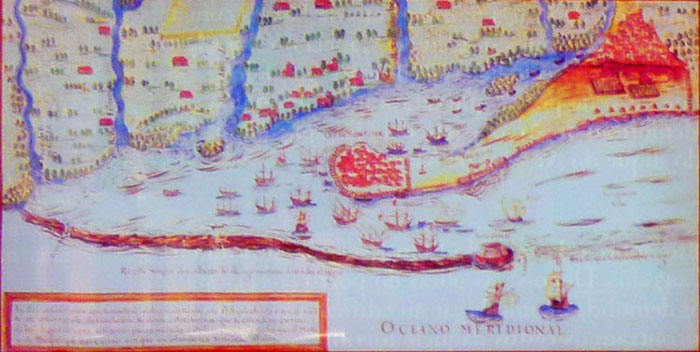
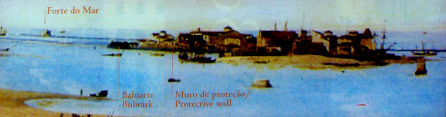
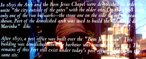
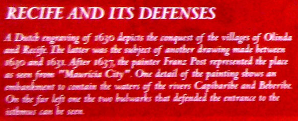
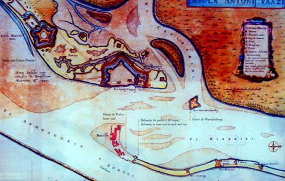
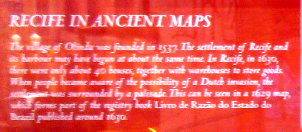
Done by the cartographer Joao Leixeira Albernaz I and appears in the registry book Livro de Razao published around 1630.
The map was used to show Recife's situation in the year this registry book was written.
The palisade (wooden fence) built in 1629 is marked.
|
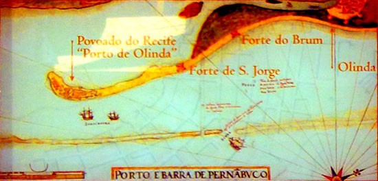
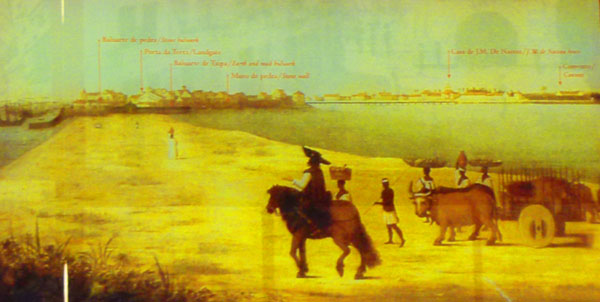
Again done by cartographer Joao Leixeira Albernaz I.
The map was published around 1630.
The street arrangement and the harbor entrance are marked on the map which includes the representation of a ship and the depth of this part of the harbor. Sao Jorge and Brum's forts are also represented.
|
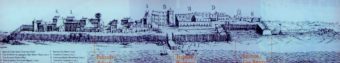
It is an illustration of the Pernambuco conquest that originally appeared in a Dutch pamphlet circa 1630.
The image is part of a report describing the conquest and was drawn from real life observation.
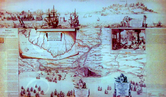
The image below of "Recife de Pernambuco" is an illustration by Johannes Lact in a book about the history of the West Indies Company published around 1630:
|
|
|
|
|
|
|
|
|
The whole exhibit was kind of interesting, and it would have been even more so had I been a resident of Recife or a Brazilian. It's too bad that the United States is so new; I am never going to run across an archaeological dig in this country where old city walls and bulwarks are going to get dug up.
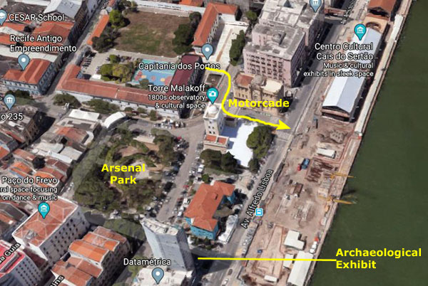
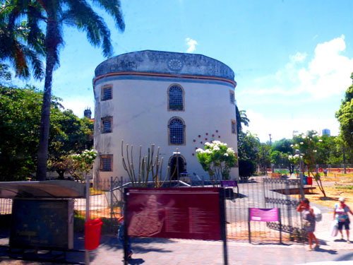
Arsenal Park
|
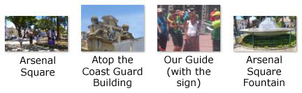
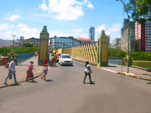
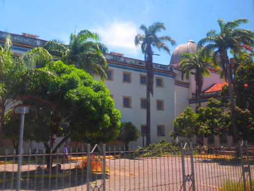
The square was designed by the landscaper Roberto Burle Marx and there are several Imperial Palm trees and a nice fountain. To the north of the square is the Captaincy of the Ports, on the east side is the Malakoff Tower (built in the 19th century to serve as an astronomical observatory), to the south is the Pa�o do Frevo (one of the main museums of the city of Recife), and to the west are the Recife Tourist Center and the Museum of Wax Dolls.
Ours was one of a couple or three identical tours that had left the cruise terminal on a staggered schedule. When we got to the park, our guide stopped to tell us some about it, and one or two of the other groups caught up to us.
|
(Mouseover Image Above for Video Controls) |
Here are a few pictures taken in and around the square:
|
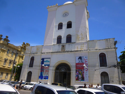
It was actually the Malakoff Tower that our guide wanted to take us into, and he (and the guides for two other groups like our own who had been behind us by a few minutes) were calling on the phone trying to arrange entry for all of us, but, as it turned out, there was some reason why we couldn't gain entry.
|
Eventually, the city thought to solve the problem of the deteriorating structure by simply razing it, the a movement arose among the citizens of Recife and various cultural institutions that mobilized opposition to the demolition (harking back to the actions of the building's namesake during the Crimean war).
The tower was saved from the wrecking ball, and what followed was a period of considerating and planning that resulted in the building's complete renovation in 1999. The culturally-significant features of the old Tunisian-style monument were retained, and in the early 2000s the building became a cultural center and astronomical observatory.
The cultural areas of the building host activities involving science, art, and technology, as well as exhibitions of all kinds (recently there have been exhibitions of photos and comic books). The building also contains one of two astronomical observatories belonging to the Brazilian Space Science Museum (the other being up the coast in Olinda).
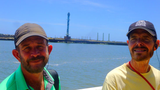
Pretty soon, I heard a band playing, and so while our guide was occupied with seeing if we could get into the Malakoff Tower, I walked across the street from the park to the north to see what was going on. It looked like some sort of departure ceremony going on for some high-up in the Brazilian Port Authority, which happens to be part of the Brazilian Navy. It was right in front of the Port Authority Building. I thought it was kind of interesting, and I didn't have anything else to do for a few minutes, so I made a movie of the band and some of the officials milling about. Then there was a motorcade departure, and just on the off chance that it was President Trump, I filmed that, too.
|
(Mouseover Image Above for Video Controls) |
(Mouseover Image Above for Video Controls) |
Returning to our group, our guide told us we'd not be able to get into the observatory, so we began the return trek to the cruise terminal. Not too much to see along the way, although I was reminded at one point that we are in a country that takes its siestas seriously. Back out on Av. Lisboa, we headed back north, passing once again the neat old building that is the home of the Pernambuco State Department of Science, Technology, and Innovation. When we arrived back at the start point of our tour, we thanked out tour guide and then while Greg went back onboard the ship, Fred and I thought that we would try to see some more of the city.
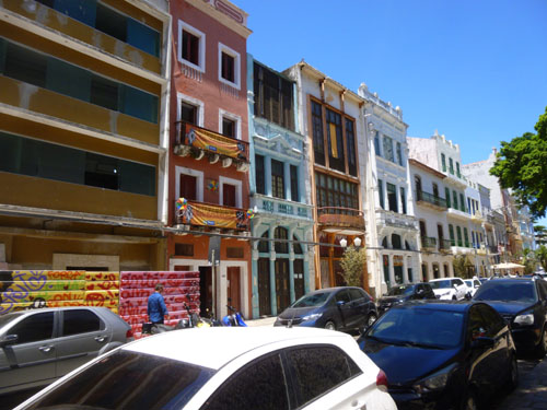
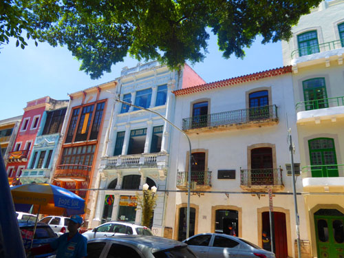
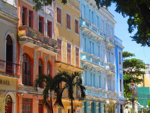
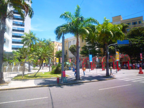
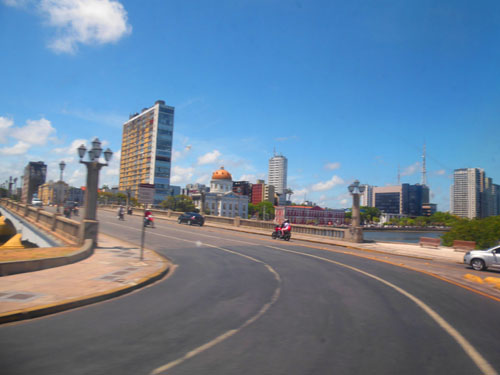
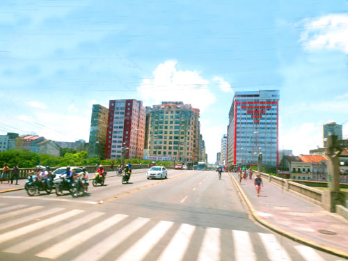
A Bus Ride into Recife
When we got back to the cruise terminal, Fred and I thought that since we had about 90 minutes before we were supposed to be back on board around one-thirty, that we would hop on to the shuttle bus that Viking was running from the cruise terminal to the Casa de Cultura in the center of Recife Antigua (Old Recife).
|
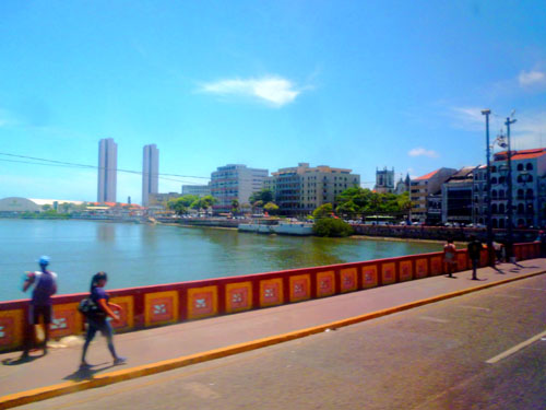
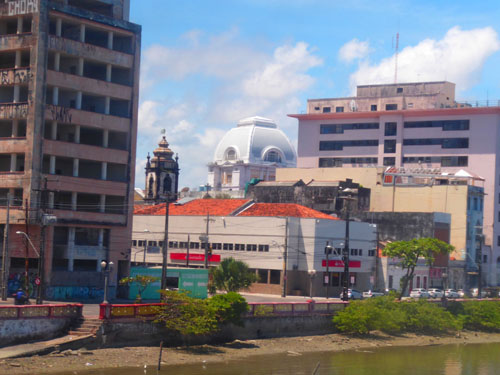
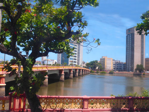
I didn't quite realize it at the time, but the ship was actually docked at the east side of an island, and it was on this island that Recife was first established. For quite a few years, the city existed only on this island, but at the end of the 1600s it had begun to spread to a second island to the west and shortly thereafter spread also to the mainland.
When the first bridges were built in the late 1700s, this expansion accelerated, and by the turn of the twentieth century one could easily identify Recife Antigua and the new city on the mainland. The new city grew rapidly, but Old Recife, constrained by the available land on the island, became, over time, more of a historic area, and with the growth of tourism after World War II, began to renovate itself into the area we see today.
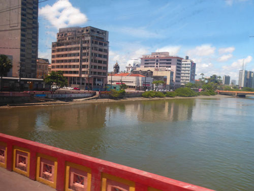
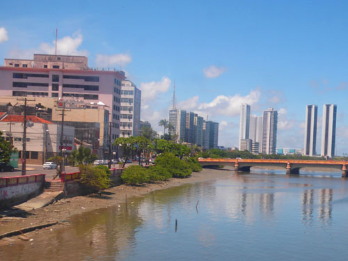
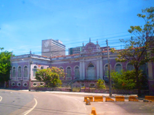
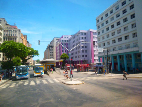
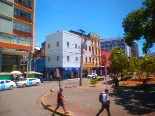
New Recife is a typical, modern city- with skyscrapers, expressways, and even a Metro (although it is aboveground). We never got to this part of the city, as our shuttle bus ride stayed on the two original islands of Old Recife. But in some of the pictures we took from the shuttle bus you can see the new part of the city across the water (and you could certainly see it in the pictures we took from the ship as we came in to dock.
|
|
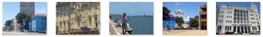
The bus ride was kind of neat, although being a simple shuttle we didn't have a guide aboard to tell us what we were looking at. I've found some of the buildings and such online, but not enough to try to label all the images, so I just hope you enjoyed the assorted scenes of Old Recife.
We Return to the Viking Jupiter
When the shuttle dropped us off back at the cruise terminal, we walked through it (the welcoming band was gone by this time) to the port shuttle bus stop out by the water. Eventually, one of the buses filled up and took us back to the ship.
|
|
Our visit to Recife was short, but interesting. I wish we'd been able to join one of the tours to Olinda, which is even more historic, but seeing Recife was neat also. Now we have a couple of sea days before our next stop in Rio.
You can use the links below to continue to another album page.
|
November 29, 2019: Rio de Janiero, Brazil |
|
Sea Days Aboard the Viking Jupiter |
|
Return to the Index for 2019 |