|
December 2, 2019: A Visit to Montevideo, Uruguay |
|
November 26, 2019: A Visit to Recife, Brazil |
|
Return to the Index for 2019 |
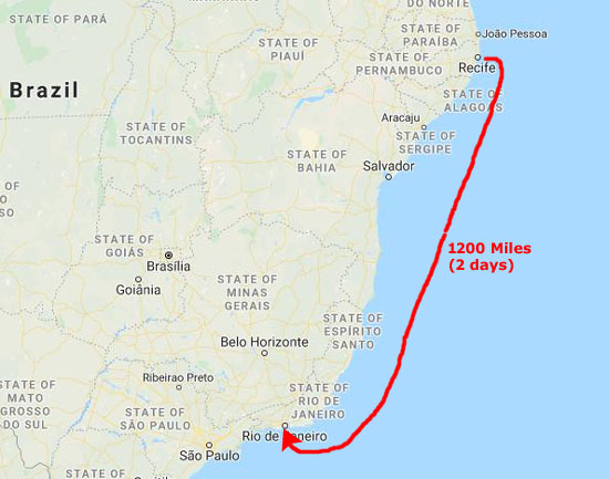
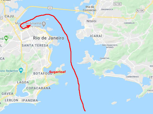
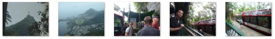
Today, after a couple of sea days, we are arrving in Rio de Janiero, and we will be taking a shore excursion that will take the three of us to both Sugarloaf and Corcovado (Christ the Redeemer).
We left Recife, Brazil on the evening of November 26, and we arrived in the Rio area early in the morning on the 29th after spending two full days and two nights at sea.
|
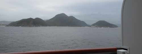
We were far enough out to see so that we could not see the coast of South America from the ship, save for our departure in the evening and arrival in the morning two days later.
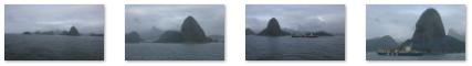
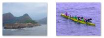
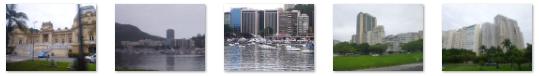
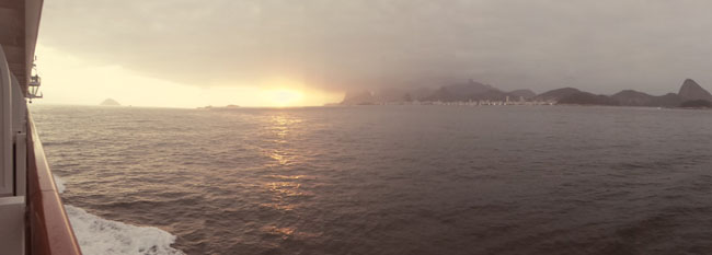
Rio was one of those ports where the first sight of land occurs when it's still dark, so by the time we'd woken up around six, we were already in sight of the ghostly islands that dot this part of the coast of Brazil:
|
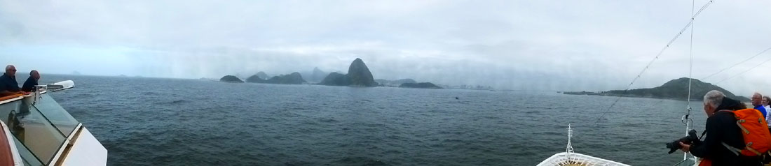
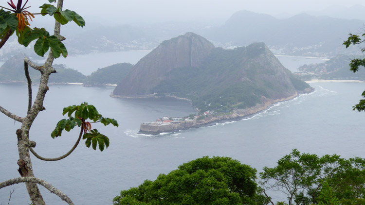
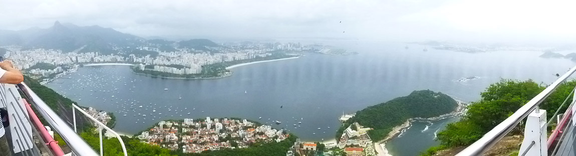
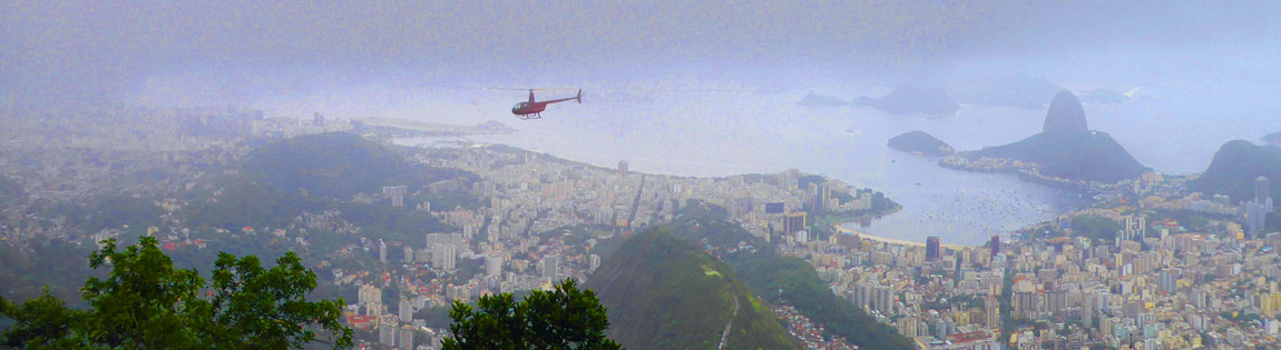
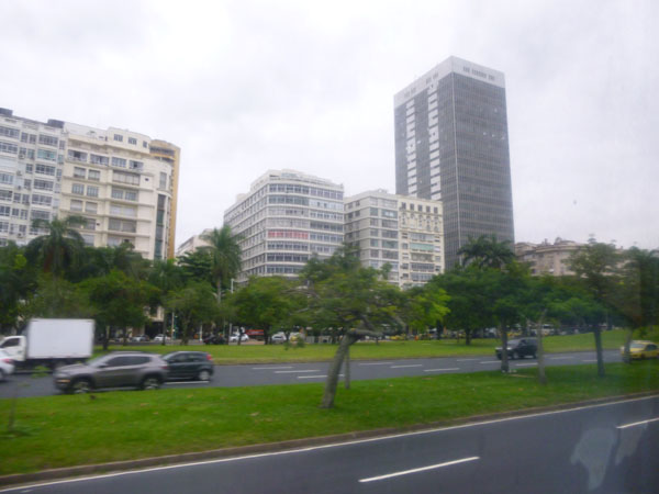
Most of the pictures you've seen of Rio de Janiero have been on postcards and in print; those pictures are usually taken on clear sunny days. At this time of year, those days are quite in the minority, and as we came into the harbor area of Rio, the views were distinctly indistinct- almost ethereal. Here are two good examples of what I mean:
|
|
|
|
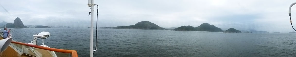
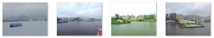
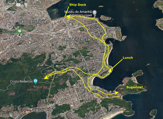
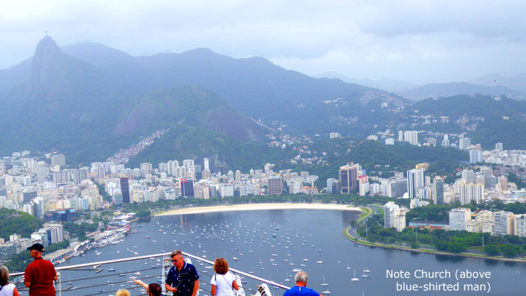
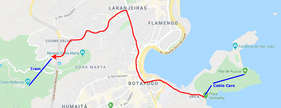
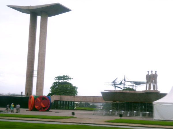
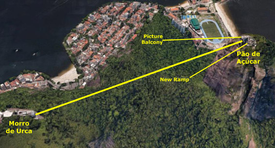
The second of the four pictures above is, I think, the most interesting. Obviously, you can Sugarloaf in the foreground, with its distinctive baguette shape. But if you look to the left of Sugarloaf, and off into the distance, you will see Corcovado Mountain and, on the top, you can just make out the huge statue of Christ the Redeemer. Referring to the map at right, you can see pretty much exactly where the ship had to be when that photo was taken.
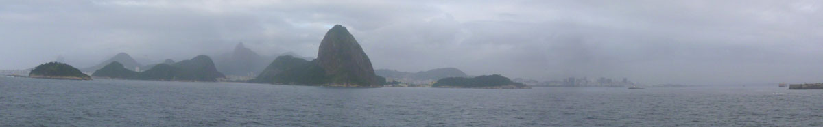
Approaching the entrance to the harbor, we of course left the open sea, but before we did that I made one more panorama showing Sugarloaf, the harbor entrance to its right, and then more of the islands east and north of the harbor entrance:
|
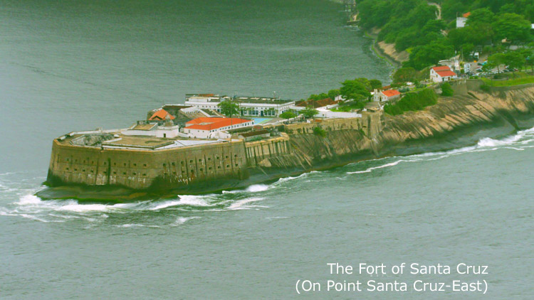
Once we passed Sugarloaf, you can see from the map that we coming past the actual city of Rio on our left, and the northeast islands on our right. Both sides of the harbor entrance have fort-like structures built by the Portuguese to guard its approaches.
|
|
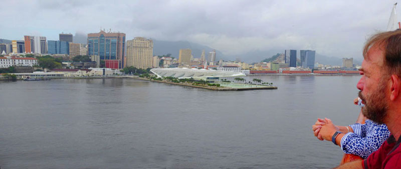
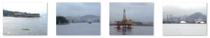
From when we first started taking pictures this morning, it took maybe 90 minutes for us to make our way slowly up through the harbor channel and into our berth at the cruise port. During that time, we had a bit of breakfast and then, while we were docking, went back to the cabin to get ready for our departure on today's shore excursion to Sugarloaf and Corcovado- as well as lunch at a traditional Brazilian churrascaria.
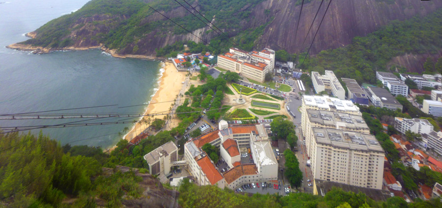
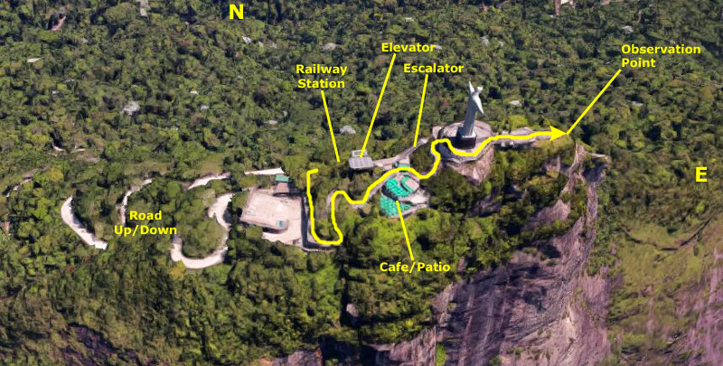
Rio de Janiero: The Lay of the Land
Before we get off the ship and meet up with our tourguide, I thought it might be a good idea to orient you a bit to Rio, give you an idea where we are going, and also tell you a bit about the city. Rio de Janeiro was founded in 1565 by the Portuguese, and in 1763 became the capital of the State of Brazil in the Portuguese Empire. The city was, from 1808 to 1820, actually capital of the Portuguese Empire, but in 1822 became capital of an independent Brazil. It remained the capital until 1960, when the capital of Brazil was transferred to Brasilia.
|
Rio de Janeiro is one of the most visited cities in the Southern Hemisphere and is known for its natural settings, Carnival, samba, bossa nova, and balneario beaches such as Copacabana and Ipanema. In addition to the beaches, some of the most famous landmarks include the giant statue of Christ the Redeemer atop Corcovado mountain, named one of the New Seven Wonders of the World; Sugarloaf Mountain with its cable car; a "Sambadrome"; and one of the world's largest football stadiums.
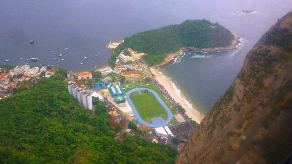
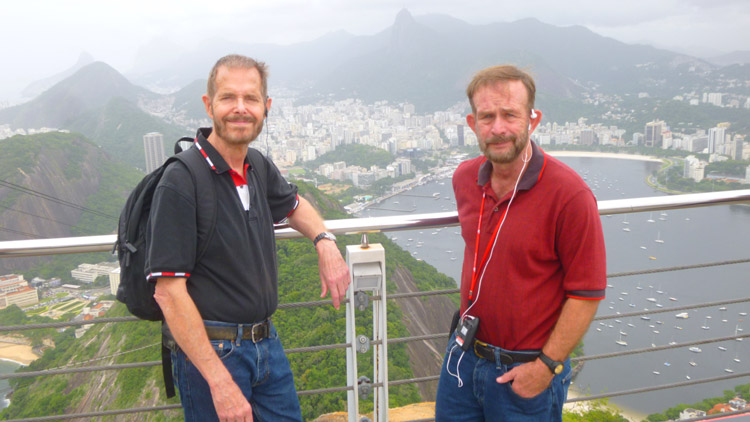
So what do we plan to do here in Rio on our excursion? Well first of all, I should point out that I have been here before- on a business trip in 1980. On that trip, I stayed at a Sheraton Hotel on the coast southwest of Corcovado (and way out of the aerial view at left). I did my classes in a hotel just off Ipanema; both the hotel and Ipanema are south of the part of Rio de Janiero shown in the aerial view at left.
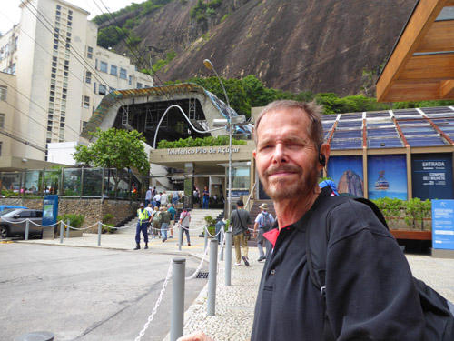
At that time, I visited both of the sites we will visit today- Sugarloaf and Corcovado. I visited Sugarloaf on my own, but had a young guide to Corcovado (one of the people who was in one of the classes I did). Greg had also been here before, but I don't think he took the time to do much sightseeing. So this will be a nostalgic return for me, but I am sure that in 40-odd years much will have changed. In addition to visiting these two sites on our excursion, we will also be stopping for lunch at a typical Brazilian barbecue restaurant, and also riding through a good deal of Rio on our tour bus. Lots of pictures today, so I'll break the excursion down into sections- the first one of which will take you from the ship to the foot of Sugarloaf.
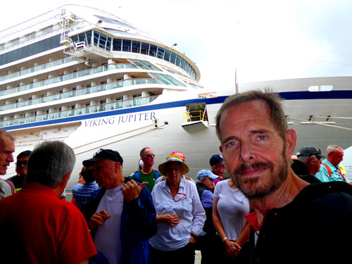
Disembarking from the Viking Jupiter
The first part of our excursion will take us from the ship to the pier, where we will meet our tour guide. She will lead us through one of the cruise ship terminal buildings to the point where we will get on our tour bus. Then we will drive from the port down to the southeast to be base of Sugarloaf Mountain.
|
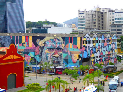
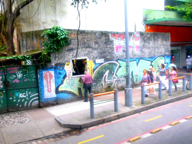
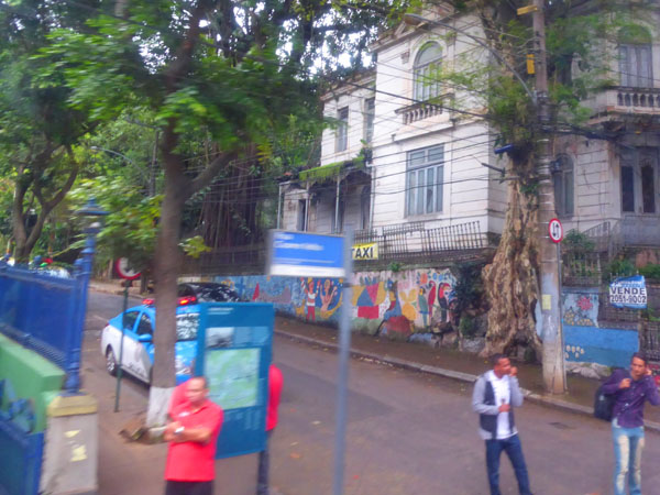
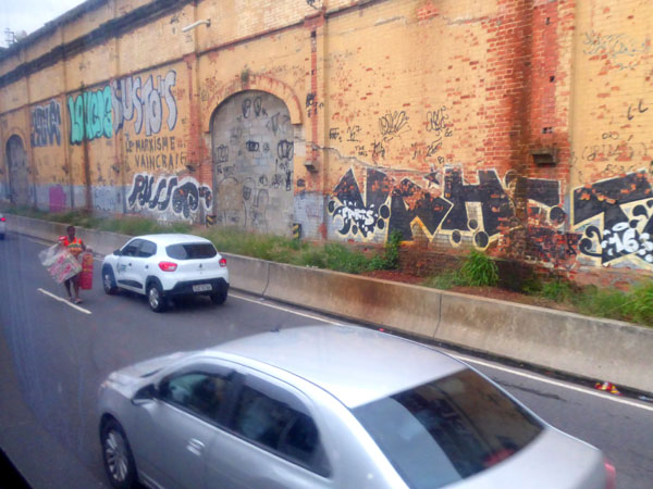
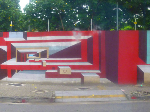
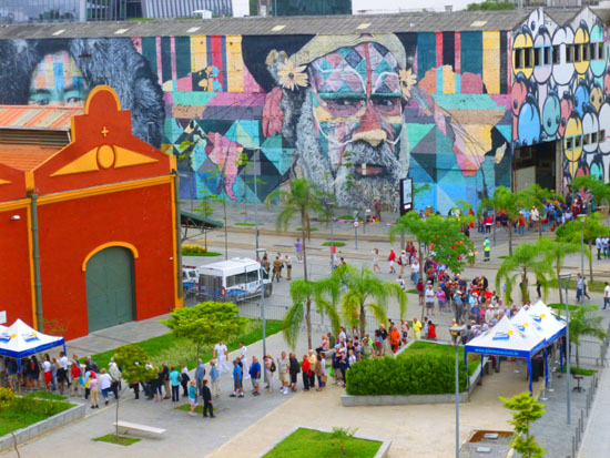
That colorfully-decorated building across the way is actually a parking garage used, we came to find, by tour buses and by individuals who come to the area to embark on cruises themselves. I think you'll agree that the pictures and designs painted on the building are way beyond graffiti, and indeed our guide told us that the decoration of many of the buildings here was commissioned. When we get back from our shore excursion, I'll try to get some closer views of some of these amazing decorations.
I should also say that during the day we saw a good deal of "street art", a term that I will use instead of "graffiti". Much of the art we saw was light years beyond the kind of "tagging" one often sees in American cities. A bit later on I'll collect some of the many pictures we took of it into one place.
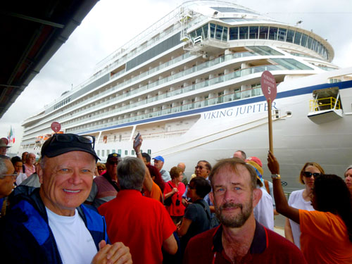
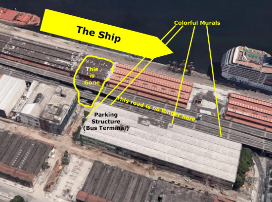
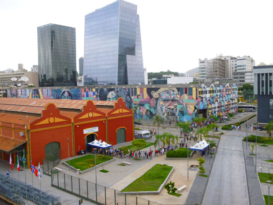
Anyway, we got off the ship onto the dock, and there were a couple other ships in front of us at the dock. The cruise port here is relatively new (as the aerial views and the new ultra-modern tourist building we passed on the way in can attest). On the pier, we gathered around our tour guide- one of three that would be leading different groups on the same excursion today.
|
|
While the group was assembling, I walked a bit further down the dock to get this great picture of the Viking Jupiter. Shortly after I took that picture, our guide and our group began walking down the pier towards me and the exit through one of the terminals and out to the city itself.
|
(Mouseover Image Above for Video Controls) |
|
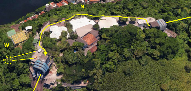
We crossed the Metro tracks and headed around the northwest side of the parking structure to go in and find our bus. On the way, we took a few pictures of the area (although we got some better ones late in the afternoon when we got back).
One line of the metro kept going northwest along the pier, presumably to other terminals, but one line branched here and turned to head southwest between the parking structure and the building north of it- which was decorated with colorful rectangles. It seemed to be some sort of office structure.
Anyway, our guide led us inside the parking structure where the tour buses were lined up. We found our bus, got aboard and seated, and were the first group on our particular excursion to head out to Sugarloaf. This would turn out to be fortunate, although we wouldn't figure that out until the day was almost over.
The Drive to Sugarloaf
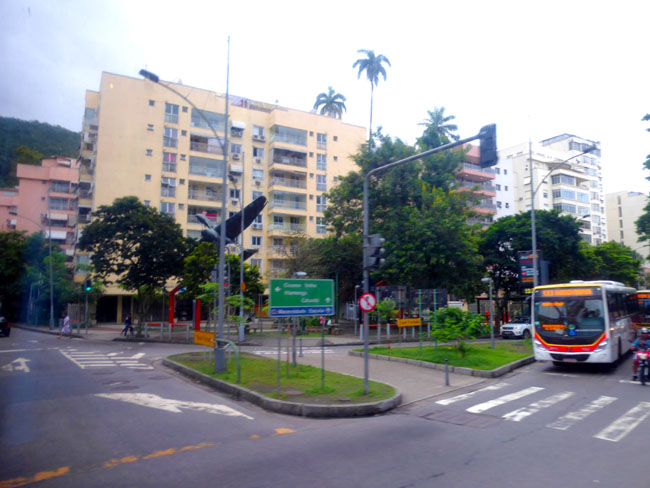
Once we were all aboard our tour bus, we set off on the drive to the Urca district, south of the port. In general, our route took us through one of the older areas of Rio- very commercial- and then down alongside a large park (with what looked like a lot of nice residential high-rise buildings and also the restaurant where we would have lunch), around a very pretty inlet and marina area and then into the Urca neighborhood.
|
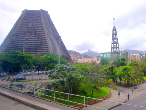
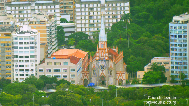
The Metropolitan Cathedral of Saint Sebastian, better known as the Metropolitan Cathedral of Rio de Janeiro or as the Cathedral of St. Sebastian of Rio de Janeiro, is the seat of the Roman Catholic Archdiocese of S�o Sebasti�o do Rio de Janeiro. The cathedral is the See of the Metropolitan Archbishops of the city and the church is dedicated to Saint Sebastian, the patron saint of Rio de Janeiro.
What was so unusual was the design of the cathedral. This is certainly not the first cathedral we have visited in the New World; we have visited the cathedrals of Quito, Lima, and Cuzco, but all of them were designed like the cathedrals of Europe. This cathedral was designed by Edgar de Oliveira da Fonseca in a modern style based on the Mayan architectural style of the pyramids. Completed in 1979, this church is the latest in a series of churches that served as the seat of the Archdiocese since 1676, the most recent and notable of those being the Church of Our Lady of Mount Carmel of the Ancient See, now known as the Old Cathedral, built in the 18th century, and that had been declared Rio's cathedral in the early 19th century.
The New Cathedral, as it is sometimes called, is located in the center of the city. Conical in form and with an internal diameter of 315 feet and height of 246 feet, the inside area is almost 80,000 square feet- sufficient for 5000 seats and a standing-room capacity of 20,000 people. The cathedral's four rectilinear stained glass windows soar 210 feet from floor to ceiling.
|
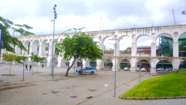
During the rule of governor Aires de Saldanha (1719�1725) it was decided that the canals, which at the time only reached partway into the city, would be extended to the city center via aqueducts. The first one was finished in 1723, and clean water flowed directly to a decorative Baroque fountain in Santo Ant�nio Square near the city center. Twenty years later, with this aqueduct now in bad shape, the new governor ordered the building of a new, larger structure. It was modeled on similar structures in Lisbon, and was inaugurated in 1750.
The most impressive part of the system is this section that connects the hills of Santa Teresa and Santo Ant�nio, in today's Lapa neighbourhood. It is about 850 feet long, consisting of two storeys of arches- 42 in total- about 50 feet high in the middle. As the needs of the city grew, other streams and rivers were tapped to feed an expanding system. The aqueduct was deactivated in the 1880s as new alternatives to supply water to Rio were developed. The structure was adapted in 1896 to serve as a viaduct for a tram line� the Santa Teresa Tramway� that transports passengers between the centre of Rio and the hilly Santa Teresa neighbourhood. The picturesque ride is popular among locals and tourists alike. This is the only tram still in operation in Rio de Janeiro, although the 2016-opened Rio de Janeiro Light Rail system is similar to a tramway on some sections.
|
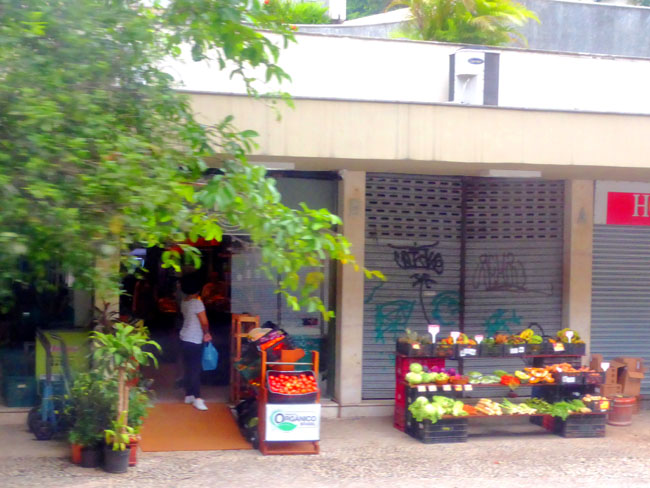
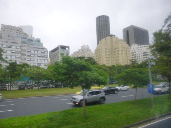
The weather wasn't very good this morning; it was mostly overcast. This meant than even the pictures we tried to take from the bus were mostly not worth trying to include here. In fact, of the fifty or sixty pictures I have that Fred and I took from the bus, only a dozen are even passable. Here are the rest of the interesting street scenes that turned out well:
|
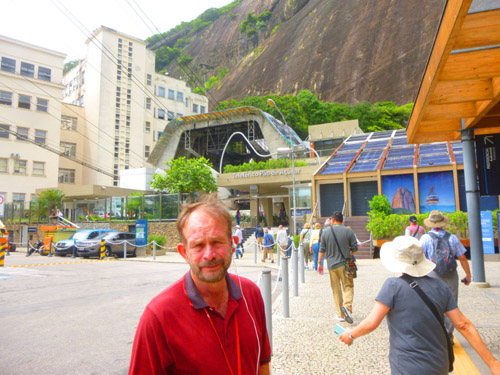
Our Visit to Sugarloaf Mountain
It took about a half hour to get from the port down to Urca, and than a bit more time for the bus to maneuver around to a point where it could let us off so we could follow our guide into the ground station for the tramway to the top of Sugarloaf.
|
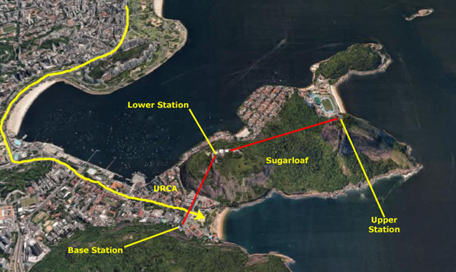
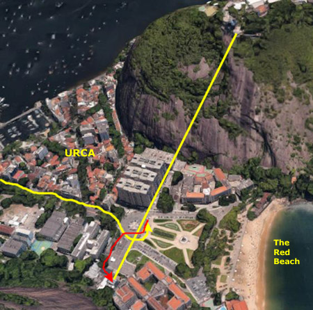
On that view, you can see our route into the district from the port (way out of the view to the north). The bus let us off at a large plaza between two mountains- Sugarloaf being the one to the north. (An attraction known as The Red Beach is very nearby, but we didn't know that at the time or we might have walked over to have a look.)
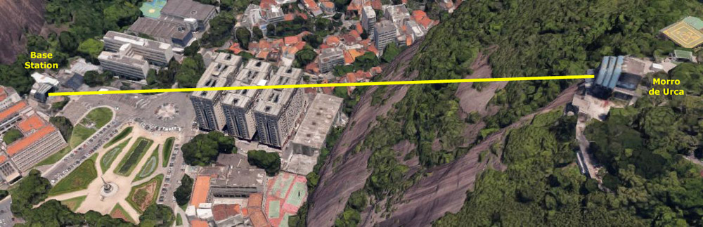
The base tram station for the tramway up to the top of Sugarloaf is not located at the base of Sugarloaf itself, but rather at the base of the next hill to the south. This allowed the first leg of the tram ascent to be a great deal less steep.
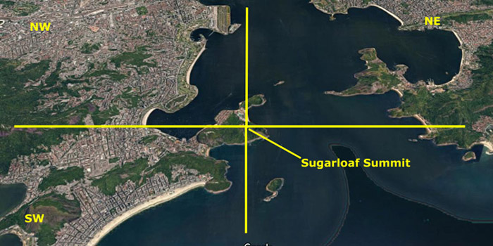
I realize that most of you reading this haven't been to Rio, as I know from the emails I get that most of the visitors to my photo album are either friends and family or people who are planning trips to some of the places that are featured here in the album. So I want to spend rather more time orienting you to the mountain.
|
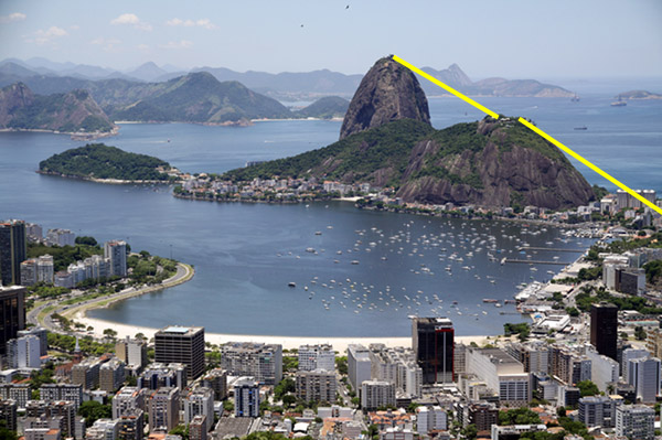
The picture at left, borrowed from Wikimedia Commons, was taken in January, 2012, by photographer Halley Pacheco de Oliveira (and is copyrighted by him, in case you want to use it for something). (On seeing the date, I found myself wondering if Oliveira was one of those people who thought that it might all be gone on the Winter Solstice that same year.)
You can compare this view (and please note that I have added the routes of the first and second cable car spans) to the aerial view above. You will see that the camera was high up, somewhere to the northwest in relation to that aerial view.
The beach that you see in the foreground in the photograph is the same one you see in the upper left of the aerial view; it is Botafogo Beach. Botafogo itself is a beachfront neighborhood (bairro), a mostly upper middle class and small commerce community, and is located between two hills which separate it from Laranjeiras and Copacabana. The word Botafogo also refers to a Latin American ballroom dance move, named so because it originated here.
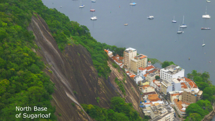
Anyway, I think the photograph also gives you a better idea of what the area all around Rio de Janiero actually looks like. You can see that Sugarloaf mountain is just one (perhaps one of the highest and certainly one of the most recognizable) of several monolithic granite and quartz mountains that rise straight from the water's edge around the area. Geologically it is considered part of a family of steep-sided rock outcroppings known as non-inselberg bornhardts.
At the Tramway Base Station
|
We got off the bus in the circle at the west end of a small park- the Praca General Tiburcio The park was constructed in 1817, and was named after General Tiburcio who faught bravely in Brazil's war with Paraguay. A statue was erected in his honour. Our guide said that most locals refer to the area as Lion Square, named for some large bronze lions imported from Paris in the early 1900s.
|
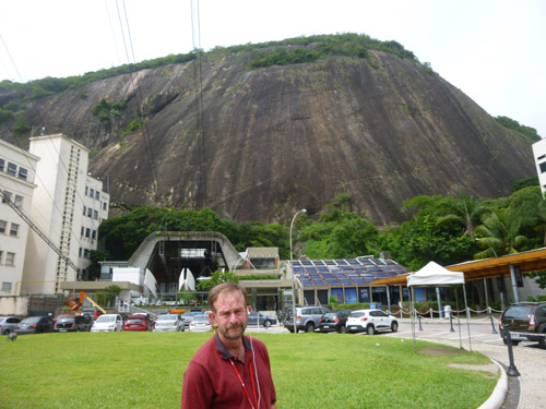
Our guide led us south to the tramway base station, which is up against the base of Morro da Babil�nia (Babylon Hill). This hill is another of the rock outcrops that form the pointed hills that are prevalent in the entire area around Rio. This particular one (an environmentally protected area) separates the Urca/Botafogo area from Copacabana beach.
As our group made its way to the tram base station, Fred and I were snapping pictures. I recalled the area looking pretty much the same as when I was here in 1980, but then I was on my own and not with such a large group. So we had to take our pictures with one eye on where our guide was going:
|
|
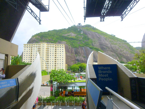
We were a large group, and our guide's company had to pre-arrange tickets for the whole group so we could go up and down as a group. This turned out to be something of a logistical challenge, and we had to wait around just a bit. Eventually, though, we were ushered up the steps to the tram station, passing right the cable cars before we went inside and up the stairs to the departure level. Up there, we found a patio that offered a neat view of both the cable car to the middle station and the second transit to the top of Sugarloaf. After quickly snapping that picture, we were ushered into two sequential cars (or group being too large to fit into a single one).
The Cable Car Ride to Morro da Urca (Urca Hill)
|
|
Fred took a closeup of our car coming down (picture at left) while I was taking a picture with a broader view (right). You'll be able to see some of the buildings in my picture from above in a moment. I made two movies here that you might want to watch.
|
(Mouseover Image Above for Video Controls) |
(Mouseover Image Above for Video Controls) |
In the left-hand movie, you can see the car we are going to board arriving at the base station. We are here fairly early, so the cars up are full while the ones coming down are not. In the other movie, I began filming as we were lifted out of the base station, and I filmed almost all the way up.
|
The panoramic view at left shows much of the Urca district. Because our ascent is basically to the northeast, the picture goes from southeast (at the left) to northwest (at the right). It may be confusing, but the Red Beach can give a clue. You can pick out the park, of course, the statue to General Tiburcio, and, at the lower left, the Brazilian Army's Command and Staff School.
Here is a good still picture of the area around Tiburcio Park- including the base station and the Red Beach.
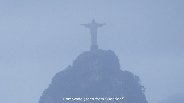
Looking in another direction, here is the view to the northeast. You can't see Copacabana (that is behind the hill opposite) but you can see the business center of Rio de Janiero and, in the distance, Corcovado and the statue of Christ the Redeemer. (Looking at the statue in the distance, Fred and I were wondering if the weather would allow us to see much when we got there, but maybe, we thought, it would be better in a few hours.)
Having seen some pictures from the first cable car ride to the top of Morro de Urca, I thought you might want to see a 3D view of the cable car route. This view looks basically north, from somewhere out over the water off the Red Beach:
|
The Cable Car Ride to the Top of Sugarloaf
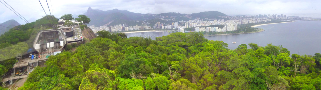
I made no movie on the way up, but I did take a number of pictures, and I have put most of them together into panoramic shots. Let's begin with the first couple of pictures shortly after leaving the Morro de Urca station:
|
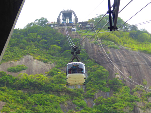
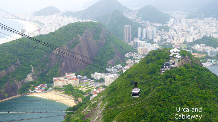
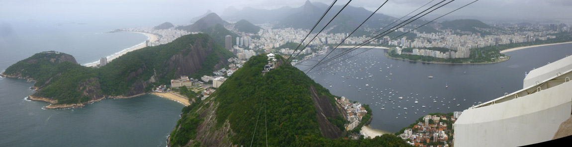
To reach the summit of Sugarloaf, passengers take two cable cars. The first ascends to the shorter Morro da Urca, 722 feet above Urca, and the second ascends to P�o de A��car. The views on the way up get better and better:
|
|
Swiss-made bubble-shaped cars offer passengers 360� views of the surrounding city. The ascent takes three minutes from start to finish. A glass-walled cable cars hold 65 people and make the 1-mile trip between the two peaks every 20 minutes. The original cable car line was built in 1912 and rebuilt once in 1972�73 and again in 2008. As we approached P�o de A��car, I put two more panoramic pictures together. They are similar, but I thought both were pretty good:
|
|
At the end of the advertised two-or-three-minute ride, we disembarked at the top of Sugarloaf, and walked out of the P�o de A��car station.
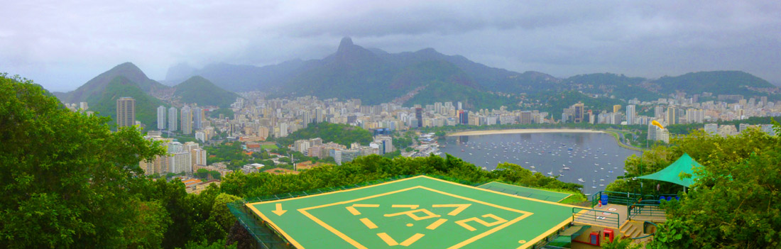
At the Sugarloaf Summit (P�o de A��car)
|
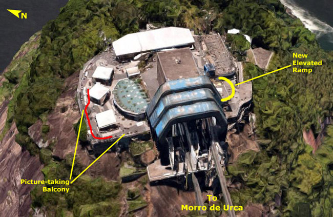
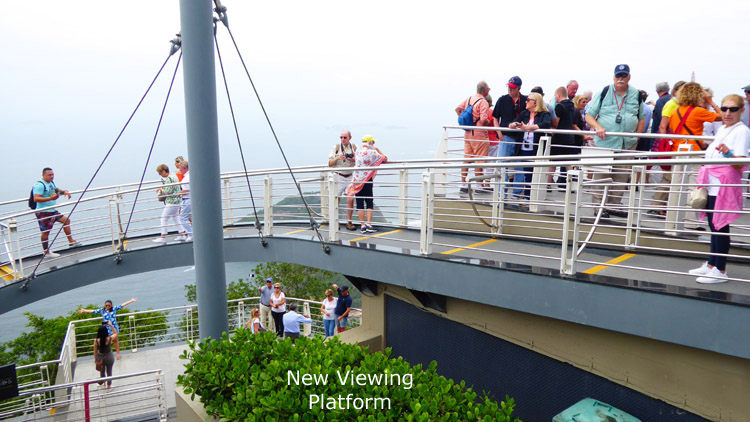
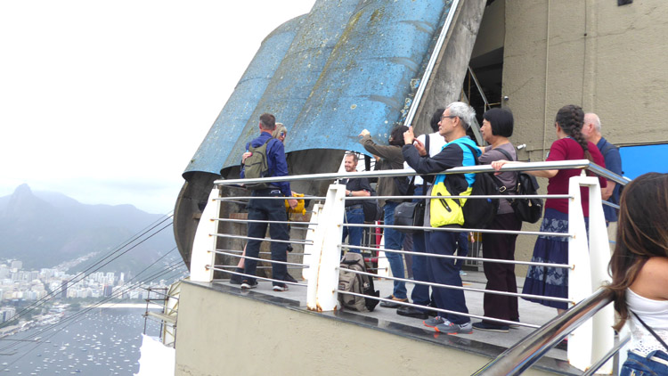
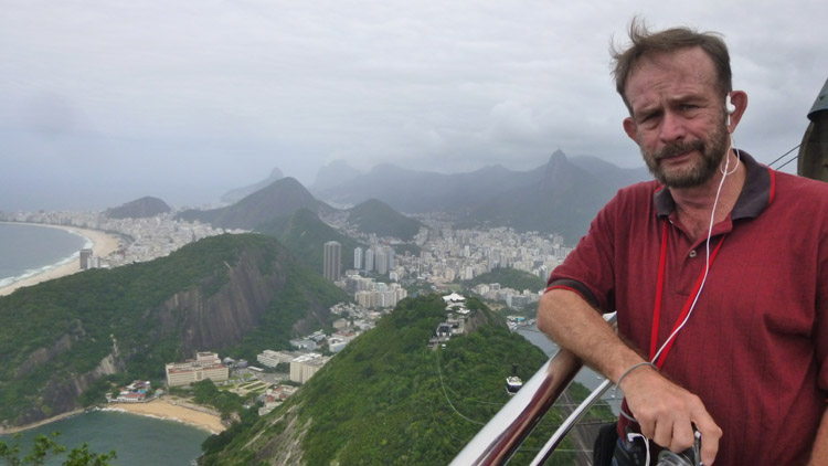
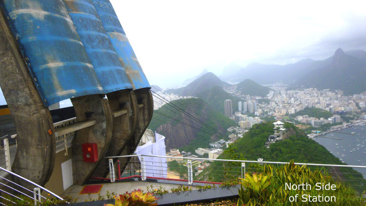
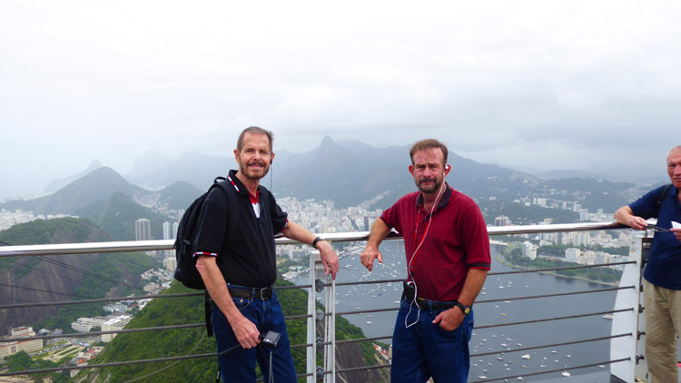
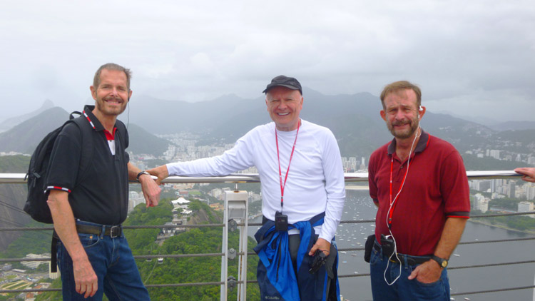
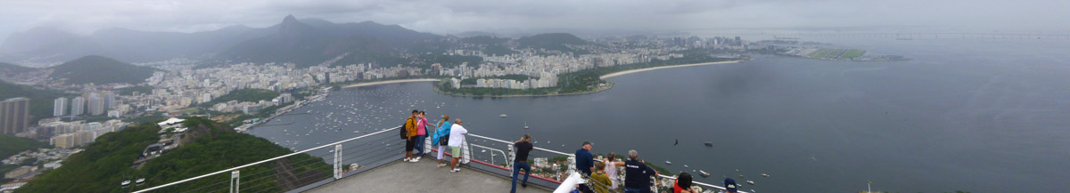
At left you can see an aerial closeup of the area here at the top of Sugarloaf. I have noted that this aerial view is a bit out of date; on the south side (right, in the picture) a lot of construction has been done, and now there is a cantilevered, semi-circular walkway on that side that offers better picture-taking opportunities looking to the south. I have drawn in where that walkway is now. On the north side of the area is a wide, multi-level balcony. It offers great views west and all around to the north and northeast from its own cantilevered area. We took most of our pictures here, as the views seemed more expansive. (In a bit, you'll see the major movie that I made on this side of the area, and I have marked in red the path I walked during filming.)
We took a great many pictures from here at the top of Sugarloaf. As I said earlier, I'd been here before, but back in the days of actual film and developing and printing, pictures were not basically cost-free as they are today, and so I did not take that many pictures then. I planned on remedying that now.
|
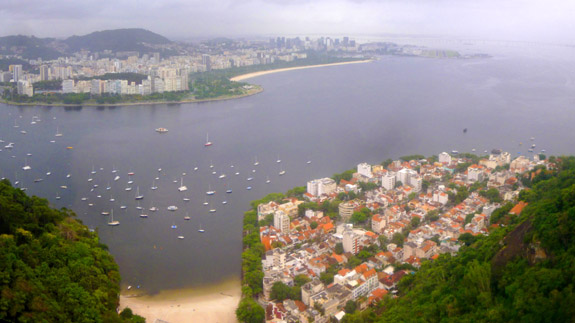
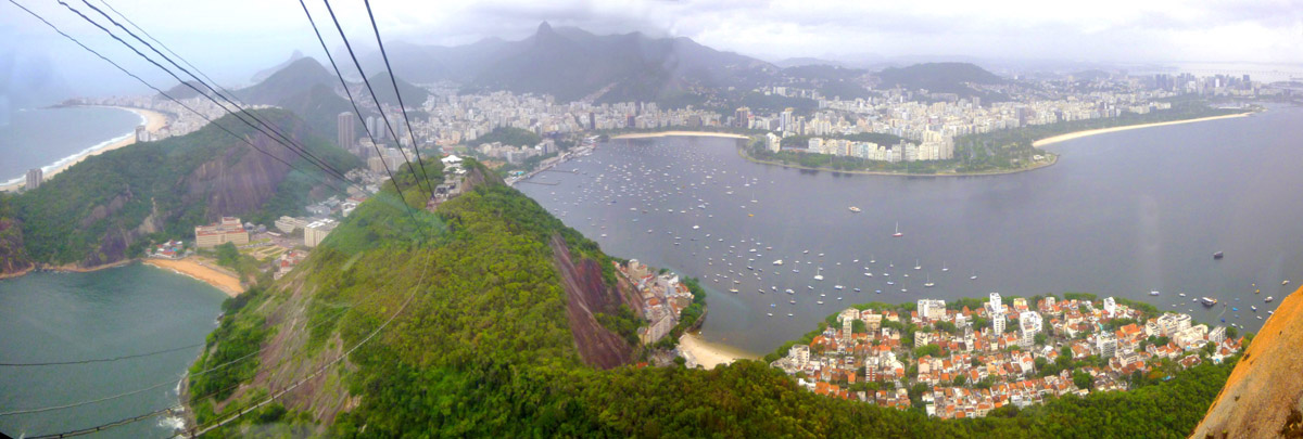
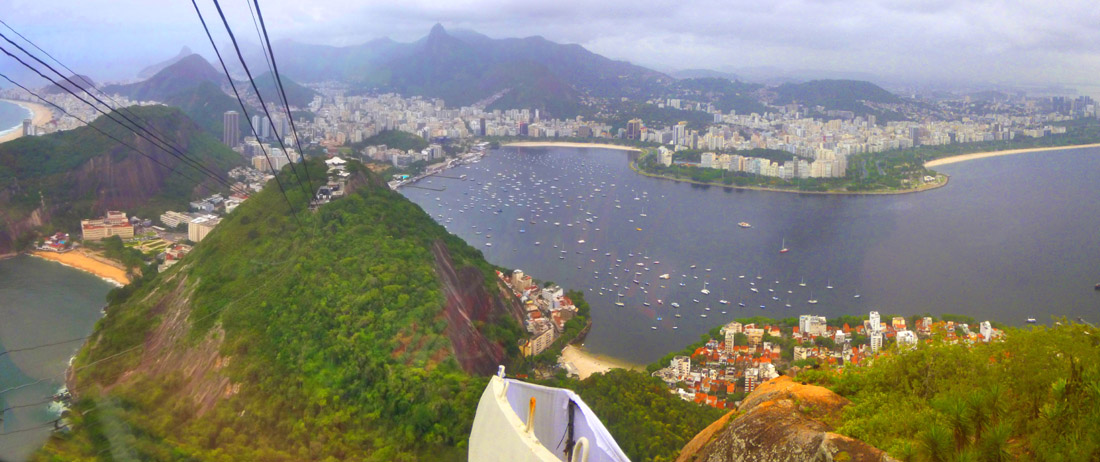
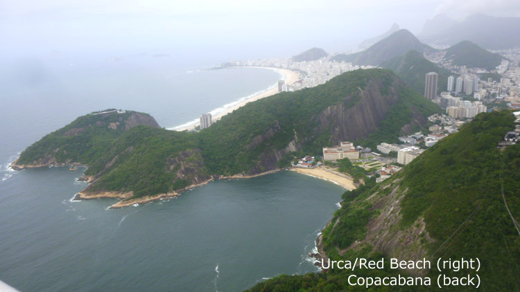
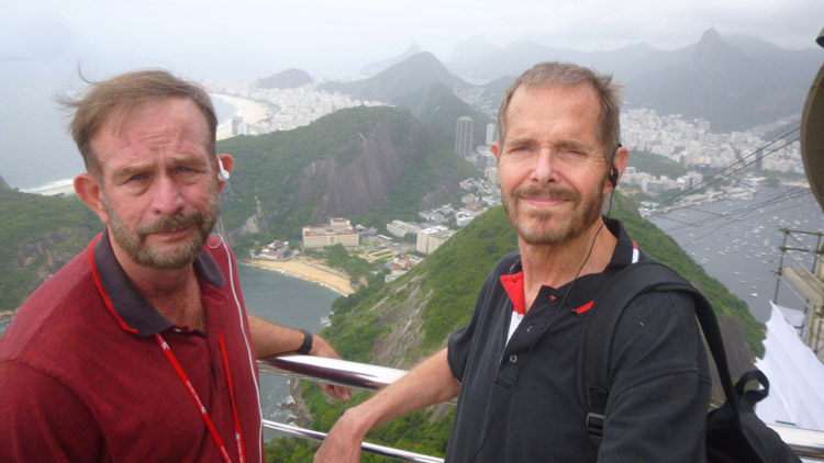
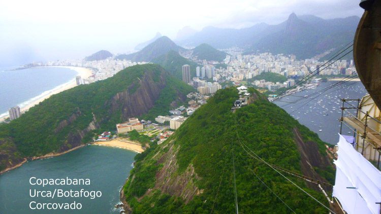
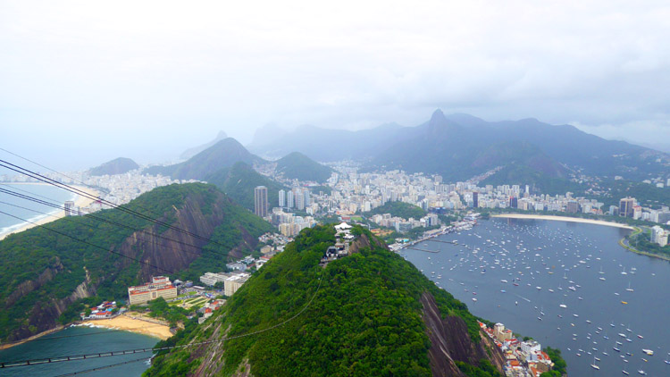
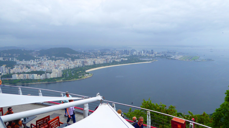
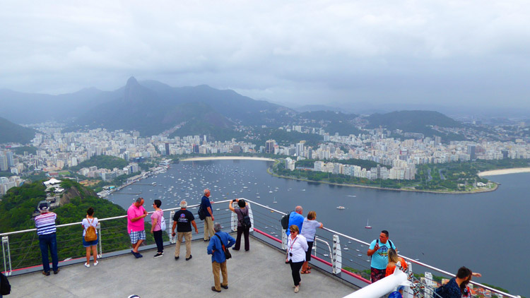
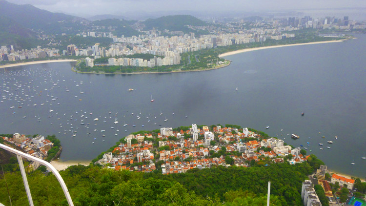
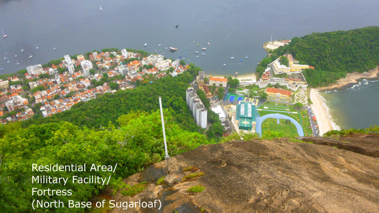
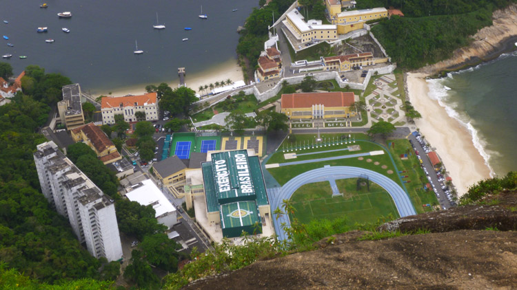
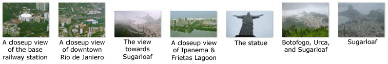
In any event, I wanted to orient you to what you will be seeing in the pictures on this page. The great majority of our pictures were taken to the west. Between south and west, landmarks included Copacabana Beach in the distance and the Red Beach much nearer in Urca. In that quadrant too, usually hidden by hills, is the resort area of Rio, including Ipanema Beach (made famous in song in 1964- "The Girl from Ipanema" by Astrud Gilberto, Jo�o Gilberto and Stan Getz). Just barely in this quadrant we could also see Corcovado- hidden by cloud most of the time. Most of these pictures were taken from the new elevated, curved ramp on the south side of the station- the one Fred photographed me standing on here.
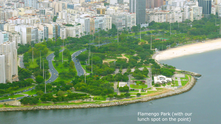
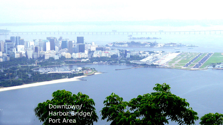
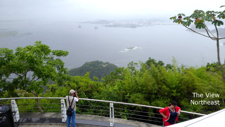
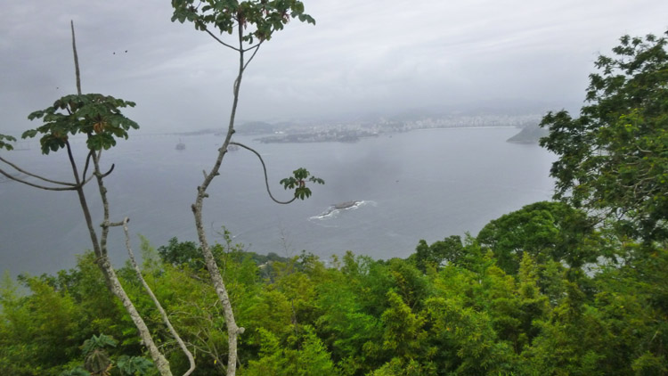
Between west and north we find the bulk of the commercial area of Rio de Janiero and much of its residential area as well. These views, taken from the large cantilevered platform on the north side of the station, featured Flamengo Park- Rio's version of Central Park- near us across the water. Beyond, all the way to the hills in the distance, it is mostly residential, with much of the commercial center (including the port) almost due north of Sugarloaf. The harbor bridge, out of the view to the north, crosses the bay to the suburbs to the east. We did not take many pictures in the north to east quadrant- the scene being mostly hills with small residential areas nestled in between them, and much of what there was in that direction was to far away to be clearly scene on such a cloudy day. Finally, from the east back around to the south, we took no pictures at all- this being the direction out to the open ocean.
|
|
For those pictures where I want to tell you where you are looking or what is in the shot, I've just put a little bit of labeling somewhere on the image. And I've arranged the photos with those taken between south and west in the first group, west and north in the second, and north around to the east in the third.
The name Sugarloaf was coined in the 16th century by the Portuguese during the heyday of sugarcane trade in Brazil. According to historian Vieira Fazenda, blocks of sugar were placed in conical molds made of clay to be transported on ships. The form of the peak reminded them of the well-known resulting "sugarloaf" shape, and the nickname has since been extended to be a general descriptor for formations of this kind.[2] In case you don't know (and I didn't), the name "Sugarloaf" was coined in the 16th century by the Portuguese during the heyday of sugarcane trade in Brazil. According to historian Vieira Fazenda, blocks of sugar were placed in conical molds made of clay to be transported on ships. The form of the peak reminded them of the well-known resulting "sugarloaf" shape, and the nickname has since been extended to be a general descriptor for formations of this kind.
Enjoy looking at the vistas that opened up below us from here- on the summit of the mountain!
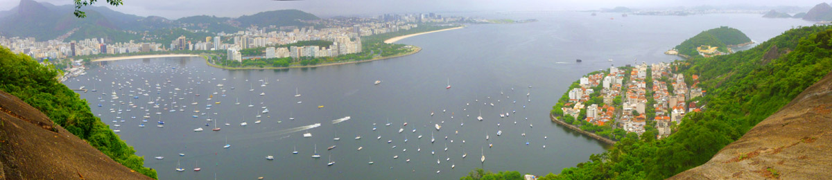
In addition to the regular photos, here are a couple of panoramic views that we took from the summit:
|
|
There were some other things to do and see up here, but of course the views are what most people come for.
|
(Mouseover Image Above for Video Controls) |
Just outside the cable car station there is memorial to Cristov�o Leite de Castro. Born on April 15, 1904, in Belo Horizonte, State of Minas Gerais, Castro earned in 1928 a degree in Engineering from the Polytechnical School of Rio de Janeiro, where he was assistant to the famous engineer Paulo de Frontin in the Machines course. In 1930, he joined Companhia Caminho Aereo Pao de Acucar as Technical Director and held the post of Director-President from 1962-1999.
He implemented a new system for the cable cars in 1972, expanding capacity from 115 to 1300 passengers per hour. Under his administration, the tourist complex became the venue for countless cultural and social events, and the cable cars he personally conceived came to represent one of the greatest symbols of the City of Rio de Janeiro.
Before we wind up our visit to the top of Sugarloaf, here are two more movies Fred and I made here at the summit:
|
(Mouseover Image Above for Video Controls) |
(Mouseover Image Above for Video Controls) |
And a final panoramic view:
|
After about an hour here at the top, our guide shepherded us over to the station, and we went down to the middle station in two groups. Here's me at the cable car as we are getting ready to go board ours.
Getting Back Down to the Urca Base Station
|
(Mouseover Image Above for Video Controls) |
(Mouseover Image Above for Video Controls) |
As you can see from that last movie, the ride down to Morro de Urca was neat (as almost all cablecar rides are). I was fortunate to get a good window position, unlike on the ride up.
|
On this return trip, though, we went along the north side of the area between the two stations, and here there were views back up to the Sugarloaf summit as well as expansive views to the north and west, and also various exhibits- including one of a couple of the earlier cable cars.
I thought that aerial view was pretty interesting, as you will be able to see on it some of the very things that we photographed as we made our way from one station to the other.
|
(Mouseover Image Above for Video Controls) |
|
From a different area midway along our walk, they had a display of some of the older cars from previous years- including one of the first yellow ones that I rode when I was here before. There was also an observation platform from which I put together a couple more panoramic views to the north of the city of Rio:
|
|
Eventually, we all met up at the station for the tram down to the base station, although again we had to go in two separate cars (as there were already some people not part of our tour waiting to board a car down).
|
|
(Mouseover Image Above for Video Controls) |
We arrived at the base station in our two groups, and our guide led us out to the park plaza to where our bus was waiting. We boarded, and thought we would be heading off to lunch.
Our Visit to Corcovado and "Christ the Redeemer"
As has often happened on these shore excursions, our guide contacted her tour company- in this case to get updated information on what was going on over at Corcovado. Was it raining? Was it congested? Should we head on to lunch as scheduled?
|
So our guide proposed that we delay lunch until after our visit to Christ the Redeemer. She thought if we did lunch now, we might find our time much restricted at Corcovado later. So, she asked, would anyone be opposed to going directly to Corcovado, and having our lunch more towards mid-afternoon? I don't think anyone at all objected to going right over to Corcovado; after all, the was one of the things that everyone had come all this way to see, and to risk shortening that visit for just another eating opportunity seemed silly to all of us. So our guide directed our bus drive to head west to the station for the tram to the top of that mountain.
The Bus Ride to the Corcovado Tramway
|
|
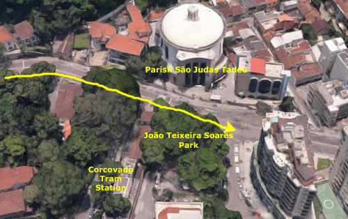
The bus had to double back to let us off on the south side of the street, right in front of Jo�o Teixeira Soares Park. Below is the route of the last part of our bus ride:
The Soares family settled in Rio in 1856 and got into the coffee business. From the age of 12, young Jo�o wanted his own career. He earned enough money from a succession of jobs to enter one of Rio's best schools, eventually attending Rio Polytechnic, and graduating from the School of Engineering in 1872 with a degree in Civil Engineering.
|
|
The reason there is a statue of him in the park just here is that he spearheaded the construction of the Corcovado Railway to the top of the mountain; this line was the first electrified railway in Brazil. Just across the street from this park is the modern Parish S�o Judas Tadeu Church. We did not have time to go in, which is a shame because I found out later it is quite beautiful inside. Instead, we followed our guide a few feet up the street to the tram station entrance (with its metal representation of the statue at the top of the mountain).
Riding the Corcovado Railway
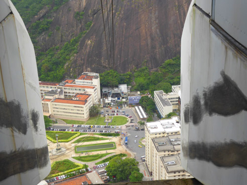
|
Our ride up began as our guide led us up the walkway to the base station. As she had discovered from her phone calls, we had no wait at all here at ground level; she got our tickets quickly and herded us through the turnstiles and onto a waiting train.
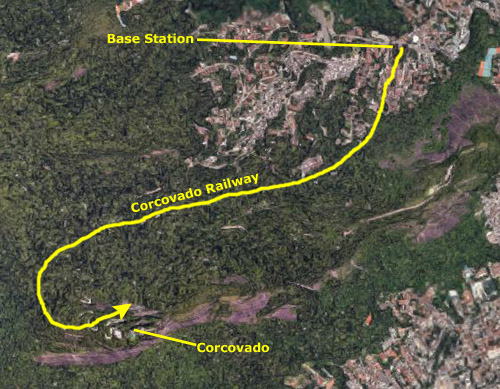
The Corcovado Train is the rack railway that carries passengers from Cosme Velho to the summit of the Corcovado Mountain at 2,329 ft. A rack railway (also "cog railway") is a steep-grade railway with a toothed rack rail, usually between the running rails. The trains are fitted with one or more cog wheels or pinions that mesh with this rack rail. This allows the trains to operate on steep grades above 10%, which is the maximum for friction-based rail.
The Corcovado Railway is 2.4 miles long using a 1,000 mm gauge rack railway using the Riggenbach rack system. The line was opened by Emperor Dom Pedro II on 9 October 1884. Initially steam hauled, the line was the first railway to be electrified in Brazil in 1910, using three-phase electric power with two overhead wires, and one of the few remaining railways using this method of power. The railway was re-equipped in 1980 and again in 2019. The vehicles we rode today are capable of reaching a maximum speed of over 15 miles an hour, compared to the previous equipment the top speed of which was less than 9 MPH. Today, the ascent is made in about 15 minutes. During the descent, energy is recovered by regenerative braking, which leads to a saving of 75% of the overall power consumption.
|
|
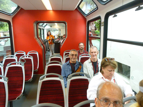
As promised, there was no wait to board the train; in fact, we sat for a few minutes while the trail filled up. Using three trains simultaneously meant, of course, that there had to be a siding somewhere where two trains could pass each other, and it also meant that the trips had to be timed. I guess the trains start up and down at particular times, even if they aren't quite full. As near as I could see, our train was full, but not to overflowing.
The line has been ridden by many famous people, including Pope Pius XII, Pope John Paul II, Alberto Santos-Dumont (a Brazilian inventor and aviation pioneer, one of the very few people to have contributed significantly to the development of both lighter-than-air and heavier-than-air aircraft), Albert Einstein and Diana, Princess of Wales. Sadly, I couldn't say any of those folks rode in my own car, unless they did so earlier this year.
|
(Mouseover Image Above for Video Controls) |
We got a few good pictures on the way up (including a rear view of the statue), and we also took some at the summit station before we began the walk up to the statue itself. Here are some of them:
|
In addition to the bottom station at Cosme Velho, and the Corcovado Cristo Redentor station at the top, the railway has two other stations (at each one of which is a siding allowing two trains to pass). About 20% of the way up is the Morro do Ingles station (as near as we could see mostly used by people intending to hike to the top), and about halfway up is the Centro de Visitantes Paineiras (Visitor Center) station (there being no room at the summit for the Visitor Center facilities).
On the descent, I didn't get the ideal seat again; I wanted to sit right in front, but I did get a seat a row back, and I was able to get up and kneel down at the front of the car to take a series of movies on the way down. You may find these a bit repetitive, but I think that each shows some interesting aspect of the ride, and I think each will give you a good idea of what being on the railway was like.
|
(Mouseover Image Above for Video Controls) |
(Mouseover Image Above for Video Controls) |
|
(Mouseover Image Above for Video Controls) |
(Mouseover Image Above for Video Controls) |
I thought it was interesting in that last video that it appeared at first that the ascending train would come onto our track, but of course it didn't. When it passed, I took a closeup picture of the switch ahead. As you can see, the switch is still set for the train that just passed, and if you look closely you can see the parts of the switch that will have to swivel to allow our train to continue down.
|
(Mouseover Image Above for Video Controls) |
(Mouseover Image Above for Video Controls) |
I hope you enjoyed learning a bit about the Corcovado Railway, and experiencing it via pictures and movies. If you've never ridden a cog railway, it is worth experiencing. You don't have to go to Rio- Mount Washington in New Hampshire is a lot closer.
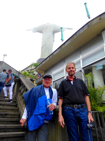
The Summit of Corcovado/Christ the Redeemer
|
(Mouseover Image Above for Video Controls) |
Today, from both the train terminus and the top of the road, the observation deck at the foot of the statue is reached by 223 steps, or by elevators and escalators. Among the most popular year-round tourist attractions in Rio, the Corcovado railway, access roads, and statue platform are commonly crowded- and as you will see in our pictures, today was no exception.
I'd like to orient you to the facilities here at the top of Corcovado, and show you our route up to the statue from the train station down the mountain. To do that, I've borrowed an aerial view of the top of Corcovado from Google Maps.
|
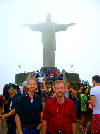
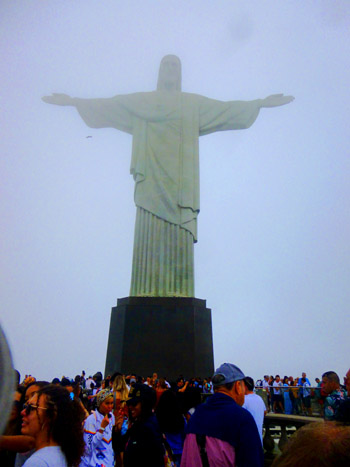
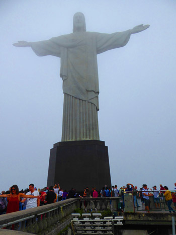
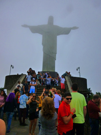
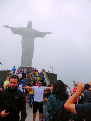
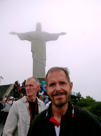
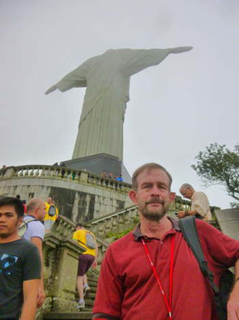
We took the walkway and steps, stopping off on the patio outside the cafe so that we could take some pictures looking south and west. The views were pretty neat in that direction. Here is a view of Brazilian Jockey Club and Racecourse that is situated on the short of the Frietas Lagoon. In the distance is Ipanema. Then we continued up the pathway and stairs; these brought us to the back of the statue the rear of the statue, and we found ourselves on the plaza at its base. Walking around to the front of the statue, it was very crowded, even on a day like today being so cloudy and threatening.
In front of the statue there is a pathway that continues to the east for a hundred feet or so and down some stairs to the easternmost observation platform. From here, you can get views east and north. This whole area was very crowded, as everyone wants to get a picture of themselves with the front of the statue in the background, and so it is tough to keep people from wandering into your picture and getting between you and your subject. As you will see shortly, everyone wants their picture taken with their arms outstretched, mimicking the pose of the statue itself.
|
|
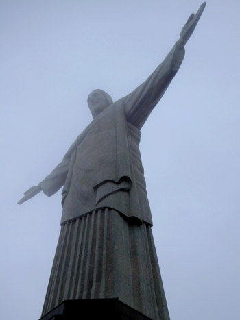
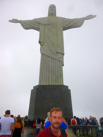
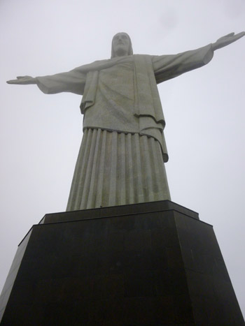
The statue weighs 635 metric tons and is a symbol of Christianity across the world; it has become become a cultural icon of both Rio de Janeiro and Brazil. Made of reinforced concrete and soapstone, it is listed as one of the "New Seven Wonders of the World".
We took quite a few pictures of the statue from various angles (most from the front), but because the weather was so bad none of them were the iconic picture we were looking for. Nevertheless, I've selected some of them to include here, and you will find them in the short slideshow at left. Use the lower corner arrows to go from one picture to the next, and track your progress through the pictures with the index numbers in the upper left.
The first suggestion for a monument here was in the mid-1850s, but it wasn't approved, and in 1889 the country became a republic, and due to the separation of church and state, the proposas was shelved. The Catholic Circle made another proposal in 1920, motivated by what they perceived as 'Godlessness' in the society. Donations from Brazilian Catholics came in, and the statue of Christ the Redeemer Christ the Redeemer with open arms, a symbol of peace, was chosen.
Construction took nine years, from 1922 to 1931 and cost the equivalent of $4 million today. The monument opened on October 12, 1931, in a ceremony conducted by Cardinal Dom Sebastiao Leme, Archbishop of Rio. During the opening ceremony, the statue was to be lit by a battery of floodlights turned on remotely by Italian shortwave radio inventor Guglielmo Marconi, stationed 6000 miles away in Rome but because of bad weather, the lights were activated on-site.
Of course, in addition to the statue itself, the attraction of Corcovado is that the views from here are pretty tremendous, as this is the highest peak in the area. In front of the statue, down a walkway and some steps, is the observation platform which was, even on a day like today, quite crowded. It was particularly hard to do panoramic shots, what with all the people, and of all those we tried, Fred's came out the best:
|
Here are a selection of the pictures we took from the observation platform (although bear in mind that the day was not a great one for really good views):
|
When we first got off the railway here at the top of Corcovado, our guide gave us a time to meet back at the upper station, and with that time approaching we headed back down there. This time, we went around the north side of the base of the Christ the Redeemer statue, and could see the escalators and elevator. We took the stairs down, of course, arriving back at the railway station in time to return to the base station. The visit to Corcovado was pretty incredible, although I of course wish that the weather had been better.
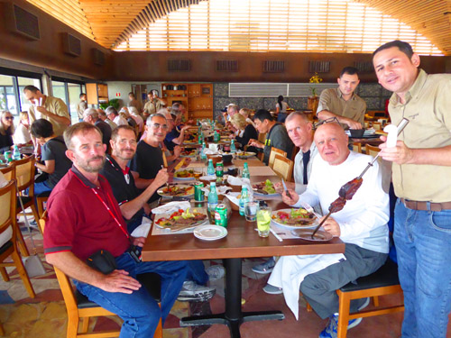
Lunch at the Assador Restaurant
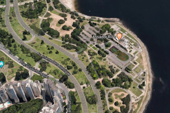
We reboarded our tour bus and headed off to the Assador Restaurant where we were to have lunch. The restaurant was pretty much due east, and so we had to navigate our way through city city again until we got to the broad avenue along Flamengo Park.
|
|
When we turned off the main avenue into the park itself, we came past an area where a large parking lot had been taken over by some motorcyclists. I wasn't sure what was going on, but later I found a sign that said that every month there was a city-sponsored motorcycle school. There are so many motorcycles on the streets of Rio it is nice to know that the city is making some effort to ensure that cyclists get some training and familiarization. I made a movie of what was going on, but all it turned out to be was a movie of a few cyclists putt-putting around.
We parked near the restaurant beside an artificial pond just west of the restaurant itself. From this area, where I walked around for a bit after lunch, you had good views of Sugarloaf and the second tramway. I was sure this would be the case, because in the pictures we took from that second leg of the tramway and from the top of Sugarloaf itself, you have good, direct views of the restaurant down below. Anyway, we all got off the bus and headed over to the restaurant.
| |
|
| "300 years ago, barbecue started in the south of the country. The roaster was the one who prepared the meats, who understood the cuts, knew the materials, the knives, the grills and even the best floor to stick the wooden skewers and start to bake. The barbecue of that time was done anywhere, only by experts, who passed the knowledge on to their children and grandchildren. Since then, almost nothing has changed. We brought all the barbecue ritual and the ancestral knowledge of the roaster. The difference is that you can enjoy all this in one of the most charming places in Rio de Janeiro, with a privileged view of the Sugarloaf Mountain. The Assador's soul remains the same. We just changed the story that the best barbecue is made anywhere." |
The wisdom of going to Corcovado before lunch became apparent once we'd sat down and had a chance to talk to our guide (and the waiters). One of the other groups of the same tour as us, had left here only an hour earlier, and our guide told us that Corcovado had gotten considerably more crowded since we left. So that group may not have as much time as we did. And we were almost finished when the next tour group, that had also eschewed lunch for Corcovado, came in. So our group turned out to be fortunate, in that we had plenty of time at both sites and encountered little waiting.
|
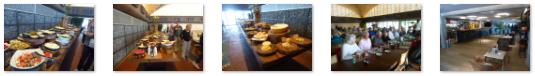
This restaurant was, of course, like the one I remember from my visit to Brasilia many years ago (which was my first visit to a Brazilian Steakhouse). It also reminded Fred and I of a place we've been to once in Fort Lauderdale- Chima. It is also a Brazilian Steakhouse. Here we had salads featuring more Brazilian elements and dressings, and it was all very good. Here are some other pictures taken at lunch and elsewhere in Assador's:
|
We enjoyed the leisurely lunch immensely, and we had some time to wander about the area outside, which is when we took many of the pictures earlier in this section. At about three-thirty, our guide shepherded us back to the waiting bus and we headed back through the streets of Rio to the port.
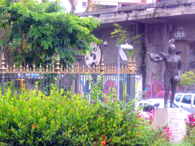
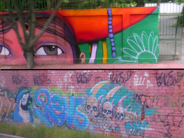
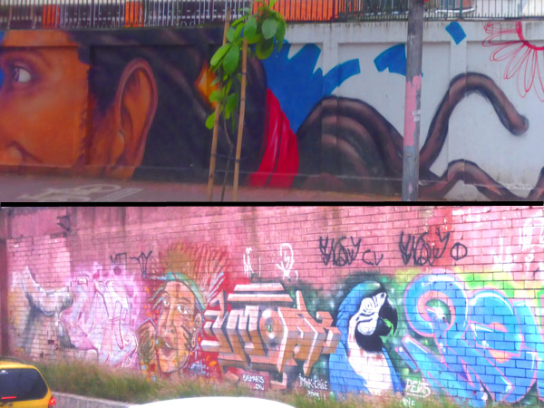
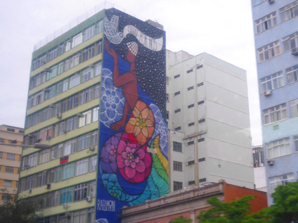
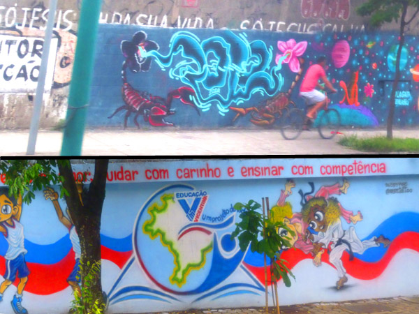
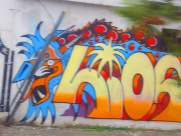
Street Art in Rio de Janiero
On our way back to the port, we were again able to photograph buildings and street scenes, but what was most photogenic was the incredible number of murals and wall art that we saw. This was not simple graffiti or "tagging" but in most cases really serious art.
|
|
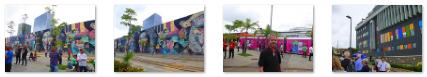
There was a wide variety of this "art", and many examples of it are in the slideshow at left. (Use the lower-corner arrows to go from one picture to the next, and track your progress using the index numbers in the upper right.)
NOTE:
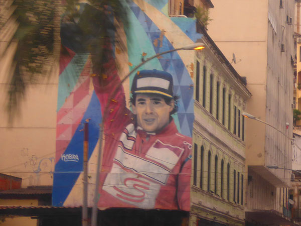
I want to credit my nephew,
Ted Barbour
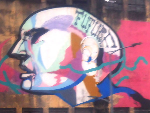
(Ted is at right, and also in the picture are myself, Ted's sister Jeffie, and their mother and my sister, Judy), for identifying the subject of the mural shown on the very first slide at left. It depicts Brazilian race car driver Ayrton Senna da Silva. He won the Formula One World Drivers' Championship in 1988, 1990 and 1991, and is widely regarded as one of the greatest Formula One drivers of all time. He died in an accident while leading the 1994 San Marino Grand Prix while driving for Williams Racing.
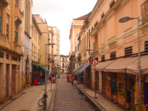
Sprinkled in among the pictures of this street are some of the better "street scene" pictures that we took from the bus. It is important to remember that the route we took today was through the older, business-oriented part of Rio de Janiero. From movies and photos you may be much more familiar with the "resort" parts of Rio, notably the upscale hotels and residences along the two most famous beaches here- Copacabana and Ipanema.
Also keep in mind that this was hardly a "good" day for picture taking, but one has to make do with what one gets when one is only in the city for one, specific day. I do recall that on my last trip here, the weather was, on the whole, much better.
It took about 45 minutes for us to get back to the port. I'm not positive, but I think our driver made a wrong turn in the heavy traffic that was building later in the day, and this took us ten or fifteen extra minutes. But we made it back to the parking structure at the port in plenty of time that we could walk around the area before reboarding the ship. (I wasn't quite sure how the other tours behind us would fare, as there was still one busload that had not arrived at lunch by the time we left.)
A Walk Around the Cruise Ship Port
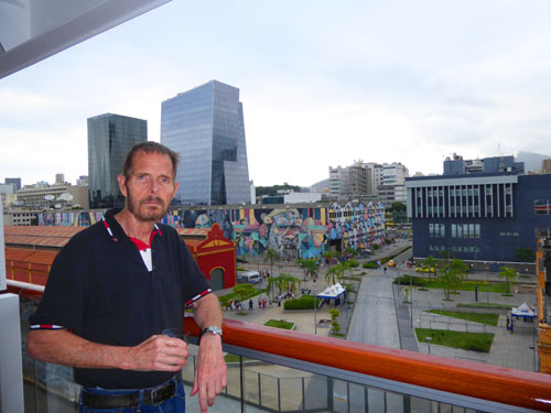
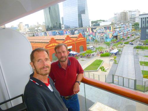
When we said goodbye to our tour guide, most people headed right back on board, but Fred and I want to get a better look at the pretty amazing artworks on the walls of the buildings near the ship.
|
When we came out of the parking structure, we were exiting from the door at the west end of the building. As I showed you earlier today, the wall of the building just across the light rail tracks to the west was also colorfully-decorated, as was the west wall of the parking structure itself.
When we came out, we turned right towards the ship, but instead of proceeding further north to the security checkpoint, Fred and I turned right again to look down the north wall of the parking structure. In that picture, you can see that the entire north wall is one huge artwork, consisting of a number of facial portraits (with other colorful designs separating them). We'll take a closer look at those faces in a moment. But you can also see the tram station alongside that building (again, this station does not show up in the aerial view). There were two tracks, one on either side of the platform; if I remember correctly, the trains on both tracks run in the same direction here- northwest.
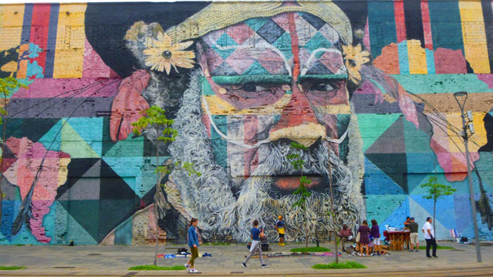
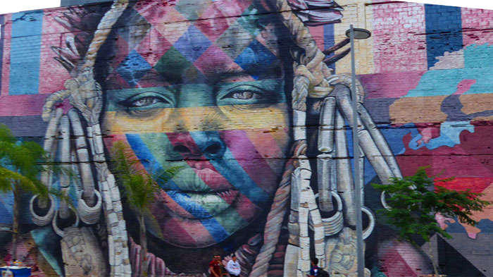
Now for the artwork itself. As I said, it consisted of five or six portraits, interspersed with geometric designs and what looked like sections of a world map. At first I thought that each face would be placed near where on the world map those faces might be found, but I couldn't make this theory work for every face. So we'll just take them one at a time.
|
In this picture, you can clearly see that there is a map on the wall as well; you can pick out Africa to the right of the face and South America to its left.
You'll have to use your imagination to think about what ethnic or cultural group this face represents- if indeed it was the point of the artist(s) to make such a representation. Elements of the portrait make me think of the South Pacific, while other elements could harken to peoples on either side of the South Atlantic. I just have no idea.
What I was sure of was that the portraits were very well done. If you would like to see a larger view of this particular face, just click here.
|
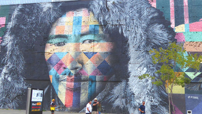
This portrait was just to the left of the first one, and as you can see here, the continent of South America is between them. If that's the case, then it may be that this portrait is positioned to the west of the North American continent, perhaps indicating Alaska or close by. In any event, I perceive Native American or even Asian features, so that would make some sense. I don't mean to over-analyze, for the portraits are simply pretty amazing to look at.
If you would like to see a larger view of this particular face, just click here.
|
Just after I took the photo at right, Fred took a picture of me on the station platform and the view looks further down the wall towards the last two faces.
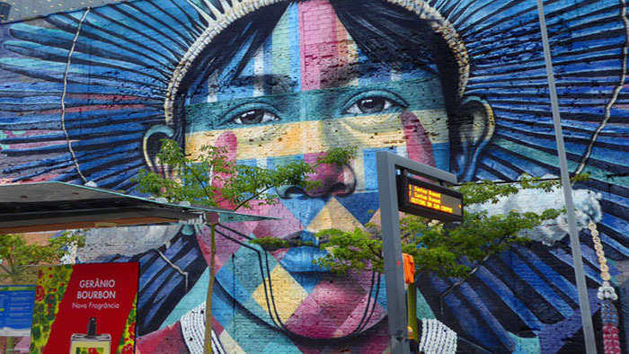
The only map element I could see near this face was what I supposed was Australia to its left, so perhaps this is supposed to be the portrait of a Pacific Islander (although the sunburst image might be indicative of Japan).
I did get an unobstructed view of the face by standing as far back as I could, but I wasn't able to get it all in. In any event, you can see that picture if you click here.
Just as I was taking my own picture, Fred was standing behind me on the platform and took this photo looking back the way we'd come.
|
Fred, of course, was walking down the length of the wall with me, and I stopped to take a picture of Fred with this portrait in the background. You can see the two light-rail tracks as well.
As with the other portraits, this one was pretty amazing, and I got as near as I could to get a closeup view of it.
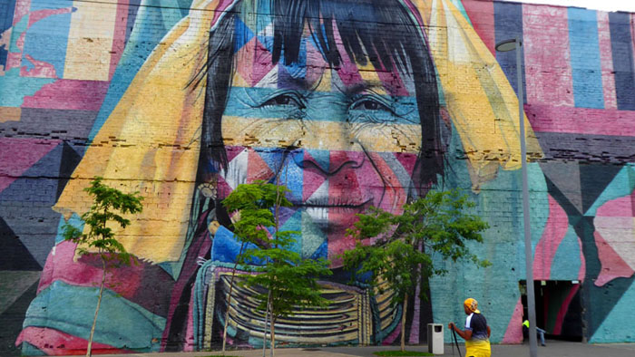
Leaving the fourth portrait, Fred took a picture of me walking towards the last portrait.
|
Fred took another picture of me with the fifth portrait, here at the southeast end of the parking structure building. If the intention of the city was to decorate the port buildings and make the cruise terminals less industrial-looking, they certainly achieved their objective. Many places where our various cruise ships have docked are either at the end of long, sterile piers that jut out into a harbor, or in more commercial areas like this that have been adapted for passenger traffic. Rio did a good job of rebuilding this whole area to make it an efficient and visually interesting area.
By the way, if you would like to see a close-up of this fifth portrait, please just click here.
If we had had more time, it would have been interesting to buy a ticket on the light rail and take it in a big circle through the city and back to the port, as one of the station maps said you could do. But we had only fifteen or twenty minutes before our "be back aboard" time, so, sadly, we had to eschew that. As it turned out, some of the other tours were later getting back, and it was well over 90 minutes before everyone was actually back on board.
Aboard Ship/We Leave Rio
Rio is one of those places where you could easily spend a great deal of time and still not see most of what the city has to offer, but at least we were able to visit two of the three top sites for tourists (the third would have been either Copacabana or Ipanema beach). So Fred was satisfied, although since both Greg and I have been here for at least a week at different times, we knew that the city was well worth more than just a day.
From our balcony, late in the afternoon, we took a number of pictures as the remaining guests were returning to the Viking Jupiter. Here are the best of those pictures:
|
|
|
|
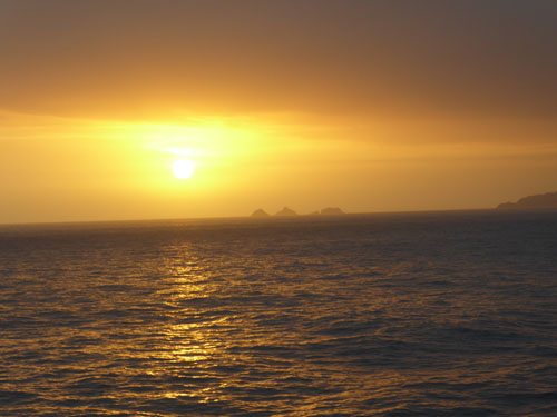
We went off to the gym while the last passengers were returning, and by the time we got back the ship was heading out to the open ocean for our trip to Montevideo. By the time we were cleaned up and ready for dinner, the sun was setting and the pictures were tremendous. So I'll close the day with this selection of Fred's beautiful sunsets:
|
|
|
We have two sea days now- are last two, as it happens- before we arrive in Montevideo. It will be a weekend at sea, and we will arrive in Montevideo, Uruguay, on Monday morning.
You can use the links below to continue to another photo album page.
|
December 2, 2019: A Visit to Montevideo, Uruguay |
|
November 26, 2019: A Visit to Recife, Brazil |
|
Return to the Index for 2019 |