|
February 11-23: Our Trip to Ecuador Part 2 (Brad's Visit) |
|
December 29 - January 15, 2024: Our Winter Trip to Florida |
|
Return to the Index for 2024 |
Our first trip to Ecuador this year will be the first of our trips here during which someone has come to visit; in fact, we will have two visitors. First, my niece Jeffie will be visiting from Prague. A few days after she departs for the Czech Republic, our friend Brad from Dallas will visit, and he will be bringing a friend of his that we haven't met. We did quite a lot on this trip, since our visitors hadn't seen any of the sites we've already visited in Quito and its environs, and took quite a few pictures.
So I'll be breaking this trip down into two parts, the first going from our arrival, through Jeffie's visit, and the few days when we were by ourselves before Brad's arrival, and the second dealing with Brad's visit. As the four of us left for Dallas at the same time, the end of Brad's visit will also mark the end of our trip to Ecuador.
Getting to Our House in Ecuador
|
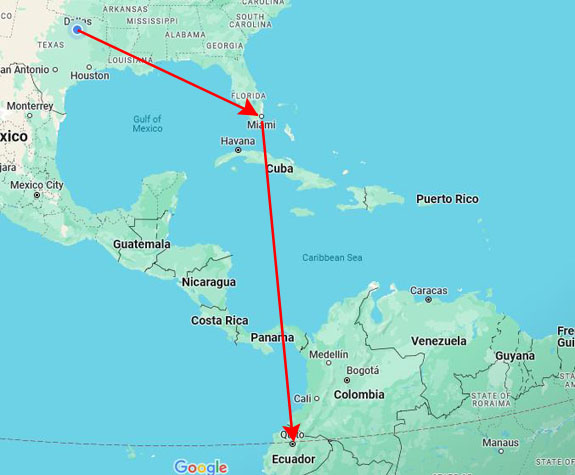
So for this trip, we flew American Airlines all the way from Dallas to Quito. There is no non-stop flight, only flights that go first to Miami, involve a plane change, and then go on to Quito. But the times are pretty convenient. The Miami flight leaves about one in the afternoon, and we get into Quito at the same time as the Jet Blue flight from Fort Lauderdale- around 10:45 in the evening.
And of course since both flights are on American, we can pick good seats and also check bags without any extra fees. The flight to Miami is on a big plane, and the entertainment options, which Fred likes, are extensive. But the bad part is that the flight to Quito is on an older 737, and that plane doesn't have a seat-back entertainment system. But it's only a 4-hour flight, so I hope that Fred won't be bored.
There were no significant delays today, and the transfer between flights in Miami wasn't too bad. Neither of us like the Miami airport, because it is so large and usually requires long walks between flights- particularly between domestic and international. But we had time, so we were OK.
We landed in Quito, and, since we now had a house and keys to it, we didn't have to overnight at the Quito Airport Wyndham. We just hopped in a cab and asked the cab driver to take us to Urbanizacion Santa Lucia Baja at Paseo San Francisco in Cumbaya. I also had the audio file our architect had recorded, which helps the driver in the last half mile of the trip to get right to the gate for our community.
This is one nice thing about where we live: almost all cab drivers know of our community and of course where Paseo San Francisco is located. So even if I don't play the voice file, we are able to get where we need to go with no problem. (I sent that file to Jeffie and to Brad, along with maps they could print and show their Uber or cab drivers, and both arrived at our gate with no problem at all.
Jeffie Arrives for a Visit
Jeffie's First Day
|
|
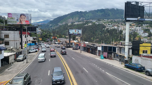
We had some lunch, and then walked around our neighborhood. We took Jeffie over to the mall and then walked across the pedestrian walkway towards the university, and that's where I got this picture:
 |
We made a shopping trip to SuperMaxi so that Jeffie could lay in a supply of the things she likes to eat for breakfast and snacks, we of course showed her around the house, and in the early evening had a dinner out. We also made plans for tomorrow's excursion- which would be to the Equator Park (and, as it turned out, a "cat cafe" in Quito).
A Visit to the Equator Park
|
 |
|
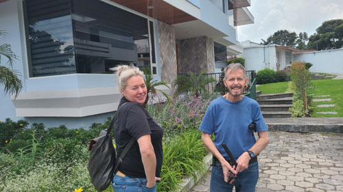
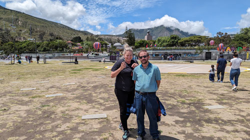
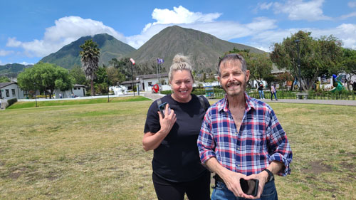
One of the first pictures we took was the one at left with Jeffie and I. In the background was an ultra-modern building that we had first seen on our visit to this same park in 2014 when we were in Quito prior to our trip to the Galapagos. At the time, we did not know what the building was, but now I've done some investigation and found out what it is/was used for.
The building is the former headquarters of UNASUR, the Union of South American Countries. The organization was formed in 2008 and began operation in 2011 with this building as its headquarters and twelve South American nations as members. Over the years, however, numerous countries suspended their participation in the organization, citing its lack of concrete objectives and achievements. But now only six small nations are still members, but meetings and staffs no longer occupy the building, and so it fell into disuse following Ecuador's withdrawal from the organization in 2019.
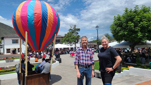
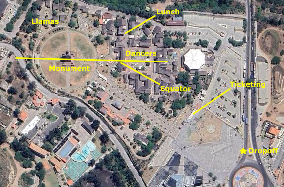
Between the drop-off point and the ticketing center is a broad open area with, oddly enough, a heliport. There is also a place over to the side with some big colorful letters that spell out "Mitad del Mundo" and offer a photo op (which we and just about everybody else took advantage of). Here are a couple of pictures taken before we bought our tickets:
|
|
The tickets were $5 for "regular" folks, but only $2 for us oldsters. (We have gotten in the habit of looking for lines marked "Preferencia" which are for the over-65 crowd, along with the handicapped or infirm, and we have also started showing our cedulas whenever we think there might be an unposted discount.) We walked through the "city" of tourist shops and restaurants, heading towards the music we heard.
|
We are walking through the tourist shops and restaurants towards the music. |
|
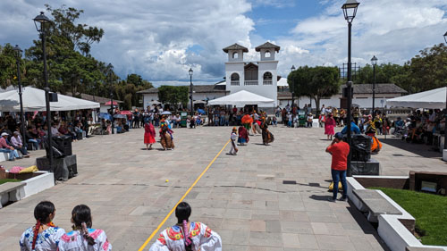
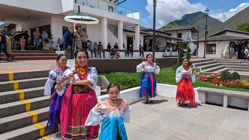
In the "square" of the city, young dancers in what I assume is native ceremonial dress, were doing various dances. I made a movie of some of the dancing and also took some still pictures.
|
Here is some of the dancing. |
|
|
|
Along with the examples of Ecuadoran culture, the "city" area offers souvenir shops and restaurants- along with various amusements for credulous tourists.
|
|
Also, there is an apparent weakening of muscles due to low latitude. This is also linked to the claim that certain physical forces, including the Coriolis force, are significantly weakened at the equator. Many of the demonstrations and associated claims made among tour guides are inconsistent with each other. Some tour guides will admit the truth that proximity to the equator has no measurable influence on these demonstrations, but they are fun to do or watch nevertheless.
|
The monument is made of iron and concrete and covered with cut and polished andesite stone. The monument was built to commemorate the first Geodesic Mission of the French Academy of Sciences, led by Louis Godin, Pierre Bouguer and Charles Marie de La Condamine, who, in the year 1736, conducted experiments to test the flattening at the poles of the characteristic shape of the Earth, by comparing the distance between a degree meridian in the equatorial zone to another level measured in Sweden.
The older monument was moved 5 miles from here to a small town called Calacalí.
Inside the monument there are souvenir shops and both stairs and elevators to take you to the top. Sadly, on the day we visited, there was maintenance being performed and neither the stairs nor the elevators were open. The pyramidal monument, with each side facing a cardinal direction, is topped by a globe which is 15 feet in diameter and weighs 5 tons. Inside the monument is a small museum that displays a variety of indigenous items pertaining to Ecuadorian culture: clothing, descriptions of the various ethnic groups, and examples of their activities.
Of course, one of the main attractions here, and the reason so many people visit, is to stand astride the equator, with a foot in both hemispheres. This is the photo obligatore, and to come away without one is considered very bad form. The constructors of the park have obligingly painted a yellow stripe that begins at the square and extends through the monument so that visitors will have no doubt just where the equator is.
|
 |
The line runs right up the steps to the monument walkway and right through the monument itself, so there are actually plenty of place to get that "perfect" photo souvenir.
|
Years after that, it was brought to light that the "Geodesic Mission" had been wrong about the exact coordinates where the line passed through— the measurements had indeed proved the world was oblate and not elongated (egg-shaped) at the poles, but their studies to define the placement of the equator were incorrect by 240 metres (790 ft). The Catequilla ruins found throughout the expedition between 1735-1745 were actually situated at latitude 0 (0°0′0″N 78°25′43″W), or the exact position where the Equatorial line crosses.
|
|
Based on data obtained by the French Geodesic Mission, it was long believed that the equator line that passed through this area was pretty precisely correct. When the yellow line was painted, and the monuments built, this was the assumption and, over the years, countless tourists have had their pictures taken straddling the line drawn down the center of the east-facing staircase and across the plaza. But, sadly for all these people with iconic "foot in both hemispheres" photos (including us), the latest readings based on the World Geodetic System WGS84, used in modern GPS systems and GIS products, reveal that the equator actually lies about 800 feet north of the marked line. But if you won't tell, I won't.
|
|
|
 |
After walking around the monument for a while, we headed over to where the sign had said there were some llamas. What we found first was a store selling tourist kitsch, and I had Jeffie pose with the (not real) llama outside. That's the picture at left.
Then we did find the llama enclosure, and there were a couple of animals that we could see fairly close up. (I thought this might be Jeffie's and our only chance to see llamas during her visit, but I would soon be proved wrong in spectacular fashion.) Here are two of the llamas in the enclosure:
 |
 |
From the llama enclosure, we walked around the south side of the monument and back to the "city" to find a place to get some lunch.
|
|
Back by the town square, we looked around for a restaurant, and found a reasonable burrito place that had a little area where we could sit outside.
|
|
Back near the dropoff point, I arranged for another Uber to take us back to Quito.
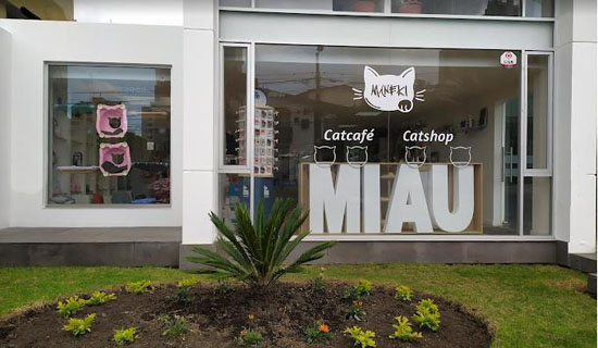
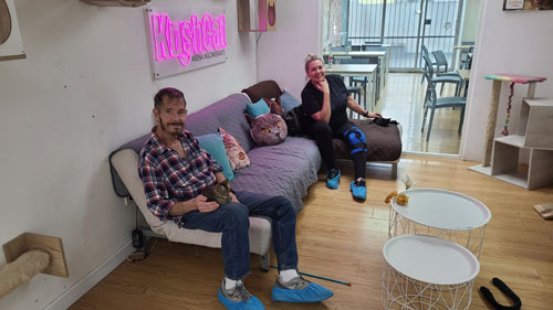
The Maneki Cat Cafe
|
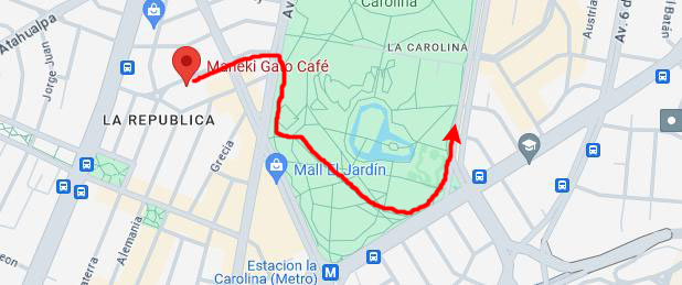 |
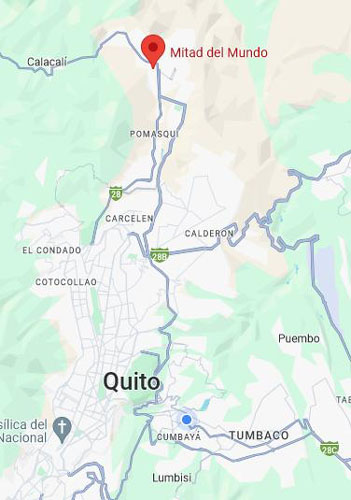
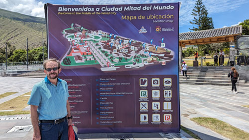
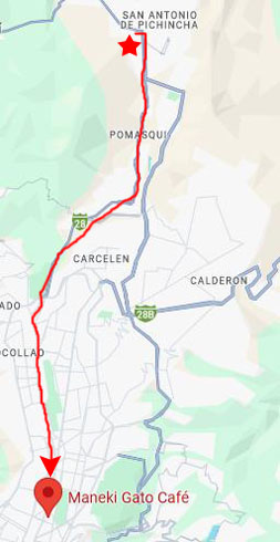
You can see the location of the cat cafe (marked with the red pin) on the map above. Pay no attention to the red walking route for now; that was the route we took later on from the cat cafe to a point where we could pick up an Uber to get us back to Cumbaya.
But you can see that the cat cafe is just off Parque Carolina to the west. The Uber driver from the Equator Park dropped us where I'd put the pin, but we found the cafe to be a couple of doors down the other side of the street.
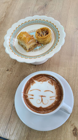
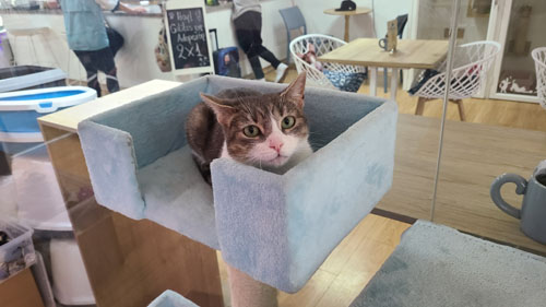
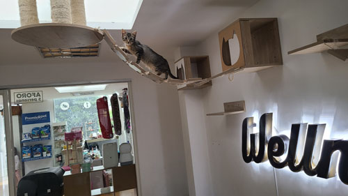
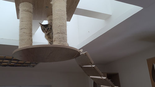
Coffee, sandwiches, sweets and cats. Maneki is a cafe and cat shop in Quito that is also dedicated to rescuing kittens and managing their adoptions.
|
|
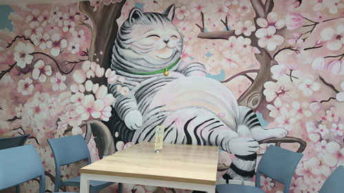
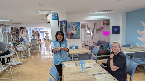
The place is spacious and carefully decorated. The kittens have an isolated space where, by following certain rules, you can enter and interact with them (although you can also see them through the glass while you enjoy your food and appreciate the other details of the place).
Sofía Jaramillo, owner of Maneki, is an art restorer, floral designer, sign language interpreter, but above all she is an advocate for animal welfare. More than a million dogs and cats survive on the streets of Quito She began her work fourteen years ago , as a cat rescuer. She focused on felines because she saw that at the time other organizations were more focused on dogs.
Together with collaborators, she sold products through social networks to support her social work. Until in February 2020, she decided to open a physical store and cat house (transitional space for abandoned felines) which at that time housed 35 kittens.
The pandemic caused setbacks, they closed the physical store, but they continued to manage adoptions, they reopened and moved to their current location in November 2021. Since they began keeping track, in January 2022, there have been 802 rescued kittens put up for adoption.
|
|
|
|
|
|
We enjoyed the cat cafe very much. It was rainy here in Quito at the moment, so it was nice to be inside. By the time we left, it was just a very slow drizzle. Rather than get an Uber right here, we wanted to show Jeffie what Parque Carolina (like Quito's Central Park) looked like, so we walked west down the street to the park and then walked through the south end of it. We would have done more, but the weather was not inviting. I did take a couple of pictures as we walked through the park:
|
|
Over on the east side of the park was the place to get an Uber; if they pick us up right there, then there is easy and direct access to the street that takes you over to the tunnel between Quito and the Tumbaco Valley. Getting the Uber was no problem (I see why so many people use the app) and twenty-five minutes later we were being dropped off at Paseo San Francisco right near the house. I might mention that down in Cumbaya, there was blue sky and clouds; the weather in Quito itself is often cloudier and more rainy at any given time than it is where we live.
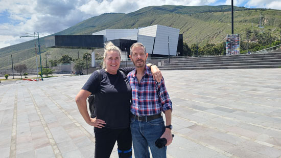
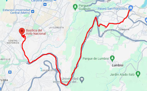
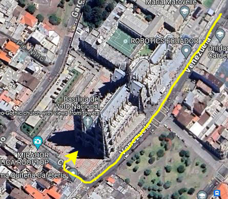
The Basílica del Voto Nacional
|
We always specify Paseo San Francisco as our pickup point, since everyone knows where it is, and of course the app lets you specify exactly where you want to be dropped off. Easy peasy. At this time of day, the Uber fare was a little over $7, which is very reasonable for the distance the driver has to go, and the navigating of street he has to do to get there.
There is a highway that winds around the south end of the mountains that separate Quito from Cumbaya; we didn't use the tunnel as this would take us into central Quito, and the old city is at the south end of the valley. So we had to wind our way through Cumbaya to pick up this highway.
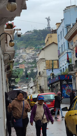
We haven't yet taken an Uber ride that wasn't in a nice car, with a friendly driver, and a generally pleasant ride. Fred did take one picture out the window at what appeared to be an art installation on the hillside on our right as we approached Quito itself. Then there was some navigating through city streets so the driver could drop us off right by the basilica.
|
|
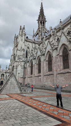
For photographers, the one problem is that it is very difficult to get a good picture of the entire front facade (without, I suppose specials lenses and such). Fred's solution was to get as far back in the northwest corner of the plaza as he could, and take a picture of the facade at an angle. The picture at right is the result, and is probably the best picture we have of the face (although I am sure there are stock photos that are much better).
I tried something different- taking a series of pictures of the front facade and then stitching them together. (I completely forgot that my phone has a camera setting for situations like this.) Anyway, no matter what kind of projection is used during the stitching process, the image either bulged out in the middle or, as in the best of my stitches below, a bit squished. I put my stitched photo and a stock image below.
 |
 |
It's amazing what a professional photographer can do as compared with some tourists with cellphones!
The basilica arose from the idea, proposed by Father Julio Matovelle in 1883, of building a monument as a perpetual reminder of the consecration of Ecuador to the Sacred Heart. President Luis Cordero issued the decree on July 23, 1883, and it was carried out by president José María Plácido Caamaño on March 5, 1884. The congress, in accordance with the year's budget, designated 12,000 pesos for the construction - 1,000 pesos per month, beginning in 1884.
We took a number of pictures of the outside of the main chapel and its various towers.
 |
 |
 |
 |
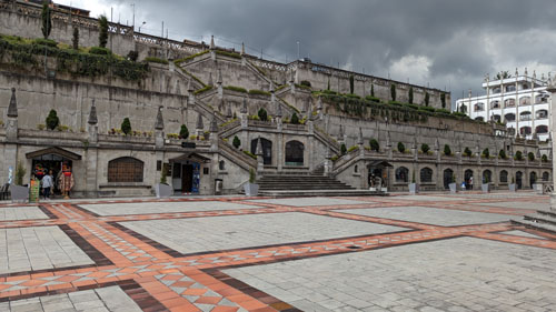
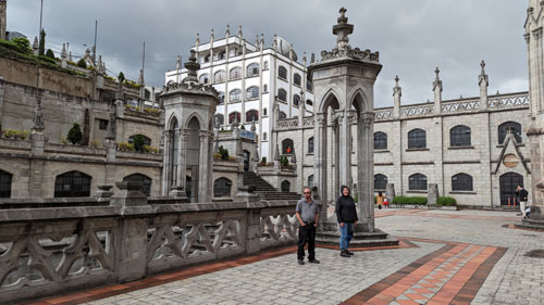
To the northwest of the chapel, across an open plaza, a series of stairs and landings have been built into the hillside. Had the weather been better, I would have taken pictures from the top, but since I've done so before (and, as it turned out, would do again when Brad and Jason came to visit) I didn't today. But here are two pictures of these stairs (and the little shops that are right off the plaza):
|
|
The plaza area outside the church is a great place to be, but on a rainy day like today it was a bit cool and raw:
|
|
By the decree of July 3, 1885, the fourth Quitense Provincial Council turned the construction of the basilica into a religious commitment in the name of the country.
|
In 1901, Father Matovelle and his Community of Missionary Monks, took charge of the construction at the request of Archbishop Pedro Rafael González Calisto. The building was designed by architect Emilio Tarlier at the cost of 40,000 French francs. Tarlier was inspired by the Bourges Cathedral. On July 10, 1892, the first stone was placed. Between 1892 and 1909, the Heart of Mary Cathedral was constructed. The basilica was blessed by Pope John Paul II on January 30, 1985, and it was consecrated and inaugurated on July 12, 1988.
The basilica remains technically "unfinished." Local legend says that when the Basílica is completed, the end of the world will come.
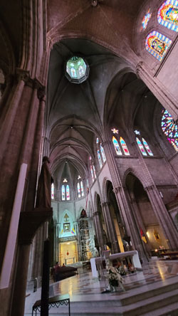
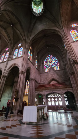
Fred and I have been to many large churches all over the world, and it seems that almost all of them are strikingly beautiful inside. I am often amazed how much money must have gone into the construction of these edifices, and I wonder how much of it came from people who really couldn't afford the funds over the centuries. The inside of this basilica is just a beautiful as so many others we have seen, as the pictures below might show:
 |
 |
 |
 |
We spent quite a bit of time in the chapel- particularly since it was still raining outside. I asked Jeffie if she would like to go up in one of the towers, but she demurred, so we spent our time in the nave.
|
|
to View the Slideshow |
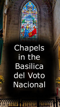
Fred and I photographed almost all these small chapels (each of which seemed to have its own stained glass window), and the diverse nature of the chapels was very interesting. I have gathered together all of these photos and have put them in a slideshow so you can look at them fairly quickly if you wish.
To view the slideshow, just click on the image at left and I will open the slideshow in a new window. In the slideshow, you can use the little arrows in the lower corners of each image to move from one to the next, and the index numbers in the upper left of each image will tell you where you are in the series. When you are finished looking at the pictures, just close the popup window.
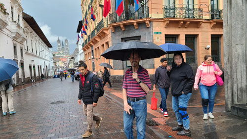
When we'd finished walking through the church, we went across the street to the west and found a little rooftop cafe where we could get some coffee and a bite to eat. It rained fairly hard while we were there, but the rooftop was covered. We chatted with another group of two guys who were in Ecuador from Boston, MA. At the end of our lunch, the rain let up quite a bit so we walked down Venezuela Street to the old city square- Plaza Grande (officially named Independence Square).
|
|
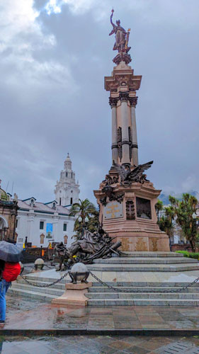
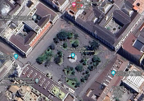
Although the first colonial town square was what today is known as Plazoleta Benalcázar, this has always been considered as tentative as the square wasn't really suitable for the growing town of Quito. It was only in the 17th century, in the year 1612, when the powers of the city moved to the area around the Plaza Grande.
Initially the square was just an esplanade of packed dirt with a water source for residents. It was larger than Plazoleta Benalcázar, and since there was unused land around it, some institutions moved to it. The Catholic Church acquired land on the north and south sides, where they built the Quito Cathedral and the Archbishop's Palace.
One of the founders of the city, Captain Juan de Díaz Hidalgo, built his house, called Palacio Hidalgo, near the Archbishop's Palace, and it is the only private building on the square today. Other founding families built homes here as well, but they were destroyed in the earthquake of 1627, after which the Palacio de Carondelet took their place. On the eastern side of the square the city council building was constructed, but it was demolished in the 1970s so the modern city hall of the Municipality of Quito could be built.
Here are Jeffie and I in the square with the view towards the eastern corner. And here are two more pictures we took in the square this afternoon:
|
|
It wasn't a very nice day, so we didn't stay in the square long, opting instead to walk from the square to the south to a street where we might pick up an Uber for the trip home.
|
 |
I was trying to find a corner on a street that would have the Uber positioned in the right direction to head back down to Cumbaya, and we found one. I used the app to specify Paseo San Francisco as our destination, and the app did the rest. The Uber (I like that you can see on the map where your driver is and from which direction he is approaching) arrived in less than six minutes, and a half hour later we were getting out at Paseo San Francisco. As usual, down in Cumbaya is wasn't raining; there were lots of clouds but some blue sky as well.
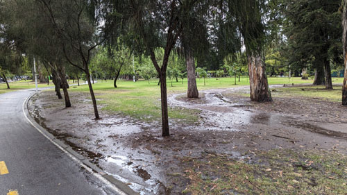
Guangüiltagua Park
|
The Qhapaq Ñan or Inca Trail passes through here; it is a cultural heritage of the Andean Region of Ecuador, an ancient route that linked the north with the south of the Inca Empire. This park is part of the group of tourist places that allow bird watching in the surroundings of Quito.
|
We didn't explore all the trails that there are. At right is an aerial view of the part of the park that we traversed. The trails that offer good views of downtown Quito and the old city (where the Basilica of the National Vow is) are out of the aerial view to the south.
|
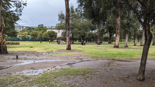
One of the reasons (probably the primary one) Jeffie was attracted to this destination was the fact that there is a herd of llamas that roam freely through the park, and the Internet said that one can usually find them just inside the park from the entrance gate or up on the roadway/trail that goes along the crest of the ridge where the overlooks are. Some people online said you could get quite close to them, and that was a draw for coming here today.
We had good weather (thankfully) for our trip to the park, and it was a thoroughly enjoyable day. We began by picking up an Uber at Paseo San Francisco, and the driver took us up the east side of the ridge of mountains that separate Quito from the Tumbaco Valley, around the north end of this ridge, and than back south along the west side of the ridge to the main entrance to the park. He took us as far into the park as he could, and for all this the fare was about $8.
|
The llama is a domesticated South American camelid, widely used as a meat and pack animal by Andean cultures since the pre-Columbian era. Llamas are social animals and live with others as a herd. Their wool is soft and contains only a small amount of lanolin. Llamas can learn simple tasks after a few repetitions. When using a pack, they can carry about 25 to 30% of their body weight for 5-8 miles. The name "llama" (in the past also spelled "lama" or "glama") was adopted by European settlers from native Peruvians.
The ancestors of llamas are thought to have originated from the Great Plains of North America about 40 million years ago, and subsequently migrated to South America about three million years ago during the Great American Interchange. By the end of the last ice age (10,000–12,000 years ago), camelids were extinct in North America. As of 2007, there were over seven million llamas and alpacas in South America and over 158,000 llamas and 100,000 alpacas, descended from progenitors imported late in the 20th century, in the United States and Canada.
It is hard to express what a joy it was to walk out among these seemingly gentle animals. The llamas in this particular herd are not so domesticated that you can walk up and pet them, but I did get close enough on a couple of occasions to actually touch them and feel what their coats felt like (a little coarser than I might have thought). I think the best way for you to experience what we did is to watch some of the movies we took. We took a lot of them, but I've chosen four of the best ones to include here.
|
|
|
|
|
|
Watching these animals was really neat, and at one point I thought I would take a panoramic picture of the area where we found the llamas roaming slowly and feeding on the lush grass:
 |
|
To view the slideshow, just click on the image at left and I will open the slideshow in a new window. In the slideshow, you can use the little arrows in the lower corners of each image to move from one to the next, and the index numbers in the upper left of each image will tell you where you are in the series. When you are finished looking at the pictures, just close the popup window.
Incidentally, that little open-air building you can see in some of the pictures in the slideshow is actually a library, with lots of books that you can sit down on one of the benches to read.
We'd seen from the park map that to get up to the road along the ridge, that leads from one viewpoint to another, all we had to do was continue up the road from the llama encounter to its intersection with the ridge road. When we got there, we encountered someone walking along that road, and we got some useful information about which way to go. We could have turned right to viewpoints one and two that offer city views, or left to viewpoints 3-5 that offer views out across the Tumbaco Valley. We didn't think we had time for both, so since the three valley viewpoints were in the general direction of where we would be leaving the park, we opted for that.
The first stop was Mirador Number 3, and it was a wooded picnic area with views through the trees out to the valley. I think that these various overlooks are actually more intended for people or families to use during outings in the park. We took some nice pictures from this overlook, which was only a couple hundred feet down the road after we made our turn.
|
|
|
|
|
|
 |
The road we were walking along must be for park vehicles only; we saw no vehicles at all during the afternoon. There is also an actual trail that winds through the woods from overlook to overlook, and we might have gone that way, but the trail looked muddier than we wanted to deal with.
|
Eventually, the area opened out and we found ourselves at a much larger mirador than number 3. This one had numerous buildings, and would seem to be able to accommodate numerous groups.
One of the first pictures taken here was Fred's picture of this beautiful specimen of agapanthus praecox (aka blue lily, African lily, or lily of the nile). It was right by the road here at Mirador #4. Agapanthus praecox is a variable species with open-faced flowers. It is a perennial plant that can live for up to 75 years. Its evergreen leaves are 2 cm wide and 50 cm long. Its inflorescence is an umbel. The flowers are blue, purple or white and bloom from late spring to summer, followed by capsules filled with black seeds. Its flowering stem reaches one meter high. Its roots are very powerful and can break concrete.
At this stop, we once again encountered the large, colorful letters that we have seen at numerous other locations around Quito. This letters, as you can see, spelled out Q-u-i-t-o. I wanted to get all three of us in the letters, but hadn't brought my tripod with me. So we ended up with these two shots:
 Fred and I in the Quito Sign |
 Jeffie Taking in the View |
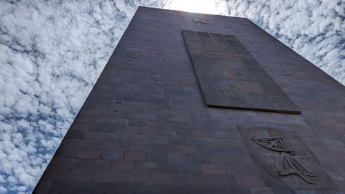
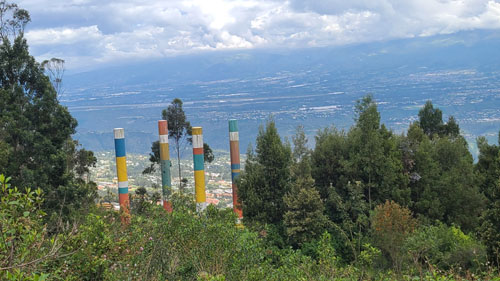
In the left-hand picture above, you can see some tall, colored cylinders down among the trees. Fred took another picture of them while I clambered down the hill to get right up to them.
|
|
As it turned out, this was an outdoor sculpture called "Crayolas" by the French artist Guy Rouge Mont. The sign that was off to the side continued with: "The tubes are placed forming a square. The result is an impressive set due to its scale, color and simplicity."
The views from here were pretty spectacular. Here are some of them:
 |
|
|
Further on down the road we came to a sign pointing off to the right for Mirador #5, and we walked a few hundred feet down the hillside to this smaller overlook. There were just a couple of buildings here, and again nice views out across the Tumbaco Valley:
|
|
According to the map, that was the last overlook along this ridge road. If we continued along it, we would come to a small residential community called Comuna Miraflores. This part of the park had not, apparently, been used for much, so the city of Quito allowed the construction of a small community here. There are about two hundred people who live here, in one of the most secluded communities in all of Quito, located as it is in the Guanguiltagua Metropolitan Park. So we followed the map, and our noses, and turn to the left to head downhill towards the other entrance to the park- the one used by the residents of Comuna Miraflores.
At times, we were actually on just a trail, and along it Fred found some opportunities to photograph the local flora:
|
|
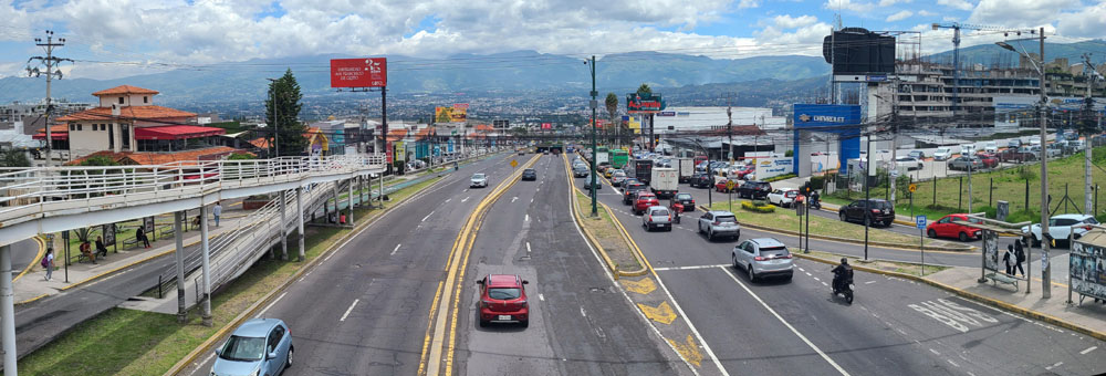
Eventually, we came out on the road that led downhill to the park entrance, and as we walked along the road we could see awesome views of Quito.
When we came out of the park, we actually found that the road had a guard shack and an arm that could be raised or lowered to block or allow cars to pass. I don't know for sure, but I think that traffic is restricted to the inhabitants of Comune Miraflores, so that cars aren't able to get onto the park roads like the one we were walking along. Just across the street, we found that we had to head down a steep hill to a street where we might be able to get an Uber. Here are some pictures of the view we saw and the stairs we had to descend:
 |
 |
 |
At the bottom, we hung a right to walk down to a busier street and also to find a little cafe where we could get something to drink. We found a little restaurant, had a soda, and then I arranged for an Uber back to Cumbaya.
That night we went and ate at a restaurant near Parque Cumbaya. I hadn't mentioned that the night before we took Jeffie to the Indian restaurant further down the street beyond the Colineal furniture store where Fred paid and inadvertently left his credit card. So as soon as we sat down I asked Fred to order for me while I hotfooted it down the street to retrieve his credit card- which I did with no problem, arriving back at the restaurant just when the food was brought out. On the way back up the hill, I stopped to photograph one of the smallest cars I've ever seen.
Jeffie had to head back to Prague the next afternoon, so we took her over to Paseo San Francisco andgot her in an Uber to the airport. We learned later that she had some delays getting home, which she did about 40 hours late. I have made a resolution that the next time she chooses to come visit, I will get the ticket for her, so she doesn't make so many stops and endure so many plane changes, since that's where delays happen. I have a nice routing in mind: Prague to Amsterdam to Quito, involving just one plane change and a nice comfortable connection time both ways.
After Jeffie left, we had a few days to ourselves before Brad and his friend Jason arrived the evening of the 11th. We did take some pictures during the interregnum that I want to include here.
Pictures Between Our Visitors
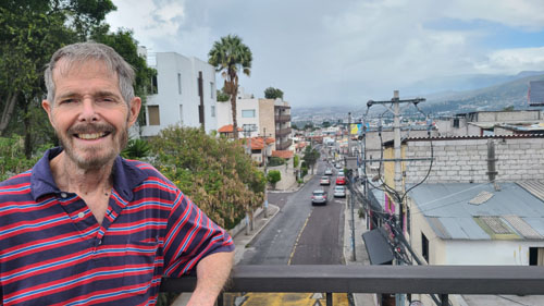
On one of the days between our two visitors, Fred and I had to walk up to our lawyers' offices to finalize some trust documents, and also arrange for them to aid us when our visas come up for renewal. There office is quite close to the major pedestrian overpass at the top of our shopping street.
|
|
|
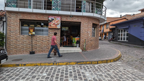
While we were up here, we decided to stop and have lunch at Baguette, a nice restaurant and bakery that is at the north end of Plaza Cumbaya (the strip center on the north side of Av. Oswaldo Guayasamin. After lunch, while Fred was settling up and buying a pastry to take with us, I took this picture of the inside of Baguette:
|
|
|
Walking to the square is always a pleasure, and I used to take lots of pictures, but this time I have just a couple.
|
|
It is always fun just to sit on one of the park benches near the fountain (which has inexplicably been off for a while) and just watch all the activities around us. Today, I just made a movie.
|
|
Finally, some miscellaneous pictures, including this Valentine's teddy bear outside the Pycca homegoods store over in Paseo San Francisco.
|
|
|
|
That's it for Jeffie's visit; now we are ready to welcome Brad and Jason.
You can use the links below to continue to another photo album page.
|
February 11-23: Our Trip to Ecuador Part 2 (Brad's Visit) |
|
December 29 - January 15, 2024: Our Winter Trip to Florida |
|
Return to the Index for 2024 |