|
March 13 - April 3: Our Spring Trip to Florida |
|
February 1-11, 2024: Our Trip to Ecuador Part 1 (Jeffie's Visit) |
|
Return to the Index for 2024 |
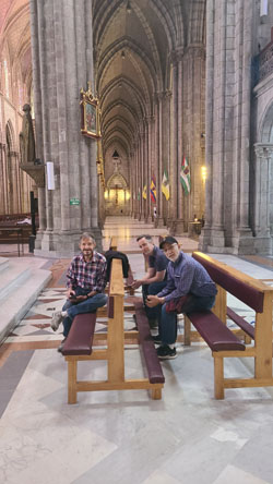
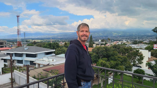
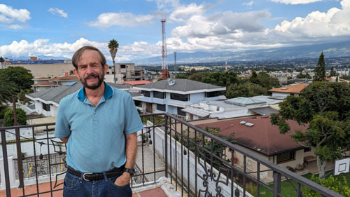
The second set of visitors arrived late on February 12th- Brad and his friend Jason. Their trip down was not without incident. When they got off their DFW-MIA flight, someone took Brad's carryon luggage by mistake. Also, their flight was late, and so American had to put them up in MIA the night of the 11th and book them into Quito on the 12th. As it turned out, the person who got Brad's luggage had brought it back to the airport late that evening, but it didn't catch up with Brad until the 13th in Quito- after we'd taken him shopping to replace some of the essentials he was missing.
The First Few Days of Brad and Jason's Visit
|
|
|
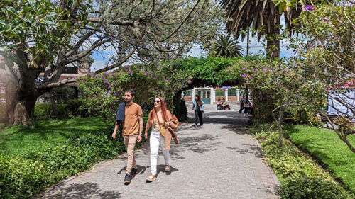
Brad and Jason Visit the Equator Park
The Ciudad Mitad del Mundo (Middle of the World City) is a tract of land owned by the prefecture of the province of Pichincha, Ecuador. It is located at San Antonio parish of the canton of Quito, 16 miles north of the center of Quito. The grounds contain the Monument to the Equator, which highlights the exact location of the Equator (from which the country takes its name) and commemorates the eighteenth-century Franco-Spanish Geodesic Mission which fixed its approximate location.
The park also contains the Museo Etnografico Mitad del Mundo, Ethnographic Museum Middle of the Earth, a museum about the indigenous people ethnography of Ecuador.
When they returned, we went shopping at the grocery store because Brad wanted to cook dinner the next night.
Our Activities on the 15th
|
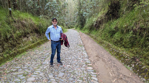
As we started down the trail from the trailhead where the left-hand picture below was taken, I thought I would make a movie to show you what the trail is like. |
|
|
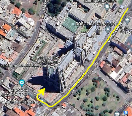
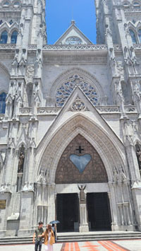
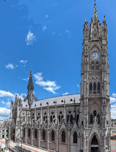
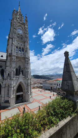
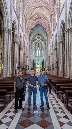
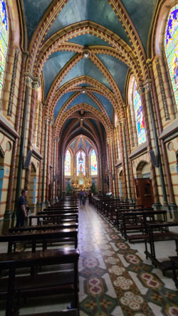
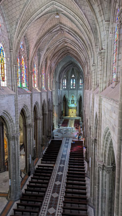
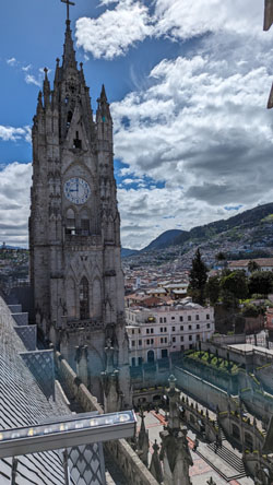
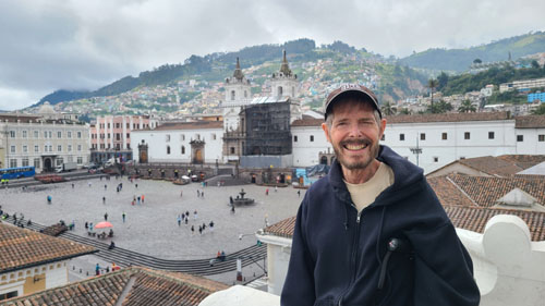
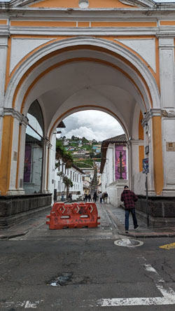
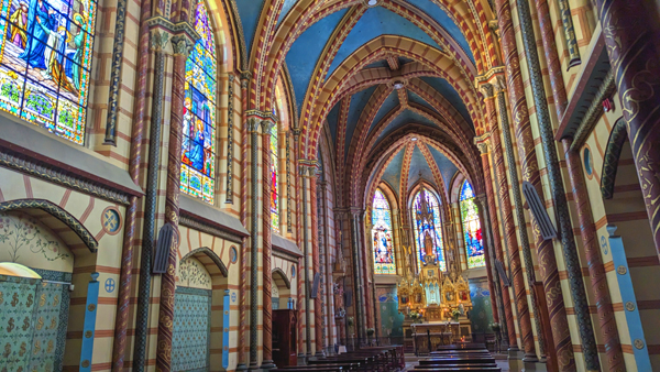
The Basilica del Voto Nacional
|
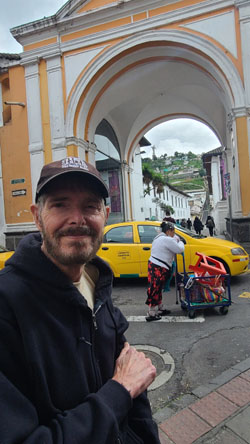
We always specify Paseo San Francisco as our pickup point, since everyone knows where it is, and of course the app lets you specify exactly where you want to be dropped off. Easy peasy. At this time of day, the Uber fare was a little over $7, which is very reasonable for the distance the driver has to go, and the navigating of street he has to do to get there.
There is a highway that winds around the south end of the mountains that separate Quito from Cumbaya; we didn't use the tunnel as this would take us into central Quito, and the old city is at the south end of the valley. So we had to wind our way through Cumbaya to pick up this highway.
Oddly enough, just as our Uber was leaving the Paseo San Francisco to head around the traffic circle and back down southwest to connect up with the highway that goes to Quito, I looke just ahead of us at the stoplight, and simply couldn't resist taking a picture of the truck ahead of us. If you will look closely at this Ecuadorian-licensed vehicle, you'll see a bumper stick on the left of the tailgate. I would love to know the story of how the driver came to put it there. We don't take this southern route to Quito often, unless we are going to the old city, but on the way into the city I snapped this picture of a new tower with a mosaic on the side of it. The utility lines spoil the picture, but they are ubiquitous in Quito.
|
The Basilica of the National Vow (Spanish: Basílica del Voto Nacional) is a Roman Catholic church located in the historic center of Quito, Ecuador. It is the largest neo-Gothic basilica in the Americas, and a site that anyone coming to Quito should visit.
The basilica arose from the idea, proposed by Father Julio Matovelle in 1883, of building a monument as a perpetual reminder of the consecration of Ecuador to the Sacred Heart. President Luis Cordero issued the decree on July 23, 1883, and it was carried out by president José María Plácido Caamaño on March 5, 1884. The congress, in accordance with the year's budget, designated 12,000 pesos for the construction - 1,000 pesos per month, beginning in 1884.
In 1887, the Issodum Fathers began construction for five years, with the approval of Pope Leo XIII. The Oblato fathers donated the land for the basilica. To continue construction, donations were accepted from believers, who provided stones in exchange for engraving their names on them. In 1895, the state established a tax on salt to continue the building and making it more established.
By the decree of July 3, 1885, the fourth Quitense Provincial Council turned the construction of the basilica into a religious commitment in the name of the country.
|
|
|
If you would like to see even better pictures of the facade of the basilica, I should point you to the Internet where, in Google Images and many other places, you can find professional photographs. It's amazing what a professional photographer can do as compared with some tourists with cellphones!
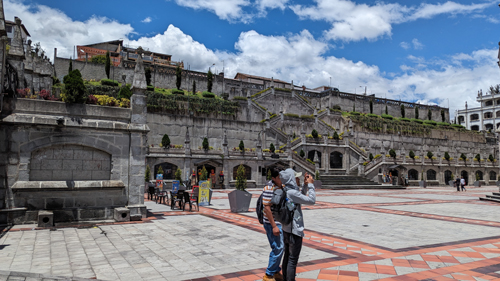
The Hillside Staircase
|
|
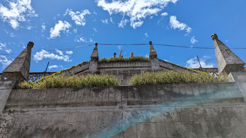
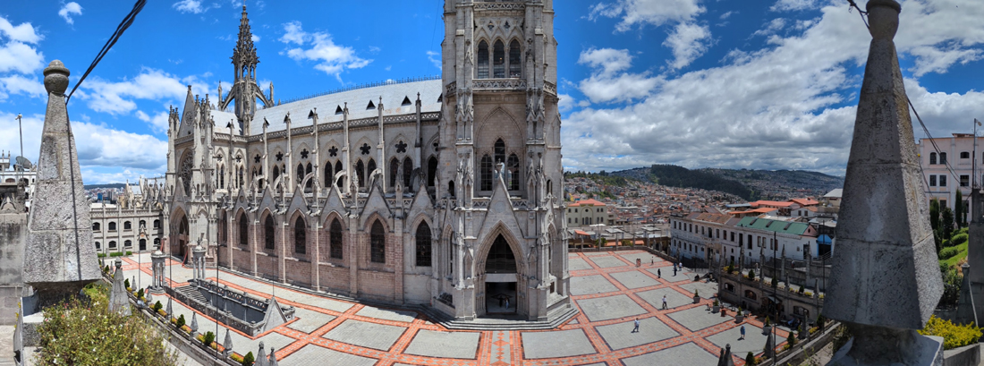
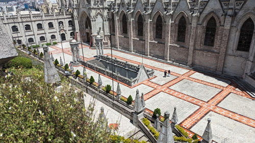
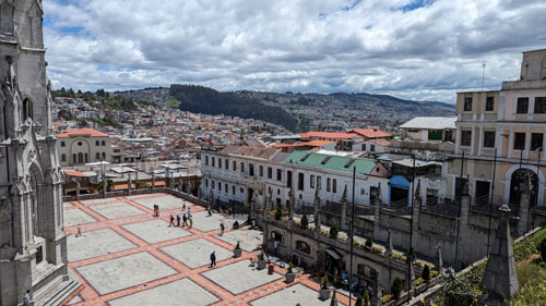
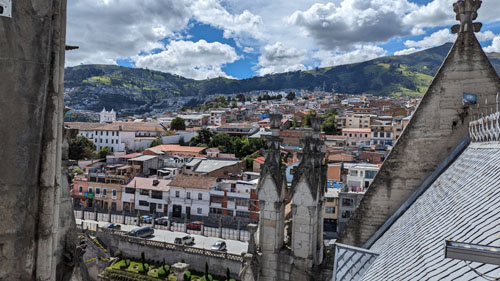
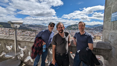
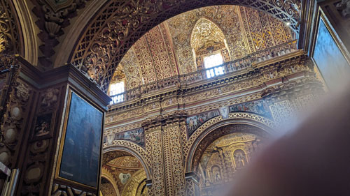
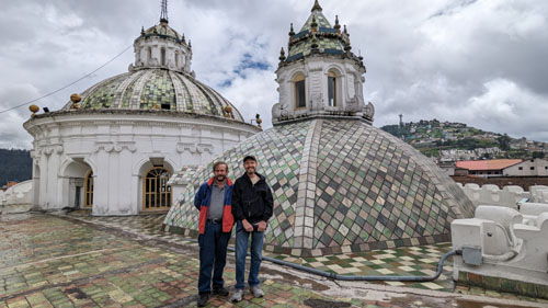
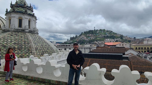
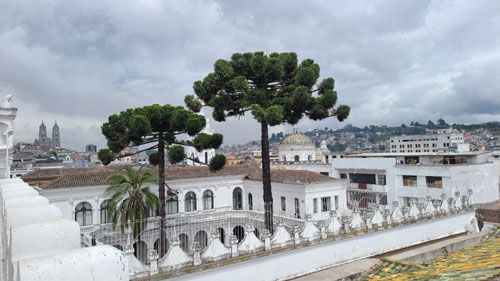
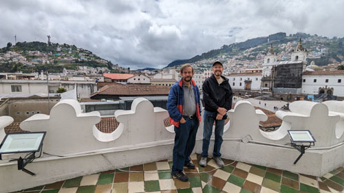
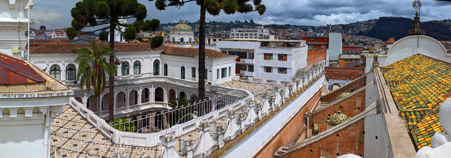
With such nice weather, we all walked up to the top of the stairs to get excellent views of the plaza below and also the northwest side of the main chapel building. At left is the best image we got of the church from this vantage point (and this image is actually a combination of three separate images, as the church is still so large that getting it all in, even from the top of the stairs, is impossible).
For his part, Fred is very interested in the details of the intricate carvings on the side of the chapel.
We didn't take many pictures of the stairs themselves, perhaps because this is the third time we've been here. But I did make a point to take two pictures of the from the bottom and the top.
|
|
Here are some additional pictures we took from the stairs, taking advantage of the beautiful weather:
|
|
|
|
|
|
And at right is a movie that I made from the top of the stairs, looking at the north side of the plaza and the basilica. You can use the player at right to watch this movie.
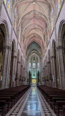
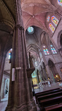
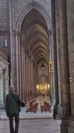
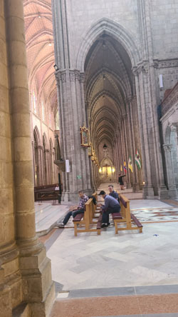
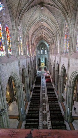
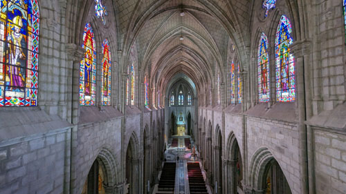
Inside the basilica, there are distinct areas of interest. Of course, there is the nave- the main area where worshippers gather. A different area is comprised of the side chapels that flank the nave on both sides (and even behind the main altar). And finally, in this church as in many others, there are some larger chapels that are worship spaces of their own; these are often found in the transverse of the typical church layout.
In the Nave
|
|
|
In 1901, Father Matovelle and his Community of Missionary Monks, took charge of the construction at the request of Archbishop Pedro Rafael González Calisto. The building was designed by architect Emilio Tarlier at the cost of 40,000 French francs. Tarlier was inspired by the Bourges Cathedral. On July 10, 1892, the first stone was placed. Between 1892 and 1909, the Heart of Mary Cathedral was constructed. The basilica was blessed by Pope John Paul II on January 30, 1985, and it was consecrated and inaugurated on July 12, 1988.
The basilica remains technically "unfinished." Local legend says that when the Basílica is completed, the end of the world will come.
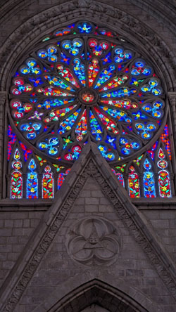
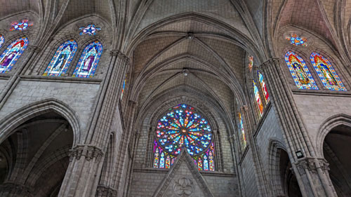
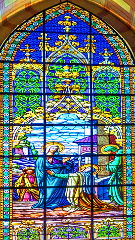
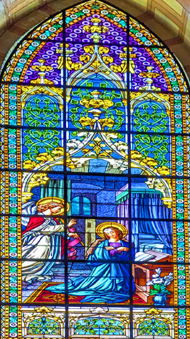
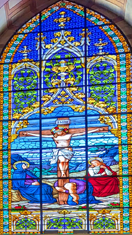
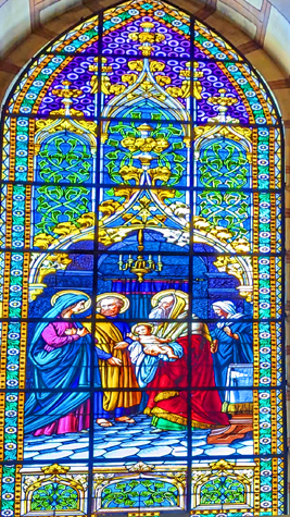
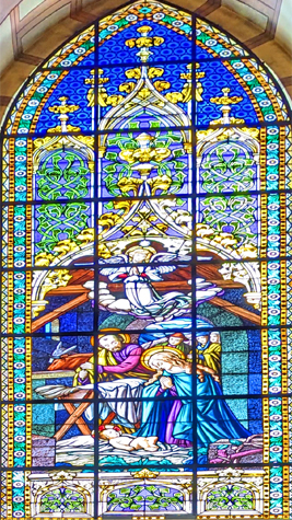
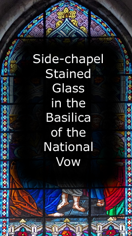
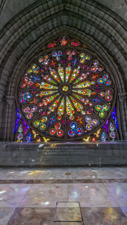
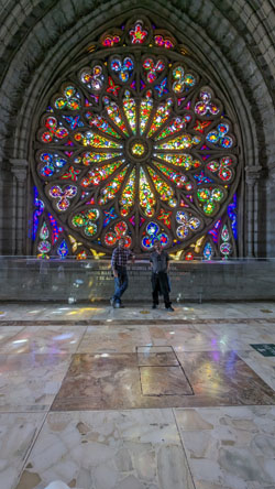
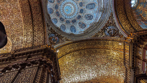
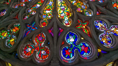
One of the things that I think makes this church so beautiful is the extensive use of stained glass windows. Each of the side chapels has its own window, and there are rows of them up high, just below the ceiling of the nave. There are rose windows at all four points of the cross, and just above the nave-transcept intersection is a cupola with more stained glass. Take a look at the pictures below, all of which feature the stained glass in the Basilica of the National Vow:
|
|
|
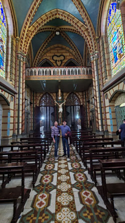
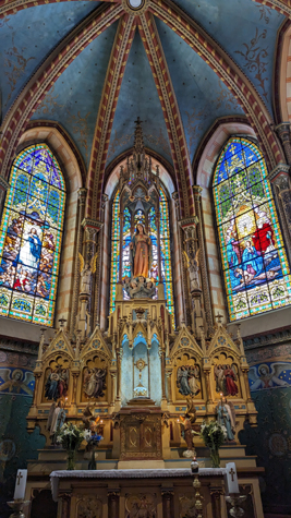
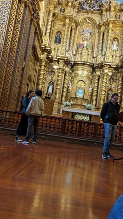
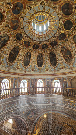
In a Large Side Chapel
|
Just inside the entrance there was a small platform, apparently left by some workmen, so I climbed up onto it and took the picture below looking down one wall of the chapel to the altar:
 |
I thought that the altar and the stained glass windows behind and around it were extremely beautiful, and both Fred and I took a number of pictures of it. Fred took an excellent picture of the alter (left-hand picture below) and I got a bit closer to take two pictures that I then stitched together (the right-hand picture below):
|
|
|
The Small Side Chapels Off the Nave
|
In the pictures at left you can see both of these long aisles on either side of the nave. At the transverse intersection on both sides there are some benches/pews and each faces one of the larger chapels (except for the northwest side where there is an exit out to the plaza.
to View the Slideshow |
Fred and I photographed almost all these small chapels today (each of which seemed to have its own stained glass window), and the diverse nature of the chapels was very interesting. I did the same thing when we were here with Jeffie a little over a week ago. At that time, and on that page previous to this one, I put a slideshow showing each of the side chapels. If you haven't already visited that page, you can do so and see the slideshow with pictures of all those chapels.
Today, the weather was much better outside, and I think that the bright sun showed off the stained glass to better effect than when we were here with Jeffie. So on this page, I want to concentrate on the stained glass. I have taken another picture in each chapel, but this time just of the stained glass, and I have put those pictures of the beautiful glass works in a slideshow. That slideshow is at right.
To view the slideshow, just click on the image at right and I will open the slideshow of stained-glass pictures in a new window. In the slideshow, you can use the little arrows in the lower corners of each image to move from one to the next (just put your mouse or point in the lower corner of the image and the arrow will show up), and the index numbers in the upper left of each image will tell you where you are in the series. When you are finished looking at the pictures, just close the popup window.
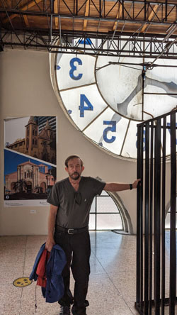
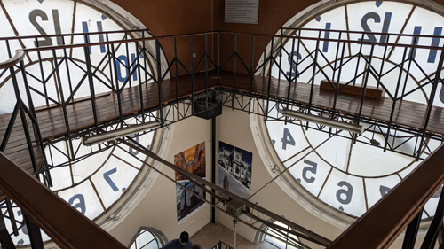
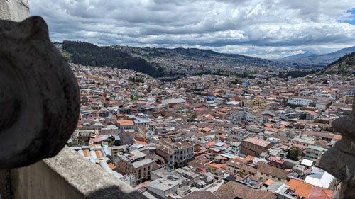
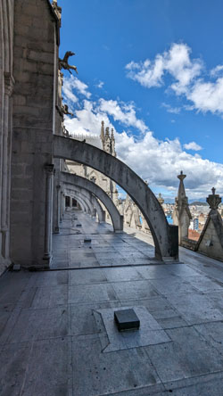
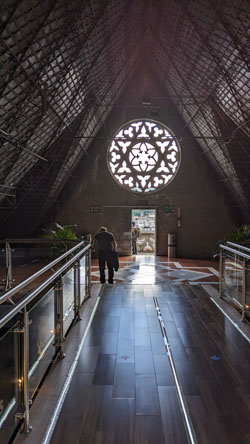
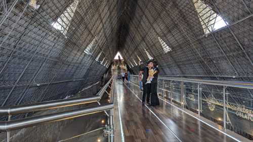
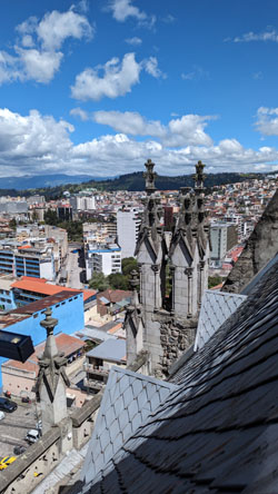
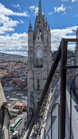
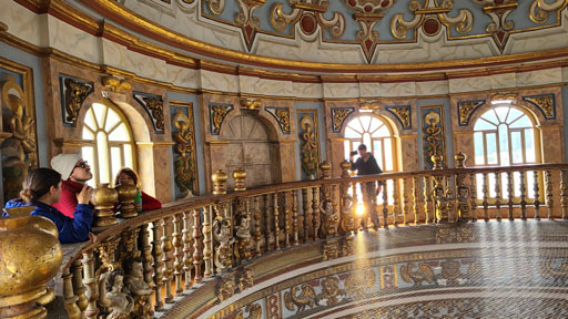
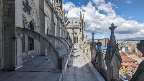
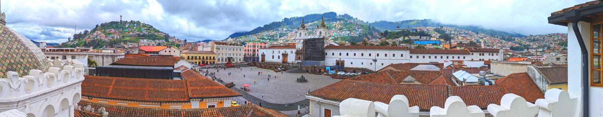
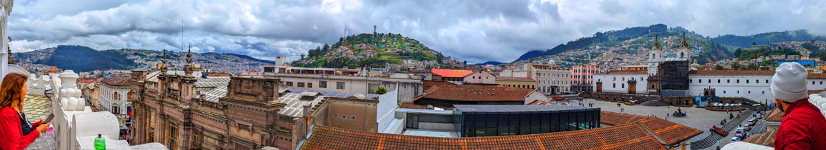
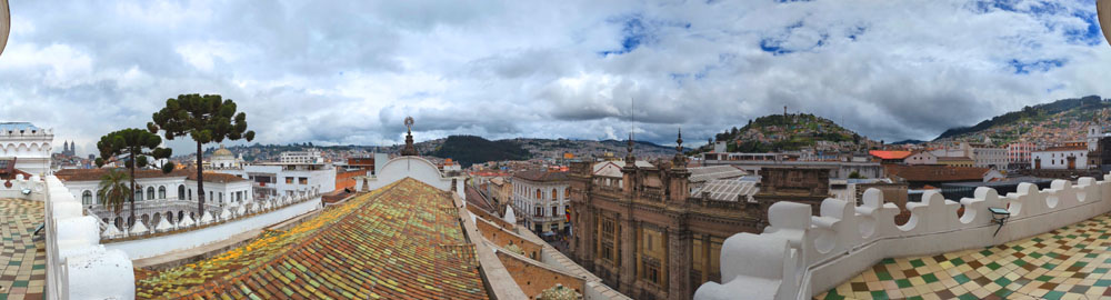
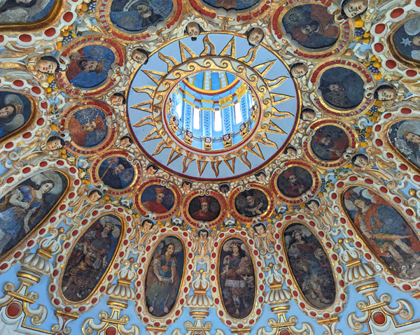
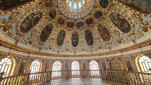
In the Clock Tower
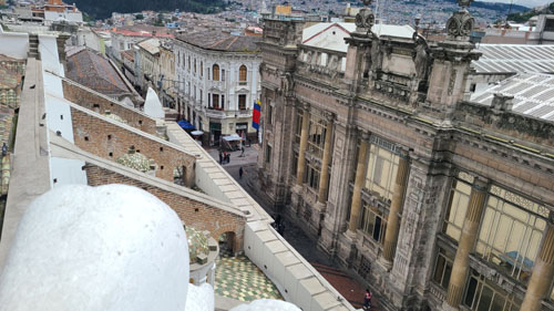
There are stairs and an elevator, so we took the latter to the third level of the tower. Here there is a cafe, a closeup of the front rose window, and the pathway across the roof of the nave to the tower at the other end of the church. There was also an open area with good views out across Quito.
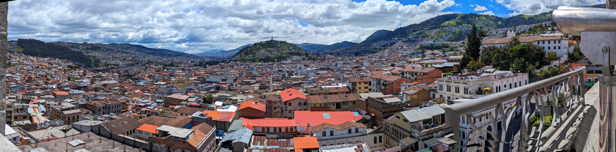 |
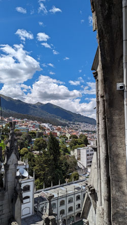
I'll come back to the Rose Window in a moment, but for now we took the stairs up another level to find ourselves on the level that has us behind the clock faces (there are faces on three sides of the tower). Before we look at the clock, there was another outside area that offered spectacular views out over the old city of Quito:
 |
Now, let's talk about the level behind the clock faces.
|
|
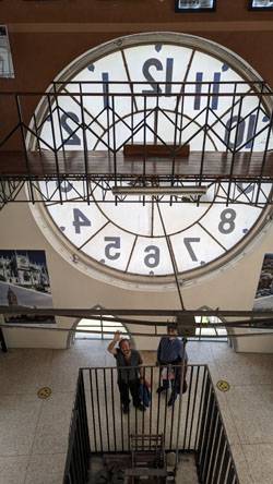
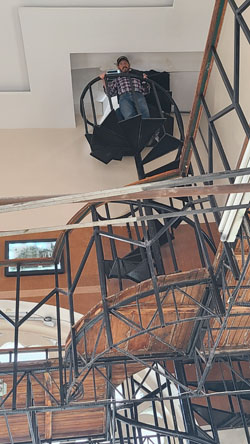
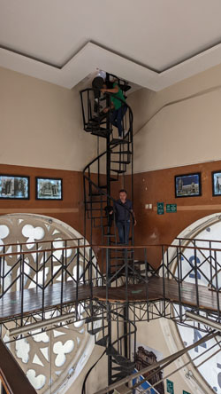
If you begin climbing the spiral staircase in the corner of the room (which Jason and I did), a ways up (but still in this room) there is a catwalk that runs all the way around the room. You can walk around it, which I did, but it is mainly for the use of the people who maintain the clock mechanisms.
|
To the right of that picture is one I took from the opposite corner of the room on the catwalk, showing him about to ascend the staircase to the room above. It was a little tricky, climbing the staircase, as there is no way to pass somebody. So it was good that there weren't many people here today and we only had to wait for a few moments sometimes to go up or down.
Finally, the rightmost picture of the set of three is another picture of the stairway, again taken from the catwalk, as Jason is almost to the top of the stairway in this room and about to go through the floor to the top room above.
The top "room" here in the clock tower is basically an observation deck. From a small vestibule at the top of the stairs you can go to a number of viewing areas, which look in all directions from the tower. The views were pretty amazing, so I will just include them here, as the actual directions don't matter, and there are no easily-spotted landmarks in them.
|
 |
|
|
|
|
|
Then we took the stairs down one level to the little cafe, where we stopped to have some lunch. For just a couple of hotplates, the little cafe had a surprisingly extensive menu, and it was quite enough for lunch.
Behind the Front Rose Window
|
 |
Also on this level, across to the other side of the church past the Rose Window, you could look out past the other clock tower towards the hillside stairs.
Back to the middle of the church, we were right behind the Rose Window at the front of the church.
|
 |
|
|
|
 |
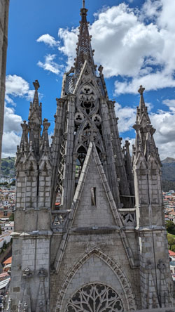
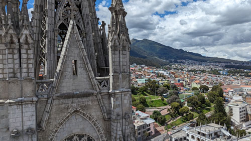
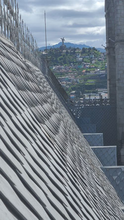
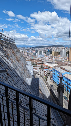
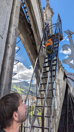
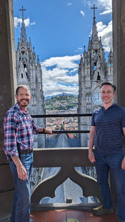
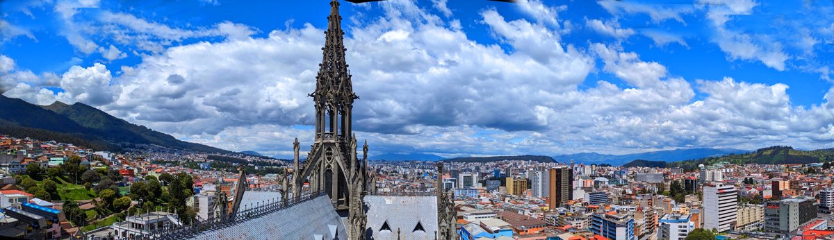
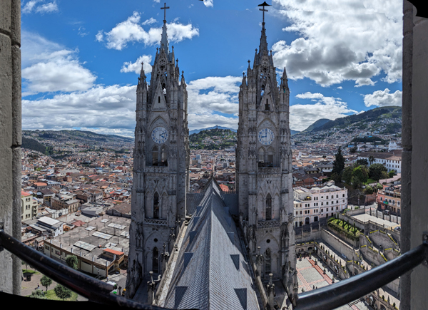
The Church Tower at the Opposite End of the Building
|
|
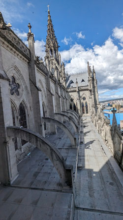
At this level, a walkway has been built just a few feet above the ceiling of the nave and running from the front of the church to the tower. This makes it ridiculously easy to get to the base of the tower, and this is exactly what we did. You can see this attic area in the pictures at left and right.
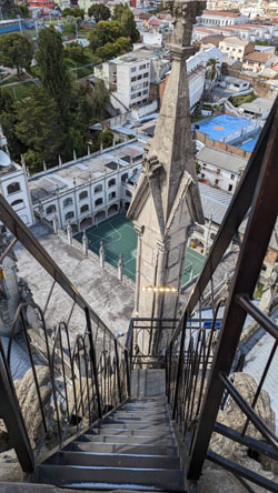
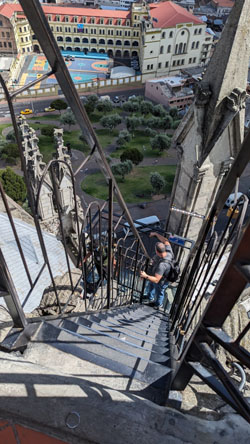
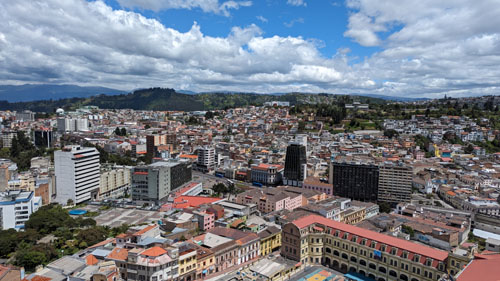
At the end of the walkway, you climb a few steps and go outside, where you find yourself standing on a kind of observation platform. At one side of the platform are some steep iron stairs with one landing that lead up to the highest point you can reach. These stairs are quite narrow and quite steep, so two-way traffic is impossible. So from that highest point there is a second set of stairs that bring you back down to the lower observation platform. So visitors climb one set of stairs, admire the views from the top, and then come back down via the other set.
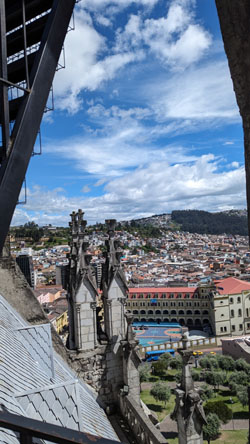
But the views from even this lower platform are quite amazing. Here are some of them:
|
|
|
|
NOTE:
We have not yet visited the statue of the Virgin of El Panecillo atop El Panecillo hill, but we have it on our list of things to do either by ourselves or when a guest is here.
|
|
|
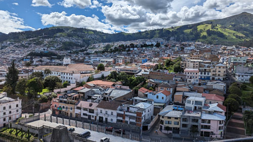
In one of my views looking around I spotted a kind of quirky sight, so I zoomed in on it. Maybe lots of people in the buildings in this old section of Quito now have washing machines, but it appears that not all of them have dryers.
|
|
So, Jason and I left Brad and Fred on the lower platform, and we climbed the stairs to the upper one to see what kind of views were available.
|
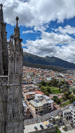
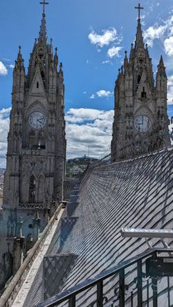
Eventually, it was our turn to climb the two flights of steep stairs to the upper platform, and the views (as we thought they might be) were really neat. Take the picture below, for example, looking across the church roof to the front clock towers (stitched together from three separate photos):
 |
|
 |
Here is a pretty amazing panoramic view that I took from this upper platform. The view looks south and west:
 |
|
|
After a while, we were ready to head back down to rejoin Fred and Brad, and I took some pictures of the stairs and on the stairs as we descended:
|
|
|
|
We were done here in the tower so we retraced our route back down the stairs and out of the church back onto the plaza. We stopped to get a drink at one of the little shops in the corner of the plaza, and took a moment to utilize the facilities. I thought that this shop display was particularly colorful.
When we were all done and refreshed, we headed off to Plaza Grande, the old square of old Quito.
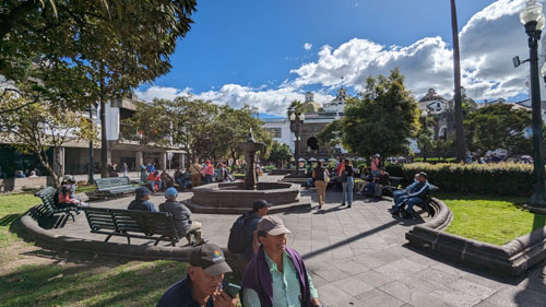
At Plaza Grande (Independence Square)
From the church, we left the plaza through the main gates and found ourselves on the little steep side street that provides access to the entrance.
|
|
We walked down Venezuela Street towards the old city square- Plaza Grande (officially named Independence Square).
|
 |
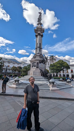
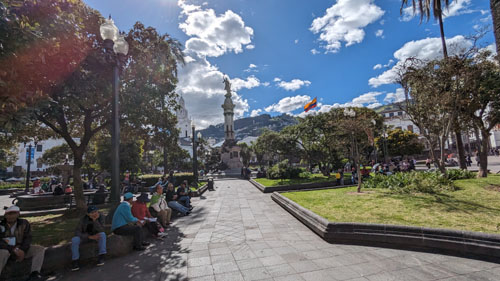
Independence Square is a focal point not only in the Old City of Quito, but of Ecuador itself. The square is flanked by the Carondelet Palace, the Metropolitan Cathedral, the Archbishop's Palace, the Municipal Palace and the Plaza Grande Hotel. We arrived at the square at its west corner, and of course the first thing we saw is the 1809 Monument, shown at left. The Independence Monument , also known as The Monument to the Heroes of August 10, 1809 , is located in the center of the Plaza Grande. It stands in memory of the Quito patriots who began the fight for independence in Ecuador. It was inaugurated in 1906 to remember the so-called First Cry of Spanish-American Independence by the then president, General Eloy Alfaro Delgado. It is one of the most important icons of the Historical Center of the city and the country; in addition to an important site of political concentration as it is located in front of the Carondelet Palace- seat of the Ecuadorian government.
|
Spanish authorities considered this an uprising, and hastened to suppress it. Nearby cities joined in the independence movement, while Guayaquil on the coast remained loyal to the Spanish King. From Bogota and Lima, the Spanish viceroys urgently dispatched troops to suffocate the uprising. Isolated and blocked, on October 24, 1809, the junta returned command to Count Ruiz de Castilla, who promised no reprisals and free entry/exit to Quito. Castilla went back on his word; after dissolving the Junta, he chased and imprisoned the leaders of the August 10 revolution, ordering criminal proceedings against all patriots.
On August 2, 1810, a popular riot occurred, with the intention of attacking two barracks and freeing the prisoners. Some were freed, but the Spanish killed many others. But after days of conflict, looting, and murderous clashes, the Quitoans were successful, and the Spanish Viceroy was driven out. The cost was 200-300 patriots dead and at least half a million pesos in property losses.
|
|
In 1888, planning to erect a memorial commemorating the August 10 revolution and the then President issued the decree authorizing its design and execution. It would be at the center of Plaza Grande, replacing an allegory of the Discovery of America. In 1894, Italian artist Juan Bautista Minghetti received the commission, but a civil war and Minghetti's departure delayed things. The project resumed in 1898. A small tax was levied for constructions, and on the ceremonial date of 10 August, 1898, the first stone of the base was placed.
During the next five years, fifteen famous sculptors, including Frederic A. Bartholdi, sculptor of the Statue of Liberty in New York, presented sketches and proposals. But it fell to Quito native, Francisco Durini Cáceres, to present the winning design- which was based on the works of Italian artists and Minghetti's original idea. The pieces of the monument were created in several Italian cities, and were brought to Quito from Genoa via the Straits of Magellan to Guayaquil, then overland from there. There were hitches in the assembly process, and several pieces had to be reworked. Ahead of the dedication date the entire square was spiffed up and surrounding buildings renovated and painted. On August 10, 1906, the monument was officially presented to the Ecuadorian people.
Here are some pictures taken in and around the square:
|
|
The square is surrounded by the following four streets: Calle Venezuela (east), Calle Chile (north), Calle Gabriel García Moreno (west) and the pedestrian segment of Calle Eugenio Espejo (south). Although the first colonial town square was what today is known as Plazoleta Benalcázar, this has always been considered as tentative as the square wasn't really suitable for the growing town of Quito. It was only in the 17th century, in the year 1612, when the powers of the city moved to the area around the Plaza Grande.
|
|
Initially the square was just an esplanade of packed dirt with a water source for residents. It was larger than Plazoleta Benalcázar, and since there was unused land around it, some institutions moved to it. The Catholic Church acquired land on the north and south sides, where they built the Quito Cathedral and the Archbishop's Palace.
One of the founders of the city, Captain Juan de Díaz Hidalgo, built his house, called Palacio Hidalgo, near the Archbishop's Palace, and it is the only private building on the square today. Other founding families built homes here as well, but they were destroyed in the earthquake of 1627, after which the Palacio de Carondelet took their place. On the eastern side of the square the city council building was constructed, but it was demolished in the 1970s so the modern city hall of the Municipality of Quito could be built.
It was a wonderful afternoon, and we walked around and sat in the square for quite some time. Eventually, though, we left the square, heading out of it at the south corner and down further south to the first non-pedestrian street where we might arrange ffor an Uber. Here are some street scenes as we made our way to the Uber pickup spot:
|
|
|
|
We had a great day at the Basilica and in Independence Square. Thirty minutes after getting into the Uber, we were back at Paseo San Francisco.
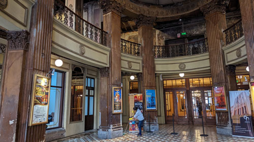
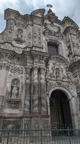
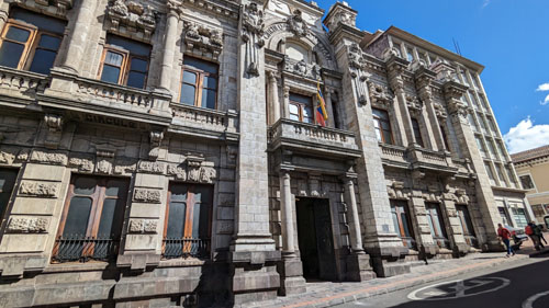
Church of La Compania
Today, we are going to go with Brad and Jason to some places we haven't been to before, and the first one is the Church of La Compania. It has the reputation of being the "golden church", as, apparently, everything inside is covered in gold leaf.
|
|
The columns, statues and large decorations were executed in the quarry that the Jesuits had in nearby Píntag; the rest of the material was brought from a quarry on the western slope of El Panecillo hill, next to the city. The facade, as it has come down to us is more Baroque than not. The main entrance door is flanked by six Solomonic columns five meters high, fluted in their middle third, derived from those of Bernini on the altar of the Confession of Saint Peter's Basilica in Rome. In the same way, the side doors are flanked by two Roman-Corinthian style pillars with Renaissance decoration.
There is a frieze decorated with flowers, stars, foliage, and above this the cornice is adorned with acanthus leaves, which follows the projections of the facade stretching out in a semicircular arch to protect a niche formed on an interrupted pediment that, supported by four cherubs, crowns the main door and accommodates an image of the Immaculate Conception surrounded by angels and cherubs. At the top of the niche, another smaller pediment contains the Holy Spirit in his dove symbol.
|
Between its pilasters and columns are niches with full-length statues of Saint Ignatius of Loyola, Saint Francisco Xavier, Saint Estanislao of Kostka and Saint Luis de Gonzaga. These are flanked by statues of Saint Francis Borgia and Saint John Francis Regis. There are busts of the apostles Peter and Paul next to the main door; and on the lintel of the side doors, the Hearts of Jesus and Mary, which attest to the antiquity of the faith and worship of the Quitoan people to the Sacred Hearts.
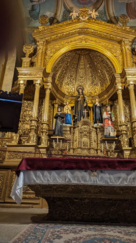
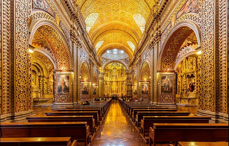
The church complex includes the Residencia San Ignacio, "Mother House" of the Jesuits in Ecuador. The church, and its rich internal ornamentation, completely covered with gold sheets, is one of the main tourist attractions in the city and an invaluable heritage, both artistic and economic, for the country. It was visited by Pope John Paul II, who presided over a mass in the church on January 30, 1985, within the framework of his three-day visit to Ecuador. It was also visited by Pope Francis on July 7, 2015, who prayed there before the image of Our Lady of Sorrows.
I suppose the first thing I should say about this particular church was that no photography, flash or otherwise, was allowed in the nave of the church. I suppose the second thing I should say about this particular church was that I took the first thing as something of a challenge. I was determined to get my own photographs of the church interior, but I had to do so surreptitiously. Because of that, the photos that I took aren't all that great, so I am going to supplement them with a stock photo (obviously done by a professional photographer with the permission of the church).
Admission to the church was $5- except for those of us in the "third age"; our admission was free, although Fred and I paid extra to have guided tour of the dome and the roof of the church building. That, I recall, was $2. As I have said before, there are lots of advantages to being old in Ecuador, which counterbalance maybe a bit of the disadvantages of being old just about anywhere.
The greatest characteristic of the internal decoration of La Compania de Quito is its very Baroque forms in carved cedar wood, polychrome and bathed in 23-carat gold leaf on a red background. The main altarpiece, in the apse, and the richly decorated pulpit stand out above all. We were told by our guide that close to 170 pounds of gold were used to make all the gold leaf that covers just about every surface in the nave.
|
You can imagine all the effort that it took to pound raw gold into wafer-thin sheets, and then to meticulously cover all the nooks and crannies in the wood construction of the altar and elsewhere in the nave. It is always incredible to me how the faith of the masses can accumulate the wealth to finance, and put the effort into constructing, and take the time to decorate these houses of worship (more in Europe, Central America, and South America of course).
Given that, I thought it a shame that photography was not allowed. Not using flash I can understand, but given the relatively small number of visitors to the church at any given time, I don't think that the one justification often used for "no photography allowed" (causing backups and confusion in crowded situations) didn't apply.
Anyway, here are the best of the surreptitious pictures that I took before someone I mistook for a visitor was actually a roving docent reminded me that photography was not allowed.
|
|
As I may have mentioned, Fred and I paid a bit extra to have a guided tour not only of the nave, which was very interesting, but also some of the other chapels. But the main attraction of the tour was that with a guide you could get up into the top of the dome and also outside onto the roof of the church. We followed our guide who took us on a short elevator ride and then up some stairs to come out on the roof of the church, and the first thing we did was to walk around.
|
|
Here is the first of the panoramic shots I took from the roof of La Compania. The view is west at the left and east at the right. You can obviously pick out Plaza San Francisco. One of the new metro stations is now underneath it.
 |
|
|
Here is another panoramic view. In this view, the center of the picture, looking towards the Virgin of El Panecillo is almost directly southwest. So the left of the picture is basically south and the right side is basically west. The panorama spans a bit more than that, but the approximation is OK.
 |
|
|
Again, this next panorama takes in the Virgen el Panecillo, but it looks more south/southeast along the roof of the nave of La Compania. That is the Museum of Money to the right.
 |
|
|
|
Being up here on the roof, and taking in the pretty amazing views out over the old city of Quito was really neat, but I was looking forward to getting into the dome above the transcept. So our guide took us to the dome with the entry doors and we headed inside.
Well, right off the bat, I have to say that being here, inside the dome but high up from the nave floor, was pretty amazing, as I think the pictures we took will illustrate. When our small group got inside, we found ourselves on a wooden walkway that runs completely around the inside of the dome at this level, and we were encouraged to take a walk around it if we wished.
|
 |
Here are two beautiful pictures that Fred took here inside the dome:
 |
 |
|
So I began at the entry door we'd come in and filmed my walk all the way around the suspended wooden catwalk here in the dome. Pretty amazing. |
|
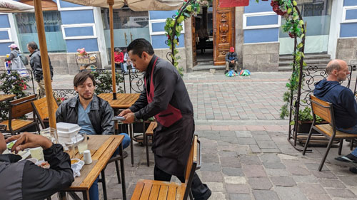
Lunch and Plaza San Francisco
When Fred and I rejoined Brad and Jason after our tour, the next thing on the agenda was lunch.
|
After leaving the church, we were just basically following our noses looking for someplace that might be acceptable to have some lunch. The corner between the church and the monetary museum was pretty active, and I made a movie here:
|
|
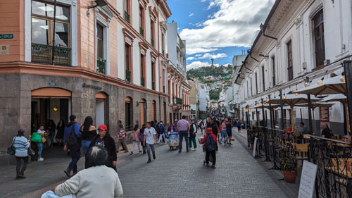
Just by random chance, we decided to turn right onto Calle Garcia Moreno as it looked like there were a fair number of shops along the way, and enough people that we thought we might find a place to eat.
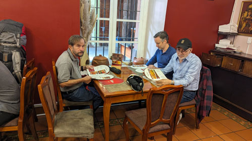
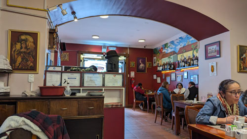
We were less than half a block up that street, we found a little restaurant called Cafe Modelo. We stopped out side to look at the menu that was on display, and pretty quickly we settled on this restaurant as our place for lunch.
The cafe turned out to be pretty nice, and it had an extensive menu, and we were all able to find something we wanted.
|
|
|
|
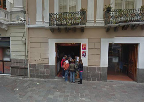
Now, when I was doing this page, I hadn't recalled the name of our restaurant, but I recalled where it was. So I used Google Maps aerial view to pin it down.
|
But hey, wait a minute! In the picture I took when we left the restaurant, there was outside seating, but in the Google picture, there isn't any. Had I made a mistake? Was the restaurant we ate at actually elsewhere? No, as it turned out.
|
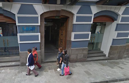
Now take a look at the Google Street View picture that I grabbed simply by turning the view of the restaurant entrance to the view of the opposite side of the street. Obviously, I have the right restaurant, because the Google Street View of the opposite side of the street is identical to the picture I took. Sure, the vendors aren't there, but that's to be expected.
This was one of those situations that have occurred so often in my photo album that I've been able to validate pictures I took with pictures from the Internet- and most of those from Google Maps, either aerial views or street views.
We continued walking southwest, noting that there was some kind of archway a couple of blocks ahead, and we wanted to see what it was. Here are four pictures we took on the way to and at that arch:
|
|
|
|
We've read about the statue of the winged virgin before, and at some point we need to get up the hill to see it. Had the weather not deteriorated a good deal in the last few hours, I might have suggested we get and Uber and go up there (there are stairs, but they are reputedly dangerous at times), but we will save that for another time.
|
Its construction probably began in the last decade of the 16th century, since by the year 1618 Mariana de Jesús Paredes y Flores had been born there, who would later become the first Catholic saint in Ecuador. After his death in 1645, the house passed into the hands of the Order of Discalced Carmelites, who occupied it as early as 1647, although it was not until February 4, 1653 that they converted it into a cloistered monastery with the name of "El Carmen de San José", which is its official name.
The name "Carmen Alto" was popularized when a group of nuns from the same order were forced to settle in Quito after the destruction of their monastery in Latacunga in the earthquake of 1698. But due to a rule that prohibited more than 21 veiled nuns in each monastery, they had to establish another house in the San Juan neighborhood, receiving the name "El Carmen Nuevo or Bajo", while the one that previously existed in the city took the name of "El Carmen Antiguo or Alto."
Since 2013, the two oldest cloisters of the convent were opened, including the original house of Mariana de Jesús, so that a museum could operate there that would allow the exhibition of the pieces collected by the Order of Discalced Carmelites over the centuries. Part of the pictorial collection includes paintings by Hernando de la Cruz, Joaquín Pinto, and Víctor Mideros. The complex was adapted for museum purposes and the spaces necessary for the life of the 21 cloistered nuns who currently inhabit it were sealed off from the public spaces- to maintain the idea of a cloister.
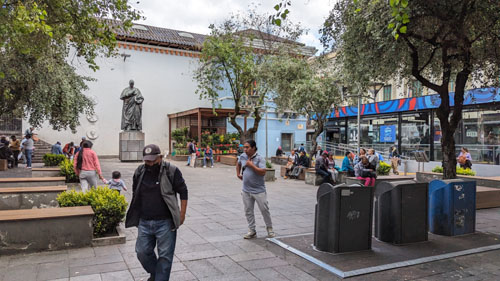
We intended to continue up to the corner of Calle Sebastian de Benalcazar where we could turn right again and come into the Plaza San Francisco. Just before we got to the corner, I passed a shop that only sold one item- eggs, of course. In the US, there'd be a sign like "Eggs R Us".
Another block of walking and we were back to Plaza San Francisco.
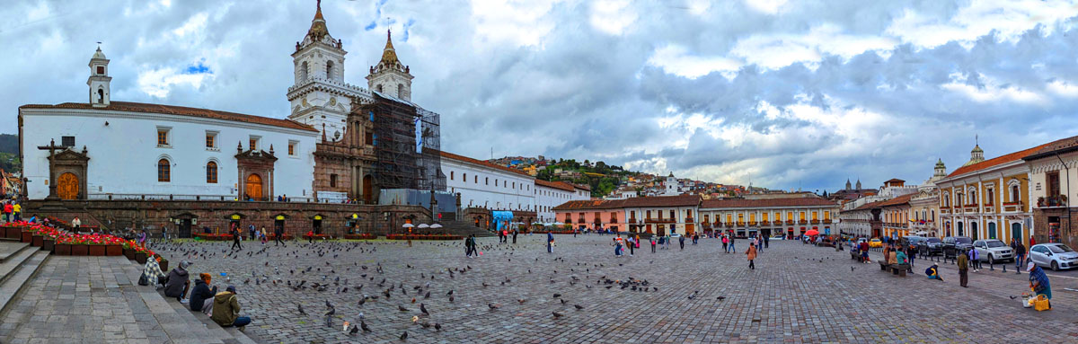
Church and Convent of San Francisco |
The square is rectangular in shape, with a length of about 360 feet and a width of about 225 feet; it is the largest square in the historic center of Quito, followed by Plaza de la Independencia and Plaza de Santo Domingo.
|
Some historians believe that it was built on the area of the Tianguiz, or aboriginal market, around which several structures of the Inca civilization (1497-1533) would have been built, including the barracks of the generals Quisquís and Calicuchima. However, recent excavations for the brand-new Quito Metro (one of which stations is directly under the square), have not found any vestiges of pre-Hispanic structures. The excavations found only old sewer pipes, dated to the early 20th century.
Since the 16th century the architectural complex of San Francisco was necessarily linked to its urban environment, and there are three spaces that historically defined the relationships with the outside world. First is the plaza itself, which was a clearly urban space, perfectly demarcated, which connected the Franciscan religious and civilians through various activities (tianguez, doctrine, market, water supply). Second was the Atrium, which was the one that, without ceasing to fulfill urban functions, had much more sacred characteristics than the plaza. This, at least during the 16th and 17th centuries, was the burial place of the common people of the town. This space is preceded by a half-concave and half-convex staircase. Third, of course, were the church, chapels and convent, which were properly sacred places.
After the Spanish founding of the city, the plaza and its fountain became a water supply point for the residents, to which the vital liquid reached through a system of canals and was transported to the houses in large vessels by the water bearers. During the first presidency of Gabriel García Moreno, the Plaza de San Francisco was converted into a market that would later be moved to the neighboring Plaza de Santa Clara.
Fred took one movie of Plaza San Francisco and I took two. Fred's was taken from the west end of the actual plaza, while the first of mine was taken from the roof of La Compania. In mine (the right-hand movie below) you can get a better view of the new San Francisco station for the Quito Metro. In those movies, you will see a series of flower boxes that added a lot of color to the square.
|
|
|
Here is my other movie of the square, again taken from its western end:
|
|
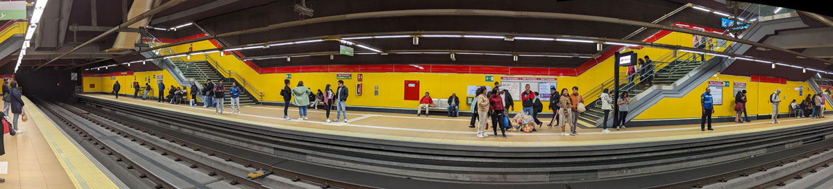
At the beginning of the 20th century, the square was landscaped with a water fountain in the center, and it remained that way until 1930, when it was completely paved with stone, the fountain was removed to be sent to Calacalí and a monument to Federico González Suárez was erected in its place. This was removed in the 1980s and placed in Plaza Chica , leaving San Francisco as a large space that has since been used as a social, cultural, military and political meeting place. About a dozen buildings stand on the four sides of the square, all built during the colonial era and redesigned at the beginning of the 20th century. Other than the church itself, there are two museums, numerous houses, and a few commercial establishments. The newest structure, built in 2023 and located at the southeast corner, is the entrance to the San Francisco Station of the new Quito Metro.
Here is my last panoramic view of Plaza San Francisco:
 |
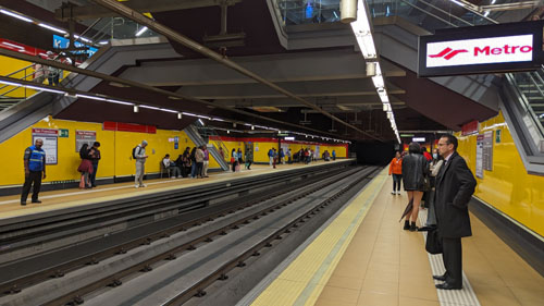
Riding the (almost) Brand-new Quito Metro
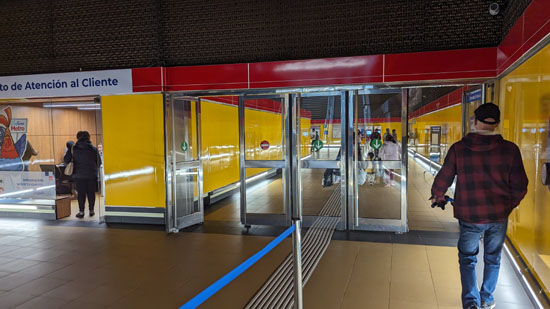
Now, we are going to head to the east corner of the square (near where the yellow taxi is in the right side of the panorama, for there we will find the entrance to the Quito Metro, which we want to ride on. The Quito Metro is the underground underground railway network that serves the city; it was inaugurated on December 21, 2022, although several technical and operational problems delayed the debut of its commercial transportation operations until December 1, 2023- just two months ago!
|
The Quito Metro has a single line of fifteen stations, and it runs through the city from south to north, from Quitumbe to The Labrador ("The Farmer", for some unknown reason). The subway is the main element of the Integrated Mass Transportation System of Quito, which also includes the Metrobus-Q lines and the bus network.
So how did Quito come to have a metro system at all? Well, due to the unusual geographical configuration of the city, sited such that it is some 30 miles north to south but barely 3 miles east to west at its widest part, the problem of public transport in Quito was more acute, especially in the last decades of the 20th century. Many thought that a metro was unviable, even in the face of the 450,000 vehicles that congested the city's streets daily which increased the levels of environmental pollution in the city- particularly due to the fact that the city is in a long valley. This generated a continuous debate about the need to have a mass transportation system.
In 1978, during the mayoralty of Álvaro Pérez Intriago, the "Burehensive Urban Development Plan of Quito" was drawn up, including works necessary for the city until 2020. Among these was a metropolitan transport system (metro), which due to the elongated shape of the urban area was the option endorsed by experts from France and Spain, with whom Perez spoke extensively, although the work was not completed during his administration.
|
The next mayor put that proposal aside in favor of a trolleybus network, and in fact the Quito Trolley opened in 1995 with just a small network. The diesel trolleys didn't help achieve the air standards that were paramount. The trolleybus system never was built out; even it was being outstripped by ridership demands although in its short life it transported 200,000 people.
In the 2009 Quito municipal elections, mass transit was a focal point. Candidate Augusto Barrera proposed the construction of an underground subway system. The most recent previous plan had been for a combination of surface light rail, with underground and elevated sections. The crossing problems at major streets were never solved, and eventually the project was completely scrapped. Plans to build a subway began.
The initial cost of Line 1 of the Quito Metro was estimated at $1.5 billion. Financing was arranged, split between the National Government of Ecuador and the Municipality of Quito. The federal government got loans from a variety of entities, and the Municipality found loans from the World Bank, the Pinchicha State Bank, from rolling stock suppliers, and from Municipal funds. As with almost all large projects, the costs rose during construction, capping out at an even $2 billion; financing was found for the $500 million overage.
In 2012, the Quito Metro Metropolitan Public Company was formed to accomplish the design, construction, equipment acquisition, and operation of the Quito Metro. Construction began in 2013 with the two major transfer station. Tunnel construction was a major element of course, and conventional tunneling techniques began at the north and south ends. But in 2016, it was announced that the Historic Center section would be built with a tunnel boring machine. The stations were mostly constructed using the "cut and cover" technique, with the prominent exception of the San Francisco station. The average station is 500 feet long and 100 feet wide, and designed to withstand earthquakes of up to 7.8 magnitude.
|
|
The designof the Metro was complex, as it passed through natural groundwater collectors, an aquifer, and several underground streams. The Labrador (northernmost) station began construction in 2013, as part of the very first phase, the contract for which was awarded to the Spanish company Acciona, who have extensive experience in building city subways.
The second, and most complex phase, went out for bids in late 2013. This phase would include the construction of the subway tunnel, the remaining stations with complete facilities and other complementary works. Another subphase would be for the acquisition of rolling stock. The tender for the second part, the acquisition and inspection of the 18 self-propelled trains, was initiated in 2014. By September, the contract to supervise actual construction was awarded to a consortium made up of Swiss, Spanish and Mexican companies with extensive experience. The actual construction contract 15 miles of tunnel and thirteen stations) was awarded to a Spanish/German consortium. The contract called for a 5-year timeframe.
Construction actually began in 2016 with the construction of the Control Center at Quitumbe. The first of three tunnel boring machines arrived in late 2016. It took three months to assemble and test, and tunnel drilling began in February, 2017. This started the "five-year" clock. Two more machines arrived in 2017, and both began on their own sections that same year. Each tunnel boring machine was operated by a team of 240 people, grouped into four teams of 60 people rotating every 6 hours. In the case of one machine, it was Ecuadorian-operated by personnel trained in Spain. The three TBMs were not only designed to drill underground, but also putting in place six-foot wide concrete rings called "voussoirs"; these were fixed in place with mortar and bolts. These voussoirs were made in two factories located in Quitumbe and El Labrador, and these factories turn out 60 of them daily. In total, more than 14,000 rings were used to seal the subway tunnels.
|
There was concern about the construction in the historic city center- a UNESCO World Heritage site. Citizens were concerns, but the municipality took great pains to conduct studies and hold seminars by experts from Spain, Italy, Colombia, Peru and Chile with the community to assure them that the current construction plans and methods did not represent any problem for the Heritage areas. As it turned out, they did not.
Construction of the stations and of the tunnels proceeded apace. There was a sort of competition between the three tunnel boring machines which, by this time, had been affectionately named. Records were set and broken with some regularity. In early September, 2018, the first of 18 trains arrived at the Quitumbe yard, south of the southernmost station on the line. Trains continued to arrive regularly until the beginning of 2020.
On the morning of October 2, 2018, the "Light of America" tunnel boring machine arrived at the extraction well of the "El Arbolito" park in the north center of the city, completing 100% of the construction of the 22 km of tunnel for the Quito metro. Now, track and track accessories could be laid and installed, and work could begin on the interiors of the 14 stations on the line. By the beginning of 2019, the project was over 75% complete. As you can see from my pictures and movies, the stations were complex engineering and construction tasks, and it took the next couple of years to bring them close to completion.
|
Trains Arriving at San Francisco Station |
This testing began in 2020. Numerous activities had to be carried out to perform these tests. All the electronic componentry along the tracks had to be operational, and the Control Center had to be fully functional. Drivers had to be trained; it turned out that with the ambitious schedule the municipality wanted the trains to follow meant that that over 150 drivers would be needed. Indeed, the Quito Metro created well over 1000 permanent jobs.
Some final decisions still had to be made. What about operating hours? It was decided that the Metro would open at 6AM and close at 11PM on weekdays and 1AM on weekends. Since the pre-feasibility studies were presented, there was talk of an average rate of 40 or 45 cents per ride. After several years of debate regarding operating costs, fares, and subsidies the Metropolitan Council in 2022 settled on a fare of 45 cents for a single trip. This is complemented by a 60-cent fare for trips integrated with the Metrobus-Q system or with urban buses. With this fare, the expected ridership, and traffic reduction on the surface, the project was on a firm financial footing.
The project was not without controversy. One was a series of photographs, taken clandestinely within the work area of the San Francisco Station, that went viral on social networks. But the Municipality didn't hide anything; they announced that several structures had indeed been found during the work but that the National Institute of Cultural Heritage had been called in to take all necessary steps to extract and preserve the found objects.
To pay the fare and use the Metro, single-ride users can go entirely paperless, buying their tickets at the ticket office or automated machines and receiving a QR code on their phone that is presented to the reader of the access turnstiles. More commonly, riders can register on the Metro website and get a "City Account," allowing you to recharge your virtual card and generate entry QR codes. We went "old school" and bought our tickets (a small piece of paper with a QR code) with actual cash from an actual human being. Then it was through the turnstiles and down to the platform for the northbound train.
|
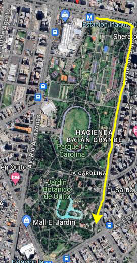
It was our intention to take the northbound train six stops to the Iñaquito station at the Avenue United Nations at the north end of Parque Carolina.
Walking Along Parque Carolina
When we came aboveground from the Inaquito Station, we were on the south side of Avenida United Nations, the major east-west street that is the north border of Parque Carolina. We just headed east and then turned south along the park side of Av. de los Shyris.
|
|
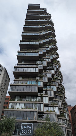
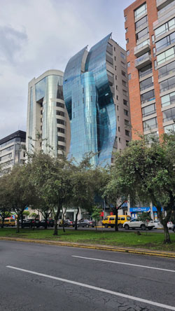
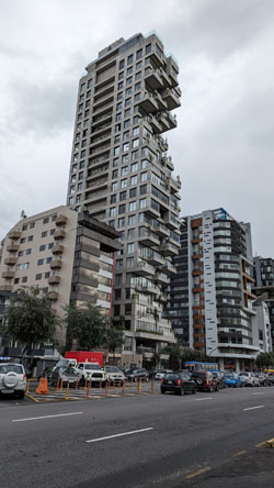
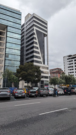
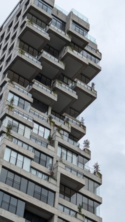
The structure is pretty interesting, almost as if the architect was on a flight of fancy, or wanted to indulge his whimsey. We have seen other highrises similar to this one elsewhere in Quito, which makes me wonder if the same architect was involved.
Other than the park, the only other things we thought Brad and Jason should see were the examples of interesting architecture that seem to be concentrated along the east side of Parque Carolina- and there are a lot of them:
|
|
|
|
|
|
|
We walked along the park until we got to about the same point where we called for an Uber a week ago with Jeffie, and then we did the same thing. The Uber took us back to Paseo San Francisco through the same tunnel we've gone through numerous times.
Taking Brad and Jason to Guanguiltagua Park
|
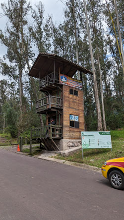
The Qhapaq Ñan or Inca Trail passes through here; it is a cultural heritage of the Andean Region of Ecuador, an ancient route that linked the north with the south of the Inca Empire. This park is part of the group of tourist places that allow bird watching in the surroundings of Quito.
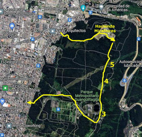
We did something different this time, based on our experience a week ago with Jeffie. Instead of having the Uber driver take us to the main park entrance, leaving us a long walk uphill to search for the llamas and get to the ridgeline trail and the overlooks, we had him take us to Hacienda Miraflores (locally known as Comuna Miraflores), which is a community that is actually inside the northern end of the park.
Located a bit more than a mile north of the main entrance of the Metropolitan Park, the Comuna Miraflores, first settled in August, 1991, before the park in which it is located was built, has changed little. The longest residents have lived there for 40 years, as it took years for the community to be officially recognized by the Municipality.
It began as an actual commune, with ten or twenty families living and working together to improve the little hamlet. It was a little universe independent of urban growth and isolated from the hustle and bustle of the city. A small group of farmers and workers first fought to occupy the land. The Municipality relented, and each of the five founding members received a hectare of land, which was then divided between the heirs, as they grew and formed their families.
|
Before and since its establishment, the commune has been expanded and maintained mostly by its residents; it is big news when the Municipality of Quito provides some new service to them. Every Sunday, all the residents take the day to clean and spruce up their community.
The Miraflores commune still preserves the characteristics of the countryside, but this is not without effort. For example, the commune still has no city sewage or drinking water; everyone uses septic systems. There is only one tap, at the foot of the soccer field, from which residents run hoses to the courtyards of their homes. The commune only got electricity around 2000, but there are only four meters; the commune is lobbying the electric company and the Municipality for more. Even with all their problems, and although they do not have property titles (the commune belongs to all), the residents consider it a fair trade to "breathe the air ppurified by the trees and to live in silence."
So, we had the Uber driver drop us at the southern corner of the commune. There, we could begin to walk down the ridgeline road towards the overlooks we have visited before. There is a barrier here so that private vehicles cannot get onto the park roads. (The only vehicles we saw when we were here with Jeffie were park maintenance vehicles.)
We started down the road, and I made a couple of movies as we went:
|
|
|
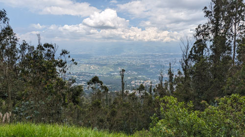
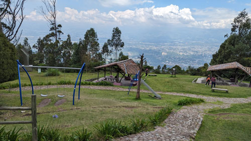
Of course, having just recently been here with Jeffie, we didn't take nearly as many pictures today as we did then, but we did try to take at least a few at each of the three "miradors" (overlooks) we stopped at. At the first one we came to, Mirador #5, we took Jason and Brad down the short trail to the overlook itself. This seems to be the smallest of the overlooks, with just "banos" and a picnic shelter.
Here are the three pictures we took at this overlook this time:
|
|
|
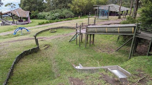
The road we were walking along must be for park vehicles only; we saw no vehicles at all during the afternoon. There is also an actual trail that winds through the woods from overlook to overlook, and we might have gone that way, but the trail looked muddier than we wanted to deal with. So we continued south down the road, which sloped gently up and down. We continued on until we reached Mirador #4.
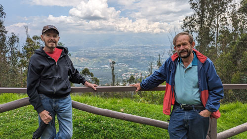
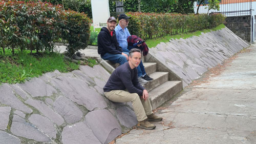
There are two defining objects at Mirador #4. You saw both of them on the previous album page for our visit with Jeffie, but let me mention them again. First, a bit down the hill from the road, there is a sculpture named "Crayolas", by the French artist Guy Rouge Mont. The sign that was off to the side continued with: "The tubes are placed forming a square. The result is an impressive set due to its scale, color and simplicity."
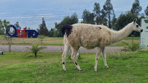
The second object here at this overlook was the "Quito" sign. These types of signs are all over the city- mostly in parks but sometimes on city streets. I think that this sign is an echo of one that most tourists encounter at the Teleferico cable car. All these signs are constructed out of large, colorful letters, and each just begs to be included in a picture with its visitors. So Fred took this picture of Jason, me, and Brad in the "Quito" sign.
|
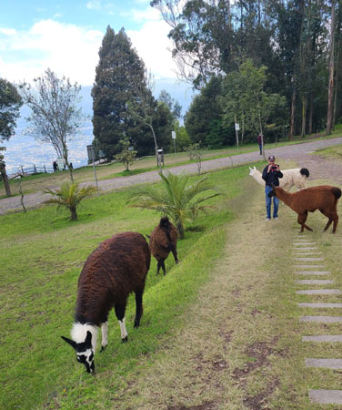
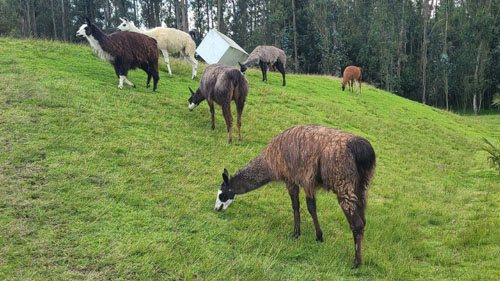
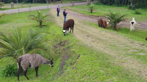
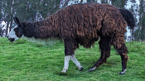
The llama is a domesticated South American camelid, widely used as a meat and pack animal by Andean cultures since the pre-Columbian era. Llamas are social animals and live with others as a herd. Their wool is soft and contains only a small amount of lanolin. Llamas can learn simple tasks after a few repetitions. When using a pack, they can carry about 25 to 30% of their body weight for 5-8 miles. The name "llama" (in the past also spelled "lama" or "glama") was adopted by European settlers from native Peruvians.
|
|
The ancestors of llamas are thought to have originated from the Great Plains of North America about 40 million years ago, and subsequently migrated to South America about three million years ago during the Great American Interchange. By the end of the last ice age (10,000–12,000 years ago), camelids were extinct in North America. As of 2007, there were over seven million llamas and alpacas in South America and over 158,000 llamas and 100,000 alpacas, descended from progenitors imported late in the 20th century, in the United States and Canada.
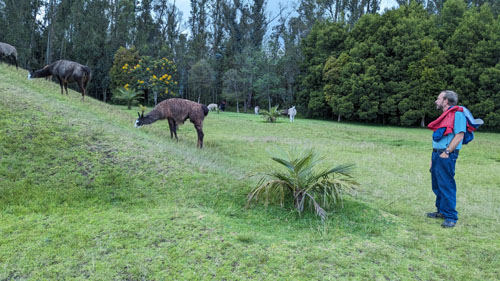
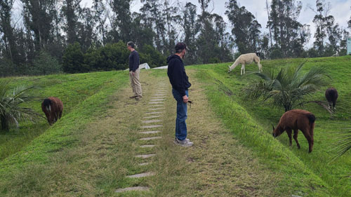
It is hard to express what a joy it was to walk out among these seemingly gentle animals. The llamas in this particular herd are not so domesticated that you can walk up and pet them, but I did get close enough on a couple of occasions to actually touch them and feel what their coats felt like (a little coarser than I might have thought). We took quite a few pictures, but since there were so many on the last album page, I am just going to include the six best pictures here.
|
|
|
|
|
|
I think that Jason and Brad really enjoyed seeing the llamas and getting so close to them, so once again I have to thank Jeffie for searching out the fact that there was a herd of them in this park.
|
|
|
We reached the intersection with the road that leads down to main entrance to the park, so we turned here to follow that road. Along the way we saw an art installation that we'd missed last week when we cut across to see the llama herd; that art piece is at the far left.
At the near left is the "entrance station" for the park, something we'd missed last week as we drove by it in our Uber. It was a three-storey affair, very rustic, manned by the equivalent of a park ranger. We noticed that there were a couple of cabs here, perhaps waiting for people who've been using the nearby picnic and play areas. But we continued walking down the hill to the entrance for the park.
When we got to the park entrance, we found a little park-like sitting area which, oddly enough, contained a plaque given to Ecuador by the nation of Turkey. Here are the two good pictures we took here at the park entrance:
|
|
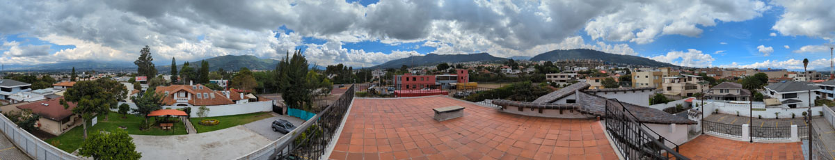
When we returned to Paseo San Francisco, we walked down the street past the entrance to our community and then we curved around onto Via de Ferrocarril. (The street name translates to "road of the iron carriage" because a rail line used to run where the street is now- the same rail line that you can see traces of near the Parque Cumbaya and on the Ecological Trail.) Just past the fire station (Bomberos) is a restaurant called "Cinco y 1/2" (Five and a half). We thought this would not only be a good place for a late lunch, but we also wanted to show Brad and Jason how, because the restaurant is actually just on the other side of the wall around Urbanizacion Santa Lucia Baja, you have a perfect view of our house from the patio; our house is only 100 feet or so from the restaurant (as the crow flies).
|
|
After we came to this restaurant for the first time, we realized that we needed to be a bit careful when the restaurant was open late, as there are views right in our bedroom and bathroom windows. I also did a panorama from the patio. In the panorama below, our house is at the extreme left and extreme right (and so the picture covers 360°):
 |
This was our last outing with Jason and Brad, as we will be heading home tomorrow. I should mention that we actually fixed food at the house occasionally, although we ate out most of the time.
|
|
The Trip Home
The trip was uneventful. Actually, there were only two memorable occurrences.
|
After we got to our gate, we noticed people setting up some kind of performance. As it turned out, sometime this evening the 50 millionth passenger would go through the new Mariscal Sucre airport. |
|
Going through Miami customs was the usual zoo, but at least the line kept moving. We learned later that even though he was using Global Entry, Brad only beat us through customs by a few minutes. We also learned that there is something called "Mobile Passport" that anyone can use and which has a special line that seemed to move a heck of a lot faster than ours. I resolved that when we return from our next Ecuador trip, we will try it.
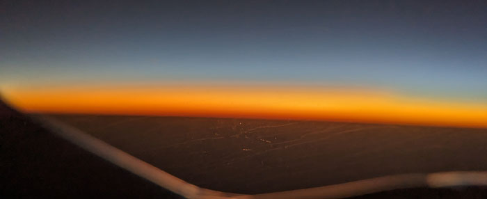
The flight to Dallas left within a few minutes of its scheduled time, and the flight was smooth and uneventful. I did get a really nice sunset picture about an hour out of Miami:
 |
This was a particular good trip to Ecuador. We did a lot and were able to show two sets of guests around our house, our neighborhood, and Quito.
You can use the links below to continue to another photo album page.
|
March 13 - April 3: Our Spring Trip to Florida |
|
February 1-11, 2024: Our Trip to Ecuador Part 1 (Jeffie's Visit) |
|
Return to the Index for 2024 |