|
January 25, 1971: A Day Trip to Nikko and Lake Chuzenji |
|
January 21-22, 1971: Circumnavigating Tokyo; Yokosuka Navy Base |
|
Return to the Index for the Japan Trip |
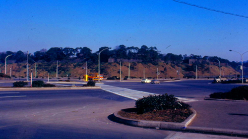
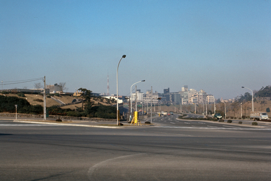
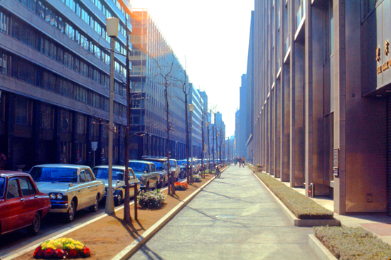
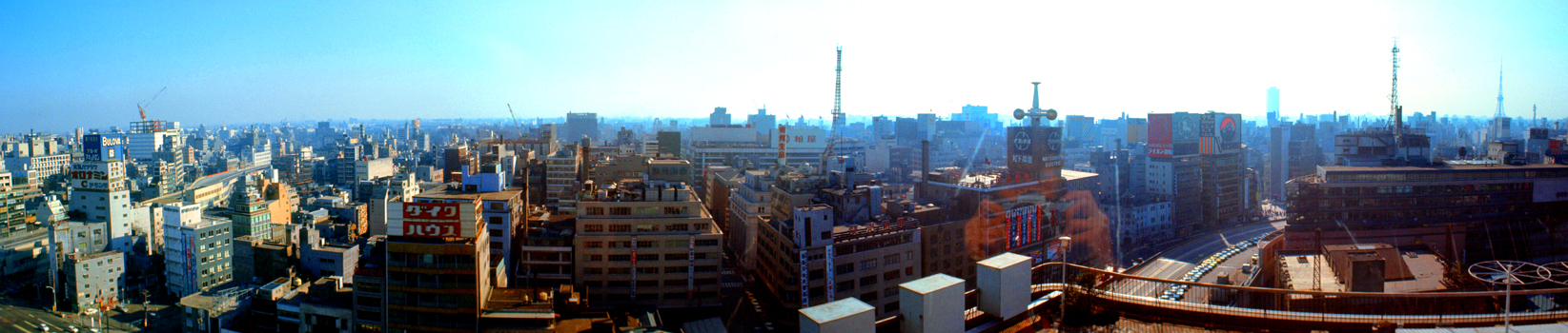
While we had already seen a lot of Japan, or at least of Tokyo, in our meandering about the city on this errand or that, we had yet to take a comprehensive look at either the city itself, or any of the areas close by, such as Mt. Fuji or the Nikko shrines. It would have been nice to take trips to places like Osaka, but the time factor just did not permit. We settled for the two mentioned above, and also resolved to take a tour of the city. Tentatively, we set Sunday aside for a trip to the Nikko area. Today, Saturday the 23rd, we decided to really take a look at as much of Tokyo as possible, and for once we got an early start.
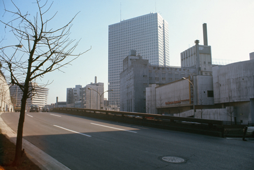
The National Diet Building
|
As it seems to be turning out, both here and in Korea, the only physical structures that are the same are public buildings, like the National Diet Building below, palaces and such, like the Emperor's residence we visited, or structures like Tokyo Tower. But most commercial buildings have undoubtedly either been replaced or modified so much that I cannot recognize them or compare them to my pictures from fifty years ago.
I did not visit Tokyo again after my Korean deployment until 2004, shortly before I retired. Even then, the city seemed very new to me, although I did walk by the Diet and the park north of it, as well as visit Tokyo Tower again. But I will continue, for my own enjoyment if nothing else, to try to marry up current views with old ones, and maybe I will discover, as we did when we visited Seoul in 2018 that, lo and behold, even a few commercial structures lasted for the 47 years between then and now.
|
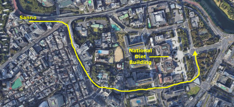
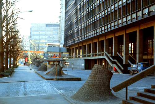
The new, elevated expressway runs along the edge of the Akasaka district, where the Sanno is, and a lot of the new construction in the area is along this highway, which is part sunken and part entirely underground. The results are attractive, and looking North you can see one of the new office structures that has gone up recently. We are going to walk along under this street for a ways, eventually turning southeast to head over to the National Diet Building- the equivalent of our Capitol.
|
Construction of the current building began in 1920, although plans date back to the late 1880s. The Diet met in temporary structures for the first fifty years of its existence because there was no agreement over what form its building should take. German architects were called in in 1886-1887, but political intrigue kept either of the proposed designs from being built. An American was also called in, but a change in government brought that project to a halt as well. Finally, a joint German-Japanese design for a temporary structure was approved. The building, a two-story, European-style wooden structure, opened in November 1890 on a site in Hibiya.
An electrical fire burned down the first building in January 1891, only two months later. Another German-Japanese partnership produced a second building, completed in the mid-1890s. The second building was larger than the first, and housed the Diet until 1925 when another fire destroyed it.
Meanwhile, the search for a design for a permanent build proceeded. A commission chaired by the then Prime Minister produced an Italianate design, which was not approved. Finally, the government sponsored a public design competition in 1918, and 118 designs were submitted for the new building. The winning design was approved, and construction began in 1920 and was completed in 1936. During construction, elements of other submitted designs were added, although no one knows for sure which entrant's design resulted in the roof and tower. That same design is familiar to Californians as it was also used for the downtown Los Angeles City Hall, completed in 1928.
As you can see from the aerial view above, we took that iconic picture of the building from the center of the broad plaza in front of it. Here are two views of the triangular parks that lie immediately to the west:
|
|
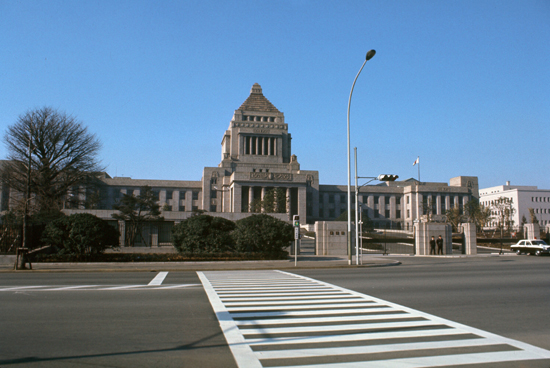
The result of all the renovation since the war has been in part the creation of a governmental plaza, the focus of which is the Diet. While not so much an impressive structure, it is well-situated in a pleasant area of the city. The well-laid-out park has a few monuments, and lots of low Japanese trees. It is all quite peaceful, and it is right in the center of the city. You can also see the sharp contrast between Tokyo and Seoul as regards cleanliness, traffic, people and atmosphere. Even allowing for all the differences between Korea and Japan, the Koreans have a long ways to go to emulate the Japanese model. I realize that Japan is the world's third greatest industrial power, but my impression of Koreans is that they fully expect to catch up at some point in time. We continued down the hill to the east.
|
|
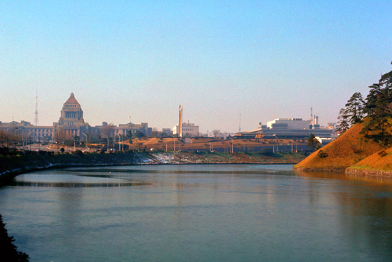
The Imperial Palace and Grounds
|
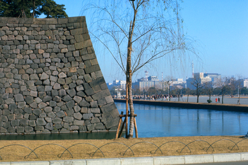
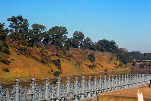
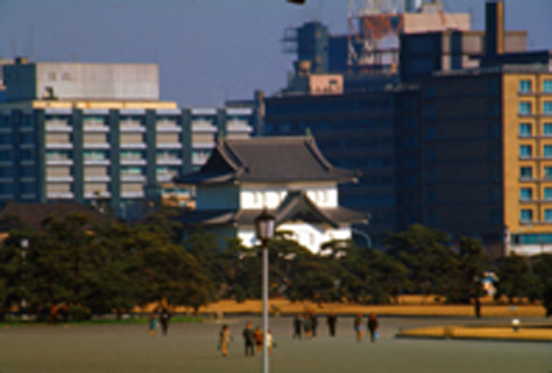
I guess I should point out that the grounds are not open to the public save for special occasions, and today was not one of them, so all we could do was look at the grounds from across the moat, using our long lenses to get pictures of the palace itself.
It was cold, and there was a thin coating of ice on the moat. I guess that it was a pretty effective defense when all you had to defend against were men with catapults, instead of computers and nuclear weapons. It just serves to add a note of beauty, and implied seclusion to the Palace area, and in truth it is probably a lot more effective than a ring of guards.
|
In it you can see some of the moat and much of the open area to the east of the palace grounds. The Imperial Palace is right in the center of the city, and you can see some of the city in the distance.
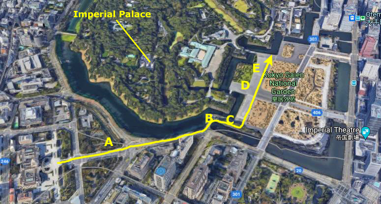
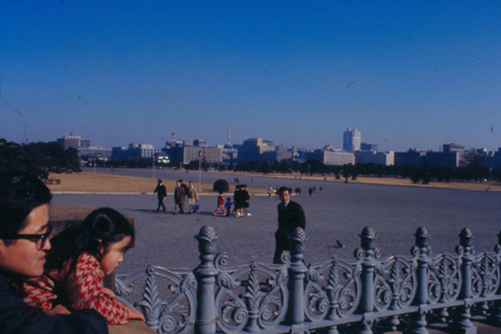
We walked up to one of the entrances to the grounds (the main one, as it turned out at about point D on the aerial view). The grounds were not open; that is, you could not go across the water and through the entry building. I don't actually know if and when the grounds are open; I would imagine that it is something comparable to the White House. You can't just walk through the gates and onto the White House grounds, although you can take a guided tour.
East of the grounds there is a broad open plaza, where even on this cold Saturday afternoon quite a few people were about. The moat continues around, although I am not sure if it continuous all the way around the grounds. The wall must be quite old but it seems extremely well-built.
Here are some more of the pictures I took here at point D:
|
|
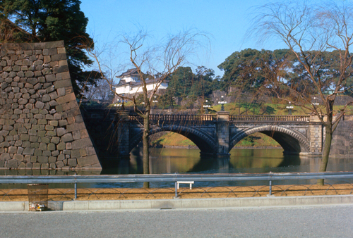
The Seimon Ishibashi bridge is one of the most recognizable bridges of Japan, as it leads to Edo Castle. The bridge is also called the Seimon Stone Bridge or the Eyeglass bridge due to its distinct looks. Although the bridge itself is not open to the public, tourists still take thousands of iconic pictures of the bridge, like mine.
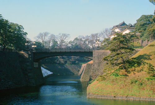
Looking back into the extremely serene and well-kept grounds, it is apparent that the one moat has divided into two or more, which apparently run through the grounds. |
|
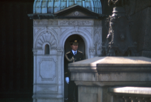
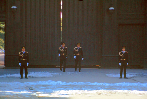
It would have been very neat had today been one of the special occasions on which the palace grounds are open, but at least we got to see part of the "changing of the guards". I took one picture before and one picture during the ceremony:
|
|
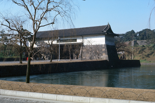
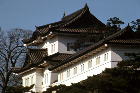
After the guard change, I used my telephoto get a couple more pictures of the buildings of the Imperial Palace complex, and two of them are worth including here.
|
A keep is a type of fortified tower built within castles during the Middle Ages by European nobility. Scholars have debated the scope of the word, but usually consider it to refer to large towers in castles that were fortified residences, used as a refuge of last resort should the rest of the castle fall to an adversary. The first keeps were made of timber and formed a key part of the motte-and-bailey castles that emerged in Normandy and Anjou during the 10th century; the design spread to England, south Italy and Sicily. As a result of the Norman invasion of 1066, use spread into Wales during the second half of the 11th century and into Ireland in the 1170s. The Anglo-Normans and French rulers began to build stone keeps during the 10th and 11th centuries; these included Norman keeps, with a square or rectangular design, and circular shell keeps. Stone keeps carried considerable political as well as military importance and could take up to a decade or more to build. It is not known just how the idea spread to the Far East, but keeps were a part of Japanese castles as early as the seventeenth century.
Another of the three surviving keeps is called "Fujimi-yagura" ("Mount Fuji-viewing keep"), and it stands further back in the castle grounds and was not visible from where we were. (The other keep, also out of view, is the "Tatsumi-nijyu-yagura". Fujimi-yagura is also called the "all-front-sided" keep because all sides look the same from all directions. It is believed that once Mount Fuji could be seen from this keep, hence the name.
|
|
It appears that the family took him at his word, for the structure was about as far as you can get from the Kyuden yet still be on the grounds of the Imperial Palace.
You can get a better idea of just how far away this structure actually was if you look at my picture of it at left, taken without using my zoom lens.
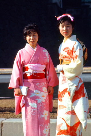
I have two more pictures taken here in the broad plaza east of the Imperial Palace grounds, and I have to thank the two very obliging Japanese women who allowed me to take them. After a comedy of errors, including a film change, I finally got a good shot of the two girls in real native dress.
|
The kimono ("thing to wear") is a traditional Japanese garment and the national dress of Japan. The kimono is a T-shaped, wrapped-front garment with square sleeves and a rectangular body, and is worn left side wrapped over right, unless the wearer is deceased. The kimono is traditionally worn with a broad sash (similar to a cummerbund), called an obi, and is commonly worn with accessories such as zōri sandals and tabi socks.
|
The kimono, I have learned, is actually five separate pieces of clothing. First, there is a kimono-like undergarment, the white material under the pink kimono of the girl on the left. Second is the kimono itself. Third, a stiff wrap-around affair made of cardboard and some kind of contrasting material. Fourth, there is a pad under the front of this wrap-around, and finally there is the folded material that is attached to the back of the outfit. The result is very attractive.
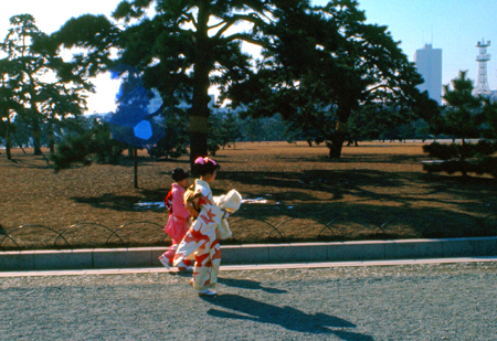
Nowadays, the kimono is not typically worn as everyday dress; generally, its popularity is declining. Kimono are now most frequently seen at summer festivals, but are worn formally to funerals, weddings, graduations, and other such events. People who commonly wear kimono include geisha and maiko, who are required to wear it as part of their profession, and rikishi, or sumo wrestlers, who must wear kimono at all times in public.
Despite the low numbers of people who wear kimono commonly and the garment's reputation as a complicated article of clothing, the kimono has experienced a number of revivals in previous decades, and is still worn today as fashionable clothing within Japan.
Downtown Tokyo
|
And here I was the one walking around, half expecting animosity to be directed at me for the apocalyptic destruction caused to this country by my own. (At the time, I did not understand how average Japanese looked at the period from 1930 to 1950, although I would come to understand better these feelings before returning home later this year.
But I just want to recall that I was amazed at this megalopolis- by far the largest city I have ever been in. A resident of New York or Chicago might not have been fazed by Tokyo, but then neither of those cities has ever been bombed by a foreign power during a war. What the Japanese have done seems to me to be nothing short of miraculous- even considering the generosity of the United States in the surrender terms offered to the nation, and the immense amount of aid that has flowed into this country from my own. Maybe if I ever get to Germany, I will find that the Japanese experience as a result of losing a war to the United States is not a unique one; I do not know. I am just tremendously impressed that from all appearances, World War II, and particularly the War in the Pacific, never even happened.
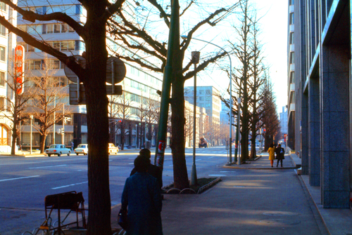
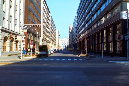
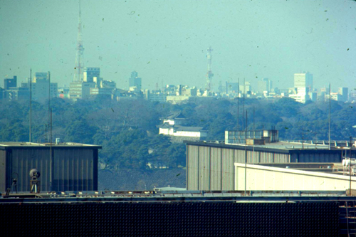
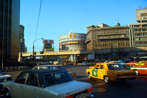
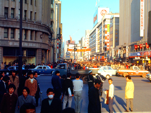
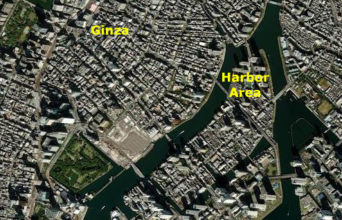
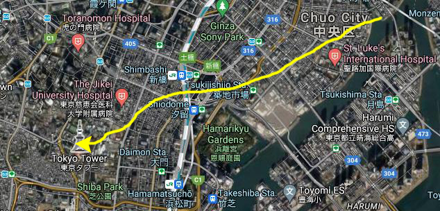
From the Imperial Palace, we basically wandered. We passed first through a business district (deserted on this Saturday afternoon) and then through the Ginza (the exact opposite). Finally, we ended up at the harbor area. You can see on the aerial view above, left, generally where we walked. Fifty years has wrought its changes, though, and the aerial view no longer bears much resemblance to the city we saw today.
|
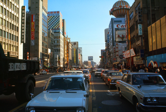
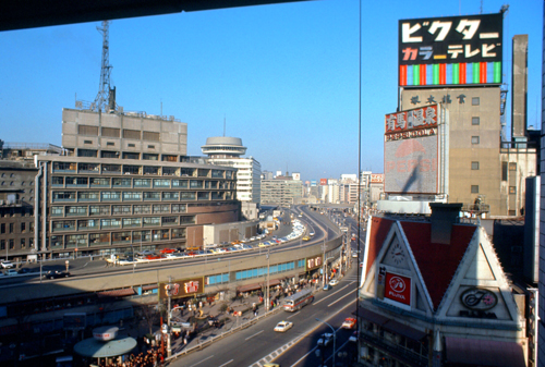
We stopped at one intersection, and were amazed at how far in every direction the blocks and blocks of new offices ran. Unlike New York City, which I am sure offers the same vistas of unbroken masonry, not many of the buildings in Tokyo are very tall at all, except some of the newest. Crossing the street, I looked to the right and was impressed with the row of immaculately clean new structures stretching almost as far as I could see and the view was the same, standing on the same corner, but looking in different directions. This scene probably does not look any more like Japan that like Paris or London, but after being in Korea for six months, the differences are striking. The appurtenances like electric walk/don't walk signs, good road signs and clean streets are conspicuous by their absence in Korea.
Here are some views taken from the same corner as the picture above left, but looking in different directions:
|
|
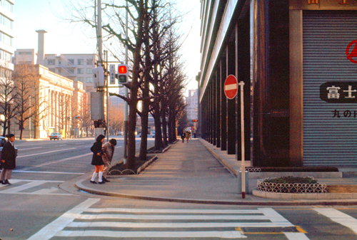
We are walking straight ahead, now, heading south towards the famed Ginza. The area is still pretty much deserted, and would be until we arrived in the Ginza shopping and entertainment area. In the picture below, right, I thought that the air ducts protruding from the ground look like some sort of ultra-modern sculpture. They are, I assume, outlets from a subway station, for I believe that three is one under the intersection up ahead. They could, however, be for the building itself:
|
|
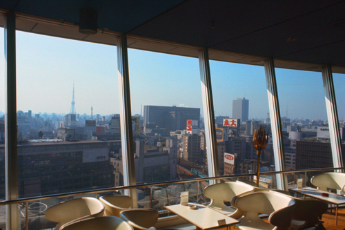
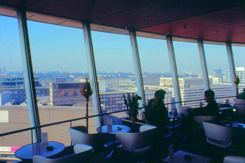
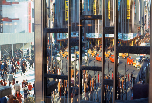
Next, we walked down the street in the view above, and under that overpass that you can see. Then we turned right, heading down towards the Ginza area. On the way, we passed a hotel that has a revolving restaurant on the top. Having never been in one, Dan and I decided to go up, and when we got there we recognized that it offered an excellent vantage point for viewing the city. Here are a couple of pictures of the inside of the restaurant:
|
|
I took a number of pictures from the windows of the restaurant; the pictures I took covered about a 180° view from the East around through the South (towards the Ginza). I was going to simply include those four pictures here, but then I noticed that the pictures all overlapped, and at the time I am actually creating these web pages I have software that can stitch these four pictures together into a single panoramic view. So that is what I have done here, and you can find this expansive panorama in the scrollable window below:
 |
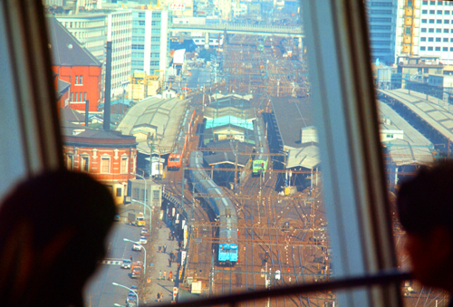
I took these pictures in 1971, but didn't actually write all the narratives until I was living in Chicago in 1975. In 1971, I found this restaurant to be pretty amazing, but by the time I wrote the narratives, I had been in enough such revolving restaurants to know that this one was fairly standard. But now, I found it pretty amazing. I took a number of photos with my telephoto lens, including this picture of Tokyo Tower in the distance about 2 miles away. Here are the other pictures that I took from the rooftop restaurant:
|
|
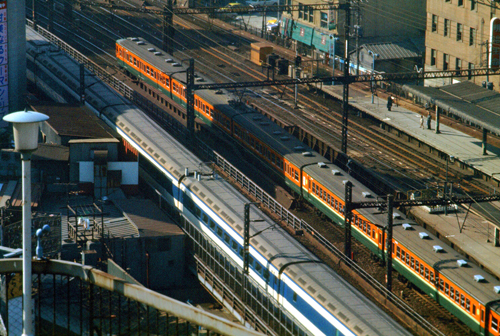
Two of the pictures were of the train lines that ran close to the hotel. It was the fact of these train lines, which still exist, that allowed me to discover that the hotel we visited is no longer there. From the current aerial views, there are only business highrises along the train lines in this area.
|
|
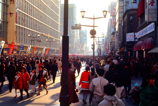
We went back down to the street level and went over to the Ginza. It was as lively as the other districts were abandoned.
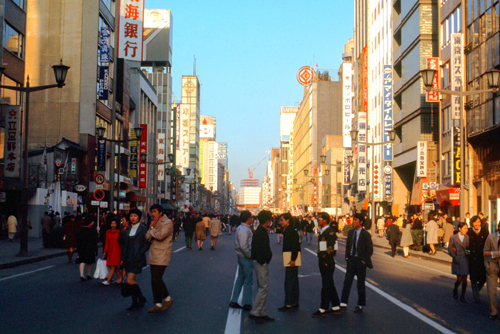
The Ginza
|
|
These "bricktown" buildings were initially offered for sale and later were leased, but the high rent prevented many of them from being permanently occupied. Moreover, the construction was not adapted to the climate, and the bold design contrasted the traditional Japanese notion of home construction. The new Ginza was not popular with visiting foreigners, who were looking for a more Edo-styled city. Isabella Bird visited in 1878 and in 1880 implied that Ginza was less like an Oriental city than like the outskirts of Chicago or Melbourne. Philip Terry, the English writer of tour guides, likened it to Broadway, not in a positive sense.
|
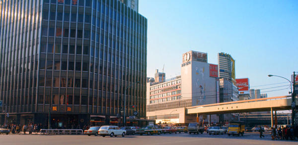
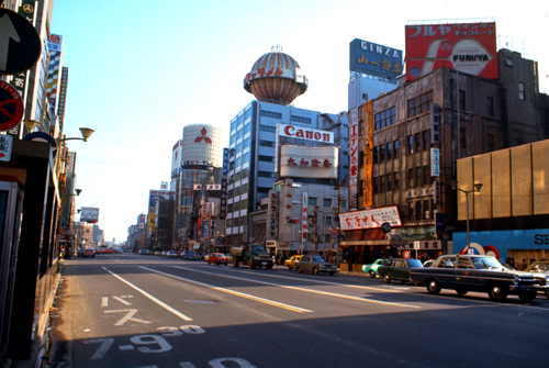
Almost none of these older buildings remain; by the time of my visit, there were a mixture of mid-rise buildings housing some corporate offices and low-rise stores and shops. Today's aerial views (and my return visit in 2004) reveal that the area has been almost entirely redeveloped, with many new highrise buildings. The scenese shown in the pictures above and below are long gone, as the Ginza has gone even more upscale than it once was. Its recent history has seen it as a prominent outpost of Western luxury shops.
The Ginza area was not yet the iconic center of world luxury brands that it is today back when I visited in 1971. It was certainly a vibrant, very busy area, but most of the buildings, except for the newest ones, were perhaps 3-8 stories high- some newer since the war and a few updated.
|
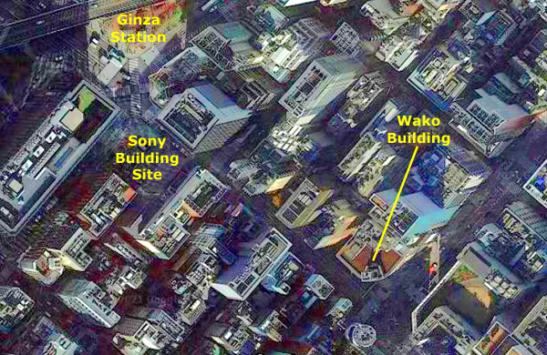
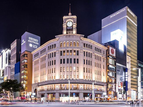
I noted in the Wikipedia article for "Ginza" that while all the Georgian buildings from the first half of the 20th century were gone, one of them, the the Wakō building with the now-iconic Hattori Clock Tower, still remains. The building and the clock tower were originally built by Kintarō Hattori, the founder of Seiko. I was able to locate this building on the aerial view (since I had its address), and you can see that I have marked it at left.
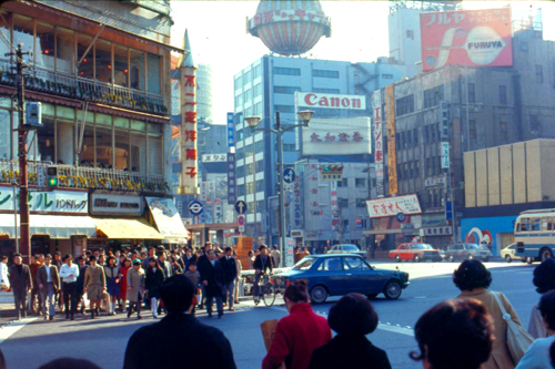
On the off chance that I might have photographed it, I looked through all my pictures for the famous clock tower, figuring that if I had seen it, I would have taken a picture of it, but I could not locate it. But then I noticed one of the pictures I took from a busy corner in Ginza, and perhaps if I juxtapose a picture of the Wakō building with this picture, you will notice the same thing I did:
|
|
Compare the picture of the Wakō Building at left, above (courtesy of Wikimedia Commons), with my picture taken at a major Ginza intersection in 1971. Look at the building seen partially at the left of my picture, and compare its facade to that of the actual Wakō Building. You can see that it is indeed the same building. That precisely locates where I was standing when at least one of my 1971 pictures was taken!
Here are two pictures taken at a different intersection:
|
|
In my investigations while I was creating this page, there was another situation in which my pictures didn't dovetail with the aerial view of today, but for good reason.
|
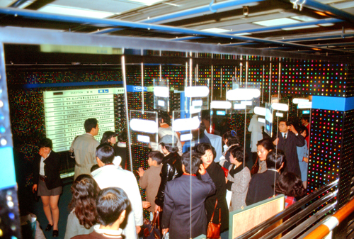
| The new Sony Building, facing the Sukiyabashi intersection on Ginza, has been a well-patronized showplace from the day it opened. Color television on every floor, a seventh-floor Italian restaurant that's built partly of marble and is open until 2 a.m., an ice-cream parlor on the 4th floor, men's and women's clothing shops, a bamboo pipe organ, and a basement American-type drug store would be more than enough to draw the crowds. But, added to the above, you'll find Sony's own showrooms displaying all the latest in radios, TV sets, tape recorders, and video phones. One device, a set of fairly low circular stairs, plays the notes of the scale as you ascend, and when you walk down the other side you can see a slightly-delayed TV tape of your movements. This contraption is already is in demand by wealthy golfers who can spend 30 seconds practicing three swings and then raise their heads to watch the playback. The Sony showrooms, opened to the press with a big party at which miniature reproductions of the building containing radios were handed out, are open till 8 p.m. There's an attractive, street-level coffee shop, The Cardinal, and the basement leads not only to the soda fountain-drugstore but also to the subway. |
We walked into the building, and found that it had a central stairway, which is more or less circular. Each floor has four different levels, divided into fourths, and the stairs in the center lead from level to level. It's like a spiral staircase with landings every quarter turn.
Each level has something different. One of the exhibits has a picture of the Matterhorn on the wall that looked so realistic that I almost took a picture of it. Another floor had a computer simulation designed to test one's intelligence. I flunked, but then I can't read Japanese. Finally, on top, another restaurant, offering a fair view of the city.
|
|
On the upper levels, we found that there were places you could get away from the central stairway and look outside:
|
|
NOTE from 2021:
A major renovation was made in 1992, with the exterior restored to its original condition. Exterior louvers and tiles were replaced, new entrance doors were installed, and the small square at the corner of the intersection was renovated. The original facade, a light display consisting of a large number of 5-inch cathode ray tubes, was replaced with 74 aluminum panels. Interior renovation was done at this time as well. Twenty-five years later, in 2017, the entire building was demolished. A new Sony building is to be built on the site, but, at the moment, it is a small park. You can see that park on the aerial view above, although the new building is supposedly now under construction.
|
Each Saturday and Sunday, from 12:00 p.m. until 5:00 p.m., the main street through Ginza is closed off to road traffic, allowing people to walk freely. This is called Hokōsha Tengoku or Hokoten for short, literally meaning "pedestrian heaven". There are some people who do street performance such as magic and playing instruments. As a famous photo spot, some cats sleep on signs, where people can put their own cats onto these signs. The location where cats are is different depending on the date. In Japanese folklore, cats have protective powers and symbolize good fortune. A bobtail supposedly lured a feudal lord with a "come hither" gesture, which saved him from being struck by lightning. Today, business owners put "maneki neko" (beckoning cat) statues in front of their shops, in hope that the moving paw will bring in customers.
Here are a couple more pictures taken this afternoon 1n Ginza:
|
|
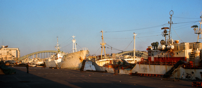
The Harbor
|
Just adjacent to the central area of Tokyo, there is (or was) a kind of inlet from the main part of Tokyo Bay. Beginning in the early part of the 20th century, various land reclamation projects have been undertaken to create usable land that is essentially in the city center. Up through our visit, these areas have been used for industrial purposes (and of course, during the War, for military ones). It was not until the 1990s that the reclamed islands were seen as a potential for residential and commercial areas. By the present day, there are numerous neighborhoods of highrise apartments, complete with the commercial areas needed to serve them. The northernmost of the islands, the ones we saw in the pictures we took, have become very desirable residential areas, and are now connected to the mainland with numerous bridges as well as subways.
It took us about a half hour to walk south to the harbor area, but it was a nice walk.
|
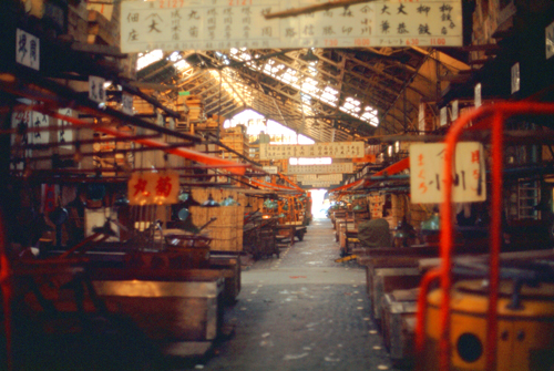
We walked through the interior of the fish market, which is deserted now, at four in the afternoon, but which will be jumping at four in the morning. Everyone's tools were all laid out, aprons hanging unused, and a layer of fish scales over it all.
|
Beyond the ships, you can see some of the buildings that have been built on landfill in the bay. There were articles in Fortune, I recall, some time ago, about the Japanese efforts to expand the city of Tokyo by creating land in the middle of the bay. This has apparently been done. Are these buildings constructed on compressed garbage with a layer of soil?
I have not been in harbor areas like this much- at least not since moving away from Muskegon- so I found it very interesting just to wander around looking at the names on the different vessels. There were Korean, Japanese, American and French vessels tied up there, and also some that I think were from China. The names looked Chinese, but I don't know if Japan trades with them or not. I suspect they do; everybody else does.
|
So we wandered around the harbor area for a while, and I just snapped photos of anything I thought looked interesting. It turns out that I have a good deal to learn about photography- including shot composition, holding the camera still in low light, and so on. So some of the pictures I took aren't really all that great.
I have put the pictures I took into a short slideshow to make it easy for you to have a look at them. If you will click on the image at right, I will open this slideshow in a new window. You will be able to use the little arrows in the lower corners of each image to go forward and backward through the eight pictures, and you can use the index numbers in the upper left to see just where you are in the show.
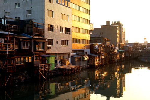
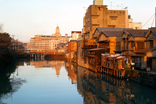
Leaving the actual harbor and its maritime scenery, we started walking back, and on the last waterway we crossed I got a couple of nice pictures. I really think that these are two of the better slides. The combination of the yellow light, the reflections in the water and the mixture of new and old lend a kind of timeless quality to the scenes, and there is much of interest to be found in them. Even the really old structures seem to be clean and neat. Either of these would probably make a pretty fair jigsaw puzzle.
|
|
We decided that we would try to make one more stop during this particular day, with the expectation of the Mongolian Barbecue for dinner. So, we got out the map, and located the nearest subway station, preparing for a trip out to the Tokyo Tower.
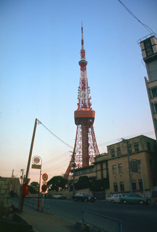
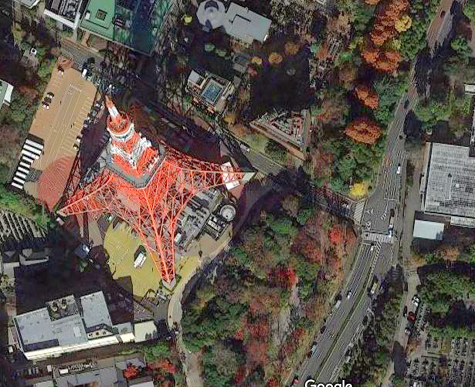
Tokyo Tower
|
We are getting pretty good with the subway, and only about twenty minutes after leaving the harbor we'd come up aboveground at the subway station nearest to the tower.
The Tokyo Tower (officially called the Japan Radio Tower) is a communications and observation tower in the Shiba-koen district of Minato, Tokyo. At 1,092 ft, it is the tallest structure in Japan. The structure is an Eiffel Tower-inspired lattice tower that is painted white and international orange to comply with air safety regulations.
Built in 1958, the tower's main sources of income are tourism and antenna leasing. The tower gets close to a million visitors a year; there is a four-story building directly under the tower that houses museums, restaurants, and shops. Departing from there, guests can visit two observation decks. The two-story Main Observatory is at 490 ft, while the smaller Special Observatory is at a height of 819 ft. The tower is repainted every five years, taking a year to complete the process.
|
|
Since its completion in 1958, Tokyo Tower has become a prominent landmark in the city, and frequently appears in media set in Tokyo.
A large broadcasting tower was needed for the Tokyo region after NHK, Japan's public broadcasting station, began television broadcasting in 1953. Private broadcasting companies began operating in the months following the construction of NHK's own transmission tower. This communications boom led the Japanese government to believe that transmission towers would soon be built all over Tokyo, eventually overrunning the city.
The proposed solution was the construction of one large tower capable of transmitting to the entire region. Furthermore, because of the country's postwar boom in the 1950s, Japan was searching for a monument to symbolize its ascendancy as a global economic powerhouse.
|
Originally planned to be taller than the Empire State Building, a lack of both funds and materials kept the tower to a height just sufficient for the region's TV stations broadcast range- about 90 miles. The structure's designer, Tachū Naitō, based his design on the Eiffel Tower in Paris, but engineered the structure to withstand a 140-mph typhoon and twice the intensity of the 1923 Great Kantō earthquake.
The project attracted hundreds of the traditional Japanese construction workers who specialized in the construction of high-rise structures. Construction began in June, 1957; a third of the steel used was scrap metal taken from US tanks damaged in the Korean War. On its completion in October, 1958, Tokyo Tower was the tallest freestanding tower in the world, taking the title from the Eiffel Tower by nine meters. Its final cost was $8.4 million and it remained Japan's tallest structure until 2010.
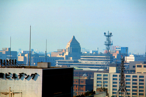
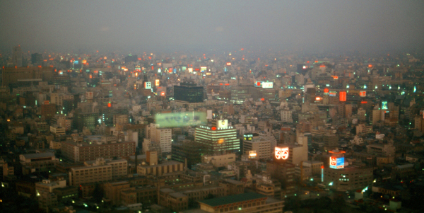
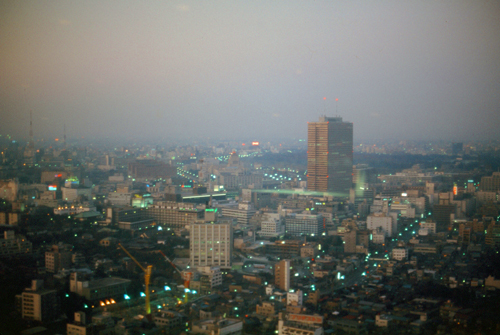
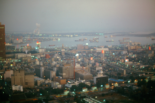
From the upper observation platform in Tokyo Tower, we got a lot of views of the city. In one, we could plainly see the Ginza area; in another, we could pick out The Sanno Hotel, the Assembly building and the Imperial Palace. We could also see Tokyo Bay and the monorail to the airport:
|
|
We had planned a trip to Nikko trip for the next day, so we returned to the hotel, ate, and did some wandering around that night. We had not planned on the length of the Nikko trip, however, nor had we planned on having to make reservations a day in advance, all of which we found out after getting up on Monday the 24th, rather late, and getting to the travel office at Tokyo Station.
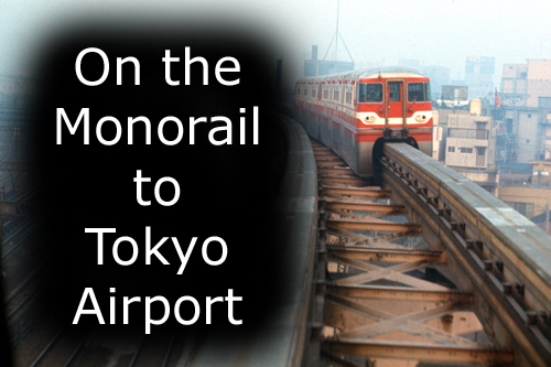
The Monorail to the Airport (January 24th)
|
Although the weather was kind of crappy, I did take a series of pictures- on the ride to the airport, at the airport (including the first time I saw one of the new Boeing 747 aircraft), and on the return trip. As these pictures don't require much explanation (except to say that the monorail passes close to the Ohi Racetrack), I have put them in a slideshow for you. To see my pictures, just click on the image at left and I will open the slideshow in a new window. You can click on the little arrows in the lower corners of each image to move from one to another, and you can track your progress by referring to the index numbers in the upper right. Just close the popup window when you are finished.
Planning for Japan's first airport rail link began in 1959 ahead of the 1964 Summer Olympics, although construction did not begin until 1963. The line was completed in 1964, just 23 days ahead of the Olympic opening ceremony.
NOTE from 2021:
When we rode, the monorail made no stops, but in the years since, 11 intermediate stations have been constructed along with a couple of extensions. Also, another conventional rail line also has been constructed to serve the airport, and both have been integrated into the Metro area transit system.
I find it fascinating that often rail, subway and other stations for transportation media were actually inside one building or another, and sometimes, as was the case in Shibuya, it is hard to tell where the building stops and the transportation system starts.
At the End of Our Day
We got off the train and started looking for all the small clubs and coffeehouses described in the guidebook, but we had unfortunately gone out the back, rather than the front, of the building, and thus didn't find what we were looking for until it was too late to stay. We wandered around for a while, up this street and down that one, until we finally got headed in the right direction. It was near here that we encountered the only area reminiscent of Korea that we found, and it was a small area just jam-packed with eating places, all of them small, all of them haphazard, all of them full, and some with very well-dressed people. There were also sidewalk vendors, a few of whose wares we sampled, and it was all very good, but not the kind of stuff you make a meal out of. Noodles and fish predominate, with rice and chicken second.
Each establishment has a distinctive curtain, the noren, which tells what type of food is served, and the family name of the owner. Young entrepreneurs with ambition will apprentice themselves out in one of these shops, and after a time branch out on their own, perhaps right across the alley. By God if we didn't stumble into another good bakery.
As dinner time approached, we decided to head back to the Sanno, this time re-entering the station from the back, which we were chagrined to find was really the front. Immediately we could see all the landmarks indicated in the guidebook, and there was little we could do but plan to return later. There were more people and more neon signs that even in the Ginza.
Back at the Sanno, we found that Monday was the only night they did not serve the Korean barbecue, so we went out to a restaurant in Akasaka, and had some tempura, soup and beef dishes. Since our train reservations were on the 7:45 train from Tokyo station to Nikko, we had to be up about six.
|
January 25, 1971: A Day Trip to Nikko and Lake Chuzenji |
|
January 21-22, 1971: Circumnavigating Tokyo; Yokosuka Navy Base |
|
Return to the Index for the Japan Trip |