|
July 11, 1971: Oahu's Leeward and North Shores |
|
Return to the Index for My Visit to Hawaii |
When I landed in Hawaii, the first thing I thought I should do was to go and check in to the Officer's Billet at Fort DeRussy, and so I should talk about that first.
Fort DeRussy
|
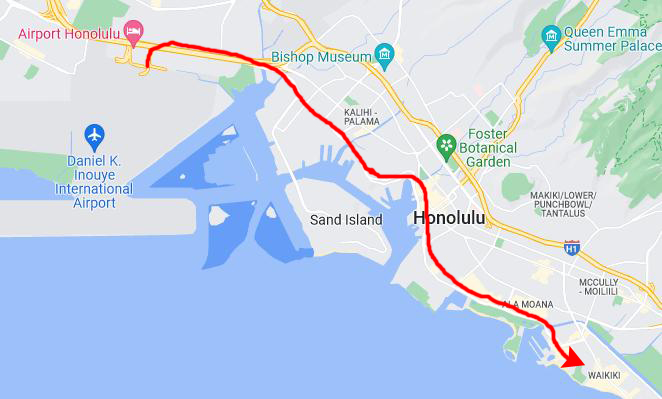
We might as well begin with the airport itself. The Honolulu Airport (HNL) opened in 1927 as John Rodgers Airport, named after World War I naval officer John Rodgers. The military took it over in 1941, but it was returned to the Territory of Hawaii in 1946, vastly expanded into one of the largest airports in the United States and its territories. The next year, the airport was renamed to Honolulu Airport in 1947, and then to Honolulu International Airport in 1951.
Being near the center of the Pacific Ocean it was a stop for many transpacific flights, and by 1950 was the third-busiest airport in the United States and had the world's longest runway until 1953. Jet service began in 1959. The new John Rodgers Terminal was dedicated in 1962, and it was this terminal that I arrived at, although it was just beginning an eight-year renovation. In 2017, the airport was renamed to Daniel Inouye International Airport, in honor of the recently deceased Hawaii Senator and Medal of Honor recipient.
The information I had from officers who'd stayed at Fort DeRussy before was that there was a military shuttle from the airport to the Fort, and arrangements could be made for it at the USO counter near the entrance to the concourses. I did have to wait a while, but at least I didn't have to figure out the taxi or airport bus situation right off the bat.
So the military bus (which was not a typical Army-green vehicle but something that resembled a small city bus) brought us via a seemingly roundabout way to an area right by the beach right at the west end of the area known as Waikiki. The Fort didn't have gates or fences, but it just seemed to be a big open area with some typical nondescript government buildings, including a couple that looked like dormitories. One of them was the BOQ. The bus dropped about six of us off at a small admin-type building where there was a little office where we could check in and get room assignments.
|
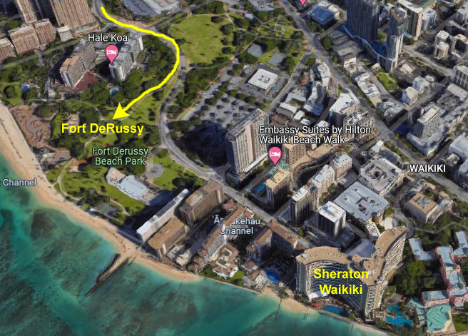
At the turn of the century, a Chinese millionaire merchant who had built a villa on the property sold it to the United States Army Corps of Engineers, who then constructed Batteries Randolph and Dudley (no longer extant). Additional land was obtained from a Hawaiian noble and her husband. The area was named for General René Edward De Russy (1789–1865), a former Superintendent of West Point.
Located on Waikiki Beach, near Oahu's historic Royal Hawaiian Hotel and the Moana Hotel, the former Shore Battery Randolph was last used as a site for servicemen on Rest and Recuperation (R&R) during the Vietnam War, and at the time of my arrival was still in use for that purpose. (Fort DeRussy would continue to function as an R&R center using the buildings then extant until 1975.
At that time, the character of the "Fort" would change. It would become a facility used for government meetings, it would host a new museum, and a new, modern hotel would be built on the site. This facility, with almost 1000 rooms, would be usable by active and retired military and DoD employees, as well as a few other classifications of individuals. The aerial view at left shows this new Hale Koa Hotel situated on the otherwise open area. Fort DeRussy had never been fenced off (although the shore batteries were), and today the public still has access to the land itself, although services at the hotel are not available to them.
So I was fortunate in that I could stay here even though the modern hotel had not yet been built. My own single quarters were in a long, low, two-storey building. The rooms were quite plain, with military furnishings, a window AC unit, and a small private bath. Very luxurious by the standards of my BOQ in Korea, but much like the BOQ I lived in at Fort Lee, Virginia, just prior to my tour in Korea. Even better, the cost was nominal- a dollar or two- really little more than a cleaning fee for the room. Compare this to a typical Waikiki Hotel nearby going for $30-50 per night. It was certainly more in line with my salary of about $500/month!
|
LT Peter Cannon was one of my best friends while I was in Korea; he also worked in the Finance Office. I met him on my very first day in-country, and over the subsequent year learned much about his background and family life. He was born and grew up in Honolulu, certainly one of America's iconic, exotic locations, in a state that most of us would consider a paradise. He'd also been to this part of the world before, with his family when he was younger.
Pete's tour ended about a month before mine; in fact, his Army Service ended at about that same time. He returned to Hawaii, was mustered out, and then he began something of a backpacking tour through Asia and Australia. Before he left, I mentioned that I planned to make my first visit to Hawaii on my way home. He gave me numerous recommendations for places to visit and things to see, but he went beyond that to give me his parents' telephone number. He said I should call them when I arrived as they would probably like to have me over to his house. I thought all this was very, very good of him.
When I landed, I did stop at a pay phone and called Pete Cannon's home. I spoke with his mother, who said that Pete had indeed told her I would be calling. Apparently, he had told them a good deal about me as she immediately invited me to their house for dinner on my first night here.
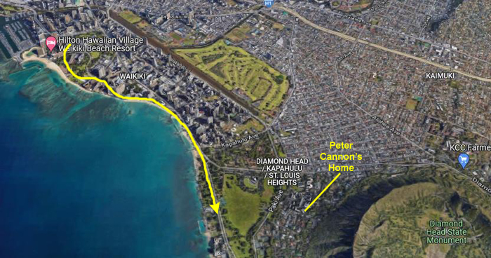
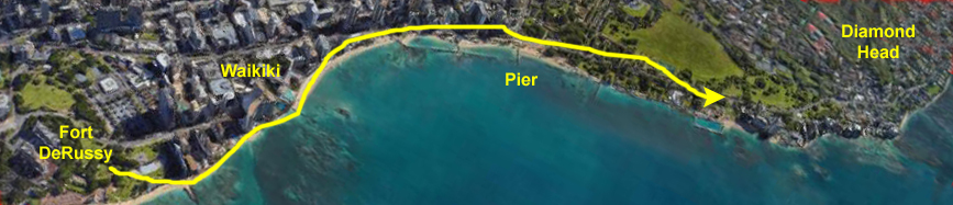
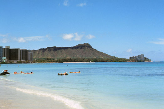
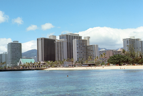
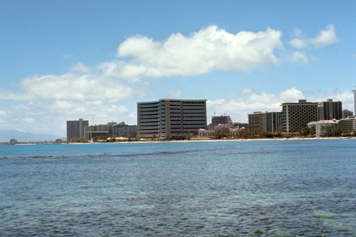
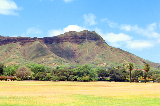
But on this first afternoon, I just left Fort DeRussy and walked over to Waikiki Beach to head southeast towards Diamond Head, just to see what I could see. Here is an aerial view (circa 2020, of course) of the area I covered. I have rotated the view so southeast is at the right:
|
Here are the pictures that I took while on my walk this afternoon:
|
|
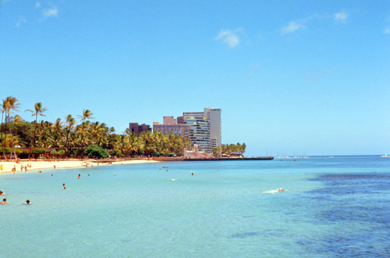
As the beach widened out near Kapiolani Park, I found a series of piers and breakwaters that protect the beach itself from major erosion, and so I was able to walk out on them to get some pictures that look as if I was on a boat or something. I was impressed by just the water- all blue and turquoise. Very different from the often dull, dirty green you see on Atlantic beaches.
|
|
In the right-hand picture above, the iconic, curved Sheraton Waikiki is right in the center of the picture. I would come to know it well in the future, staying there at least five times on various trips to the islands.
|
If you are curious, the four "directions" locals on Oahu use are not based on compass points, but on features that everybody knows. If someone says that something is "Diamond Head" from something, they simply mean in the direction of that almost-always-visible feature. Of course, "Diamond Head" can mean different compass directions depending on what you are "Diamond Head" from. If you go "Diamond Head" from the Sheraton Waikiki, for example, you will be heading generally southeast. But if you are in the suburb of Kailua, Diamond Head is south of you.
The other directions are "Pearl" (towards Pearl Harbor, generally west of Fort DeRussy), "Ewa" towards the ocean (which obviously means different directions depending on where you are, but which locals accept means towards the ocean off Waikiki), and "Lanai", which means "towards the mountains". I discovered that these directional indications are really only used in the city of Honolulu, and not, for example, on the North Shore on the other side of the island.
|
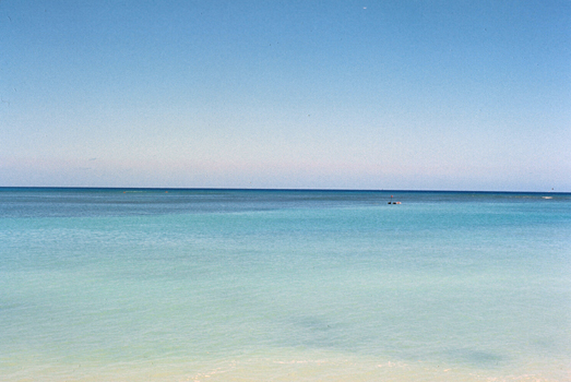
In all the pictures I took this afternoon, you will note the difference in the weather as compared to either Japan or South Korea. The weather was uniformly wonderful throughout my week here, although there were rather more clouds over on the Big Island. I remember only one minor shower, and that occurred in early evening and was soon over. It does not usually rain during the day unless there is a storm.
After walking around for a while, I went back to my room on Fort DeRussy and got ready to go visit Pete Cannon's family. Armed with their address, I grabbed a taxi on Kalakaua Avenue, not quite sure how far it would be.
The taxi dropped me off at a beautiful, rambling house partway up the Pearl slope of Diamond Head crater. His parents were very, very nice, and anxious to hear any stories I could relate that involved Peter or the goings on at Camp Howze. Peter was not, apparently, a frequent letter writer. I enjoyed the dinner very much, but what absolutely floored me was when Mr. Cannon (an officer at the Bank of Hawaii) found I had not rented a car and offered me one of their cars to use while I was on Oahu! He said Peter had actually suggested that they do so, and I gratefully accepted.
Having access to the vehicle, which I was able to park near the BOQ on Fort DeRussy, enabled me to visit all four sides of the island, see the Punchbowl and pineapple plantations, and go to the Arizona Memorial without having to worry about taxis or getting back out to the airport to try to rent a car. If I recall correctly, the vehicle was a Buick.
I came back to visit the Cannons again on my next to last night in the Islands, and we had another nice dinner. By then they had an update on where Peter was, which was in Singapore. If I returned to the Islands, I hoped that I might be able to see Peter and thank him as well.
You can use the links below to continue to another photo album page.
You can use the links below to continue to another photo album page.
|
July 11, 1971: Oahu's Leeward and North Shores |
|
Return to the Index for My Visit to Hawaii |