|
July 13, 1971: Marineland of the Pacific/Polynesian Cultural Center |
|
July 11, 1971: The Leeward and North Shores |
|
Return to the Index for My Visit to Hawaii |
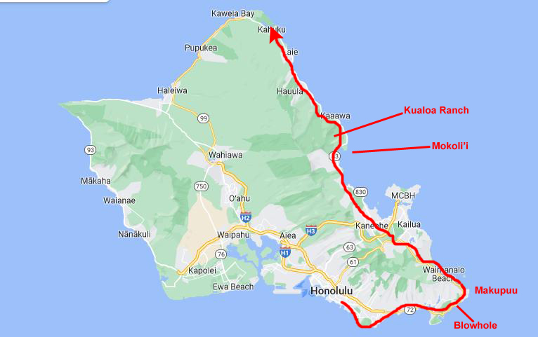
Today I am going to continue to make use of the car that the Cannons have lent me to make another excursion- this time to the Windward (East) coast of Oahu. This side of the island starts at Diamond Head, passes Koko Head and the cities of Kailua and Kaneohe, and then continues up north to Kahuku Point. This side of the island is as rough or rougher, terrain-wise, than the West Coast.
|
On this, my first day, I am planning to simply drive along the coast road from Waikiki all the way to Kahuku Point- the northeast tip of Oahu. I will circle south of Diamond Head and then up the coast past another extinct volcano crater at Koko Head.
Then I'll head more north around Makupuu Point and up into the small cities of Kailua and Kaneohe, the latter situated at the head of a major inlet. Then I will just drive along the coast going north, just seeing what I can see.
I didn't know much about what I would find on my drive, which took most of the day, and as it turned out I passed two attractions that I would come back to see on another day- Marineland of the Pacific and the Polynesian Cultural Center. I ran across each of these on my drive, and I didn't think that I had time to see them both and accomplish my goal of getting familiar with this coast of the island.
So let's drive up the east side of Oahu by first heading east from Waikiki and around the base of Diamond Head to come into an area known as Kawaikui Beach. This relatively narrow area lies at the base of a long series of ribbed ridges; the series runs from west to east, and the individual ridges run from north to south. At the east end of this section of the highway is the Hanauma Bay Nature Preserve, and here the road turns to the northeast- heading towards Koko Head- another volcano crater, but smaller than Diamond Head.
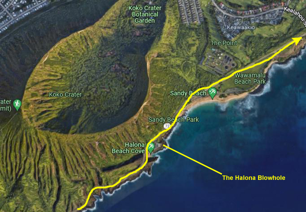
The Blowhole
|
The first thing I want to mention was that while the guidebook talked about the crater (and about Diamond Head, of course) I missed where it mentioned that there were trails to the rims of both craters (and in fact you can get down into Diamond Head). Had I been aware of this, and had I done some investigation, I might have put a day trip to Diamond Head on my agenda, and I certainly would have allocated a couple of hours for the trail that started just a mile or so behind me and went to the rim of Koko Crater. I'd already allocated all my time here when I became aware of these things, and I recall thinking that perhaps I would be back here sometime and would do both hikes.
Koko Head is the headland that defines the eastern side of Maunalua Bay, and it is comprised to two tuff cones- Koko Head and the taller Koko Creater (1200 ft.). Koko Head itself has three significant depressions or old vents, the largest of which forms the well-known Hanauma Bay. This eastern end of Oʻahu is quite scenic and most of the area is part of Koko Head Regional Park, which has numerous natural features.
Koko Crater is the large tuff cone that visually dominates the area, while Hanauma Bay is another tuff ring that has been breached by the ocean. Lānaʻi Lookout is a scenic lookout that features a very distant view of the Island of Lānaʻi and a better view of Molokaʻi. I am parked, of course, at the Hālona Blowhole- right across from Hālona Cove (best known as the site of the love scene between Burt Lancaster and Deborah Kerr in the movie From Here to Eternity. Finally, just a few hundred feet up the coast is Sandy Beach, popular for surfing and extreme water sports.
|
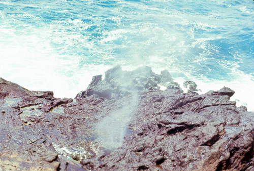
On windy days when the tide is high, the ocean breeze sends the waves rolling on to the shore where the rock formation then shoots sea spray high into the air through the cave acting like a geyser. The blowhole is most active when the tide is high and the winds are strong, and it can shoot sea spray up to thirty feet high in the air.
Hālona Point is a tourist spot, with visitors coming for the scenery, the beach at the cove, and in the winter as a spot to go to see humpback whales or Honu turtles (Hawaiian Green Sea Turtles). The blowhole is perhaps the most popular rock formation of its kind found in Hawaii.
I waited for a bit in the parking area to see where the geyser would form, and then walked down a short way towards the actual blowhole to stand in an area that didn't look as if it was getting sprayed. Then I waited a bit longer to gauge when the geyser might shoot up in relation to the waves coming in. Finally, I went for a picture as the geyser came up, and the result was the photo at right.
The Hālona Blowhole was formed thousands of years ago during the period of volcanic activity in Oahu, with Koko Crater's lava flowing into the ocean. The lava tubes extend into the ocean which are narrow at the top. There is also a narrow rift along the base of the cliff which was formed by a large section of rock that broke away from the land.
|
Hālona Cove, called "Cockroach Cove" by the local population, is the small pit of sand close to Hālona Blowhole, visited by tourists and locals for swimming when the surf is calm.
In a large wedged shape area next to the cove is a reef coated with Sinularia Leather Coral, with different species of fauna like echinoderms, slugs, corals, and eels.
This was the site of the love scene between Deborah Kerr and Burt Lancaster in the 1953 film From Here to Eternity.
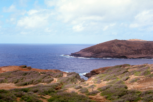
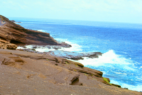
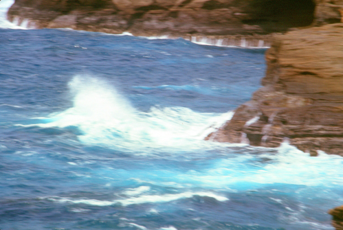
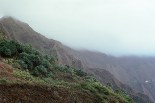
Generally, though, the coast here is very rugged, the volcanic lava flows not having had nearly enough time to erode away into any kind of more beach-like area. Indeed, the Hawaiian Islands will never look anything like East Coast (of the continental US) beaches, or even California ones, since the Hawaiian Islands are actually mountaintops that stick up above the ocean. The slopes are way too steep for there ever to be the kind of flat areas conducive to the formation of wide, sandy beaches. The islands themselves would erode away and drop below the ocean surface long before that happened. Here are a couple of views of this coastline:
|
|
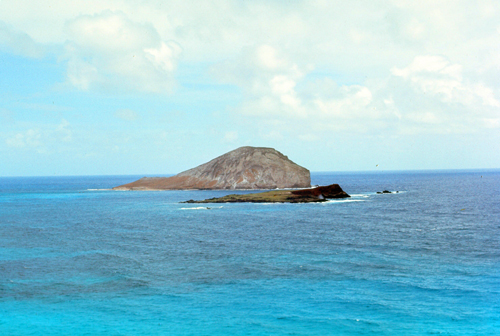
Makapu'u Point
|
The lookout point is located within the 38-acre Makapu'u Point State Wayside Park, which also encompasses Makapu'u Head and the Makapu'u Point lighthouse. The lighthouse can't be seen from the lookout. To get there, one has to walk up the paved road that begins just below the entry to the lookout (on the Hawaii Kai side of the lookout). It's a 1.75-mile trail, and while it sounded interesting, I eschewed it in favor of continuing my slow drive up the coast.
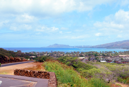
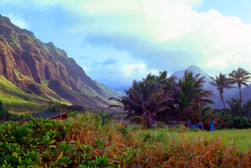
Along this side of the island, a highway parallels the shore, and it lies between the ocean on one side and these steep mountains, the Koolau Range, on the other.
The Cities on the Windward Coast
|
Kāneʻohe ("bamboo man") gets its name from an ancient Hawaiian story about a local woman who compared her husband's cruelty to the sharp edge of cutting bamboo; thus the place was named Kāneʻohe or "Bamboo man". Kāneʻohe is larger than Kailua. From ancient times, Kāneʻohe was important as an agricultural area, owing to an abundance of rainfall. Today, Kāneʻohe is mostly a residential community, with very little agriculture in evidence. The only commercial crop of any consequence in the area is banana.
The Northern Part of the Windward Coast
|
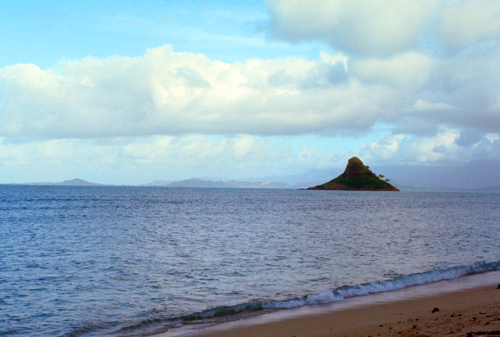
Mokoliʻi translates from Hawaiian as "little lizard." According to the Pele epic in Hawaiian mythology, while the goddess Hiʻiaka was traveling to retrieve Pele’s lover, Hi’iaka killed an evil giant lizard at Kuala. Part of its body fell into the bay and became Mokoli’i: the island is the tip of the tail sticking out of the water. The closest land on the main island is Hakipu’u, which bears the broken spine of the lizard, with "haki" meaning to break or broken and “Pu’u” meaning the hill or back.
The islet is owned by Honolulu County and is unpopulated. Both the wildlife and plants of Mokolii have been affected by the presence of non-native species, in particular the black rat and yellow crazy ant. Although other species of birds previously nested there, the wedge-tailed shearwater is the only species of bird that nests on Mokolii. Seventy-two species of plants have been identified, the majority of which are invasive non-native species. This does not sound like a place anyone would want to visit.
Along my entire drive I could imagine the violence of the prehistoric forces that built the Hawaiian islands from the incline of the rocks close to the shore. I could also tell, that the islands were quite new, relatively speaking.
|
Kualoa, incidentally, is a 4,000-acre private nature reserve and working cattle ranch, as well as a popular tourist attraction and filming location here on the windward coast. I am about 24 miles from Honolulu, and 15 miles from my destination at Kuhuku Point.
The valley was sacred to ancient Hawaiians from the 13th to the 18th century, as Chief Laʻa-mai-kahiki settled there after visiting Kauaʻi before returning to Tahiti. It was also the site of the sacred drums of Kapahuʻula and Kaʻahuʻulapunawai as well as the sacred Hill of Kauakahiakahoʻowaha, the key to the sovereignty of the Kingdom of Oʻahu. As written in the Kumulipo, an ancient Hawaiian genealogical chant, Kualoa is where Papa and Wakea buried their first still born child, Haloa. It is said that the first kalo (taro) plant grew up from where Haloa was buried at Kualoa.
In 1850 an American doctor, Dr. Gerrit P. Judd purchased the first 622 acres of ranch land at Kualoa for $1300, and also the island of Mokoliʻi just offshore, from King Kamehameha III. Dr. Judd was the first person to translate medical journals into the Hawaiian language for King Kamehameha and so the king was very grateful for his works.
In 1863 Charles Judd and his brother-in-law Samuel Gardner Wilder started a sugarcane plantation and built a sugar mill at the ranch. Several years of low rainfall brought sugar farming to a close, and the mill closed in 1870. The ruins of the old sugar mill can still be seen along Kamehameha Highway. In 1941 during World War II, the U.S. military occupied the land, which became the site of Kualoa Airfield. After the war the ranch was returned to the Morgan family, the owners and descendants of Dr. Judd.
I suppose one reason why rain is so infrequent during the day is because the breezes blowing in from the ocean serve to keep the clouds perched on top of the mountains. At night, when the winds reverse themselves, the clouds descend and drop what rain they have in gentle showers- just like Camelot. You can see this occurring in the last two pictures that I took here on the eastern shore of Oahu:
|
|
Evening in Honolulu
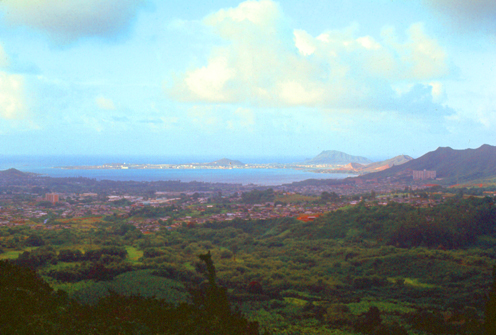
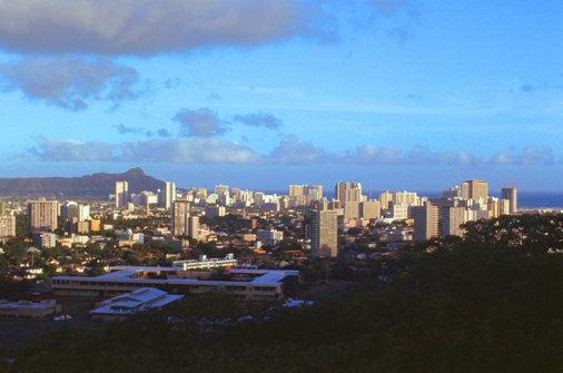
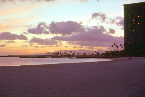
So I spent a very pleasant evening in Waikiki. First, I followed my little tourist map and drove up one of the mountainsides to an overlook that had good views of the city, and then I came back down to Fort DeRussy, left the car, and walked over to the beach. I got two good sunset pictures- one from each location.
|
|
I did some more walking around Waikiki and ate dinner at a very good buffet restaurant where, incidentally, I consumed a good deal of very fresh pineapple. There is always a lot going on along Kalakaua Avenue, as "tourist season" in Honolulu is pretty much all the time. The hotels are all full and so there are scads of people from all over the planet having a good time here.
You can use the links below to continue to another photo album page.
|
July 13, 1971: Marineland of the Pacific/Polynesian Cultural Center |
|
July 11, 1971: The Leeward and North Shores |
|
Return to the Index for My Visit to Hawaii |