|
July 15, 1971: The Big Island/Northeast Coast |
|
Return to the Index for My Visit to Hawaii |
Today I am going to spend the rest of the time I have here on Hawaii to explore Volcanoes National Park south of Hilo. I will spend the day there and fly back to Honolulu late this afternoon. And since I will be leaving Honolulu early tomorrow morning to get back home, I will go ahead and add that bit to this page as well. I got up and left fairly early- stopped in Hilo to have some breakfast, and then headed off down the Hawaii Belt Highway towards the park.
Volcanoes National Park
|
|
Volcanoes NP Crater Rim Drive
The ranger had suggested that I make my first stop the Haakulamanu Sulphur Banks which were only a quarter mile across the parking lot just northwest of the Visitor Center. So I left the car where it was and headed over there. At the beginning of the short trail there were the usual disclaimers, but then I took the short trail to the
Sulphur Banks, a formation at the base of a twenty-foot cliff where there are a number of steam vents that leave thick deposits of sulphur on the broken rocks at the cliff's base.
The Sulphur Banks were an interesting place, but just a small taste of what the park had to offer. With all the rain this area gets, you'd expect a lot of vegetation, and there was, including some plants and foliage that seem to like the steam or the sulphur or both.
|
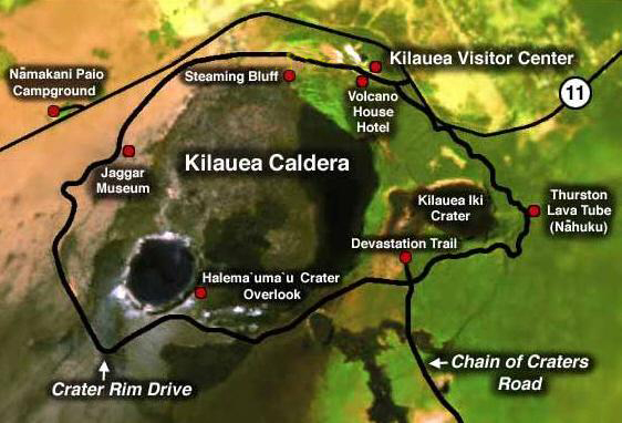
One possibility would be to use an aerial view, as I've done elsewhere in this photo album. But this turned out to be a poor solution. The aerial views available on the Internet at the moment can only seem to orient you to the major features of the park- basically the Kilauea Caldera and one or two of the major craters. But you can't make out roads or trails very well, and that's a major part of what I want to show you.
So I decided to use the clearest available park map that I could find, and I did find a very good one on the National Geographic website. That map is reproduced at left. I am putting it here so when I mention some of the stops along the Crater Rim Drive you will be able to see about where they are.
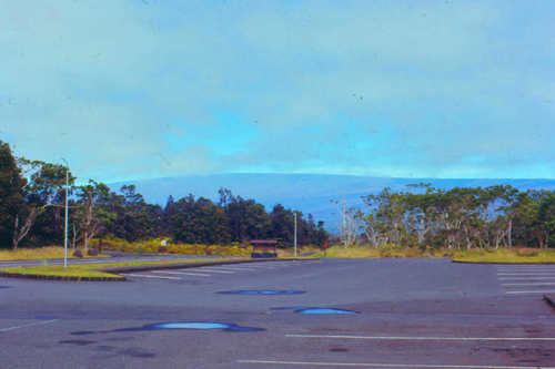
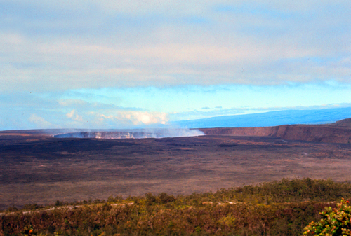
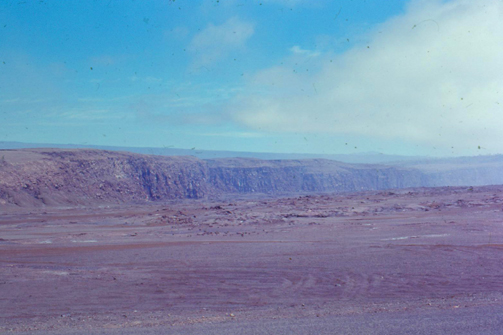
So, from the parking area I started driving counterclockwise around the Kilauea Caldera, and it wasn't long before I was able to get some good views of the currently-smoldering crater.
|
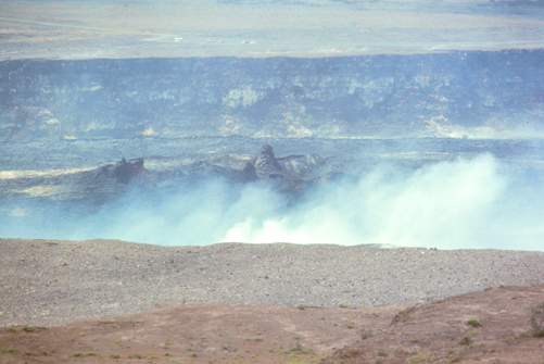
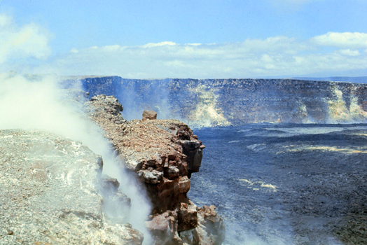
It's not easy to see from either the aerial view or from my pictures, but the Halemaumau Crater is actually a further depression in the caldera, currently another eighty feet deep. The depth of the crater and of the caldera change over time as magma pushes near the surface or then drains away.
The road soon came close to the rim of the Halemaumau Crater, and I got a couple of good pictures of the rim of this crater.
|
|
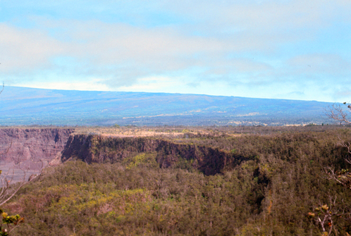
There are trails that lead across the Kilauea Caldera; apparently it is inactive enough that the risk is minimal. Indeed, other than at Halemaumau, there has not been an eruption in the rest of the caldera since the 1920s. From my vantage point on top of the cliffs I could see both the caldera and the crater.
|
|
Halemaumau Crater is the site of the most eruptions at the summit of Kilauea Volcano. Between 1905 and 1924, a period of about 20 years, a dazzling lake of molten lava circulated within its walls. Then, in 1924, the lake drained away, allowing groundwater to penetrate deep inside the volcano. Enormous steam explosions resulted, showering the landscape with rocky drbris, still visible around the rim today.
|
During the 1924 steam blasts, Halema'uma'u collapsed, forming a gaping pit about a mile wide and about 1200 feet deep. Since then, 17 eruptions and 4 collapses have occurred in the crater. The net effect has been a slight increase in the crater's diameter and a decrease in its depth from 1200 feet to a present-day 250 feet, somewhat deeper than the rest of the caldera.
As I was walking around this area, I could see a few leis that have been left here by tourists or locals; leis are those flower necklaces that are routinely given to arrivals in the islands or used in hula shows. I suppose that old traditions die hard, but what harm can it do? Actually, many Native Hawaiians still revere the goddess Pele, and frequently throughout the year they hold celebrations and give offerings here at Kilauea.
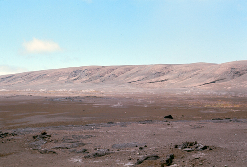
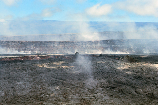
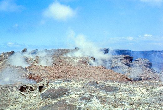
Continuing my drive, I want to try to show you how desolate the landscape is here in the caldera. Because minor eruptions happen fairly frequently, more major eruptions happen every generation or so, and there always seems to be steam rising from the landscape, there is little chance for vegetation to begin to break down the volcanic rock into soil that can support it. There are some stands of small trees and grass away from areas of activity, but most of the landscape might as well be the surface of the moon:
|
|
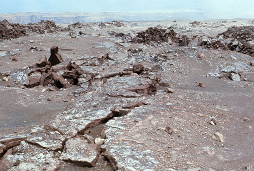
I continued around the Crater Rim Drive and eventually arrived at a point where the signage said there were some examples of "fissure eruptions" and so I stopped to take a look.
|
|
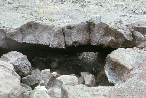
But at right was another fissure you could get close to, and this one had warm, slightly sulfurous air emanating from it. Not that it was about to erupt, or anything, but I wasn't about to stick my nose in it.
Some of the fissures seemed to have some sort of red coloration on the walls of the fissure, and the signage said that the coloration results from the oxidation of the rock by escaping gases. I enjoyed walking on this short trail to an observation area where I could see some of the fissures close up.
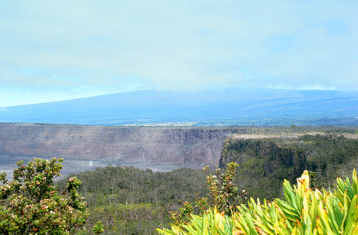
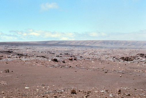
The day was getting warmer, but the humidity is not too high, so it is fun to walk around and look at things. This side of the caldera seemed dry in comparison to the area near the Visitor Center. As it turns out, this side of the Kilauea Caldera is called the Kau Desert, and it is in the rain shadow of the summit. The Kau Desert receives about half as much rain as Kilauea Visitor Center. It also bears the brunt of hot winds blowing volcanic fumes and natural acid rain— which stunts plants— down from above.
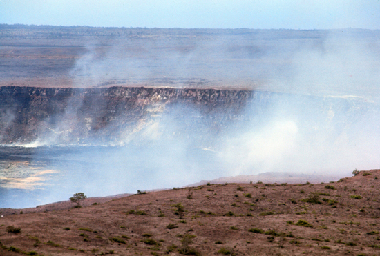
All around are the vistas of the Kau Desert in one direction and the constantly visible Halemaumau Crater in the other:
|
|
In the right-hand picture above, you can also see some small spatter cones on the caldera floor just this side of Halemaumau Crater. There are no trails down there, and I can only imagine that the caldera floor is very warm, if not hot, here.
|
|
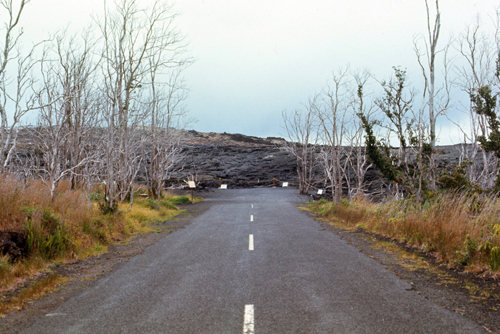
But it's not like some mud flowed across the road and all they have to do is get a bulldozer to remove it. The lava has solidified into solid rock, and I assume that it has bonded with the asphalt, so they will have to blow it up and then rebuild the road. I would not have wanted to be driving down this road when the lava flowed across it. I am told that there were some park vehicles that were trapped and had to be lifted out by helicopter.
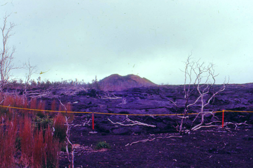
I also walked along the road that remained and took some pictures of the lava flow from that last eruption. These are both pictures of the same flow, and I think that it is also interesting that right in the middle of the flow there is another cone that must have been an additional vent that opened up when the flow had at least partially solidified:
|
|
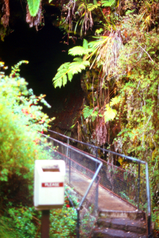
My last visit along the Rim Drive was the Thurston Lava Tube. I was actually able to park and go walk through the lava tube itself, but it was too dark inside to take pictures- even with the flash.
|
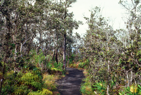
This loop trail began with a short walk down the paved pathway to the lava tube. By the time I arrived at the entrance to the lava tube, I was deep in a damp, rainy forest.
The trail now passes through a section of the Thurston Lava Tube. I did try to take some pictures inside the tube, but the tube is big enough that the flash doesn't do a good job of illuminating the walls. Some people had flashlights, but about the only thing to see is the water on the floor of the tube and the ferns and vegetation hanging from the walls and ceiling. There was a lot of water dripping in the tube.
At the other end of the tube, there is a small cave-like room, formed when some of the tube collapsed. After that the trail then returns to the parking area through what is called a "Special Ecological Area." This 25-acre unit of mountain rain forest is a sample of native Hawaiian forest, free of destructive feral pigs and most non-native plants.
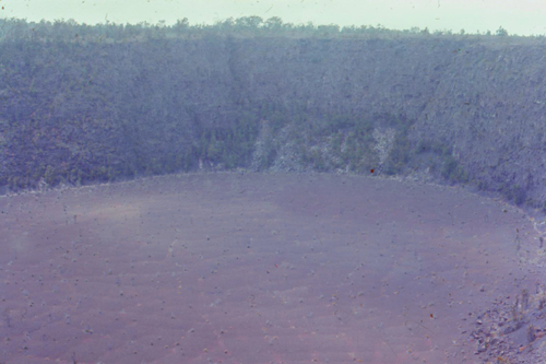
I eventually got back around to the Visitor Center, but then I started around the Rim Drive for a second time. I did this because the day had gotten steadily better weatherwise, and I thought that I would try for a few more pictures of Kilauea Crater itself. So I drove back down to the closest observation point and got out of the car to follow a different trail to one of the marked vantage points. That's where I got these two views:
|
|
I very much enjoyed my tour through Volcanoes National Park, but I did have one regret. Since I was leaving from Hilo later this afternoon to return to Fort DeRussy, I would not be able to go to the nighttime lava viewing.
|
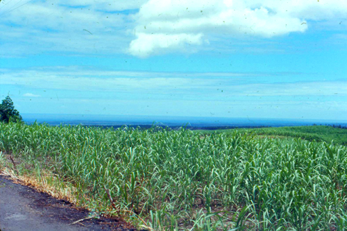
Along the way, between the highway and the ocean, were more fields of sugar cane.
I got back to the Hilo airport about 3:30, in plenty of time for my 5PM flight back to Honolulu. It was uneventful, and by 8PM I was back in Waikiki having some dinner.
The picture of the sugar cane is my last picture from Hawaii, and the last photo I took before returning home after a 13-month absence.
My Final Return Home
Maybe sometime later I will have more to say as a coda to my tour in Korea, but for now I can just say that it was the experience of a lifetime. I don't know what's in store in the future, although if I stay in the Service I would assume there would be other overseas duty stations. But we will have to see. Korea and Japan were an experience that few people will ever get, and I feel fortunate to have spent so much time there.
And of course, save for the luck of the draw, it could have been Vietnam instead.
You can use the links below to continue to another photo album page.
|
July 15, 1971: The Big Island Northeast Coast |
|
Return to the Index for My Visit to Hawaii |