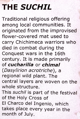
|
Galeria Atotonilco (Atotonilco Crafts Gallery) |
|
The Jardin Allende (San Miguel Town Square) |
|
Return to the Index for Our Mexico Trip |
While there are other parks and squares in San Miguel, and while one of the other squares in the historic district is considered to be the "old" Spanish town square, the Jardin Allende, situated as it is between the family homes of two of the town's most significant individuals and right in front of the spirtual home of the city (La Parroquia), Jardin Allende is the city's heart- its main gathering place.
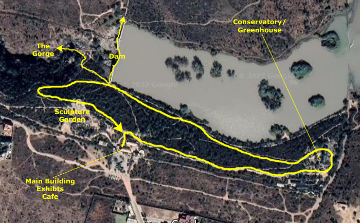
About the Botanical Garden
Since 2014, El Charco del Ingenio has had a federal certificate from the National Commission for Natural Protected Areas (CONANP), in the category of "Area Voluntarily Destined for Conservation (ADVC)".
|
As you can see from the aerial view, the gardens are located along the southern shore of one of the town's reservoirs. Actually, I think that there are some natural areas on the northern shore, across the dam, but I don't think there are any interpretive trails there.
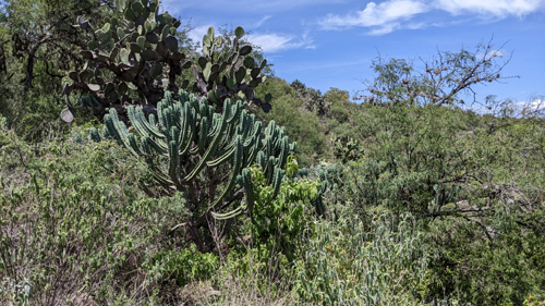
El Charco del Ingenio is an extraordinary Botanical Garden and Nature Reserve in that it has an extensive collection of cacti and other succulent plants from Mexico, many of them rare, threatened or in danger of extinction.
Garden History
The effort to establish a botanical garden and natural conservation area in San Miguel de Allende began in 1989, at the initiative of the organization Cante AC. The monumental ravine of El Charco del Ingenio was presented as the ideal site for the imagined project: an area of great ecological, scenic and historical value, in danger of being overtaken by the urban expansion of the city.
The project envisioned a large botanical garden within in a natural conservation area- a space dedicated to the study, assessment and enjoyment of nature for the local population. It was also seen as an example of sustainability, as well as an attraction for tourism.
With both public and private financial support, it was possible to acquire the land, which had been seriously affected by human activity: logging, soil extraction, hunting, grazing, fires, clearing, accumulation of garbage. Restoration actions were undertaken in order to reverse the environmental deterioration of the site, while trails, squares, viewpoints and plant exhibition areas were planned and constructed. Simultaneously, collections of native species began in arid and semi-arid areas of the country, thanks to the support of federal authorities and the Institute of Biology of the National Autonomous University of Mexico. With these first specimens, El Charco del Ingenio began to build its botanical collection.
|
Over the years, the Botanical Garden has received accolades from the thousands of visitors from very different origins who come to El Charco every day, as well as various publications, institutions and conservation groups inside and outside the country. For this constructive work, the Botanical Garden obtained in 1995 the National Award for Ecological Merit of the Government of Mexico.
The dynamics and dimension of the conservation project soon made it necessary to create a new independent organization of a territorial nature. In 1998, the The Charco del Ingenio AC was established; this is the organization that owns and manages the Botanical Garden and its plant collections. In addition to this primary mission, the Garden performs a social function as a space for community gatherings and as a source of environmental education. This is carried out through visits and programs aimed at students of different levels, especially from the creation of a new Environmental Interpretation Room, designed to enhance people's understanding of El Charco del Ingenio and the hydrographic basin where it is located.
|
In 2005, when the San Miguel City Council added over 1000 acres to the Botanical Garden as an Ecological Preservation Zone, which prioritizes environmental conservation over urban expansion, with the purpose of conserving this magnificent place as a natural and historical heritage of San Miguel de Allende. In 2020 the Mexican government declared El Charco del Ingenio an Ethnobotanical Garden for the State of Guanajuato. This has involved the creation of new ethnobotanical collections on the site, as well as various activities with rural and indigenous communities, holders of ancestral knowledge related to regional plants, as a fundamental part of Mexico's bio-cultural heritage.
El Charco del Ingenio Botanical Garden is being built day by day as an open and unique space, with various aspects of interest for everyone. It is a natural monument, a wildlife sanctuary, a set of botanical collections, a scientific research unit, an environmental education center, an historical site, and a recreational and community space. As it has from the beginning, it remains an autonomous civil initiative, made possible largely thanks to the contributions of its visitors and friends, silent promoters of its success.
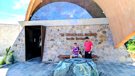
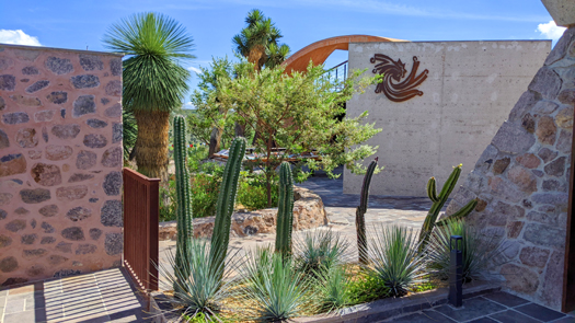
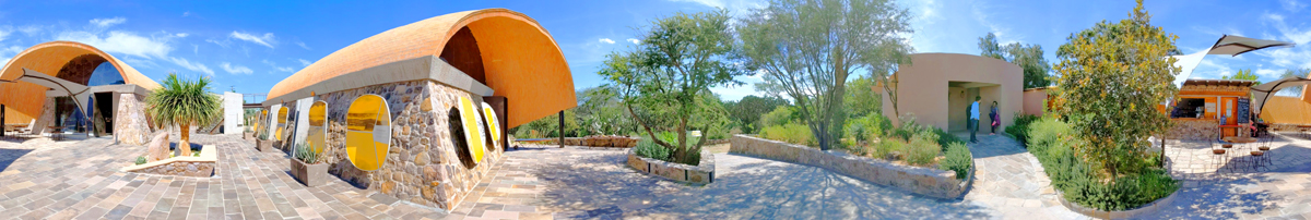
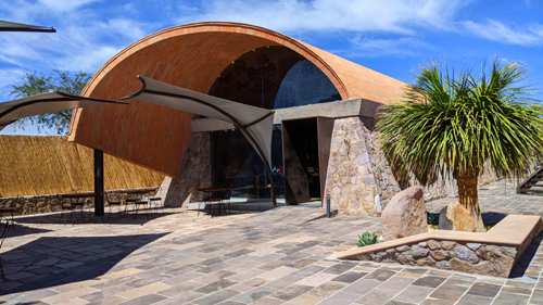
The Four Winds Plaza
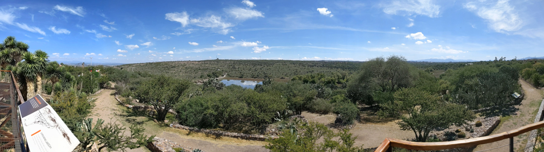
Both the entrance building/gift shop and the cafeteria/facilities are located in the Four Winds Plaza, the main gathering and event space in the gardens. You can see my panoramic view of the plaza below:
|
|
|
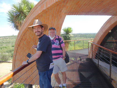
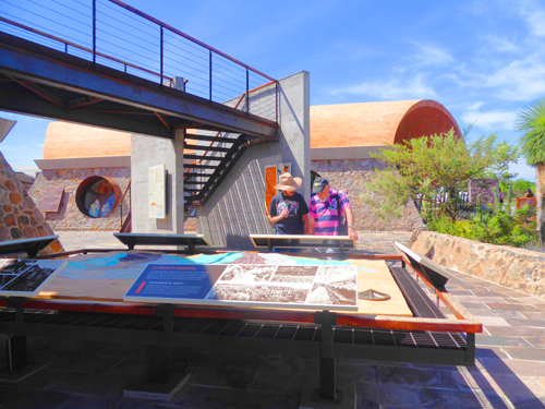
There was an elevated walkway that wrapped around one of the buildings, and it was reached via a stairway near the main information display. Of course, we went up there to take in the views, and they were pretty neat.
|
In the panoramic view above, you can read the informational sign that is on the railing to my left by simply clicking on it. And you can click on the lake in the distance to see a closeup view of it and the dam that is holding it back. We'll be visiting the lake and dam in a little while.
|
|
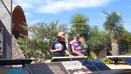
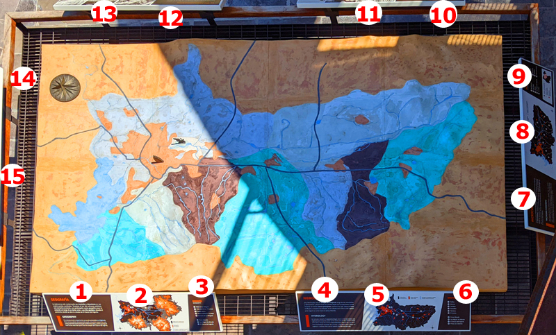
Actually, that large information display that Greg and I are looking at was immensely interesting, and I photographed the relevant parts of it, which were the informational signs around the edges of the central display area. (While we could read the center part from where we were standing, it was almost impossible to hold the phone out over and above the display to photograph it.
|
So at left is an image of the display, taken from its south side. I realize that other than the signs right in front of me you can see them to read (and the ones in front of me are too small for you to read). So I went around the periphery of the display and photographed each of the signs, and then cropped and adjusted them so you could read them.
To be able to do so, you can just click on the numbered circles in the image at left, and the sign, or portion of one, that was near that number will pop up in an enlarged version so you can read it. You can work your way around the display reading as many of the signs as you would like. Don't forget to close each of the little windows that open up before you go on to the next one.
When we finished learning a bit about the Botanical Garden and the area itself, we headed off down an interpretive trail to the east.
The Regional Plants Trails
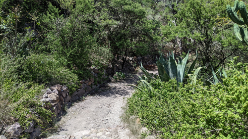
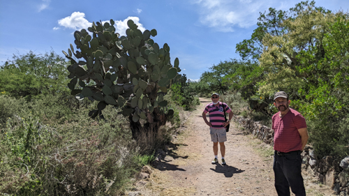
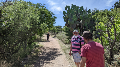
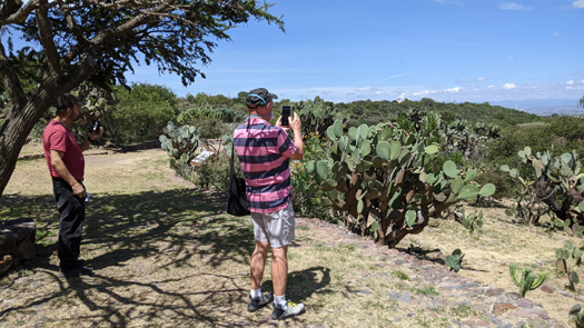
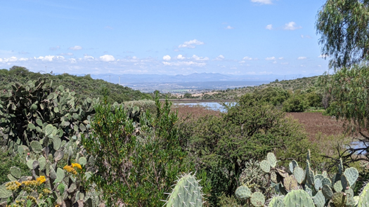
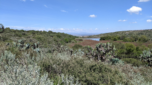
The reserve is crossed by an extensive network of trails. In addition to its magnificent landscapes, they are pedestrian routes of environmental interpretation that allow the visitor to discover and enjoy the natural life of the site. The first trail we walked was one of the Regional Plants Trails, this one atop the ridgeline with good views all along the way eastward.
 |
 |
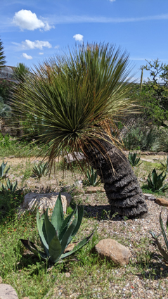
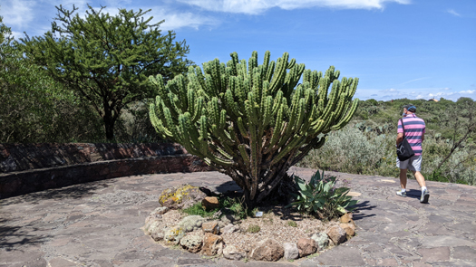
They display a sample of trees, shrubs and cacti from this semi-arid region. With the exception of some few specimens that have been introduced, they are mainly plants that grow spontaneously in El Charco. You will find mesquites, acacias (including this unusual white acacia), and various species of prickly pears (nopales), an emblematic and widely-used plant in Mexico.
 |
 |
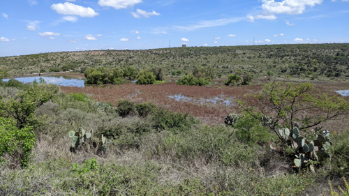
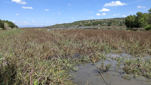
The trails also provide exceptional views of the Las Colonias dam and wetlands, as well as El Charco's ample northern reserve. These trails lead to the Conservatory of Mexican Plants and the ethnobotanical exhibition areas.
|
Botanical Exhibition Areas
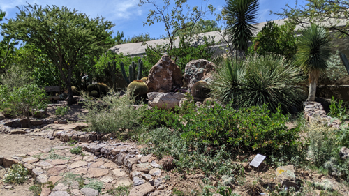
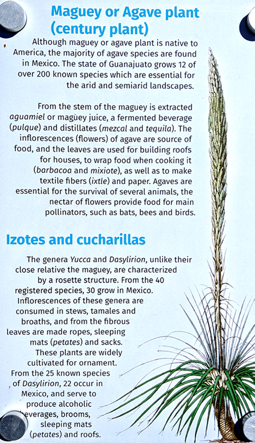
Throughout the Garden there are various exhibition spaces displaying plants from Mexican deserts and semi-deserts, whose botanical and ecological importance is mostly complemented by a great ethnobotanical value, based on the ancestral uses and knowledge preserved by indigenous and peasant communities up to the present days.
|
There are also plants valued for their melliferous characteristics, and there are plants used in ceremonies. Plants represent a biocultural and economic value for the subsistence of rural communities, and the knowledge of these plants developed and held by indigenous peoples is often transferred through oral traditions to our modern, urban society, and this enriches us culturally.
|
|
 |
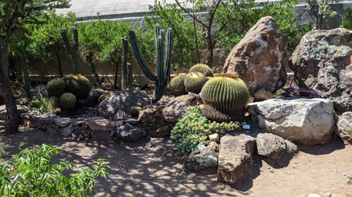
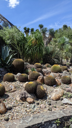
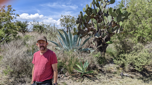
The nopal garden focuses on the cacti known as nopales (prickly pear), emblematic plants of Mexico. Essential food for fauna, nopales have also been essential for humans for millennia (stalks and fruits), being also a medicinal plant and useful as a living fence. Along with native species from El Charco, the samples includes specimens collected from various regions of Mexico.
 |
 |
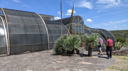
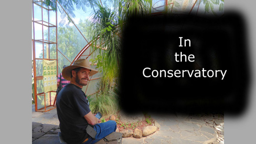
The Conservatory of Mexican Plants
|
The greenhouse was not nearly as large as many we have been in, but it was nevertheless very well done, and we enjoyed very much walking through it and looking at the large variety of plants it contained.
|
To view the slideshow, just click on the image at left and I will open the slideshow in a new window. In the slideshow, you can use the little arrows in the lower corners of each image to move from one to the next, and the index numbers in the upper left of each image will tell you where you are in the series. When you are finished looking at the pictures, just close the popup window.
We left the Conservatory by its west side, and had good views out towards Las Colonias Dam.
 |
 |
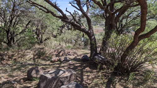
We consulted our little garden map and then picked a trail to the northeast, which would take us down towards the wetlands and the dam.
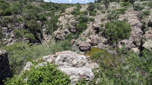
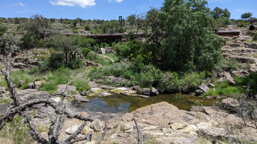
As we got near the reservoir, I saw a trail off to the right, that seemed to be a tunnel through the vegetation, and it turned out that the trail led down close to the wetland, offering some interesting views.
|
In this movie, I am making my way down to the wetland on the "tunnel" trail. |
|
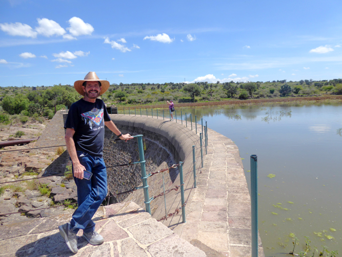
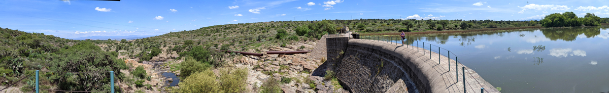
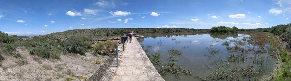
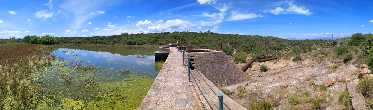
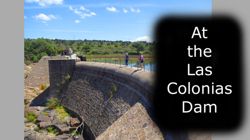
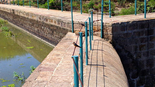
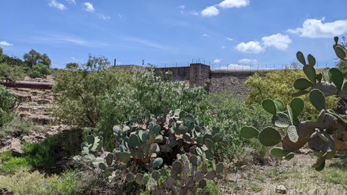
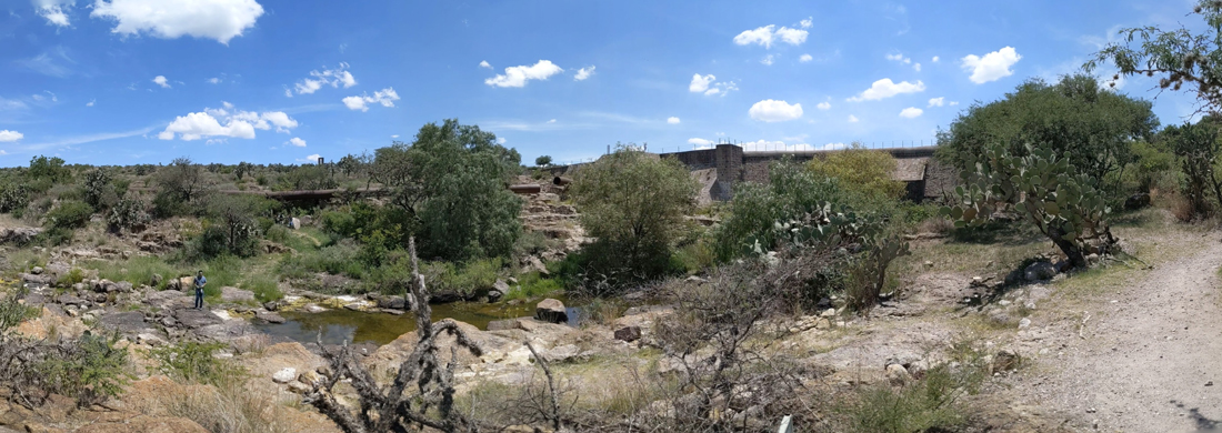
Las Colonias Dam
|
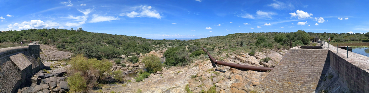
In many of the pictures we took of the dam as we walked out onto it and actually across it, you will see the remains of "the Iron Pipeline". This long aqueduct was built to convey the water from the dam to the La Aurora textile factory a ways down the canyon; there, the water was used to generate electricity. It stopped working at the end of last century, due to the depletion of the springs that fed the dam, as well as the increased silting that continually clogged the water intake.
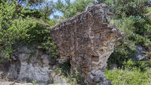
At the north end of the dam, you will see pictures of a ruined stone structure that dates from the late viceregal era (c. 1800). This structure was once part of a water mill to grind grains or to treat wool, which mill was powered by the force of the water from a permanent stream that existed at that time. You can still see the base of the axis of the spinning wheel and, above it, part of the stone aqueduct that poured water onto the wheel. It is a relevant element of the historic site of Charco del Ingenio.
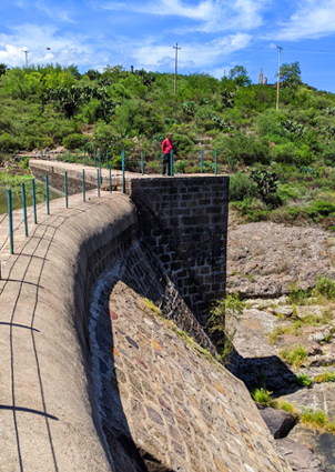
The dam was immensely interesting, and while Greg and Fred walked out to the end of the curved portion seen with me in the picture above, I walked all the way to the other side of the dam to see some of the ruined structures there. The dam and the surrounding landscape begged for panoramic views, and I want to show you a few of them now:
|
|
|
|
|
To view the slideshow, just click on the image at left and I will open the slideshow in a new window. In the slideshow, you can use the little arrows in the lower corners of each image to move from one to the next, and the index numbers in the upper left of each image will tell you where you are in the series. When you are finished looking at the pictures, just close the popup window.
|
 |
When I got back to Fred and Greg, Greg was chatting with another visitor who'd come down the trail- an American considering actually moving to San Miguel. Greg and Fred were going to walk up the trail back towards the visitor center, but I wanted to take a detour on a marked trail that advertised views into Charco Canyon.
Charco Canyon
The trail led from the dam downward to the west, although it didn't descend too far into the canyon. I passed through a kind of sitting area to get down to a place that offered neat views back up to the dam and of the pipeline:
 |
 |
And I was able to put together a neat panorama- with another hiker down on the rocks to give us some scale:
 |
Further down the trail I cam eo the vestiges of what was probably San Miguel's first hydraulic work (called ingenio, probably built at the end of 16th century. Water spilled from the aqueduct spinning a vertical wooden wheel with its axis on a stone base, thus generating energy. This technology was applied to the milling of seeds and also to the treatment of woll at the textile factories during the period of Spanish rule.
|
|
|
|
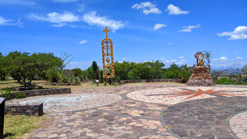
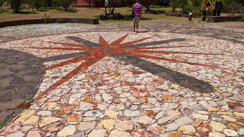
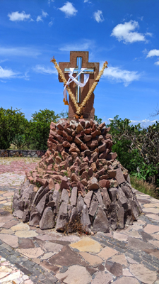
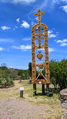
The Peace Zone
In 2004, El Charco del Ingenio was selected by the Dalai Lama, leader of the Tibetan people and Nobel Peace Prize winner, to be consecrated as a Peace Zone, during his visit to Mexico. Peace zones were then selected as spaces free of violence and weapons, committed to nature conservation and community development. There were five peace zones declared in different parts of the country.
|
|
|
|
|
Our Visit Ends
Coming up here to El Charco del Ingenio was an excellent idea. We all enjoyed the walk and there was much to see. We bought a couple of things in the gift shop while waiting for the taxi we'd called to show up. We had a pleasant ride back to Casa Pina, although I was very glad that someone else was driving through the narrow cobblestone streets. Waiting for us was one of Theresa's delicious lunches.
You can use the links below to continue to another photo album page.
|
Galeria Atotonilco (Atotonilco Crafts Gallery) |
|
The Jardin Allende (San Miguel Town Square) |
|
Return to the Index for Our Mexico Trip |