|
September 2-4, 1988: A Weekend in Houston and Galveston |
|
Return to the Index for 1988 |
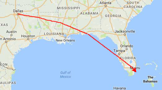
Grant and I decided to take advantage of my having a week with no assignments to take a week-long vacation to Florida. We plan to visit Key West and Fort Lauderdale (because both locations have boats)!
A Few Days in the Florida Keys
|
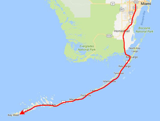
We crossed onto the Keys at Key Largo, and began the 100-mile trip down to Key West.
I have driven to Key West before; a number of years ago I had a CULPRIT installation at a bank in Miami, and I took a few extra days to drive down to Key West, since I had heard so much about it. This will be Grant's first exposure to one of America's most interesting drives- the Overseas Highway to Key West.
|
Since the 1950s the Overseas Highway has been refurbished into a main coastal highway between the cities of Miami and Key West, offering travelers an exotic roadway through a tropical savanna environment and access to the largest area of coral reefs on the U.S. mainland. Many exotic animals such as the American Crocodile and Key Deer inhabit the tropical islands of the Florida Keys.
While the Overseas Highway today runs along the former Overseas Railroad right of way, portions of the highway came into existence during the Florida land boom of the 1920s, when developers sought vehicular access to the upper keys where there were thousands of acres of undeveloped land. The original highway opening for traffic on January 25, 1928, and consisted of two segments. The northern segment ran from the mainland to Key Largo and extended as far as Lower Matecumbe Key (30 miles); the southern segment ran from No Name Key to Key West (20 miles).
As for the 40-mile gap, an automobile ferry service connected the two road segments. The northern segment followed the railroad while the southern one departed from that route. Most of the bridges in the Lower Keys were of wooden construction and had been in use by the early 1920s. The entire highway is amazingly scenic, and I wish I had taken many more pictures than I did.
|
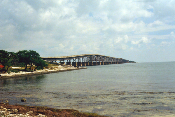
The original bridge was damaged by the Labor Day Hurricane of 1935, and when it was repaired it was widened to allow for vehicular traffic, and the railroad was entirely replaced. (It was actually recycled, as the rails were ripped up, painted white, and used as guardrails). In the 1970s, repairing the bridge became economically infeasible, and the new, current bridge was constructed from 1978 to 1982.
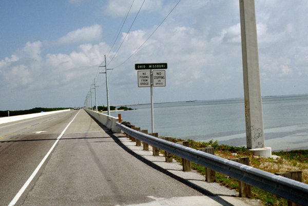
The new bridge is a box-girder structure built from precast, prestressed concrete sections, comprising 440 spans. Near the center, just as the bridge touches down on a very small, uninhabited key, it rises in an arc to provide 65-foot-high clearance for boat passage. The remainder of the bridge is considerably closer to the water surface. The total length of the new bridge is actually 6.79 miles- slightly shorter than the original (when two angular curves were cut off).
By the early 1930s it was clear that the ferries were insufficient for the travel needs of the keys, and Monroe County and the State Road Department began making plans to connect the two portions of the highway. In 1933, the state legislature created the Overseas Road and Toll Bridge District to seek federal funding to extend the roadways. Funding was delayed as the country was in the midst of the Great Depression, but when it became available as part of FDR's "New Deal", hundreds of World War I veterans seeking early payment of wartime bonuses were employed for construction on the roadway and bridges.
|
Construction on a bridge connecting Lower Matecumbe Key and Long Key was already underway when the Category 5 Labor Day Hurricane struck Islamorada on September 2, 1935. The hurricane caused widespread damage and over 400 fatalities- more than half were veterans and their families. The hurricane effectively put the Florida East Coast Railway out of business in the keys. Florida purchased the entire right-of-way, in a stroke almost completing the highway. The railroad's bridges, still in good shape, were retrofitted with new two-lane wide concrete surfaces for automobile use. In the case of the Bahia Honda Rail Bridge, which was a truss bridge, the concrete road surface was built on top of the trusses. The full highway from the mainland to Key West was officially opened for traffic on March 29, 1938.
As the United States entered into World War II, the U.S. Navy sought improvements to the highway to improve their access from the Naval Air Station on Boca Chica Key to the mainland- replacing the winding road and wooden bridges in the lower keys. This resulted in completing the rest of the highway throughout the keys on the former railroad right of way, which the state already owned and was a more direct route with smoother curves that would allow for higher speeds. A new access from the mainland to Key Largo was also constructed, shortening the trip to Key West by 17 miles.
Since World War II, the original highway segments on keys have been widened and many of the bridges have been modified, strengthened or entirely replaced. These included the Seven Mile Bridge, the Bahia Honda Bridge and the Long Key Bridge; although these three original bridges are no longer open to vehicular traffic, except for part of Seven Mile Bridge, they became listed on the National Register of Historic Places in 1979 and are currently used as fishing piers. The more modern bridges were completed in the early 1980s.
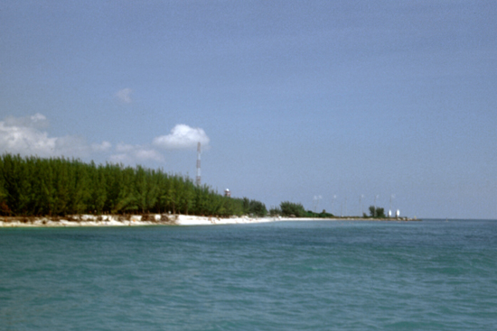 A Scene in the Southern Keys This picture was taken just before we arrived on Key West itself; we were, at the time, near the Boca Chica Naval Air Station |
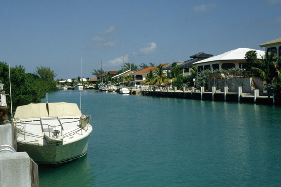 Pelican Key We left the highway to drive around the key, and went in a couple of homes that were for sale. Having your boat right behind your house must be nice. |
The drive down to Key West was really amazing, not least because Grant enjoyed it immensely. The Florida Keys are a whole different world; everything is oriented around the water, and on every key you found little towns, a wide range of housing and more boats than you could count. I found myself wondering what most of the folks did who lived along the Overseas Highway; I assume a great many of them are retired (this is Florida, after all) or have jobs dependent on tourism. But it was very idyllic.
|
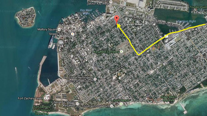
When US 1 comes onto Key West, it becomes Truman Avenue, which runs northeast to southwest. The street system in Key West is a grid, but that grid is tilted along the length of the key, so almost all the streets are 45° off the compass points.
We had made reservations at a guest house called The Brass Key; to get there, we turned right off Truman Avenue onto Frances Street (heading northwest). The Brass Key was about five blocks up on the left.
The guest house (like a bed and breakfast) was quite nice; it was two-storey with about eight guest rooms. Along the side of the Victorian structure was a garden and a small swimming pool. We got into our room with no problem, got settled, and then went out for our first walk.
The city of Key West encompasses the island of Key West and parts of adjacent islands and keys on the north and west. Key West is the southernmost city in the Continental United States. It is also the southern terminus of U.S. 1 (which runs uninterrupted from Truman and Whitehead Streets some 2400 miles north to the Maine-Canada border), State Road A1A (the alternate north-south highway through Florida that tends to be along the ocean), and, before 1935, the Florida East Coast Railway. Key West is 129 miles southwest of Miami, Florida, and 106 miles north-northeast of Havana, Cuba (the island which, at its closest point, is only 94 miles away). The central business district primarily comprises Duval Street, and includes much of the northwest corner of the island along Whitehead, Simonton, Front, Greene, Caroline, and Eaton Streets and Truman Avenue. The official city motto is "One Human Family", which is in keeping with the quirky nature of the town and its welcoming of people of all kinds.
|
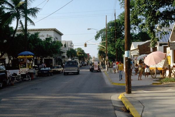
Key West is very picturesque. It is where Hemmingway had his last home and is noted for its artistic bent. It is also noted for being quite a gay resort, and indeed there are many gay guest houses from which to choose. We picked one of the nicest ones; they can get pretty plain. Development in Key West has been held in check, and as a result the main town is pretty much as it has always been; most of the new hotels and stuff are further North.
The history of Key West is a long one, beginning with the Calusa people in Pre-Colonial times and the first visit by a European- Ponce de Le�n in 1521. As Florida became a Spanish territory, a fishing and salvage village with a small garrison was established here. The name is a corruption of "Cayo Hueso", the original Spanish name for this westernmost key with a reliable supply of water. In 1763, when Great Britain took control of Florida, the community of Spaniards and Native Americans were moved to Havana. Spain still claimed the island after the American Revolution, but no nation exercised de facto control over the community there for some time.
|
At the time Florida was transferred to the United States in 1821, the owner of Key West sold it twice- both to a General John Geddes, a former governor of South Carolina, and also to a U.S. businessman John W. Simonton. Simonton, from Mobile, Alabama, secured his claim first (with the help of influential Washington friends). He and a friend, John Whitehead (who had been shipwrecked on the island in 1819) saw its strategic potential. In 1822, Lt. Commander, Matthew C. Perry, sailed the schooner Shark to Key West and planted the U.S. flag, claiming the Keys as United States property. Simonton acquiesced, since his ownership was unchallenged.
Soon after his purchase, Simonton subdivided the island into plots and sold large ones to three men, including Pardon C. Greene; Greene was the only one to move to the island and take up residence. He later became a business success and mayor of Key West before his death in 1838. John Whitehead lived in Key West for only eight years, and became Greene's business partner, before leaving the island in 1832. Simonton spent his winters in Key West and his summers in Washington, where he lobbied hard for the development of the island and to establish a naval base on the island, both to take advantage of the island's strategic location and to bring law and order to the town. He died in 1854. All these names, as well as that of Florida's first territorial governor, are immortalized as the names of main Key West streets.
Development and settlement continued slowly up to the Civil War. (Fort Zachary Taylor in Key West, active during the Civil War, contains the largest collection of Civil War cannons ever discovered at a single location.) When Florida seceded, Key West remained in Union hands because of the naval base. However, most locals were sympathetic to the Confederacy, and many flew Confederate flags over their homes. Four forts were constructed during the war, including one in the Dry Tortugas.
|
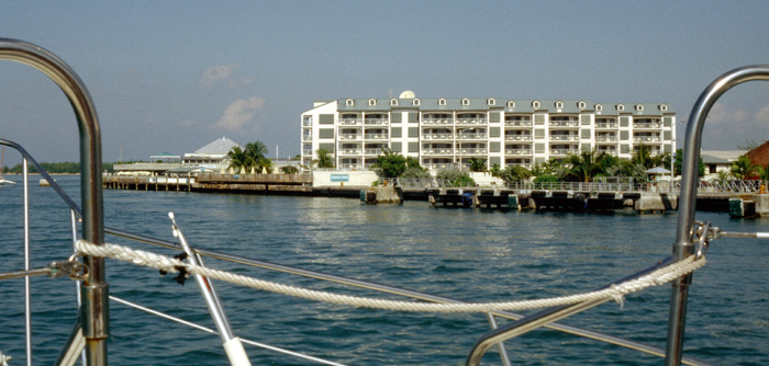
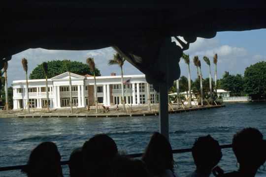
We very much enjoyed the boat ride, and as we came back into the harbor near Mallory Square, we passed a very nice-looking resort- the Ocean Key House. I did some research on the resort the next day, and although it was a bit more expensive than the Brass Key Guesthouse, it had a lot of amenities- and the benefit of being right on the water. I thought that if Grant and I came back to Key West again, it would be an excellent place to stay. That's the resort in the picture at right.
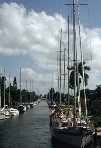
We stayed in Key West for two more days, spending all of our time out seeing the sights and enjoying the beautiful fall weather, and then headed back up the Overseas Highway towards Fort Lauderdale. As we did on the way down, we drove slowly, stopping frequently to look at the scenery or tour a marina. The profusion of bridges, long and short, and the constant view of the Gulf on our left and the Atlantic on our right made the trip memorable; it reminded me of traveling down A1A when I was a kid and we came each year to Ormond Beach. Except at some of the inlets, the water is not very deep, so I imagine that building the bridge system was not as difficult as one might think, although I am impressed at the size of the project.
Three Days in Fort Lauderdale
|
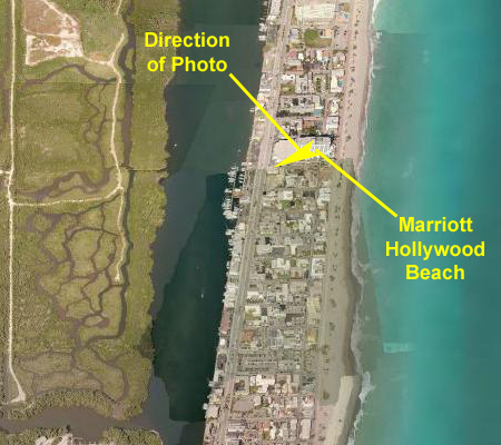
We decided not to stay there, and continued to drive up A1A towards Ft. Lauderdale. When we arrived in the beach city of Hollywood, we came past a Howard Johnson's hotel right on the beach, and we decided to stay there. (I would show you an aerial view of the hotel, but it seems it is no longer there. The closest hotel seems now to be a Marriott, but it looks much different than the one in which we stayed.
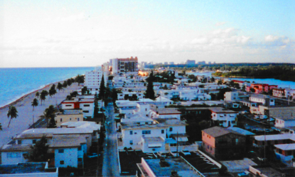
We checked in late in the afternoon, and got a decent room about six floors up in the eight-storey building. Our room faced south, and that is the view you can see at left.
I had time to go for a run down the boardwalk that fronts the beach there while Grant went to the pool. When I got back, I found Grant talking to the lifeguard, who was about as nice looking a man as we had seen on our trip.
|
Beyond it was some undeveloped wetland (and in the current aerial view to the right of the picture, you can see that it is still undeveloped) and then the inland portion of the city of Hollywood beyond it. (I have returned to this area a number of times since our visit this year, and while the portion of the barrier island we are on has not changed all that much- save for a few new hotels- the inland city has grown a great deal, and today this view has quite a few highrises beyond the wetland.)
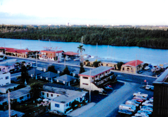
We cleaned up and then walked down the street to a Chicago-style pizza place (actually run by people from Chicago). In the evening, we walked around looking at the boats. We had thought that we would check out of the hotel when we drove further north to Fort Lauderdale, but when we discovered it was so close, we decided just to remain at the HJ Hotel. One of the first things Grant wanted to do (after visiting West Marine and Boat US, both of which were along US Highway 1 south of downtown Fort Lauderdale) was to see some boats, so we went to the area near the 17th Street Bridge over the Intracoastal just north of Everglades Inlet. There, we stopped at one of the boat brokerages so Grant could indulge his passion. I got him to take a picture of me on one of the boats we looked at.
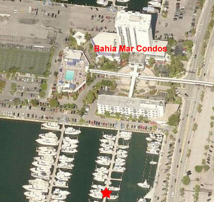
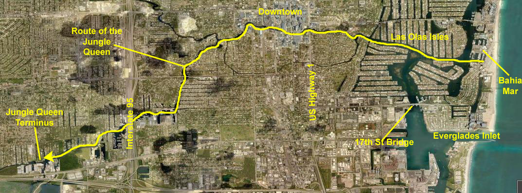
We did a number of things during our two days here in Fort Lauderdale, and you might like to see where some of them were. Here is an aerial view (current to 2016, of course) of the area of Fort Lauderdale where we spent our time:
 |
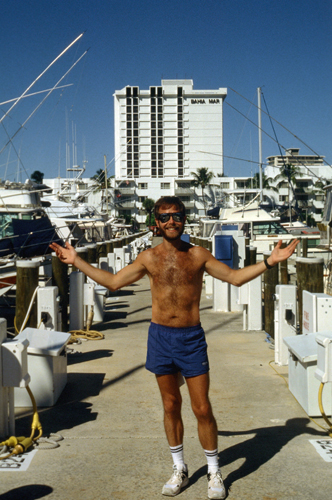
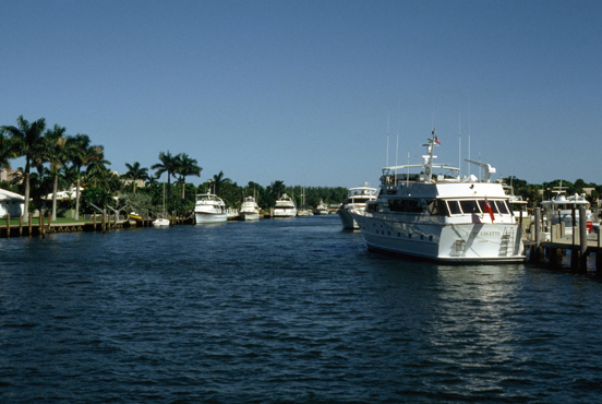
On the advice of the boat broker we saw at the 17th Street Bridge, we drove up A1A to an area called Bahia Mar. Here, there were two or three separate marinas- mostly filled with large powerboats and sailboats- many of them longer than 100 feet. As usual, Grant talked his way out onto the docks so he could see the boats up close.
|
|
Both this marina and Pier 66 are pretty exclusive; situated where they are, some of the larger boats can be docked there. There are restaurants and other facilities in both places, although down at Pier 66 there is a hotel and restaurant complex on the ocean side of the intracoastal, and a whole street full of seafood places on the western side. Grant and I spent most of the afternoon at these two marinas, just looking at the boats. We also drove over to the beach to have a look at it, too.
While we were here at Bahia Mar, we did two other things. First, we found out about an excursion boat called the Jungle Queen, which looks like a paddlewheel steamer from the Mississippi but which is actually diesel powered. It is a Fort Lauderdale institution, and it leaves from Bahia Mar to travel inland along the New River past Interstate 95. It is billed as a great way to see Fort Lauderdale, so we made plans to do it tomorrow. We also ran across a place at Pier 66 that rents small powerboats by the day or half day, and Grant thought that we should do that, tomorrow, too, so we could just motor around the many canals and look at the houses and the boats. So, tomorrow will be a full day.
We were back up at Bahia Mar the next day to take the lunch cruise on the Jungle Queen. It left Bahia Mar at ten in the morning, and it returns about two in the afternoon. At the terminus inland, the boat stops for a while and you can have lunch or dinner and watch alligator wrestling. Here are the few pictures that we took before boarding the Jungle Queen and on our cruise upriver.
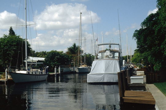
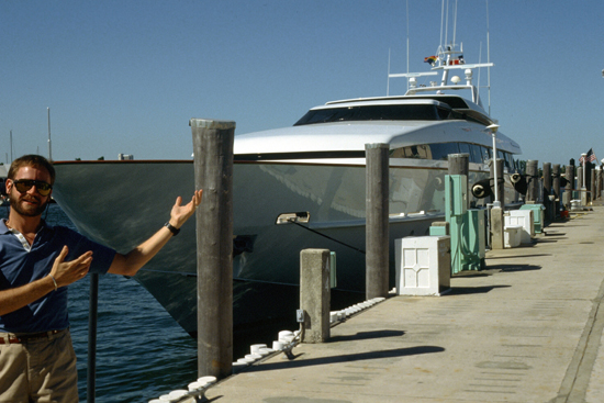 A Large Yacht Moored at Bahia Mar We got to Bahia Mar early, and so had a chance to walk docks we hadn't visited yesterday. Grant was particularly impressed with small cabin cruiser. |
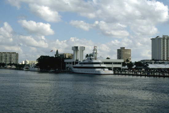 Looking North as the Jungle Queen Leaves Bahia Mar We crossed to the west side of Intracoastal; the white building is an clubhouse building for Bahia Mar. The value of the boats tied up here must be immense; that single large yacht that you can see is supposedly four or five million dollars all by itself. |
Listening to Grant chat up boat owners and brokers is an experience, but particularly so with the brokers. He can make it sound as if he is just about to buy something new, when in fact there's no chance we might buy something here, because we'd have to move. I usually stay pretty quiet, although I remember one time, shortly after Grant had said to me that I should be more "into" the process- that is, I should talk as if we are going to buy something big immediately, trading something else big that we already own. I know we aren't, and it is difficult for me to waste the salesman's time. On the one occasion that I have tried this, moreover, Grant has gotten even more in the spirit of it and thinks I am actually serious about selling the S-2 that we have in Dallas and moving to wherever we are looking at the boats! So I don't want to encourage the salesman, but more than that, don't want to encourage Grant!
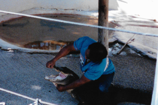 Alligator Wrestling at the Jungle Queen "Island" At the Jungle Queen terminus we got lunch (barbecue) and then we all stood around watching a guy wrestling an alligator. That part was pretty cheesy. |
 A New Home Under Construction in Las Olas Isles The homes on the water here are just as impressive as the boats tied up near them; this little chateau must have set someone back quite a few shekels. |
We enjoyed the cruise very, very much, and I could see the wheels turning in Grant's head. It was pretty obvious that he would like to live here, but I wasn't about to move to a coast- it would make travel much more difficult. If that ever changes, then perhaps, but for the forseeable future, I doubt it. (NOTE: Little could I know that less than two years from now, the subject of living in Fort Lauderdale would come up again, and a year after that, it would be a reality- if only part time.)
When we got off the Jungle Queen, we went down to Pier 66 to the boat rental, and we rented a 20-foot Grady-White outboard, bought a couple of drinks and some snacks, and then headed off on our own trip around the Intracoastal and back up the New River. All afternoon, we tooled around the area, sometimes tying up the boat and walking around, but mostly cruising around. It was one of the most enjoyable afternoons I can remember; here are the pictures we took:
 A Typical Canal in the Las Olas Isles You can see these "isles" in the aerial view- long, artificial fingers of land separated by canals. A street goes down the center of each one, with homes on both sides. Each home has its own dockage on the canal behind it. Each "isle" is about a quarter-mile long, and then run north and south from Las Olas Boulevard. |
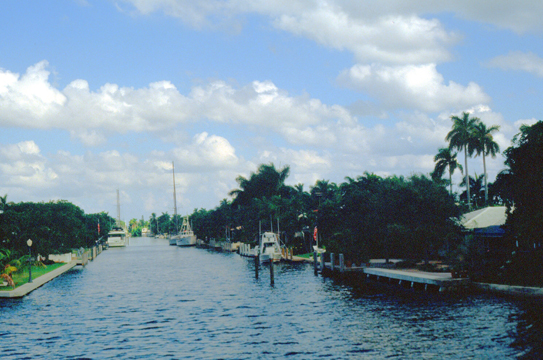 A Canal West of Downtown Up the New River Fort Lauderdale is actually "The Venice of America", there are so many canals. Even up the New River there are large areas that are essentially man-made islands intertwined with canals- some wide, like this one, some very narrow. But the number of homes with dockage and ocean access is huge. |
 Grant Inspecting a Sailboat |
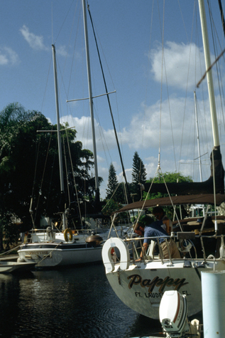
(Picture at left) As we were going up one canal, Grant called to someone aboard a sailboat moored on the canal and they started talking. The owner invited us to tie the motorboat up at his dock so Grant could come aboard his sailboat- "Pappy". I don't think it was for sale or anything, but one thing I have noticed about boat owners is that they love to show off their craft.
(Picture at right)
|
 Sailboats on a Canal |
 A Canal Near the 17th Street Bridge As you can see in the aerial view above, there is another section of finger islands down by the 17th Street Bridge, and this is one of the canals there. The houses in that area are larger, and consequently, the boats are too. |
 The View from Pier 66 The last picture we took was just as we were returning the Grady-White at Pier 66, which is just north of Seventeenth Street. That is the 17th Street Bridge and, looking past it, Lake Mabel, where the cruise ship docks are. |
With that last picture in mind, I might note that the 17th Street Bridge, intended to provide a second way off the barrier island in the city of Fort Lauderdale (the other being the Las Olas Bridge about two miles north), had a 28-foot clearance when it opened in 1956. In the 1960s, the number and size of the larger yachts in Fort Lauderdale increased dramatically, and the bridge had to open every half hour to let them pass. This resulted in more and more traffic congestion. The situation got worse and worse, and so a new, 55-foot clearance bridge was planned, funded and constructed between 1998 and 2002. It still opens every half hour if boats are waiting, but most often there are not, and so it only has to open about 20 percent of the time. You will see pictures of the new bridge on the photo album pages devoted to Fort Lauderdale trips in 2003 and later.
Not all of the boats along the canals belong to the owners of the houses there; if a resident doesn't have a boat, they can lease the space to someone who does. Many of these spaces are "live aboard" spaces, and the boats docked there are actually residences themselves. Of course, only the larger yachts are used in this way.
Grant and I liked Fort Lauderdale very much, and we both thought it would be a great place to come on vacations. Little did we know that Fort Lauderdale would be much more than an occasional vacation place in the years hence.
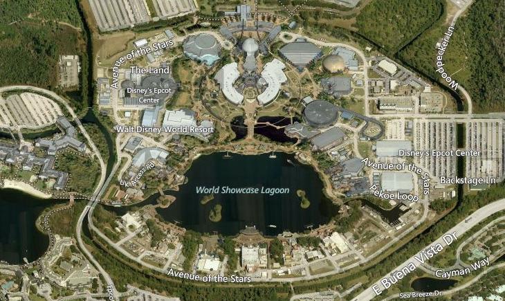
Disney World in Orlando
|
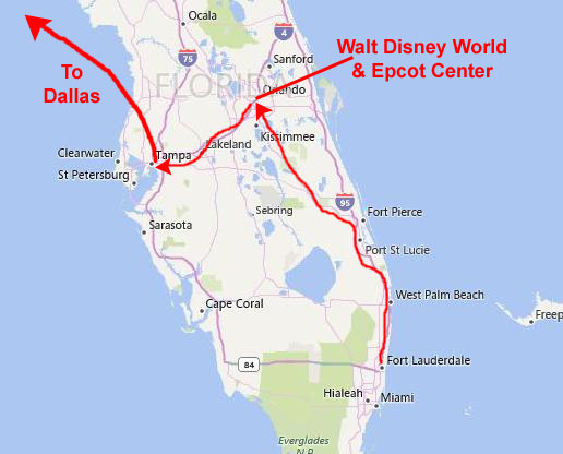
Our plan was to spend the night near the Disney Resort and then spend the next day in Epcot Center, which is adjacent to Disney World. Grant didn't have much interest in the rides and stuff at Disney World, and so opted for the more educational opportunities at Epcot Center. When we arrived in Orlando, we drove a short ways down Interstate 4 to find a motel outside the Magic Kingdom but near enough to be convenient. We stopped for dinner on the way up from Fort Lauderdale, and so when we found a motel we just turned in for the night.
Epcot, originally EPCOT Center, is the second of the theme parks at the Walt Disney World Resort in Bay Lake, Florida, near Orlando. It is owned and operated by The Walt Disney Company through its Parks and Resorts division. Inspired by an unrealized concept developed by Walt Disney, the park opened on October 1, 1982, and was the second of four theme parks built at Walt Disney World, after the Magic Kingdom. Spanning 300 acres, more than twice the size of the Magic Kingdom park, Epcot is dedicated to the celebration of human achievement, namely technological innovation and international culture, and is often referred to as a "permanent World's Fair". The park is divided into two sections: Future World, made up eight pavilions, and World Showcase, themed to eleven world nations.
The park's name, EPCOT, is an acronym for Experimental Prototype Community of Tomorrow, a utopian city of the future planned by Walt Disney. In Walt Disney's words: "EPCOT will take its cue from the new ideas and new technologies that are now emerging from the creative centers of American industry. It will be a community of tomorrow that will never be completed, but will always be introducing, and testing, and demonstrating new materials and new systems. And EPCOT will always be a showcase to the world of the ingenuity and imagination of American free enterprise."
|
Transportation would have been provided by monorails and PeopleMovers (like those in the Magic Kingdom's Tomorrowland). Automobile traffic would be kept underground, leaving pedestrians safe above ground. The Board of the Disney Company would not give Walt the funding and the permission to build EPCOT until the Magic Kingdom (Walt Disney World) was finished. Disney never got to build EPCOT, as he died nearly five years before the Magic Kingdom opened.
After Disney's death, Walt Disney Productions decided that it did not want to be in the business of running a city without Walt's guidance, so the plans were changed to focus the park more on an "exposition" theme. Some "Imagineers" wanted EPCOT to represent the cutting edge of technology, while others wanted it to showcase international cultures and customs. At one point, a model of the futuristic park was pushed together against a model of a World's Fair international theme, and the two were combined. The park was originally named EPCOT Center to reflect the ideals and values of a city. It was constructed at a cost of approximately a billion dollars over three years; at the time it was the largest construction project on Earth.
|
Epcot is divided into two main themed areas: Future World and World Showcase. The World Showcase usually opens two hours after park opening and remains open later than the Future World section of the park. As with most large theme parks, the attractions change over time, although at EPCOT there is still the division between Future World, where the rides and other typical attractions are, and the World Showcase, the kind of "perpetual world's fair".
We found EPCOT to be immensely interesting; as we had read, the park is much more educational than your typical theme park. There were some rides and stuff, but most of the pavilions in Future World, and all of the 11 national pavilions in the World Showcase are more educational than entertaining. We were getting such an education that I neglected to take a great many pictures, but that didn't mean we weren't enjoying ourselves.
|
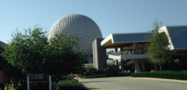
Spaceship Earth is the iconic and symbolic structure of Epcot; one of the most recognizable structures of any theme park, it is also the name of the attraction that is housed within the 18-story geodesic sphere that takes guests on a time machine-themed experience using the Omnimover system. The 15-minute dark ride demonstrates to guests how advancements in human communication have helped to create the future one step at a time.
Passengers journey back in time to witness the origins of prehistoric man, then travel forward in time to witness important breakthroughs in communication throughout history�from the invention of the alphabet to the creation of the printing press to today's modern communication advancements, including telecommunication and mass communication.
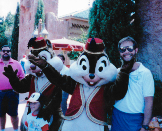
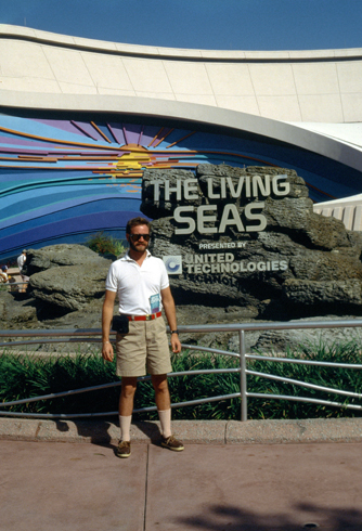
At the conclusion of the ride, passengers have the chance to design their own future using touch screens that are embedded into the ride cars. Nearby, Grant's attention was drawn to an exhibit/ride called "The Living Seas", and so that's where we headed next.
|
The Living Seas houses the largest saltwater tank in the world- 5.7 million gallons. (NOTE: It would hold this record until 2005 and the opening of the Georgia Aquarium.) The concept of the building is to take visitors under the ocean to "Sea Base Alpha". We then watched a short movie about the formation of the oceans ("The Sea"), and then took an elevator ride to the ocean floor aboard a "Hydrolator" (in reality, the floor merely shook and effects in the walls simulated downward motion). Then we got in a "Seacab" and traveled along an underwater tunnel through the aquarium at the Caribbean Coral Reef Ride. After that we rode around Sea Base Alpha and got an up-close view of the marine life. The end of the ride put us in the main exhibit area.
(NOTES:
The Living Seas was sponsored by United Technologies from its opening until 1998. After the departure of United Technologies as sponsor of The Living Seas, all their sponsorship references were removed, of course, but a new walkway was added allowing guests to bypass the pre-show (and its educational value) and go directly to the Hydrolators.
On that point, I recall The Living Seas as being not only entertaining, but, even more than that, extremely educational. I have not been back to that attraction since our visit, but I do know that in December 2003, Disney began to re-theme The Living Seas into a new pavilion based on the recently released Pixar film "Finding Nemo". From all accounts, while the transformation made the ride itself better, the educational value of the pavilion was much compromised in order to make it more attractive to kids or other fans of the enormously successful movie.)
We spent a significant portion of our time in two attractions- "The Living Seas" and "Spaceship Earth". The rest of the time we walked around the lake at the center of Epcot, visiting one national-themed area after another.
|
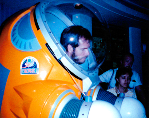
One of those interactive exhibits allowed me to get inside one of the pressure suits that might be used to allow researchers to actually leave the habitat and walk on the ocean floor. (To get inside, you simply enter the suit from the back, which has an open seam.) When I got my head into the plexiglas helmet, Grant chose that moment to snap the picture of me at right.
We very much enjoyed EPCOT, and ended up having dinner at one of the national-themed pavilions. That evening, there was a show out in the World Showcase Lagoon, and we stayed to watch it. We stayed that night (October 29th) there in Orlando, and then the next day drove the remaining 75 miles over to Tampa, where we had a late afternoon flight back to Dallas. Over in Tampa, we just drove around town for a while, and over to the beach on Florida's Gulf Coast. We found that Tampa has some residential areas similar to those in Fort Lauderdale- houses with canals behind them. We happened on a boat brokerage, and were directed to a nearby home where there was a boat that Grant wanted to see. We drove to the home, Grant talked to the owner, and he looked at the boat. Before we left, Grant took a picture of the sailboat and me on the dock.
Late that afternoon, we turned in our car at the airport and caught our flight back to Dallas after a really great week-long trip to Florida. I know I will be back on business, but I think Grant and I will be back as well.
You can use the links below to continue to another photo album page.
|
September 2-4, 1988: A Weekend in Houston and Galveston |
|
Return to the Index for 1988 |