|
October 25, 1992: Mesa Verde and Silverton, CO |
|
Return to the Index for Our Western Trip |
Fred and I coordinated so that when he came down after work on Friday, October 23, I was ready with my stuff to load the truck and set out right away. When going on a long trip west, Fred likes to get as far as possible that first night, and I think that is a good idea.
|
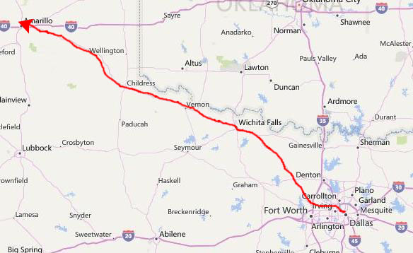
We continued along US Highway 287 to Amarillo, following a road that would, in the coming years, become very familiar to me. In Amarillo, we found a motel and got a room for the night. This made for a very long drive, but on these trips out west it is essential to collapse the driving into as few days as possible.
I might note that after we returned from this trip, and I had a chance to look at the map, I suggested to Fred that if we take this route again, it would save time to leave from his house. Not that the distance is all that shorter, but we would eliminate all the traffic that there is around Dallas. I could bring my stuff up to his house instead, and he could come home from work as usual, and then we could drive north through Sherman and then west through Gainesville and Denton. We would merge into the same route to Wichita Falls somewhere northwest of Denton.
Fred said that he had thought of that already, but wasn't sure if I would be comfortable coming up to his house and waiting for him to get off work, as I'd only been there once so far. But the next time we head out northwest, we agreed that we should give that scenario a try.
|
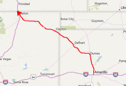
We got on I-25 North, and after just a few miles, crossed into Colorado. This would be my first visit to the state of Colorado with Fred, but it would not, by any means, be my last.
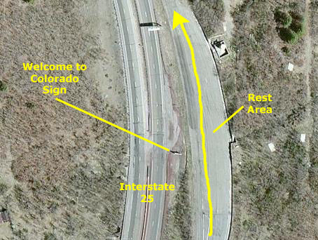
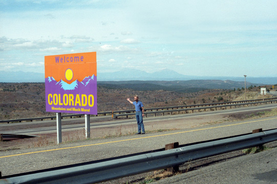
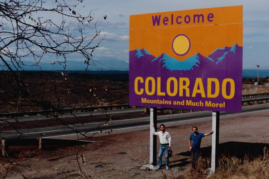
When Interstate 25 crossed into Colorado, there was a turnout off to our right, and we thought we'd not only stop and have a snack but also record our entry into Colorado by taking a couple of pictures.
|
The view is of the exact point where I-25 crosses the Colorado State Line. You can see the turnout where we stopped for our snack, and I have also pointed out that there was one of those "Welcome to Such-and-Such a State" signs that one often sees when major highways cross state lines. How do I know that the little mark is a "Welcome to Colorado" sign? I know because we walked over to it and took a couple of pictures. I took one of Fred, and he set up his tripod and took one of the two of us.
Here are those two photos, and I think it is pretty amazing that I have the ability to zero in on the exact location where one of our pictures was taken- from above:
 |
 |
Fred almost always has his tripod with him, and makes an effort to take pictures of himself and whoever he might be with. Actually, he pretty much always tries to have a human being in his pictures; "It gives the picture scale", he often tells me. I am kind of lax about that, so I shall have to make an effort to do the same thing.
|
While not particularly well-known now, the town would be the setting for an animated cartoon show of the same name that will premiere on the Comedy Central cable channel in 1997. It will become a cult sensation, and is still running as I write this in 2016. The show will spawn two feature-length movies, one of which will garner an Academy Award for Best Original Song, and even a Broadway Show. But all that is still ahead for the sleepy little Rocky Mountain ski town.
|
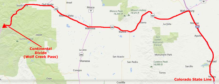
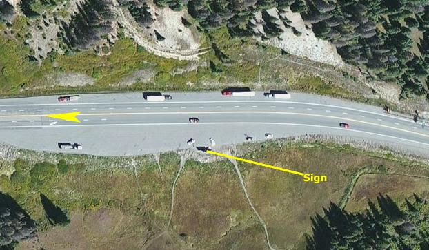
Once again, I am able to include here an aerial view of the pass, and you can clearly see the marker that will appear in two of the pictures we took here. I saw in the aerial view that the highway was two lanes in each direction, although I was pretty sure it was just a two-lane road when we came through. Sure enough, I discovered that the highway was widened in the late 1990s, because the road carries so much east-west traffic.
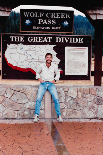
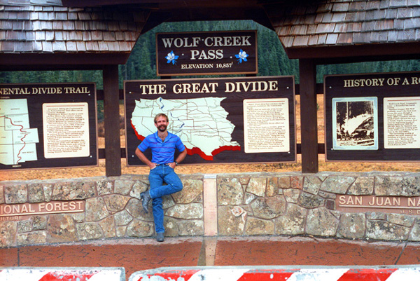
We pulled into the parking area on the south side of the highway to get out and take some pictures. Of course, we wanted to use the Wolf Creek Pass sign as our backdrop.
|
|
The sign was pretty interesting. On the left, it talked about the Divide Trail; in the middle, it talked about water flow; and on the right, it described the building of the road through the pass. If you would like to read any of those signs, just click on it, and I'll enlarge it in a little popup window for you.
From Wolf Creek Pass we continued west on US 160; as we drove on towards Durango, Fred was eagle-eyed enough to spot these deer that were quite close to the road. They stayed where they were as we rolled slowly to a stop by the side of the road, but fled when I opened the truck door to take their picture. We were driving along the western slopes of the San Juan Mountains, and so there were wonderful views out ahead and to the west of us.
 From an Overlook in the San Juan Mountains This view looks West towards the town of Durango, which is down in the valley at the extreme right of the picture. In the center of the picture, and many miles off in the distance, is Mesa Verde. |
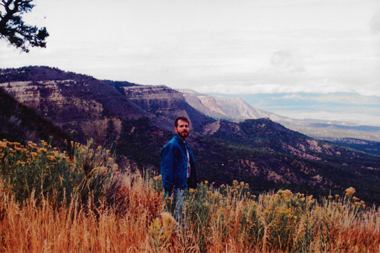 On the Western Slope of the San Juan Mountains The day had become cold at this elevation, and even with the jeans jacket it was a bit uncomfortable. |
The day was actually cloudier than it appears here, at the edge of the San Juan National Forest, which tapers off as you near Durango. I was a bit worried that Mesa Verde, where we were going to camp, would be just as cold, but Fred pointed out that it was a good deal lower and thus should be warmer. As it turned out, the first snowfall occurred the next day here.
 The Western Edge of the San Juan Mountains This is just another shot taken at the same overlook as the previous two. I have added a shirt and jacket since this morning, and my hands are in my pockets for a reason. |
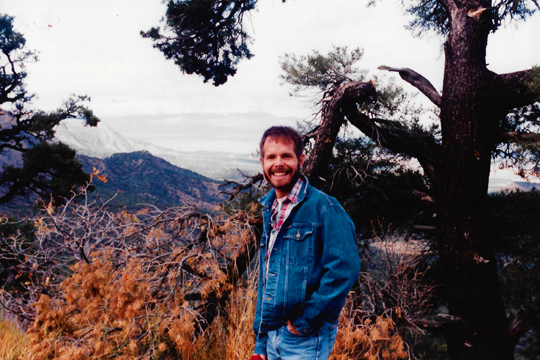
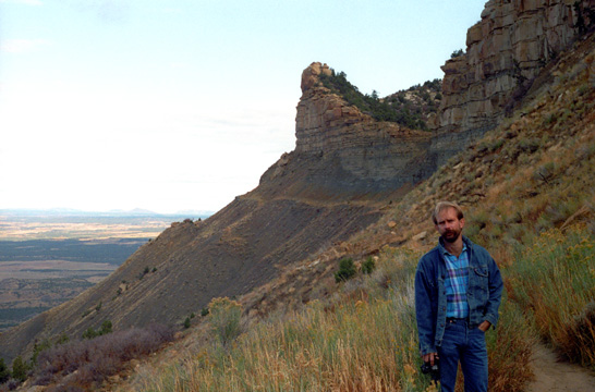 Fred in the San Juan Mountains The overlook has a trail that you can walk down, although the mist was making it just a bit muddy, so we didn't go very far. |
You can see that the trail actually continues on and curves around the rock outcropping in the background. At this point, the forest gives way to more grassy vegetation. Further west of here, the trees are mostly evergreens and mostly varieties of Juniper. The large stands of hardwoods have been left in the East. It looks as if there are lots of rock slides in this area.
|
We got to Durango just at dusk, and since I had neglected to bring a pillow to use while camping, we stopped at a K-Mart to get one. Then we continued to follow Highway 160 into and through Durango and on out towards Mesa Verde. As we climbed out of Durango, the weather turned rainy and it got quite dark. As we were driving along, we were trying to decide whether we really wanted to be setting up a tent in the dark and the rain, and then trying to fix dinner under the same conditions. We decided that it was getting so late that we would probably even have difficulty finding a campsite, even if it was late October.
All these things combined to influence us to decide to go back the six or seven miles into Durango and get a motel room for the night, and that's what we did. We ate dinner at a Mexican restaurant in town, and since it was not raining much in the town itself, walked around a bit and looked at the station where the train to Silverton stops (something else Fred had done but which he thought I might like to do sometime). We spent a relaxing evening, and got a good night's sleep.
You can use the links below to continue to another photo album page for our Western Trip or return to the Index to continue through the photo album.
|
October 25, 1992: Mesa Verde and Silverton, CO |
|
Return to the Index for Our Western Trip |