|
July 23, 1993: Lost Valley / Eden Falls / Eden Cave |
|
Return to the Arkansas Trip Index |
Today, we'll be walking around Eureka Springs first, and then later on going out to Hurricane Caverns.
Eureka Springs
|
Eureka Springs is very much a tourist creation; other than the old springs that are here, the whole town is tourist-based. There are lots of bed and breakfast inns, quite a few old hotels, and a plethora of new motels and such. Most of the stores downtown cater to tourists; there are lots of art galleries and lots of local crafts.
As you might expect, the history of Eureka Springs revolves around its namesake springs. Native American legends tell of a Great Healing Spring in the Eureka Springs area, and artifacts indicate the area was long visited by verious indigenous cultures. Europeans arrived in the 1800s, and they described the waters of the springs as having magical powers. Dr. Alvah Jackson is credited with first documenting the location of the spring; in 1856 he claimed that the waters of Basin Spring had cured his eye ailments. Dr. Jackson established a hospital in a local cave during the Civil War and used the waters from Basin Spring to treat his patients. After the war, Jackson marketed the spring waters as "Dr. Jackson's Eye Water".
In 1879 Judge J.B. Saunders, a friend of Jackson, claimed that his crippling disease was cured by the spring waters, and he started promoting Eureka Springs across the state; a boomtown was born. By 1880, the city had expanded from a rural spa village to a major city and flourishing tourist destination. The city incorporated in 1880 as thousands of visitors covered the area with tents and shanties. By 1889, Eureka Springs was Arkansas's second largest city- behind Little Rock.
We spent some time just walking around the town and taking pictures. After his term as a Reconstruction governor, Powell Clayton moved to Eureka Springs and began promoting the city and its commercial interests. Clayton promoted the town as a retirement community for the wealthy, and the town soon became known for gracious living and a wealthy lifestyle. The last decade of the 1800s saw an unprecedented building boom, and many of the beautiful Victorian buildings built by the turn of the century have been preserved and form the quaint streetscape that is Eureka Springs.
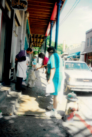 Outside a Bakery |
(Picture at left) We stopped at a small bakery to get a bite of breakfast. Outside of the shop, the proprietress was feeding this neighborhood dog, who was cute when he stood on his hind legs begging.
(Picture at right) |
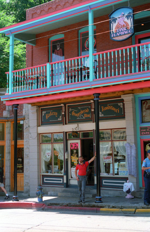 A Typical Eureka Springs Storefront |
The Ozarka Water Company was formed in Eureka Springs in 1905; it still operates today. Carrie Nation moved here towards the end of her life, founding Hatchet Hall on Steele Street; the Hall is closed but we walked by the building. In 1950 Opera in the Ozarks at Inspiration Point was founded, and the summer festival continues today. Religion played its part; in 1967, the famous 7-story Christ of the Ozarks Statue was built and a year later, The Great Passion Play was begun as an outdoor performance piece (it, too, is still in operation). Other Christian-themed attractions have been added, including architect E. Fay Jones' 1980 Thorncrown Chapel.
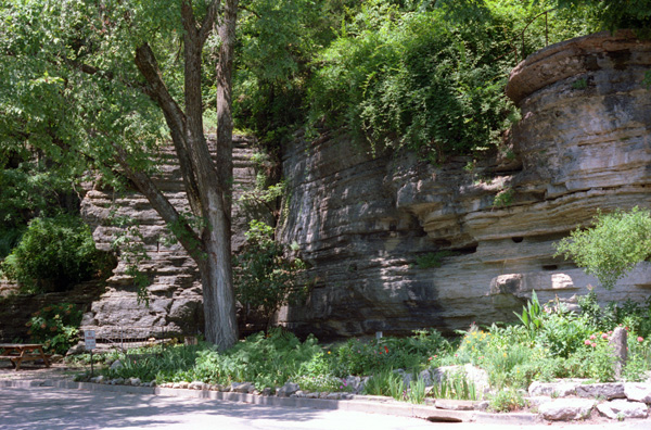
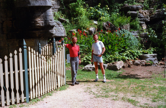 At One of the Many "Eureka Springs" An obliging tourist took this photo of Fred and I at one of the many springs that dot the area; this one was just a few blocks from downtown, and emerged from the mountainside behind a very pretty little pocket garden that had been created around it. |
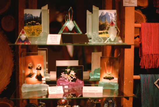 Artwork by Don Davidson (Bartlett, Texas) When we visited Don earlier this year, we learned that he had shipped some his glass-and-metal artwork to this gallery in Eureka Springs, and I wanted to take this picture to show him. Unfortunately, you cannot read his name on the small card in the center of the picture. |
We spent some time driving through the homes in the area, and we found many of these corner parks, each with its own little spring. On the way back to the center of town, we stopped at a couple of antique stores, and Fred found some more stereopticon pictures for his collection.
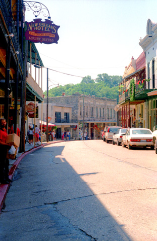 A Eureka Springs Streetscape |
(Picture at left) Fred is off to the left carrying the packages containing the things we have bought.
(Picture at right) |
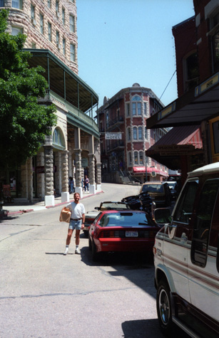 Eureka Springs Archiotecture |
We did our part for the local economy; we actually stopped in to quite a few shops and stores- something I don't usually make a point of doing. I found a buffalo cut-out for Fred and some owl motif carvings for Larry. After we got back to the car, we drove around the Eureka Springs area for a while to see some of the local color. We also passed a number of small springs. Many of the homes are actually bed and breakfast inns; there are quite a few of them. There are also some isolated springs, some of which are public.
|
|
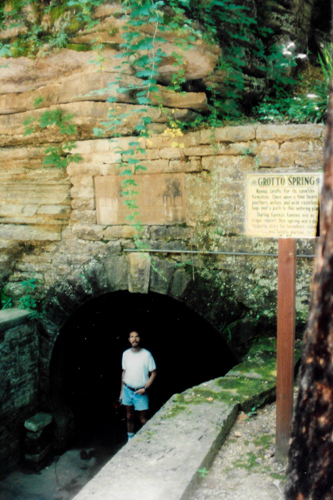
Grotto Spring really wasn't a cave, more like a hollowed out area in the cliff face. As soon as we got down into the opening, the air temperature dropped about twenty degrees, cooled just by the underground insulation.
The spring was neat; someone had built a low rock wall on which to sit, and the water dripped into a small pool. I think there must have been some underground outlet, for the water level stayed constant, even though there was no little stream exiting the pool.
This was a really neat little area, and the perfect place to stop and relax on such a warm day. After about fifteen minutes, we went back to the car to continue our tour of Eureka Springs.
|
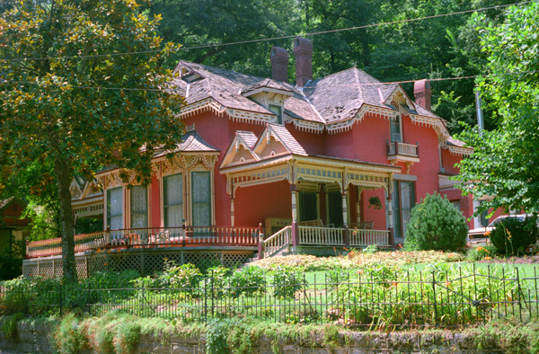
This home has been restored (or maintained) perfectly, and I just couldn't get by without taking a picture of it. Many of the larger homes that we drove by were bed and breakfast inns. Fred and I have never stayed at a "bed and breakfast", usually opting for an inexpensive motel wherever we ran out of steam for the night or, of course, a tent camp.
But we certainly know what they are, and how they differ from your traditional hotel. There are lots of "B&Bs" here in Eureka Springs; many of them, we understand, are gay-owned and/or gay run. At some point, when we have the luxury of advance planning, perhaps we can give one of them a try.
Eureka Springs was one of the most picturesque little towns I have ever seen. Parts of it were way to touristy, but the residential areas were really neat. I definitely got the feeling that many of the permanent residents knew each other in that way of small towns; but they also know on which side of the bread their butter is located.
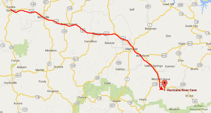
Hurricane River Caverns
|
In the late 1800s zinc mining began on the property below the cave, and this continued up through World War I. It was not a tunnel mine, but rather an open pit mine, where they kept going deeper and deeper. Today, the zinc vein lies beneath 20-30 feet of rubble. But this mining activity opened up other caves, and this area has some of the only publicly-accessible cave excavations in the world.
For example, there is a very small cave, called Bear Cave, down in the canyon, and it is accessible to the public. You can explore the cave on your own (although beginning many years ago, visitors have to sign a liability waiver. There is also another cave across the valley from Bear Cave, being slowly revealed beneath a bluff shelter. At that site, volunteers have been excavating the cave manually, in the hope of being the first ones to discover the extent of this new cave system. This is a free activity, for one and all. The whole area is rich with crinoid fossils, and visitors can keep the ones they find.
|
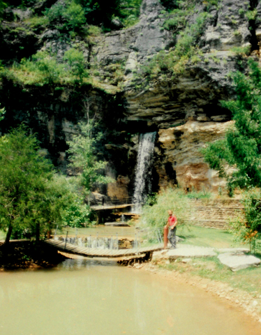
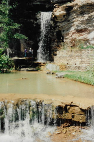
When we arrived we had no problem signing up for the next tour, but we did have thirty minutes or so to wander around by the entrance to the Caverns; that's when I took the picture of Fred at left.
Hurricane River Caverns is located in the heart of Ozark Mountains of Arkansas. These caverns are extensive, and still have not been fully explored. New passageways have recently been discovered, and partially explored. Since this is a living cave system (formations are actually growing), visitors not taking one of the guided tours (there are self-guided tours and a wild cave tour for adventure seekers), are cautioned not to touch the formations, and of course not to leave anything in or take anything natural out of the cave. I actually found out shortly after our tour started that only a few of the formations in the cave are still growing; this, apparently, is why self-guided tours are allowed.
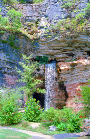
A word about the waterfall in the picture at left. The Caverns are part of an underground aquifer, and there was an underground river here before the zinc mining. Its course was changed as a result of that activity, but there is still some water that comes out at the main entrance. There is no natural waterfall, though; that was constructed to add interest to the main entrance. The water that comes out of the cave here, and the water that follows the new underground course, ends up in the Buffalo National River.
We did not have long to wait for our own tour to begin, and so let's head off. We took a number of pictures inside and outside the caverns, so let's have a look at them:
 The Caverns Entrance |
(Picture at left) That water is not actually coming out of the cave; it is supposed to simulate what the flow was like before some blasting for mining changed the course of the underground river that fed the cave. But it makes a nice touch.
(Picture at right) |
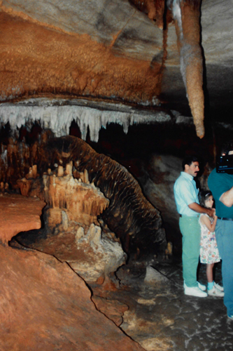
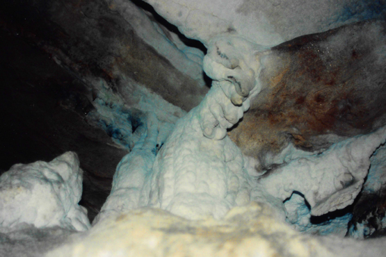
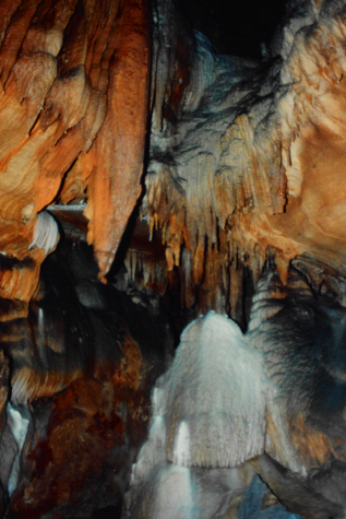 Formations in the Caverns |
The guide said that the cave does not go back extremely far, and that much exploring has been done, but that not every nook and cranny of the cave has been investigated. There are actually a lot of minerals in this cave, and were it not for the fact that it was not protected early on (the people who owned the cave before allowed others to take formations) and also were it not for the situation with the reduction in water flow, the cave would still have many growing formations.
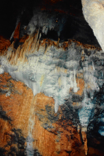
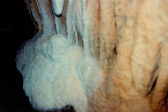
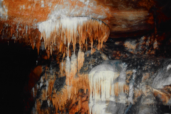 More Delicate Formations The colors of the formations were interesting, but not as vibrant as in some of the caves out West. This particular cave is not a major one, but even the off-the-beaten-path caves usually have something to recommend them. |
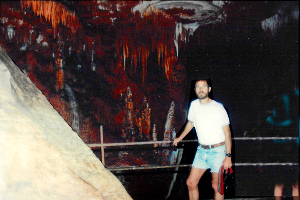
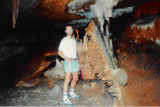 Me With Some Collapsed Formations This is what most of the cave looks like- relatively featureless and uninteresting. Here, you can see a large chunk of ceiling formation having fallen (or having been dislodged by human activity). You can see a couple of larger stalactites have been broken as well. |
Many of the formations are still pretty, however. There used to be a great deal more water coming through this channel; now there is just a trickle. There is also a lot of sediment that is clogging up the water flow through the cave, with the result that the major formations are no longer active.
|
|
Our guide pointed out that this particular cave seems only to be about a half-mile in length, and only a couple of levels have been found and explored. Even so, all caves are interesting- this one no less than others we have visited or will visit.
When we got to the back of the cave, we spent some time listening to our guide and asking some questions. She could answer most of those commonly asked, but I don't think she was well-versed in much beyond that.
|
|
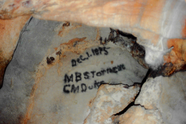
First, it was inscribed in a section of the cave that had no formations, so nothing had to be destroyed or defaced to do it, other than a section of featureless rock. Second, this is "authentic" graffiti, recording the fact that someone took the time and the trouble to come back this far into the cave, which, in 1875, was no mean feat. At least the graffiti doesn't say "Cindy from Los Angeles" or "Blackhawks Rule" or "Pick up milk, bread and hamburger."
Here are the last two pictures that we took inside the Caverns. One shows a kind of ropy formation, and the other is a slightly out-of-focus shot of more of the crystalline formations:
 |
 |
We thought that our 90-minute tour of Hurricane River Caverns was interesting and fun, and well worth the small admission fee involved. The private folks who own and operate the cave have done a thoroughly decent job of maintaining this cave, even though it is hardly a first-tier attraction.
|
I was interested to find, in creating this page, that the tour setup has changed dramatically since our visit this year. I have no idea when these changes took place, but now Hurricane River Caverns offers a choice of four different tours: our regular self-guided cave tour (there is no longer a guided, non-strenuous walking tour like the one we took), and three guided, extreme cave tours. All four of these tours now involve a signed liability waiver (why, I am not sure).
The extreme guided cave tours are: the "Deep North", the "East Passage", and the "Mill Creek" extreme tours. These cave tours, are billed as being very popular for extreme adventure lovers, because they include any combination of vertical climbs, sliding, stumbling, contortionist positions, sticky gooey clay, irregular terrain, tight squeezes, short swims, disconcerting ravine crossings etc. These extreme cave tours, according to the Caverns' current website, "will undoubtedly test your courage and endurance...are not for the faint of heart or the claustrophobic". I think this probably just increases their popularity; certainly if these tours had been available when we visited, we probably would have tried one.
Perhaps the tour guides also got a makeover, because the website continues: "The wild tours we provide are guided by highly trained and knowledgeable tour guides. We also provide equipment such as caving helmets, headlamps, knee pads, and gloves, to ensure the safety of our wild cavers".
It was mid-afternoon when we were done at Hurricane River Caverns, and we drove to a picnic spot close to the Buffalo River and had a sandwich and something to drink. We discussed the trip home, now that we'd done the things we wanted to do. From here to Dallas is an 8-9 hour trip, and we didn't particularly want to tackle that this evening. Soe drove on down US 62 to Conway and then on into Little Rock intending to stay the night there.
We got a room at a La Quinta, which was quite nice, and we spent some time in the pool there. Then we went to dinner at a seafood place that Fred and Prudence had been to years earlier. It was a pleasant and delicious dinner, although I got lost on the way to the restaurant. When we got back to the hotel, we changed and went out see what kind of trouble we could get into at the only local bar my guide mentioned; we stayed just a while before heading back to the hotel.
On Sunday morning, we slept in, but by noon were on the road back to Dallas along I-30. We ate lunch on the way and reached home about six-thirty; getting back a bit earlier than we usually do gave both of us a chance to rest up before beginning another work week.
This was another very enjoyable trip with Fred. Taking these trips has become a staple of our friendship; I certainly enjoy doing them with Fred, and I hope he enjoys doing them with me. No one knows what the future holds, but I look forward to more of them.
NOTE:
I wrote the above words in late 1993 as I was cataloging photos from the year, but I am creating this page in 2016, sitting in the Best Western Comanche (Texas) waiting for Fred to finish up a visit with his Mom up in DeLeon. We are actually on our way back from our fifth trip to Big Bend National Park, this one with four friends that in 1993 I had yet to meet- Prudence Lucas, her sister Nancy, and their husbands Ron Ruckman and Karl Gleim. Actually, I just met Prudence for the first time a few months ago when we took her a kitten from our trip down to Bartlett, Texas, but a lot has to happen before I meet and become very close friends with the others. Fred and I did turn out to take more trips together- so many it is hard to count- but at least four or five a year. I hope you will move forward through this album to experience some of them with us.
Just use the links below to either go to another page for this Arkansas trip or to return to the trip index page so you can continue through the photo album.
|
July 23, 1993: Lost Valley / Eden Falls / Eden Cave |
|
Return to the Arkansas Trip Index |