|
October 24, 1993: At Frank and Joe's in Leakey, TX |
|
October 22, 1993: Big Bend: The Window and Boquillas Canyon |
|
Return to the Index for Our Big Bend Trip |
Today, we plan to hike the Lost Mine Trail before we leave Big Bend this afternoon. Then we will drive behind Frank and Joe heading to their house near Leakey, Texas, where we will spend tonight.
|
Before starting out on the day's activities, which will be highlighted by a hike up the Lost Mine Trail, we have struck the campsite and now driven up to the lodge area to buy some postcards and a few supplies.
This morning, I happened to talk with a ranger who gave me some surprising information. We had noticed the day before when we went to put our campsite fees in the slots provided that there was a little sign that said due to cutbacks in staff, campsite fees would not be collected. That seemed silly to me. I realize that they might not have the staff to go around and verify that all the occupied campsites had paid their fees, but campers are an honest lot, and I would have thought that the rangers would just "harvest" the fees and not worry about who paid and who didn't. After all, any money is better than none.
If you had a store, but couldn't afford staff, but were still required to allow customers to shop, wouldn't you at least put a sign inside for customers to deposit the approximate amount of their purchases in a slot by the door before leaving? You certainly would if you knew that your customers were an honest lot. Well, what we found out was that campsite fees did not stay at Big Bend National Park, but were sent to Washington, so of course the park gets little benefit from them. So if staff is tight, it made sense that they wouldn't worry about collecting them. I still think that campers should be on the honor system to deposit their fees, though.
I think what was going on was some kind of tiff between local Park personnel and the National office, and that not policing the campsite fees was one way that the Park could show its displeasure. The ranger did say that when visitors to a particular park make donations at the marked points, then these donations did stay at that particular park. I mentioned this to the guys, and we ended up dropping our campsite fee in one of the donation boxes in the Lodge office.
|
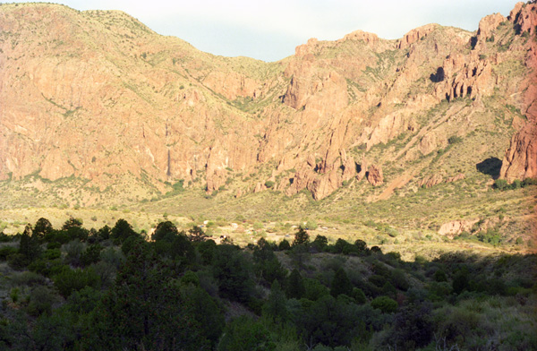
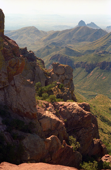
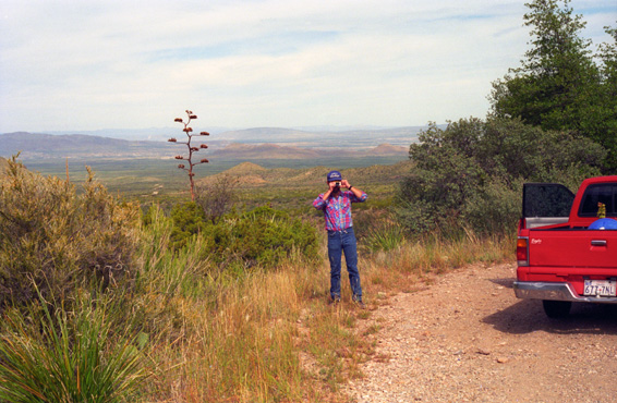
Taken from the top of the switchbacks heading to the pass, this view looks view towards The Window. You can see the basin campsites in the right center of the picture, and The Window is that first ravine from the right of the picture. An amazing view, and you should click on the little thumbnail at right to see the full-size picture.
The Lost Mine Trail
|
Lost Mine Peak is actually off to the east, but at the saddle you have a decision to make. You can turn west onto the Casa Grande Trail, and continue past that peak to intersect with the Emory Peak Trail which you can take back into the Basin. Or you can turn left and continue up the Lost Mine Trail.
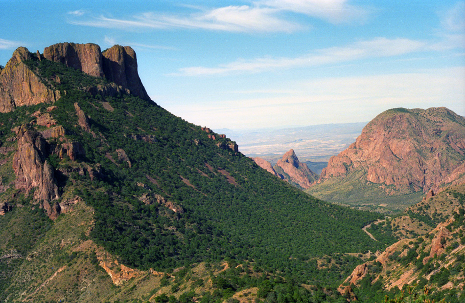
The trail works its way along the saddle for a ways and then begins a long series of fairly steep switchbacks as it climbs the slopes of Lost Mine Peak. Eventually, the trail comes out on an open rock outcrop from which there are spectacular views of Juniper Canyon and, across the canyon, Casa Grande. Lost Mine Peak is behind and above. At this point, trail continues as a backcountry trail, intersecting with the Chisos Loop Trail, a 30-mile trail that encircles the entire Basin.
|
The hike starts out fairly easy, and there is a self-guiding nature trail included. Fred has taken one of the guidebooks and is reading to us at the various stops along the nature trail. We have seen much Mexican pinyon pine, one of the most common evergreen trees in the mountains. Both animals and man have gathered and eaten the pine nuts produced by this tree. There are many plant-eating mammals, such as rodents, and of course a whole population of meat-eating mammals that feed on them, including the ring tail fox, the gray fox and the cougar.
The trail starts out through a montane woodland of species generally only found in Mexico, but whose range just crosses the border in Big Bend and perhaps a couple of other mountains in West Texas. These include Mexican pinyon pine, and the weeping juniper, and the red peeling bark of the Texas madrone. In the case of the first two, the Chisos are the only place in the U.S. to see them. Other common species on this trail include Alligator juniper, evergreen sumac, and a variety of scrubby oak species, including Emory oak and Chisos red oak. In the understory are agave, yucca, sotol, and cactus species.
|
As we were walking along, we were talking about why the peak is named Lost Mine Peak. Everybody seemed to have ideas, including the obvious ones, but it took some later investigation to uncover the whole story. Stories that are two centuries old and involve four differrent cultures- Indian, Spanish, Mexican and American- have circulated forever; they talk lost mines and buried treasure in the Chisos. Though historians may dismiss the story as legend, documented history does hold suggestions that the mine may well have existed.
The Lost Chisos Mine is so popular in the Big Bend that the National Park Service sanitized one version:
| "Of many romantic legends which abound throughout the West, few match the lost mine story from which Lost Mine Peak takes its name. Is it true? Did the mine exist? Or was it a camp-fire fabrication handed down from generation to generation? It is true that early Spanish explorers of the Southwest discovered and developed many mines, some yielding silver and gold. According to legend, a rich ore body was discovered near the summit of Lost Mine Peak. Prisoners were forced to work the mine. These men were blindfolded on several occasions, in their march from Presidio San Vicente, to prevent them from learning its location. (The ruins of this presidio are about 20 miles southeast of this peak.) The story relates how Indians who resented the Spaniards' invasion of their homelands, attacked and killed them to the last man. The final act, according to the story, was to seal the mine entrance to prevent further exploration. The legend states, however, that if a man stood in the door of the chapel at Presidio San Vicente on Easter morning, he would see the sun's first rays strike Lost Mine Peak at the exact mine entrance. (It's not necessary to point out that Easter is floating holiday, and that the sun wouldn't always be in the same position on that day; the church no longer exists, and so there is no door in which some modern-day treasure hunter could stand." |
|
There are several oaks here as well. The oaks of the Chisos Mountains are very difficult to identify because of the great variability of leaf size and shape, even on the same tree. They also hybridize, producing trees with intermediate characteristics. Many of them produce edible acorns for the wildlife, and they are the prime ingredient in the Fall color within the park.
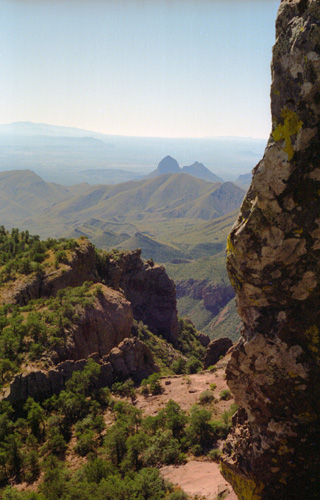
The trail steadily climbed along the side of the ridge and then reached the ridgetop at about one mile. From here, the first of the spectacular views opened up. At this panoramic point, you can see down the Juniper canyon across the entire southern portion of the park. You can also look across to Emory Peak (the highest in the park) and behind to the sheer cliffs of Casa Grande. We took a number of pictures from here at the saddle ridge (click on the thumbnail images to view):
|
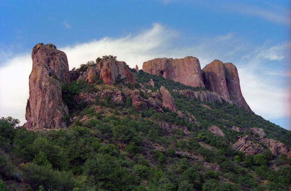
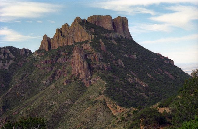
Juniper Canyon and other formations were built by great dome-shaped masses of molten rock moving towards the earth's surface. In some places, like Casa Grande, the lava breached the surface and flowed over the land. In other places, like Lost Mine Peak and Pulliam Peak, the lava cooled beneath the surface. The Peregrine Falcon, and endangered bird, uses some of these cliffs during nesting, which is why you aren't allowed to hike up Casa Grande from February through July.
|
|
We continued heading east along the saddle, the trail ascending the slope of Lost Mine Peak as it approached the longest and steepest series of switchbacks on the trail. Just before we reached them, the angle was perfect for unobstructed views back towards the Basin- and beyond.
|
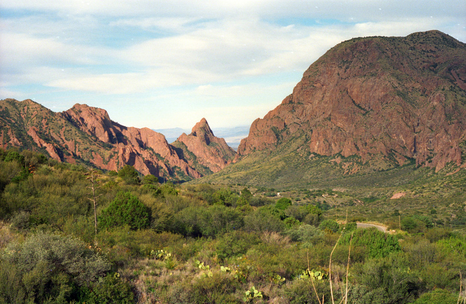
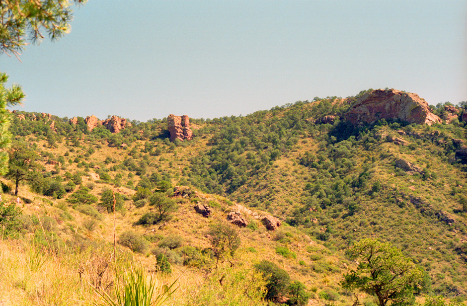
This picture offers an excellent view of where we were hiking yesterday morning. You can barely pick out the basin campground, and you can see the road where the trailhead for the Lost Mine Trail is just at the right of the picture and quite a ways below us. That is Casa Grande at the left. Can you pick out The Window? It is the first v-shaped depression from the right of the picture.
I think its also interesting that you can see, at the bottom of the picture, the saddle where we came up to get our first views of Juniper Canyon. You can make out the trail that runs over past Casa Grande, and you can also see the route that we just took to get up here to the switchbacks.
Now the trail began ascending in earnest, up a series of switchbacks as it climbed higher and higher. It is here that we came across several nice specimens of Texas madrone. Eventually after several steep switchbacks, the trail reached the top of Lost Mine Ridge. The trail continued along the ridgetop until we reached a rocky point where the day-hike portion of the trail ended; at that point we were more than 6800 feet high. All along the ridge the views were just incredible, and I will let the pictures speak for themselves.
|
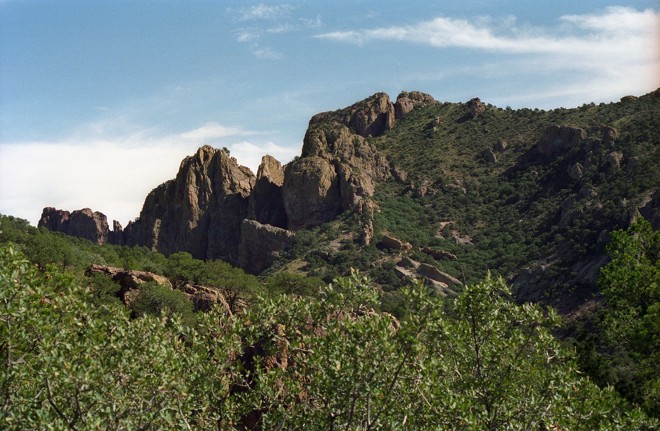
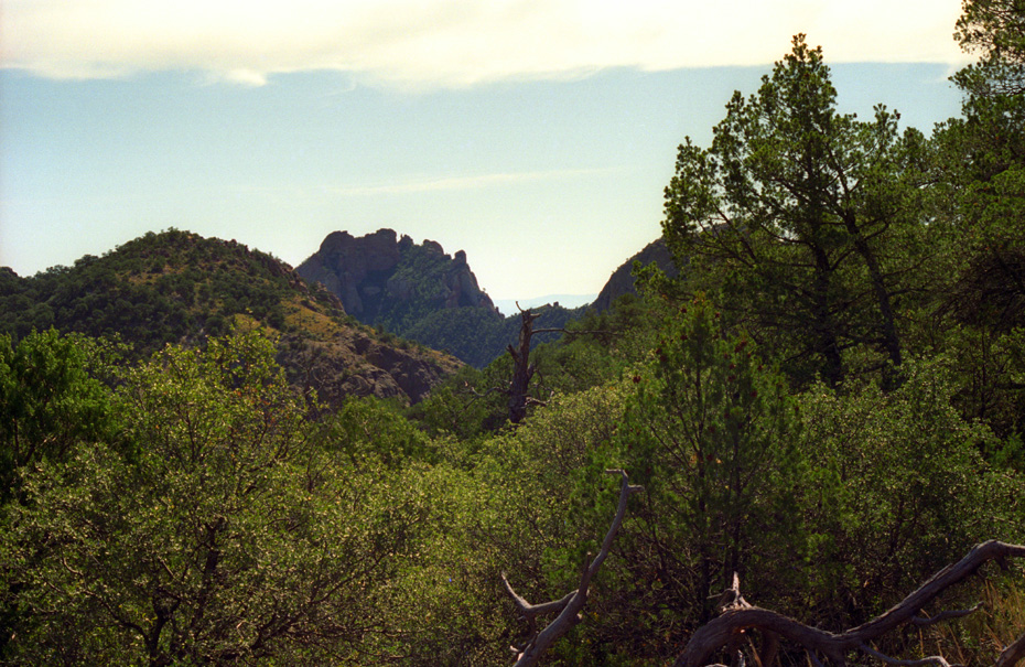
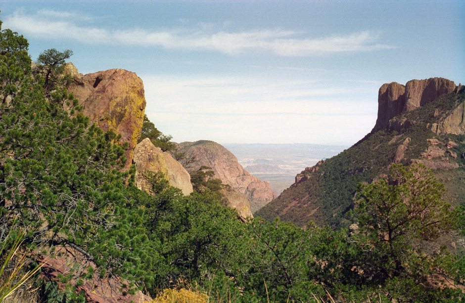
Here is a view of the ridge line between Pine Canyon (beyond the ridge) and Juniper Canyon on the Lost Mine Trail. This is the ridge we are traversing, although that is not Lost Mine Peak. The day-use portion of the trail does not go all the way to the top of that ridge, though. |
Here is a view of Lost Mine Peak, taken from the Lost Mine Trail ridgeline; as you can see, getting to the summit would be an all-day affair. It can be done, I suppose, if you start early enough, but the summit is achieved mostly by backpackers who either do an overnight out and back or who do the Chisos Loop Trail. My guess is that if we were to try to attain the summit, we would have another three or four hours to go and another fifteen hundred feet to climb (and not nearly enough time to do it). |
We have been passing many varieties of cactus on our trip so far. Common among them is the lechuguilla, which is closely related to the century plant. The Agave, or century plant, spends its entire life, ten to twenty years, manufacturing and storing nutrition in roots and leaves. In its final year of life, the plant uses this energy to grow a great flowering stalk which may grow as much as twelve inches in one day. After seeds have matured, the plant dies.
|
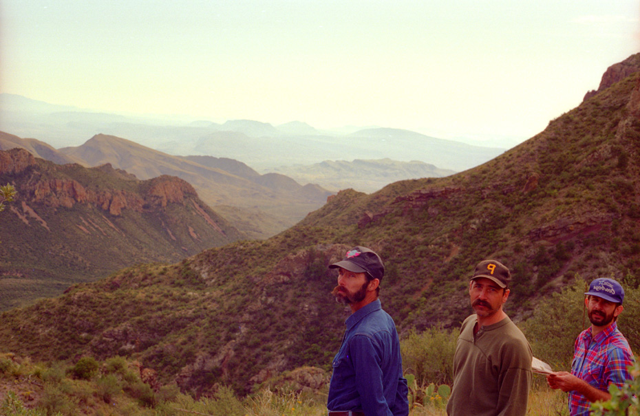
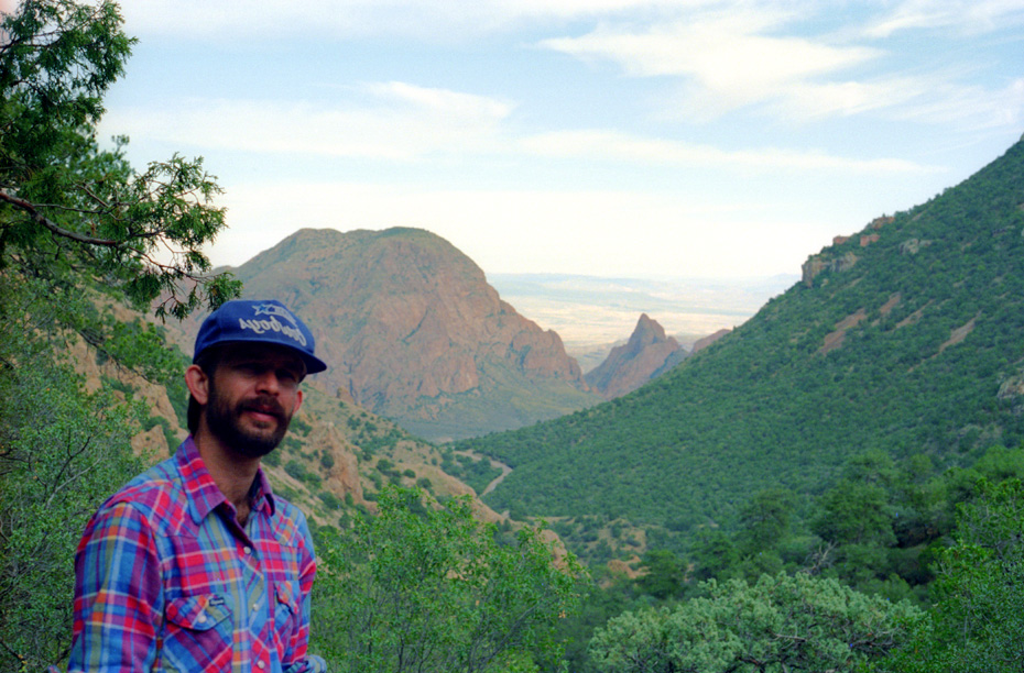
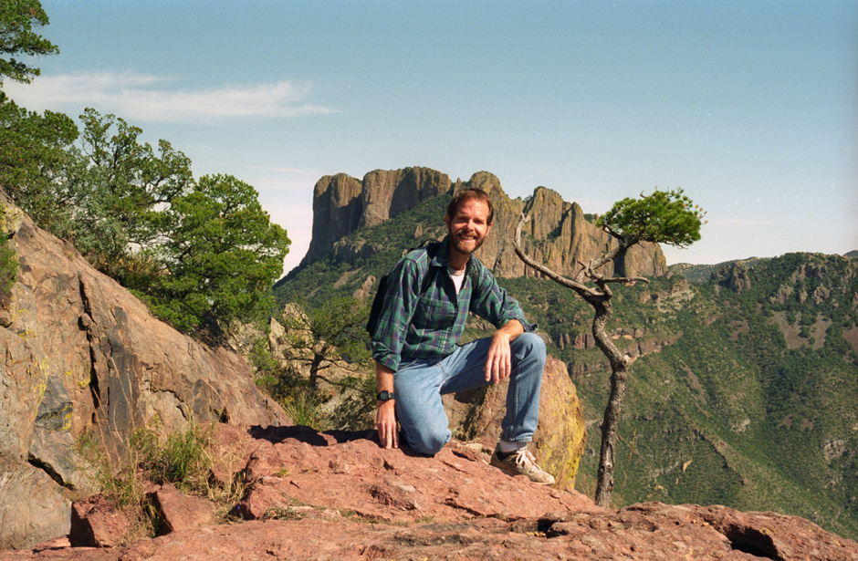
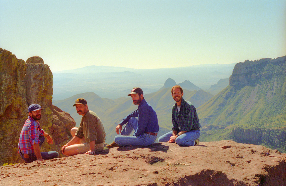
Here are myself, Fred, Joe and Frank on the Lost Mine Trail with Juniper Canyon in the background. We have gotten so high now that we can see over most of the Chisos Mountains to Mexico in the distance. We have seen a lot of one-seed juniper, which can be identified easily by process of elimination. If the leaves do not droop, and if the tree does not have alligator bark, it is probably one-seed juniper, so named because each cone usually only has one seed in it. |
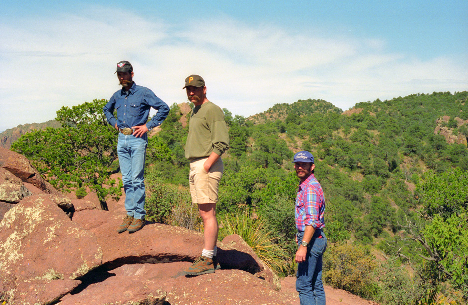
Here again are Frank, Fred and Joe on the Lost Mine Trail. As we have moved along the trail, we have stopped to look at a number of different varieties of plant life. We have seen lots of ocotillo, a common plant in the Southwest desert. It is not actually a cactus, but is in a family all its own. It is unusual in that it completely sheds its leaves during periods of drought to minimize wasteful evaporation. The leaves grow in immediately after soaking rains. Hummingbirds are attracted to the bright red flowers of the plant. |
As we approached the end of the trail along this ridgeline, we got another excellent view of Lost Mine Peak We also saw quite a bit of Sotol, a common plant of the Chihuahuan Desert. It has long slender leaves with teeth along the edges. It flourishes, along with grasses, in the gravel slopes intermediate in elevation between the high mountains and the arid lowlands. The Mexicans distill a fiery alcoholic beverage, known also as Sotol, from the juices of this plant.
|
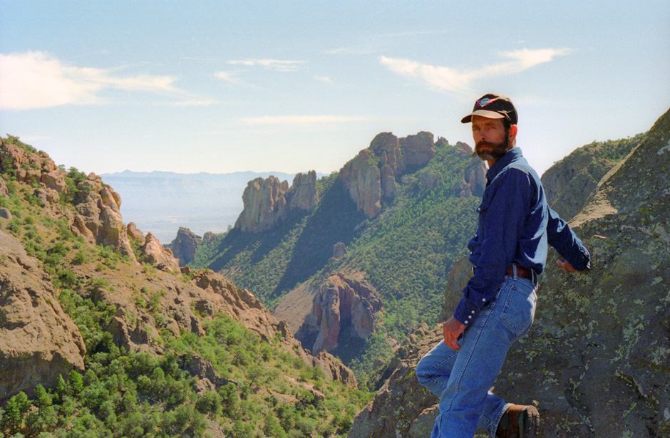
Here I am, high along Lost Mine Trail, with Casa Grande in the background. We have passed a lot of dead trees in this area, most of which died during a sever drought between 1951 and 1957. |
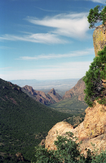
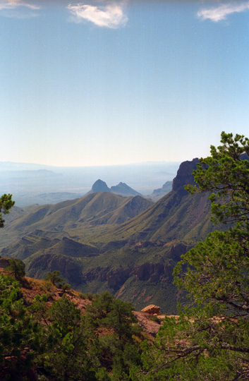
Here is another view back towards The Window from Lost Mine Trail. Now, we are too high to see The Window itself; we are looking over it to Santa Elena Canyon and the valley beyond. |
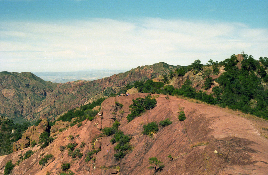
At the end of the day-hike trail, we came to a bare rock outcrop where we could sit down and admire the spectacular views. Looking down into the canyon to our south, we saw a number of large Arizona pines, which look very much like the closely related Ponderosa pine. This was Pine Canyon and those pines are relics of the ice age when the climate was considerably cooler. Only the shade provided by the canyon keeps it cool and moist enough for them to survive.
|
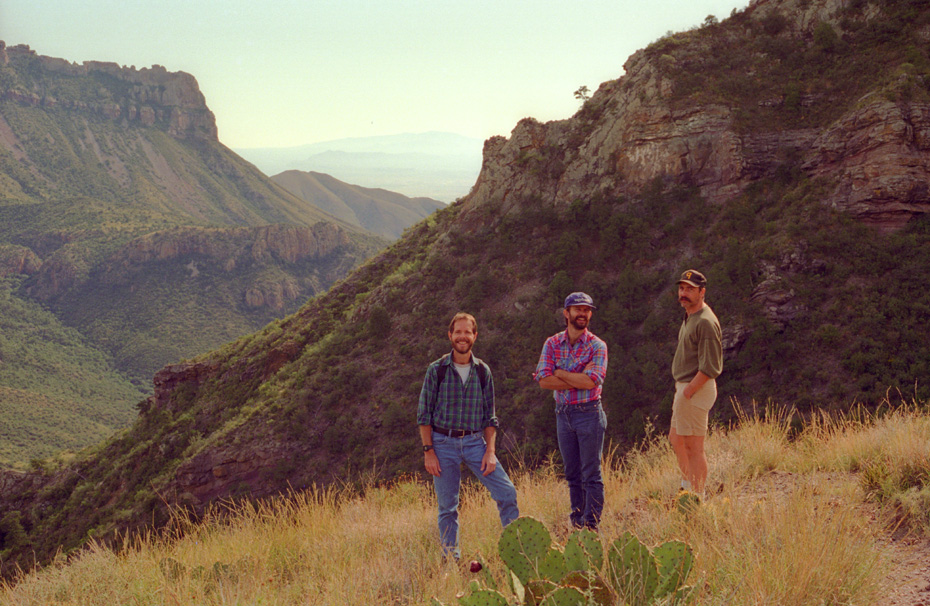
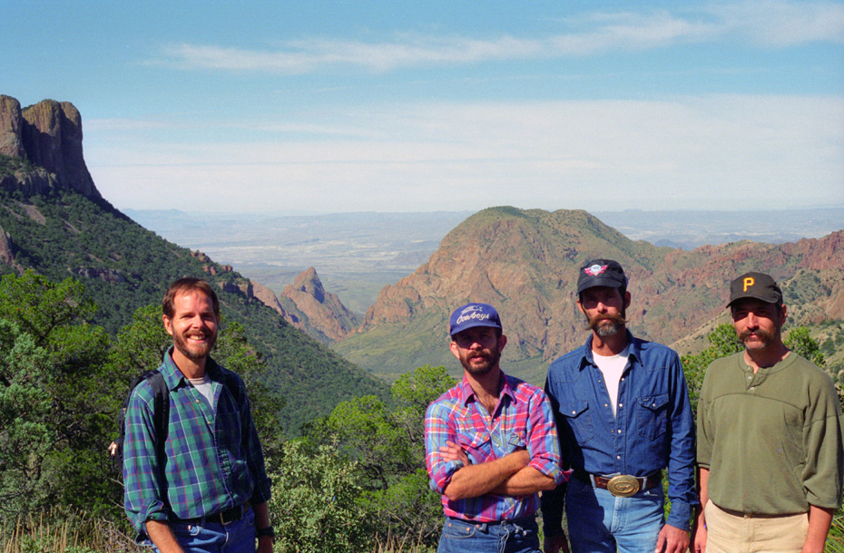
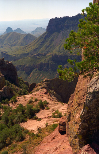
Here are Frank, Joe, Fred and myself at the end of the Lost Mine Trail. After more than two hours on the trail, we have reached the rock outcrop that is the end of the day-hike portion of the trail, and are taking a well-deserved rest. We are alone up here, except for one other couple who are sitting on another high spot some distance away having their lunch. This view looks southwest across Juniper Canyon into Mexico across the Rio Grande. In the far distance, in Mexico, is Pico Creel, about as high as we are now. |
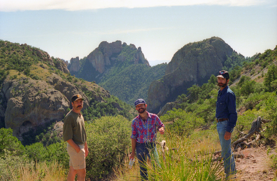
Even though we were at trail's end, I went a bit further up and along the ridgeline so I could get a picture Frank, Joe and Fred and the rock outcrop itself. This shot looks northwest, also towards Mexico. The trail we took to the summit comes out on this peakis point came out onto the rocky outcrop from behind where the other guys are sitting, rather than from where I am now. Right about this point I had to change film, and I wasn't sure if this picture had turned out, but I was happy to find out that it had. |
Across the other side of Juniper Canyon on the upper slopes of Emory Peak, a mature forest of pines grows and if you have binoculars, you can even see some Rocky Mountain Douglas firs growing on the shady slopes. At over 7000 feet, it is the only place these trees can grow for nearly 250 miles to the north in the Guadalupe Mountains, although they are found in the Sierra del Carmen 40 miles east in Mexico.
 A Southwest View from Lost Mine Trail |
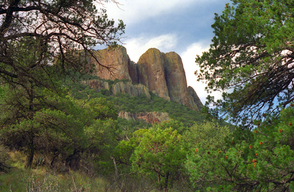
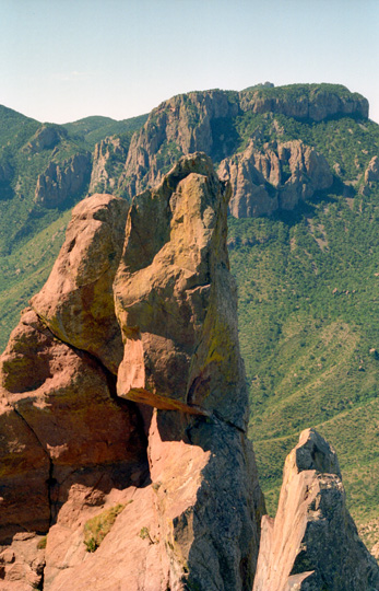
(Picture at left) At right is one of the sheer rock spires, with the meeting of Juniper Canyon and Pine Canyon beyond. To get this shot, I had to climb down from the trail to a narrow rock shelf from which I could look at the supporting rock outcrop. To my left, as I sat wedged in the rock face, was a drop-off of about a hundred feet or so down to the slope of Pine Canyon. Sitting in this position, I was insulated from the sounds of everyone on the peak itself, and all I could hear was the wind whistling softly along the rock face. It was also sunny and warm at this spot.
(Picture at right) |
 Juniper Canyon |
In this spectacular setting, we could look across the desert and truly feel the remoteness of this place. It was very, very beautiful up here, and we hated to have to leave. We stayed about an hour, taking some final pictures, before heading back down the trail.
|
The last picture from our Lost Mine Trail hike was taken on the lower portion below the saddle, and is a good view of Casa Grande. I commented before that I would like to climb that peak sometime; I understand that it can be scaled out and back in a single day, so I hope Fred and I will get to do that in the future. We got back down to the parking area about two-thirty in the afternoon, and then we debated what we should do for the rest of the afternoon. The feeling was that another hike would take too long, and get us on the road to Leakey too late in the day for comfort. Frank and Joe wanted to reach the ranch before midnight if they could, and certainly none of us wanted to be driving real late at night as tired as we would be by that time. So, while we ate lunch, we decided to just strike out for Leakey right afterwards.
The Drive to Del Rio
 Fred Along the Basin Access Road This view looks north into west Texas. You can also see an excellent view of a century plant, whose life cycle I have described earlier. |
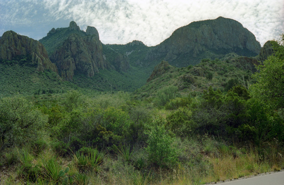
 Looking Back Towards the Basin At another point, I wanted to get a picture of the Chisos Mountains that surround the Basin, and this viewpoint was a good one for that. |
 The Chisos Mountains Another shot taken from the Basin Access Road. Lost Mine Peak is just beyond these mountains, but hidden from us by the angle of the shot. |
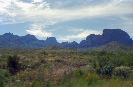 The Chisos Mountains From a little further down the road out of the Basin, this view shows the Basin area in the center, Casa Grande just left of center, and Lost Mine Peak at the left. |
We got to the main park road, turned eastward, and drove the few miles to Panther Junction. We stopped at the visitor center to mail postcards and so that Fred could buy another CD that he had been interested in, and so we could all use the facilities before starting out.
|
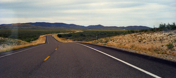
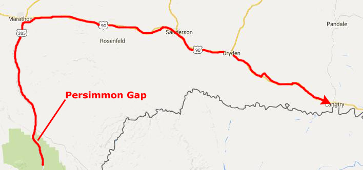
We then headed north on US Highway 385. This is the area a few miles before Persimmon Gap where we pulled off the road a ways and went hunting for cactus. Fred found exactly what he was looking for, and Frank also found some new varieties of cactus for his own collection. Even I found a neat specimen that Fred said he would take and pot up for me. We were all a bit anxious as we neared the Persimmon Gap entrance to the park, since we were technically poaching to be bringing cactus samples out of the park.
But there was no one to stop us or even slow us down as we left Big Bend National Park headed for Marathon, Texas. Like every single one of the trips I have been on with Fred, this visit to Big Bend National Park was extremely enjoyable and informative. It was especially good to be camping with Frank and Joe. I don't think they get away from the ranch as often as they should, and it was a pleasure to have them with us.
|
Langtry is notable as the place where Judge Roy Bean, the "Law West of the Pecos", had his saloon and practiced law. Established in 1882 as a Southern Pacific Railroad as a grading camp, the town was later renamed for George Langtry, an engineer and foreman for the railroad. Roy Bean arrived soon after completion of the railroad and set up a tent saloon on company land. He later built a wooden structure for his saloon, which he called "The Jersey Lilly" after the well-known British stage actress Lilly Langtry (no relation to George). Appointed a Justice of the Peace and Notary Public, he Bean used the saloon as his headquarters. After a notable career, Bean died in 1903.
At its height in 1892, the town had a post office, a general store, a railroad depot, and two saloons. But when the highway was moved slightly north, and railroad left, the town population dwindled to 40. However, tourism to the Judge Roy Bean Visitor Center continues to keep the town alive.
|
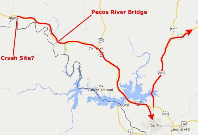
We stopped, intending to visit the Bean Museum, but were there just long enough to find out that the Judge Roy Bean museum was for the day, but we did look around for a while. We didn't see any debris, either. Then we headed on towards Del Rio.
We found ourselves crossing the Pecos River near sundown late in the afternoon. I'd never been here before, so we thought we stopped to have a look at it.
|
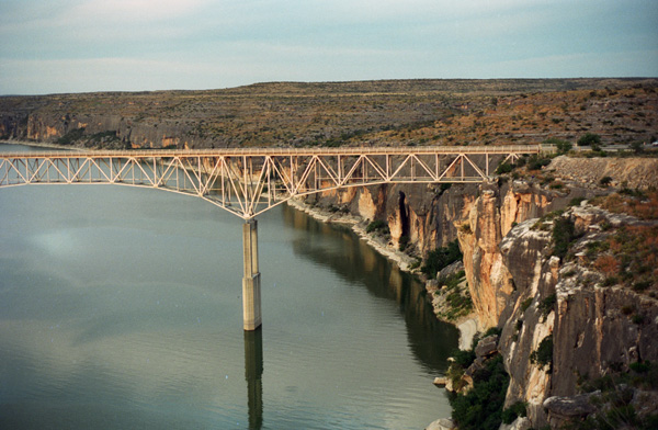
The current bridge, at 1,310 feet long and originally 273 feet above the water (a measurement that now fluctuates with the rise and fall of Lake Amistad water levels), the Pecos River Bridge is the highest highway bridge in Texas. An overlook alongside a pullout on the northeast end of the bridge affords excellent views of the Pecos River canyon.
On the Del Rio side of the bridge there is an observation point, so we drove up there to get some more views of the bridge. Here you can see how graceful the bridge is. It looks as if something this light and fragile couldn't possibly carry the weight that it can, but it does.
Upstream just a few miles, out of sight around a river bend, is the second iteration of perhaps the most famous bridge in Texas � the Pecos High Bridge, also known to railway enthusiasts as the Pecos Viaduct. Completed in 1892 to accommodate the southern transcontinental railroad, it was at the time the third highest bridge in the world. The cantilevered bridge, composed of an iron and steel latticework suspended across the canyon, contained over 1820 tons of metal. Reinforced in the 1920s, the bridge remained in service until a replacement was constructed during World War ll, another engineering marvel still in use today.
We stopped at the end of the bridge and walked out on it, and we drove to the overlook just south and just above the bridge to get a better look at the structure. Here are some of the photos we took:
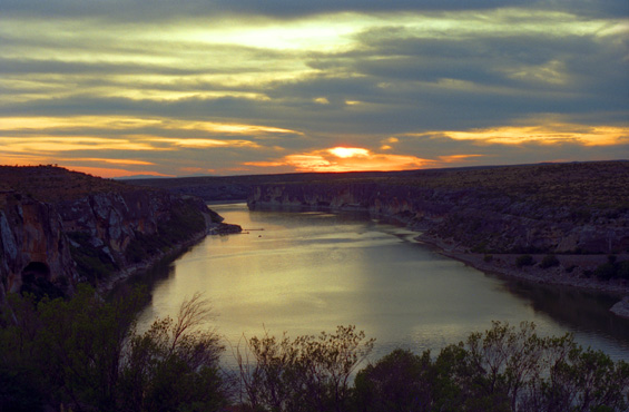 Sunset Over Lake Amistad This view looks west-northwest from the western approach to the Pecos River Bridge. |
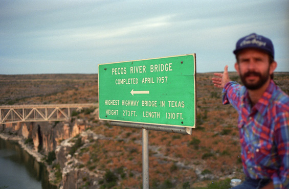 Fred at the Pecos River Bridge The light was really is really beginning to fade, so to get the sign in focus meant that Fred had to be blurry. |
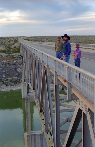 On the Pecos River Bridge |
(Picture at left) Here are Frank, Joe and Fred on the bridge. Fred's fear of heights has kept him from going right to the edge of the bridge and looking over. In fact, while we were standing there, a large tractor-trailer truck came rumbling by and Fred was visibly upset by the vibrations that its passing caused in the bridge structure.
(Picture at right) |
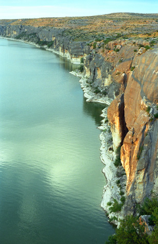 Looking Upstream |
When we left the bridge, we went on to the town of Del Rio, Texas, where we asked Joe and Frank to pick a restaurant for dinner. We had suggested Mexican, but hoped that Joe would pick something he felt comfortable with. He did pick a Mexican place, and it turned out that they had never been to it before. The meal was not very good, and unfortunately Joe got sick immediately. We waited a while until he felt better, and then we headed on.
Events on the Drive to Leakey
After dinner, we headed north on US Highway 377 to Rock Springs, planning to then take Texas Highway 55 to Camp Wood, where Joe's parents live, and then east on Texas Highway 337 to Leakey. The trip should have been uneventful, and it was, except for the fact that Fred and I got stopped by the Border Patrol.
|
Just north of Carta Valley, the headlights became the flashing lights of a police car, and we got pulled over. Frank and Joe saw what was happening, and they came to a stop a quarter mile ahead of us. It wasn't the police, it was the Border Patrol. I'm still not sure why they chose to stop us. Sure, we had the bed of the truck full of stuff, and I suppose an illegal could have been hiding there, but a simple inspection would have shown that not to be the case. The claim was that we were suspicious because we were speeding up and slowing down, but we explained that was really their fault for following us for 50 miles. But when they found out that we were returning from Big Bend, things got out of hand. Apparently, they got it in their heads that we might be transporting drugs.
Now, neither Fred nor I had ever been stopped for either reason, and so we had no real knowledge of the protocol in these situations. We have since educated ourselves, of course, but that night we were neophytes. We had no idea that when the agents asked Fred if he had any objection to having a dog sniff around the truck we would have been well within our rights to decline. The Border Patrol does not have the right to conduct random searches for drugs; they can do so for aliens, but you only need a visual inspection for that.
Anyway, Fred said yes, and happened next was predictable. The dog "found" something in the driver side door. Well, that was all the justification the Border Patrol agents need to keep us tied up for the better part of an hour in a fruitless search for something that didn't exist, forcing us to take most of our stuff out of the truck for inspection. Of course, nothing was found, and we were eventually let go.
Talking with Frank and Joe about it the next day, we've concluded that the Hispanic agents were taking the opportunity to cause trouble for a couple of Anglos. But had we had time to figure things out, and had we had our rights explained at each step, we could have avoided all but about five minutes worth of delay. It was a frustrating experience, being jacked around by the Border Patrol. While one might agree with and support their objectives, at least in this instance their methods didn't help us feel any better about the job they are supposed to be doing. I thought seriously about writing the Border Patrol about the incident, but Fred correctly pointed out that this would do little, if anything. So we just wrote it off.
We got to the ranch between eleven and midnight, took a welcome shower, the first we had since leaving Midland, had a snack, relaxed for a while watching television, got some animals fed, and then hit the hay.
You can use the links below to continue to another page for our Big Bend trip or to return to the trip index so you can continue though the photo album.
|
October 24, 1993: At Frank and Joe's in Leakey, TX |
|
October 22, 1993: Big Bend: The Window and Boquillas Canyon |
|
Return to the Index for 1993 |