|
October 29, 1995: Fall Trip to Arkansas: Day Four |
|
October 27, 1995: Fall Trip to Arkansas: Day Two |
|
Return to the Index for Our Fall Trip to Arkansas |
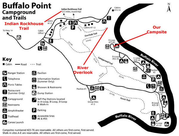
We arrived at the Buffalo Point area of the Buffalo National River at about 7PM last night, and we got a campsite with no problem.
Camping at the Buffalo National River
|
The Buffalo River, slightly more than 150 miles long, was the first National River to be designated in the United States. The lower 135 miles flow within the boundaries of an area managed by the National Park Service, where the stream is designated the Buffalo National River. The river flows through Newton, Searcy, Marion, and Baxter Counties, from west to east. The river originates in the highest part of Boston Mountains of the Ozarks, flows out onto the Springfield Plateau near the historic community of Erbie, and finally crosses the Salem Plateau just before joining the White River.
The Park is home to the state's only elk herd. The upper section of the river in the Ozark National Forest is managed by the U.S. Forest Service and is designated as a National Scenic River and a National Wild River; that section is not part of the area managed as a park by the Park Service, but is managed as a part of the Ozark National Forest.
|
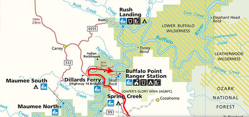
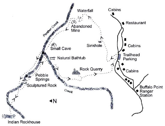
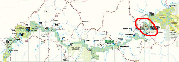
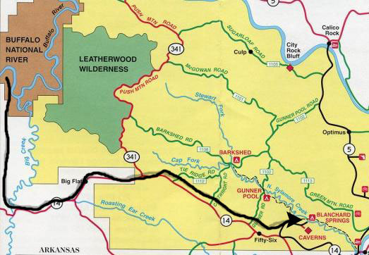
The Buffalo National River actually wanders over a hundred miles through Arkansas. We have been to the Buffalo River before, but this was the furthest east along the river that we have been. Here is a small map of the whole National River with the small area where we will be today marked on it:
 |
The Buffalo National River was established by an Act of Congress on March 1, 1972, ending the recurring plans of the U.S. Army Corps of Engineers to construct one or more dams on the river. The National River designation protects natural rivers from industrial uses, impoundments and other obstructions that may change the natural character of the river or disrupt the natural habitat for the flora and fauna that live in or near the river.
|
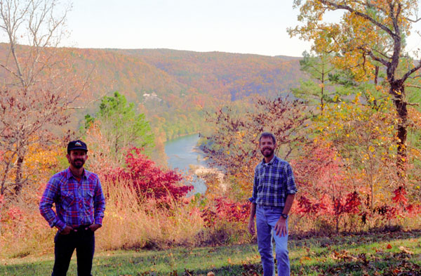
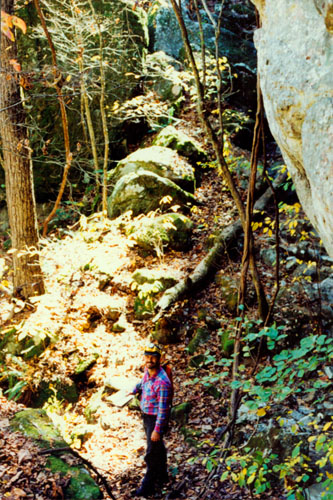
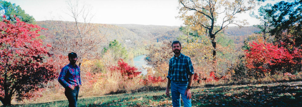
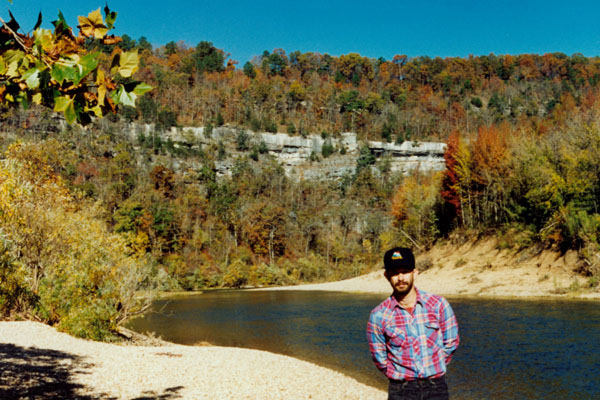
Before we struck the tent and set out on our first hike today, we got out the tripod and posed on the hillside with the Buffalo River in the background, and that's the picture you can see at left.
At a point about 15 miles above the Park boundary in Newton County, Arkansas, the Buffalo River begins as the Main Prong of Big Buffalo Creek. The river flows north through Boxley to Ponca, where it then begins an eastward trek across northern Arkansas to its confluence with the White River on the Marion-Baxter County line. Advanced canoeists and kayakers often refer to the 15-mile section upriver from Boxley, Arkansas as the Hailstone River. This extremely challenging section of the river is floatable only during periods of high water and should be attempted only by those with solid whitewater skills.
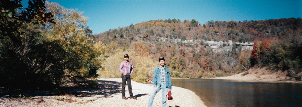
After we took the picture above, Fred got the idea to take a panoramic picture from the same spot, mostly just to see how much different the view would appear in that mode:
 |
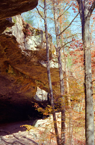
Along the upper river, the gradient is steep and the water is fast, leveling and slowing as the river runs its course. The upper section has most of the whitewater rapids to be found along the river, and features dramatic topography including sink holes and caves, springs, and waterfalls, over 500-foot-tall sandstone and limestone bluffs, and many rock formations. The river's ancient current also gives life to well over 300 species of fish, insects, freshwater mussels, and aquatic plants.
|
 |
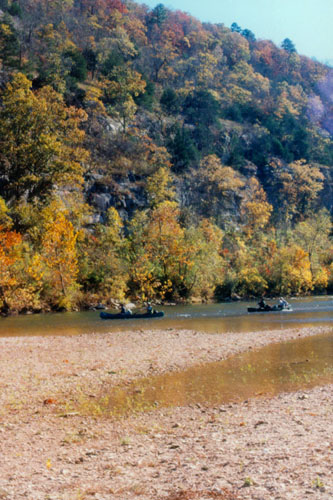
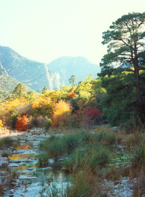
This was just a beautiful morning for walking down here by the river. I understand that the current water flow is classifed as "low", with the heaviest rains in this part of the country occurring in the late spring and early summer.
|
We've been to the Buffalo River before, but it was considerably upstream (actually southwest) from here. Originating high in the Boston Mountains, the buffalo drops steadily to its confluence with the White River. The gradient is steeper and water runs faster along the upper river, leveling and slowing as the river runs its course. In some places, long quite pools between rapids disguise its vertical travels. The land's wilderness and isolation are dramatized by side trips into the hollows flanking the river, many of which have not been frequented since the Civil War.
The river is fairly wide, but at this time of the year there's not a lot of water in it, so there is only a small channel that is too deep to wade across. Most of the river bottom rocks lie exposed, and there are always interesting specimens to find. Many prehistoric and historic cultural sites are located in the park, some dating back more than 10,000 years. These sites range from terrace village sites, to bluff shelters once occupied by Archaic Indians, to cabins built by early settlers. Buffalo Point itself, the campground where we stayed, was built in the early 1930s by the Civilian Conservation Corps.
While we were walking along the river, Fred took another panoramic view picture:
 |
We spent more than an hour down by the river before heading back up the trail to the campground to head off for our major hike of the day.
The Indian Rockhouse Trail
|
The Indian Rockhouse trail winds on hillsides and along a streambed to Indian Rockhouse Cave, once a shelter for Native Americans. Considered moderately strenuous, the trail is 3.5 miles round-trip and the return is mainly uphill.
It was a beautiful day for hiking and from the trail guide there would be much to see.
Immediately after starting down the trail, one gets an education in forest flora. We passed stands of smooth sumac and quite a bit of poison ivy. As the springs along the trail became more frequent, we begin to see Christmas, maidenhair and bracken ferns, and also may apples.
|
|
During heavy rains, great amounts of water flow down the ravine and pour into the sinkhole, disappearing into the crevice below. Over thousands of years the action of the water has carved the limestone into beautiful pieces of natural art.
We continued down the trail, through stands of oak, elm and hickory, a large stand of white oak, and glades with scattered cedar trees- very much a hardwood forest. We passed a number of small waterfalls, many of which were dry at this time of year.
|
|
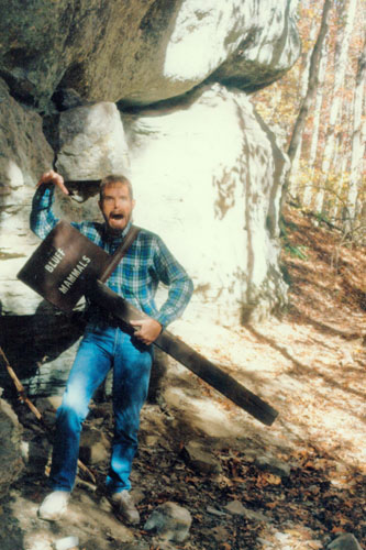
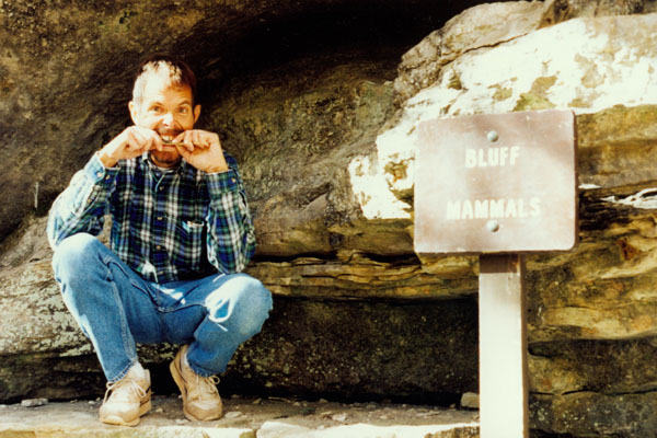
There were actually quite a few signs along these rocky outcroppings that small mammals do indeed make the crevices their homes. We might see a bed of dry leaves, tiny hairs, and droppings, all indicating the presence of wood rats, deer mice, and white-footed mice.
However, these creatures are seldom seen because they are active at night and typically hide out somewhere during the day. Many people have an aversion to these small mammals because of their pesky relatives- the house mouse and the rat. These latter species are imports from the Old World, and have caused serious prejudice against many of the harmless woodland rodents.
|
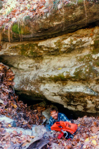
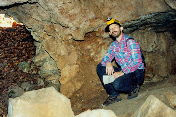
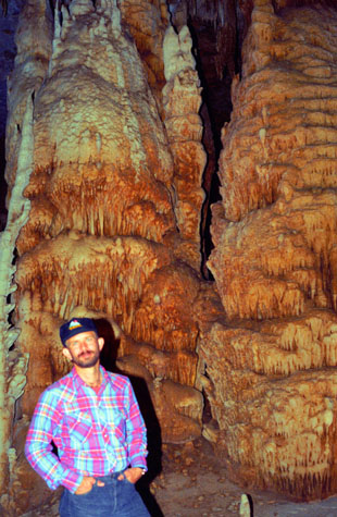
Around 1800, zinc was found in this area and mining towns began springing up everywhere. The largest mines in this area were located just eight miles down the Buffalo River at the abandoned town of Rush. During World War I, the value of zinc skyrocketed and local people, thinking of getting rich quick, began prospecting their own lands.
Unfortunately, most of the mines such as this small opening proved to be void of any mineable zinc and were soon forgotten. This mine is now the home of deer mice, wood rats, and cave salamanders. Notice the day pack up the mine entrance.
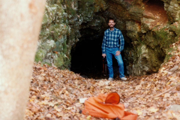
We took this picture in one of the abandoned mine entrances, and after we did so, I left ahead of Fred, walked past the day back and then across a very small glen to stand in front of the opening of yet another mine.
|
Fred followed me out of the first opening and then got his camera down low to the ground to take the picture of me at right. The daypack is in the same place as in the picture above, which may give you some indication as to the relative positioning of the two openings.
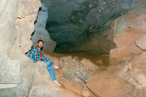
This part of the trail was really interesting for all the little caves and such along it. Of course, I had to go in all of them as far as I could.
A short distance away, the trail joined Panther Creek, a tributary of the Buffalo River, and there is sometimes a waterfall here, fed by a spring. But the spring itself is dry most of the year, and it was dry now. Like so many Ozark streams, most of the water is underground in a myriad of passages through the porous limestone. From here, the trail sloped upward to the Indian Rockhouse. Along the creek were a number of places where much witch hazel grows.
Small waterfalls are common in the Buffalo River Valley. In many cases, as with this particular waterfall, water flows from the ground at a spring, travels a few hundred feet and spills over a bluff. Many times the water flows back into the ground just below the fall, only to reappear as a spring somewhere else. There was a muddy, damp area below where the waterfall would be, and the guide said that a well-traveled road once passed between the spring and the fall, creating erosion during hard rains and making the fall area muddy. The road has been closed and nature is slowly beginning to repair the fall’s beauty.
|
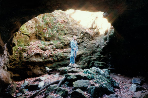
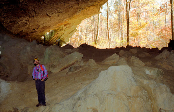
This cave was especially interesting, and Fred and I spent a bit of time here. One entrance slopes fairly gently down to the floor of the cave, about twenty feet in front of me. On my right, there is another crevice that continues down some thirty or forty feet to a small chamber.
It was easy to scramble down there, and it got fairly dark- too dark for any pictures. Both Fred and I were able to get down there, and we really felt like spelunkers. The other entrance to the cave is behind me, and is basically a large sinkhole.
After Fred took this picture, he went out the main entrance while I climbed up and out of the cave via the sinkhole. It wasn't difficult but it was fun.
But when Fred went back out the main cave entrance, he was going slightly downhill, while I was going uphill to get out of the cave via the sinkhole. So when I got out, I found us vertically separated.
|
In this cave, unlike the little rock overhangs we'd already seen, we could actually feel the coolness of the cave air. Small caves like this one are home to many kinds of wildlife including rodents, toads and tree frogs. The cool, dark crevices and moss-covered ceilings make an ideal home to many such animals.
The phoebe is a common bird of caves and can often be heard calling its name; it's call sounds like "fee-bee". They build their well-camouflaged nests of mud and mosses on the walls and ceiling. The guide cautioned us not to disturb any nests we might find; in spring they may contain eggs or young.
When I rejoined Fred, we continued down the the trail. We were going to take a side trail to Bat Cave, but we met some people coming back who told us that it really wasn't worth the hike, and that the Indian Rockhouse was much more interesting, so we continued straight on to the point where the trail met an old roadbed.
There we turned a bit right to follow the old roadbed to the Indian Rockhouse. We reached the rockhouse and, sure enough, it was pretty impressive. We enjoyed exploring around inside, and we took some good pictures here.
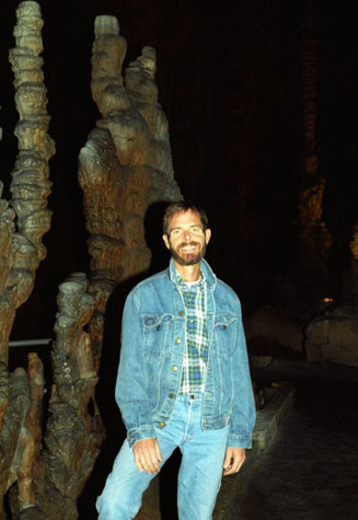
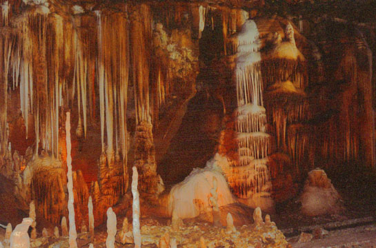
 Fred in the Indian Rockhouse The main opening of the rockhouse is quite large, and you can see about half of it here. Just above Fred's head is another opening in the ceiling that can be used, and behind him to the left is another small room that leads to yet another entrance to the cave. Inside the rockhouse, the floor is bare and quite sandy, possibly the action of the water that runs through the cave. |
 Me in the Back of the Indian Rockhouse The rockhouse is a fine shelter, with a natural skylight, a running stream during most of the year, cool springs in the rear part of the cave, and a fairly constant year-round temperature. It must have made an ideal home. There is the room you can see (perhaps thirty feet long and twenty feet high and bare), and one more room connected to it off to the left of the picture. |
To get to the back of the Rockhouse, you have to cross over the stream that runs through the cave, then climb up the rocks to the level area in back.
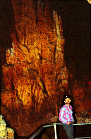
 Fred at the Back of the Indian Rockhouse At the very back of the rock shelter water flows partially underneath the back wall- either an underground stream or water from a nearby spring. Fred is kneeling by the place where the water first enters the overhang. The water is flowing fairly swiftly, so if it's a spring, it's a good one. The water was quite cold and seemed clear, but I supposed one can't tell its purity from that. I tried some, and it was delicious, and I suffered no ill effects. The pool behind Fred goes ten feet or so back under the overhanging rock until it meets the back wall of the cave. |
 Fred Kneeling by the Stream in the Indian Rockhouse The stream eventually disappears way back in this crevice. We went back as far as we could go, taking different routes to a final small room where you can stand up. The water disappears into an opening too small to go through, and it must go back underground, because there is no stream outside nor any further down the trail with that much water in it. I think the stone shelves that Fred is on are really neat. It is certainly pretty back here, and this must have made an ideal shelter through the ages. Fires could be built near the skylights, there were rooms in back for security, it is easily defensible, and there was a constant supply of fresh water. |
The entire floor of the rockhouse was covered in a find sand, and I'm not sure where it would have come from. It either blew in over time, or people's footsteps over time have ground down the sandstone and limestone, or the action of the water flowing through the rockhouse slowly created it.
|
|
I didn't think the bathtub was all that impressive; I've seen similar formations out west that look a lot more like tubs, so I assume the name is just to identify the formation. Various old artifacts indicate this break in the woodland was once a homestead. Early settlers of these parts learned to live with nature and took advantage of its every offering.
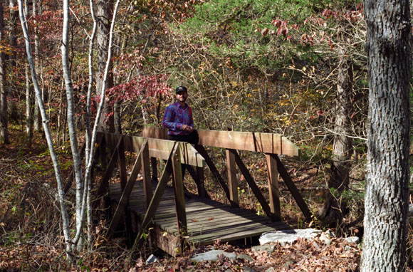
From the bridge, the trail began to ascend through the forest. I hadn't realized that we'd been walking downhill all the way from the trailhead, and we were about to make all that up pretty quick.
|
This entire area was once at the bottom of a vast ocean that teemed with life. The fossils most common here are crinoids. When you look at the loose rock near the bluff of the quarry, you can see their round, disc-like segments. You can also find brachiopods. Geologists say that rock layers 450 million years old, some of the continent's oldest, are found near the mouth of the Buffalo only thirty miles downstream.
Here one of nature’s forces, water, has labored for thousands of years, slowly modeling this bedrock into a variety of curces and drops. Each pebble and stone within the stream is a tool- rollingand turning, chipping and scraping. However, the real beauty of nature’s sculpture is that it is never complete- constantly being altered into a new and more fascinating one.
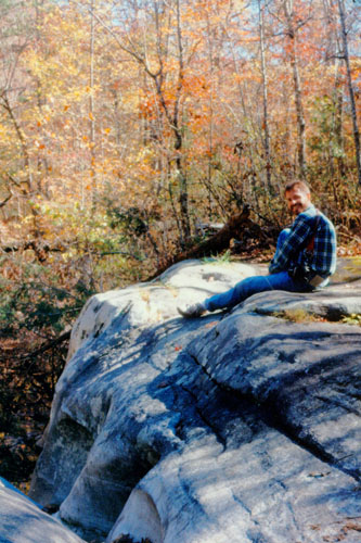
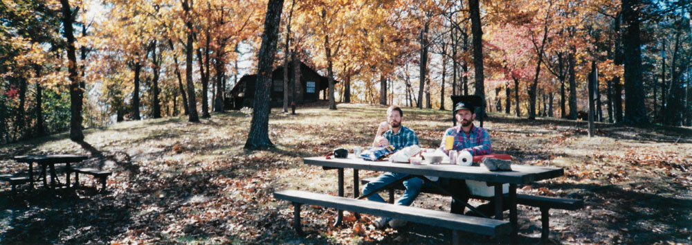
We got back to the car in early afternoon, so we stopped at the lodge (closed for the season) across the road to utilize one of the picnic tables. That's where Fred took this panoramic picture of us having lunch:
 |
Blanchard Caverns
 |
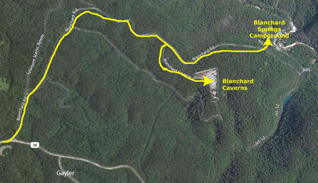 |
We wanted to go ahead and get the campsite secured, so we drove past the actual road to the caverns and on down to the banks of Sylamore Creek. There, we found the campground and picked out a nice site- paying our $5 fee at the honor station. The we drove back up the road to Blanchard Caverns.
|
Blanchard Springs Caverns is a three-level cave system located in the Ozark National Forest; tours are available for two of the levels. The Dripstone Trail runs through the upper level of the caverns and opened in 1973. The Discovery Trail on the second level opened in 1977 and runs through the middle of the cavern. Also offered is a "Wild Cave" tour which allows access to undeveloped parts of the cave to more adventurous visitors. Fred had been here before, and at the time had done the upper level of the cave, so we opted for the Discovery Trail for this visit.
Blanchard Caverns keeps a constant, year-round temperature (58°F). The limestone rock from which the caves and their formations developed was laid down in an ancient sea more than 350 million years ago. It remains a "living" cave in part because of the care given by visitors and the United States Forest Service. Living caves are ones in which slow metamorphosis due to minerals deposited by seeping and dripping water is still in process.
Local residents knew about the cave by the 1930s and called it Half-Mile Cave. The first systematic exploration of the cave began in 1955 and went on for five years. Additionally, in 1955, explorers discovered a 1000-year-old Native American skeleton in the cave. The skeleton had a fractured skull, fractured ribs, and a fractured leg. How this explorer entered the cave is unknown. The caverns were opened to the public in 1973 after ten years of development on the Dripstone Trail. Blanchard Springs Caverns received its name from the cave's source, Blanchard Springs.
We took quite a few pictures here in Blanchard Caverns, although not all of them turned out as we might have liked. But I will include most of them here, along with short explanations of what our guide told us (or what I can recall from what our guide told us).
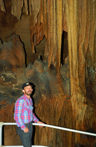
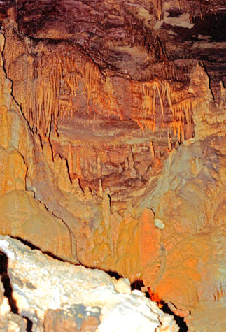
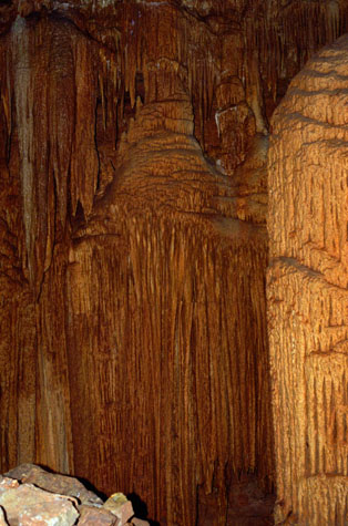 Curtain Formations |
(Picture at left) The tour guide that we had was certainly easier to listen to and more knowledgeable than the one we had at Hurricane Caverns, but then this is a State Park, run by the State of Arkansas, while Hurricane Caverns was private. These are some of the curtain formations in the cave.
(Picture at right)
|
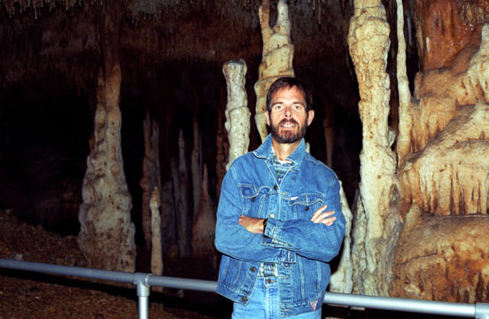
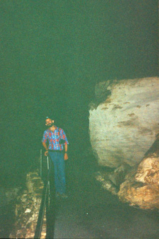 Fred in a Large Caverns Room |
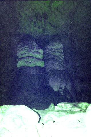 Pillars in Blanchard Caverns |
(Picture at left) I thought these two pillars were pretty amazing, so I took a photograph. I did not realize it at the time, but have since learned that a flash only works across a fixed distance, a distance shorter than I imagined. Of course the rocks in the foreground were brightly lit, but the flash barely reached the columns themselves.
(Picture at right)
|
 Me in Blanchard Caverns |
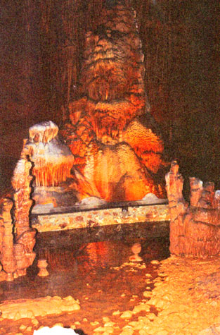
 A Massive Column |
(Picture at left) The State has done a good job inside the cave. The pathways are commodious without being obtrusive, and there are frequent places where the entire tour can sit down and hear about one formation or another in detail. The cave is also interesting in that the elevator leaves you at a point rather high in one of the main rooms, and the trail leads constantly downward, so that you have the feeling of exploring the cave from the top down, which was the way it was done in the early part of this century when most of the exploration took place. Unfortunately, the room was much too big to get a picture of the entry point in relation to where we were now.
(Picture at right)
|
 Inside Blanchard Caverns |
The State has done a good job inside the cave. The pathways are commodious without being obtrusive, and there are frequent places where the entire tour can sit down and hear about one formation or another in detail. The cave is also interesting in that the elevator leaves you at a point rather high in one of the main rooms, and the trail leads constantly downward, so that you have the feeling of exploring the cave from the top down, which was the way it was done in the early part of this century when most of the exploration took place. Unfortunately, some of the rooms were much too big to get good pictures- even with a flash.
 The Stream in Blanchard Caverns |
(Picture at left) Blanchard Caverns has a stream that runs through it, and one stop on the tour is at the side of that stream. We were able to get this good photo of it.
(Picture at right)
|
 Fred in Blanchard Caverns |
 Formations in Blanchard Caverns Here are some particularly interesting formations. Note how slender the stalagmites in the foreground are. This is caused by a very, very slow drip from the ceiling. Since the drips are so slow, there is time for one drop to essentially evaporate, and leave its minute load of calcium, before the next drop hits. Thus, there is little water left to run down the side of the column or splatter about the base, thus building something thicker and more massive. In the background is another type of column, one that also indicates changes in the way the water was dripping down. Something had to happen to cause those areas of solid limestone to build up, followed by more intricate flows. Finally, we have the long pointed stalactites in the back left of the picture. |
 Me inside Blanchard Caverns There were all kinds of formations in this area, including one behind me that "forked" when the drip pattern changed. There were many soda straws hanging from the ceiling here. On the whole, the tour was very interesting, and we didn't feel rushed as we were on the last tour of the day. |
Once outside, you have to take a little bus back up to the entry point, since the inside trail has been steadily descending. When we got back to the Visitor Center, we got in the car and drove down to where the stream that flows through the Caverns exits and flows into the Buffalo River.
|
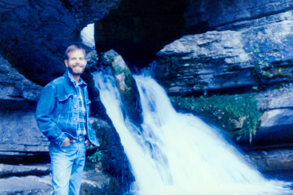
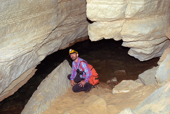
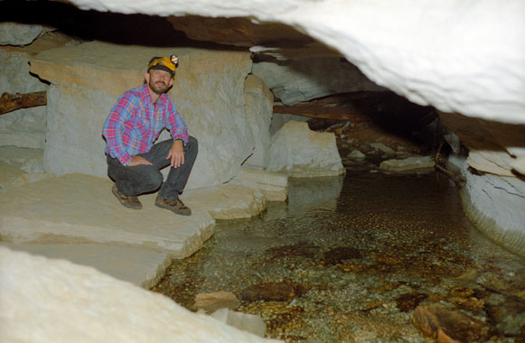
This is actually an entrance to the cavern, but it is illegal to try to go inside here. In any event, one is supposed to need special equipment to get in through here, as I understand you have to go underwater at some point. This seemed to be quite a lot of water to me, but then the caverns cover a fairly wide area. The rocks were quite slippery here, and you can see some of the moss growing behind me. I would have liked to have climbed up and gone part way into the cave, but I didn't relish slipping and getting soaked.
There was a trail off to the left that led up a dry, rocky streambed, so we spent some time climbing up it towards the top of the mountain. Had we taken the time, we probably could have gone all the way up, but we stopped at what used to be an overlook on a maintained trail, and then walked back down to the car. It was getting much too late for pictures. We took one final short hike along one of the Buffalo River tributaries before returning to the campsite. Again, the trail would have gone on for quite some ways, but it was getting too dark to be enjoyable. What was enjoyable was another of Fred's excellent camp meals and a good night's sleep.
You can use the links below to continue to another photo album page.
|
October 29, 1995: Fall Trip to Arkansas: Day Four |
|
October 27, 1995: Fall Trip to Arkansas: Day Two |
|
Return to the Index for Our Fall Trip to Arkansas |