|
October 25, 1996: Hiking in Big Bend - 1 |
|
Return to the Index for Our Big Bend Trip |
Getting to West Texas
|
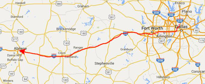
Our goal for this evening is Abilene, which will put us halfway out to Big Bend. We went south on Inwood/Hampton Road down to I-30 west to Fort Worth. On the west side of Fort Worth, I-30 ends and merges into I-20 west. We ate dinner in Thurber, Texas, the old mill town that is now a tourist spot. Last June, on the way to the Guadalupe Mountains, we at the Smokestack Restaurant, but this time we ate at the other restaurant in Thurber- a family-style place on the south side of I-20.
After eating, we continued on west and, as we hoped, we made it to Abilene about midnight and found a convenient motel right by the Interstate.
|
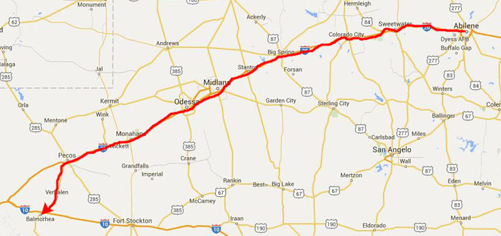
At Pecos, we turned south towards Saragosa and continued until we came to Interstate 10. We went west one exit and then continued south to Balmorhea.
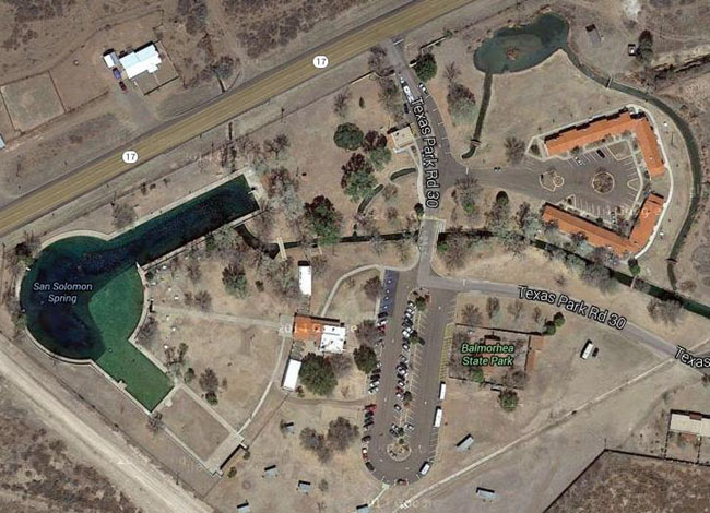
The Springs at Balmorhea
|
Mexican farmers called the springs “San Solomon Springs.” They dug the first canals by hand, and then used the water to irrigate crops. They sold those crops to residents of Fort Davis. With plentiful water and the arrival of the railroad, a cattle ranching industry emerged in the 1880s. In 1927, the Bureau of Reclamation dredged the springs and constructed a canal to better harness their flow.
Today, after the spring water flows through the pool and cienegas, it enters irrigation canals and travels about 3.5 miles east to Balmorhea Lake. Farmers today use that water to irrigate thousands of acres of crops such as alfalfa and cotton.
The creation of Balmorhea State Park began in 1934 when the State Parks Board acquired nearly 46 acres around San Solomon Springs. This acquisition was part of the larger plan of the Civilian Conservation Corps to provide jobs for millions of the unemployed during the great Depression. The park was built between 1935 and 1940.
Imagine yourself with little food, less money and no job. This was the case for many Americans during the Great Depression, and the Civilian Conservation Corps, created in 1933 by Franklin D. Roosevelt, provided jobs and job skills by hiring young men to work on conservation projects. The program enrolled men between the ages of 17 and 25 who qualified for public assistance. They earned clothing, food, medical care and $30 a month; they sent $25 of that home to their families.
|
|
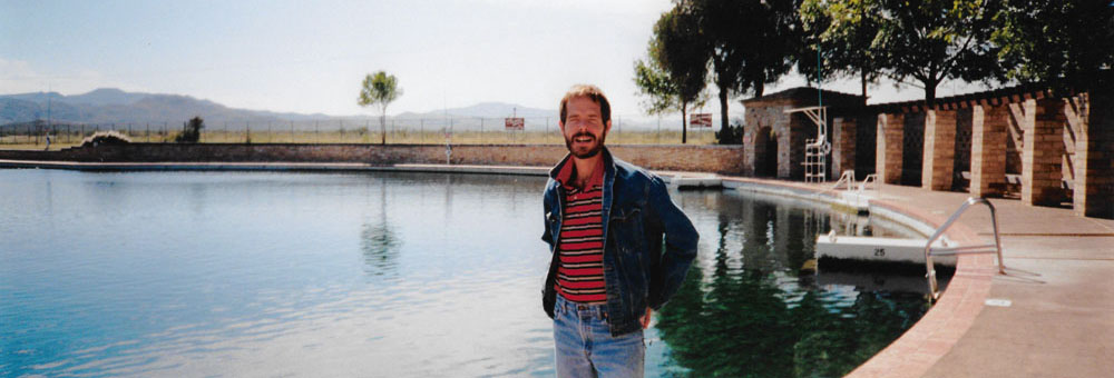
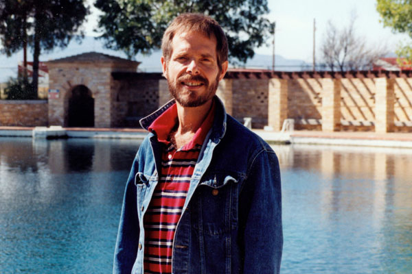 Me at Saragosa Springs |
The bricked-in area of the springs is quite large, and I imagine there is room for quite a few people in the summer. Although the towns around here are very small, I can only imagine that on the hot West Texas summer days just about everyone who could get here to cool off would do so. This is not a swimming pool as you are familiar with. The bottom is natural, and there are even small fish in the pool from time to time. But the well-constructed pool would probably be great to swim in during the long, hot summers- particularly since it is spring-fed and thus cold most of the time.
We used Fred's camera to take a couple more panoramic pictures here; while they are very similar, I have put both of them below:
 |
 |
The park took the name of the town; its name came from four men’s surnames: E.D. Balcom, H.R. Morrow, Joe Rhea and John Rhea: Bal-mor-hea. These men formed an irrigation company in the area in the early 20th century. In the 1930s and early 1940s, troops and horses of the 1st Cavalry from Fort Bliss, Texas, camped nearby. They were among the first to enjoy the newly-built park. The park became a center for travelers touring the area by car and a gateway stop for those heading to the popular Davis Mountains. Private concessionaires ran the park for many years, until the state took over in 1968. Today, more than 200,000 people visit Balmorhea State Park each year.
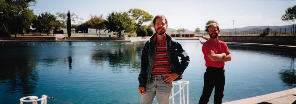
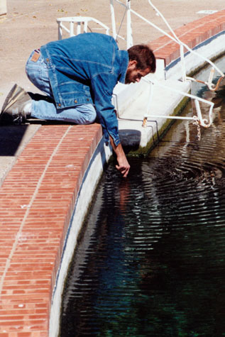
Here are two more pictures that we took here at Balmorhea State Park:
 At San Solomon Springs |
(Picture at left) Fred had been here before, but I had not. There is a park here, with some water features, ponds and botanical stuff. This pool is apparently quite the summer activity spot, although at this time of year there was no one around.
(Picture at right)
|
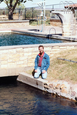 At San Solomon Springs |
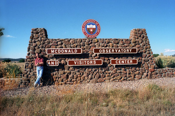
McDonald Observatory
|
The observatory produces StarDate, a daily syndicated radio program consisting of short segments related to astronomy that airs on many National Public Radio affiliates. The observatory also produces a similar program, Universo, in Spanish.
The McDonald Observatory was originally endowed by the Texas banker William Johnson McDonald (1844–1926), who left about $1,000,000 - the bulk of his fortune - to the University of Texas to endow an astronomical observatory. The provision of the will was challenged by McDonald's relatives, but after a long legal fight, the University received about $800,000 from the estate and construction began at Mt. Locke. The telescope was dedicated in 1939, and was at that time was the second largest telescope in the world.
|
 |
Research today at the McDonald Observatory encompasses a wide variety of topics and projects, including planetary systems, stars and stellar spectroscopy, the interstellar medium, extragalactic astronomy, and theoretical astronomy. The McDonald Observatory is equipped with a wide range of instrumentation for imaging and spectroscopy in the optical and infrared spectra, and operates the first lunar laser ranging station. The high (6000-7000) and dry (only 19 inches of rain a year, with most of that in the summer months) peaks of the Davis Mountains make for some of the darkest and clearest night skies in the region and provide excellent conditions for astronomical research (we are hundreds of miles from any major urban area).
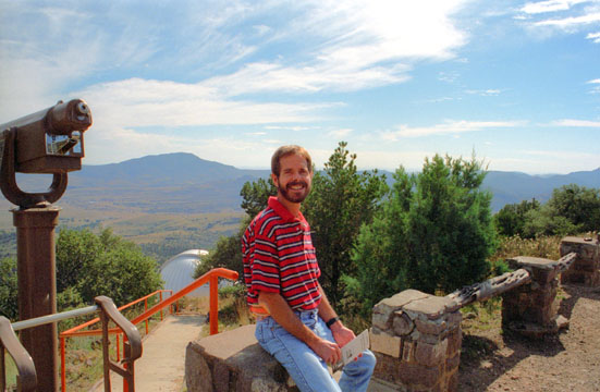
Here's a nice panoramic view of the observatory that Fred took:
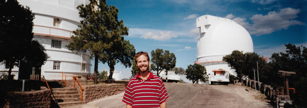 |
The Otto Struve Telescope, dedicated in 1939, was the first large telescope built at the observatory and is located on 6790-foot Mt. Locke. The road we took up from the Visitor Center, Texas Spur 78, is the highest point on Texas highways. The Smith Telescope, also on Mt. Locke, was completed in 1968. Another telescope- the Hobby-Eberly Telescope (HET)- is under construction on the summit of 6660-foot Mt. Fowlkes.
Here are the other two pictures we took during our visit to the McDonald Observatory:
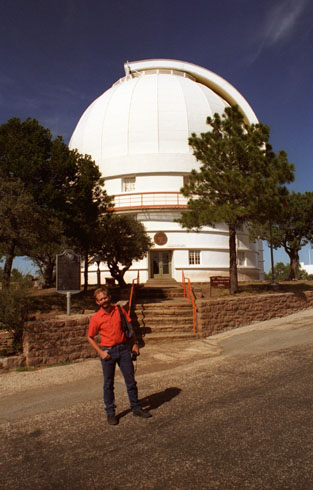
 These are the two actual observatory buildings, taken from the valley just below the hills on which they are situated. |
 We took a tour of the observatory building, and it was interesting to see the actual telescopes and the mechanisms that move them around. |
When we visited, the visitor center was a very small affair, but there was an exhibit that showed a proposal for a reconstruction of the center. The new center will include a café and both an expanded gift shop and larger exhibit hall. In the same theatre where we watched our introductory there will be "star parties" and daily live solar viewings.
|
After walking through the Observatory, we drove on back down to the Visitor Center where we took a look at some of the other exhibits and displays, including an outside exhibit which was billed as a model of the 82-inch mirror in the large telescope. This exhibit was not actually a mirror, of course, but just a plaster cast intended to give you an idea of what their size actually is.
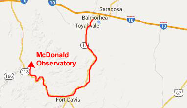
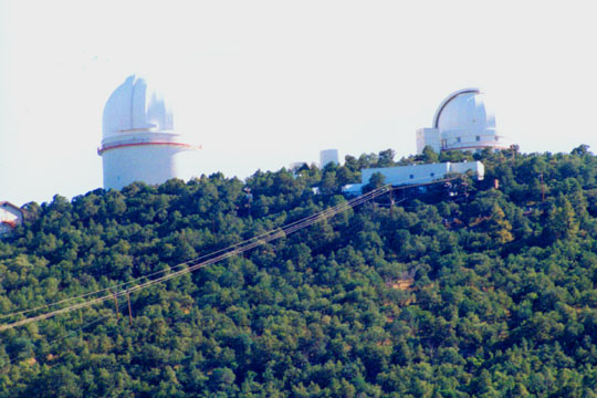
We went back out to the route 118 and headed back southeast towards Fort Davis, and stopped alongside the highway to look back at the McDonald Observatory in the Davis Mountains. This shot gives you a good idea of where the observatory buildings are actually situated. Note the contrast between the grassy area, which is pretty dry this time of year, and the wooded mountain itself, which is just high enough for that kind of vegetation to grow.
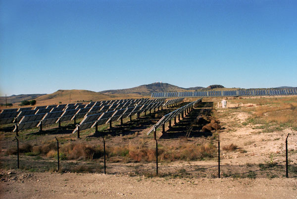
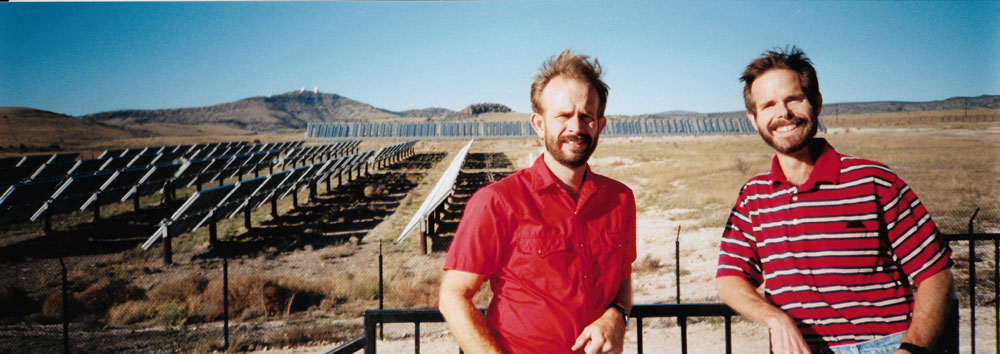
We continued on down the highway towards Fort Davis. About a mile or so south of the Observatory, we saw an interesting installation off to our left, so we stopped to have a look.
|
There were some walkways intended for people to come and look at the installation, although the actual panels were in a fenced-off area that you couldn’t go into.
And Fred took a really nice panoramic shot of the solar installation:
 |
Hiking in the Davis Mountains
|
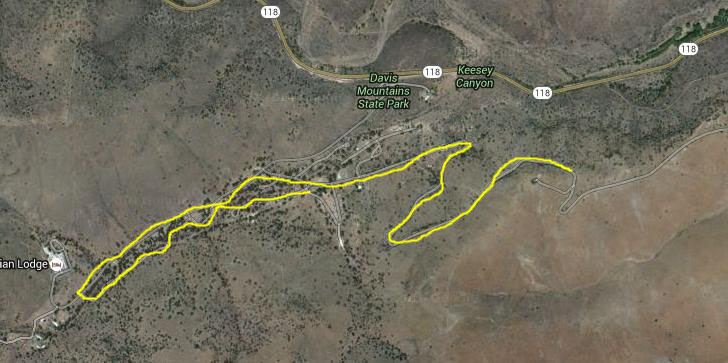
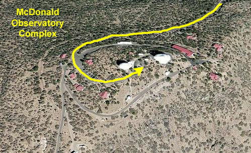
I've put an aerial view of the park at left, and used a thin yellow line to show the extent of our walks through the hills. This is an aerial view from 2015, of course; I don't recall the developed area of the park as having been quite so extensive.
Interest in developing a state park in the Davis Mountains began in earnest in 1923 when the Texas Legislature directed the newly created State Parks Board to investigate the area. However, the Parks Board failed to secure any land donations and had no appropriations to buy the land.
|
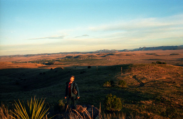
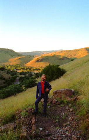
At right you can see Fred along the hiking trail. The light is beginning to go, so pictures are harder to come by. The trail led generally along the crests of the hills you see here, with just enough climbing to make it interesting.
The park is next to the Fort Davis National Historic Site (where we have been before) and the two are connected by four miles of hiking trails. Within the park is the "Indian Lodge", an adobe motel with thirty-nine rooms, sixteen that were built by the Civilian Conservation Corps during the 1930s (completed in 1939) and twenty-four added by Texas Parks and Wildlife in the 1967.
A large bird blind next to the main road offers enclosed and open viewing areas for the many species of birds that are attracted to the feeders near the blind. The park also has seven miles of equestrian trails in the special use Limpia Canyon Primitive Area, the section of the park north of Texas State Highway 118.
The trail led from a parking area, where we had a snack, up into the hills above Fort Davis itself. The trail was interesting but not very strenuous, and there was a water feature or two to pique Fred’s interest. Here are the other two pictures we took towards th end of the day here in the Davis Mountains:
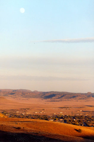 A View of Fort Davis |
(Picture at left) This is a picture taken from the beginning part of the trail, looking eastward towards Fort Davis. Fred thought the rising moon would be a nice addition to the picture. It was also getting quite chilly this late in the afternoon.
(Picture at right)
|
 Picture Title (475H) |
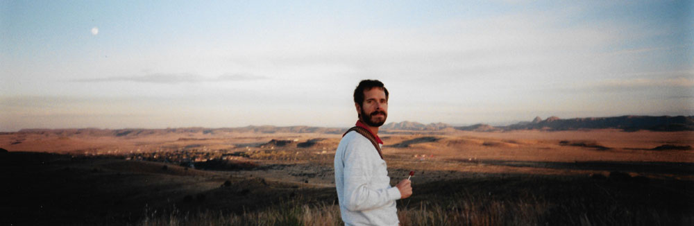
As the light was fading, Fred took a very nice panoramic picture of me atop the Davis Mountains:
 |
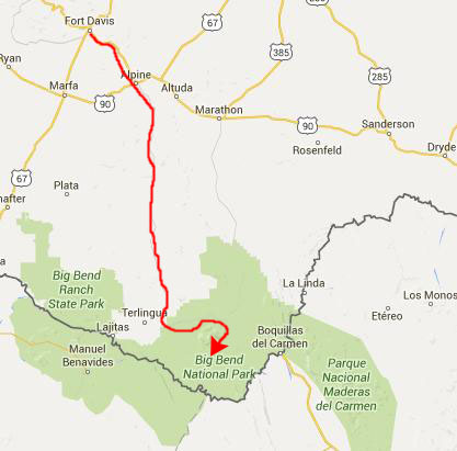
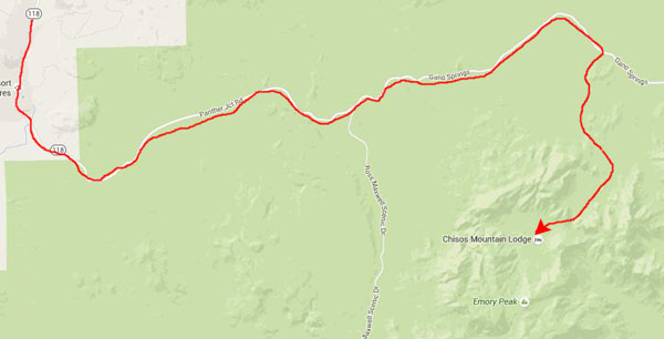
By the time we got back to the car it was time to head off back through Fort Davis, and down Texas Highway 118 through Alpine (where we got some supplies) and Study Butte and on to Big Bend National Park in the Chisos Mountains.
|
 |
When we got to the main camping area, we didn’t have too much difficulty getting a good campsite, setting everything up, and cooking dinner. By that time it was dark, and not much else we could do.
So we spread out our hiking map and the park brochure and planned some of the hikes we would do in the next couple of days. This was our second time here, so of course we wanted to do things that we hadn't done before.
You can use the links below to continue to another photo album page.
|
October 25, 1996: Hiking in Big Bend - 1 |
|
Return to the Index for Our Big Bend Trip |