|
October 26, 1996: Hiking in Big Bend (2) |
|
Return to the Index for Our Big Bend Trip |
Today we have to leave Big Bend and head on back home to Dallas. On the way, we plan to stop at the Caves of Sonora.
Leaving Big Bend
|
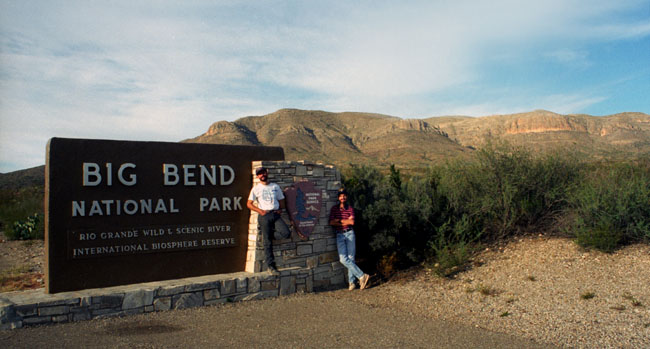
As we exited the Park on US Highway 385, we stopped to take the picture below to record the event:
 |
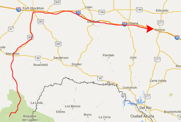
We thought that if we got away from Big Bend early enough, we would have time to stop at some caverns that Fred knew about near the town of Sonora, Texas, and so that was our plan.
|
We thought the best thing to do was to take the fastest route, both to give us the maximum amount of time at the caverns and also to position ourselves to get home at a decent hour this evening.
So it was Highway 385 to Fort Stockton and Interstate 10 to Sonora.
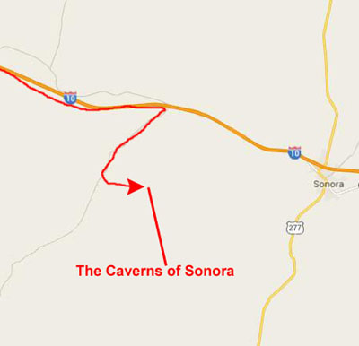
The Caverns of Sonora
|
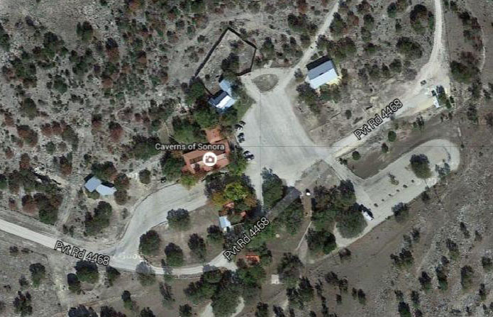 |
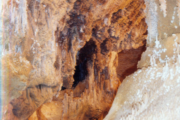
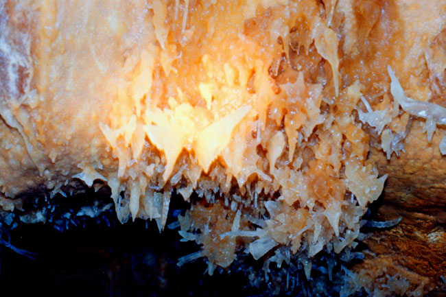
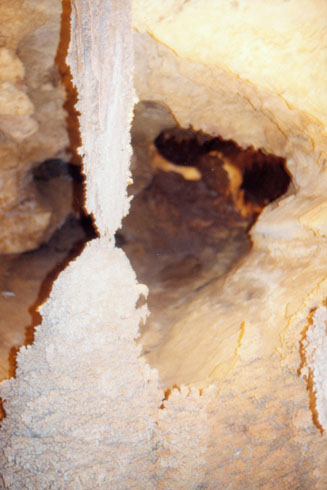
The Caverns of Sonora is a National Natural Landmark, a unique cave located about ten miles west of the small city of Sonora, the seat of Sutton County, Texas. It is a world-class cave because of its stunning array of calcite crystal formations, especially helictites. The founder of the National Speleological Society has said of the cave: "This is the most indescribably beautiful cave in the world, its beauty cannot be exaggerated, not even by a Texan."
|
A set of stairs took us down about 125 feet to the entrance hall for the cave, where our tour guide stopped to give us an orientation. Then we were taken on in to the caverns.
The first quarter-mile of the cave was known to local ranch-hands by the early 1900s. It was known by the name Mayfield Cave, after the landowner, Stanley Mayfield. In 1955, Mayfield gave permission to four cavers from Dallas, who discovered a further seven miles, including what are now considered the most scenic areas.
The cave has been operated commercially by the Mayfield family since 1960. At the time of our visit, a little over a mile and half of trail had been developed, although an additional half-mile has been added. This is just a fraction of the extent of the cave, though; seven miles of cave have been explored.
The development of the trails was done by Jack Burch, starting in 1959 and completed in 1979. Burch revolutionized cavern development worldwide with his "conservation through commercialization" approach to the project.
|
The cave is formed in 100-million-year-old (Cretaceous) Segovia Limestone, of the Edwards Group. The formation of the cave itself probably occurred between 1.5 to 5 million years ago. The cave is formed primarily along a fault, which allowed gases to rise up from depths of around 1.5 mi (2.4 km) to then depths of about 300 ft.
At this depth, the gases mixed with water in the aquifer. The resulting highly acidic water dissolved out the limestone, forming the cave. Between 1 and 3 million years ago, the water drained from the cave. The famous mineral formations, known as speleothems, all formed after the water drained from the cave.
The Caverns of Sonora is an "active" cave, in that the formations are still growing. It is also a bit unusual in that it is a "warm" cave. This is a relative term, as most caves are around 65° while these caverns are a steady 72°. Due to the 100% humidity, it felt like it was in the 80s inside the cave. There is no elevator here- just 400 steps on the average tour.
|
The caverns were interesting and we both enjoyed seeing them. The tour took about two hours, and when we were done we stopped for a drink and a snack and planned our route home.
Looking at the map, I suggested that we take a northern route home, a route which would have led us through DeLeon, where Fred goes once a month to see his mother. I have always been curious about what the town and her place looked like, although Fred tells me that unless she knows well in advance that someone she does not know might be coming to see her, a surprise visit is not likely to be a good idea. And we hadn't thought that far ahead.
So, we decided to continue east on I-10, angling off the Interstate on US Highway 290 through Fredericksburg. There, we planned to (and did) stop to have dinner. We continued on Highway 290 all the way into Austin, picking up Interstate 35 there and taking that north all the way home (a route we've taken numerous times before).
So, in the end, that’s what we did, and we arrived home, tired as usual, late on Sunday evening. This was another good trip but, as always, it was good to be home.
You can use the links below to continue go back to yesterday or to return to the Index Page for our Big Bend trip. (From there, you can continue on through the photo album.)
|
October 26, 1996: Hiking in Big Bend (2) |
|
Return to the Index for Our Big Bend Trip |