|
October 27, 1996: The Caves of Sonora |
|
October 25, 1996: Hiking in Big Bend (1) |
|
Return to the Index for Our Big Bend Trip |
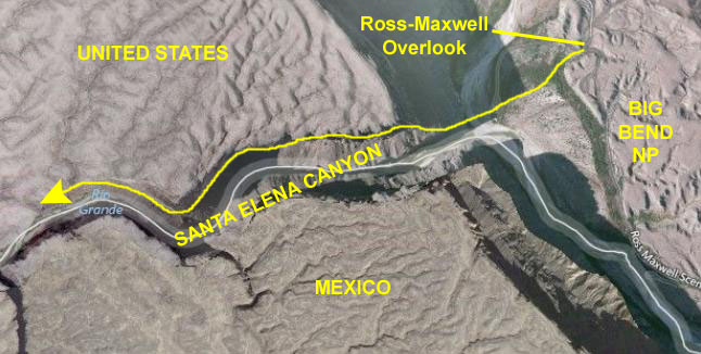
The next morning, we had some breakfast at the Lodge, and then headed off for a day of hiking in the desert area north of the Basin We're going to visit an area of Big Bend that we haven't (well, I haven't) been to before- the northwest side of the Chisos Mountains. We will end up in Santa Elena Canyon and the Rio Grande River.
|
From our campground, we drove out the Chisos Basin Road to the main park road- Texas Highway 118- intersecting it at Basin Junction. East on the Park Road is Panther Junction and US Highway 285 leading north and then east towards San Antonio and South Texas.
To the west are Santa Elena Junction (and the road we will take to the Chimneys Hike and to Santa Elena Canyon. Further west is the last junction, Maverick Junction, and another road leading south to the Rio Grande.
But our first hike will be off a park road leading north from Highway 118 to the Grapevine Hills. This road was just a short distance west of Basin Junction, and driving five miles or so up that road brought us to the trailhead for the Grapevine Hills Hike.
The Grapevine Hills Trail
The Grapevine Hills Trail was, in its own way, very interesting- even though it wasn't one of those "up the mountain" or "down into the canyon" hikes. It was essentially level, but the deep gully and the oh-so-climbable boulders made it fun. We found the hike without much problem.
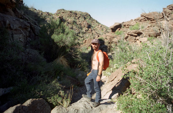
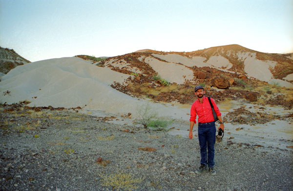
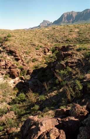
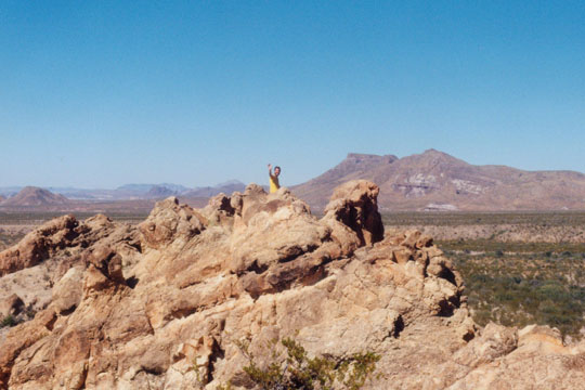
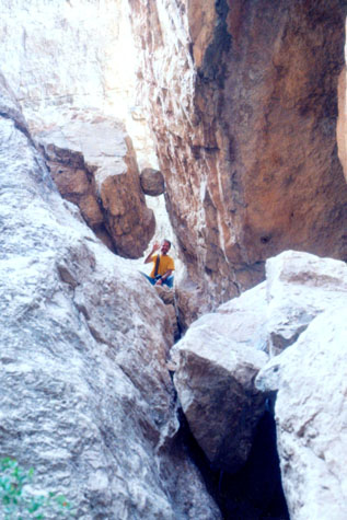
 Me on the Grapevine Hills Trail |
(Picture at left) The hike took us through a canyon that is dry most of the year but which offers some interesting climbs through the dry riverbed. Here I am at the top of one of the sides of the canyon, while Fred is further down. I guess the canyon was maybe fifty feet deep from cliff to bottom- maybe more. But it was easy to clamber up and down the sides of it.
(Picture at right)
|
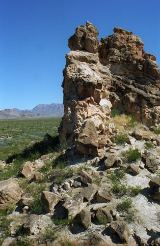
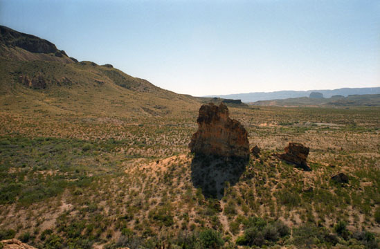
 Grapevine Hills Canyon |
Although it was October, the sun was already getting quite warm, particularly down here on the desert floor. While we are actually quite high in absolute terms, this is “high desert”, like much of the terrain on the eastern side of both the Rockies and the Cascades. Although the Rockies don’t come this far south, the same principle applies- weather than moves eastward, coming down out of the higher land to the west, picks up both moisture and temperature as it descends, with the result that the eastern slopes of these mountain ranges get very little rain and are quite a bit warmer than the western slopes will be. Add that to the fact that there is not much rainfall here, and you can see why this is desert terrain.
|
The hike offered some coolness in the shadow of the cliff faces, as you can see here, but even that was fast disappearing as the morning progressed. The hiking was relatively easy, and there were lots of interesting plants to look at. The canyon winds back and forth for some distance along the desert floor. This is the kind of place that you wouldn’t want to be caught at the bottom of during a heavy rain. I’d imagine you wouldn’t get much warning of a flash flood.
As we hiked along, I was varying it up by climbing up and down the "cliffs" on either side of the canyon, zig-zagging my way up along the trail. Much better than just walking along a trail.
|
I don’t imagine that this land is good for much except the occasional hunting or perhaps some sort of research. It may well be that the Park actually leases the land for something, but we didn’t find out.
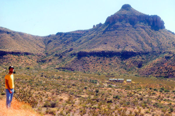
Fred thought that the mountains across the valley were interesting; there seem to be three different, separate levels of caprock, each protecting a layer of sedimentary rock. As I’ve probably mentioned before, this entire area of the country, from the Guadalupe mountains on south, was once at the bottom of the vast inland sea that covered this part of North America, and that’s where the sediments come from.
This was certainly an enjoyable, if short, hike, and I was glad we'd come up here to wander through Grapevine Canyon. We returned to the car the way we'd come, and then headed back to the Park Road, turning west and heading towards Santa Elena Junction. There we picked up the park road south towards the Rio Grande.
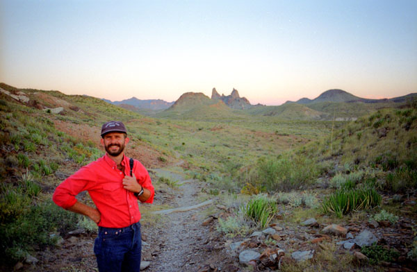
The Chimneys Trail
|
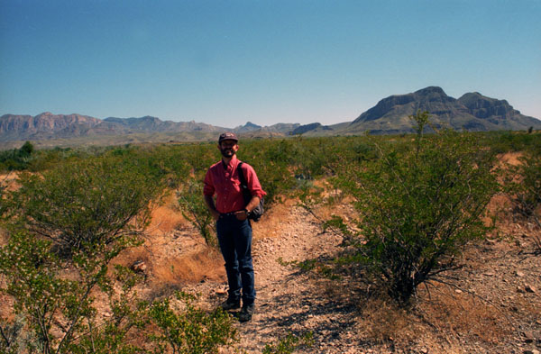
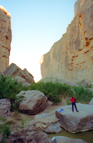
The Chimneys formation is about two miles from the road out into the desert, so most of the trail just winds through the desert terrain, neither rising nor falling much. There were also no trees for shade, so the hiking was not so interesting as in other places. On this trail, the destination is really the only attraction, unless you like desert plants. It was not oppressively hot, though, and that helped. This picture is typical of the type of terrain we were hiking over. This shot looks north towards the Park boundary.
The Chimneys Trail was advertised as moderately difficult; I would have classified it as an easy walk- at least until you get to the actual Chimneys Formation, but even there it is just a matter of a bit of rock scrambling to get up to the top of the formations. It may be that it gets that difficulty rating more for the fact that it's a five-mile hike through a desert.
|
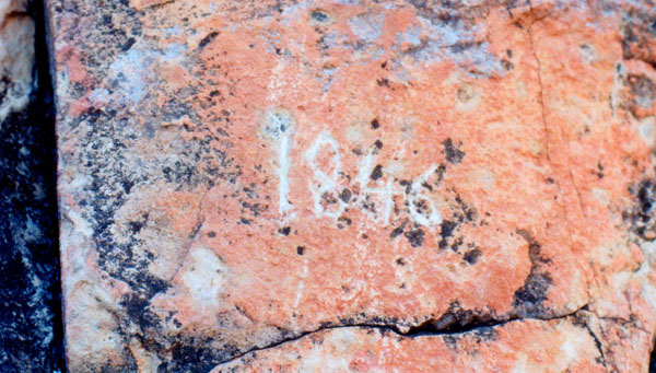
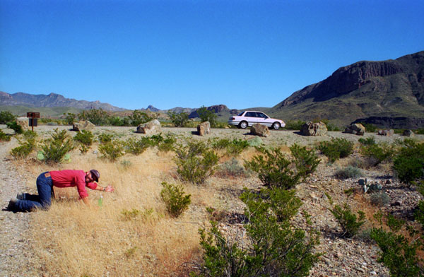
We found our first inscriptions on this first formation. We knew that the guidebook said that this whole area had been traveled and explored for well over a hundred years but, even so, I personally found the inscription seen here to be unusual. Why? Well, if we were at the top of Mount Everest, and it weren't snow-covered, anyone who reached the top could hardly be blamed for leaving an inscription, one that would feature the hiker's name, I would think. But these formations are not that outstanding; there are many higher, more obvious peaks within a couple hours walk from here.
So what are the chances that some nineteenth-century explorer would have taken the time to inscribe, on this rock formation, the year he reached this point? Someone from 150 years ago might have thought these formations memorable, but not so much so as to need to record the date he reached them. So I am skeptical that this date was actually carved 150 years ago. I suppose it’s possible, but my bets would be against it.
|
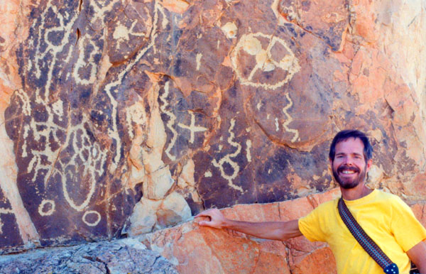
In this case, I think not. Our experience has been that petroglyphs are often, if not usually, found on rocks that are fairly easily accessible; indeed, like Newspaper Rock outside Canyonlands National Park, these drawings and symbols are found on rocks that are hard to miss. Indians would logically have wanted these carvings to be widely seen.
The chimneys are such a location. While there are high mountains all around, these formations "stick out" from the otherwise unvarying desert floor, and so would be a logical destination or stopping point for anyone walking through this area. So from the point of view of accessibility along, this would be a good place for an Indian artist to practice his craft. It might also be true that ancient Indians did think of this formation as being significant enough that they left a good many carvings and drawings on the rock.
You might wonder why I didn't apply this same logic to the date inscription, but as I said earlier, it would make more sense to find the date along with someone's name. Fred is always interested in carvings and paintings like these. For my part, they always make me wish that I could stand in a spot like this one, invisible, and watch the events of the past and future flow by at warp speed so that I could see just what manner of person created these carvings, just when they were made, and so on.
|
|
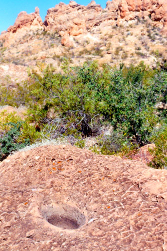
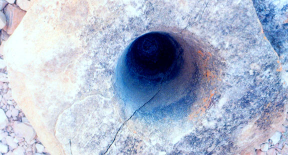
It could not have broken off and fallen here; the chances of its landing in just this position would have been too remote. This grinding pot was over a foot deep, perhaps through long use it gradually grew deeper.
It makes me wonder how the Indians got rock dust and shards out of whatever they were grinding here.
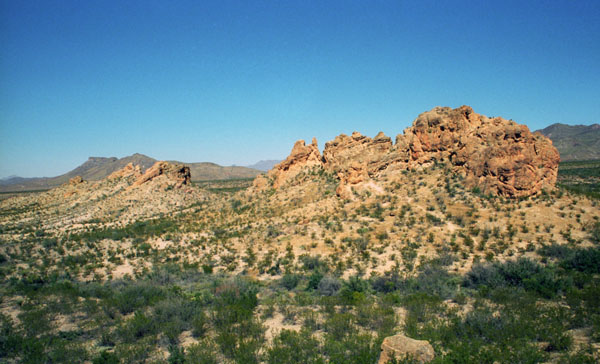
The Chimneys Formation in Big Bend is right out in the middle of the desert floor, and it sticks up like a set of chimneys- hence the name. I really don’t have any explanation as to why the formation is out here by itself; it is not connected to any other series of rock outcroppings. I can only assume that wind and water erosion has isolated the rocks over time.
|
 |
It’s almost noon now, and there is very little in the way of shade anywhere, but luckily the temperature was not too high today (although the air was very, very dry).
I thought it was a lot of fun to clamber around on these interesting rock formations, and we spent a fair amount of time here doing just that.
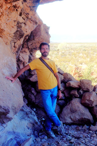 Me at the Chimneys Formation |
(Picture at left) Once we got over to the main series of rock outcroppings we found that there were indeed some shady spots under the rock overhangs- and this is one of them.
(Picture at right)
|
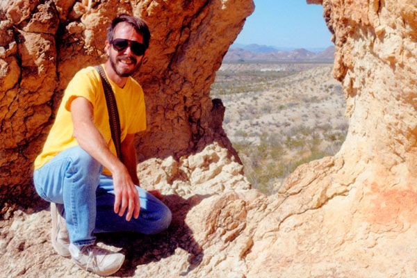
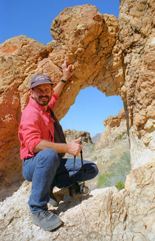 Fred at the Rock Window |
I could see that there is a fracture line that runs almost vertically at the right side of the picture, and I’d wager that at some point the rock fractured and fell away, leaving a short, sheer rock face. Then, I think, the rock on the other side was dislodged and fell against this rock face, wedging itself in tightly and thus forming the natural arch that is the top of the window. Had wind or water formed the hole, I think the sides would have been much smoother. Anyway, that’s my theory.
|
In this picture, you can see the incredible view through this particular window; we happen to be looking basically north at this point. As I mentioned above, I have my doubts as to whether these windows (or at least this one in particular) were created by the action of wind and water, but however they arose, they were really interesting.
Just on the other side of the window there is a sheer drop of about twenty feet, so there won’t be any pictures of me actually going through the window. It was a nice day, and climbing around on the rocks was a lot of fun.
Let's take a look at some of the other good pictures we took here at the Chimneys:
 This is a view of the first rock chimney from the second formation. The trail from the car led first to the single isolated chimney you can see here- the formation where we found the rock “bowls.” We are looking due south here, and the trail back to the car goes to the left. |
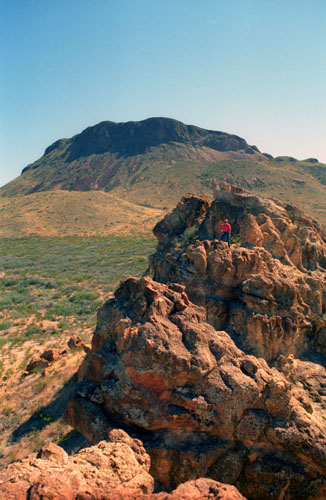
 Here I am on top of one of the Chimneys. From the spot where Fred is in the picture below, he has returned the favor and taken a picture of me from his vantage point. We are looking southwest here, and I am just sitting on the rock and waiting for Fred to rejoin me. |
We certainly enjoyed the hike out here, but we discovered later that the trail continues beyond the chimneys another 4 miles or so and ends on the Old Maverick Road- the westernmost road in the park. We might have continued on, but we didn't want to take all day out here in the desert.
|
|
Anyway, we decided to go ahead and have lunch here at the car, and then head off down the road to Santa Elena Canyon and the Rio Grande.
Hiking in Santa Elena Canyon
|
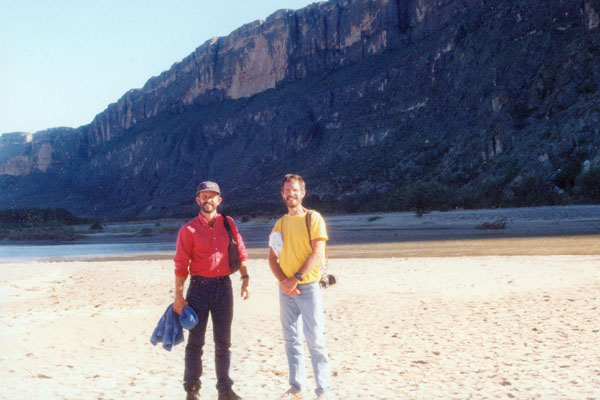
We are going to make the 2-mile-round-trip walk into Santa Elena Canyon. Since the water level is low this time of year, we may be able to go even further. Sometimes, you can't make this hike at all, when Terlingua Creek is in flood, for you have to cross it after the sandy stretch to get up into the United States side of Santa Elena Canyon.
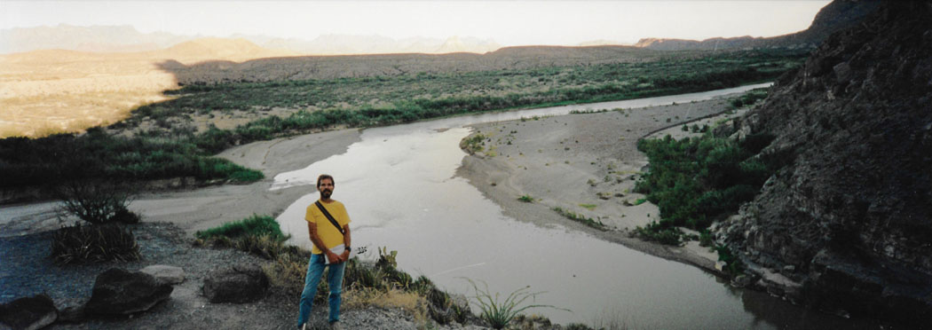
The majestic Santa Elena Canyon is at its most impressive here in Big Bend National Park; the mouth of the canyon is visible from many miles away. The Rio Grande changes direction abruptly here after following beneath the straight Sierra Ponce cliffs for several miles; these cliffs form the Santa Elena Canyon which runs pretty much east-west.
|
The whole area where we are standing is usually under water at that time, and the guidebook said that taking the trail earlier in the year means having to take off shoes and still getting wet. Anyway, we’ve carried some towels with us as the guidebook said the river levels and courses are unpredictable. As it turned out, we didn’t need them.
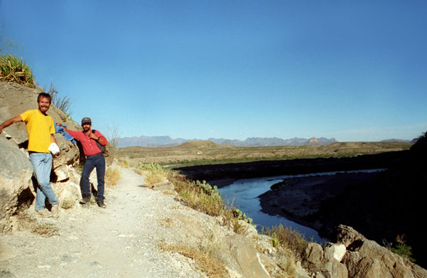
The Santa Elena Canyon trail follows the Rio Grande as it heads due west from here, cutting through the mountains via a deep, narrow gorge. The sharp bend in the river here was formed by movement along the Terlingua fault zone that crosses the park. For many miles upstream the river is trapped beneath the high walls, and our one mile path will follow the river along the United States side (north side) of the canyon.
The trail begins as it crosses the sandy, level area (with rock cairns to mark the trail, cairns which have to be replaced each year after the river flood dies down), and then climbs up the canyon wall on the eastern side of the Rio Grande.
|
It’s good taking pictures in this direction (east) as both of us are facing west, and there’s no problem getting our faces lit up.
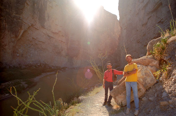
Down in the canyon itself, though, it is an entirely different story. The canyon is so narrow, and its walls are so steep (particularly on the Mexican side) that very little direct sunlight reaches the river on the floor of the canyon (except, I guess, pretty much at noon). So the pictures are a lot darker. Here are a couple of them (which I have had to lighten considerably):
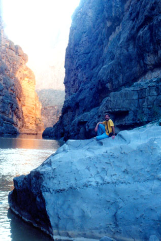
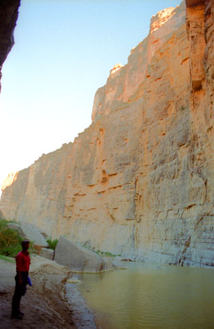
 Santa Elena Canyon in Big Bend NP |
(Picture at left) This picture looks west into Santa Elena Canyon. I thought I had compensated for the sunlight, but I should have compensated even more. The trail is going along the cliff face (there is plenty of room, so Fred is not unnerved). The canyon walls are about the same height on both sides of the border, so you can see that there is still considerable height off to the right out of the picture. Note the prickly pear cactus that I was using to hide the direct rays of the sun.
(Picture at right)
|
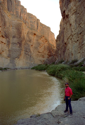 Fred in Santa Elena Canyon |
Above us, the cliffs rise vertically for over 1,000 feet and the purposefully trickling waters help make this a very pleasant setting, especially if no other people are present. The water is always cloudy, flows quickly and looks rather deep in places but at some times of year the depth is no more than 2 feet and so the canyon may be explored upstream on foot, either by crossing channels between exposed sandbanks or simply walking directly up the river.
|
We have proceeded some ways into the canyon now, and while I could adjust the exposure (compensating for the sun angling into the canyon) so that you could see our faces, I wasn’t able to adjust enough so that you could clearly see the surface of the Rio Grande about fifty feet below where we are standing. The trail is an interesting one- well-maintained and with much stark beauty all around.
Now that we are far into the canyon, and down towards the bottom, we won’t have the problem with the sun that we had before, so the exposures are much more even (although now the low light can make things difficult). Here you can see the Rio Grande at the left, and the cliffs of the canyon on the Mexican side just beyond. The way the river is turning back beyond this point we have a build-up of soil on the American side, so there is room for a trail. The cliffs on the Mexican side are among the sheerest that I have remembered from any of our trips anywhere.
I went ahead of Fred to take up a position on a big rock ahead of us so Fred could take this panoramic view of the canyon:
 |
Down here by the river, picture-taking is easier; here is a view, looking upriver, of Fred beside the Rio Grande. This picture really shows the beauty of the Canyon. Those mountains in the far distance are on the Mexican side of the river, as I think it takes a turn north just beyond that dark headland. I also think it’s particularly interesting how the land has been shifted here; you can see the sedimentary layers on the Mexican cliffs are angled down into the water, which shows that the land has not risen or fallen evenly. The sun is fast disappearing, so I was lucky to have enough light to get Fred out of total darkness.
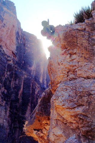
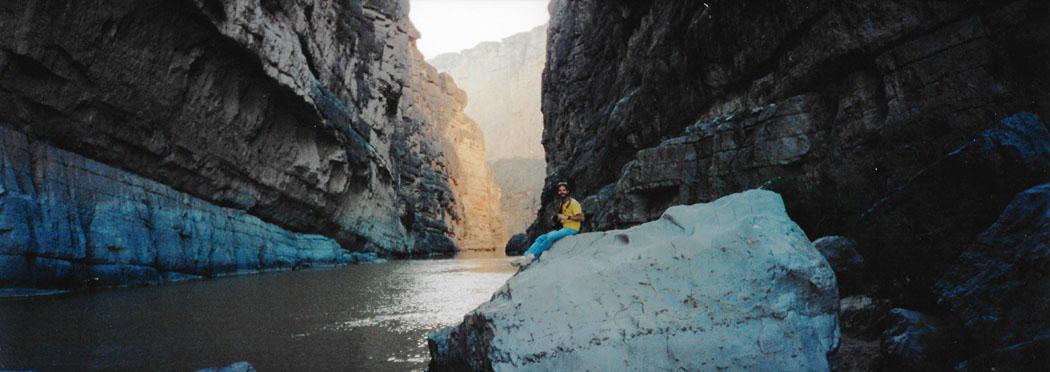
 At the End of the Santa Elena Trail |
(Picture at left) At the end of the trail is a significant pile of boulders, although it is possible to work your way through them and continue the hike for a few hundred feet. To get to where I am, I had to go through a series of narrow rock tunnels and come up from behind where I am kneeling. I thought that the rock perched perilously above my head made for an interesting shot, so I called to Fred to get him to take this picture.
(Picture at right)
|
 At the End of the Santa Elena Trail |
Fred also got out his panoramic camera again to take two vertical panoramic shots of the canyon- appropriate, since it is much taller than it is wide. You'll have to use the scrollable windows below to have a look at these views:
|
|
|
Not to be outdone, after Fred got some pictures of me in this area of boulders at the end of the hike, I got a couple of him as well.
 At the End of the Santa Elena Trail |
(Picture at left) This is about as far as the trail goes into the canyon. At this point, a number of sizeable boulders have fallen from the cliff face, giving plenty of place to climb and plenty of vantage points for pictures. It’s getting really dark in the canyon though, and hard to take good pictures.
(Picture at right)
|
 At the End of the Santa Elena Trail |
We sat on the rocks at the end of the canyon for a while, just taking in the sound of the water and the absolute stillness of the canyon. This is indeed a beautiful, magical place. We then retraced our path back out of the canyon. As we were coming out of the canyon, Fred took this panoramic picture of the Rio Grande in the fading evening sunlight:
 |
Back at the car, we had some water and then headed off back up Ross-Maxwell Drive to get back to our campsite in the Basin.
|
|
|
Although I didn't plan it, I think the picture is actually improved by the fact that I captured my own shadow and the shadow of the car when I snapped the picture.
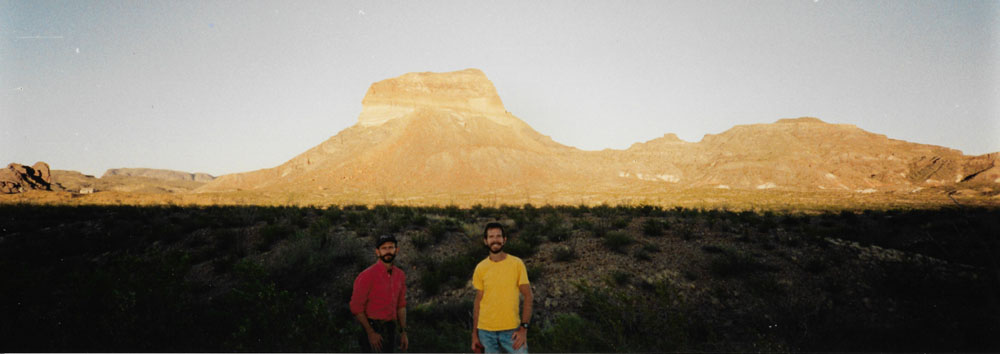
For the last picture of the day, Fred got out his panoramic camera and set up this picture with the brilliance of the setting sun lighting up the mountains across the desert behind us:
 |
Getting back to the campground meant continuing north to Santa Elena Junction, heading east to Basin Junction and then going south into the Basin itself. We made it back to the campsite just before total darkness, when it was still possible to get things organized for dinner- which was another of Fred’s campsite specials. We enjoyed our last day in Big Bend, for tomorrow we had to head home.
You can use the links below to continue to another photo album page.
|
October 27, 1996: The Caves of Sonora |
|
October 25, 1996: Hiking in Big Bend (1) |
|
Return to the Index for Our Big Bend Trip |