|
July 13, 1999: The Mariposa Redwood Grove and King's Canyon NP |
|
Return to the Index for Our California Trip |
We began our trip to California by taking a morning flight to San Francisco.
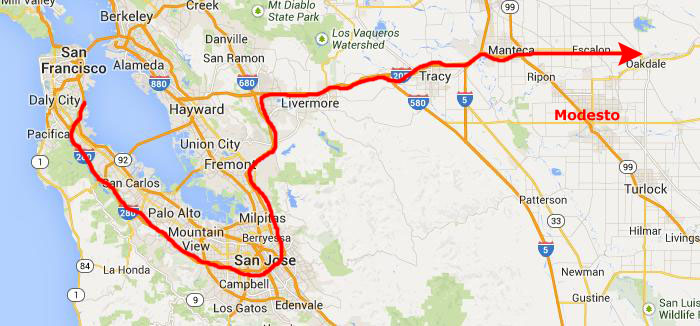
Driving to Modesto
|
This gave us time to drive over there very leisurely, and I decided to take Fred on a little tour of the Peninsula by driving up into the San Bruno hills and then down I-280 to San Jose. This stretch of highway is quite scenic, and I thought Fred should see it. When we reached San Jose, we circled around and headed north on I-680 to pick up I-580 east. This took us over the mountains above Oakland and down into the central desert past Livermore. We branched off on I-205 and crossed I-5 at Tracy, California.
The expressway ended just past I-5 and we had to do some twists and turns to get onto California 120 which heads east around the north side of Modesto. It was late in the afternoon by now, so we found a local motel, had some supper and stayed the night.
Arriving at Yosemite National Park
 |
A few miles west of Yosemite, we came around the top of what appeared to be a large lake, which we discovered was the Don Pedro Resevoir. We saw the historical marker, so we stopped to have a look. I know you can't read the marker, so here is what is says:
| Near this site stood the historic town of Jacksonville, now inundated by the waters of Don Pedro Reservoir. The town was settled by Julian Smart, who planted the first garden and orchard in the spring of 1849, and named for Colonel A. M. Jackson. In 1850 it was the principal river town in the area and the center for thousands of miners working the rich bed of the Tuolumne River. |
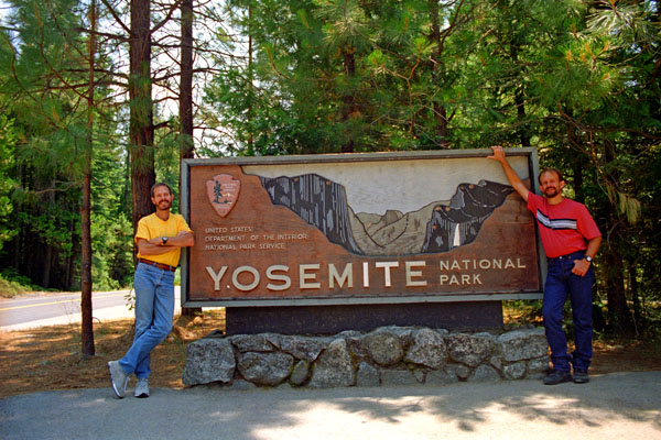
After taking in the lake, we hopped in the car and continued eastward, passing into Yosemite National Park at the West Portal.
|
The Tuolumne Redwood Grove
|
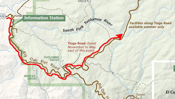
Right away we saw a sign for the parking area for a grove of redwoods- the Tuolumne Grove- and we decided to go ahead and stop to have a look.
Actually, this area of Yosemite has two very small redwood groves- the Tuolumne and Merced groves. The two groves are just a few minutes from each other near the intersection of Tioga Pass Road and Big Oak Flat Road. The hikes are similar, too; both are on old roads to Yosemite, and both require a downhill walk.
|
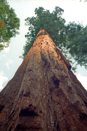
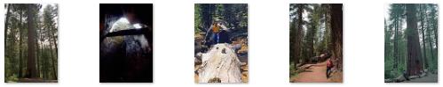
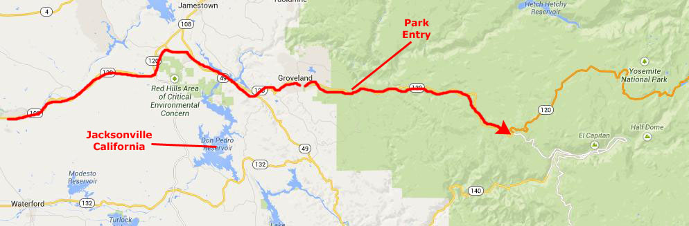
Having been to Muir Woods before, I found the grove something of a letdown. Maybe 5 or 6 big trees were clearly visible, all of which grow in a ravine just left of the paved road among a dense understory of dogwoods. A short bypass road leads to the Dead Giant, a ghastly-looking, long-dead sequoia with a stagecoach-sized tunnel cut through it. It's of the grove's most popular attractions. Click on the thumbnail images below to see more views of the trees and logs along the trail:
|
The short loop trail didn't have many notable living sequoias, just some small sequoias and big fallen logs. At the far end of the trail, though, there was one more big sequoia in a relatively open area. After that point, the grove ends as the road enters a logged area.
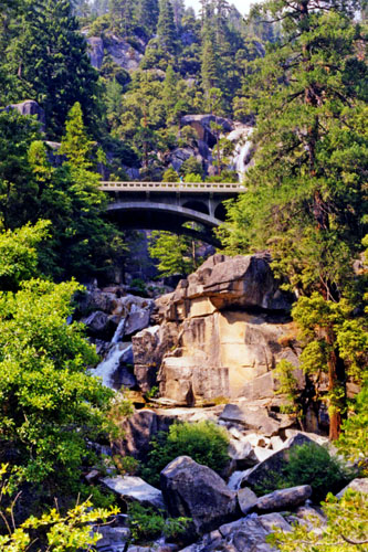
The South Fork of the Tuolumne River
|
 |
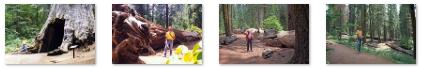
As we were returning up to the bridge, Fred stopped to take a picture of some local wildflowers that were growing by the stream. When we got back to the bridge, I got a good picture looking upstream with Fred on the bridge, and you can see that picture here. There was also a beautiful view looking downstream towards the Yosemite valley.
|
In fact, the road was heading to a part of the Park called Tuolumne Meadows, but we stopped before we got there because we wanted to allow plenty of time today to visit the Yosemite Valley itself and also find a place to stay for the night outside of the Park (knowing that all the Park facilities were booked up way in advance).
As we drove along the very scenic road, we passed little streams and dense forest and every so often there were good views out to our left. Eventually, we reached what appeared to be a popular overlook where we pulled over and got out.
|
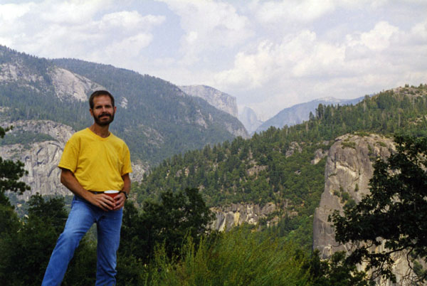
Fred got another good picture looking along the ridge where the road went, and you can see that picture here.
After hanging out here at the overlook for a time, we backtracked down the highway, back to its intersection with the road into Yosemite itself, turned east again, and continued on into the Park.
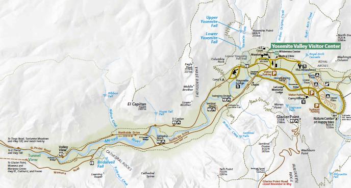
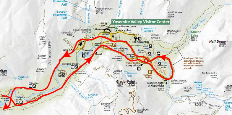
In the Yosemite Valley
|
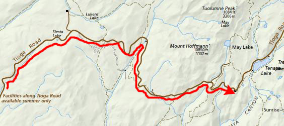
I put this diagram here for a reference. We'll be driving most of these roads, but we'll do so in sections, and so, since the whole diagram is too large to fit conveniently on the page (and still allow you to read it), I cut out little sections of this master diagram and enlarge them so you can.
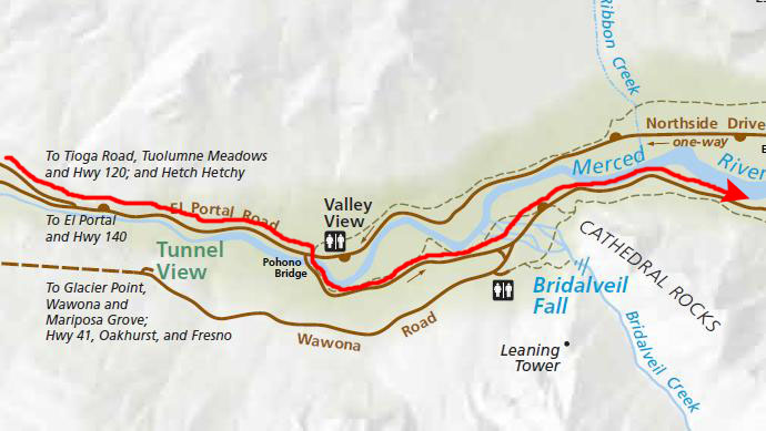
Bridalveil Fall
|
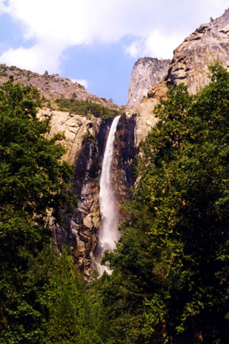
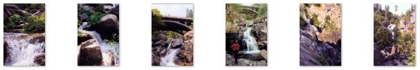
As I said, the first sight we saw (and the first sight most Yosemite visitors see when they enter the valley from the West) was Bridalveil Fall.
|
The glaciers that carved Yosemite Valley left many hanging valleys which spawned the waterfalls that pour down. All of the waterways that fed these falls carved the hanging valleys into steep cascades with the exception of Bridalveil Fall. Bridalveil Creek still leaps into the valley from the edge of the precipice, although that edge has moved back into an alcove from the original edge of the valley. While Yosemite Falls seem to also fall into this category, the original course took the Yosemite Creek down a gorge to the west of its current location. The primary source of Bridalveil Falls is Ostrander Lake, some 10 miles to the south.
When the wind blows briskly, as it was on and off this afternoon, the waterfall appears to be falling sideways. During lesser water flow, the falls often don't reach the ground. Because of this, the Ahwahneechee Native Americans called this waterfall Pohono, which means "Spirit of the Puffing Wind."
Click on the thumbnails below to see some various views of Bridalveil Fall that we got as we drove into the Park and to the base of the fall:
 |
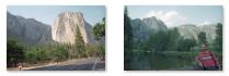
We drove to a spot below the fall where there was a parking area for a trail that led over to the base of the fall, got out, and hiked the short trail to the base. The trail was perhaps a quarter mile long, and took us to the rocks below the last, small cascade. Fred got a picture of me at the base of the fall as we stood in the gentle mist, and you can see that picture here.
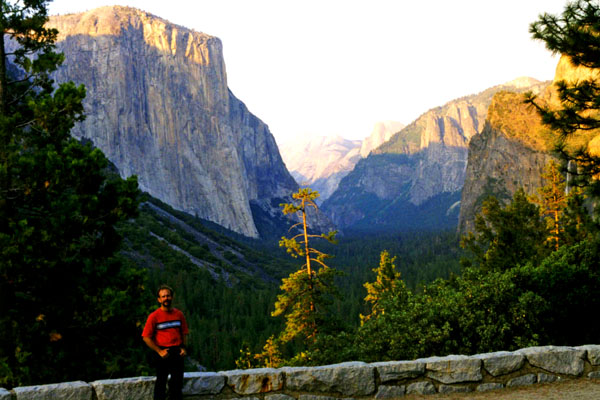
The Valley of the Yosemite
|
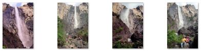
We hadn't gotten very far along the south road (which is a one-way road going east) before we found a particularly nice view looking back at Bridalveil Fall, so we stopped to take that picture looking back at it. There were also a number of small lakes, and the road crossed a couple of them. At others, we just got out to walk around, where we got this nice picture of the craggy mountains that ring the valley. There were other very nice views of the surrounding mountains and you can click on the thumbnail images below to see a couple of them:
 |
It was a very nice drive, and towards the eastern end of it we found the parking area for a hike to two waterfalls- Vernal Falls and Nevada Falls, and we planned to come back and do that hike at least.
|
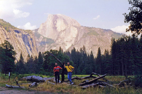
The impression from the valley floor that this is a round dome which has lost its northwest half is an illusion. From Washburn Point, Half Dome which can be seen as a thin ridge of rock oriented northeast-southwest, with its southeast side almost as steep as its northwest side except for the very top. Although the trend of this ridge, as well as that of Tenaya Canyon, is probably controlled by master joints, 80 percent of the northwest "half" of the original dome may well still be there. On March 28, 2009, a large rock slide of 1,500,000 cubic feet occurred from Ahwiyah Point. The slide happened at 5:26 a.m and damaged a large area under the dome. No one was injured but hundreds of trees were knocked down and a portion of the Mirror Lake trail was buried. The slide registered on seismographs as an earthquake reaching 2.5 on the Richter Scale.
Half Dome was originally called "Tis-sa-ack," meaning Cleft Rock in the language of the local Native Americans. Tis-sa-ack is also the name of the fourth route on the formation, ascended by Royal Robbins and Don Peterson over eight days in October 1969. Tis-sa-ack is the name of a mother from a native legend. The face seen in Half Dome is supposed to be hers. Tis-sa-ack is the name of a Mono Lake Paiute Indian girl in the Yosemite Native American legend.
The image of Half Dome seems to be its own cultural meme. In 1988, it was featured on a 25 cent United States postage stamp, and the image appears on the California State quarter, released in January 2005. Starting October 2010, an image of Half Dome is included on the new revised California drivers license in the top right-hand corner. In 2014, Apple revealed their new version of their operating system, Yosemite, and Half Dome was the default wallpaper on the new OS. Half Dome is also an element or inspiration of various company and organization logos, including that of The North Face, Sierra Designs, & Mountain Khakis outdoor product companies, the Sierra Club environmental group and the Sierra Entertainment game studio. Of course, there are views of Half Dome from all around the valley.
|
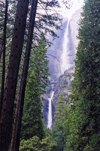
Yosemite Falls is the highest measured waterfall in North America, and one of the park's major attractions- especially in late spring when the water flow is at its peak. The total 2,425 feet from the top of the upper fall to the base of the lower fall qualifies Yosemite Falls as the sixth highest waterfall in the world, though with the recent discovery of Gocta Cataracts, it appears on some lists as seventh.
The falls consist of three sections. The Upper Yosemite Fall is a 1,430-foot plunge (among the world's 20 highest). Trails from the valley floor and down from other park areas outside the valley lead to both the top and base of Upper Yosemite Fall. The upper fall is formed by the swift waters of Yosemite Creek, which, after meandering through Eagle Creek Meadow, hurl themselves over the edge of a hanging valley in a spectacular and deafening show of force.
The Middle Cascades are a series of smaller falls- taken together they drop 675 feet. Because of the narrow, constricted shape of the gorge in which these drops occur and the lack of public access, they are rarely noted. Most viewpoints in the valley miss them entirely.
|
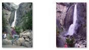
The Lower Fall was easily reached and we spent a half hour or so there. We had not inquired about the trail to the upper falls, but we found later that it can be reached via a steep, strenuous, and usually crowded 3.5 miles trail. (We had also discovered that there is a hike called "the Cable Route" to the top of Half Dome that is very popular, and one of these days, I'd like to return here to do both of these hikes.
|
As we were leaving Yosemite, we passed the entrance for the Mariposa Redwood Grove. We had researched that grove before setting out on our trip, and it was something we wanted to do, but there wasn't enough light left today to do it. So we made a change in our plans. We had already planned to go to King's Canyon National Park tomorrow, staying down in Fresno tonight. We saw signs for the town of Mariposa nearby, so to avoid a lot of backtracking, we thought it would be best to find a motel there, which we did. This would allow us to visit the Mariposa Grove first thing in the morning, before heading down to King's Canyon. We could then stay in Fresno tomorrow night before returning to Yosemite the day after for the waterfall hikes.
We did find a local motel in Mariposa, as well as a little local restaurant where we had dinner before before turning in for the night.
You can use the links below to continue to another photo album page.
|
July 13, 1999: The Mariposa Redwood Grove and King's Canyon NP |
|
Return to the Index for Our California Trip |