|
July 15, 1999: The Napa Valley/San Francisco |
|
July 13, 1999: The Mariposa Grove/Sequoia and King's Canyon National Parks |
|
Return to the Index for Our California Trip |
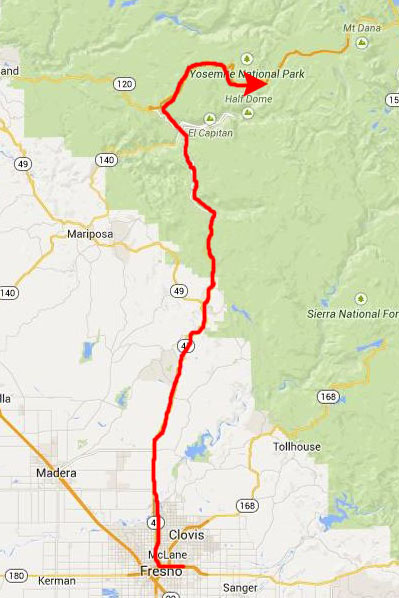
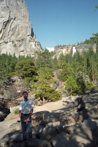
Today, we'll leave Fresno and return to the Yosemite Valley to hike to two waterfalls at the east end of the valley- Vernal Falls and Nevada Falls. We will drive around the valley a bit more before heading west out of the park to stay the night back in Modesto, California.
Getting back to Yosemite National Park
|
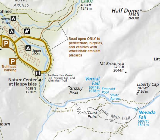 |
The Hike to Vernal Falls
|
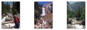
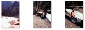
After the first 3/4 mile we arrived at the footbridge, where we were treated to excellent views of Vernal Fall and the Merced River. You can click on the thumbnail images below to see some of these views:
 |
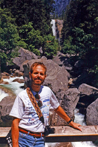
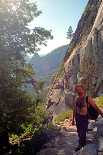
Right near the footbridge, Fred also got a picture of one of the local residents before we headed on up the trail to the top of Vernal Fall.
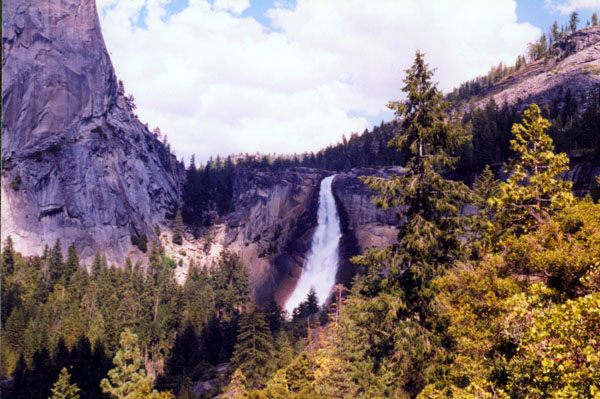
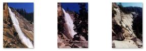
From the footbridge, it was another half mile to the top of Vernal Fall. This part of the hike was somewhat more strenuous, as the trail was much steeper- gaining another 600 feet in that half mile.
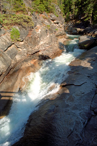
The hike up was very enjoyable, for we were able to follow the Merced River as it flowed through the forest on its way down into the Valley. And just before we reached the stone stairway, we got a really beautiful view of Vernal Fall through the trees.
|
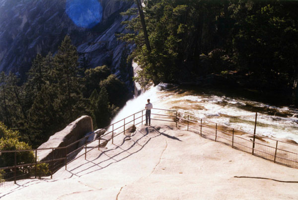
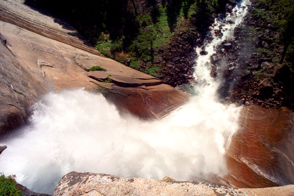
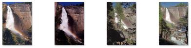
At the top of Vernal Fall, we were treated to jaw-dropping views straight down the length of the 317-foot waterfall. A number of people have fallen to their deaths over the years from here- most of them who tried swimming in the pool just above the fall. For that reason, railings have been installed, and there are caution signs all around advising visitors not to go beyond them and not to step anywhere where the rock is wet.
|
Our Hike to Nevada Falls
|
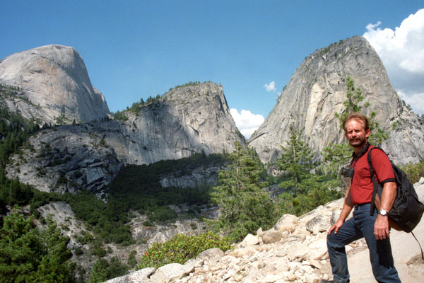
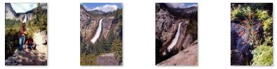
From Vernal Fall, we just continued uphill on the Mist Trail to the top of Nevada Fall. The trail took us up the west side of the fall and then down the east side, and we had to share the trail with other hikers and equestrians. There were many spots along the trail where we could see ahead and get great views of Vernal Fall, and you can see one of the nicest views here.
As we ascended, and got closer to the Fall, the views got better and better, and you can click on the thumbnail images below to see some of them:
 |
The hike to the top of Nevada Fall took us another ninety minutes or so; we could have gotten there quicker, but the day was beautiful and the hiking conditions ideal, and we were just enjoying our leisurely pace.
|
The trail was level for short stretches, but most of it considted of steep, rocky switchbacks, and, eventually, we found ourselves at the top of Nevada Fall.
I must say that the views from here, at the top of Nevada Fall, and after a two-hour trek to get here, were so very much well worth it that deciding to do this hike was probably the best decision we made on the whole trip.
|
|
We spent the better part of an hour at the top of Nevada Fall, just reveling in the day and the views. Instead of heading back down the way we came, we continued over the bridge to the John Muir Trail.
|
 |
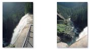
The Muir Trail leveled out a bit once we got to the level of the base of Nevada Fall, and it also opened out for a ways, offering us really spectacular views looking back up at the fall. You can click on the thumbnail images below to see some of these tremendous views:
 |
One nice thing about the return trail is that we were closer to the Merced River as it flowed down to the top of Vernal Fall, and we got a couple of really nice pictures of it along the way. Below, you can see those views, along with a final picture we took when we reached the footbridge below Vernal Fall again two hours later:
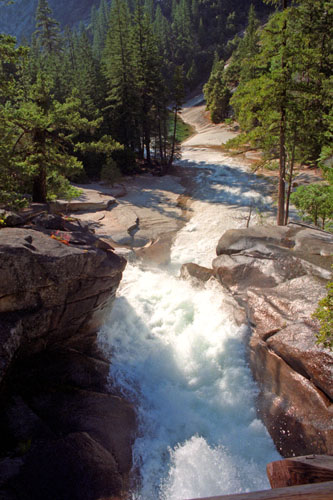 The Merced River |
 The Merced River |
 Vernal Fall |
We reached the car in the parking area about five o'clock, and began to make our way out of Yosemite. This place is really beautiful, and I hope we can return here to do some of the hikes that take you to the top of Half-Dome and into the backcountry. For now, though, we retraced the route we'd driven two days ago to head back west towards San Francisco. We planned to stop in the Napa Valley, but it was too late to do that today, so we stayed overnight northeast of Modesto.
You can use the links below to continue to another photo album page.
|
July 15, 1999: The Napa Valley/San Francisco |
|
July 13, 1999: The Mariposa Grove/Sequoia and King's Canyon National Parks |
|
Return to the Index for Our California Trip |