|
June 28, 2001: Grand Coulee Dam |
|
Return to the Index for Our Canada Trip |
|
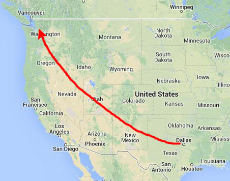
June 26-27, 2001 Getting to Seattle On Mt. Rainier At the Columbia River To Ephrata, WA |
Getting to Seattle
|
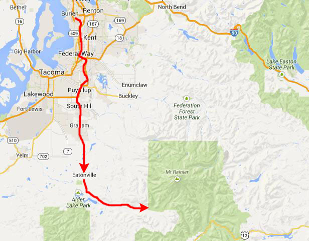
We landed at SeaTac about nine o'clock, as I recall, and planned to stay as near as we could to the southwest entrance to Mt. Rainier National Park so we would be positioned to begin our day tomorrow at Mt. Rainier.
|
We found a Wal-Mart just outside Auburn, stopped, and got all our supplies- including a cooler. Then we drove further south to the small town of Eatonville where I had made a motel reservation for the evening.
You can return to today's index
or continue with the next section below.
Exploring Mt. Rainier National Park
|
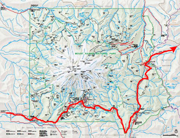
Mount Rainier National Park was established on March 2, 1899 as the fifth national park in the United States. The 370-square-mile park encompasses all of Mount Rainier, a 14,410-foot stratovolcano. The mountain rises abruptly from the surrounding land with elevations in the park ranging from 1,600 to over 14,000 feet- the highest point in the Cascade Range. Around it are valleys, waterfalls, subalpine wildflower meadows, old growth forest and more than 25 glaciers. The volcano is often shrouded in clouds that dump enormous amounts of rain and snow on the peak every year and hide it from the crowds that head to the park on weekends. This was to be our lot today as well.
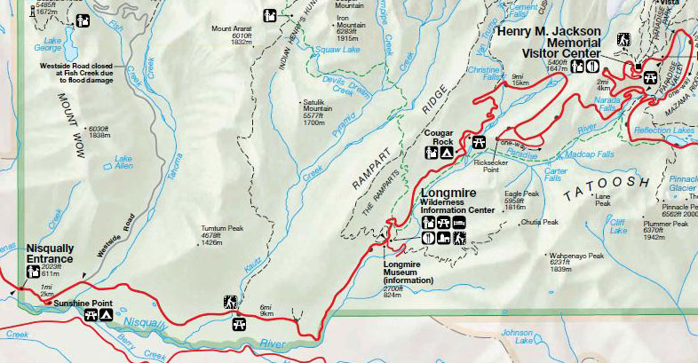
It took us about an hour from Eatonville to reach the park headquarters, which is actually outside the park itself about ten miles from the actual entrance, and a few minutes after that to reach the Nisqually Entrance at the extreme southwest corner of the park.
|
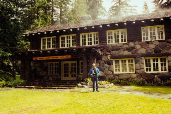
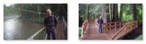
The first place we stopped at to get out and walk around was Longmire- the Wilderness Information Center.
|
 |
With the establishment of Mount Rainier National Park in 1899, Longmire became park headquarters. The site had previously served as James Longmire's homestead, lodging, and mineral springs resort. Although park headquarters are no longer at Longmire, the original headquarters building houses a museum that tells the story of the early days of the park. All of Longmire is now designated a national historic district.
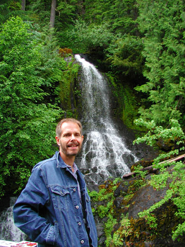
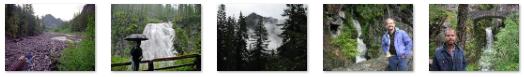
Continuing our drive to the Visitor Center, we passed two or three interesting waterfalls, and of course we stopped at each one. At one point, we could look to the south and see a high, thin waterfall coming down the slopes. On the way up the mountain we got rained on a few times, but most of the time we stayed dry, although the day seemed very overcast. Use the clickable thumbnails below to see some of the pictures we took along the road into the park and up to the Visitor Center:
 |
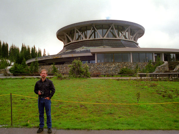
A ways beyond Longmire, the road became very twisty and steep, and eventually we saw the sign for the turnoff to the Visitor Center. We reached the Visitor Center a few minutes later. Mount Rainier was a pilot park in the 1960s "Mission 66" program to expand National Park visitor services. The plans for the Paradise Visitor Center as a day-use facility came about as a compromise when the program was still trying to determine whether overnight lodging would be feasible. Construction began in 1964, and was to include a restaurant, museum, information center, ski rental shop and a warming hut. The building was completed in 1966.
|
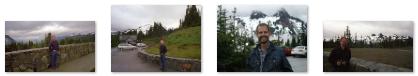
Inside, the Center did seem sparse and cavernous, although part of that was probably due to the weather. I have to admit, the latticework windows you can see at left offered expansive views 360° around. We spent some time looking at the exhibits before going outside to take in more of the mountain scenery and some views of the cloud-obscured Mt. Rainier. Use the clickable thumbnails below to see some views of the Tatoosh Range:
 |
Other than 40 years of snide comments, other more significant architectural problems led the National Park Service to replace the Jackson Visitor Center (the name was changed to honor Henry "Scoop" Jackson, the longtime U.S. Senator from Washington) with a more traditional design. The roof of the original structure was not designed to handle the copious amounts of snowfall in the Paradise area each winter; melting it to avoid a roof collapse used up hundreds of gallons of diesel fuel each day. Additionally, the building no longer met building and accessibility codes, despite ramps and other features that required a disproportionate amount of space. The National Park Service began construction of a smaller, more energy-efficient visitor center in 2006. The new Henry M. Jackson visitor center opened in the Fall of 2008. Demolition of the building you saw here was accomplished in 2009.
|
We didn't take a lot of pictures at any one spot, and so ended up with an eclectic collection. You can use the clickable thumbnails below to see some of the pictures that we took:
Scenery in Mt. Rainier NP |
We worked our way to the northeast corner of the park, and by mid-afternoon were leaving it along US Highway 12 east. As we began to descend the eastern slopes of the Cascades, the weather, which had been fairly gloomy up until now, began to clear, and the terrain began to change- rapidly. The forests disappeared behind us and were replaced with grassland. The clouds disappeared and the humidity dropped. This is all because of the west-to-east movement of weather systems. As moist air hits the west slopes of the Cascades, it begins to rise and cool. When it does, it drops its moisture as rain or snow. By the time the air flows over the crest, it is much drier, and as it descends it warms, what moisture is left disperses and the sky clears.
You can return to today's index
or continue with the next section below.
Driving to the Columbia River
|
At Yakima, we took I-82 north and then I-90 east to the Columbia River, continuing north on I-90 on the east side of the waterway.
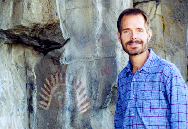
A few miles west of yakima, we saw a roadsign for some Indian cliff paintings (pictographs) and so we took a short detour to a cliff face near the road and hiked the short trail up to them.
|
The state park was acquired from the Yakima Valley Canal Company in 1950. The rock paintings are stylized polychromatic paintings using white, red and black colors. (In early 2007, the Washington State Parks Department closed Indian Painted Rocks park because of graffiti. There are plans to restructure the park in order to protect the painted rocks.)
Not only were there paintings here, but the cliffs were also home to swallows, who build strange-looking conical nests attached to the cliff face. One of the other two pictures we took here shows these nests clearly. Use the clickable thumbnails below to have a look:
 |
A sign erected by the Washington State Highway Commission at the park's entrance states the following: The origin of these paintings is unknown to present-day Indian tribes of this region. They are similar to many others found in western North America an dare often interpreted as depicting religious experiences as well as records of hunts or meetings with othe tribes. This location was on the old Indian trail which ran from the Wenas Mountains to the Ahtanum band of the Yakimas. In the 1850s, miners enroute to British Columbia gold fields used the same trail. later, as Americans settled Yakima Valley, a stagecoach route passed these cliffs.
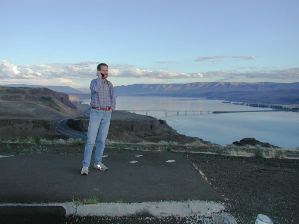
We got back on the road to Yakima and followed the route mentioned above. Eventually, we came down into the Columbia River valley, and we could see the Columbia River bridge ahead of us.
|
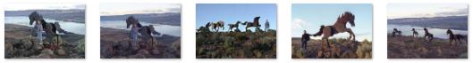
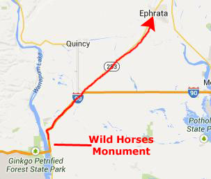
A short hike up the path led to the base of the hill, from where we could peer up to admire the monument. We continued to follow the scramble trail from the viewpoint up to the horses. This steep, rocky path was only a few hundred yards long, but it was enough to lead us to some beautiful wildflowers and increasingly open views down to the river. Over its last part, the trail climbed steeply to the fifteen surprisingly lifelike horse sculptures. These beauties stand on a bluff overlooking the Columbia River. Constructed out of welded steel plates, they are the work of Spokane artist David Govedare. The tempered steel ponies were put on the bluff in 1989 for Washington State's Centennial Celebration.
Once at the side of the horses, we could enjoy them up close, and then continue to hike along the slope behind them until we could frame the horses against the blue ribbon of the Columbia down in the canyon to the southwest. It almost felt as there was a real herd of wild mustangs running over the hills when we looked back on them, as if we'd been transported back hundreds of years to a time when horses first migrated into the area and ran wild through these hills.
This simple little trek offered us some of the most impressive geologic and historic views of the Columbia River area. The uniquely beautiful sculptures at the top of the ridge offered great exposure to one of the most impressive outdoor art pieces in the Northwest. And from the overlook at the top, and the plaque from which much of this narrative was taken, we got an incredible river view in the fading afternoon light. Please use the clickable thumbnails below to see some of the excellent pictures we took here at Wild Horses Monument:
 |
We walked around the sagebrush flats above the monument for a while, enjoying the views, and then headed back down. To the west, we could see the rugged landscape of the Ginkgo Petrified Forest State Park highlands. We arrived back at the parking area and continued on.
You can return to today's index
or continue with the next section below.
To Ephrata, Washington
|
 |
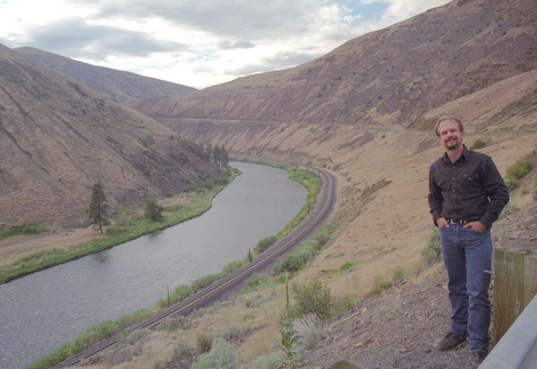
Before we lost our light completely, we got one more picture of a picturesque river valley and railroad that the highway paralleled. You can see that view at left.
You can return to today's index
or use the links below to continue to another photo album page.
|
June 28, 2001: Grand Coulee Dam |
|
Return to the Index for Our Canada Trip |