|
June 29, 2001: Metaline Falls and Into Canada |
|
June 27, 2001: Mt. Rainier National Park |
|
Return to the Index for Our Canada Trip |
|
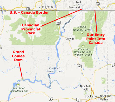
June 28, 2001 The Grand Coulee Grand Coulee Dam The Drive to Metaline |
Today, we will be heading generally northeast through Washington State. We want to enter Canada from the northeast corner of the state so that we can make a big circle around through Banff, Jasper, Revelstoke and Vancouver. There is no direct route to where we want to go, as no Interstate runs north-south through eastern Washington. But that's OK, because we want to see the scenery anyway. One good thing is that Grand Coulee Dam is right on our way.
Driving Through the Grand Coulee
|
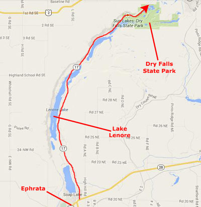
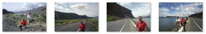
This was the beginning of Lake Lenore, a 1,670-acre lake formed by the Missoula Floods (more on the Missoula Floods in a bit). The lake is rather narrow, but long. The length of the lake runs north and south right beside the highway (Washington route 17) that we were taking from Ephrata up through Coulee City to Grand Coulee Dam. We took a few pictures as we drove north, and you can use the clickable thumbnails below to have a look at them:
 |
The drive along the lake (actually a series of lakes) was really great, and the weather was just about perfect.
|
The Grand Coulee is part of the Columbia River Plateau. This area has underlying granite bedrock, formed deep in the Earth's crust 40 to 60 million years ago. The land periodically uplifted and subsided over millions of years giving rise to some small mountains and, eventually, an inland sea.
From about 10 to 18 Million years ago, a series of volcanic eruptions from the Grand Ronde Rift, near the Idaho/Oregon/Washington border began to fill the inland sea with lava. In some places the volcanic basalt is 6,500 feet thick. In other areas granite from the earlier mountains is still exposed. Many animals roamed the area including camel, horse and rhinoceros.
Two million years ago in the Pleistocene epoch, glaciation took place in the area. Large parts of northern North America were repeatedly covered with glacial ice sheets, at times thousands of feet thick. Periodic climate changes resulted in corresponding advances and retreats of ice.
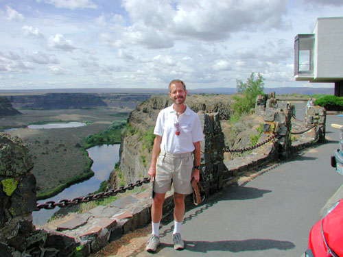
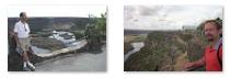
One might think that it was simple glaciation that scoured the broad coulee, but while that is true to some extent, we didn't learn about what really happened until we arrived at Dry Falls State Park and went into the Visitor Center.
|
This mass of water and ice, towering 2,000 feet high near the ice dam before release, flowed across the Columbia Basin, moving at speeds of up to 65 miles per hour. The deluge stripped away soil, cut deep canyons and carved out 50 cubic miles of earth, leaving behind areas of stark scabland. Had there been any modern structures in the way, or even a medium-sized city, everything would have been utterly destroyed and swept away.
Over nearly 2500 years the cycle was repeated many times. Most of the displaced soil created new landforms, but some was carried far out into the Pacific Ocean. In Oregon's Willamette Valley, as far south as Eugene, the cataclysmic flood waters deposited fertile soil and icebergs left numerous boulders from as far away as Montana and Canada.
At present day Portland, the water measured 400 feet deep. A canyon 200 feet deep was carved into the far edge of the continental shelf. This web-like formation can be seen from space. Mountains of gravel as tall as 40-story buildings were left behind; boulders the size of small houses and weighing many tons were strewn about the landscape.
|
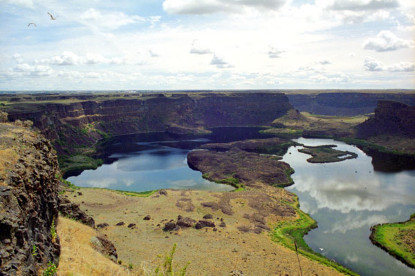
Use the clickable thumbnails below to look at a couple of additional views of the Dry Falls area of the Grand Coulee as seen from the Visitor Center high on the basalt cliff:
 |
Dry Falls, a 3.5-mile scalloped precipice five times the width of Niagara, is thought to be the greatest known waterfall that ever existed. According to the current geological model, catastrophic flooding channeled water at 65 miles per hour through the Upper Grand Coulee and over this 400-foot rock face at the end of the last ice age. At this time, it is estimated that the flow of the falls was ten times the current flow of all the rivers in the world combined.
The Missoula Floods, as they are called, put parts of Idaho, Washington, and Oregon under hundreds of feet of water in just a few days. These extraordinary floods greatly enlarged the Grand Coulee and Dry Falls in a short period. The large plunge pools at the base of Dry Falls were created by these floods. Once the ice sheet that obstructed the Columbia melted, the river returned to its normal course, leaving the Grand Coulee and the falls dry. (Not entirely dry, actually, because near the Interpretive Center we passed a water seep coming down the cliff face.)
You can return to today's index
or continue with the next section below.
The Grand Coulee Dam
|
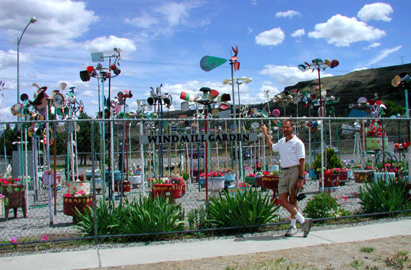 The Gehrke Windmill Garden |
The windmill garden, I found out just recently, was the result of the eccentricities of a Mr. Gehrke of Electric City, who filled his yard with wind-propelled junk art gewgaws. (I can only imagine that he had something to do with Grand Coulee Dam, for the town of Electric City did not exist before the dam was built.) Emile Gehrke (1884-1979) lived in Electric City and built whimsical windmills and other folk art and decorated his back yard with the stuff. After his death, most of the devices were moved to this fenced-in display on the main highway in Electric City. This display was about a mile west of the dam, in a lakeside park (North Dam Park) where everyone can enjoy it. (So don't be too hard on that neighbor of yours with the plethora of garden gnomes; maybe one day they, too, will be in a park somewhere.)
|
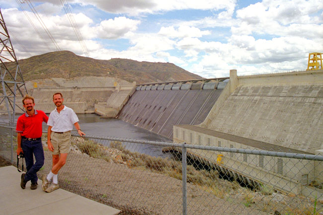
Grand Coulee Dam is a gravity dam, built to produce hydroelectric power and provide irrigation. It was constructed between 1933 and 1942, originally with two power plants. A third power station was completed in 1974 to increase its energy production. It is the largest electric power-producing facility in the United States and one of the largest concrete structures in the world.
The proposal to build the dam was the focus of a bitter debate during the 1920s between two groups. One wanted to irrigate the ancient Grand Coulee with a gravity canal and the other supported a high dam and pumping scheme. Dam supporters won in 1933, but for fiscal reasons the initial design was for a "low dam" 290 ft high which would generate electricity, but not support irrigation. The U.S. Bureau of Reclamation and a consortium of three companies called MWAK (Mason-Walsh-Atkinson Kier Company) began construction that year.
On August 4, 1934, President Franklin D. Roosevelt visited the construction site and was impressed by the project and its purpose. He gave a speech to workers and spectators, closing with this statement: "I leave here today with the feeling that this work is well undertaken; that we are going ahead with a useful project, and we are going to see it through for the benefit of our country." On the basis of what he had seen, the President began endorsing the "high dam" design which, at 550 ft high, would provide enough electricity to pump water to irrigate the Columbia Basin. The high dam was approved by Congress in 1935 and completed in 1942; the first water over-topped its spillway on June 1 of that year.
|
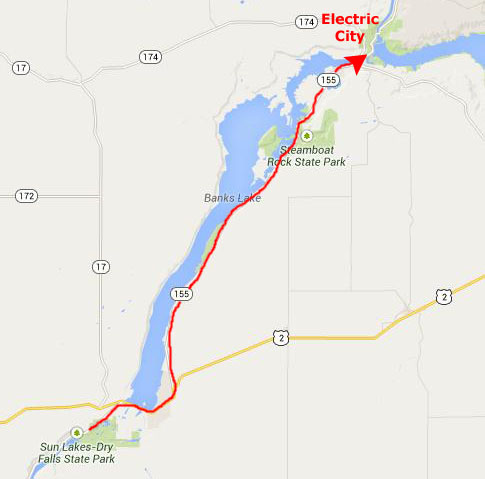
Up until the construction of the dam, the interior of Washington State could only support dryland farming (because weather systems dropped almost all their moisture on the western slopes of the Cascades. The Columbia Basin Project changed this in 1952, using the ancient river bed as an irrigation distribution network. The Upper Grand Coulee was dammed and turned into Banks Lake (along which we had driven coming up from Dry Falls State Park). The lake is filled by pumps from the Grand Coulee Dam and forms the first leg of a hundred mile irrigation system. Canals, siphons, and more dams are used throughout the Columbia Basin.
The Grand Coulee Dam is an engineering marvel. While not as spectacularly tall as, say, Boulder Dam, it is nevertheless an amazing sight to look at.
|
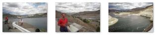
Photos of Grand Coulee Dam |
While we were walking around, we saw a store that was selling Native Indian art and crafts, and we stopped in for a while. I found a number of buffalo-themed gifts to buy and lay away for Fred's birthday and Christmas presents.
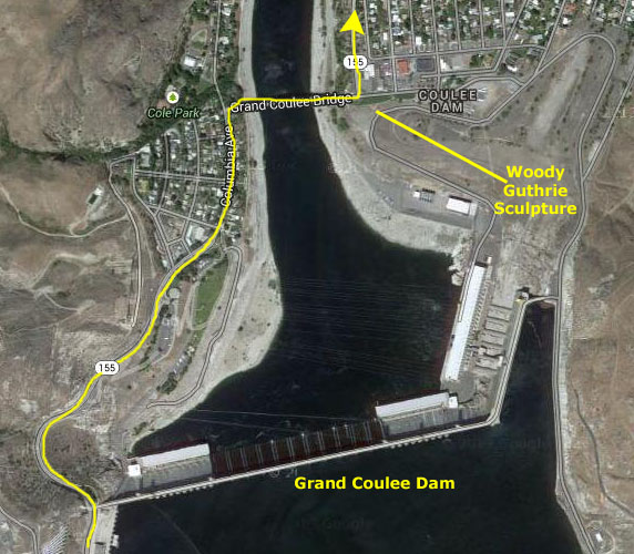
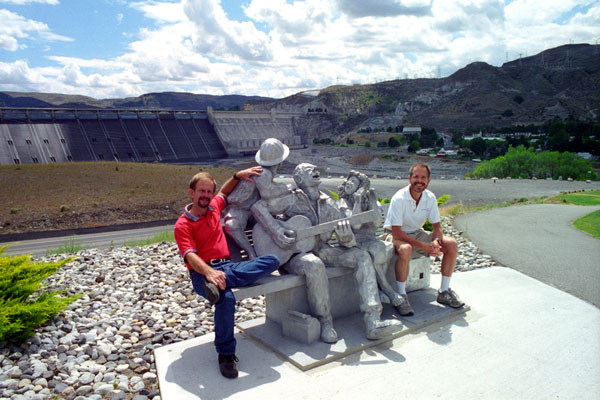
Near where we parked the car, we noticed a life-size sculpture of a man sitting on a bench singing, and the installation was on a platform overlooking the dam. As it turned out, according to the nearby plaque, the person depicted was Woody Guthrie.
|
The song was part of the Columbia River Ballads, a set of 26 songs written by Guthrie as part of a commission by the BPA, the federal agency created to sell and distribute power from the river's federal hydroelectric facilities, in particular the Bonneville Dam and Grand Coulee Dam. On the recommendation of Alan Lomax, the BPA hired Guthrie to write a set of propaganda songs about the federal projects to gain support for federal regulation of hydroelectricity.
Although the intended documentary film was never completed, Guthrie's songs were recorded in Portland, Oregon in May 1941. The tune for "Grand Coulee Dam" is based on that of the traditional song, "The Wabash Cannonball". Guthrie's recording was reissued on the Folkways album Bound For Glory in 1956, and subsequently on numerous compilations of Guthrie's songs.
If you'd like to have a listen to Woody Guthrie and his song, just click the play button on the little player below:
|
Woody Guthrie performing "Grand Coulee Dam" |
Although it is really the Columbia River, the reservoir (the portion of the river whose flow is interrupted by the dam) is called Franklin Delano Roosevelt Lake, named, of course, after the United States President who presided over the authorization and completion of the dam.
|
While creation of the reservoir forced the relocation of over 3,000 people, including Native Americans whose ancestral lands were partially flooded, and while the dam has blocked the migration of salmon and other fish upstream to spawn, water has turned the Upper Coulee and surrounding region into a haven for other wildlife, including Bald Eagles. Recreation is a side benefit and includes several lakes, mineral springs, hunting and fishing, and water sports of all kinds. Sun Lakes (Dry Falls, which we visited earlier) and Steamboat Rock State Parks are both found in the Grand Coulee.
You can return to today's index
or continue with the next section below.
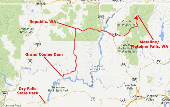
The Drive to Metaline, Washington
|
 |
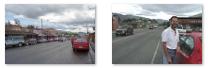
Then the river bent to the west while the highway angled off northeast, so we eventually lost site of the river, although we didn't lose sight of the beautiful countryside. Over an hour later, after some very pleasant driving through the Grand Coulee, we came to the small, picturesque town of Republic, Washington. Here, we stopped to gas up, check our route and get a snack. It was here that we planned our next stop- Metaline Falls, a good ways east of here. We also took a couple of pictures of Republic, and you can use the clickable thumbnails below to have a look at them:
 |
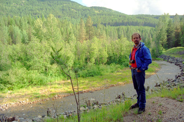
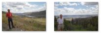
From Republic, we headed east, crossing Roosevelt Lake near Colville, Washington. There were a number of little creeks and streams in this area, and since the sun had come back out, we stopped at a couple of them.
|
But at another stop a bit later, we got out of the car and actually walked down to a stream to appreciate it fully in the late afternoon sunlight. Without a topographical map, all the streams and creeks were confusing, flowing in directions you wouldn't expect. If you click here, you'll notice that this particular stream was flowing north, rather than south as one might have expected. I assume that since were still in the Columbia River basin, though, that when this water finally reaches Roosevelt Lake, it'll be flowing south again.
It was getting dark when we reached the Pend Oreille River that flows south from Canada (and on which Metaline Falls is located), and we took scenic highway Washington 31 north along the river. Eventually, we saw some signs for the town (which only has 225 people) and, apparently, only one hotel/apartment building, so we turned off, found the hotel (more about it tomorrow), checked in, and had some supper in our room (eating the sandwich stuff we'd bought the evening we landed in Seattle) since there was no restaurant we could find that was open.
You can return to today's index
or use the links below to continue to another photo album page.
|
June 29, 2001: Metaline Falls and Into Canada |
|
June 27, 2001: Mt. Rainier National Park |
|
Return to the Index for Our Canada Trip |