|
July 3, 2001: Revelstoke and Vancouver, British Columbia |
|
Return to the Index for Our Canada Trip |
We leave Seattle today- about five in the afternoon. So we won't have time to do anything extensive, particularly since we're starting out way north in Bellingham. But we at least want to visit the Space Needle, which I think is something Fred should see. I think I may have visited it once between my stop here in 1969 on my way to Korea and now.
Bellingham to the Space Needle/Pacific Park
 Our Drive to Seattle |
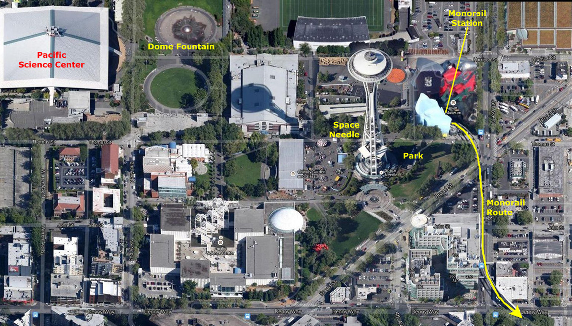
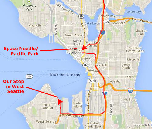 Getting to Pacific Park |
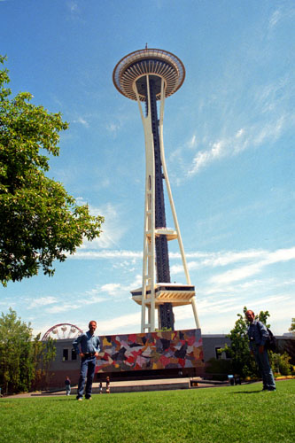
As I thought, there were some signs directing people to Pacific Park, although by the time you get to where you have to exit from I-5, you can see the thing sticking up into the sky. We parked a few blocks away and walked towards the Space Needle and the Park.
|
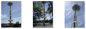
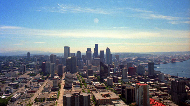
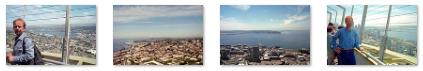
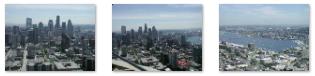
The observation deck is 520 ft up the structure, and there is a rotating restaurant just below it. From the top of the Needle, one can see not only the downtown Seattle skyline but also the Olympic and Cascade Mountains, Mount Rainier (in a remarkably good picture that Fred took) and Mount Baker, as well as Elliott Bay and the surrounding islands. There is a bank of elevators to take visitors to the top in a 41-second, 10MPH trip. On April 19, 1999, the city's Landmarks Preservation Board designated it a historic landmark.
|
Construction of the Space Needle was delayed because of difficulty locating an appropriate plot of land within the upcoming World's Fair site; when the location was finally acquired, only one year remained before the World's Fair would begin. The privately built and financed Needle was built by a construction team working around the clock. The foundation is a block of concrete built below ground level. The block is 30 feet by 120 feet, weighing 6000 tons (including 250 tons of reinforcing steel), and requiring 500 concrete trucks a full day to fill. The structure is bolted to the foundation with 72 bolts, each one 30 ft long.
The domed top is so perfectly balanced that it requires a motor the size of an average garbage disposal to turn it. Even with all of the over-engineering, the Needle was completed on time, in April 1962, at a cost of $4.5 million. The Skyline, a banquet facility, was added at the 100-foot level in 1982. Renovations were completed in 2000 that cost approximately the same as the original construction original price ($21 million in current currency).
|
|
Being at the top of the Space Needle was as interesting as I remembered it, and I think Fred was impressed as well. We went back down to ground level and walked over to the Pacific Science Center and its beautiful filigreed arches. The Science Center is a museum, and if we'd been here all day, we probably would have gone in. Instead, we walked over to the huge dome fountain between the Science Center and the Needle to have a look. It was one of the largest fountains I'd seen in a long time, and while we were standing by it, Fred took a picture with me and the fountain as well; you can see that picture here. Actually, the little park north of the Needle was quite nice, decorated with hanging baskets and with lots of plants and flowers around.
In the scrollable window below there is an aerial view of Pacific Center and the major features that we stopped at while we were here.
|
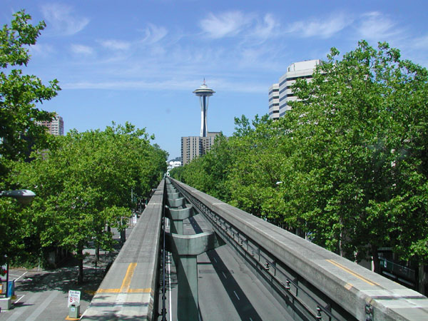
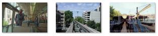
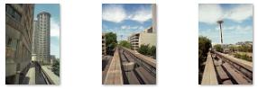
We happened to be walking through the park east of the Needle when we saw the monorail train coming along north towards the station that was part of the EMP Museum complex a block east of the Needle. The Experience Music Project and Science Fiction Museum (which we did not have time to go in) is a nonprofit museum, dedicated to contemporary popular culture, founded by Paul Allen in 2000. It is now, apparently, simply called the "EMP Museum" and it sponsors exhibits and public programs devoted to popular music. It also sponsors a yearly festival of science fiction films.
|
|
We returned to Seattle Center on the monorail and were walking back to the car when we passed a statue of Chief Seattle in a little square. Wrapped in a stained copper shawl, the chief, for whom the city is named, stands on a pedestal with one arm raised in symbolic greeting to the first white settlers who landed at Alki Point in 1851. Bear heads at the base of the pedestal spout streams of water into a pool.
The little square is called "Tilikum Place," that name meaning "welcome" or "greetings" in Chinook jargon, and is at the juncture of the original land claims of Denny, Boren, and Bell. The statue, sculpted by James Wehn from the only existing photo of the chief, was unveiled on Founders' Day, November 13, 1912, by Chief Seattle's great-great-granddaughter.
|
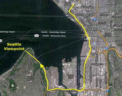
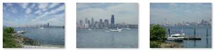
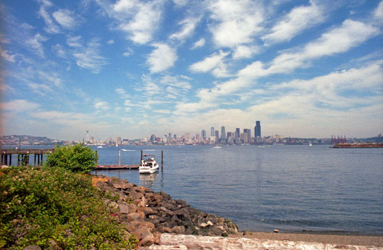 The City from West Seattle |
The view is really quite beautiful from here, and I understand that this area is a desirable place to live- for both the views and the seclusion yet closeness to the city.
|
These weren't the last pictures we took, though. We both still had some pictures left on our film rolls, so we used them up on the flight home.
|
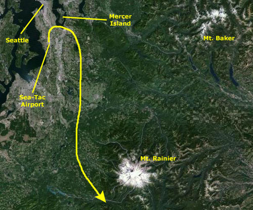
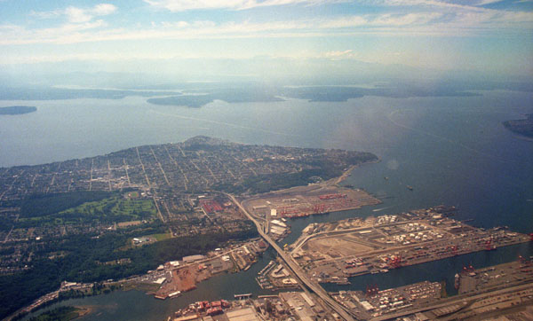 The West Seattle Bridge/West Seattle |
I thought this was a fortuitous picture, for you can easily see the West Seattle Bridge that we had driven across two hours earlier, as well as the coast road curving around to the right. We had stopped to take our earlier pictures along the nearest stretch of shoreline. The plane banked to head back south and off to the left we could see Mercer Island.
|
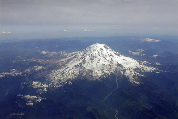
The plane banked right around to the south of Mt. Rainier National Park, and before it slipped out of view, we got one more very nice picture of snow-capped Mt. Rainier.
That was about it for picture-taking. Fred had a few more shots left, and so as we flew home, he used them up. Most of them were hazy, and really not worth including here, but he did get one nice shot as we flew over the Rocky Mountains west of Denver.
The rest of the flight was pleasant, if uneventful, and we reached home in plenty of time for Fred to get on back to Van Alstyne in preparation for going in to work tomorrow. This was a really neat trip- particularly the whole "snow in July" aspect.
You can use the links below to continue to another photo album page.
|
July 3, 2001: Revelstoke and Vancouver, British Columbia |
|
Return to the Index for Our Canada Trip |