|
July 4, 2001: Seattle, Washington |
|
July 2, 2001: Glacier and Mount Revelstoke National Parks |
|
Return to the Index for Our Canada Trip |
|
July 3, 2001 In Revelstoke, BC Mount Revelstoke Driving to Vancouver In Vancouver, BC
|
Today, we'll spend some time in Revelstoke, heading up to the top of Mount Revelstoke, which is just above the city. Then we have a fairly long drive to Vancouver where we will see what we can see in the city and also spend the night.
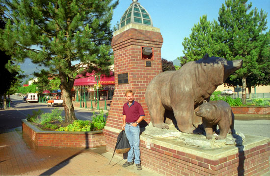
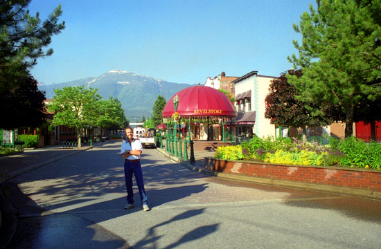
In Revelstoke, British Columbia
|
The construction of the Trans-Canada Highway in 1962 further eased access to the region, and since then tourism has been an important feature of the local economy, with skiing having emerged as the most prominent attraction. Mount Revelstoke National Park is just north of the town. The construction of Revelstoke Mountain Resort, a major new ski resort on Mount MacKenzie, just outside of town, is underway since late 2005. Revelstoke is also the site of a railway museum.
|
Revelstoke holds the Canadian record for snowiest single winter. Over 80 feet of snow fell on Mt. Copeland outside town during the winter of 1971-72. Lest you think that it doesn't mean much because the snow fell on a remote mountaintop somewhere, the actual town received over 25 feet of snow during that winter, and snow levels were higher than many roofs around town by more than ten feet.
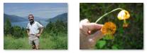
We didn't spend much time wandering around town, we wanted to drive up to the top of Mount Revelstoke.
You can return to today's index
or continue with the next section below.
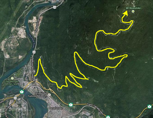
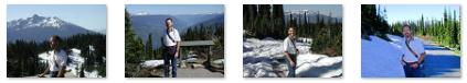
A Trip Up Mount Revelstoke
|
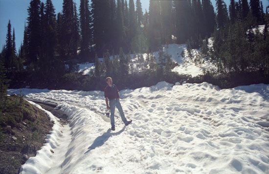 |
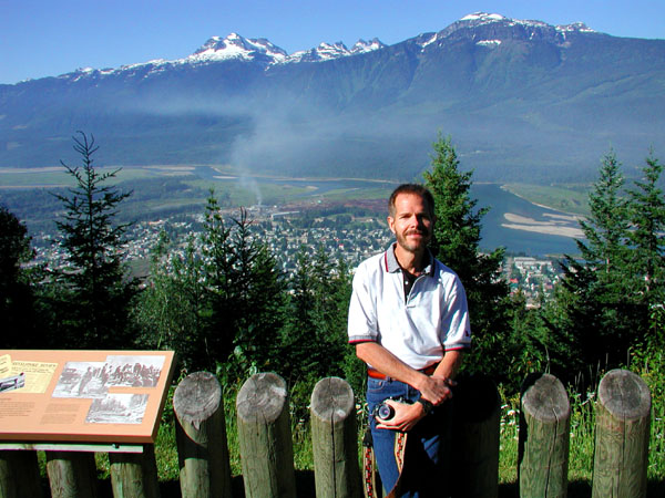
When we got to the top, we found that there was an unoccupied ranger station, which also appeared to be a kind of weather station. There were amazing views all around, with the Monashee Mountains in the west and the Selkirk range in the east.
|
|
It wasn't actually very chilly up here this morning, which made all the snow on the ground seem that much more of an oddity. I suspect, that with the daytime temperatures we've experienced in the last few days, this snow won't last the week.
When we'd had our fill of walking around the top of Mount Revelstoke (and throwing a couple of snowballs at each other) we walked back down the road to the parking area for our trip back down the mountain and back onto the Trans-Canada Highway heading west.
You can return to today's index
or continue with the next section below.
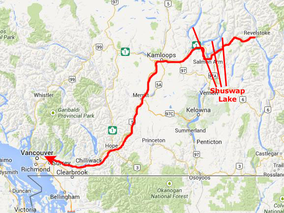
Driving From Revelstoke to Vancouver
|
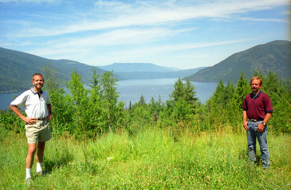
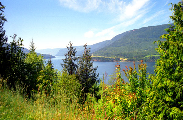
Shuswap lake is at the heart of a region known as the Shuswap Country or "the Shuswap", noted for its recreational lakeshore communities, one of which is the town of Salmon Arm.
|
To the north-west the lake is mainly fed by the Adams River, which drains Adams Lake. Other rivers that feed the lake include the Salmon River, the Eagle River, the Seymour River, Scotch Creek and numerous other smaller waterways.
Use the clickable thumbnails below to see two other pictures that we took at our roadside stop by Shuswap Lake:
 |
We took advantage of the stop and the scenery to have some lunch and get ready for the final run over to Vancouver.
|
The five hours of pleasant driving brought us to the outskirts of Vancouver on the east. Here, the land flattened out (being pretty much an ancient delta), although mountains were never out of view in the distance.
You can return to today's index
or continue with the next section below.
In Vancouver, British Columbia
|
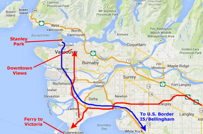
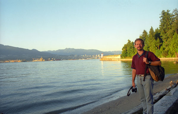
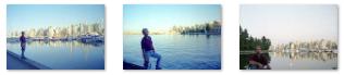
I wanted to show Fred what the downtown harbor area of Vancouver was like, so we drove north into town, stopping at a point where we could walk around and get a look at this cosmopolitan city. But in the time we had, we just didn't want to walk around aimlessly, so we drove a short distance out to Stanley park, which is on a peninsula that sticks out into the Burrard Inlet. From there, I thought, we could get some nice pictures of the city.
When we lost our light there, we drove to the harbor area where there were a number of restaurants where we could have dinner. We ended the day by driving south towards the border, crossing back into the United States and spending the night in Bellingham, Washington.
Driving into town from the ferry terminal, we just picked a place off one of the main streets that I thought might give us some decent views. It did, and we took a couple of pictures looking down the hill towards the harbor and the cityscape around it. You can see those two photos here and here. Next, we drove out to Stanley Park, and found a parking place in one of the many small lots so we could walk around.
|
Unlike other large urban parks, Stanley Park is not the creation of a landscape architect, but rather the evolution of a forest and urban space over many years. Most of the manmade structures we see today date to 1910-1940, although additional attractions, such as a polar bear exhibit, aquarium, and miniature train, were added in the post-war period. Much of the park remains as densely forested as it was in the late 1800s, with about a half million trees, some of which are 250 feet tall and hundreds of years old. Three major windstorms in the last hundred years took many of them out, but they have been replanted.
Significant effort was put into constructing the near-century-old Vancouver Seawall. The park also features forest trails, beaches, lakes, children's play areas, and the Vancouver Aquarium, among many other attractions.
|
|
It was really too bad that our drive over from Revelstoke was such a long one; it would have been great to be able to spend more time in Vancouver and particularly here in Stanley Park- not to mention taking the ferry to Victoria. Perhaps we could have stayed and done these things tomorrow, but I would have been concerned that some difficulty on the way to Seattle could have made us miss our flight.
|
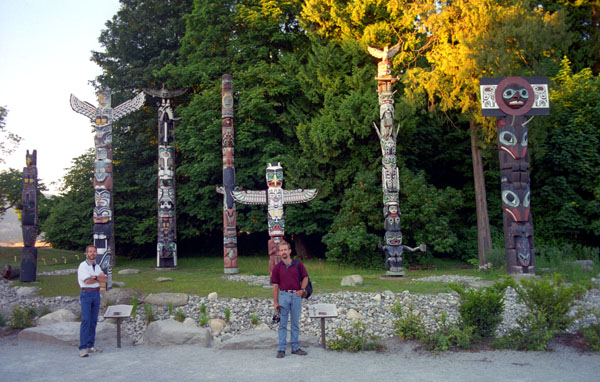
In the mid 1960s, the totem poles were moved to the attractive and accessible Brockton Point. The Skedans Mortuary Pole is a replica as the original was returned home to Haida Gwaii. In the late 1980s, the remaining totem poles were sent to various museums for preservation and the Park Board commissioned and loaned replacement totems.
(As of this writing, in 2014, a ninth totem pole has been added. It was carved by Robert Yelton of the Squamish Nation, and was installed with the other eight here at Brockton Point in 2009.)
You can see another, closer view of these colorful totem poles here.
We were losing our light, so it was time to head back to the car. Along the way, we came by another point of interest.
|
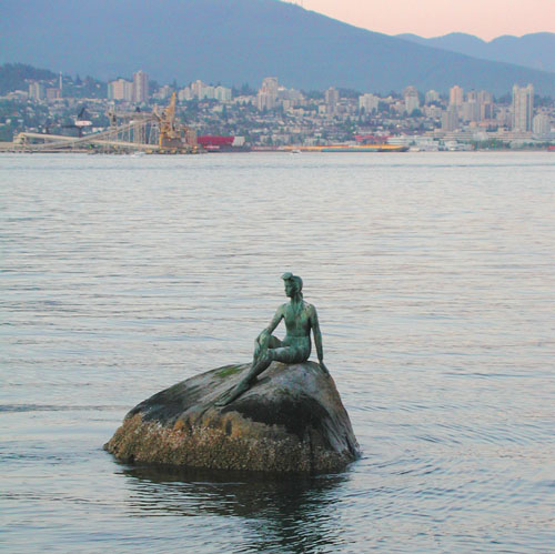
"Girl in a Wetsuit" is a life size bronze sculpture by Elek Imredy; it depicts a woman in a wetsuit and is located on a rock in the water along the north side of Stanley Park. The bronze sculpture depicts a friend of Imredy's, Debra Harrington, in a wetsuit with flippers on her feet and a mask on her forehead. Although some believe it was a replica of Copenhagen's "The Little Mermaid", the creator stated:
| "I didn't believe we should have a copy of the mermaid. She is rightfully a symbol of Copenhagen... I proposed to have a life-size scuba diver seated there. At that time scuba diving was getting quite popular here in Vancouver and, just as important, I didn't know of any similar sculpture anywhere in the world. It was a new idea… There was tremendous opposition and great controversy. I still don't know why.." |
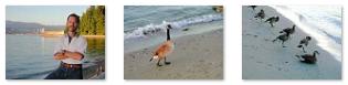
We took three final pictures on the way along the north shore, and you can use the clickable thumbnails below to see them:
 |
Back at the car, we checked our map for a route down to the waterfront entertainment area where there were lots of restaurants to choose from; we ended up at, naturally, a seafood place. Then we headed south out of Vancouver and down towards the border. At the border, which only took a few minutes, we picked up Interstate 5 and drove to Bellingham, Washington, where we spent the night.
You can return to today's index
or use the links below to continue to another photo album page.
|
July 4, 2001: Seattle, Washington |
|
July 2, 2001: Glacier and Mount Revelstoke National Parks |
|
Return to the Index for Our Canada Trip |