|
July 8, 2002: Colorado Trip Day 3 |
|
Return to the Index for Our Colorado Trip |
|
Driving to Colorado The Calypso Cascades Alberta Falls Our Campground |
Driving to Colorado
|
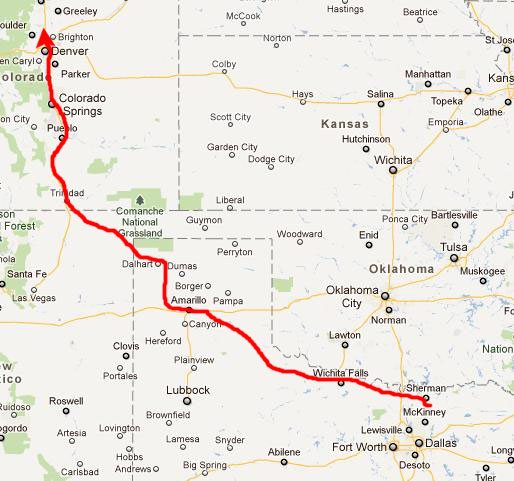
At Wichita Falls, we head west for a short distance on I-44, passing by the exit north for the Wichita Mountains, and then continue to angle northwest on US 183 towards Childress and Amarillo. Once again, you can make good time in the country, but you have to slow way down for the small towns, which come every twenty miles or so.
At Amarillo, we pick up I-40 west for a ways, and then head north and northwest on US 87 towards Dalhart. We stopped just northwest of Amarillo for a late lunch, and then continued on through Dalhart to cross the state line at Texline and head into the northeast corner of New Mexico. We continued northwest on US 87/64 to get onto I-25 north at Raton, New Mexico.
From there, it is expressway north, all the way through Denver. We stopped in Colorado Springs for some supper, and then got all the way to the north side of Denver, where we stayed in a motel for the night. Although we brought our camping gear, we usually find it convenient to stay in a motel for the first night of these trips- mostly so we can drive as far as possible without worrying about setting up a camp in the dark. But we hope to find at least a few good camping spots during the week.
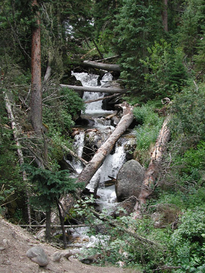
The Calypso Cascades
|
|
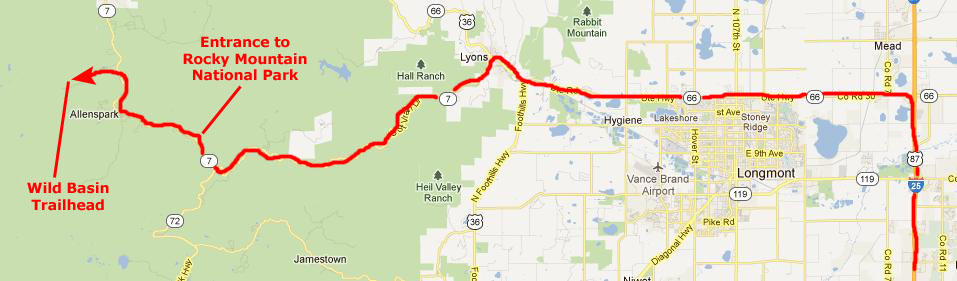
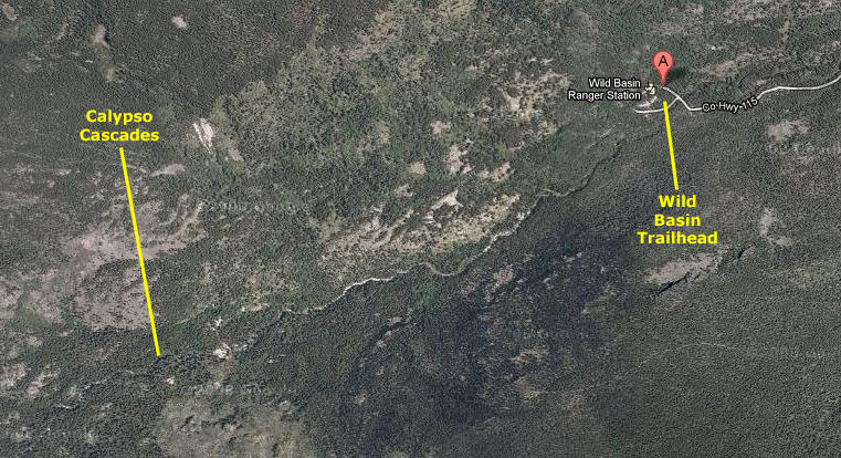
We parked by the ranger station, collected our cameras and stuff, and walked over to the information board to learn a bit about the area. Then we headed off on the trail to Calypso Cascades.
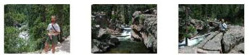
The riparian corridor through which we traveled was quite beautiful, and very shortly we came into view of, and then descended down to, North St. Vrain Creek. Soon we were down at the side of the creek, crossing the first of a number of log bridges. At the first one, I got a picture of Fred on a bridge over the creek, and he returned the favor with a picture of me on the bridge.
The trail rises gently beside North St Vrain Creek on a groomed path lined by lodgepole, fir and aspen. Two short spurs led to Lower and Upper Copeland Falls, but we didn't take those side trips.
|
|
|
|
From Calypso Cascades the trail continued up along the creek heading for Ouzel Lake. It winds up and along a north-facing valley wall, passing for a short time through an area stricken by the 1978 Ouzel Fire. Grasses and wildflowers brighten these once charred hillsides, while young aspen and pine emerge in replenished soils. Downed trees momentarily open the forest to sweeping views of Mt Meeker, Longs Peak and the northern Wild Basin Area. A mild, steady climb through lodgepole, spruce and fir leads to the lake.
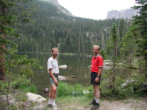
After about another mile or so, we came out on the shore of this beautiful mountain lake.
|
If you would like to have a look at some of the other pictures we took here at Ouzel Lake, just click on the thumbnail images below:
|
We relaxed up at Ouzel Lake for a bit, and then headed back down the trail to the trailhead. On the way back, Fred took another picture of me on a bridge over St. Vrain Creek while from my perch on the bridge I got a view looking downstream. The entire hike took us about three hours, and it was a good one because we were never far from the creek or some other water feature, and that is always nice.
You can return to today's index
or continue with the next section below.
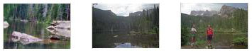
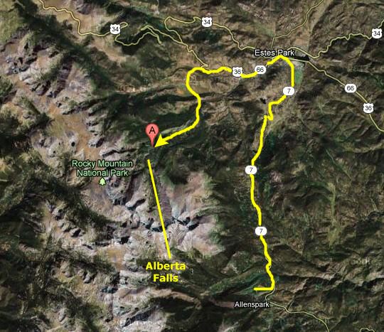
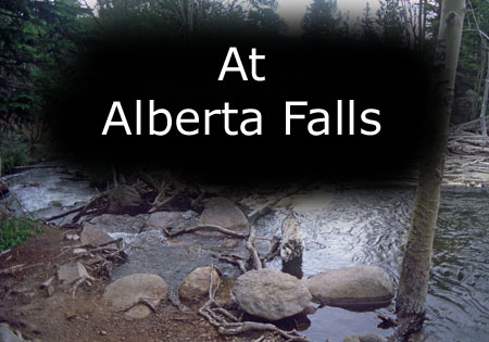
An Afternoon Hike to Alberta Falls
|
Looking back on it, this was a very enjoyable hike. The scenery was beautiful, the trail excellent, and what you get to see once you finish the hike to the falls, is without a doubt well worth it. The only bad thing about the trail is the number of people that use it, but by being here late on a Sunday afternoon, when most folks have begun to head home, we bypassed most of the crowd.
The trail started off with a decision; we could go left to go to Alberta Falls, or right to Bear Lake. The trail to Alberta Falls was very wide and well maintained, with beautiful views of the high peaks all along this trail. The Bear lake corridor is at a lofty 9,475 ft., and most of its trails ascend even higher, so one always needs to be careful about the altitude. We had no problem, though, as we only ascended about 200 feet from the trailhead to the falls themselves.
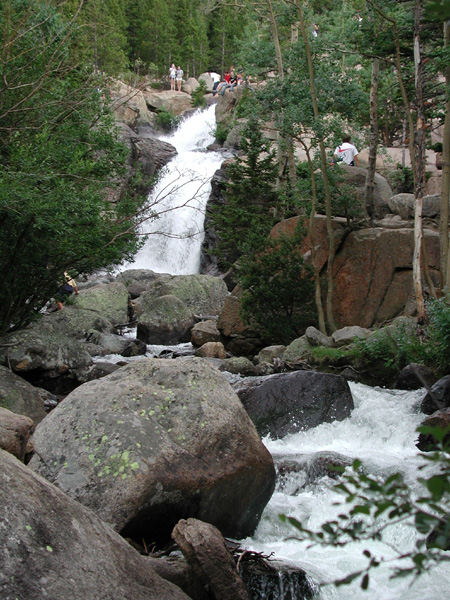
Once at the falls we not only got great views of the falls themselves but also great views of this part of the Park and the surrounding mountains. The trail actually continues upward, and there are a number of 10,000 ft. lakes that you can get to relatively quickly, but the falls was our objective.
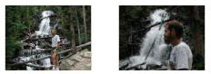
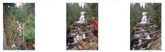
The trail was, as I said, relatively short, and we didn't take any pictures along it; we saved our film (and in Fred's case, his pixels) for Alberta Falls themselves. So let me just show you the pictures we took here at the falls.
|
|
To view the slideshow, just click on the image at left and I will open the slideshow in a new window. In the slideshow, you can use the little arrows in the lower corners of each image to move from one to the next, and the index numbers in the upper left of each image will tell you where you are in the series. When you are finished looking at the pictures, just close the popup window.
Fred also made a movie with his new digital camera here at Alberta Falls; he would take a number of additional movies on this trip. They give a really good sense of what it is like at some of these places, and thus add a new element to the photo album.
|
|
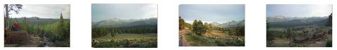
When we were finished at Alberta Falls, we headed back down the trail towards the parking area. On the way, we got some really nice pictures of the Rocky Mountain landscape in the afternoon light, and you can see some of the best of these by clicking on the thumbnails below:
|
We got back in the RAV4 and headed off back down the road to our campground.
You can return to today's index
or continue with the next section below.
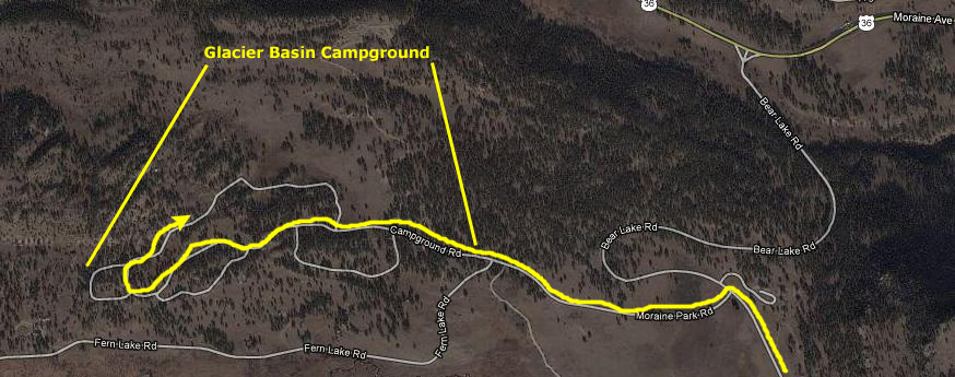
Our Campground in the National Park
|
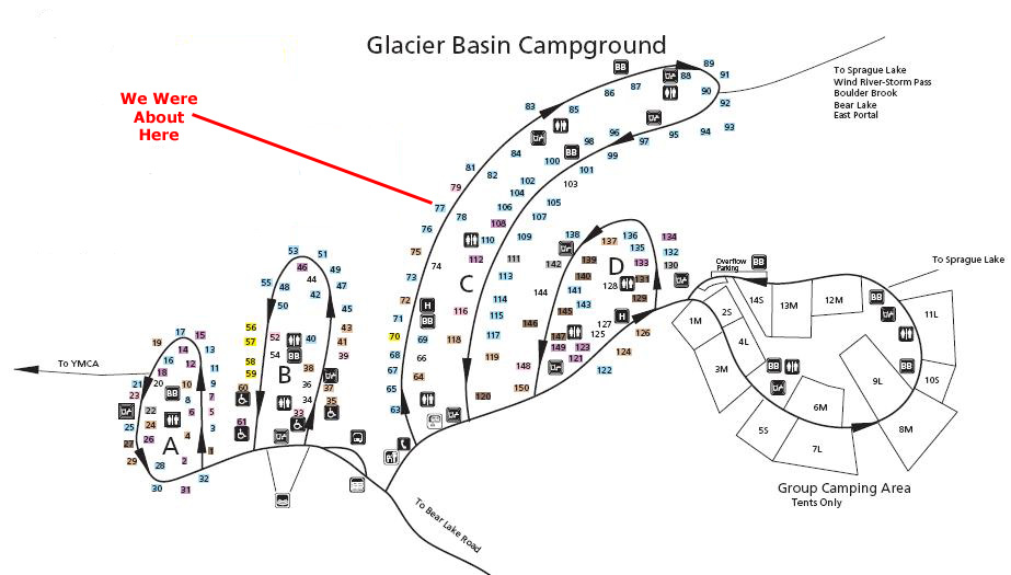
We had left a reservation card on one of the campsites earlier in the day, but when we returned we found many more empty sites, and were able to get one on the outside of one of the main loop roads.
|
The aerial view above is a lot different now than when we were there. Back in 2002, the area was heavily wooded, and there was a good deal of shade. In the years since, there has been a pine beetle infestation, and a very large percentage of the trees in the camping area have been removed.
Fred did one of his good campfire dinners while I got the tent set up. Although the campground filled up pretty much, we found it to be a quiet, restful night.
You can return to today's index
or use the links below to continue to another photo album page.
|
July 8, 2002: Colorado Trip Day 3 |
|
Return to the Index for Our Colorado Trip |