|
July 9, 2002: Colorado Trip Day 4 |
|
July 6-7, 2002: Colorado Trip Days 1 and 2 |
|
Return to the Index for Our Colorado Trip |
|
Fall River Pass Milner Pass Adams Falls To Vernal, UT |
Today, we will be heading generally west through Rocky Mountain National Park, driving over to major passes, stopping to hike to another waterfall, and ending up for the night in Vernal, Utah.
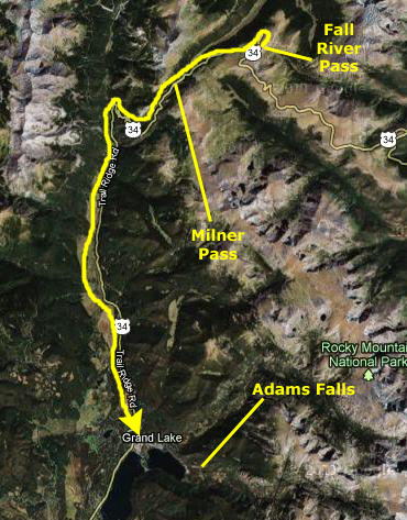
Driving Through Fall River Pass
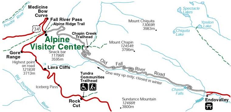
Below is a diagram that will make the relationship of the two routes to Fall River Pass more clear:
|
We, of course (the "of course" will be made a bit clearer below), are going to travel along Trail Ridge Road (the road marked in red that comes in from the bottom of the diagram).
|
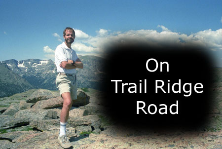
When you begin the 48-mile trip along the road from Estes Park, which we did, the changes along the road are fascinating to observe. The drive begins in mountain forests of aspen and ponderosa pine, and there is also a fair amount of open grassland. Soon, however, the vegetation changes into a thick subalpine forest of fir and spruce. At treeline, the last stunted, wind-battered trees yield to the alpine tundra.
Most Trail Ridge Road travelers drive the first ten miles or so to the treeline with a certain amount of urgency; I suppose they want to experience the high-altitude tundra as soon as they can. But from our experience, they would be better advised not to ignore all that awaits in the verdant country below the alpine tundra. Forested moraines, great heaps of earth and rock debris left behind by melting Ice Age glaciers, rise above lush mountain meadows.
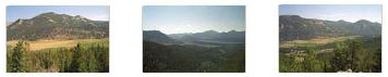
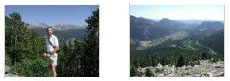
Click on the thumbnail images below to see some of the pictures we took along the first few miles of Trail Ridge Road as we ascended slowly into the subalpine forest:
|
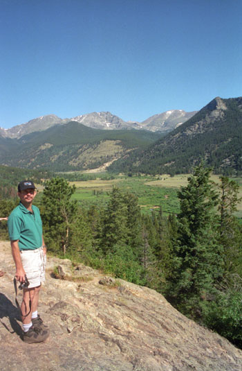
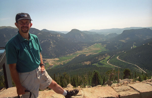
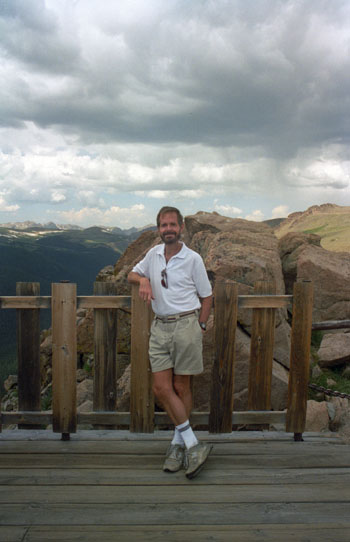
After about five miles of driving, we reached the first overlook where the picture of Fred at left was taken. While we were stopped here, Fred also took a picture of me at the overlook on Trail Ridge Road. Then the road started climbing more steeply, and I began to wonder what the old road might have been like.
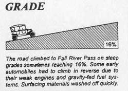
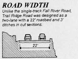
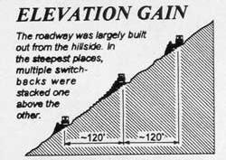
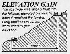
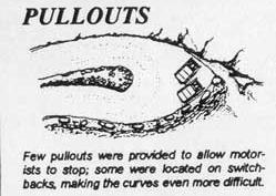
You may be interested, too, in what the drivers of the 1920s might have encountered as they drove along Old Fall River Road, so I've brought into the photo album some materials from a comparison of the two roads. You may find it interesting:

|

|
||
| Opened in 1920, Old Fall River Road earned the distinction of being the first auto route in Rocky Mountain National Park offering access to the park's high country. In the minds of many park visitors, the relatively subtle old route remains foremost. Unlike Trail Ridge Road, which is well known for being the highest continuous paved road in the nation, the Old Fall River Road is a much more "motor nature trail." | Trail Ridge Road, Rocky Mountain National Park's heavily traveled highway to the sky, inspired awe before the first motorist ever traveled it. "It is hard to describe what a sensation this new road is going to make," predicted Horace Albright, director of the National Park Service, in 1931 during the road's construction. "You will have the whole sweep of the Rockies before you in all directions." | ||
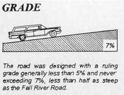
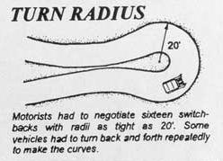
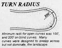
Primarily gravel, one-way uphill and punctuated by switchbacks, slower-paced, 11-mile-long. The old road quietly leads travelers from Horseshoe Park (a short distance west of the Fall River Entrance) through the park's wilderness to Fall River Pass, 11,796 feet above sea level. The journey to the alpine world at the top of Old Fall River Road is relaxing. The experience is one to be savored. |
The next year, Rocky Mountain National Park's lofty wilderness interior was introduced to the first travelers along an auto route the Rocky Mountain News called a "scenic wonder road of the world." Was all this just enthusiastic exaggeration? Hardly. |
||
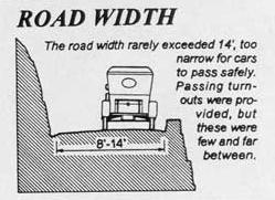
The posted speed limit is 15 miles per hour, a clear indication that a journey up Old Fall River Road is not for the impatient. There are no guard rails along this road. The road itself is safe, but narrow and curved. In places, the trees of the montane and subalpine forests are so close that motorists can touch them. Old Fall River Road is ideal for visitors seeking to become intimate with nature. |
Covering the 48 miles between Estes Park on the park's east side and Grand Lake on the west, Trail Ridge Road more than lives up to its advanced billing. Eleven miles of this high highway travel above treeline, the elevation near 11,500 feet where the park's evergreen forests come to a halt. As it winds across the tundra's vastness to its high point at 12,183 feet elevation, Trail Ridge Road (U.S. 34) offers visitors thrilling views, wildlife sightings and spectacular alpine wildflower exhibitions, all from the comfort of their car. |
||
The road follows a route traveled long ago by Indian hunters, who came to the park area in search of its abundant game. Early in the trip, travelers pass the alluvial fan scoured out by the 1982 Lawn Lake Flood and the site of a labor camp that housed state convicts who worked on the road project. For these men, crime did not pay. The laborers were forced to build the three-mile stretch of road to the scenic respite of Chasm Falls with no more than hand tools at their disposal. |
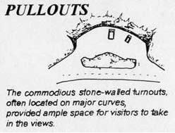
Up on that windswept alpine world, conditions resemble those found in the Canadian or Alaskan Arctic. It's normally windy and 20 to 30 degrees colder than Estes Park or Grand Lake. The sun beats down with high- ultraviolet intensity. The vistas, best enjoyed from one of several marked road pullovers, are extravagant, sweeping north to Wyoming, east across the Front Range cities and Great Plains, south and west into the heart of the Rockies. |
||
After passing Willow Park, where elk often are seen feeding on the foliage, the road enters the alpine tundra. Awaiting there is the Fall River Cirque, birthplace of glaciers that once worked their way up and down the mountain valleys. The road traverses the headwall of this amphitheater-like formation before joining Trail Ridge Road near the Alpine Visitor Center at Fall River Pass. |
But for all its harshness, the Trail Ridge tundra is a place of vibrant life and vivid colors. Pikas, marmots, ptarmigans and bighorn sheep are commonly seen. About 200 species of tiny alpine plants hug the ground. Despite a growing season that may last just 40 days, many bloom exuberantly, adorning the green summer tundra with swatches of yellow, red, pink, blue, purple and white. All are seen from the Tundra World Nature Trail, a half-hour walk beginning near the parking area at Rock Cut. |
||
Ahead lie the wonders of Trail Ridge Road, which leads travelers east to Estes Park or southwest to Grand Lake. Behind is Old Fall River Road, that winding old route that offers travelers a taste of auto travel in days gone by and a look at Rocky Mountain's nature close-up. |
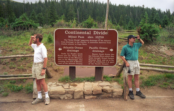
The Continental Divide, where streamflows are separated east from west, is crossed at Milner Pass, located at a surprisingly low 10,120 feet elevation. Moose munch greenery in the upper reaches of the Colorado River, which flows through the scenic Kawuneeche Valley. Grazing elk greet sunrise and sunset in many of the forest-rimmed meadows found around the park. |
I hope you found the comparison interesting; looking back on it, I am pretty sure that we would not have wanted to attempt the old road!
|
|
|
|
To view the slideshow, just click on the image at right and I will open the slideshow in a new window. In the slideshow, you can use the little arrows in the lower corners of each image to move from one to the next, and the index numbers in the upper left of each image will tell you where you are in the series. When you are finished looking at the pictures, just close the popup window.
We continued west on Trail Ridge Road, rising steadily to over 12,000 a short ways east of Fall River Pass.
|
|
|
After spending some time at the Visitor Center, we headed off down highway 34 on the west side of the pass.
You can return to today's index
or continue with the next section below.
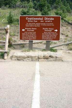
Driving Through Milner Pass
|
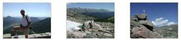
While we were here, we took the time to have a snack, and we had a little visitor who helped us with the leftovers.
|
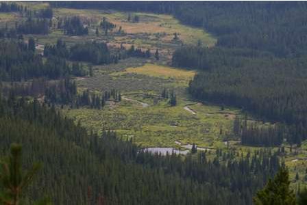
From the Continental Divide, the road continued its downhill trek, rounding five big hairpin curves (which were actually numbered on road signs), and eventually a wide valley spread out below us. There is a small picture of it below:
|
We continued on down Highway 34 towards the little town of Grand Lake, and our next stop- Adams Falls.
You can return to today's index
or continue with the next section below.
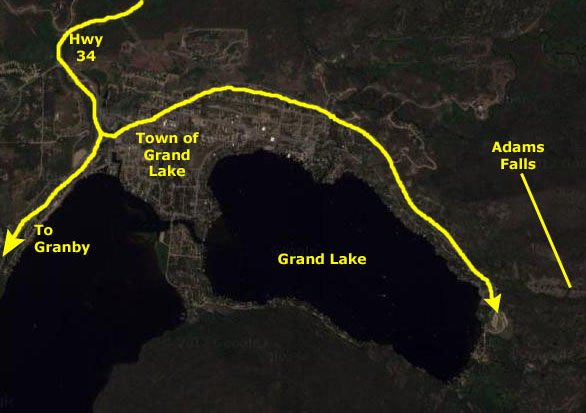
The Hike to Adams Falls
|
|
The East Inlet Trailhead is on the west side of the Continental Divide on the east side of the town of Grand Lake. We followed Highway 34 into Grand Lake to find the turnoff for Highway 278, where we turned east towards the town. We bypassed the town on West Portal Road, following the signs toward the boat launch area. We found the trailhead for the Adams Falls hike on the eastern shore of Grand Lake, in the parking area just opposite the boat launch. You can see Fred and his RAV4 (on this cloudy afternoon) here.
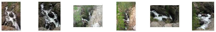
From the trailhead, we took the East Inlet Trail to the junction with the Adams Falls loop trail. Then we took that loop trail to the right and walked the short distance to the falls overlook. East Inlet Creek flows here through a narrow chasm and then down a series of cascades, with many boulders and logs strewn around. Below are thumbnail images for the best of the pictures we took here at Adams Falls; click on them to see the full-size pictures:
|
This was our last hike today, and now it was time to make tracks west so we'd be in a position to visit Dinosaur National Monument early tomorrow.
You can return to today's index
or continue with the next section below.
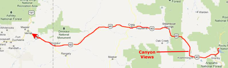
Driving to Vernal, Utah
|
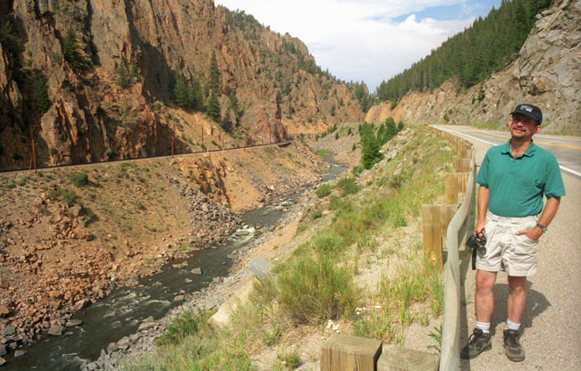
Just past Kremmling, the highway turned north and passed through a very beautiful canyon with an equally beautiful stream running through it.
|
Coming out of the canyon on the north, we drove west through the Routt National Forest, through Steamboat Springs (no snow or skiing at this time of year) an on into the town of Craig, CO.
We continued west, and by the time we reached Dinosaur, CO, it was getting dark. We went on ahead into Vernal, found a motel for the night, and had dinner at a little local restaurant.
You can return to today's index
or use the links below to continue to another photo album page.
|
July 9, 2002: Colorado Trip Day 4 |
|
July 6-7, 2002: Colorado Trip Days 1 and 2 |
|
Return to the Index for Our Colorado Trip |