|
July 11, 2002: Colorado Trip Day 6 |
|
July 9, 2002: Colorado Trip Day 4 |
|
Return to the Index for Our Colorado Trip |
|
Dinosaur National Monument The Dinosaur Auto Tour The Canon Pintado Pictographs The Colorado National Monument |
Today we'll begin in Dinosaur National Monument, touring a couple of areas we haven't seen yet- including the road that runs from Dinosaur, CO, up north into the park. Then we'll head south towards I-70, passing some petroglyphs at a place called "Canon Pintado." We'll end the day touring the Colorado National Monument, staying the night in Grand Junction.
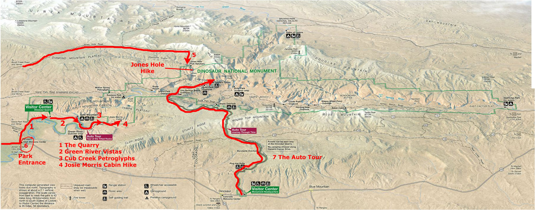
In Dinosaur National Monument (Park Map #6)
|
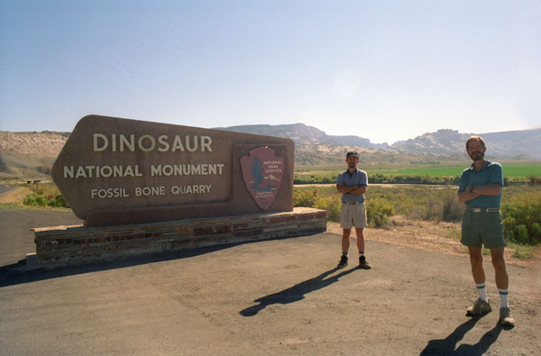
After leaving our campsite in Jensen, we drove back over to Dinosaur National Monument and drove up the entrance road to do something we had neglected to do yesterday.
|
We took a few more pictures along the entrance road to the Quarry where we'd been yesterday; you can have a look at them if you click on the thumbnail images below:
|
You can return to today's index
or continue with the next section below.
The Dinosaur Auto Tour (Park Map #7)
|
|
|
|
To view the slideshow, just click on the image at right and I will open the slideshow in a new window. In the slideshow, you can use the little arrows in the lower corners of each image to move from one to the next, and the index numbers in the upper left of each image will tell you where you are in the series. When you are finished looking at the pictures, just close the popup window.
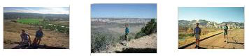
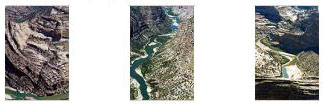
At the end of the road we found the trailhead for a two‑mile trail that led through the beautiful landscape and up onto a rocky point and to a vista with a nearly 360-degree view that included Whirlpool, Lodore, and Yampa canyons. We took a lot of really good pictures here at the vista overlook, and if you will click on the thumbnail images below you can have a look at them:
|
We've had a really good time here in Dinosaur National Monument these last two days, but now it is time for us to head off and see something different.
You can return to today's index
or continue with the next section below.
The Canon Pintado Pictographs
|
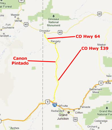
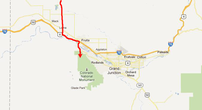
We came to the Canon Pintado site just over ten miles south of Rangely.
We had to watch the mileage carefully; there was only a green highway sign with the word "Kokopelli" on it to mark the turnoff.
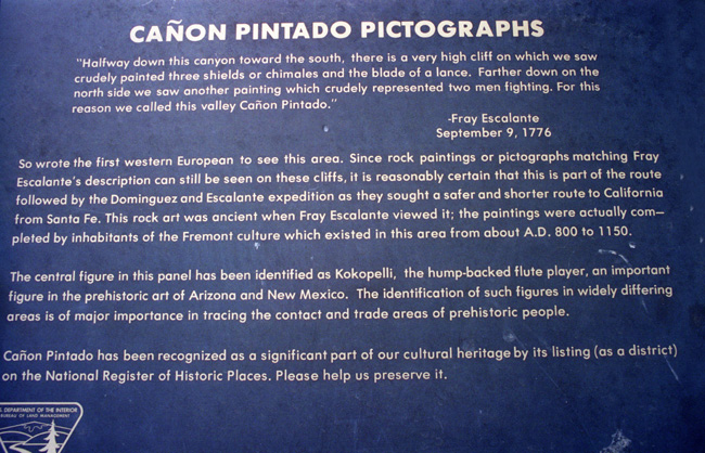
This rock art was first noticed by the first non-Native American to travel in these parts � the Spanish friar, Fray Escalante, in 1776, and is now a protected archaeological site of Native American rock art.
Ca�on Pintado, meaning "painted canyon," is located in the East Four Mile Draw, 10.5 miles south of Rangely in Rio Blanco County, Colorado. Led by Ute guides, the Dominguez-Escalante Expedition, Spanish missionaries in search of a route to California in 1776, passed through this region as the moved north and then west into Utah.
|
| "The Fremont people built villages, farmed the valley areas and on high points located watchtowers. In hidden places on the cliffs are still found cisterns and granaries where they stored corn and seeds. Petroglyphs of corn stalks are at a number of these sites. Later the Utes hunted the area and used the valley until they were moved to a reservation in 1881." |
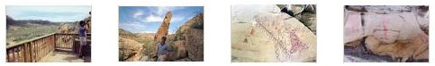
We did not take many pictures here; most of the site was closed off to the casual visitor, and only a few pictographs adjacent to an observation platform about fifty feet up the rock face on the west side of the highway were easily accessible. But below I have put thumbnail images for the four good pictures we did get, and you can view those pictures by clicking on those thumbnails:
|
It was an interesting stop and we enjoyed seeing the pictographs. Next, it was on our way further south.
You can return to today's index
or continue with the next section below.
The Colorado National Monument
Before we enter the Monument, you might want to learn a bit more about it. First of all, just where is it?
|
To get here, we came down from the north on Colorado Highway 139 from Rangely and our stop at Canon Pintado. We got onto the Interstate and went just an exit or so east to Fruita. There, we exited on US 50, drove about two miles south and came to the northwest entrance to the National Monument.
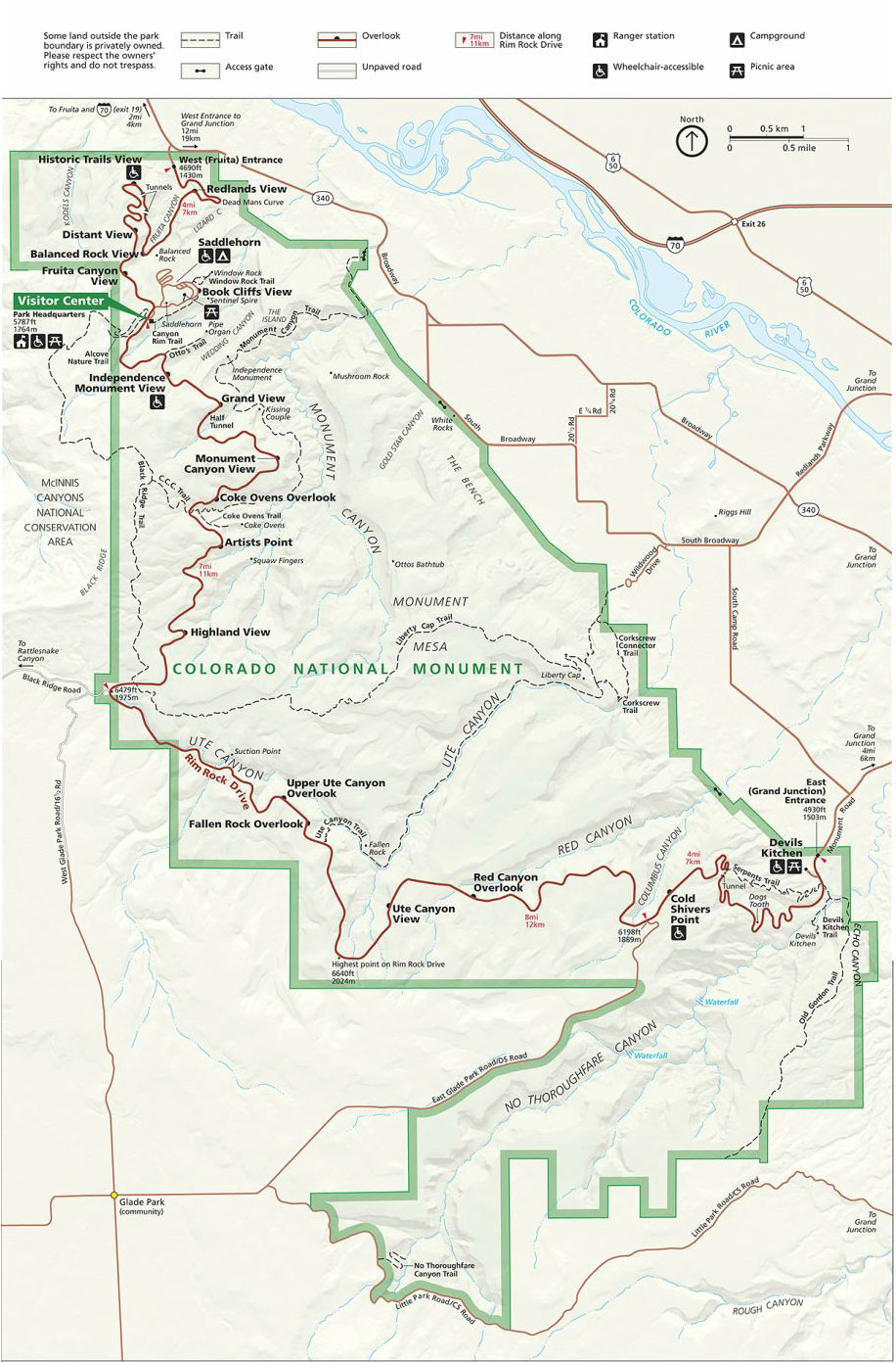
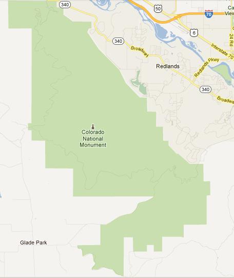
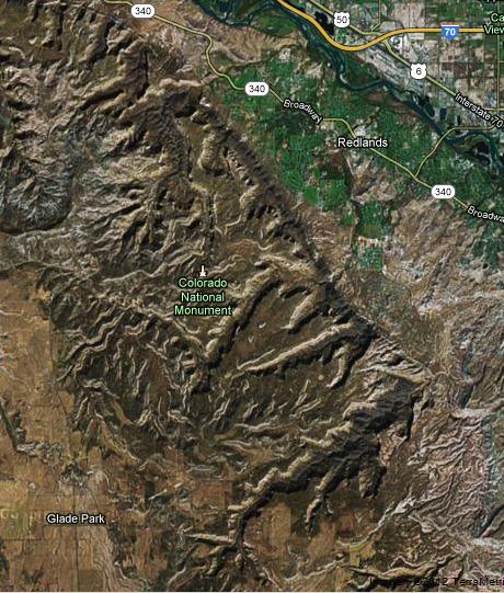
To orient you to the Monument itself, let's have a look at a map and an aerial view.
Below, you can see a map and aerial view side by side; each covers exactly the same area. The aerial view seems almost featureless, but then it's hard to discern the highs and lows of the cliffs and gorges when you are looking down on them:
 |
 |
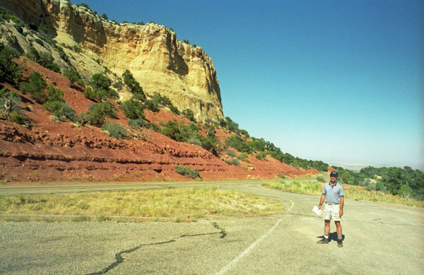
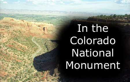
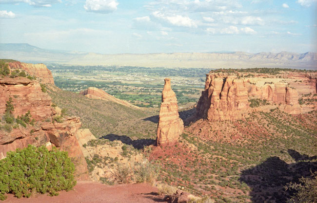
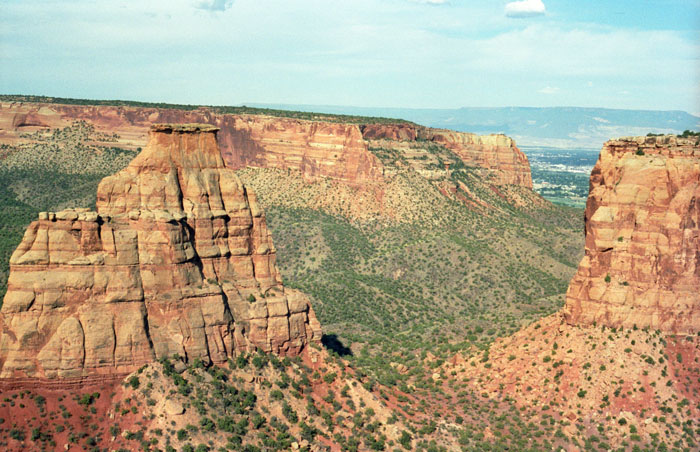
But the Monument was indeed quite beautiful. Here is an example:
 |
Colorado National Monument lies along the margin of the Uncompahgre Uplift, once a part of the Ancestral Rocky Mountains, which formed some 300 million years ago. The rock layers of the Monument are part of the Colorado Plateau�a high-elevation region spanning parts of Utah, Colorado, New Mexico, and Arizona. Other geological wonders of the Plateau include the Grand Canyon, Bryce Canyon, and Arches National Park.
The Colorado National Monument celebrated its centennial just last year- in 2011 (I am creating this page in 2012). If you would like to see some of the major events in the history of the Monument, just click on the link below, and that history will open in a new window:
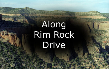
Today, we are going drive the length of Rim Rock Drive.
|
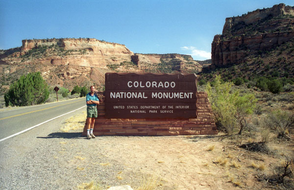
When we got on the drive, the road climbed towards the Visitor Center, and we passed the entrance marker, where Fred stopped to take my picture (shown at left).
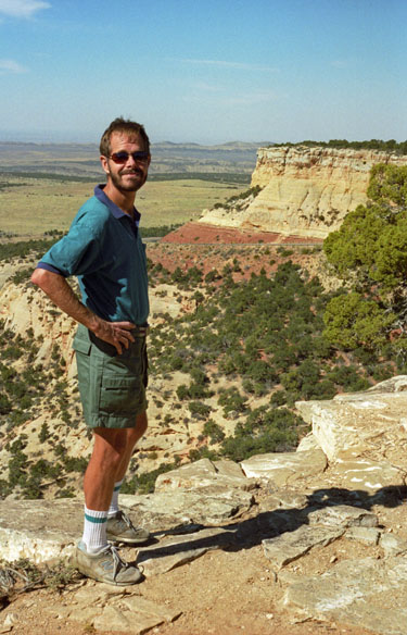
Just before we got to the Visitor Center, we pulled off again so that I could get a picture of Fred with the norther slope of the Monument cliffs behind him (looking towards Grand Junction). You can see that picture here.
Then we arrived at the Visitor Center and went in to have a look around.
While in the Visitor Center, we picked up a park brochure, and it had a very good map of the park inside, with all the overlooks and other stops marked. You might want to be able to look at it, too, so you can trace our trip through the Monument. I have put a copy of it in the scrollable window below. We came in from the north, at the top of the diagram, and left at the southeast point. So as we were driving along Rim Rock Drive we were going from the top of the park map to the bottom, stopping at just about every overlook and turnout. Here is that park map:
|
The varied landscapes of Colorado National Monument show the effects of tens of millions of years of erosion. Wind and rain have sculpted dramatic outcrops, such as those of the Devil�s Kitchen. Weathering has also produced potholes, though unlike the annoying asphalt variety, these are natural sandstone basins that collect rainwater and sediment, and provide homes to plants and animals. And the region contains fossil discoveries, including tracks left by ancient dinosaurs, turtles, and lizards.
|
Developed areas extend all the way to the border of the national monument. According to the National Park Service, the local population has doubled since 1970. While the increased population has enabled more people to enjoy the monument, it has also created challenges. Increased use of the area for recreation has increased traffic, and developments now lie in the path of flash floods and wildlife migrations.
Colorado National Monument preserves one of the grand landscapes of the American West. But this treasure is much more than a monument. Towering monoliths exist within a vast plateau-and-canyon panorama. You can experience sheer‑walled, red rock canyons along the twists and turns of Rim Rock Drive, where you may spy bighorn sheep and soaring eagles.
As you can see, we could see great distances on either side of the Rim Rock Road, and the scenery was nothing short of spectacular.
|
|
Vegetation within the monument and surrounding lands is primarily pinyon-juniper woodland, which receives less than 12 inches (28 cm) average annual precipitation. Woodland trees are usually less than 20 to 30 feet tall (6 to 9 m). Shrubs associated with this woodland include rabbitbrush, big sagebrush, single-leaf ash, broom snakeweed, Utah serviceberry, yucca, Mormon tea, mountain mahogany, and cliff rose.
|
I have put these pictures into a slideshow. To view the slideshow, just click on the image at right and I will open the slideshow in a new window. In the slideshow, you can use the little arrows in the lower corners of each image to move from one to the next, and the index numbers in the upper left of each image will tell you where you are in the series. When you are finished looking at the pictures, just close the popup window.
We reached the end of Rim Rock Drive about seven in the evening, and we found ourselves on the south side of Grand Junction. Tonight would be a motel stay, so we drove north through town to find a Super 8 Motel right on Interstate 70. We had dinner at a local restaurant, watched some TV and fell into bed.
You can return to today's index
or use the links below to continue to another photo album page.
|
July 11, 2002: Colorado Trip Day 6 |
|
July 9, 2002: Colorado Trip Day 4 |
|
Return to the Index for Our Colorado Trip |