|
October 29, 2002: Arizona Trip Day 4 |
|
October 27, 2002: Arizona Trip Day 2 |
|
Return to the Index for Our Arizona Trip |
|
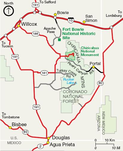
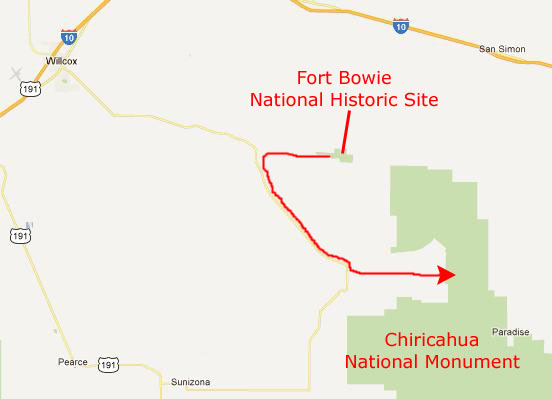
Fort Bowie Chiricahua NM
|
We are going to spend the first part of today walking around Fort Bowie, Arizona, and the time left exploring the Chiricahua National Monument.
Fort Bowie, Arizona
|
Before we look at the pictures from our hike, you should know a bit about the history of Fort Bowie. In summary, it was the focal point for military actions by the US Army against the Chiricahua Apaches for over 20 years. It was significant as the "guardian" of Apache Pass- the prime trade and immigration route through this area of the Southwest. It was the site of the "Bascom Affair," a wagon train massacre and the Battle of Apache Pass, where a large force of Chiricahua Apaches under Mangus Colorados and Cochise fought a regiment of California Civil War Volunteers.
To fill in the background of Fort Bowie, you should read the excellent (and relatively short) historical account of just how the war between the Americans and the Apache came about- and it all began with the kidnapping of an Anglo boy named Felix. Read this entertaining account written by Karen Weston Gonzales here.
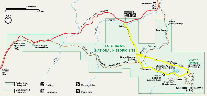
The artifacts, ruins, and written documentation here at Fort Bowie leave a rich historical record, and we were looking forward to our hike and tour, and you can see the route we followed on the park map below:
|
We started out on our hike in mid morning, walking slowly along the trail.
|
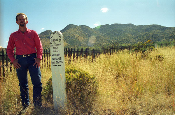
There aren't any trees around the cemetery, but it did have commanding views of the hills and mountains of southeast Arizona. Apparently, there were some buildings of some kind nearby, for we found what appeared to be the ruins of an old wall nearby.
From the cemetery we took the southern part of the trail loop heading towards the ruins of Fort Bowie, stopping at a couple of other points of interest beforehand.
|
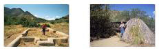
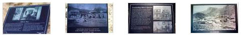
We passed the site of the Battle of Apache Pass and then reached the two sets of ruins- the first and second sites of Fort Bowie. We took quite a few pictures here, most of which were the ruins of the various buildings that comprised the Fort in the 1890s. One ruin that we found, shown here, had no identifying sign, and my memory fails in thinking about what it might have been. I've looked at the site for the National Monument, but there is no similar picture. So you can make up your own mind as to what it might have been (a trough for animals perhaps?). Below are two rows of thumbnail images you can click on to see our pictures; the second row are our pictures of some of the signage around the ruins:
|
|
We completed our hike by walking back along the Overlook Ridge Trail, and in another half hour found ourselves back at the trailhead, ready to head off to explore the Chiricahua Mountains.
You can return to today's index
or continue with the next section below.
Our First Hike in Chiricahua National Monument
|
After looking through the park brochure, we decided that for today's hike, we would drive north around the park road to the trailhead for the Sugarloaf Peak hike. Tomorrow, we'll retrace part of our route to get to a hike a bit further on into the park. We also planned on camping here in the park, so the first thing we did was drive from the Visitor Center to the campground to stake out a site.
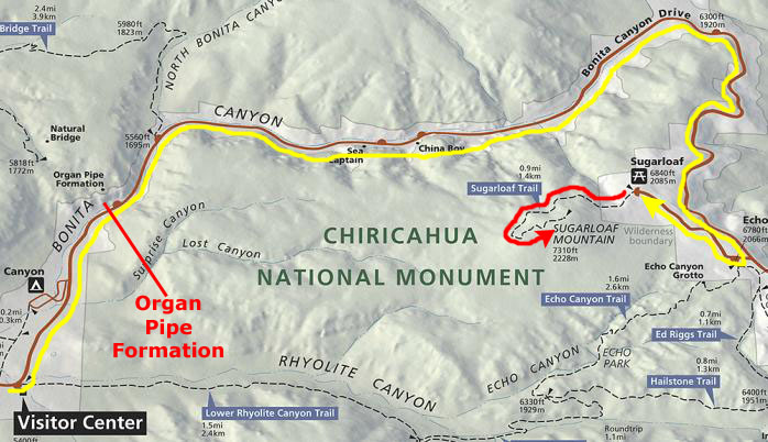
Below is a copy of the park map covering the area of the National Monument that we'll be visiting today:
|
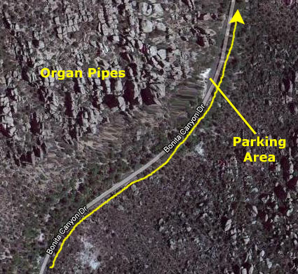
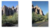
Along the park road towards the Sugarloaf Mountain trailhead, we were treated to spectacular scenery.
|
|
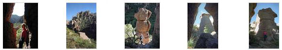
We arrived at the trailhead for the Sugarloaf Mountain hike about three-thirty, and headed off on the trail. The trail is about two miles round-trip, and this would put us on the summit at sunset. We thought we'd be able to get back to the parking area just after sunset with no problem. Rising above the surrounding canyons, the 7,310-foot summit of Sugarloaf Mountain at is one of the highest points in the monument. The dark rock is dacite, evidence of a lava flow. The monument preserves the remains of an immense volcanic eruption that shook the region some 27 million years ago. Called the Turkey Creek Caldera eruption, it eventually laid down two thousand feet of ash and pumice, highly siliceous in nature. This eventually hardened into rhyolite tuffs, and eroded into the natural features visible at the monument today. Click on the thumbnails below to see some of the pictures we took as we were hiking to the summit:
|
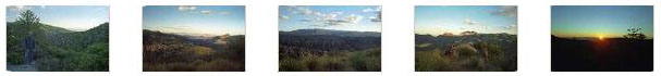
When we reached summit, late in the day, we found a fire lookout; it was built in 1936 by the Civilian Conservation Corps. It is a Model L-4 house, a 12 x 12 cabin, and it interacts with the Barfoot Mountain Fire Lookout. The building is on the National Historic Lookout Register (who knew?). Sugarloaf Mountain is a gentle dome standing quietly above the Chiricahua National Monument, and hikers reaching the summit take in 360-degree views of the surrounding canyons, valleys and peaks. There are views into and across numerous canyons including Echo Canyon to the south, Rhyolite Canyon to the southwest and Lost Canyon to the west. The San Simon Valley is visible to the southeast while the Sulphur Springs Valley sprawls to the west. Peaks visible from the summit include Cochise Head to the northeast and the Dos Cabezas Mountains to the northwest beyond Apache Pass. The Dragoon Mountains lie in the distance to the west, across the Sulphur Springs Valley, and remnants of the once-mighty Turkey Creek Volcano can also be seen. Click on the thumbnails below to see some of the pictures we took from the summit:
|
Returning from the summit, we got back to the parking area just as it was getting dark, and we headed back to the campground to set up the tent and cook dinner. It was too dark when we got to the campground to take any pictures, and we neglected to take any in the morning as we broke camp, so there isn't any visual record of our camping here in Chiricahua National Monument.
You can return to today's index
or use the links below to continue to another photo album page.
|
October 29, 2002: Arizona Trip Day 4 |
|
October 27, 2002: Arizona Trip Day 2 |
|
Return to the Index for Our Arizona Trip |