|
October 30, 2002: Arizona Trip Day 5 |
|
October 28, 2002: Arizona Trip Day 3 |
|
Return to the Index for Our Arizona Trip |
|
Chiricahua NM Kartchner Caverns
|
Today we are going to do another hike here in the Chiricahua National Monument; the trailhead for it will be at the far end of the park road, and the hike will take us much of the day.
A Second Hike in Chiricahua National Monument
|
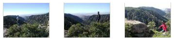
The first part of our hike will take us from the Echo Canyon trailhead through Echo Canyon and all the way to the Sarah Deming Trail about two miles away. From the parking area, we followed a level trail for a short distance, then rounded a rocky outcrop and began the descent down into Echo Canyon.
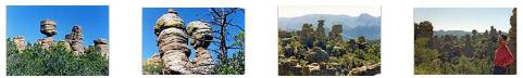
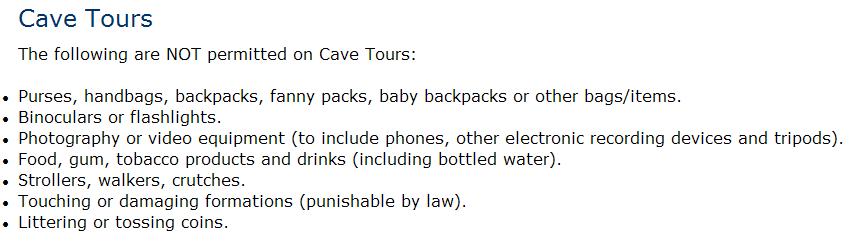
Right at the beginning of the hike, as we were descending into the canyon, we passed a number of interesting rock formations, and if you click on the two thumbnails below, you can see some of them:
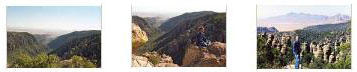
We got down to the floor of the canyon and hiked another mile or two to the intersection with the next trail. Along the way, we came alongside a "window," formed when the cap of one column finally toppled and happened to wedge itself in between two adjacent columns. You can see Fred standing underneath this wedged rock here. I also climbed around the other side of the window and got a picture of Fred on the other side of it, and you can see that picture here.
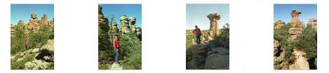
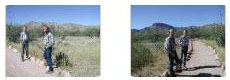
We were by ourselves on this hike; I don't recall that we saw another hiker on the whole 8-mile trek. We did, however, see a number of local denizens. We tought that walking along the portion of our hike that used the Sarah Deming Trail might be a bit boring, since the park map didn't mark any particular features until we got to the area of balanced rocks. But we were pleasantly surprised because we passed a continuous array of hoodoos.
Along this part of the trail we passed a number of interesting features, including a narrow slot canyon; the main trail went right through it. If you will click on the thumbnails below, you can see some of the scenery along the Sarah Deming Trail:
|
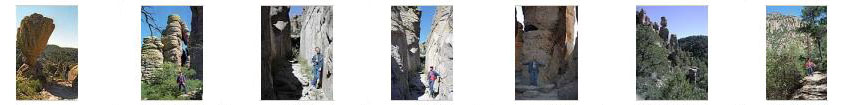
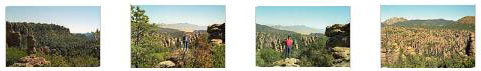
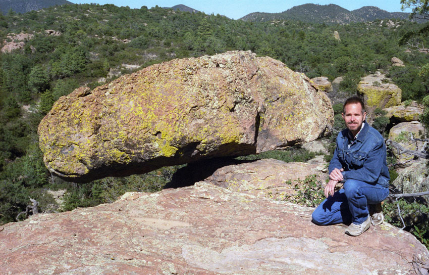
The Sarah Deming Trail curved around back to the north, and after a few hundred feet we found ourselves at the beginning of the "Heart of Rocks Loop."
|
|
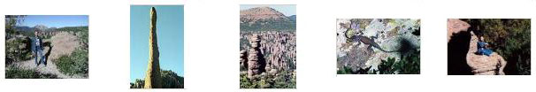
If you will click on the thumbnails below, you can see some of the other pictures we took on the Heart of Rocks Loop:
|
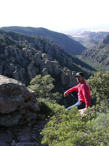
From the Heart of Rocks Loop, we continued east on the Big Balanced Rock Trail, intending to take a side trail to Inspiration Point.
|
After a mile or so we came to the offshoot trail to Inspiration Point, and headed off north.
|
|
|
When we were done at Inspiration Point, we retraced our path back to the trail junction, turned left, and hiked along the last mile of our trail today. This trail was called the "Mushroom Rock Trail," and we weren't sure why- until we got to a formation that wasn't marked on the trail map. It must have been the namesake for the trail, for the rock formation looked very much like a mushroom.
We took some additional pictures along this part of the trail back to the parking area, and if you click on the thumbnails below you can have a look at them:
|
We had a great time on this hike. When we returned to the parking area, we talked about our next objective- Kartchner Caverns near Benson, Arizona. Fred knew that these caverns had limited times for tours, so we thought it best to stop at the Visitor Center and call ahead to make a tour reservation- which we did for the 4PM tour that afternoon. This left us about two hours to get there and so we headed off pretty quickly towards Benson.
You can return to today's index
or continue with the next section below.
Kartchner Caverns, Arizona
|
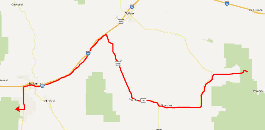
Rather than go up through Willcox, we made good time on a smaller highway west through the arid, desolate and beautiful Arizona desert to catch I-10 a good deal further west. We took this to just beyond Benson to find Highway 90 south. It was about ten miles to the caverns.
After we parked the car and gathered up our cameras and stuff, we headed off down the pathway to the Visitor Center to pick up the (expensive )tickets that we'd already bought and charged to our credit card when were in Chiricahua NM. When we went to the counter to pick them up, and the seller saw the cameras we were carrying, we were politely informed about one of the rules here at Kartchner Caverns that we hadn't known about. We know now, of course; here is the appropriate portion of the Kartchner Caverns website:
|
See the problem? We were told we'd have to leave our cameras in our car or in a locker; no photography was allowed. Maybe it was because we were a bit tired, and maybe it was something else, but this just hit us entirely the wrong way. We argued a good deal about the rule, complaining that what good was it to drive all this way and pay all this money (almost $20 each) if we couldn't come away from the experience with some recorded memory of it? This was the first (and to date the ONLY) cave or cavern system that has prohibited photography (although some restrict flash photography at certain spots). I suppose we could have cancelled the sale if we'd bitched enough about it, but we eventually decided "the heck with it," returned our cameras to the car, and then went on the cave tour. After all that, the caves were not so spectacular as some of the reviews had indicated, but they were pretty.
|
|
|
It was going to be a long drive to our next stop- some petroglyphs almost to the California border, so we decided to go back up to the Interstate, travel just a bit further west, and stop for the night in Tucson, Arizona.
You can return to today's index
or use the links below to continue to another photo album page.
|
October 30, 2002: Arizona Trip Day 5 |
|
October 28, 2002: Arizona Trip Day 3 |
|
Return to the Index for Our Arizona Trip |