|
June 25, 2003: Western Trip, Day 5 |
|
June 23, 2003: Western Trip, Day 3 |
|
Return to the Index for Our Western Trip |
|
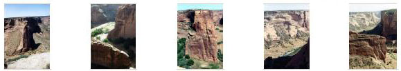
June 24 Our Camp on Navajo Land Canyon De Chelly (South Rim) Canyon De Chelly (North Rim) At the Four Corners Monument Our Stay in Cortez, CO |
This is Tuesday, although when we woke up all by ourselves in the forest, it didn't seem to matter much. Today, though, Canyon De Chelly will be the high point.
|
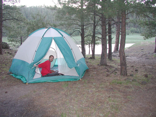
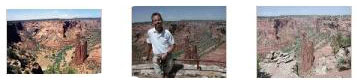
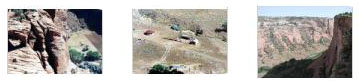
The campground was even more attractive in the bright sunshine this morning than it was when we arrived last night. I have tried to find an aerial view of this campground on the Internet, but I can't seem to pinpoint it. We didn't record exactly where we were along NM 264 when we turned north to find it- which is disappointing. But you can see if you click on the three thumbnails below to have a look at the pictures of our camp area that it was quite a pretty setting:
|
We took down the tent and packed things away and had a bit of breakfast, and then headed off west into Arizona, vowing to stop first chance we got to wash our faces and brush our teeth; there were no facilities at all here (not counting the picnic table).
You can return to the page index or continue on to the next section.
Canyon De Chelly- The South Rim
Getting to Canyon De Chelly
|
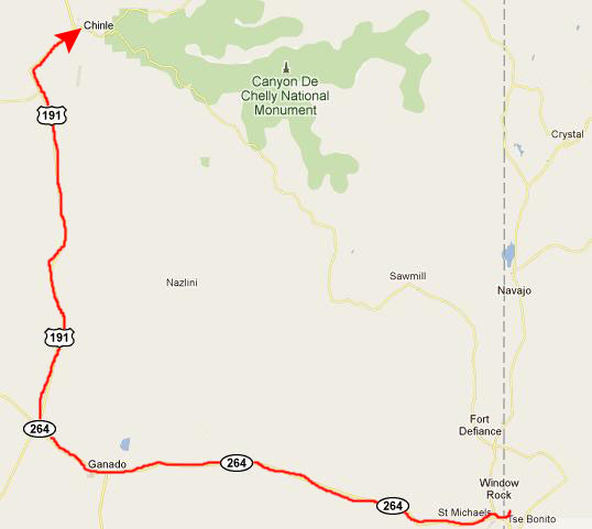
Then, we continued west, coming to the intersection with US 191, which we then took north to the town of Chinle, which is the gateway to the National Monument.
The trip this morning was about a hundred miles, give or take.
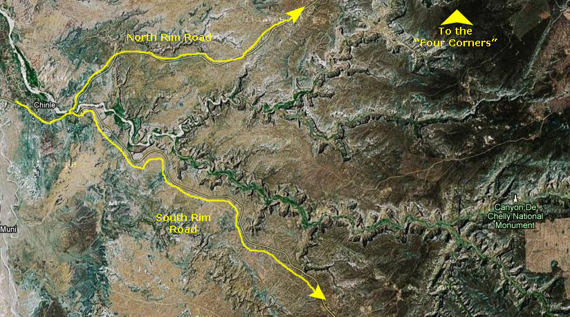
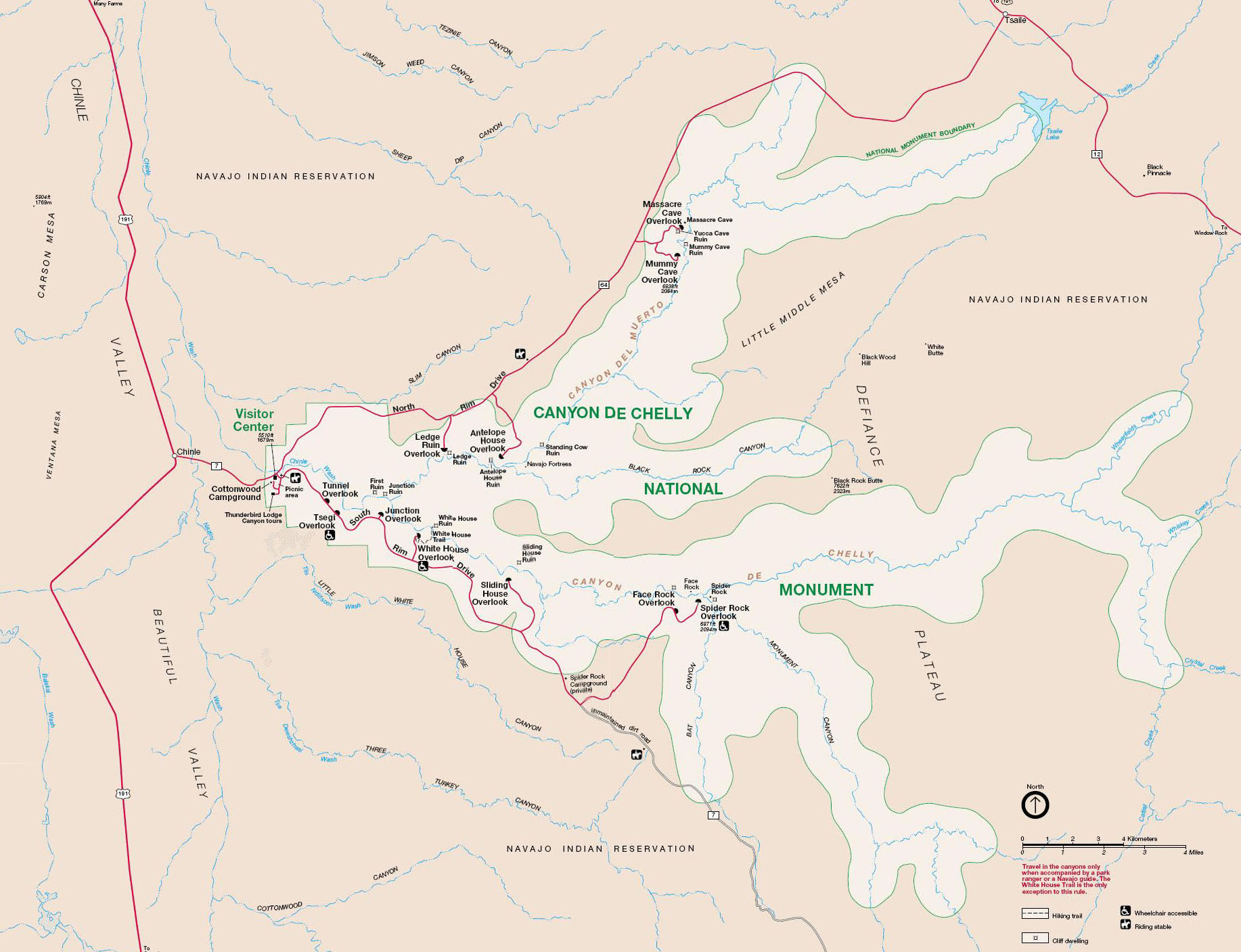
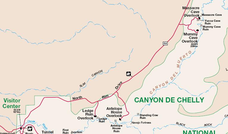
After we made our way through the town itself, we came to the entrance to the National Monument. We already knew that there were two main roads through the area- one along the south rim of the canyon system and one on the north side of the canyon and its side valleys. We'll be doing both today, starting with the south road. You can see the layout of the National Monument on the aerial view below.
|
It will be easier to follow us around using a map of the National Monument.
|
The History of Canyon De Chelly and the National Monument
Descendants of the Puebloans, the Hopi migrated into the canyons to plant fields of corn and orchards of peaches. Although the Hopi permanently settled on the mesa tops, the Hopi still hold on to many of their traditions that are evident from their homes and kivas.
Related to the Athabaskan people of Northern Canada and Alaska, the Navajo settled the Southwest between the four sacred mountains. The Navajo continue to raise families and plant crops just as the �Ancient Ones� had. Their farms, livestock and hogans are visible from the canyon rims.
Canyon de Chelly National Monument was authorized in 1931 by President Herbert Hoover in large measure to preserve the important archeological resources that span more than 4,000 years of human occupation. The monument encompasses approximately 84,000 acres of lands located entirely on the Navajo Nation with roughly 40 families residing within the park boundaries. The National Park Service and the Navajo Nation share resources and continue to work in partnership to manage this special place.
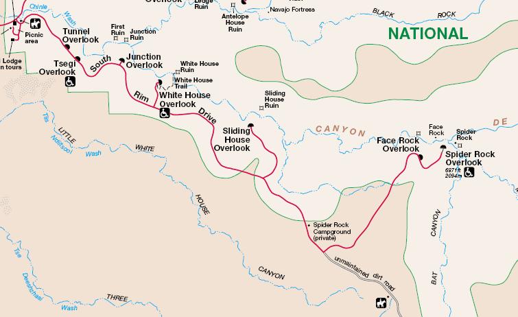
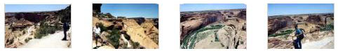
Stops on Our Drive Along the South Rim Road
|
The Tunnel Overlook
|
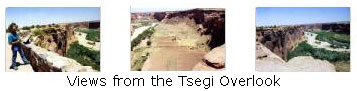
The Tsegi Overlook
|
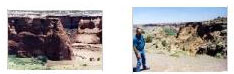
This is one of the overlooks where you can see the evidence of human habitation down in the canyon; there are planted fields, roads and outbuildings- even some houses. It was quite windy this afternoon, which accounts for my disheveled look in the picture Fred took of me at this overlook; you can have a look at it here.
We took some other good pictures here at this overlook, and you can have a look at them if you click on the thumbnail images below:
|
The Junction Overlook
|
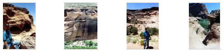
The White House Overlook and Trail
|
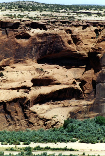
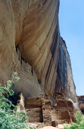
As seen from the overlook, the ruins seem very small (they are at the left in the picture, right at the base of the canyon wall), but they are actually quite large- and on two different levels. As you can see here, there is one set of ruins fifty feet up the canyon wall, and another set at ground level. You can also see, in the same picture, that there are petroglyphs here as well; note the human figure about halfway up the canyon wall.
These ruins were built by the Anasazi people. Anasazi is Navajo for "the ancient ones." The Park Service has improved an old Anasazi trail from the Canyon's edge to its bottom. Originally, the entire ruin was available, but after tens of thousands of tourists who chose to take a souvenir, the ruin has been fenced off. Ground below the ruins that was once tiled with pot shards discarded by the uphill residents, is now bare dirt. The trip to the canyon's floor takes about twenty minutes from the trailhead at the observation point. It is a drop of about six-hundred feet.
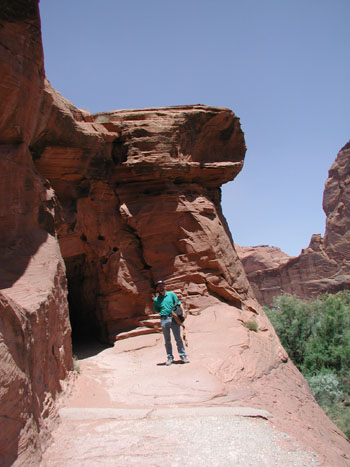
So, let's first look at some of the pictures we took hiking down the trail to the White House ruins.
|
|
|
|
|
|
Finally, for the views of the ruins themselves, just click on the thumbnail images below:
|
The hike down to the White House ruins was the highlight of the day, not only because we got to get very close to the ruins themselves, but also because the hike was enjoyable in itself.
The Sliding House Overlook
We only have one picture from Sliding House overlook, and you can have a look at it here.
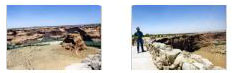
Face Rock Overlook
In this picture of Fred at Face Rock overlook, I read that you're supposed to be able to make out a face on the canyon wall across the way, but I was never able to really see it. Here is another view from close to the overlook looking down the canyon.
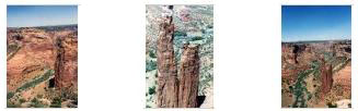
Spider Rock Overlook
The Spider Rock overlook was our last stop along the south rim road.
|
Below are thumbnails for a series of other good pictures of this amazing natural formation. Just click on them to view the full-size picture:
|
|
You can return to the page index or continue on to the next section.
Canyon De Chelly- The North Rim
|
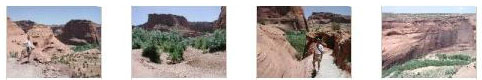
The Antelope House Overlook
As we began our drive along the North Rim Road, we thought we would first stop to see Ledge Ruins, but it turned out that the overlook has been closed for some reason, and later we found it had been closed for some time. So we went on to the overlook for the Antelope House Ruins.
|
The park brochure says that Antelope House has an unusual circular plaza. It�s hard to see the circular plaza at the site but it is visible from the overlook to the right of the tall tower. And the brochure mentioned that Antelope House might have been a trading center as pottery of many different styles was found there.
The Antelope House name comes from the series of pictographs along the left side of the site. The drawings are attributed to a Navajo who lived here in the early 1800s.
Views of Canyon del Muerto
As we were stopping at the various overlooks, we took a number of interesting pictures of the canyon- including some of the rock formations and some of the activity going on on the canyon floor, where people still live and farm today. Below are thumbnails for some of these pictures; click on them to have a look:
|
|
|
And below are thumbnails for some additional canyon views from the North Rim Road. Click on the thumbnails to view:
|
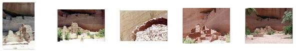
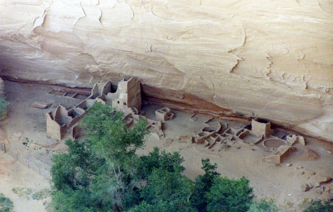
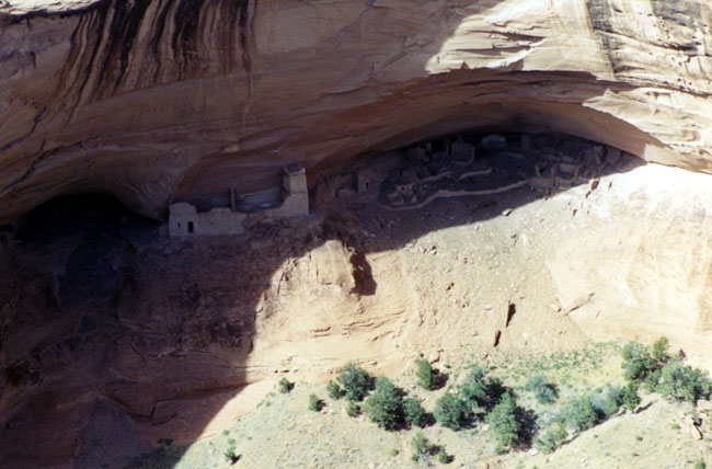
The Mummy Cave Overlook
|
The interpretive sign at the site says that habitation began here in 300 AD, making it one of the oldest Ancestral Pueblo sites in the canyon. The Navajo name for Mummy Cave is "House Under the Rock." This upper area of the Canyon de Chelly area doesn�t have the broad sandy canyon floor as the lower area. There is a meandering creek in this area, but there aren�t as many ruins or rock art sites in this upper canyon area as the lower area.
Here at Mummy Cave Ruins, the differences in styles between the side alcove sites and the center structure are easy to see even from a distance. The rooms are smaller and the stone work is rougher. The center section is thought to have been built around 1280 AD by people who moved here from the Mesa Verde area as the structures resemble the Mesa Verde style.
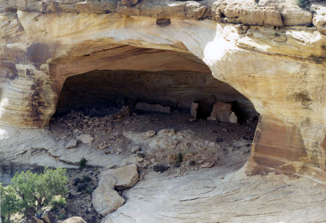
The Massacre Cave Overlook
|
The area near the canyon rim is very rocky but has good supplies of Pinon Pines and Utah Junipers. The cliffs below the ruins are vertical with an 800 foot drop to the canyon bottom. There is a small granary storage site to the left of the main alcove that looks particularly tricky.
The Yucca Cave site overlooks the area of the large Mummy Cave Ruins, though it is around the corner and not directly visible. This area is about 12 miles from the canyon mouth and at higher elevation, receiving more winter snow. In winter, the roads and parking areas are kept clear of snow and visiting the overlooks is only a short walk.
Well, we have come to the end of the overlooks and stops here on the North Rim Road at Canyon De Chelly. We are going to be working our way northward into Utah from here, and, although we could have backtracked to Chinle and continued north on US Highway 191, we saw no reason not to just work our way north from here.
You can return to the page index or continue on to the next section.
|
So we continued northeast along Canyon De Chelly NM on Indian Route 64 to the town of Tsaile. There, we picked up Indian Route 12 that headed northwest back to an intersection with US Highway 191.
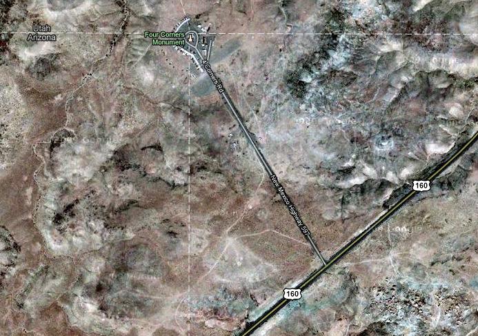
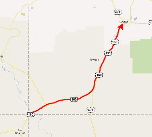
We took that north to its intersection with US Highway 160, and then we took that east to the Four Corners area.
|
|
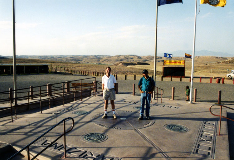
This is, of course, the only place where four US States intersect at the same point. The original marker erected in 1912 was a simple cement pad, but has since been redone in granite and brass, as you see above. The Visitor Center is open year round, and features a Demonstration Center with Navajo artisans. Navajo vendors sell handmade jewelry, crafts and traditional Navajo foods nearby. Along with the actual admission, this must be a little moneymaker for the Tribe. Of course, the area is very remote, and visitors are cautioned that there is no running water, no electricity and no telephones.
Actually, there may not even be a "four corners," for their is a good deal of controversy as to whether this is actually the right spot for the marker. Modern measurements seem to indicate that the actual spot is between 1800 feet and two miles away (whether that, if true, takes it off Indian lands is unknown to me). So there is some controversy, and you can read about it here.
In any event, as we passed by on US 160, we turned into the monument, paid our entry fee, and then walked out into the middle of the paved area to do what every other tourist does- stand on the marker, putting hands and feet in four different states. We used the tripod and just took one picture (I am surprised there wasn't a fee for taking pictures), and you can have a look at it below:
|
You can return to the page index or continue on to the next section.
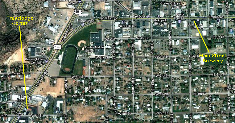
We Stay the Night in Cortez, CO
|
We stayed in the local Travelodge, and had dinner at a local place called The Main Street Brewery:
|
You can return to today's index
or use the links below to continue to the album page for different day.
|
June 25, 2003: Western Trip, Day 5 |
|
June 23, 2003: Western Trip, Day 3 |
|
Return to the Index for Our Western Trip |