|
June 26, 2003: Western Trip, Day 6 |
|
June 24, 2003: Western Trip, Day 4 |
|
Return to the Index for Our Western Trip |
|
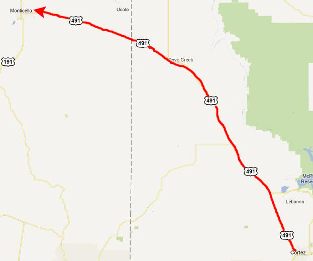
June 25 To Monticello, UT Newspaper Rock Canyonlands NP: Chesler Park Trail |
It's Wednesday, and our plan is to head next to Canyonlands National Park to camp and do some hiking.
|
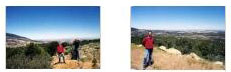
Click on the thumbnails below to have a look at the two pictures we took when we stopped at a viewpoint:
|
You can return to the page index or continue on to the next section.
Newspaper Rock
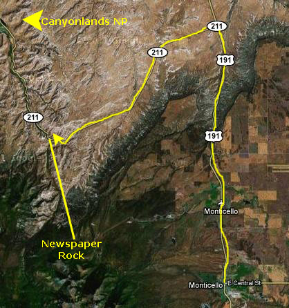
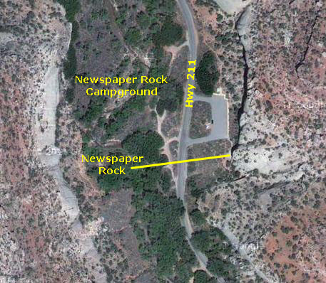
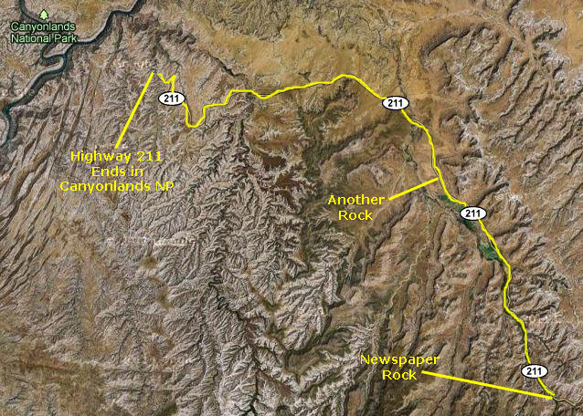
Getting to Newspaper Rock
|
|
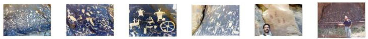
What is Newspaper Rock?
The first carvings at the Newspaper Rock site were made around 2,000 years ago, left by people from the Archaic, Basketmaker, Fremont, and Pueblo cultures. These petroglyphs, pecked into these rocks, allow a glimpse of the life and world of the people who farmed the Puerco River Valley 650 to 2,000 years ago. In Navajo, the rock is called "Tse' Hane'" which translates to "a rock that tells a story." The petroglyphs were carved by Native Americans during both the prehistoric and historic periods. The drawings on the rock are of different animals, human figures, and symbols. These carvings include pictures of deer, buffalo, and pronghorn antelope. Some glyphs depict riders on horses. While precisely dating the rock carvings has been difficult, repatination of surface minerals reveals their relative ages. The reason for the large concentration of the petroglyphs is unclear, making the rock somewhat of a mystery.
The rock face is located near a stream and trail in an area with long expanses of otherwise impassable vertical cliffs. The setting is peaceful and sheltered, as the canyon at this point is quite narrow, overgrown by bushes and tall cottonwood trees, with the clear waters of the creek flowing close to the road, and sheer reddish cliffs rising 250 feet above. A picnic area and campground are located across the road (although flash flood dangers caused the closing of the campground in 2006). Other places on the cliffs to the south have smaller groups of petroglyphs, but they are harder to find.
Our Visit to Newspaper Rock
|
You can return to the page index or continue on to the next section.
Canyonlands NP: On the Chesler Park Trail
Getting to Canyonlands National Park
|
Another ten miles up the road, I was passed by a truck coming in the opposite direction, and, it passed, a rock got thrown up and smashed into my windshield. The windshield didn't break, but there was a starburst and a crack coming from it. As the day progressed, both Fred and I noticed that the crack was slowly progressing across the windshield. As it turned out, I had to have the windshield replaced the following day in Moab, Utah.
But anyway, it was another forty-five minutes or an hour and we were coming in to Canyonlands National Park through the entrance station. The first thing we did was to investigate camping and pick out a space, which we did without any difficulty. There were many other campers here, but it was the middle of the week and so we found a good space pretty quickly. I'll postpone pictures of the campsite until later.
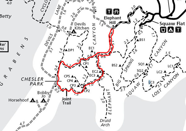
We sat at the picnic table and looked through the trail descriptions in the brochure, and picked out a longish trail to do this afternoon- the Chesler Park Trail.
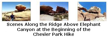
On the Chesler Park Trail
|
We got our campsite secured and left a cooler on the picnic table to confirm that it was taken (although the receipt we'd gotten at the sign-up board and displayed on a clip by the campsite number would have been sufficient). Before we left, I had Fred take a picture of me with the sandstone cliffs across from our campsite as a backdrop. You can see that picture here.
The day was warming up quickly, and the pause to do some picture-taking led me to conclude that for this hike this afternoon, I'd be more comfortable in shorts, so I went back to the tent to change. Later on, I was glad I had. Then we got in the car and drove up the gravel road to the Elephant Hill Trailhead.
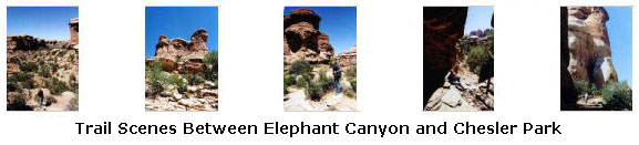
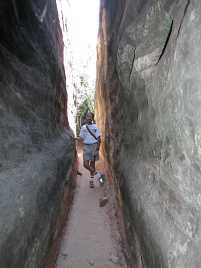
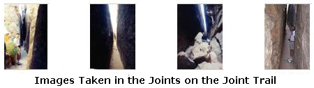
Aside from Chesler Park itself, the "joints" and a couple of other features, I can't really tie the photos to particular locations on the trail map, so I won't try. What I will do is try to describe the trail as best I can recollect it, with some help from a couple of hiking trail websites on the Internet. Where I can, I'll be specific with the pictures we took, but otherwise I'll just show you groups of them every so often. So let's head out.
|
|
Click on the thumbnails below to see some of the pictures we took on this part of the hike:
|
|
|
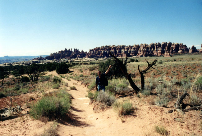
Chesler Park is about a mile in diameter and is almost completely surrounded by towering needles of pink sandstone.
Before 1964 this area was used by the Dugout Ranch as a grazing pasture for cattle; an old cowboy camp can still be seen on the southern side of the park. There was even a dirt landing strip in the meadow, although all evidence of it is gone now, with Chesler Park having been reclaimed by sandy soil desert shrubs.
But what formed the park in the first place? Was it an ancient sinkhole that gradually filled with sand? Was it caused by shifting salt beds in the Paradox Formation below it? I'm not sure anyone knows.
|
|
|
|
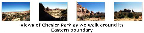
It was amazing to me how the sides of Chesler Canyon were lined with hundreds of stone needles- all constructed of the same banded sandstone. It looked like a terrestrial pin cushion. At one point in our walk, eagle-eye Fred spotted one of Chesler Park's inhabitants, peering out at us from the underbrush. It was a very beautiful part of the hike.
|
|
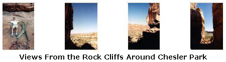
The trail emerged from the sandstone wall at the bottom of a long flight of crude stone steps that climb back to the sunshine and blue sky on the southwestern edge of Chesler Park. From here, we could look back on the rock formations concealing the Joint Trail, and they looked for all the world like giant toadstools.
This brought us to the remains of an old jeep road, and we walked north along it before the trail took us back around the northern wall of Chesler Park, and basically back to the point where we had entered right by the rock pinnacle that marked our entrance point into Chesler Park. From there, we followed essentially the same path back to the Elephant Hill Trailhead.
This was an amazing hike; while all of it was beautiful and interesting, the joints were indeed the high point. We would not again encounter such interesting formations until our hikes through the slot canyons near Palm Springs, California six years in the future.
We arrived back at the car at the Elephant Hill Trailhead about six hours after we'd started out. We'd taken some water with us but still, we were parched when we returned. It was a pleasure to get back to the campsite and have a cold drink. It was getting dark by the time Fred had dinner ready and I'd set up the inside of the tent. It was a great end to a great day of hiking.
You can return to today's index
or use the links below to continue to the album page for different day.
|
June 26, 2003: Western Trip, Day 6 |
|
June 24, 2003: Western Trip, Day 4 |
|
Return to the Index for Our Western Trip |