|
July 23, 2004: Oregon Trip Day 7 |
|
July 21, 2004: Oregon Trip Day 5 |
|
Return to Main Index for Oregon Trip Pictures |
|
Oregon Trip Day 6 July 22
Driving to Mt. Shasta |
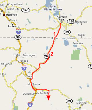
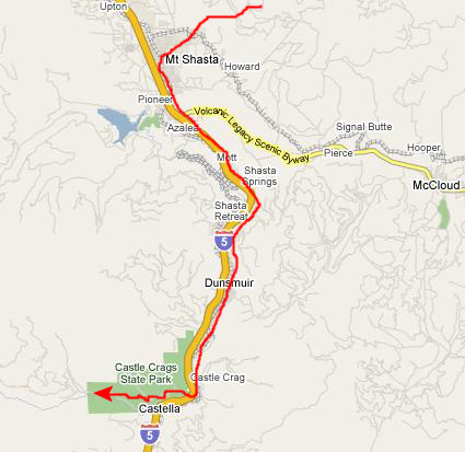
Driving From Bend, OR to Mt. Shasta
 |
|
|
|
|
Dominating the landscape, Mt. Shasta can be seen for 100 miles from certain points- drawing hikers, skiers and travelers. Mt. Shasta rises 11,000 feet from its base to its summit for a total elevation of 14,162 feet above sea level- the 49th largest in the nation. It is one of the southernmost volcanoes in the Cascade Range and is the second tallest, falling short of Mt. Ranier by 248 feet. It has a 17-mile diameter with 5 glaciers, the Whitney glacier being the largest in California. The most recent eruption occurred in 1786 and was witnessed from the sea by the explorer La Perouse. We learned all of this from the sign at the viewpoint, which is where we took this picture of myself and Fred here at the viewpoint.
While we were here at the view point, we took quite a few other pictures of Mt. Shasta and the area around the viewpoint, and I have put thumbnails for some of these pictures below. To look at the full-size images, just click on the thumbnails:
|
|
|
When we got through the town of Weed, California, we did some planning for our day, and decided to head directly for some waterfalls we'd read about in one of our hiking books- these being on the McCloud River somewhat south of Mt. Shasta itself. Then, we would work our way back to Mt. Shasta.
You can return to the Page Index or continue on with the next section.
The McCloud River and McCloud Falls So, we got on I-5 near the town of Weed, California, and headed south on the interstate. We passed the town of Mt. Shasta and the gateway to the mountain itself, and then exited on California 89 towards the town of McCloud, California.
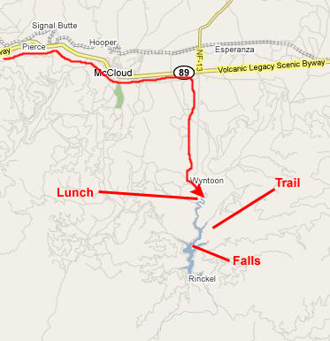 |
When we reached the parking area, we found a shady spot to park and thought that before we did anything else, we would stop and have some lunch at one of the picnic areas nearby. We got our stuff unpacked from the car, and went over to sit down. As usual, I just munched on a bag of shelled peanuts. Once again, as had happened a couple of days ago, we found that we had an audience for lunch- chipmunks obviously waiting for scraps to fall from the table. One of them wasn't willing to wait, as you can see in the movie below:
|
|
|
|
 |
|
|
This whole area was really interesting. For example, unlike many mountain streams we've seen, this one apparently flows over a solid shelf of rock, eroding it away into unusual shapes and bowls. This was different from other streams where the streambed is composed of boulders and rocks washed down the stream by the force of the water. Here, apparently, there was a solid stratum of lava or other rock that was being eaten away. There were some loose boulders, of course, but not so many as usual.
I walked along the rocky shelf near the stream, which was where Fred saw me and took this picture. At the overlook, there had been a little diagram showing the trail that followed the McCloud River upstream towards McCloud Falls, and so we headed off in that direction. As we left the swimming area, I looked back and photographed Fred alongside the McCloud River.
As we walked along the trail, it slowly ascended until it was on the hillside some fifty feet above the river, offering us very nice views of the McCloud River from above. From our vantage point on the trail, we could look a good ways upstream along the river. At a couple of points, the trail dipped down towards the river, and I would stop to make a movie of the river flowing by. You can watch a couple of those short movies with the players below:
|
|
 |
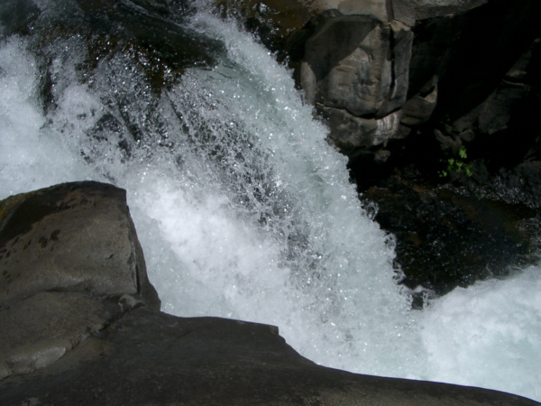
Here at the middle falls, there were maybe fifteen people on the rocks, in little inflatable boats in the pool, and even some who'd forded the stream and gotten over to a perch just underneath the falls. Fred got a good picture of all this activity as I went down to the water's edge to take some movies and pictures.
From a vantage point down by the water's edge and looking up and across at the falls, I made two movies. In the first one, I wanted to show the falls, the view across the river and downstream, and the high bluffs that were off to my right. I also wanted to get a movie that simply recorded the image and particularly the sound of the falls, without a lot of panning around. You can watch both these movies with the players below:
|
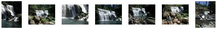
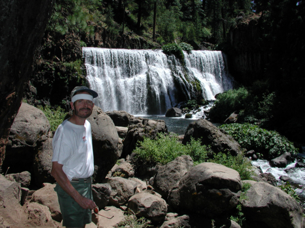
This was, as are most waterfalls, a very beautiful and restful place- particularly refreshing after our hot hike along the trail. We took a good many pictures here, and you may want to look at some more of them, so I have placed thumbnails for the best of them below; just click on the thumbnails to view the full-size pictures:
|
We learned from some of the folks at the waterfall that there was an overlook high up above the falls and a trail up to it, so when we left the falls, that's where we went. On the trail up to the overlook, we began to get very beautiful views of the falls through the trees. When we got to the top of the bluff, we found we could indeed get a wonderful perspective of McCloud Falls by looking down on them rather than up at them. This is not a common thing to happen to us when we are hiking along by waterfalls; usually, the trail just ends AT the falls and rarely continues on above them. Here are two of the best views of McCloud Falls that we took from the overlook- one normal view and one closeup.
|
|
|
|
You can return to the Page Index or continue on with the next section.
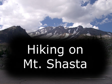
Mt. Shasta, California
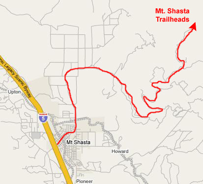 |
It was a long, winding route up to the parking area for the various trailheads up the mountain, but we eventually got there and prepared for our first hike to Panther Meadows.
The Panther Meadows Trail
|
|
|
The trail climbed quickly away from the parking area, crossing an area that was partially covered in grass, but which, for the most part, was open ground. The trail at this point was well marked as we crossed a meadow area heading up towards the mountain, and it was here I took my first movie- one that you can watch with the player at right.
|
|
|
|
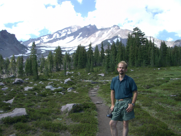
Our trail continued through the woods and out into another meadow area, where the trail continued heading directly for Mt. Shasta. As we traversed this area, I took a picture of Fred alongside the trail. Alongside the trail, Fred found some pretty mountain flowers, and he stopped to also take a picture of me on the trail. The trail continued through this meadow area, through another stand of trees, and then out onto a higher meadow which opened up a beautiful vista to the south- with Mt. Lassen just barely visible far to the south. We were also getting better and better views of Mt. Shasta as we continued up the trail.
|
|
The other really interesting aspect of Panther Meadows were the Indian artifacts that lined the edge of the meadow just inside the tree line. Here is an example of one of these indian totems- I can't think of a better name for them. Obviously, they are not very old, but the guide information we had said that they were periodically either repaired or laid out anew by some of the Native Americans that live around this area (none live on the mountain itself, apparently). We found two or three just in the small area we covered, so there must have been quite a few of them. Here is a picture that I took of Fred near these displays.
|
|
The Shasta Slope Hike From the trailhead parking area for Panther Meadows, the Everitt Memorial Highway continued up the southwest side of the mountain. As we left the Panther Meadows parking area, more excellent views of Mt. Shasta opened up. Partway up to the end of the road I stopped to take a movie panorama of the entire area, turning 360 degrees and looking in all directions. You can watch that movie with the left-hand player below. Finally, after another few miles of twisty mountain road, we came to the highest point on the road- the parking area for the Shasta Slopes hike- an altitude of 7800 feet. Fred took a movie to record our arrival, and you can watch his movie with the right hand player below.
|
The Shasta Slopes hike leads one up the rocky slope of the mountain, pretty much as high as you want to go. I think that we hiked maybe a mile or so up the slope, seeing lots of little springs and vistas of the mountain and the surrounding area.
|
To view the slideshow, just click on the image at left and I will open the slideshow in a new window. In the slideshow, you can use the little arrows in the lower corners of each image to move from one to the next, and the index numbers in the upper left of each image will tell you where you are in the series. When you are finished looking at the pictures, just close the popup window.
|
|
Mt. Shasta was another fantastic place to visit; one of these days we might return and take one of the trails that leads pretty close to the summit, but, for today, we are going to head over to another local scenic place- Castle Crags State Park.
You can return to the Page Index or continue on with the next section.
Castle Crags State Park
 |
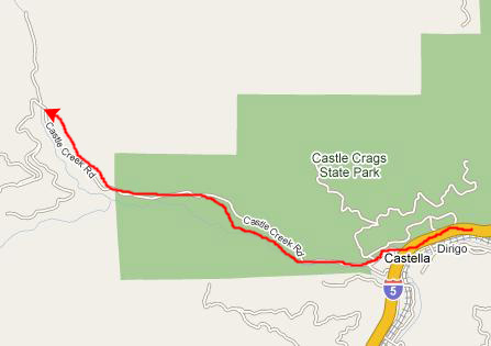
After about ten miles, we came to a bridge across the stream, and stopped to get out and walk down to the streambed.
What we found was a pretty little stream flowing from the northwest and going under the highway bridge; I made a movie of it to include here. Both Fred and I came down to explore, and, from my vantage point underneath the bridge, I filmed a movie of Fred walking along the stream which, according to the map, is Castle Creek. You can watch both these movies with the players below:
|
|
|
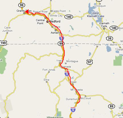
But now the day is ending, and it is time for us to head up the road to our stop for the night in Grants Pass, Oregon.
You can return to the Page Index or continue on with the next section.
Our Stop for the Night in Grants Pass
 |
 |
 |
You can return to the Page Index or continue on with another album page in our Oregon trip by using the links below.
|
July 23, 2004: Oregon Trip Day 7 |
|
July 21, 2004: Oregon Trip Day 5 |