|
July 22, 2004: Oregon Trip Day 6 |
|
July 20, 2004: Oregon Trip Day 4 |
|
Return to Main Index for Oregon Trip Pictures |
|
Oregon Trip Day 5 July 21 |
Today, we will spend most of the day at Crater Lake National Park in south central Oregon. On the way, we will drive along the Cascades Scenic Byway, around Mt. Batchelor and on down to the north entrance to Crater Lake. We hope to make a full circuit of the lake and so as much hiking and sightseeing as we have time for. Our aim would be to stay somewhere near Klamath Falls this evening, and midway through the day we'll finalize that decision and make some reservations.
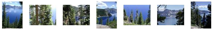
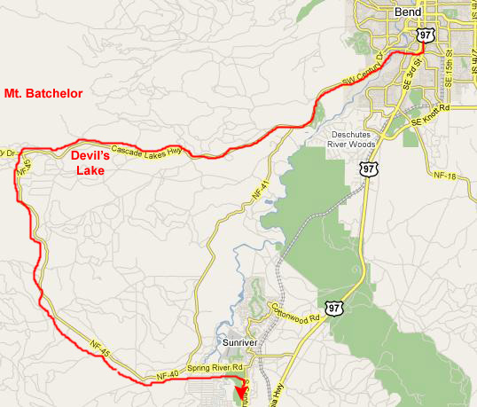
Devil's Lake/Mt. Batchelor/Cascades Scenic Byway
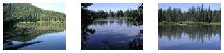
There were quite a few lakes along the highway, but most of them were a ways off the road, and didn't offer really good pictures- all except
Devil's Lake,
that is. With a maximum depth of only 9 feet, you could see the bottom most of the way out into the lake and, surrounded by green hills, mountains and trees, it was very pretty. Click on the three thumbnails below for some really nice pictures of Devil's Lake:
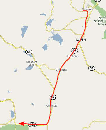
We continued on around the lakes highway, enjoying the scenery, and eventually met up with Highway 97 again at Sunriver, OR. From there, we headed south to Crater Lake.
You can return to the Page Index
or continue on with the next section.
A Day at Crater Lake National Park
From Sunriver, Oregon, we headed south towards Crater Lake National Park.
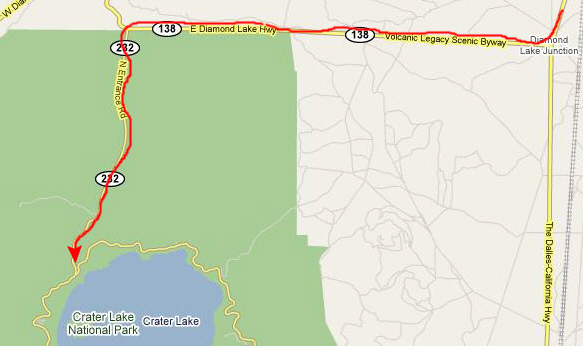
At Sunriver, we hooked up with Route 97 south, and we took that all the way to Oregon 138, which leads west to the north entrance road for Crater Lake National Park. We took the entrance road south, paid our fee, and after just a few miles found ourselves intersecting with the Rim Drive that goes all the way around Crater Lake.
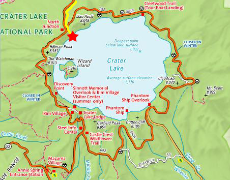
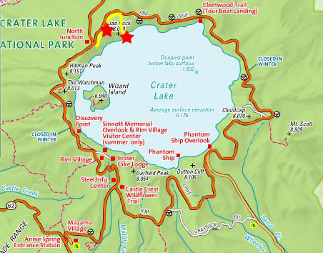
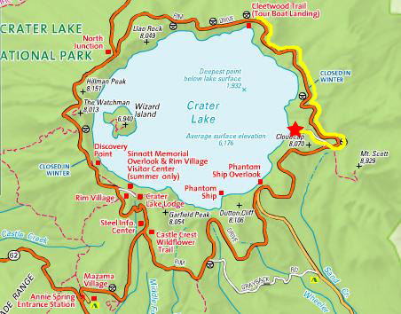
We thought that we would take the Rim Drive clockwise around Crater Lake, stopping whenever there was something of interest to do or see. Since we took so many pictures and movies here, I am going to divide the Crater Lake visit into subsections, each of which can be found on the maps that will follow.
Merriam Point
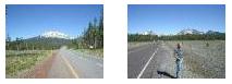
We stopped and had some breakfast at a local place on the west side of Bend, and then headed out west along the Cascade Lakes Highway towards
Mt. Batchelor,
seen here in closeup from a point about ten miles west from Bend on the highway. The scenery along the highway was very pretty, what with the tall pines, occasional lakes, snow-capped mountains and interesting lava flow fields. Below are thumbnails for a couple of other particularly good pictures that we took while on our way out to Devil's Lake; just click on those thumbnails to see the full-size pictures:
(Click on Thumbnails to View)
(Click on Thumbnails to View)
Before we left the lake, I also made a movie of it and its surroundings, and you can watch that movie with the player at right.
|
|
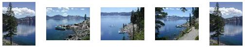
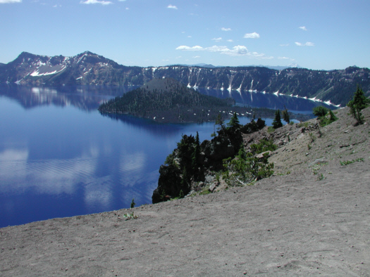
When we got to the actual viewpoint, the entire expanse of Crater Lake was spread out before us, and the first thing that both of us did was to take our own movies of that expanse, and these will give you a good introduction to the lake and surrounding area. You can watch these movies with the players below:
|
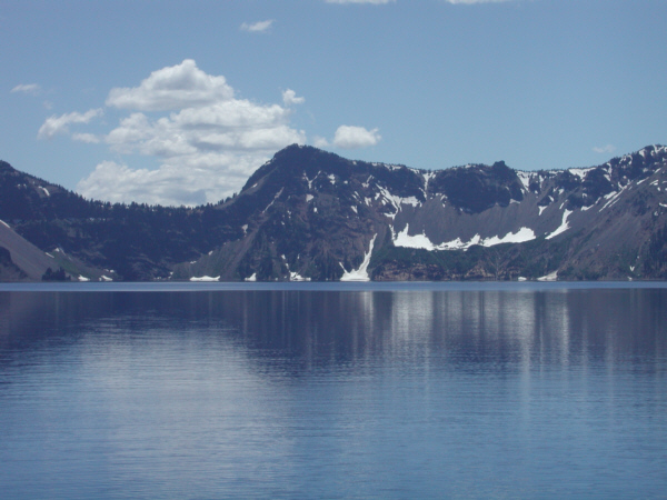
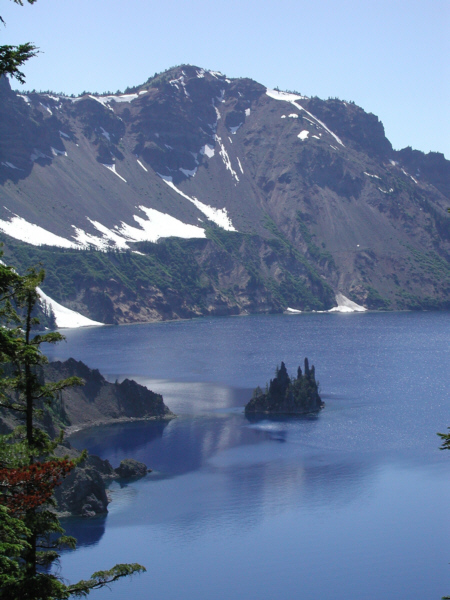
The view from here was unobstructed and spectacular. First, you could look southwest along the western rim of the crater and see all the way from where we were standing all the way around almost to the opposite side of the lake and the Rim Village. The most prominent feature on this side of the lake is Wizard Island, which is actually the tip of an underwater mountain almost fifteen hundred feet high, and that is the island that you can see in the last picture you looked at or in the picture above. Our next view looks directly across the lake to the entire southern rim, including the Rim Village almost in the center of the picture. Finally, we could look to our left at the northeast quadrant of Crater Lake. Prominent in this view is Llao Rock- the promontory sticking out into the lake directly in the middle of the picture. Beyond Llao Rock is Cleetwood Cove, but it is obscured in this view.
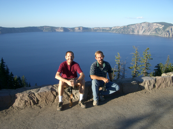
This was Fred's first time at Crater Lake, and only my second. And so, this being our first exposure to the lake, we stayed here for quite some time, just admiring the beauty of the scene. Just before we headed back down to the parking area and the car, I took a picture of Fred and the north entrance road, with the Oregon Cascades beyond him. Take a look at that picture here.
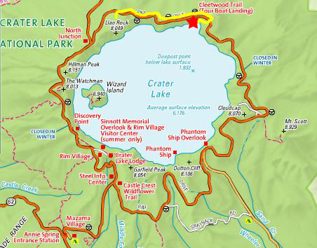
Llao Rock/Grouse Point Overlook
 |
This overview point was much like Merriam Point- a sandy gravel path up to a point overlooking the lake. As did Merriam Point Overlook, this spot offered particularly good views of the east side of Crater Lake. I also made a movie from this vantage point, a movie that pans around to include Llao Rock and most of the vista of Crater Lake; have a look at that movie with the player below:
|
|
The next stop, also shown on the map at right, was actually the overlook at the top of Llao Rock, so we drove a bit further around the Rim Drive, climbing quite a bit, until we got to the parking area for the short hike out to the top of Llao Rock. From this vantage point, you could see almost all of Crater Lake; it was certainly an awe-inspiring view.
|
|
|
|
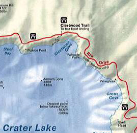
Cleetwood Cove (The Hike Down to the Shore of Crater Lake)
 |
Fortunately, there was another parking area for the next overlook just a few hundred feet up the road, so we went and parked there and then walked back to the trailhead for the trail down to the Cove. We admired the view for a few minutes, and then Fred and I started down the trail. You can see some movies of these activities with the players below:
|
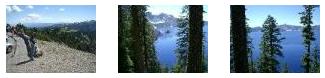
When we started out, the tops of all the trees between us and the lake were pretty much below us, but we hadn't gone very far before we'd descended below many of them, and it wasn't long after that until the sandy trail was in the thick of the forest that stands on the slope of the crater above the lake. The walk (down at least) was pleasant and shady; Fred took a picture of me on the trail and, just a bit later, I got a good picture of Fred and the trail downward.
 |
When we came to the bottom of the trail, we were heading west and, looking ahead, we could see the northern shoreline of Crater Lake, looking back in the direction of the north entrance road. Llao Rock is obscured, in this picture, by the point of land you can see at the center of the picture. But there were amazing views in every direction we looked- views made all the more interesting for us being down at lake level now.
|
|
As we were standing here taking pictures, one of the cruise boats that take passengers on trips around the lake from here at Cleetwood Cove was returning; here, it is passing in front of the crater wall down which we had come.
There was lots of activity down here at Cleetwood Cove. One of the first things that caught my attention was this little building on a platform a few feet out into the lake. You can see there is a big, circular pipe going down into the water, and there are solar panels on the roof. It could not have been a privvy (no need for the solar panels and they would not have allowed such pollution of the lake), so we concluded that the hut housed some sort of measuring equipment. Standing on that same rock outcropping, we could see all the way across the lake to the southern shoreline and Rim Village.
 |
|
|
After a while, we walked back over the rocky outcropping back to the activity at Cleetwood Cove. It was about time for us to start back up the trail to the crater rim.
|
|
Then it was time to go. But, before we actually got on the trail, Fred couldn't resist taking one more picture of the eastern part of Crater Lake, and I think this picture with Mt. Scott in the distance was one the best one we took from here at Cleetwood Cove. We had seen just about all we could see from down here at the shore, and so we headed back to the car. As we began to ascend the trail, we could see, behind us, the activity at Cleetwood Cove shrinking in the distance behind us, and ahead we could see views of the northeastern corner of Crater Lake, and Mt. Scott off in the distance. Below are thumbnails for five pictures that we took on the first half of the trail back up, and since they are in the sequence that we took them, you'll see what I meant in the description above. To ascend the trail with us, just click on each of the thumbnails in sequence:
|
|
|
I've picked seven of the best pictures that we took as we ascended, showing you the amazing views and also such interesting things as the moss growing only on the north sides of trees, and I've put thumbnails for them (left to right as we ascended) below. Take a look at the full-size pictures by clicking on those thumbnails:
|
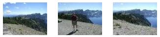
Mt. Scott and Cloudcap Overlook
 |
|
|
Seeing snow in July is certainly unusual for us Texas residents, though, and we took the time to exchange pictures so we'd each have one of ourselves at the snowfield. So here are Fred and myself. We walked around in the snow for a while and then took the road out to the Cloudcap Overlook.
From the Cloudcap Overlook you can see the entire lake except for Cleetwood Cove, for when you look north, there is a point of land that blocks your view of the cove. But you can see just about everything else, including Wizard Island, which was just a bit west of where we entered the park and intersected with the Rim Road.
 |
We took a number of good pictures while here at the overlook, most of them of the east side of the lake, and a couple which have Mt. Shasta way off in the distance. I've put thumbnails for six of these pictures below; click on the thumbnails to view the full-size images:
|
|
|
I should point out that if you have been following our route on the little maps, the picture at left was actually taken at the Ghost Ship Overlook, rather than at Cloudcap, but I did not create a separate section for that stop.
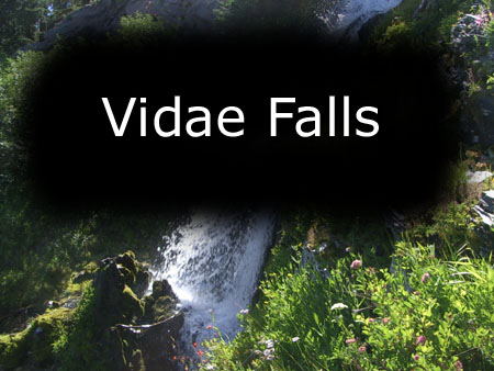
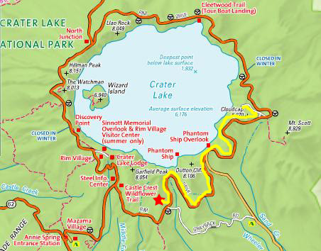
Vidae Falls From Mt. Scott, we continued to drive south along the Rim Drive, passing the turnoff to a canyon that Tony and I had gone to see when we drove across country thirty years ago; I remembered that the canyon was interesting, but hadn't really justified the long drive to get there. But, pretty soon, we saw the turnout and parking for Vidae Falls.
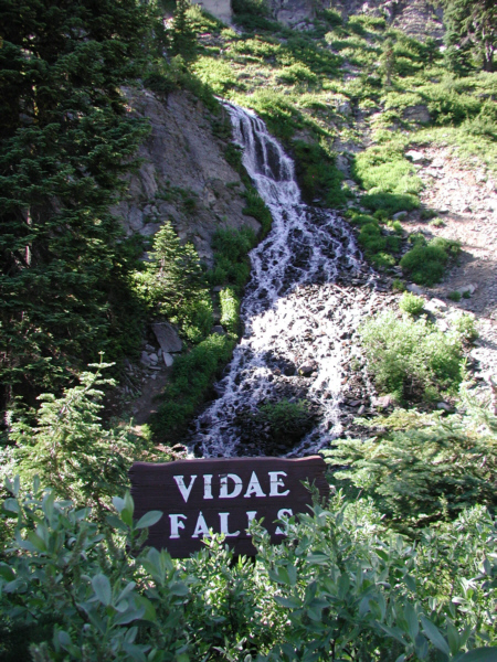 |
Vidae Falls was a little odd in that you could see the entire waterfall from the roadside; no hiking was involved to get to it. It made me think that waterfalls are even nicer when you have to exert yourself to get to the point where you can see them.
Anyway, I think the best way to show you Vidae Falls is to show them to you top to bottom, even though I took my pictures from bottom to top as I climbed up alongside the falls. Fred stayed at the bottom, sometimes taking pictures of me, and I'll show you those pictures in a moment. But let me begin at the top of Vidae Falls.
The source for Vidae Falls is a beautiful mountain stream that is, presumably, fed by snowmelt from the peaks surrounding Crater Lake. This is exactly the kind of stream that I would have liked to follow to its source, if I'd only had the time. The source could not be far away; the water was coming from the direction of Crater Lake and we were only a mile or so from the edge of the lake in any event. But I did not have the time, and had to forego that adventure.
|
|
From the same spot where I was taking the movie, I could turn towards the falls themselves and see While I was taking my movies and pictures up at the top of the falls, the stream narrowing as it approached the point where its water shot out over the uppermost part of the waterfall.
Moving down the falls to the next level, which is actually the upper level as seen from the highway or from where Fred is, you can see the very top of the falls as the water from the mountain stream flows through a narrow opening and out onto the rock face. I'll call this the "upper falls."
I took two movies of this part of the falls, movies that you can watch with the players below:
|
|
I took two more movies here at Vidae Falls, one of the middle falls and one of the lower falls; you can have a look at them with the players below:
|
Vidae Falls was, as are most waterfalls, a magical place. Without exception (except, perhaps, for the overcommercialized Niagra Falls and other waterfalls that don't require a hike to get to) waterfalls are, for us, a fitting goal for almost any hike- pretty much no matter how long.
|
Climbing around on Vidae Falls was a lot of fun, and of course we took lots of pictures of the falls themselves from various angles. I have taken the pictures of plants and flowers that Fred took and put them together with the pictures of the falls in a slideshow.
To view the slideshow, just click on the image at right and I will open the slideshow in a new window. In the slideshow, you can use the little arrows in the lower corners of each image to move from one to the next, and the index numbers in the upper left of each image will tell you where you are in the series. When you are finished looking at the pictures, just close the popup window. As you go through the slideshow, look for me in the pictures that Fred took, and see if you can pick out the various levels of the falls.
Hiking in Annie Creek Canyon
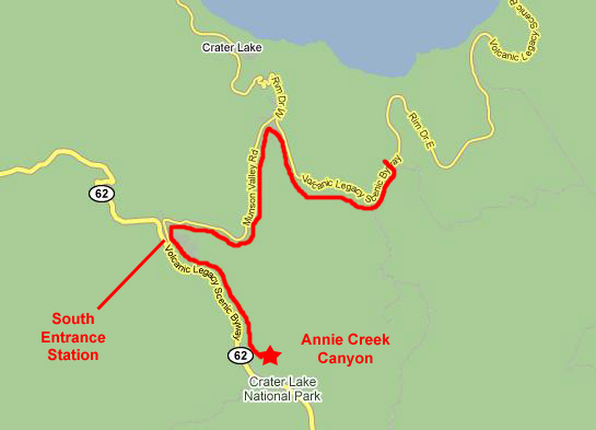 |
The Annie Creek Canyon hike begins behind the campground and then follows the creek southeast as it descends into Annie Creek Canyon. Once deep in the canyon, the trail then ascends back up onto the ridge and returns to the campground through the forest. Above the campground, there is another small canyon that you can descend into on a little separate hike, and we will do that, too.
I think that the movies and pictures that we took along the hike really don't need a lot of individual explanation; they are basically movies of the creek and pictures and movies of us walking along beside or above the creek. But it may well be helpful if I just describe the different parts of the trail before I simply provide a sequence of links to the movies and pictures taken during that part of the trail. (I have tried to find a trail map online, but have not had any luck, so my verbal descriptions will have to do.)
Annie Creek begins inside Crater Lake National Park northwest of the campground where we pick up the creek for the first time. Above this point, it first flows under the park road while it is inside the park, and then flows southeast through a small canyon that is also northwest of us to pass by the back of this campground. (That part of Annie Creek we didn't know about until we returned from the main hike, so, even though it is upstream from where we are beginning now, the pictures we took there will appear at the end of this section.) For the first section of our hike, we will pick up the creek just behind the campground. From here, it flows generally southeast, and for the first part of the three-mile hike it is fairly level, flowing through forests and meadows. In this part of the hike, we simply walked along the stream, crossing it occasionally on log bridges. Here are the pictures and movies we took of this first part of the hike; they are pretty much in order and will give you a good idea of what the hike was like. Just watch the movies in sequence below, clicking on any picture links that appear in their descriptions, one at a time, to follow us along:
|
(Mouseover Image if Video Controls Not Visible) |
(Mouseover Image if Video Controls Not Visible) |
|
(Mouseover Image if Video Controls Not Visible) |
(Mouseover Image if Video Controls Not Visible) |
|
|
(Mouseover Image if Video Controls Not Visible) |
(Mouseover Image if Video Controls Not Visible) |
Here is a still picture of the log bridge over Annie Creek. We continued walking, and soon we were walking along Annie Creek in a deep canyon.
|
(Mouseover Image if Video Controls Not Visible) |
(Mouseover Image if Video Controls Not Visible) |
Here is a picture of a fallen log bridge over Annie Creek; we had to cross it, of course, and I got a picture of Fred on the bridge over Annie Creek. Towards the end of this section of the hike, we got another good picture of Annie Creek in Annie Creek Canyon.
|
(Mouseover Image if Video Controls Not Visible) |
For the next section of our Annie Creek hike, we climb up out of the deep canyon where we have been following the creek itself, and look across the canyon at the hoodoos on the far side. As we walk back towards Mazama Campground, we had a snowball fight. Continue to watch the movies and look at the pictures to follow us along on this portion of our hike:
|
(Mouseover Image if Video Controls Not Visible) |
Here is another view of the Hoodoos in Annie Creek Canyon.
|
The last section of our hike along Annie Creek and through Annie Creek Canyon was to go see the section just above the Mazama Campground- upstream from where we started originally. When we first got down to the creek from the campground, I made a movie of upper Annie Creek as it came alongside the campground from the direction of Crater Lake. Just above the campground, Annie Creek flows into a narrow canyon, the walls of which were so steep that there was no way to walk along it and through this canyon. But I did take movies of both these features, and you can have a look at them with the players below:
|
(Mouseover Image if Video Controls Not Visible) |
(Mouseover Image if Video Controls Not Visible) |
We ended the Annie Creek hike with two final pictures. The first one shows Annie Creek entering its narrow canyon and the other one shows me at the canyon entrance. All that was left to do was for us to climb back up to the campground, return to our car, and head back into the park to continue our drive around the Rim Drive.
Exploring the Rim Village
 |
When we drove up the drive to the village and parked in the huge lot, we noticed that there were a couple of restaurants, one of which offered the Crater Lake Buffet until 9pm. We figured that if we didn't have dinner here, but waited until we got to Klamath Falls (our next overnight destination), all we'd be left with would be late-night fast food or perhaps a diner like last night, so we planned on staying here for dinner. But before that, we wanted to use the early evening light to take some final pictures of Crater Lake.
All along the lake rim here at Rim Village there is a walkway that offers a number of different views of the lake. Right in front of the shops and just across the parking area was an overlook that offered a beautiful view of the central portion of Crater Lake, this view looking directly across the lake at the north entrance where we had come into the park this morning.
Just to the left of this overlook was the Wizard Island overlook, which offered a tree-framed view of Discovery Point and Wizard Island. Wizard Island was the main lake feature that we would not get any closer to on this trip, but the view from here was all we really needed.
 |
At the right-hand end of the parking lot was Crater Lake Lodge, shown here from the front. This lodge is one of the many unique "great lodges of the American National Parks." We walked around to the back of the hotel and then back towards the rim, where there was another short rim trail with more views of the lake.
Here, instead of taking more pictures of the same thing, I made two movies, each from a different point, showing the entire panorama of Crater Lake. You can watch those movies with the players below:
|
|
After we'd walked around, we went back to the restaurant and had an excellent (if somewhat expensive) buffet meal, gazing out at Crater Lake as we ate. By the time we left the park, the light had pretty much faded completely.
You can return to the Page Index or continue on with the next section.
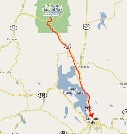
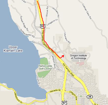
The Drive to Klamath Falls
 |
 |
 |
You can return to the Page Index or continue on to the next or previous day in our trip using the links below.
|
July 22, 2004: Oregon Trip Day 6 |
|
July 20, 2004: Oregon Trip Day 4 |
|
Return to Main Index for Oregon Trip Pictures |