|
July 21, 2004: Oregon Trip Day 5 |
|
July 19, 2004: Oregon Trip Day 3 |
|
Return to Main Index for Oregon Trip Pictures |
|
Oregon Trip Day 4 July 20
Little Zigzag Falls |
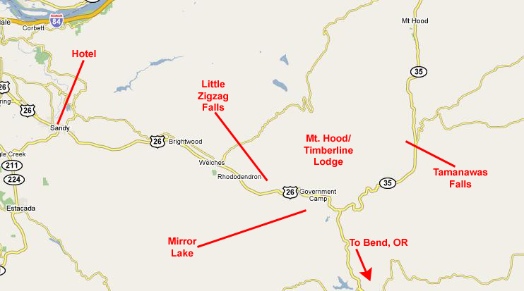
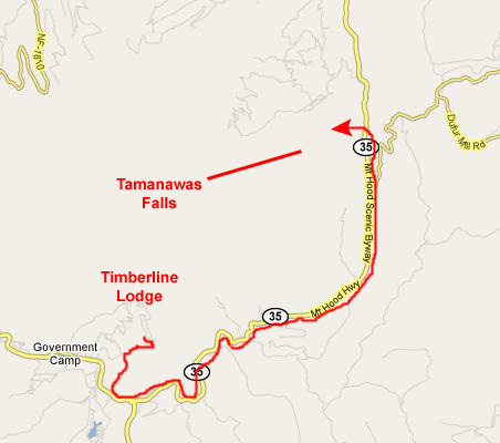
Today, we are planning to do lots of things all around Mt. Hood, in what is known locally as "Mt. Hood Territory," but more officially as the Mt. Hood Wilderness Area. We've been looking on the Internet from the hotel, and doing some work with our guidebooks, and plan to see two different waterfalls, a pristine mountain lake and Timberline Lodge on Mt. Hood itself. If all goes according to plan, we'll spend the night in Bend, OR.
A Morning Hike to Little Zigzag Falls
 |
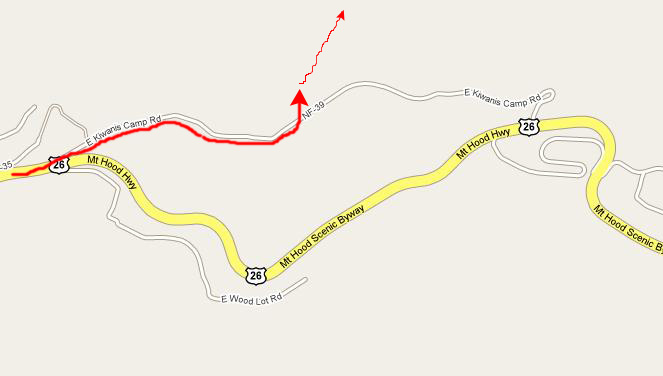 |
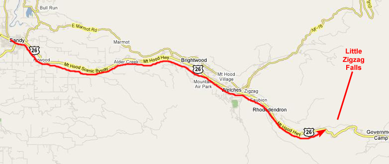
All the directions we got said that the trailhead for Little Zigzag Falls was at the end of this road and, sure enough, there was a parking area at the end of the paved road for the Falls. The map seems to show that the road continues in a loop back to Highway 26, but that must be the unpaved portion.
 |
To give you an idea of what the hike was like with the creek beside us, look at either or both of the two movies I made of us walking along the creekside trail. You can watch these two movies with the players below:
|
|
All along the hike to the falls, it was a joy to walk beside the creek; movies express this better than anything, and you can watch two of them with the players below:
|
|
 |
|
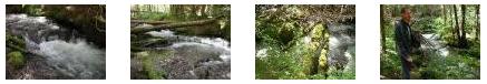
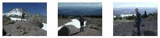
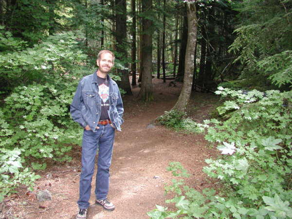
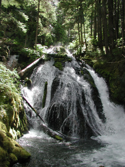
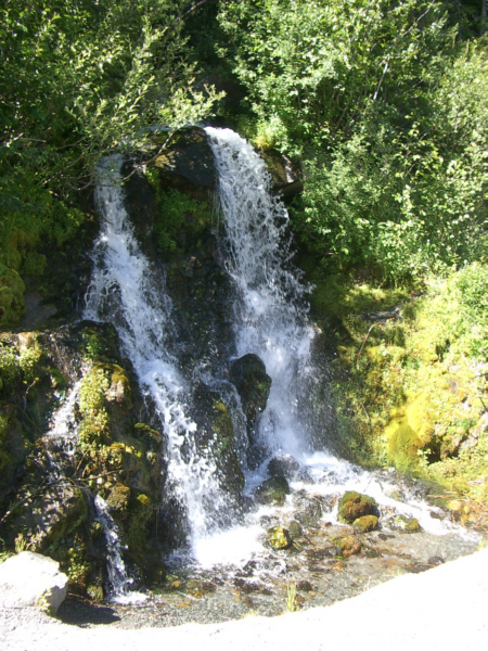
After a hike of something over a mile, we reached Zigzag Falls. These falls were certainly not high, spectacular ones, but rather a set of low but interesting and restful ones. The falls had two portions- the main falls, where most of the creek water spills over a rock outcropping and dividing into a curtain, and a set of side falls, where a side channel of the creek falls over a precipice to land in a pool about ten feet below. Like I said, the falls were certainly not anywhere near the highest or biggest we've seen, but they were worth the walk. For scale, here is a picture of Fred at Zigzag Falls.
We took a number of movies here, and I have put players for four of them below:
|
|
|
|
|
|
We walked on through the forest for a ways further, always following the creek. The forest was majestic and peaceful, what with the tall trees and the sound of the water. Fred stopped to make a movie of the forest and the creek, and a bit further on I made a movie of a particularly interesting fallen tree (one which had fallen directly into the stream). Even further on, we came to a point where two streams came together to form Zigzag Creek. Take a look at these three features with the movie players below:
|
|
We continued walking along the trail for another mile or so, just enjoying the forest. Eventually, we decided to turn around and head off to see something different- like Mt. Hood. So I made a movie at our farthest point on the trail and a movie of Fred at creekside, and we headed back down the trail to the parking area and the car. You can watch these movies with the players below:
|
You can return to the Page Index or continue on with the next section.
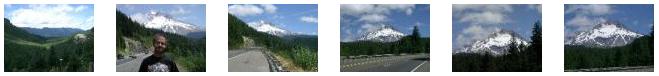
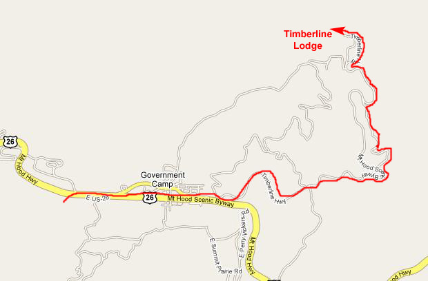
Driving Along the Mt. Hood Scenic Byway We wanted to get some lunch before our next hike to Mirror Lake, and so we drove further east on Highway 26 looking for a picnic spot. We ended up driving about five miles to find one, but also getting some great views of Mt. Hood and the surrounding area. I'll just put thumbnails for the best of these pictures below; you can look at the full-size images by clicking on those thumbnails:
|
You can return to the Page Index or continue on with the next section.
Hiking to Mirror Lake
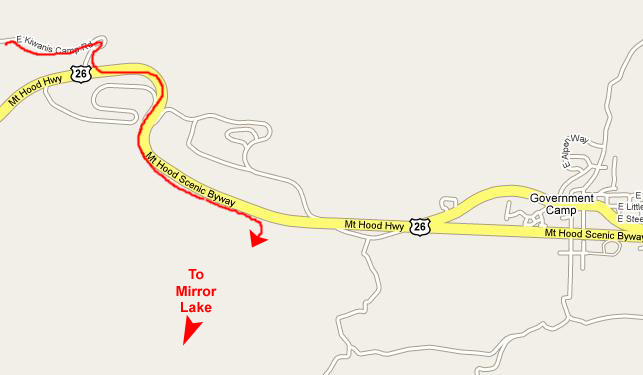 |
We drove back west after our picnic through the town of Government Camp, and just a mile or so further on west we found the turnoff parking area for the hike to Mirror Lake. We pulled off the road and parked, and then went to the end of the parking area (there were only a couple of cars here, so we knew it'd be a solitary hike) where the trail began. Running alongside the road here was a very small stream, and so we crossed it on a wooden bridge that led us to the trailhead. The sign told us that the hike to the lake would be a mile and a half, and so off we went.
The hike through the forest was pleasant, but there were not any good opportunities for picture-taking as we went- no waterfalls or streams to speak of. (I did take a couple of movies on the way back, and you'll have a chance to look at those later.) After about an hour's walk we arrived at Mirror Lake. When we arrived, of course, we were looking to the southwest, since that's the direction we'd been traveling; Mt. Hood was behind us. Right at the edge of the lake, we discovered (by reading the sign posted at the trail junction) that the mountain we could see further southwest was called "Tom, Dick and Harry Mountain," for reasons we could only surmise. But we weren't going there; we were going to take the loop trail around the lake.
We could not see Mt. Hood from where we were standing on the northeast shore of the lake, so we took the loop trail around to our left, going clockwise around the lake. When we'd gotten about halfway around, we could begin to see Mt. Hood behind the trees on the other side of the lake, and we stopped to take some pictures. As usual, we took one of each other with basically the same view, so here is my picture of Fred and here is Fred's picture of me.
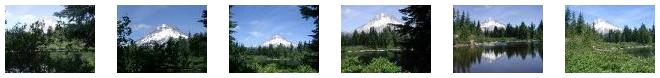
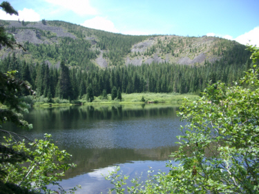
Mirror Lake is named, of course, for the beautiful mirror-like views that are usually available; the more still the water is the better those mirror images are. Today, the water is pretty still, but there is a slight breeze, so I guess the picture-taking was not exactly optimal. But of all the pictures we took here, I was able to get one that is just about perfect, and you should take a look at Mt. Hood reflected in Mirror Lake.
As we walked all around the lake, we both got many very good views of the lake and particularly of Mt. Hood in the background. Six of these pictures are noteworthy, and I have put thumbnails for them below. Take a look at the full-size pictures by clicking on the thumbnails:
|
I also took a couple of really good movies of Mirror Lake, both of them showing pretty much the entire scene. You can watch those movies using the players below:
|
|
We spent almost an hour walking around the lake and enjoying the scenery before we headed back down the trail to the car. along the trail back, I took a couple of interesting movies that I think you'll like, and you can watch those movies using the players below:
|
|
You can return to the Page Index or continue on with the next section.
An Afternoon on Mt. Hood
Driving Up to Timberline Lodge
 |
|
|
Touring Timberline Lodge
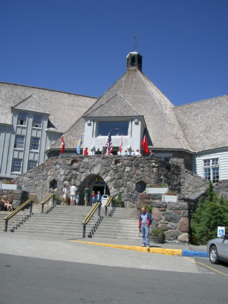 |
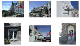
The building itself has very high pitched roof sections; even the dormer roofs are high so that the snow can more easily slide off. I did find an aerial view of Timberline Lodge, but it was taken during the winter, so it is hard to make out the lodge itself with all the snow that is everywhere around.
Fred and I took a number of exterior pictures to show some of the interesting detail work on the lodge, and you can view those full-size pictures by clicking on the thumbnails below:
|
Views from Timberline Lodge
|
|
There were some other really spectacular views from Timberline Lodge. First, from the front patio, you could look southeast at the Cascades and Mt. Jefferson. Also from the front patio, you could look south-southwest at the foothills of the Cascade Range and Mirror Lake. And, finally, from the back of Timberline Lodge you can look up the hill to Mt. Hood itself. That will be the next thing we do- walk up the paved and then gravel trail towards the summit.
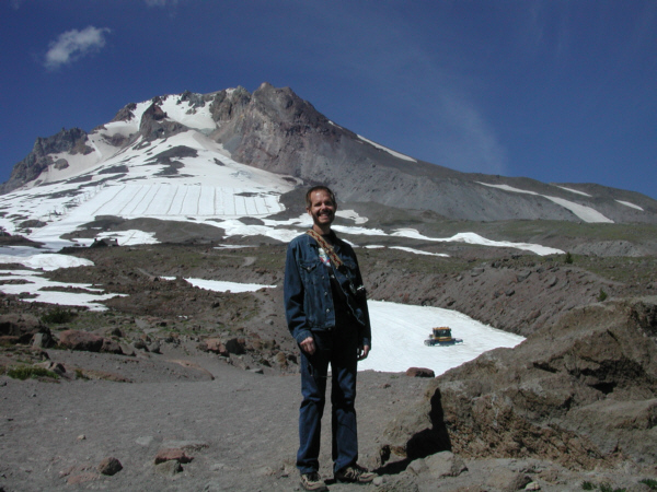
Walking Up the Slopes of Mt. Hood
 |
|
|
While I was watching the skiers and making my movie, Fred was off to the side examining some interesting mountain flowers, made all the more unusual because most of the terrain was so barren.
|
|
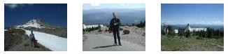
We took more interesting pictures up here on the side of Mt. Hood and, in fact, we walked quite a ways up the side of the mountain as you can see. I've included below thumbnails for some of the better pictures that we took while out on our walk, and you can look at the full-size images by clicking on those thumbnails:
|
Leaving Mt. Hood We came back through the lodge and walked around it a bit more (taking some of the pictures in the section above), and then got back in the car and headed on down the road the way we had come.
 |
|
|
|
|
Then, I scrambled a hundred feet or so down the mountainside to join Fred, who was just admiring the pretty stream as it flowed through the forest. He had taken his own picture of the rocky streambed.
We stayed here for just a few minutes enjoying the quiet surroundings before walking back up to the car and heading off to Tamanawas Falls.
You can return to the Page Index or continue on with the next section.
Tamanawas Falls
 |
 |
From the parking area, the trail began by crossing a log bridge that made its first crossing of the stream coming down from the falls (or at least I thought it was the same stream, there were so many branches and small streams on this hike). Then the trail led into the woods around to the right and started upward. We'd hiked perhaps a half-mile through the woods when the sound of water grew louder and we found ourselves at another log bridge over the stream that DOES come over Tamanawas Falls. I stopped on the bridge to make a movie of the stream, and you can watch that movie with the player below:
|
|
|
|
Occasionally, the trail led through some densely wooded areas above the stream, and at times it got quite dark in the forest (it was getting on towards late afternoon), but mostly we were out in the open. At one point, we came to a point where there had been a stream crossing, but the log bridge had been destroyed (an indicator, I suppose, that this particular stream is not always the gentle thing that we are experiencing today). The trail seemed to continue without crossing the stream over a new bridge, so I suppose that some work had been done to reroute the trail subsequent to the destruction of the old bridge.
|
|
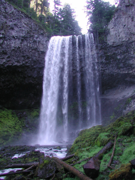
The trail led up above the streambed towards the right side of the falls; here is Fred on the trail ahead of me. Right after I took his picture, he had me leapfrog him on the trail so that he could get a picture of me and Tamanawas Falls.
|
|
|
|
|
|
Fred also took what I thought was a very good picture of the falls, showing the trail leading around behind them (where I am headed next. Take a look at that picture here.
Finally, I went along to the top of the trail and worked my way behind the falls. Just before I went behind the curtain of water, I made a movie of the waterfall from the side and a look down the valley below towards Fred. Then, I went on behind the falls themselves and made another movie through the falling water. You can watch both these movies with the players below:.
|
|
|
|
|
Once back at the car, we knew that what with the fading light we wouldn't be able to do another hike, so we just got on the road to Bend, OR.
You can return to the Page Index or continue on with the next section.
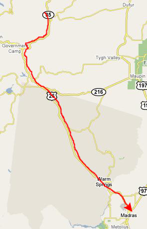
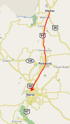
Driving to Bend, Oregon
 |
 |
We learned about the chain of restaurants from the menu, and saw that they were spread over Northern California and Oregon; there was even one in Bend. And, like most diners, they were open 24 hours, so I guess we could have waited until later to eat, but here we were.
We had a good meal (made all the better after all the hiking we'd done today) and then got back in the car and continued south.
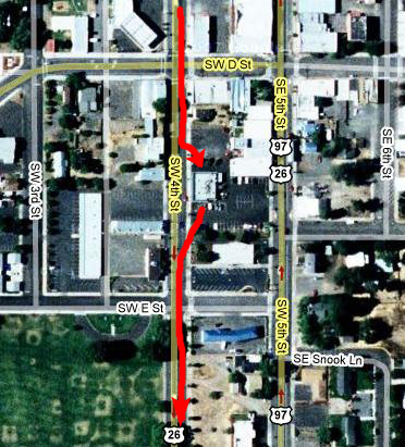
 |
 |
 |
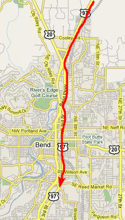
But we got back on Route 97 without too much problem and navigated our way through town (stopping at a local Baskin-Robbins just before it closed).
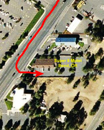
Then we arrived at our Super 8 Motel and got checked in. I made a run for some sodas and then we watched TV for a while and talked about the next day's trip which would feature Crater Lake.
You can return to the Page Index or use the links below to go to the next or previous day of our Oregon trip.
|
July 21, 2004: Oregon Trip Day 5 |
|
July 19, 2004: Oregon Trip Day 3 |
|
Return to Main Index for Oregon Trip Pictures |