|
June 24, 2005: Palm Springs Trip Day 7 |
|
June 22, 2005: Palm Springs Trip Day 5 |
|
Return to Main Index for Palm Springs Pictures |
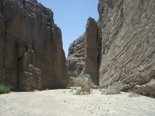
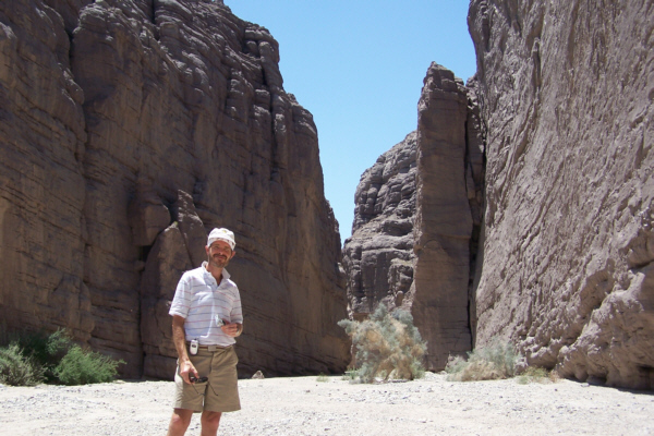
The Slot Canyons at Mecca Hills
 |
Today is another hiking day. We've done some research on the Internet and located a number of references to the slot canyons on the Ladder Canyon Hike in the Mecca Hills. There is a well-marked round-trip hike that's been referred to frequently by a number of hikers, so we decided to give it a try.
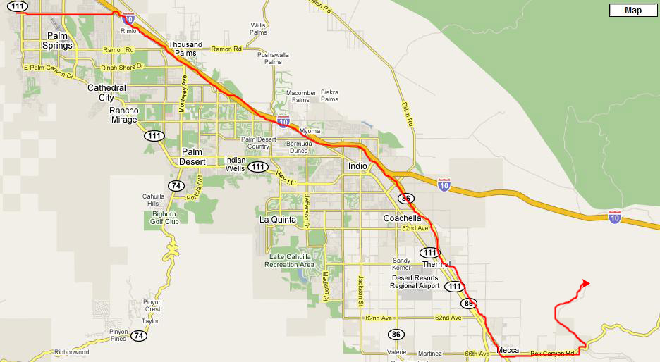
We borrowed Greg's Honda Element and left early in the morning. Getting to the trailhead was not difficult, but it was a fifty-mile drive. For most of it, we just drove southeast on I-10 until we found the exit for Highway 86 to Mecca. We could have taken Palm Canyon (Highway 111) all the way, but it would have been longer. Once in Mecca, we headed east on Box Canyon Road, looking for the turnoff for Painted Canyon Road.
 |
The descriptions on the Internet said that Painted Canyon Road was a well maintained dirt road and that it should be passable in most vehicles, so we thought that an Element would certainly qualify, being a very small SUV. However, all the sites cautioned you not to venture off the road or, as one site put it, "you WILL get stuck."
This was the dry season, so we weren't worried about mud or water, but the road was very sandy and there were times when we thought that even staying on the roadway was tempting fate. I didn't want to drive too slowly, for fear of losing traction, nor did I want to drive too fast for fear of sliding into deeper sand. So we just crossed our fingers and drove cautiously. It turned out not to be too much of a problem, although there were a couple of slips and slides. But we reached the parking area in one piece and without getting stuck.
|
|
The Mecca Hills were formed by the convergence of the North American Plate and the Pacific Plate along the San Andreas Fault. The geologic formations of Mecca Hills are among the most unusual of their kind in the world, and the San Andreas Fault that runs from below the Salton Sea all the way above San Francisco is overdue for a large quake. Layers of eroded rock, some over 600 million years old, have been pushed up and overturned by the activity of the San Andreas Fault system.
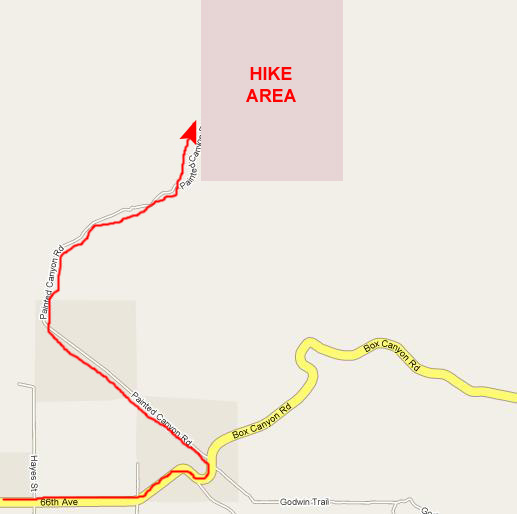
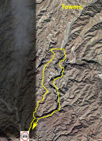
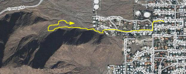
Before we get into the pictures of our hike today, I think it is probably a good idea to set the stage and show you, on both an aerial view and on a simplified trail map, just where we would be hiking. At various points throughout the hike, I'll use one or the other of these images to track our progress.
 |
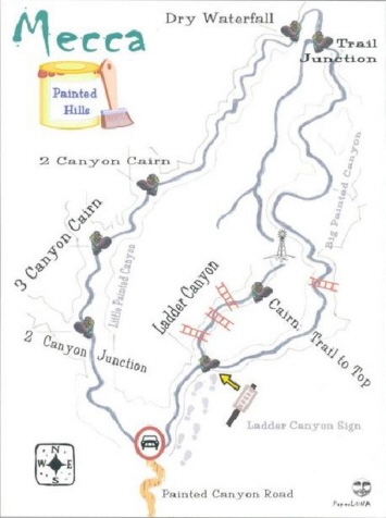 |
Once at the junction, then we'll follow a trail that should lead us back down into the Big Painted Canyon. From there, we'll hike along the canyon floor back to the parking area. During the rainy season, this hike is more difficult, but probably nicer, as we are walking along a river bottom- a river that only has water during that season. The pictures we've seen on the Internet show a broad river bottom, so I presume that, even during the rainy season, such streams as there are would not cover the entire bottom area. But we don't have to worry about that at this time of year.
I thought you might be interested in an aerial view of the hiking area as well. Although I can't be positive about the marked route, I think it is pretty close. I haven't attempted to transfer all the labels from the trail map to the aerial view; you should be able to match them up pretty closely. I did mark the location of some microwave/cell towers that we saw while hiking across the Mecca Hills to the trail junction midway through the hike, though, because you will see them in some of our pictures.
Well, that's probably enough preparatory information for you. Let's set off on our hike.
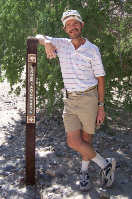
Hiking to the Ladder Canyon Turnoff
|
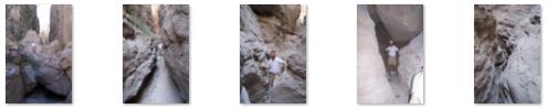
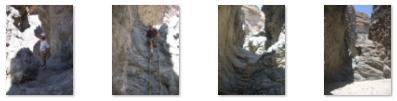
We hiked a bit up Big Painted Canyon, but weren't exactly sure where the sign directing us to Ladder Canyon was. We should have hiked until we found it, but we noticed that, off to the left, there seemed to be a pretty obvious canyon entrance, and we thought that this might be the entrance to Ladder Canyon. So we headed up into the canyon we had found. I went ahead of Fred, and when I got to the first turn in the canyon, I looked back to see Fred at the canyon entrance. So we both entered the canyon, with me in the lead, and walked, climbed and squeezed through the narrow passageways. The thumbnails below are for a series of pictures that Fred took as we headed into this canyon; just click on them to view the full-size pictures:
|
|
|
A little further on, we reached a wide point in the canyon, and thought again that we might be on the right track. Wrong. It was only around the next turn that the canyon finally narrowed so much that it was impassable. Since we knew that there were supposed to be ladders for us to climb, we knew for certain that we'd turned too early. So we turned around and went back to the entrance to this canyon, turned left again, and continued up Big Painted Canyon.
Hiking Through Ladder Canyon
 |
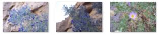
After taking the pictures of Fred entering the Ladder Canyon trail, it was his turn to look back on me as I passed some of the same blue‑flowered bushes that we had passed down at the entrance to Big Painted Canyon, and then he let me pass him so he could get a picture of me on the rock stairway to Ladder Canyon.
For the first little way on the Ladder Canyon trail, it was as if we were walking through a smaller, narrower version of Big Painted Canyon. This picture of Fred in Ladder Canyon shows a typical scene on this first part of the hike. What was happening, though, was that the canyon was getting both narrower and deeper as we went along. So deep, in fact, that we started to find all kinds of interesting formations in the lower canyon walls, formations of which this tunnel through the canyon wall was probably the most spectacular.
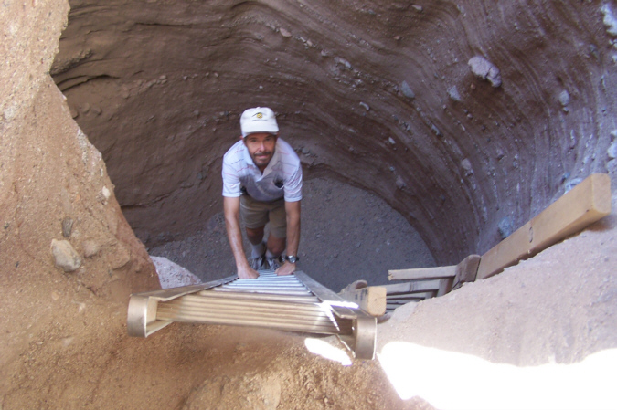
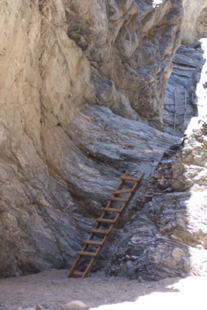
We knew that there would be several ladders that would help us reach the top of the canyon; they are maintained by volunteers, and all the trail guides cautioned that we be careful when climbing them. We reached first of these ladders after a quarter hour or so on the Ladder Trail. The slot canyon simply dead-ended in a circular room, that looked as if it were a two-storey room in a house, with a ladder leading up to a loft above the room; at least that's what it reminded me of. The ladder was the only exit from the cul-de-sac; I climbed up first and then Fred climbed up after me. Then the trail continued through the narrow canyons at this new level up. It was only another fifteen minutes or so before we reached the next ladder lobby, and you can see a movie of this "lobby" using the player below:
|
|
 |
These natural formations were very intriguing; we tried to figure out just how they had been formed. The conclusion we have come to (and one which we can't really verify from information found on the Internet) is that at one time (or perhaps periodically) there had been a lot of water flowing down through these narrow canyons. It seems clear that at points in the watercourse, dense hard rock bordered on softer formations, and so over time the water carved a waterfall over the hard rock, eating away the softer rock below. This led to the formation of a circular depression where the water swirled around and then took off in a different direction. We have seen waterfalls like this often, but since they have always been full of water, it's been impossible to see what shapes the rock is actually being carved into. And here, there must have been a dramatic difference in the hardness of the rock, or else the waterfall would have constantly lowered, or perhaps never got started in the first place.
We could see markings on the walls of the ladder room that clearly showed strata, as if at some times there was a lot of water, and at other times not much. These strata ran entirely around the walls of the room, but they were most obvious on the wall opposite the waterfall. I think we encountered three or four of these formations on our trip up Ladder Canyon, and they were certainly unlike anything we'd seen before.
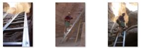
In this particular ladder room, there were some old ladders that had broken, and so the volunteers had brought in a new aluminum ladder, and anchored it to the wall, so I guess this one will last a lot longer. Below are thumbnails for three pictures we took of this ladder room; to view the full-size images, just click on them:
|
As we came up the last ladders, we came out into sunlight again, and I thought that the slot canyons might be done, but I was wrong. As we continued along the trail, the sides of the canyons got higher again, and the canyon narrowed again. Even the sunlight was getting blocked out again, and soon we found ourselves at the beginning of a deep slot canyon where we were walking along in twilight. Then things really got interesting. The canyons continued to narrow until we sometimes had to go through sideways, and the walls got higher and higher until it was quite dim as we were walking along.
It's hard to describe what walking through these slot canyons was like; even pictures don't do it justice. So both Fred and I switched to movies, both because the light was so dim that flash pictures would have washed out the surreal nature of the scenery and because only movies can really show you what it was like. Here are the five best movies that we took; you can watch them with the movie players below:
|
|
|
|
|
|
|
|
Our trip through these deepest and darkest of the slot canyons led to another "ladder lobby," this one with a wood ladder leading up to what we thought was the sunlit surface and the end of the slot canyons. Fred went up first, and then I followed, emerging into the sunlight but facing a continuation of the trail through some more narrow canyons.
|
|
|
The trail ascended steadily up through these canyons. Eventually the canyon widened out, and we reached the through a single end of the canyon and found ourselves on top of the Mecca Hills.
Hiking Across the Mecca Hills
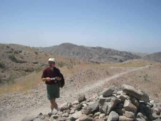 Fred Atop the Mecca Hills |
These instructions, once we reached the top of the mesas, now seemed to be confusing. There were lots of trails going off in different directions, and I knew we'd eventually be put to a guess. But before we hiked off in the way we thought would be right, I thought it would be a good idea to show you what the landscape was like. So I took a 360-degree panoramic movie of the views that we could see from our perch atop the hills, and you can watch this movie with the player below:
|
|
At the point we were standing, we were right beside Big Painted Canyon and, although we couldn't really see down into it from our vantage point, we could see the opposite walls of the canyon, and we took a couple of pictures which you can see here and here.
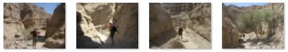
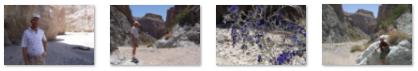
Then, using the trail information we had, we made our best guess and began following the trail system across the top of the Mecca Hills in the bright sunshine. I've included four of the best pictures from this part of the hike here. The thumbnails for these pictures are below, and you can view the full-size images by clicking on them:
|
As luck or good instructions would have it, we finally connected with a trail that led back down into Big Painted Canyon, so we left the mesas behind and descended into Big Painted Canyon.
Hiking Big Painted Canyon
 |
|
|
|
|
The first half-hour of our hike was uneventful as we simply walked along the canyon floor. Big Painted Canyon exhibits many mineral deposits in hues of rose, pink, red, purple and green. The canyon runs in a general north-south direction, and is distinguished by sandy washes sprinkled with Ironwood, Smoke Trees, and Palo Verde. Along the rim of the canyon and the tops of the mesas, there is a good deal of Ocotillo. Our information told us that Bighorn sheep sometimes cross over from the Orocopia Mountains on the east looking for water. Like in any desert area, there's probably a multitude of lizards, snakes, and the like.
We had relied on our trail information. It told us that once we got through the Ladder Trail and across the mesa, we should look for a trail that sloped down into Big Painted Canyon on our right, which we did. Then, once down in the canyon, we were supposed to go to the right and stay right at any junction. This is exactly what we did for the first mile or so. Here are the thumbnails for some of the pictures that we took along this first mile of the hike back; to view the full-size images, just click on the them:
|
 |
We took a number of pictures here at these ladders, and they are all pretty self-explanatory. So, to view the full-size images, just click on the thumbnails that you will find below:
|
If the information we had was correct, we would be on level ground for the rest of the hike, so all we had to do was keep walking, and you can see us trudging along by watching my movie using the player below:
|
|
The canyon was really beautiful- stark, but beautiful. It was hot, but we didn't sweat much since the humidity was so low. So, all in all, the rest of the hike was pleasant enough. Here are the thumbnails for the pictures we took on this final portion of our hike; just click on them to view the full-size images:
|
After about a half mile, we rounded a turn in the canyon and saw a welcome sight- the sentinel rock.
 |
An Evening Hills Hike Near Greg's
 |
There is no particular story attached to the pictures I took this evening; I just stopped every so often as we climbed into the hills to stop and look back at the changing vista. So I'm just going to include thumbnails for the eight pictures I took on our hike; they are in order, left to right and top to bottom. To view the full-size images, just click on these thumbnails:
|
I also took a couple of movies, and you can watch them using the movie players below:
|
|
|
Dinner was at a very good Mexican place down in town. Greg's friends were interesting and we all had a great time.
You can use the links below to continue to another photo album page.
|
June 24, 2005: Palm Springs Trip Day 7 |
|
June 22, 2005: Palm Springs Trip Day 5 |
|
Return to Main Index for Palm Springs Pictures |