|
June 25, 2005: Palm Springs Trip Day 8 |
|
June 23, 2005: Palm Springs Trip Day 6 |
|
Return to Main Index for Palm Springs Pictures |
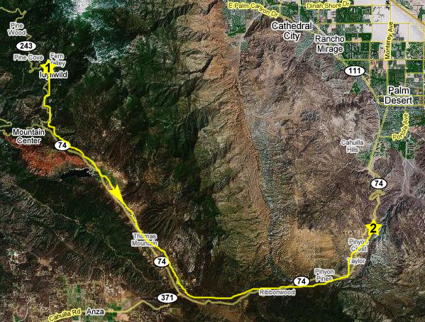
Driving to Idyllwild, California
 |
As we left Greg's house, Fred took a picture of Greg's front gate as well as a picture of Santa Elena Street looking towards the San Jacinto Mountains. Later today, we plan on being up in those mountains, way beyond the ridge line that shows up in these pictures.
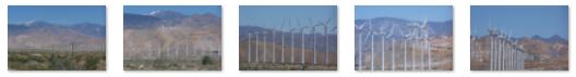
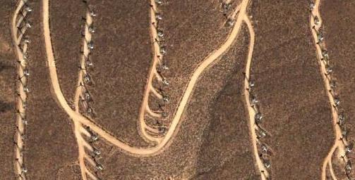
| An Aerial View Along I-10: What are These? |
 |
|
|
|
The mountains on the other side of the valley pass look as if they might be a separate range, but they aren't. They are a continuation of the San Jacinto Mountains which, at this moment, are behind us. Banning and the highway actually lie in a high mountain pass through the San Jacinto range. These mountains are pretty impressive as you can see. The valley is also the dividing line between the San Jacinto National Forest, on the mountains behind us and above Palm Springs, and the San Bernardino National Forest on the mountains across the way. Big Bear Lake, a favorite recreation area, is in the mountains you see here; we'll be making a trip there tomorrow.
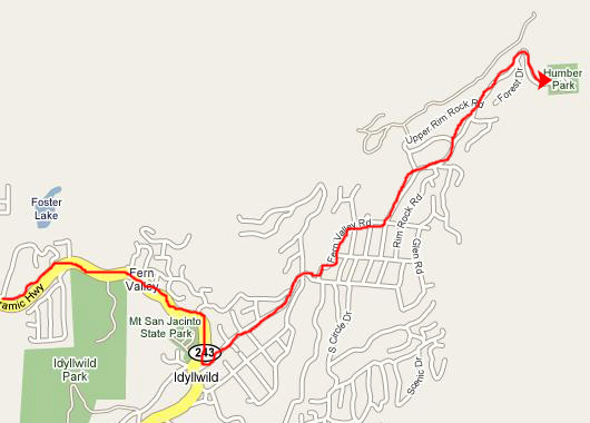
We got steadily higher as we drove south on the highway. Shortly after coming over the crest of this ridge of mountains we reached a point (#2 on the map) where we had an excellent view of Riverside, California, far off in the distance. Here is a picture of Fred at the Riverside viewpoint. At this same overlook, Fred found some interesting mountain flowers to be worth a picture.
Just a ways further on there was another stop along the highway (number 3 on the map), which turned out to be a memorial to the firefighters who lost their lives some years ago battling one of the worst fires this area has seen. The plaque also commemorates all the other men and women who yearly find themselves working to contain the wildfires that are common in Riverside County; fortunately, these fires to not often reach the National Forest. The view from this point is certainly a beautiful one.
We got back in the car and continued driving for about ten miles until we reached the picturesque mountain town of Idyllwild, California, nestled high up in the San Jacinto Mountains.
The Devil's Slide Hike in Idyllwild, California
 |
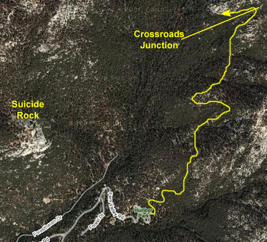
The Devil's Slide hike takes you from Humber Park up a series of switchbacks and then onto a good trail that leads along the western face of the ridgeline. From the trail, there are excellent views to the west and southwest. There are a number of prominent features, chief among them Suicide Rock.
The trail ends at a high mountain trail junction where you can transfer to any one of a number of trails that lead through the San Jacinto Mountains. One of these trails leads to the area at the top of the Palm Springs Tramway where we were the other day. Other trails lead all the way back to Palm Springs itself, as well as north to Banning.
As I've said before, the Palm Springs area seems to be a hiker's paradise; there are certainly enough trails to keep you busy for quite some time.
I've marked the approximate route the trail takes on the aerial view below.
The Hike Up
 |
A bit further along the hike, here is Fred on the Devil's Slide trail and, from about the same place, a picture of me on the trail. The trail itself was well-maintained, but we did find out that hikers are supposed to stop at the ranger station and get a hiking permit, even if they aren't backpacking. We passed a ranger coming down the trail, and stopped him to ask some questions (including the one about Suicide Rock), and he noticed that we didn't have a little permit slip clipped to ourselves somewhere. He explained that the permits are for our own safety more than anything else, but just told us that if we did another hike in the area, we should stop at the nearest ranger station and check in.
We passed lots of interesting flora and even a small waterfall that we would have missed but for Fred's attention to detail. Finally, towards the top of the trail, I made a little movie of Fred on the trail that you can watch with the player below:
|
|
At the Overlook
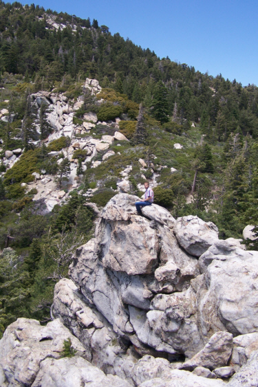 |
As I expected, the views from the rock outcropping were amazing. Below are the thumbnails for a selection of these views; view the full-sized images by clicking on those thumbnails:
|
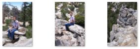
Fred wasn't too wild about climbing out to the very edge of the rocks, but I did get him to climb up a ways closer to me, although you can tell in this picture of Fred on his way up that he is just a bit uncomfortable with how close he is to the dropoff. But nothing went wrong, and he got some good pictures.
|
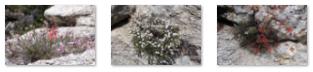
While he was climbing around on the rocks here at the overlook, Fred found some interesting flora he hadn't seen before on this trip. When you click on the thumbnails below, you can see the full-size images Fred took:
|
At the Junction
|
|
The Hike Down
|
|
I also took one last movie following Fred down the trail, and you can watch that movie with the player at right.
Idyllwild and the Return to Palm Springs
 |
As you can see, it was a beautiful day here, and the temperature was ideal and a welcome change from the Desert Cities. Here is another picture of Idyllwild, California.
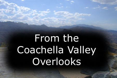
Once we'd relaxed for a while, we continued south from Idyllwild through the mountains until we intersected with the road back to Palm Springs and the Desert Cities. We crossed the high mountain valley and then climbed the ridge line to a point where we could look out over the entire Coachella Valley (point #2 on the map).
 |
Before you look at the pictures we took here, you might want to take a look at the movie of the Coachella Valley Overlook that I took, using the player below to do so; it will provide a context for the various pictures we took.
|
|
One of the most interesting pictures Fred took from here was this one of a golf course way down in the valley. He also got a picture of me at the overlook.
|
To view the slideshow, just click on the image at left and I will open the slideshow in a new window. In the slideshow, you can use the little arrows in the lower corners of each image to move from one to the next, and the index numbers in the upper left of each image will tell you where you are in the series. When you are finished looking at the pictures, just close the popup window.
Well, we left the overlook and headed down the winding road towards the valley. Fred took a couple of pictures as we drove, and you can look at those pictures here and here.
 |
Then, we were back at Greg's house for a relaxing evening and dinner at home.
You can use the links below to continue to another photo album page.
|
June 25, 2005: Palm Springs Trip Day 8 |
|
June 23, 2005: Palm Springs Trip Day 6 |
|
Return to Main Index for Palm Springs Pictures |